APARTMENT 705
THE KNIGHTSBRIDGE APARTMENTS, 199, KNIGHTSBRIDGE, LONDON, GREATER LONDON SW7 1RH
£17,117 pcm


Property details
Street crime
1342 incidents within 1 mile (Apr 2026)
Key features
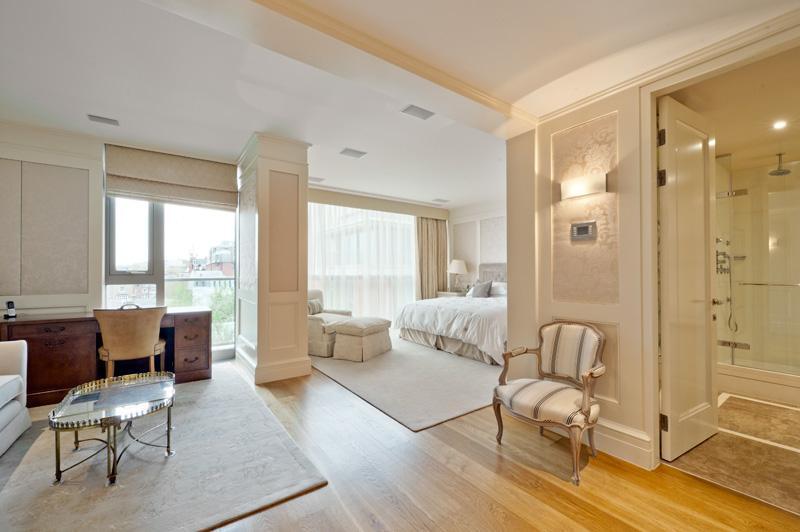
- 2 Double Bedrooms
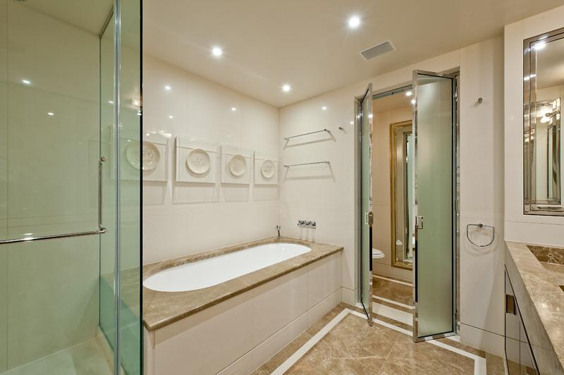
- 2 Bathrooms
- Reception Room
- Lift
- Porter
- Swimming Pool & Gym
- Communal Gardens
Additional details
- Parking
- Yes
Description
Listed by
Knightsbridge
Harrods Estates
Reference: 56552334
EPC Rating & Upgrade Cost
Fetching EPC data… Refresh this page in a moment.
Flood risk
Zone: 1
Risk: Low
Job (default Low)
Floorplans
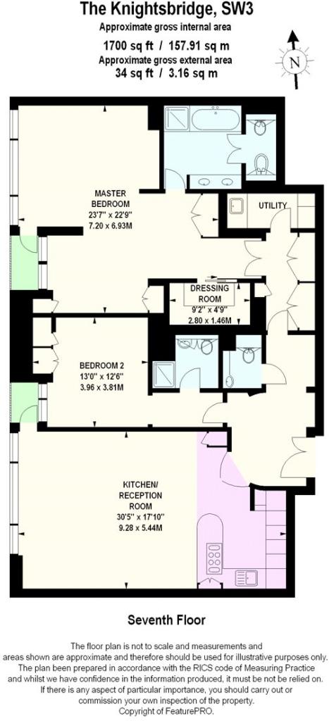
Floorplan
EPC Graphs
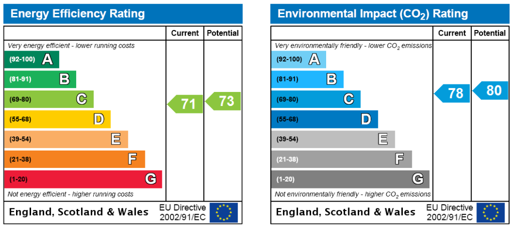
EPC Rating Graph
Company ownership
Registered legal owner is a company.
Company: CLLP LIMITED (12870689)
Rental Range
Estimated market rent for Westminster. Low = conservative, Realistic = average, Optimistic = best case.
Based on Local Authority from postcode lookup → Westminster.
LHA (30th percentile) floor for South East Herts: £1,047/mo (Apr 2025 – Mar 2026)
Location
Address
199 Knightsbridge
Nearby
Nearest stations, universities and amenities (distance from property).
| Type | Name | Distance |
|---|---|---|
| Bus stop | Knightsbridge Station / Harrods | 0.0 miles |
| Shop | Knightsbridge Advanced Beauty | 0.0 miles |
| Shop | Samer Halimeh | 0.1 miles |
| Bus stop | Knightsbridge Station | 0.1 miles |
| Train station | Knightsbridge | 0.1 miles |
| Train station | Hyde Park Corner | 0.4 miles |
| University | National Heart and Lung Institute | 1.0 miles |
| University | University of Notre Dame | 1.5 miles |
| Hospital | National Hospital for Neurology and Neurosurgery at Cleveland Street | 1.7 miles |
| Hospital | The Portland Hospital | 1.7 miles |
Street-level crime
| Category | Count |
|---|---|
| Other theft | 215 |
| Theft from the person | 210 |
| Violence and sexual offences | 188 |
| Anti-social behaviour | 174 |
| Drugs | 156 |
| Shoplifting | 132 |
| Vehicle crime | 82 |
| Public order | 56 |
| Robbery | 35 |
| Criminal damage and arson | 34 |
| Bicycle theft | 21 |
| Burglary | 20 |
| Other crime | 14 |
| Possession of weapons | 5 |
| Total incidents | 1342 |
Within 1 mile during Apr 2026. Source: data.police.uk (England & Wales).
Schools nearby
Nearest open schools with Ofsted ratings (England). Closed schools are not shown. Data from Get Information about Schools and Ofsted.
| Name | Type | Distance | Ofsted |
|---|---|---|---|
| Hill House School | Other | 0.3 miles | Good — 4 Oct 2022 |
| More House School | Other | 0.3 miles | — (No rating) |
| Knightsbridge School | Other | 0.3 miles | — (No rating) |
| Brighton College Prep Kensington | Other | 0.4 miles | — (No rating) |
| Sussex House School | Other | 0.5 miles | — (No rating) |
Rental Comparables
Residential lets from OpenRent and Rightmove for the area (same bedroom count). Use to validate rent estimates. Student lets are excluded.
| Title | Rent | Beds | Distance | As seen on |
|---|---|---|---|---|
| 2 Bed Flat, Chesham St, SW1X | £4,500/mo | 2 | 0.49 miles | OpenRent |
| 2 Bed Flat, Brompton Road, SW3 | £3,400/mo | 2 | 0.55 miles | OpenRent |
| 2 Bed Flat, Brompton Road, SW3 | £3,300/mo | 2 | 0.55 miles | OpenRent |
Average rent: £3,733/mo (3 listings)