The Parkway
Shelton, Stoke-On-Trent, ST1, ST1 3BB
£2,426 pcm
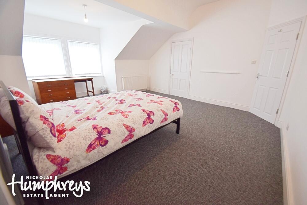
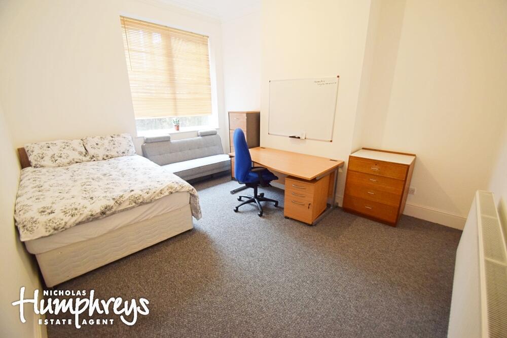
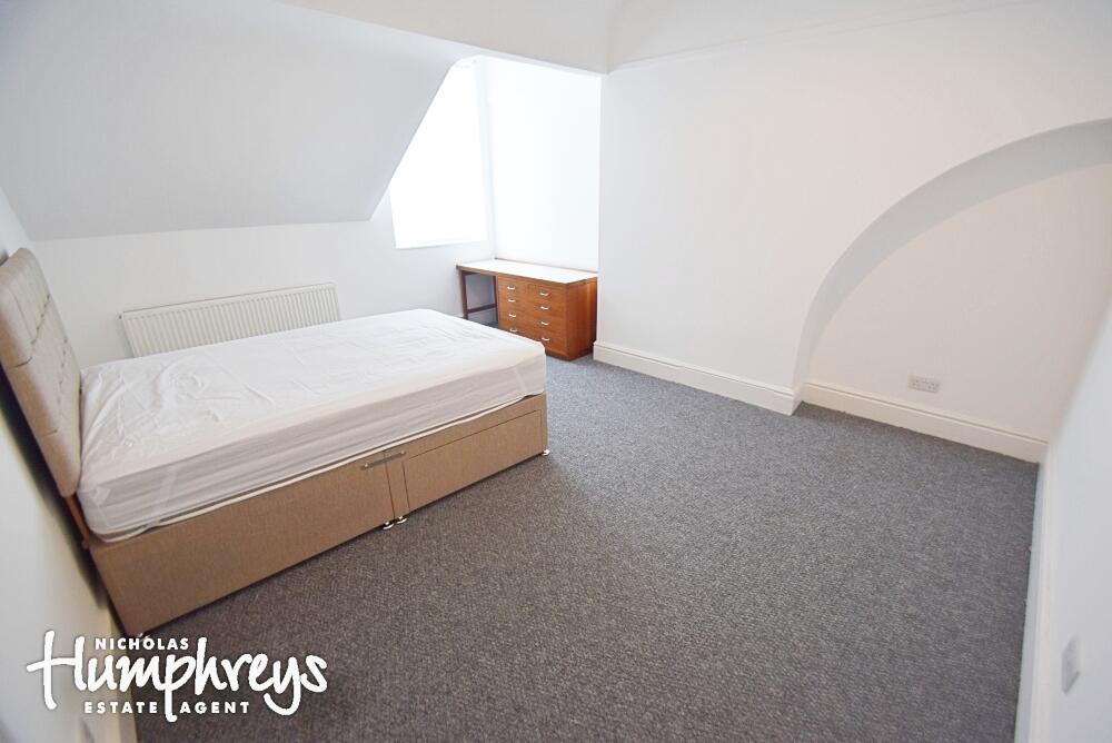
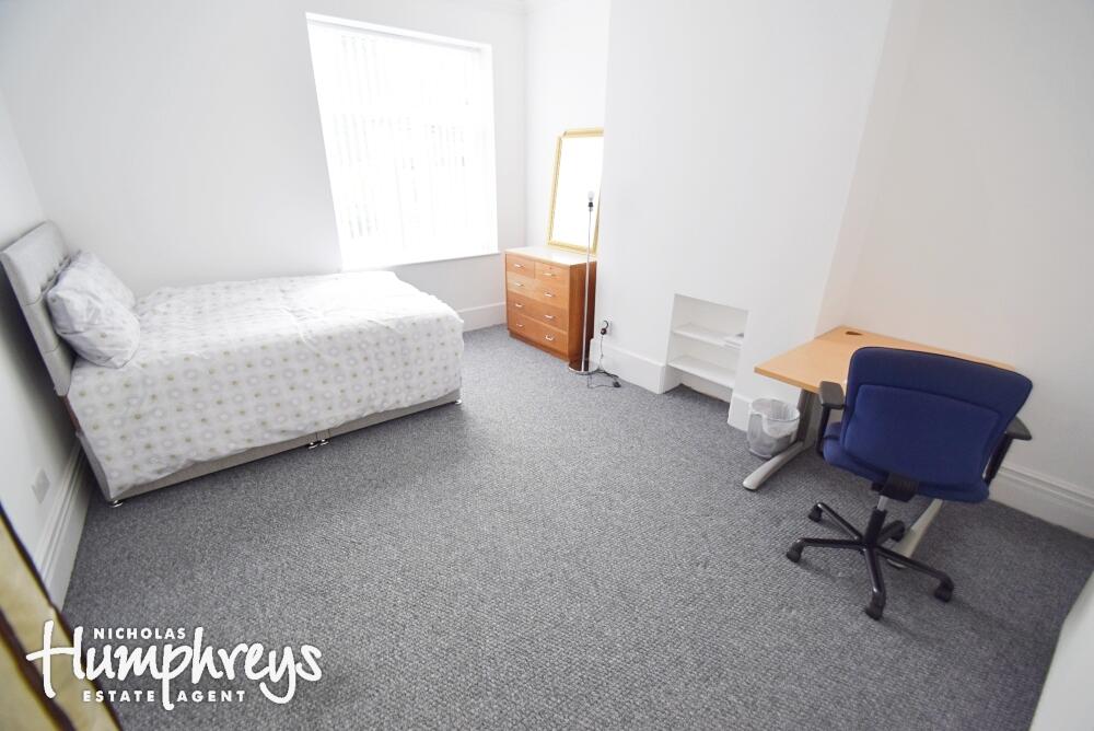
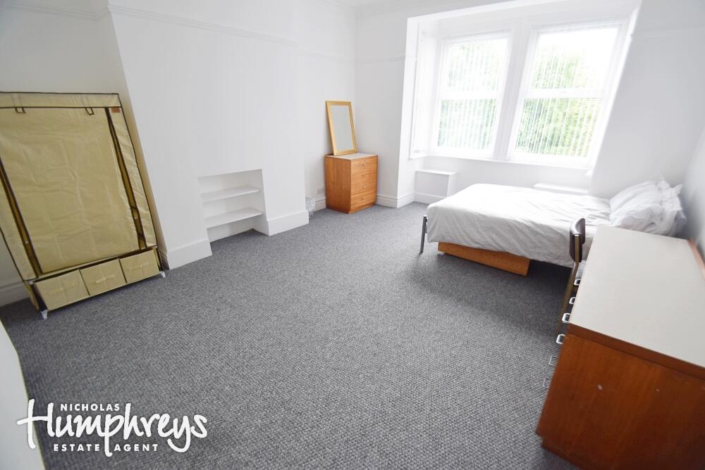
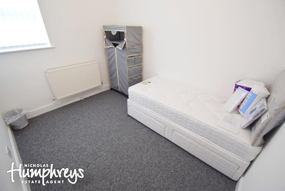
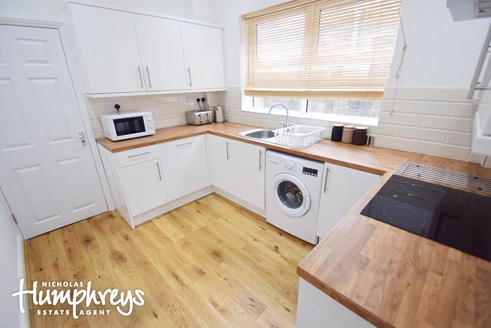
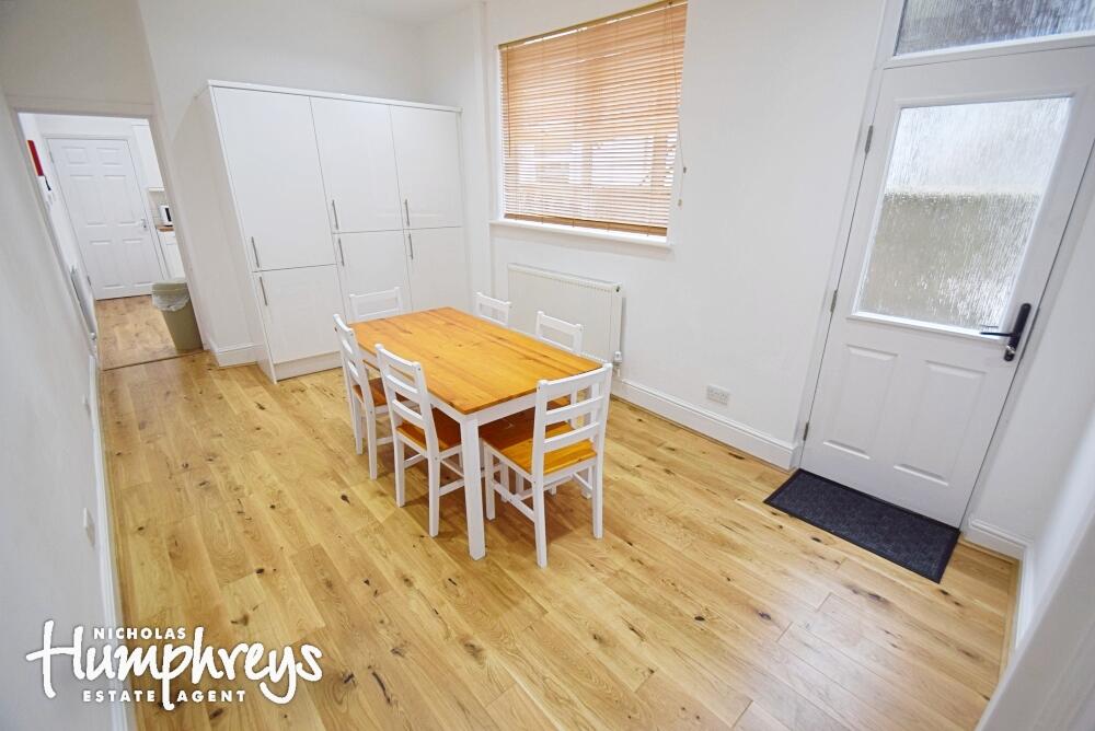
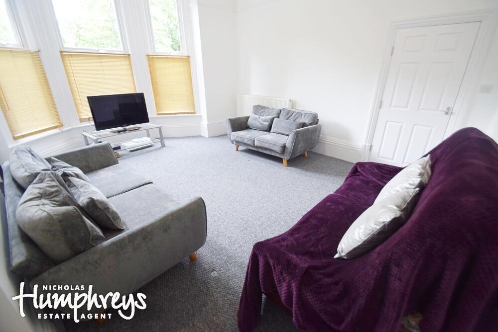
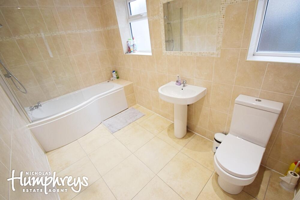
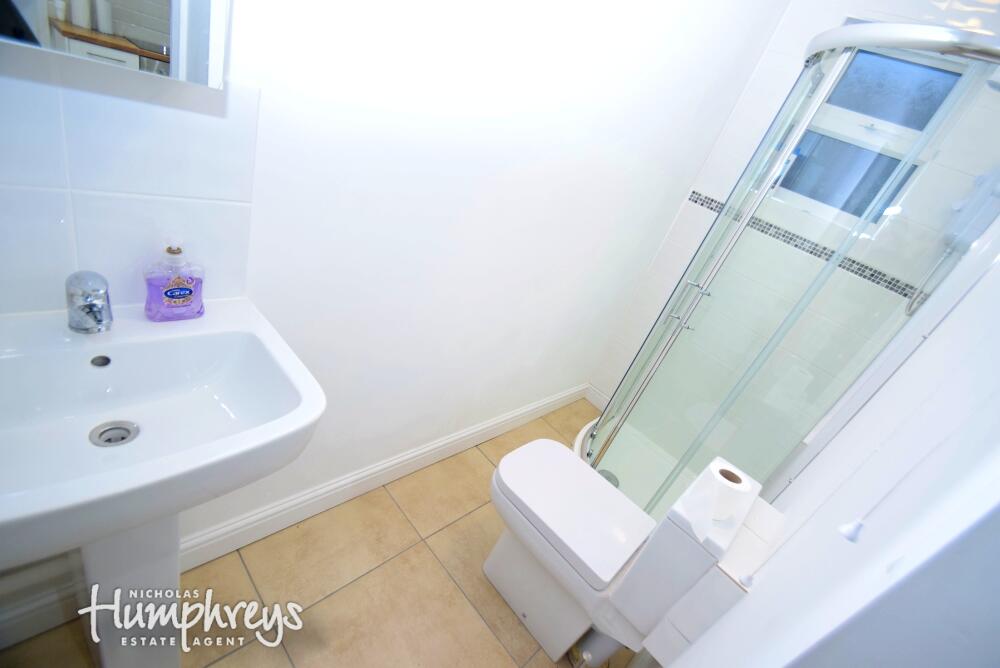
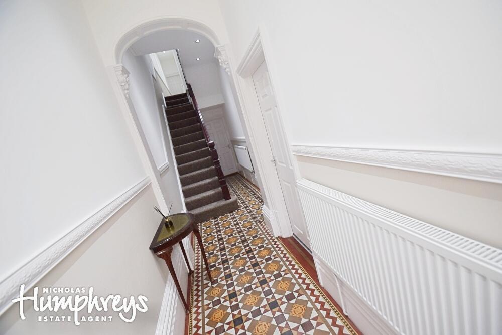
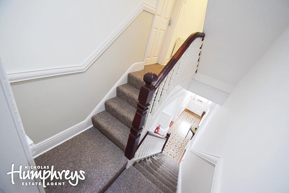
Photo 1 Photo 2 Photo 3 Photo 4 Photo 5 Photo 6 Photo 7 Photo 8 Photo 9 Photo 10 Photo 11 Photo 12 Photo 13
/ 13
Property details
Council tax band
C
Local average
£651,750 (-99.6%)
Deprivation
Decile 1 (553 of 33,755)
Street crime
596 incidents within 1 mile (Apr 2026)
Key features
- Spacious rooms throughout
- Desirable Location!
- Close to Staffordshire University
- Utilities can be included via UniHomes for an extra cost
Additional details
- Garden
- Private garden
- Listed property
- No
Description
Listed by
Stoke-on-Trent
The Property Franchise Group
Reference: 167706071
EPC ratings on this postcode
We don't have a matched EPC for this property yet. Below are efficiency scores and details for other addresses on this postcode.
| Address | Current | Potential | Floor area | Age band | Type |
|---|---|---|---|---|---|
| 13 The Parkway, STOKE-ON-TRENT | 74 | 87 | 223 m² | England and Wales: before 1900 | Terraced |
| 13 The Parkway, STOKE-ON-TRENT | 59 | 76 | 229 m² | England and Wales: before 1900 | Terraced |
| 17, The Parkway, STOKE-ON-TRENT | 64 | 80 | 296 m² | England and Wales: 1900-1929 | Terraced |
| 23, The Parkway, STOKE-ON-TRENT | 61 | 73 | 159 m² | England and Wales: 1900-1929 | Terraced |
| 25 The Parkway, STOKE-ON-TRENT | 70 | 85 | 110 m² | England and Wales: 1930-1949 | Terraced |
| 25, The Parkway, STOKE-ON-TRENT | 33 | 80 | 84 m² | England and Wales: 1900-1929 | Terraced |
| 27, The Parkway, STOKE-ON-TRENT | 56 | 82 | 129 m² | England and Wales: 1930-1949 | Terraced |
| 29, The Parkway, STOKE-ON-TRENT | 53 | 78 | 130 m² | England and Wales: 1930-1949 | Terraced |
| 33, The Parkway, STOKE-ON-TRENT | 55 | 78 | 182 m² | England and Wales: 1930-1949 | Detached |
| 37, The Parkway, STOKE-ON-TRENT | 64 | 82 | 105 m² | England and Wales: 1930-1949 | Detached |
| 39, The Parkway, STOKE-ON-TRENT | 57 | 76 | 178 m² | England and Wales: 1930-1949 | Detached |
| 39, The Parkway, STOKE-ON-TRENT | 65 | 76 | 128 m² | England and Wales: 1930-1949 | Detached |
| 39, The Parkway, STOKE-ON-TRENT | 52 | 68 | 126 m² | England and Wales: 1930-1949 | Detached |
| 41 The Parkway, STOKE-ON-TRENT | 66 | 84 | 97 m² | England and Wales: 1930-1949 | Detached |
| 41, The Parkway, STOKE-ON-TRENT | 60 | 83 | 109 m² | England and Wales: 1930-1949 | Detached |
Flood risk
Zone: 1
Risk: Low
Job (default Low)
EPC Graphs

EPC Certificate
Price history
| Event | Date | Price | % change |
|---|---|---|---|
| Listed for sale | — | £2,426 | — |
Source: HM Land Registry Price Paid Data. Crown copyright.
Sold Comparables
Same street and nearby sales within 0.25 miles (last 5 years). Data from Land Registry Price Paid.
| Address | Price | Date | Type |
|---|---|---|---|
| Same street 45 THE PARKWAY, STOKE-ON-TRENT, ST1 3BB | £395,000 | 05/09/2024 | Detached |
| Same street 41 THE PARKWAY, STOKE-ON-TRENT, ST1 3BB | £109,713 | 15/05/2024 | Semi-detached |
| Same street 25 THE PARKWAY, STOKE-ON-TRENT, ST1 3BB | £165,000 | 23/02/2024 | Terraced |
Street average: £223,238 (3 sales)
Capital growth trend
Land Registry outcode average: last 12 months vs 5y and 10y ago (from sold prices).
House Price Index (HM Land Registry — official index, not sold-price averages): Stoke-on-Trent. Series: All dwelling types. As of March 2026.
Rental Range
Estimated market rent for Stoke-on-Trent. Low = conservative, Realistic = average, Optimistic = best case.
Based on Local Authority from postcode lookup → Stoke-on-Trent.
LHA (30th percentile) floor for Staffordshire North: £798/mo (Apr 2025 – Mar 2026)
Location
Address
The Parkway
Nearby
Nearest stations, universities and amenities (distance from property).
| Type | Name | Distance |
|---|---|---|
| Bus stop | Harding Road | 0.1 miles |
| Bus stop | Wellesley Road | 0.1 miles |
| Shop | Madina Tours & Travel | 0.1 miles |
| Shop | Premier | 0.1 miles |
| University | University of Staffordshire Stoke Campus | 0.6 miles |
| Train station | Stoke-on-Trent | 0.7 miles |
| Hospital | St Augustines Hospital | 1.2 miles |
| Hospital | North Staffordshire Hospital | 1.4 miles |
| Train station | Longport | 2.4 miles |
Street-level crime
| Category | Count |
|---|---|
| Violence and sexual offences | 169 |
| Anti-social behaviour | 118 |
| Shoplifting | 59 |
| Public order | 58 |
| Criminal damage and arson | 44 |
| Other theft | 35 |
| Vehicle crime | 31 |
| Burglary | 20 |
| Drugs | 19 |
| Possession of weapons | 11 |
| Robbery | 11 |
| Other crime | 10 |
| Bicycle theft | 9 |
| Theft from the person | 2 |
| Total incidents | 596 |
Within 1 mile during Apr 2026. Source: data.police.uk (England & Wales).
Schools nearby
Nearest open schools with Ofsted ratings (England). Closed schools are not shown. Data from Get Information about Schools and Ofsted.
| Name | Type | Distance | Ofsted |
|---|---|---|---|
| Edison Pace School | Other | 0.3 miles | Good — 14 Dec 2022 |
| St Mark's CofE Primary School | Primary | 0.3 miles | — (Inspected (no overall grade)) |
| Stoke-on-Trent College | Other | 0.4 miles | — (No rating) |
| Snowhill School | Other | 0.4 miles | Good — 26 May 2022 |
| Want2Achieve The Academy | Other | 0.4 miles | Inadequate — 15 May 2023 |
Rental Comparables
Residential lets from OpenRent and Rightmove for the area (same bedroom count). Use to validate rent estimates. Student lets are excluded.
| Title | Rent | Beds | Distance | As seen on |
|---|---|---|---|---|
| Victoria Road, Stoke-On-Trent | £620/mo | — | 0.35 miles | Rightmove |
| Clayworks, Hanley | £825/mo | — | 0.38 miles | Rightmove |
| Clayworks, Hanley | £825/mo | — | 0.38 miles | Rightmove |
| Clayworks, Hanley | £895/mo | — | 0.38 miles | Rightmove |
| Clayworks, Hanley | £875/mo | — | 0.38 miles | Rightmove |
| Clayworks, Hanley | £875/mo | — | 0.38 miles | Rightmove |
| Clayworks, Hanley | £875/mo | — | 0.38 miles | Rightmove |
| Rosedawn Close East, STOKE-ON-TRENT | £2,250/mo | — | 0.45 miles | Rightmove |
| The Webberley, Stoke-On-Trent, ST1 | £520/mo | — | 0.55 miles | Rightmove |
| The Webberley, Stoke-On-Trent, ST1 | £640/mo | — | 0.55 miles | Rightmove |
| Trinity Point, Stoke-On-Trent, ST1 | £620/mo | — | 0.6 miles | Rightmove |
| Moxons Island, 48 Stafford Street, Stoke-on-Trent, Staffordshire, ST1 | £525/mo | — | 0.6 miles | Rightmove |
Average rent: £862/mo (12 listings)
Rent-driven metrics
Based on OpenRent comparables.
- This street — Gross yield for this street only (Land Registry sales + rental comparables, same postcode + street).
- Rent ratio — Monthly rent ÷ purchase price (1% rule). 1%+ = strong, 0.8–1% = okay, <0.8% = weak for cashflow.
- Max investor price — Rent ÷ 0.8%; the price at which rent would be 0.8% of price (Stoke-style target).
- Target investor price — Rent ÷ 1%; the price at which rent would be 1% of price (strong cashflow band).
- Gross yield — Annual rent as % of purchase price (no costs).
- Cost-to-rent — Price ÷ annual rent (from OpenRent comparables). Under 14× = strong, 14–16× = acceptable, 17×+ = compressed.
- Cashflow — Rent minus mortgage, 10% maintenance, £25/mo compliance. Assumes 75% LTV, 3.95% APR (5yr fixed), 25yr term.
- ROI — Annual profit ÷ cash in (deposit + 4% purchase costs).
Enter House Number
Enter the house number to help us retrieve more accurate pricing history and property data.
Please log in to submit or correct the house number for this listing.
Log in to continue