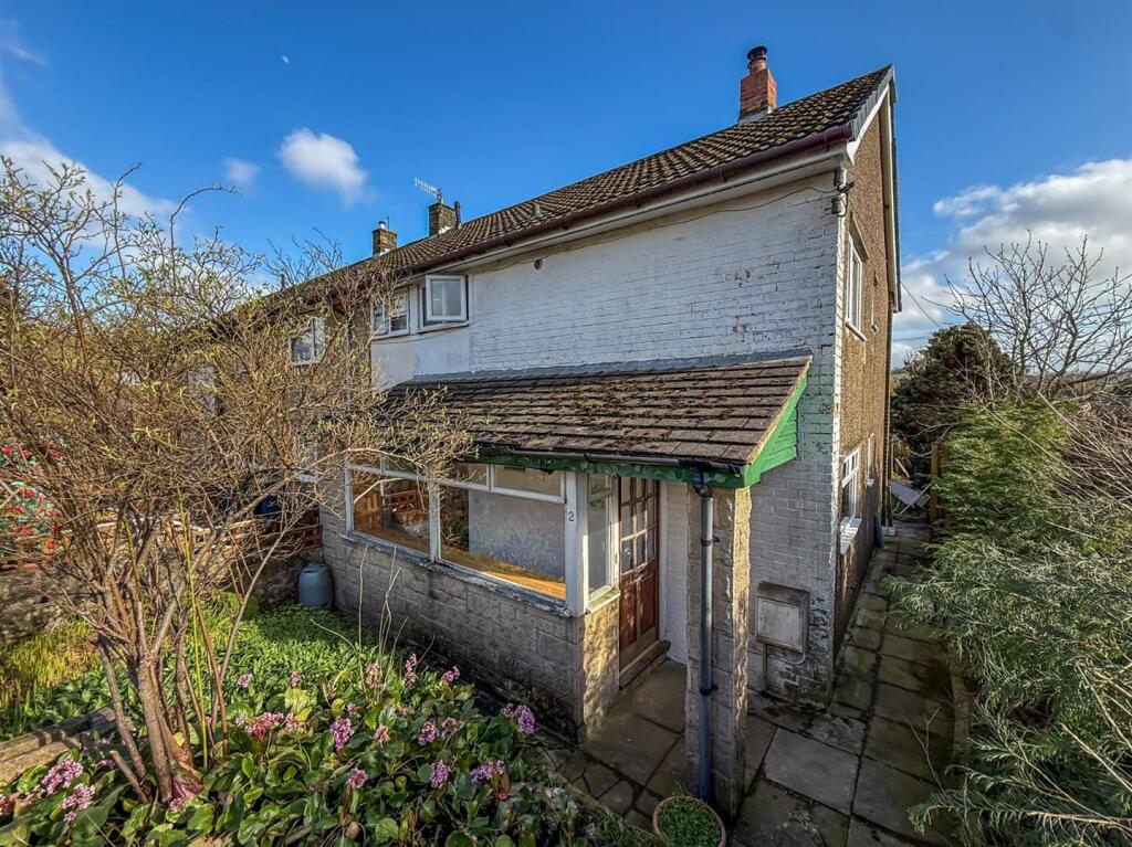
2 ELIZABETH AVENUE
BUXTON, DERBYSHIRE SK17 7RB
£170,000
Property details
Tenure
FREEHOLD
Floor area
79 m²
Council tax band
B
EPC rating
C
Year built
England and Wales: 1930-1949
Last sold
£90,000 Aug 2012
Price per m²
£2,152/m²
Local average
£240,822 (-29.4%)
Deprivation
Decile 3 (7,104 of 33,755)
Street crime
153 incidents within 1 mile (Mar 2026)
Key features
- END TERRACE PROPERTY
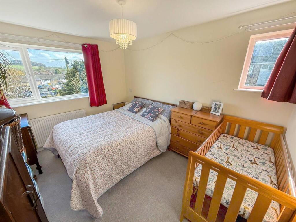
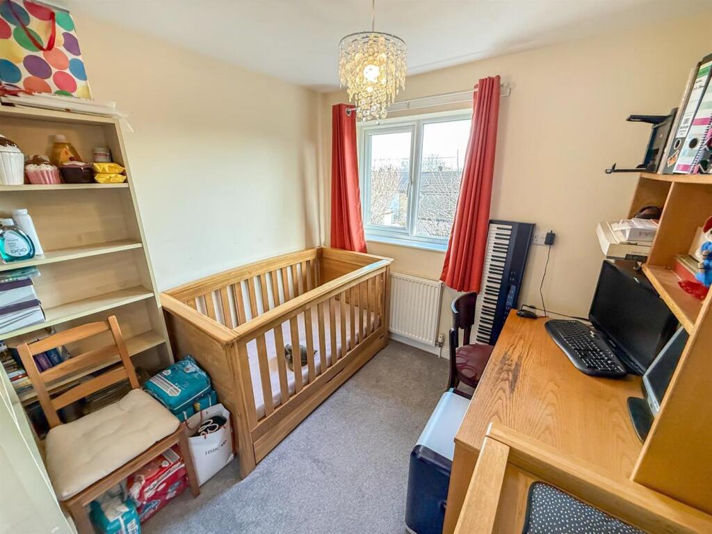
- THREE BEDROOMS
- OFF ROAD PARKING & GARAGE
- GOOD SIZED REAR GARDEN
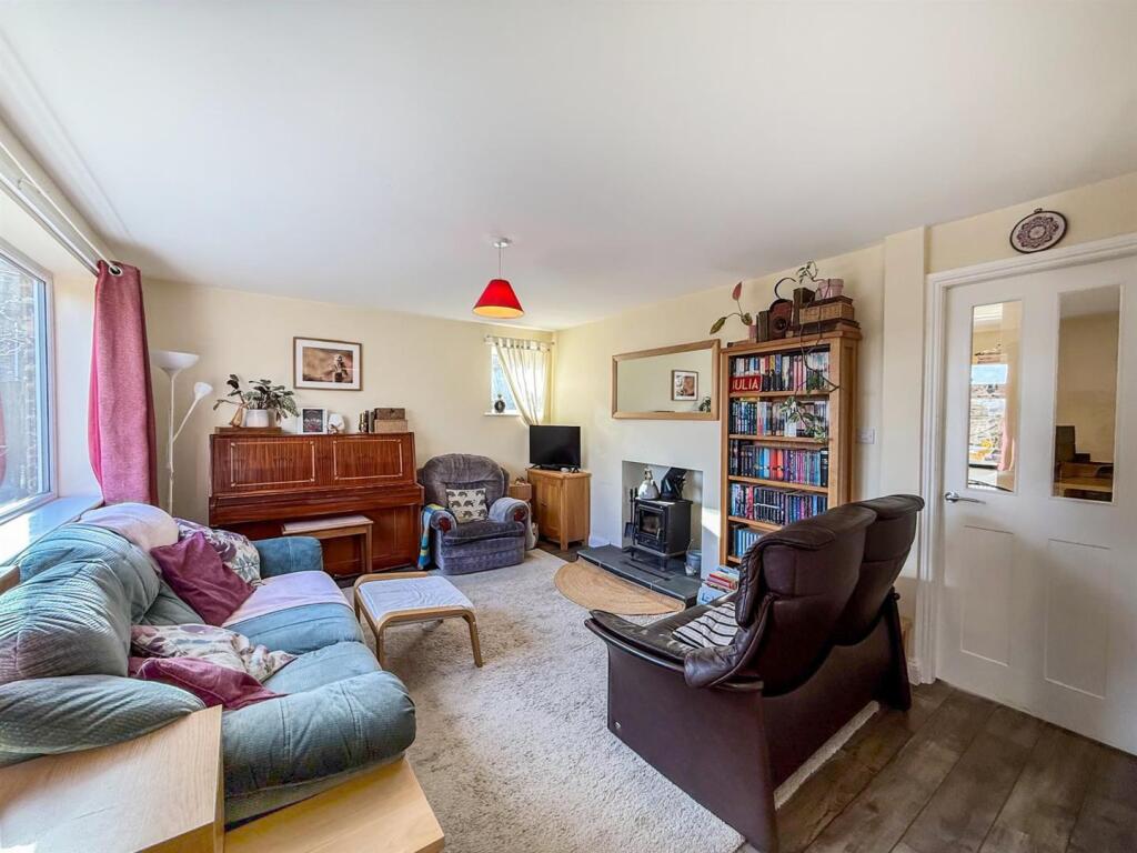
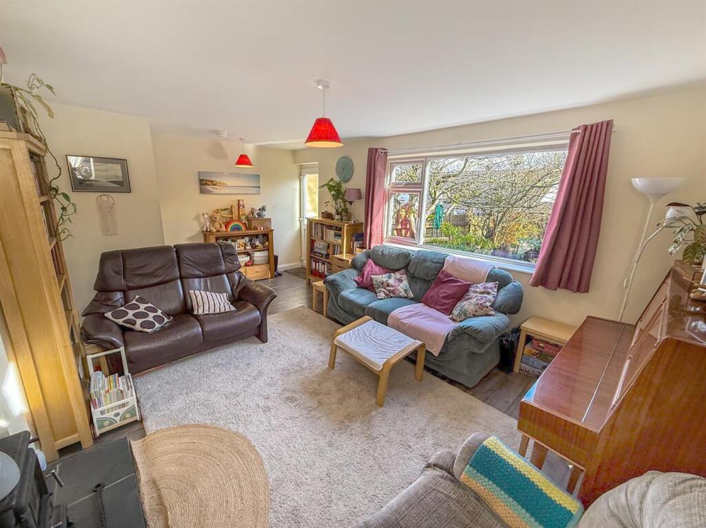
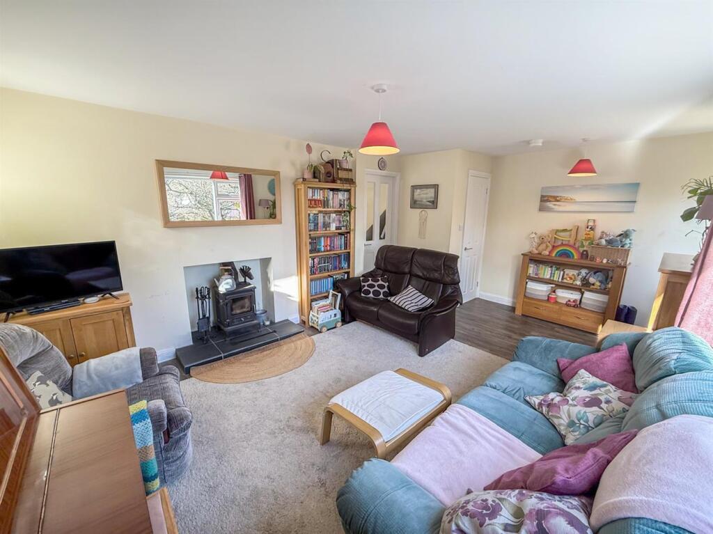
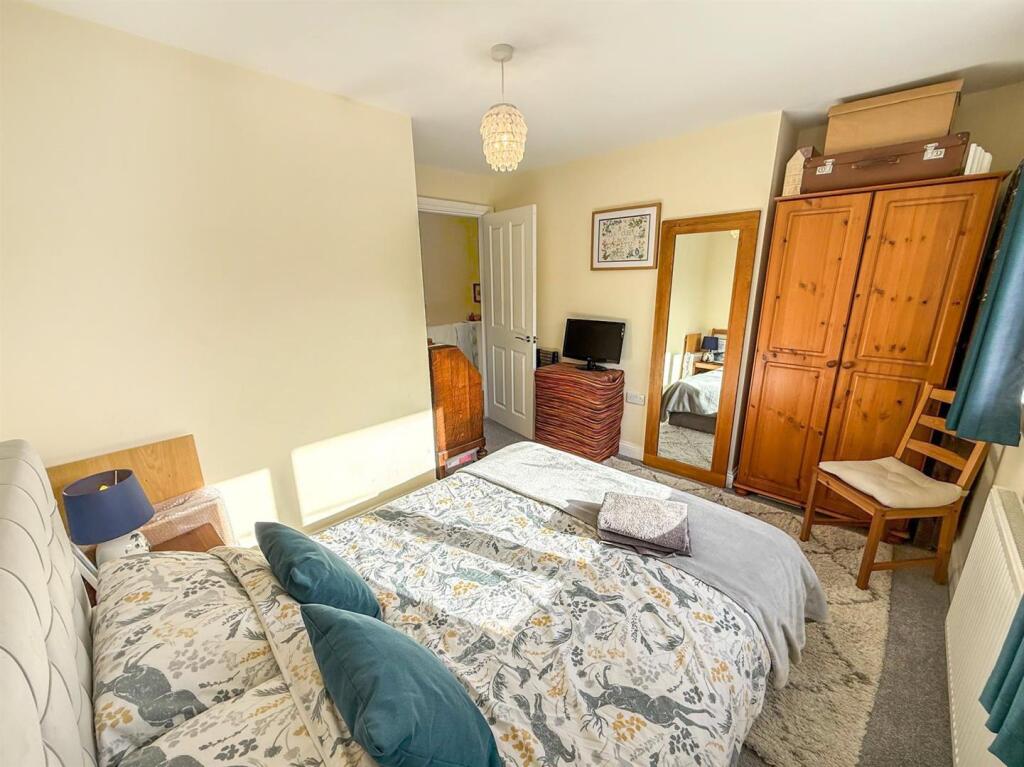
- SPACIOUS LIVING ROOM
- BREAKFAST KITCHEN
Additional details
- Parking
- Yes
- Garden
- Yes
Description
Porch - Timber entrance door with timber framed windows.
Hallway - Karndean flooring, stairs to the first floor and open to the kitchen.
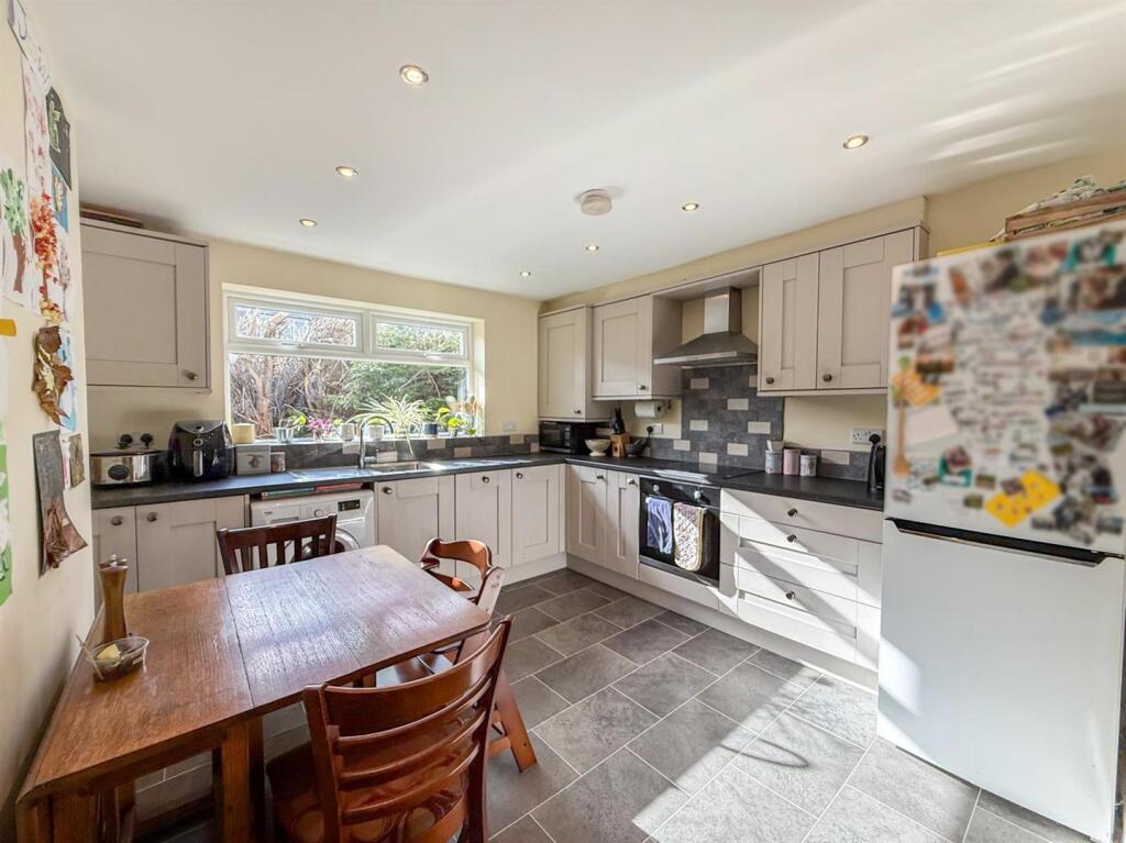
Kitchen - 3.45m x 3.40m (11'4 x 11'2) - uPVC double glazed window, fitted wall and base units, four ring Electric induction hob with integral oven, stainless steel sink and drainer with mixer tap, plumbing for a washing machine, integral dishwasher, radiator and Karndean flooring.
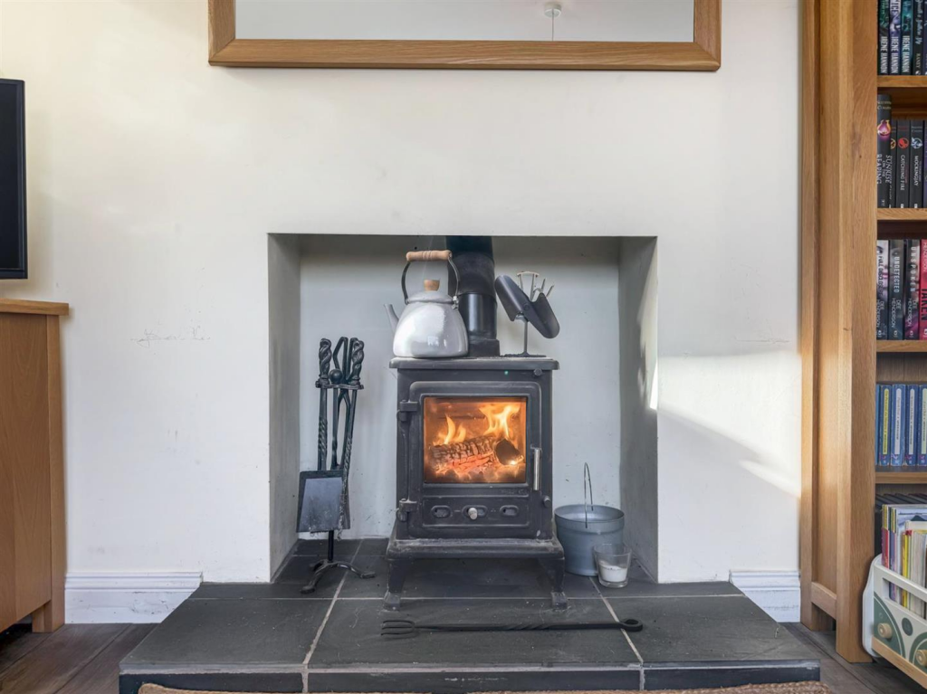
Living Room - 3.56m x 5.44m (max) (11'8 x 17'10 (max)) - uPVC door and two double glazed windows, log burner, under stairs cupboard, radiator and Karndean flooring.
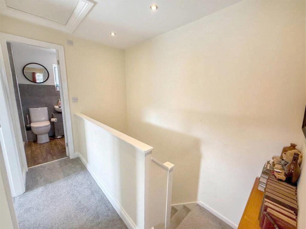
First Floor Landing - Loft access.
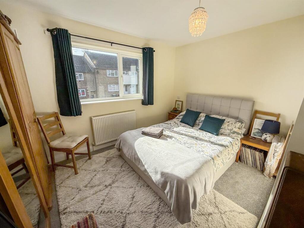
Bedroom One - 3.68m x 3.38m (max) (12'1 x 11'1 (max)) - uPVC double glazed window and a radiator.
Bedroom Two - 3.40m x 3.38m (max) (11'2 x 11'1 (max)) - Two uPVC double glazed windows and a radiator.
Bedroom Three - 2.49m x 2.54m (8'2 x 8'4) - uPVC double glazed window and a radiator.
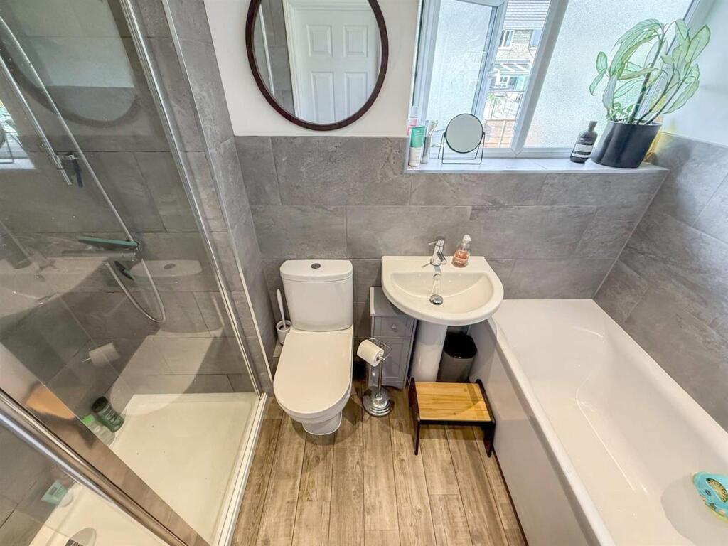
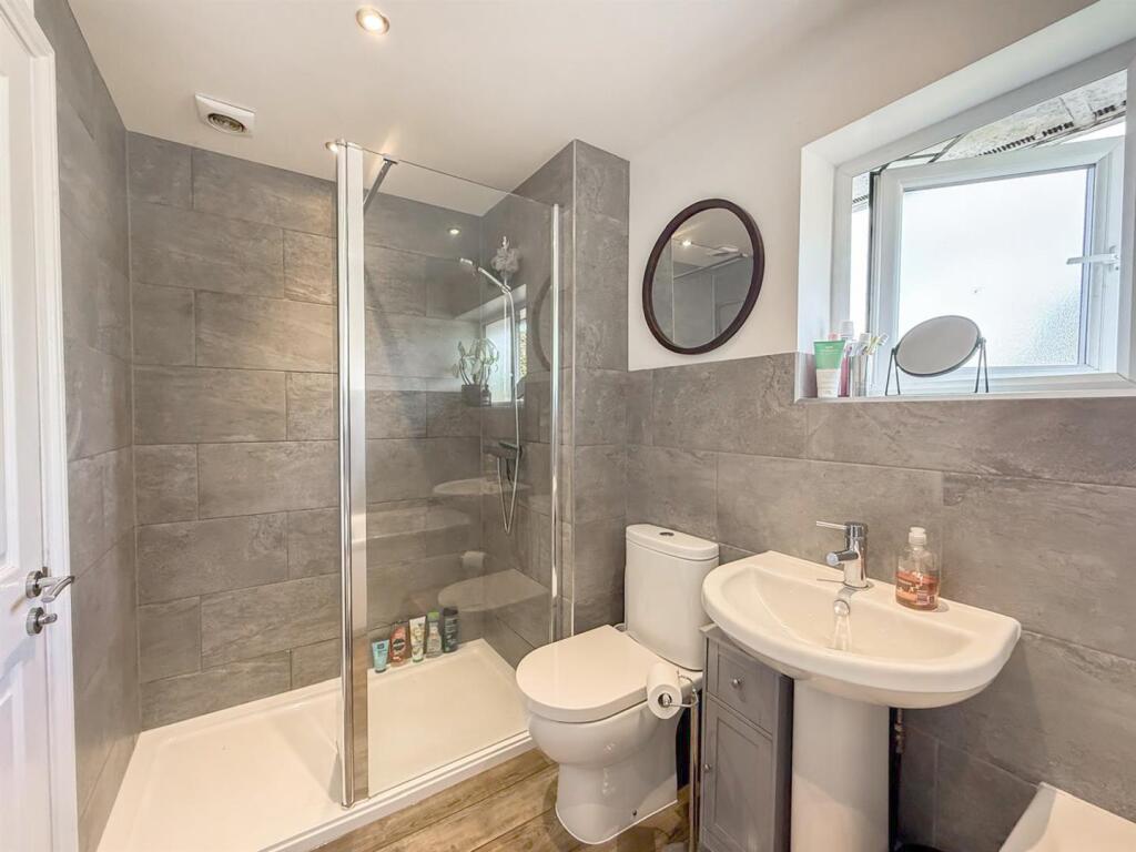
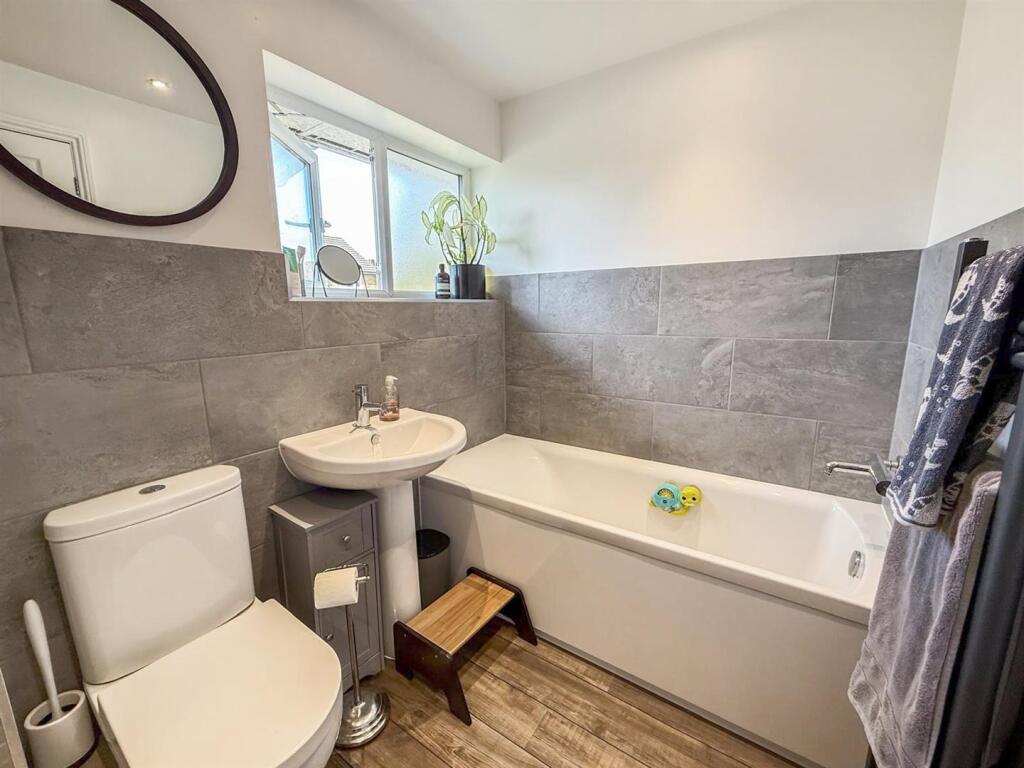
Bathroom - 1.65m x 2.74m (5'5 x 9) - uPVC double glazed window, bath with mixer tap, walk in shower cubicle with wall mounted shower, WC with push flush, pedestal wash basin with mixer tap, ladder style radiator, part tiled walls and Karndean flooring.
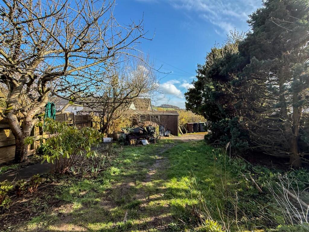
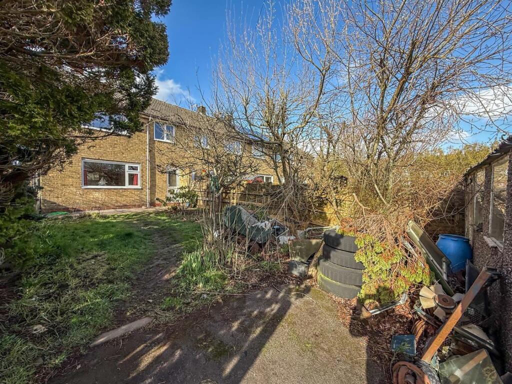
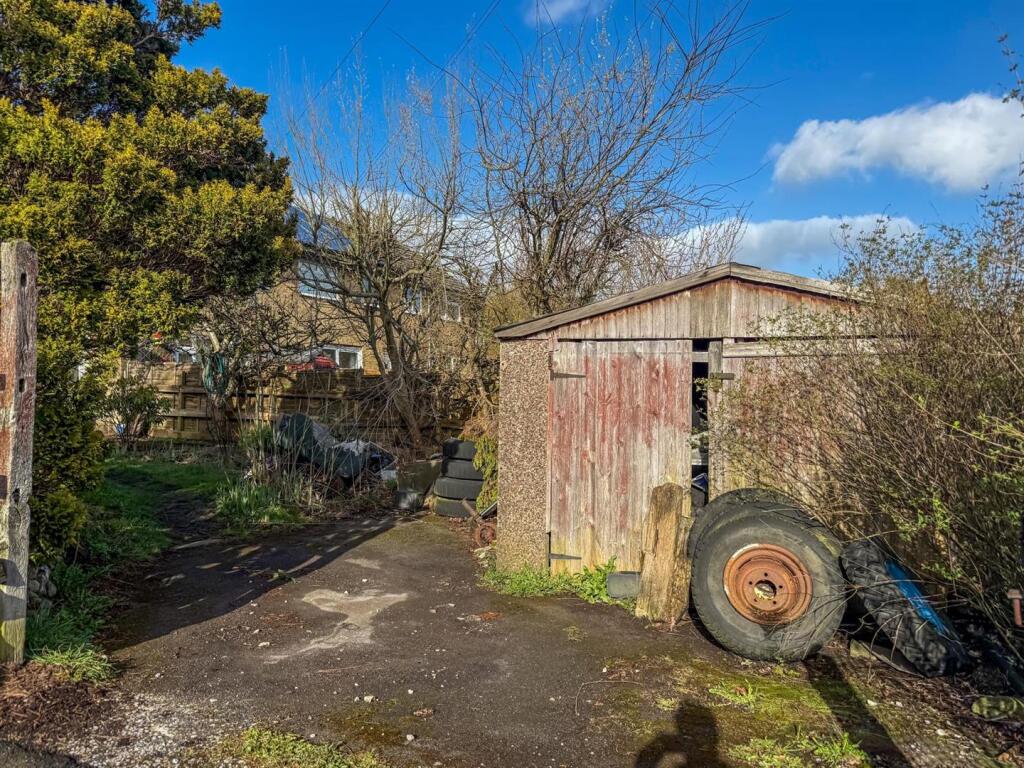
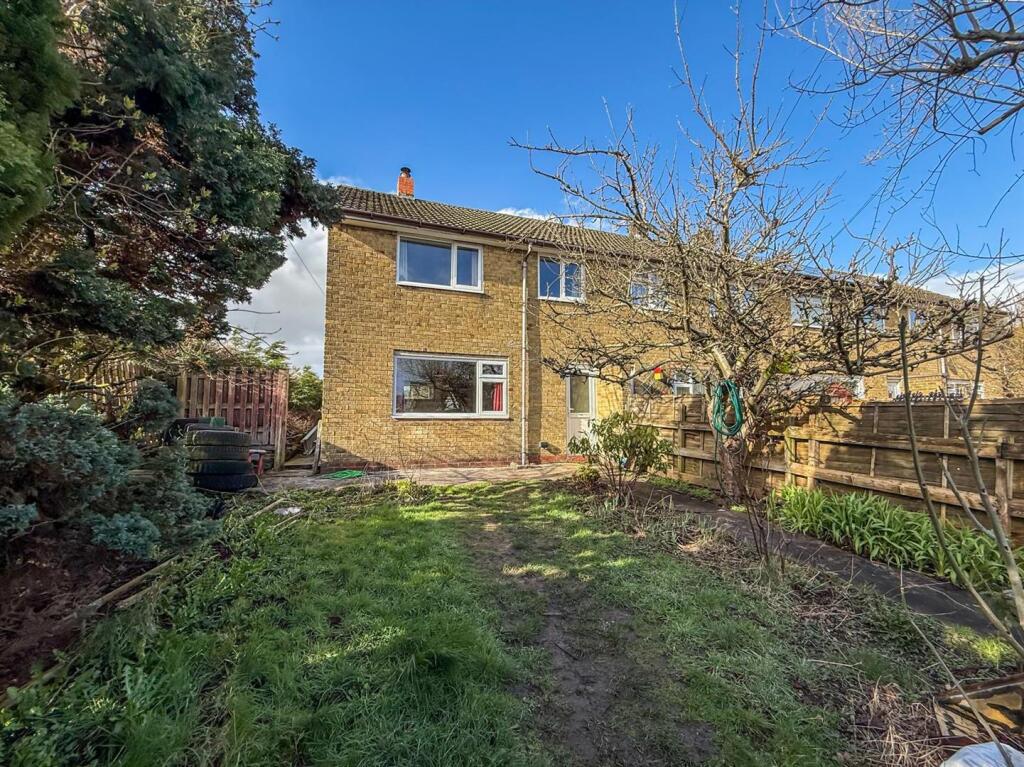
Exterior - To the front of the property are raised flower beds. To the rear is an enclosed garden, mainly laid to lawn, along with a garage and a driveway providing off road parking for two vehicles.
Notes - Tenure: Freehold
Council Tax Band: B
EPC Rating: TBC
What3Words Location: defends.workloads.crumble
Listed by
Buxton
Petty Real
Reference: 173987243
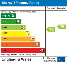
EPC Rating & Upgrade Cost
Current rating: C
Potential rating: C
Inspection date: 15/04/2026
Current heating cost: £1,002/year
Potential heating cost: £932/year
Est. upgrade cost to C: £16,500
Recommendations
- Floor insulation (solid floor) (£5,000 - £10,000)
- Solar photovoltaic panels, 2.5 kWp (£8,000 - £10,000)
Flood risk
Zone: 1
Risk: Low
Job (default Low)
Floorplans
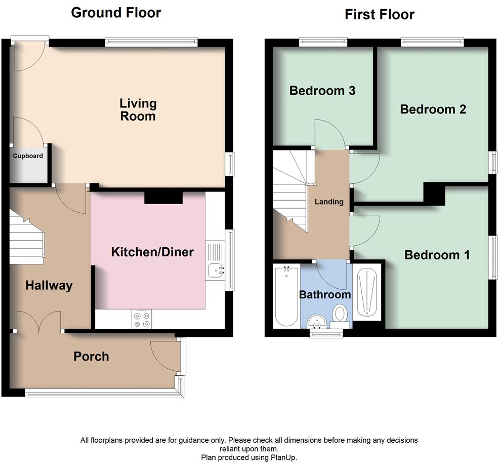
Floorplan (1) (1).PNG
EPC Graphs
EE Rating
Price history
13% since 2010
| Event | Date | Price | % change |
|---|---|---|---|
| Listed for sale | — | £170,000 | +88.9% |
| Sold | 02/08/2012 (13 years ago) | £90,000 | +12.5% |
| Sold | 09/06/2010 (15 years ago) | £80,000 | — |
Source: HM Land Registry Price Paid Data. Crown copyright.
Sold Comparables
Same street and nearby sales within 0.25 miles (last 5 years). Data from Land Registry Price Paid.
| Address | Price | Date | Type |
|---|---|---|---|
| 29 SHELDON ROAD, BUXTON, HIGH PEAK, DERBYSHIRE, SK17 7TT | £149,995 | 06/03/2026 | Terraced |
| 90 CHATSWORTH ROAD, BUXTON, HIGH PEAK, DERBYSHIRE, SK17 7QN | £170,000 | 18/12/2025 | Terraced |
| 69 PICTOR ROAD, BUXTON, HIGH PEAK, DERBYSHIRE, SK17 7TB | £155,000 | 28/11/2025 | Terraced |
| 36 MONSAL AVENUE, BUXTON, HIGH PEAK, DERBYSHIRE, SK17 7TD | £165,000 | 17/10/2023 | Terraced |
| 30 PICTOR ROAD, BUXTON, HIGH PEAK, DERBYSHIRE, SK17 7TB | £121,000 | 31/07/2023 | Terraced |
| Same street 10 ELIZABETH AVENUE, BUXTON, HIGH PEAK, DERBYSHIRE, SK17 7RB | £140,000 | 24/03/2023 | Terraced |
| Same street 32 ELIZABETH AVENUE, BUXTON, HIGH PEAK, DERBYSHIRE, SK17 7RB | £140,000 | 21/12/2022 | Terraced |
| 15 ALPORT AVENUE, BUXTON, HIGH PEAK, DERBYSHIRE, SK17 7TN | £171,000 | 08/11/2022 | Terraced |
| Same street 51 ELIZABETH AVENUE, BUXTON, HIGH PEAK, DERBYSHIRE, SK17 7RB | £153,000 | 07/11/2022 | Terraced |
| 10 MONSAL AVENUE, BUXTON, HIGH PEAK, DERBYSHIRE, SK17 7TH | £146,000 | 07/11/2022 | Terraced |
| 5 EDENSOR AVENUE, BUXTON, HIGH PEAK, DERBYSHIRE, SK17 7QL | £130,000 | 28/10/2022 | Terraced |
| 49 BENCH ROAD, BUXTON, HIGH PEAK, DERBYSHIRE, SK17 7PG | £204,500 | 30/09/2022 | Terraced |
| 25 CHATSWORTH ROAD, BUXTON, HIGH PEAK, DERBYSHIRE, SK17 7QW | £196,000 | 09/09/2022 | Terraced |
| 221 VICTORIA PARK ROAD, BUXTON, HIGH PEAK, DERBYSHIRE, SK17 7PB | £170,000 | 03/08/2022 | Terraced |
| 140 GRANBY ROAD, BUXTON, HIGH PEAK, DERBYSHIRE, SK17 7TA | £127,000 | 18/07/2022 | Terraced |
| 35 CORNWALL AVENUE, BUXTON, HIGH PEAK, DERBYSHIRE, SK17 7LU | £145,000 | 01/07/2022 | Terraced |
| 35 CORNWALL AVENUE, BUXTON, HIGH PEAK, DERBYSHIRE, SK17 7LU | £143,000 | 30/06/2022 | Terraced |
| 102 CHATSWORTH ROAD, BUXTON, HIGH PEAK, DERBYSHIRE, SK17 7QN | £125,000 | 23/05/2022 | Terraced |
| 48A CHATSWORTH ROAD, BUXTON, HIGH PEAK, DERBYSHIRE, SK17 7RA | £155,000 | 27/04/2022 | Terraced |
| 58 CHATSWORTH ROAD, BUXTON, HIGH PEAK, DERBYSHIRE, SK17 7QW | £172,000 | 23/03/2022 | Terraced |
| 223 VICTORIA PARK ROAD, BUXTON, HIGH PEAK, DERBYSHIRE, SK17 7PB | £170,000 | 08/02/2022 | Terraced |
| 4 MONSAL GROVE, BUXTON, HIGH PEAK, DERBYSHIRE, SK17 7TF | £148,000 | 20/12/2021 | Terraced |
| 3 ELTON GROVE, BUXTON, HIGH PEAK, DERBYSHIRE, SK17 7SU | £124,439 | 20/12/2021 | Terraced |
| Same street 22 ELIZABETH AVENUE, BUXTON, HIGH PEAK, DERBYSHIRE, SK17 7RB | £127,000 | 25/10/2021 | Terraced |
Street average: £140,000 (4 sales)
Area average: £154,397 (20 sales)
Capital growth trend
Land Registry outcode average: last 12 months vs 5y and 10y ago (from sold prices).
House Price Index (HM Land Registry — official index, not sold-price averages): High Peak. Series: Terraced. As of March 2026.
Rental Range
Estimated market rent for High Peak. Low = conservative, Realistic = average, Optimistic = best case.
Based on Local Authority from postcode lookup → High Peak.
LHA (30th percentile) floor for Peaks & Dales: £693/mo (Apr 2025 – Mar 2026)
Location
Nearby
Nearest stations, universities and amenities (distance from property).
| Type | Name | Distance |
|---|---|---|
| Shop | Morrisons Daily | 0.1 miles |
| Shop | One Stop | 0.1 miles |
| Bus stop | Unknown | 0.2 miles |
| Bus stop | Buxton, Fairfield Road / opposite Working Mens Club | 0.5 miles |
| Hospital | Buxton Hospital & Corbar Birth Centre | 0.7 miles |
| Train station | Buxton | 0.7 miles |
| Hospital | Buxton Health Centre | 0.9 miles |
| University | University of Derby, Buxton | 0.9 miles |
| Train station | Buxton Miniature Railway | 0.9 miles |
| University | Cliff College | 11.1 miles |
Street-level crime
| Category | Count |
|---|---|
| Violence and sexual offences | 57 |
| Anti-social behaviour | 26 |
| Criminal damage and arson | 20 |
| Public order | 13 |
| Shoplifting | 13 |
| Other theft | 6 |
| Burglary | 5 |
| Other crime | 3 |
| Vehicle crime | 3 |
| Bicycle theft | 2 |
| Drugs | 2 |
| Theft from the person | 2 |
| Robbery | 1 |
| Total incidents | 153 |
Within 1 mile during Mar 2026. Source: data.police.uk (England & Wales).
Schools nearby
Nearest open schools with Ofsted ratings (England). Closed schools are not shown. Data from Get Information about Schools and Ofsted.
| Name | Type | Distance | Ofsted |
|---|---|---|---|
| Fairfield Endowed CofE (C) Junior School | Primary | 0.3 miles | Good — 16 Jun 2019 |
| Fairfield Infant and Nursery School | Primary | 0.3 miles | Good — 14 Nov 2018 |
| Buxton Infant School | Primary | 0.6 miles | Good — 30 Jan 2024 |
| Buxton Junior School | Primary | 0.8 miles | Good — 1 Dec 2017 |
| St Anne's Catholic Voluntary Academy | Primary | 0.8 miles | Good — 7 Feb 2023 |
Rental Comparables
Loading rental comparables for this postcode. Refresh in a few minutes.
Rent-driven metrics
Based on Area rent estimate.
- Rent ratio — Monthly rent ÷ purchase price (1% rule). 1%+ = strong, 0.8–1% = okay, <0.8% = weak for cashflow.
- Max investor price — Rent ÷ 0.8%; the price at which rent would be 0.8% of price (Stoke-style target).
- Target investor price — Rent ÷ 1%; the price at which rent would be 1% of price (strong cashflow band).
- Gross yield — Annual rent as % of purchase price (no costs).