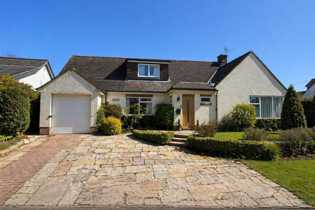
FAR HILLS
ANDERTONS LANE, MACCLESFIELD, HENBURY, CHESHIRE EAST SK11 9PB
£875,000

Front (Exterior) Hallway Living Room Living Room Dining Room Dining Room Dining Room Kitchen Kitchen Kitchen Study Bathroom Living Room Loft Bedroom Bedroom Bedroom Bathroom Bedroom Bedroom Bedroom Bedroom WhatsApp Image 2026-04-23 at 09.16.56.jpeg WhatsApp Image 2026-04-23 at 09.16.56 (1).jpeg Rear Garden Rear Garden Exterior Rear Garden Exterior
/ 29
Property details
Tenure
FREEHOLD
Floor area
203 m²
Council tax band
G
EPC rating
D
Year built
England and Wales: 1950-1966
Last sold
£580,000 Jul 2019
Price per m²
£4,310/m²
Local average
£578,919 (+51.1%)
Street crime
14 incidents within 1 mile (May 2026)
Key features
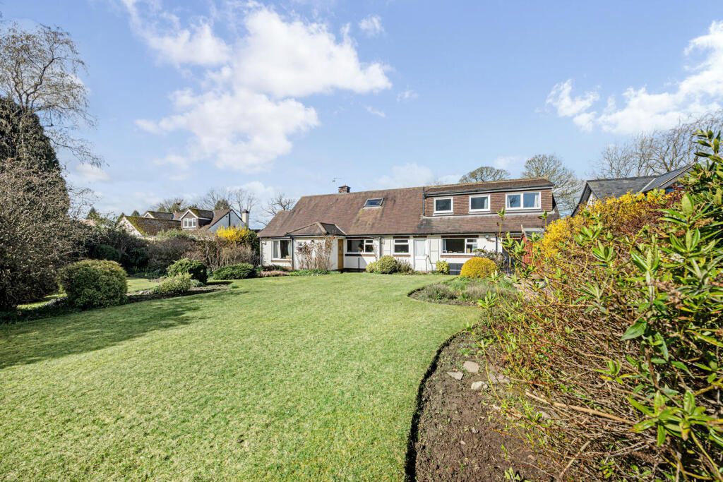
- A substantial five-bedroom detached home offers excellent space for family living
- A section of the ground floor can be used independently, offering its own bedroom, sitting room and bathroom
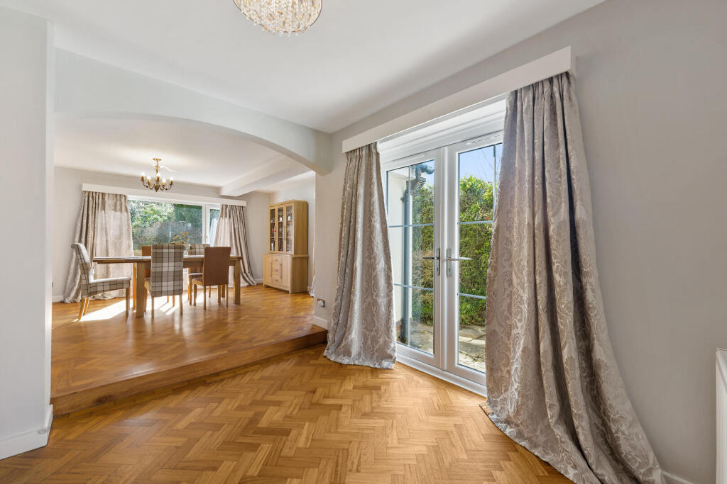
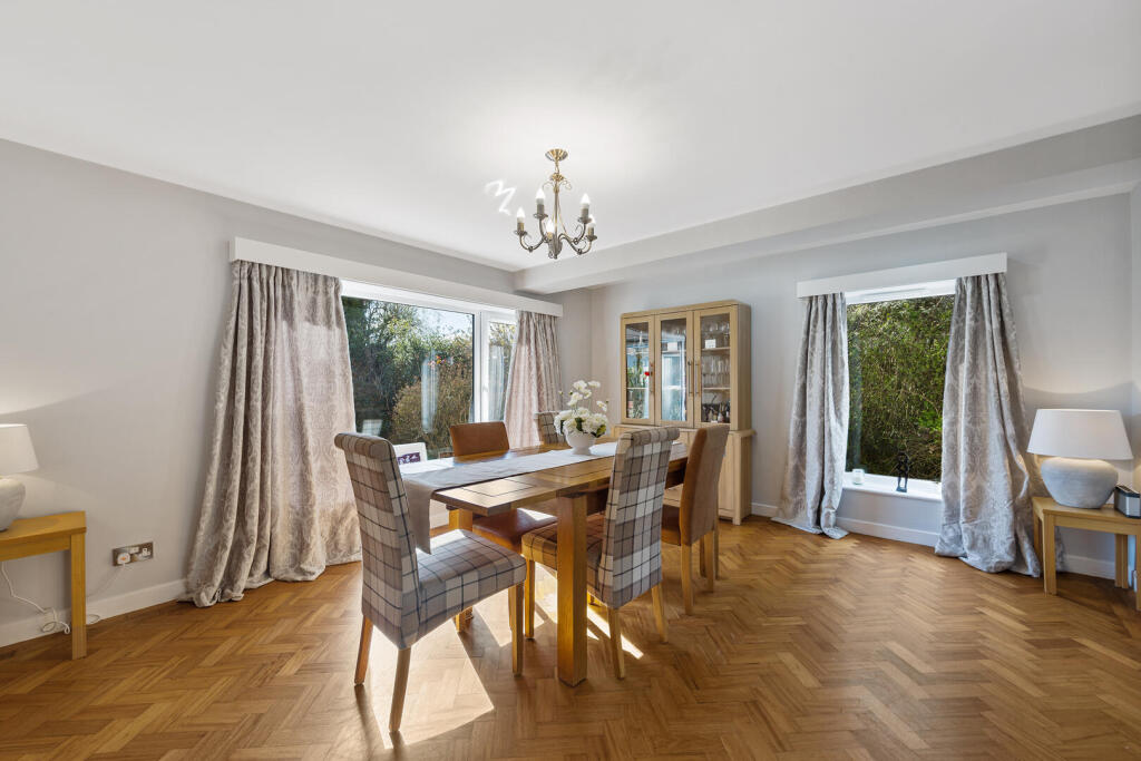
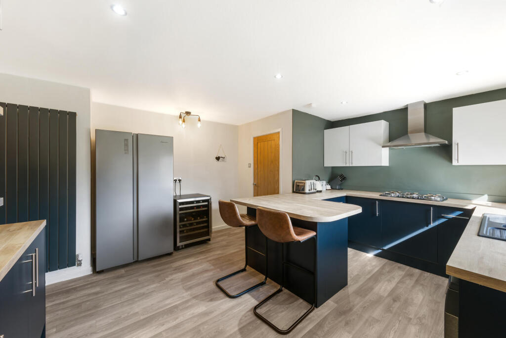
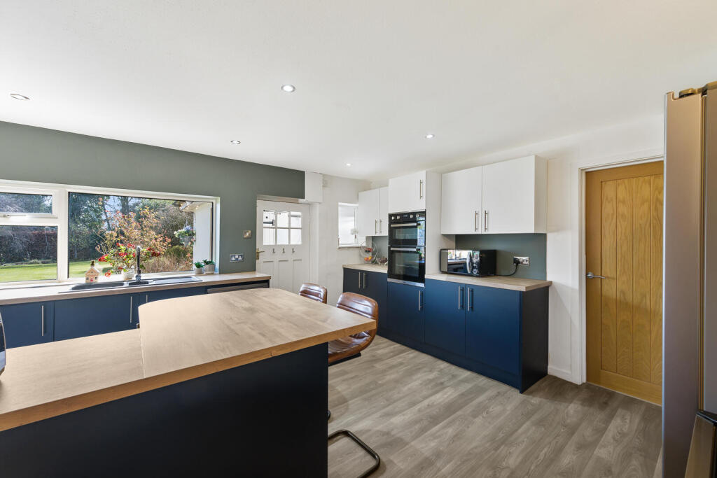
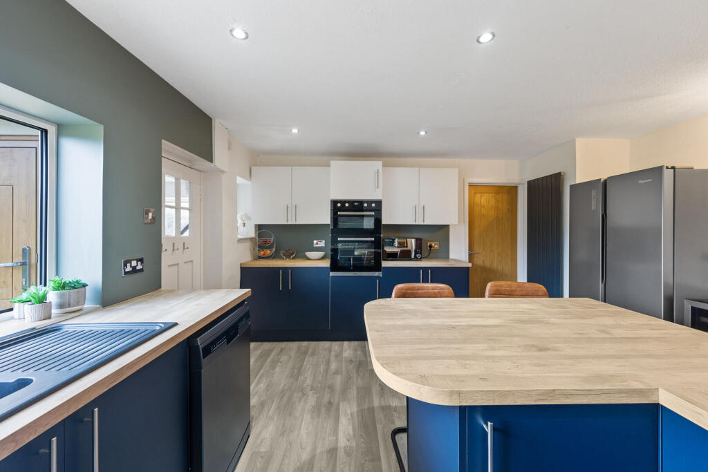
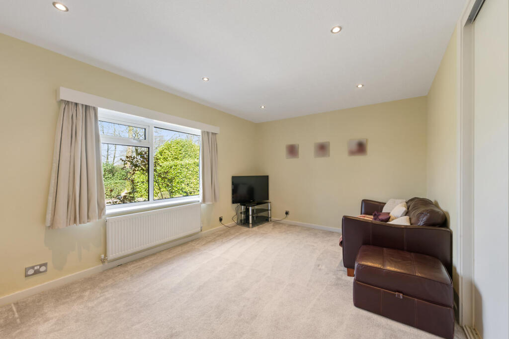
- Cloakroom/WC, living room, dining room and a breakfast kitchen with adjoining utility area
- Lawned frontage and a driveway leading to a tandem garage. Rear garden is both expansive and private
- The property also comes with approved planning permission
Additional details
- Electricity
- Mains supply
- Broadband
- FTTP (fibre to the premises)
- Water
- Mains supply
- Sewerage
- Mains supply
- Heating
- Gas central
- Parking
- Garage, Driveway
- Garden
- Yes
- Listed property
- No
- Restrictions
- Yes
- Required access
- No
- Rights of way
- No
- Flooded in last 5 years
- No
- Flood defences
- No
Description
The layout is particularly flexible, making it well suited to multi-generational living. A section of the ground floor can be used independently, offering its own bedroom, sitting room and bathroom —ideal for an older relative or guest accommodation.
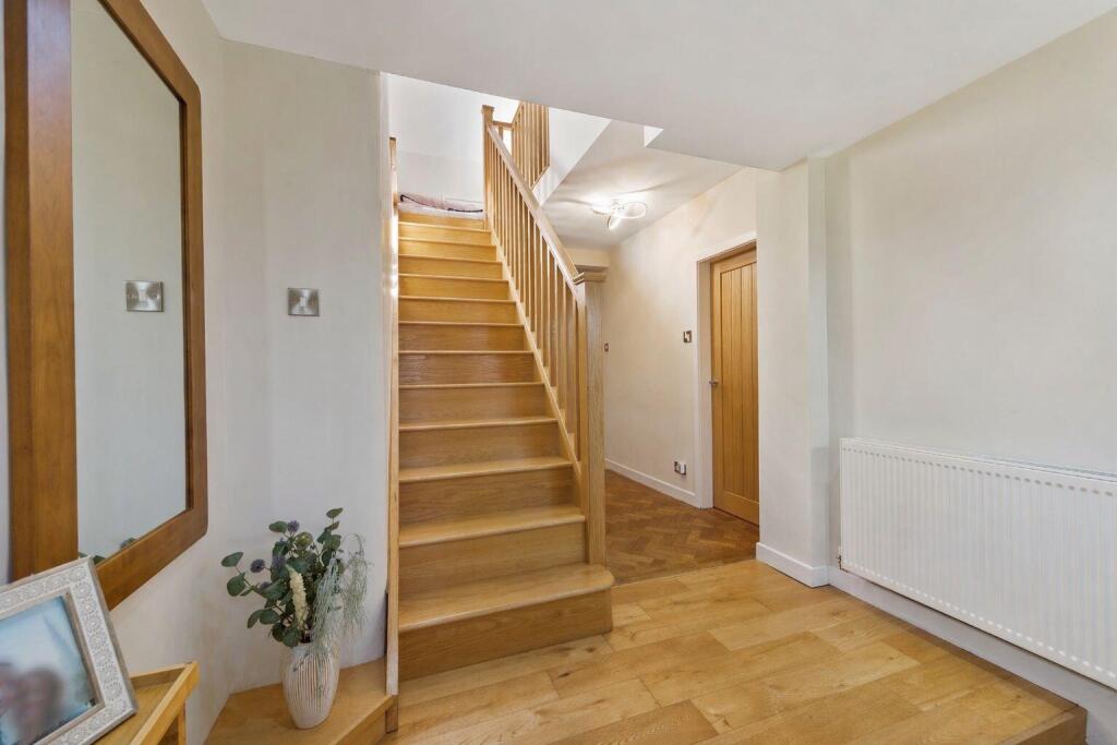
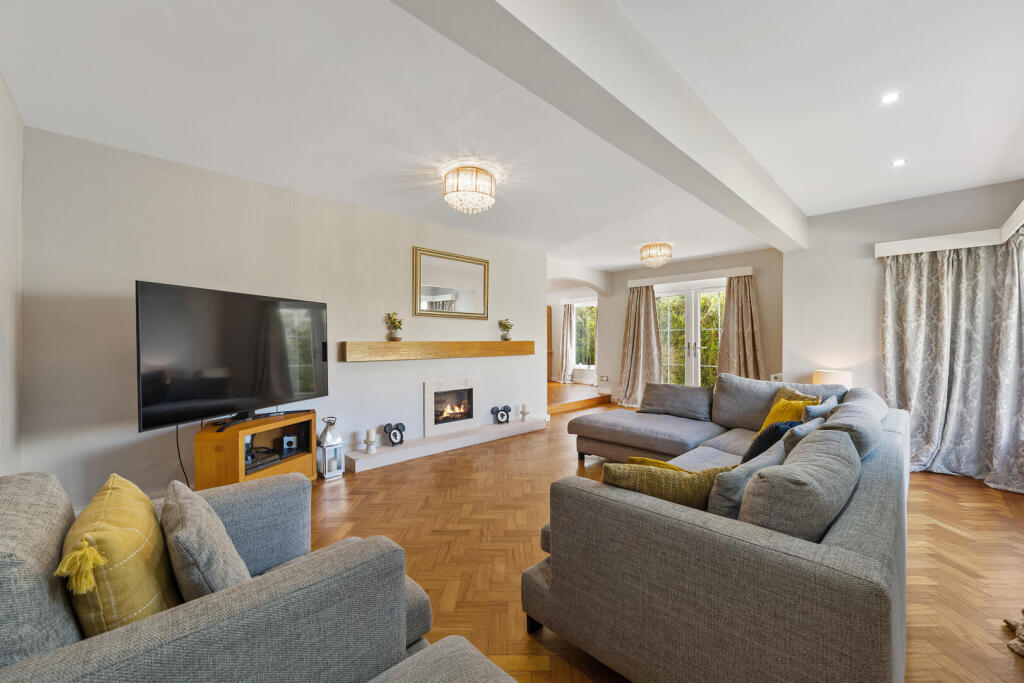
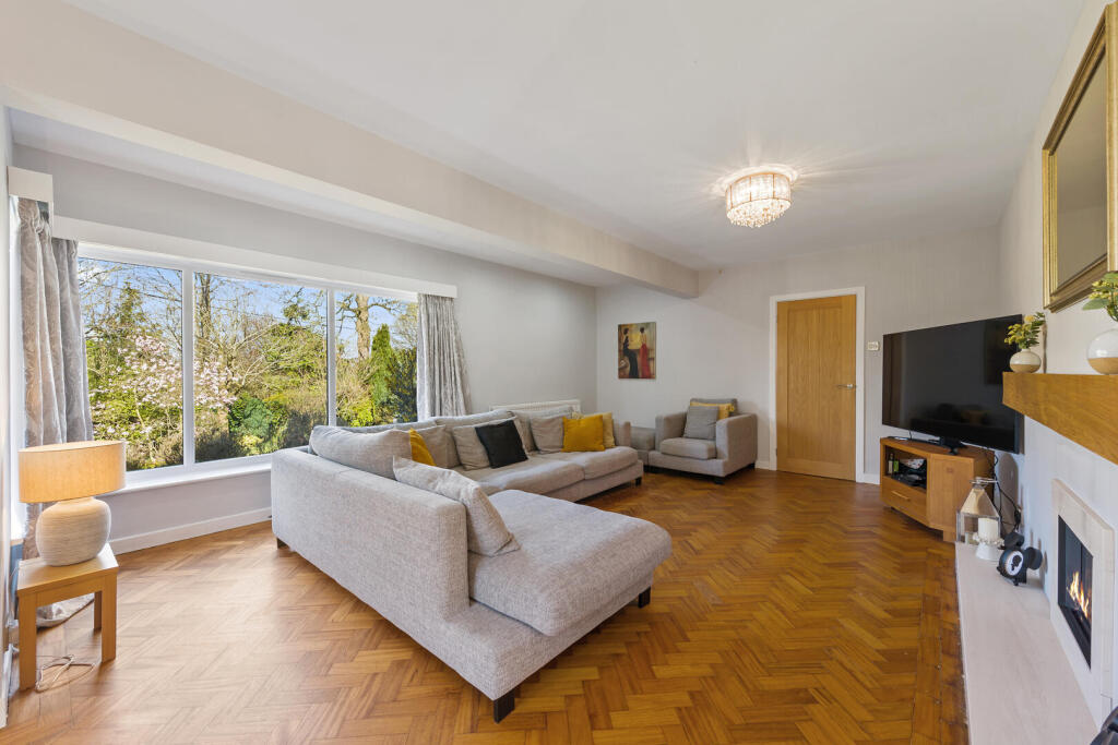
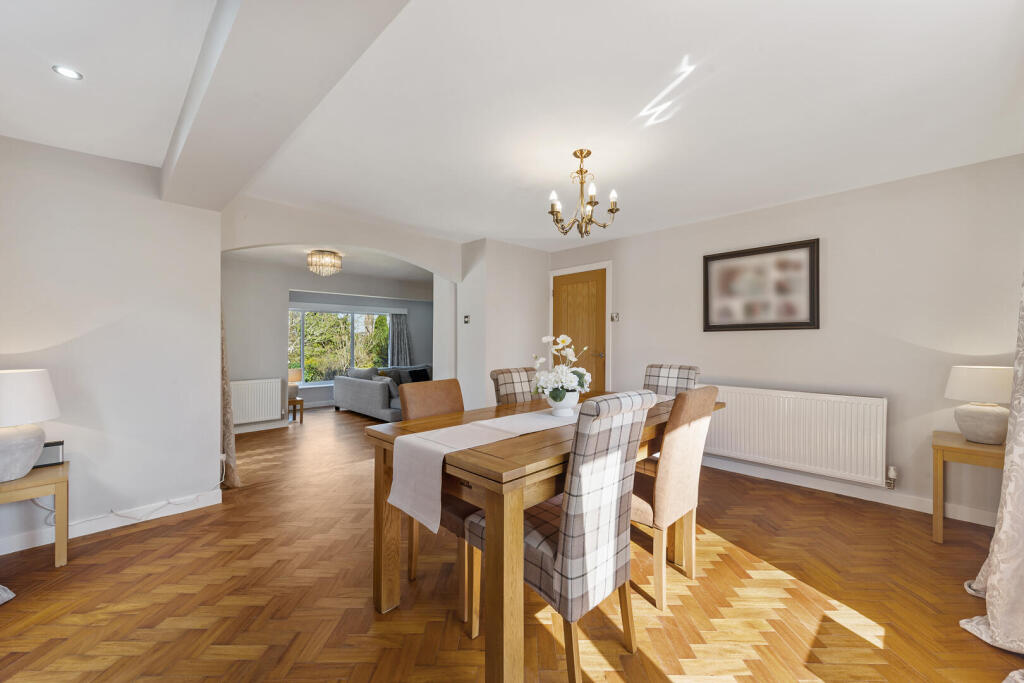
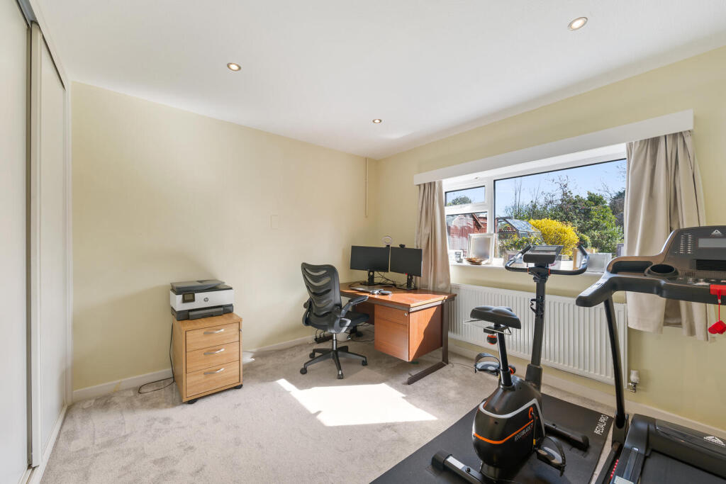
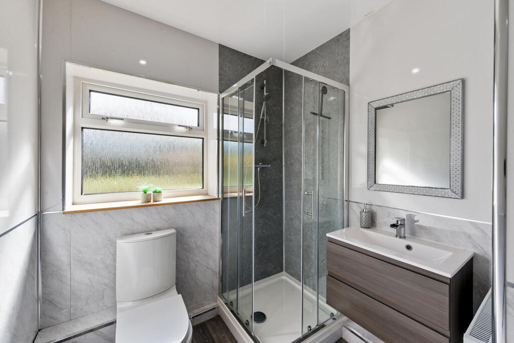
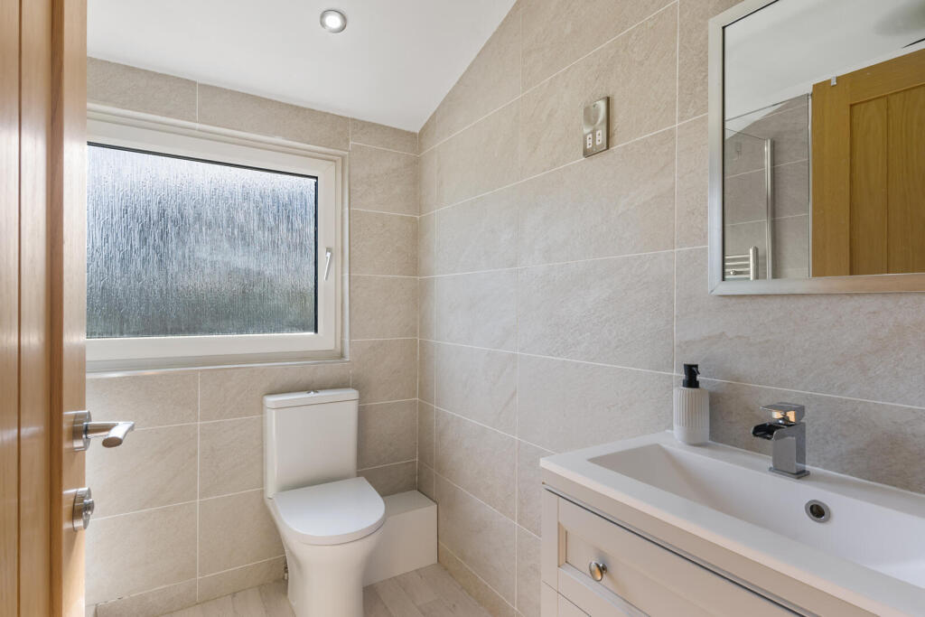
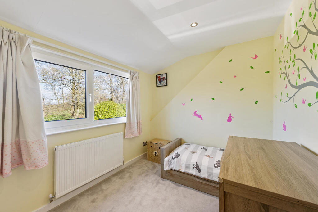
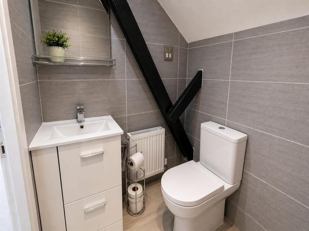
The main ground floor includes an entrance porch leading into a central hallway, with access to a cloakroom/WC, living room, dining room and a breakfast kitchen with adjoining utility area. There are also two additional rooms currently used as further bedrooms/playrooms, along with a ground floor bathroom and additional rear access.
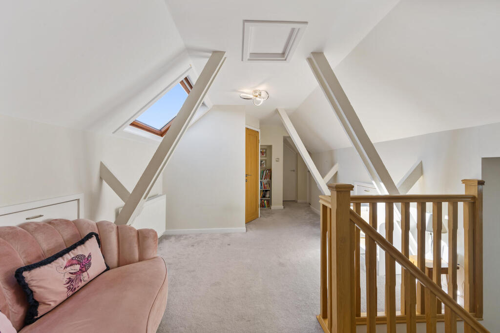
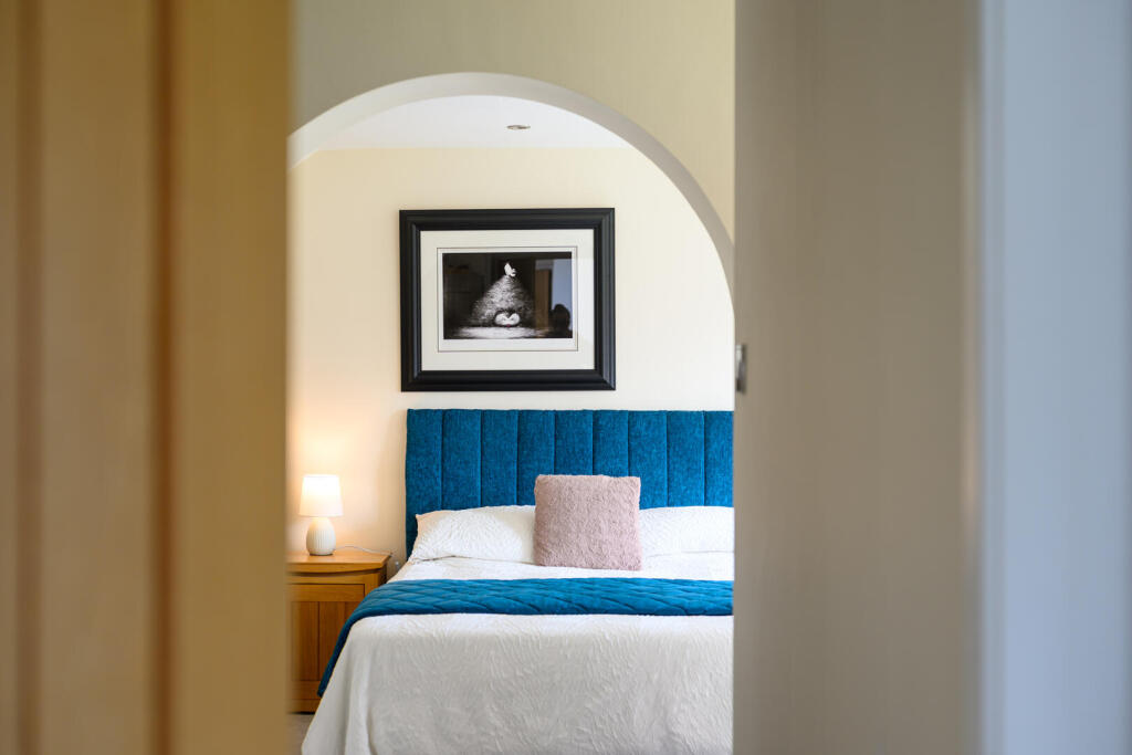
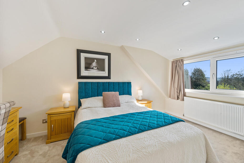
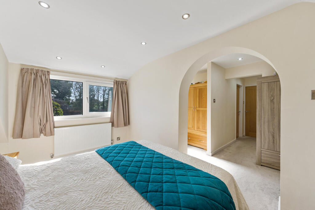
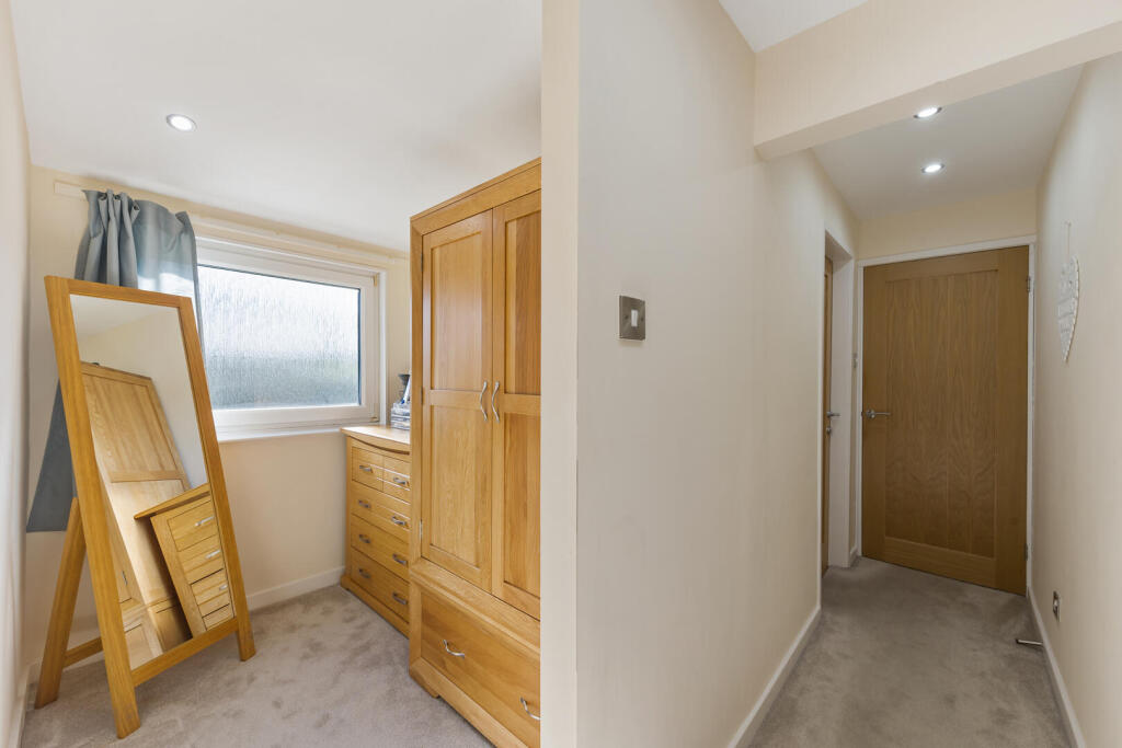
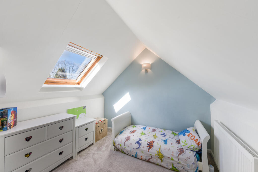
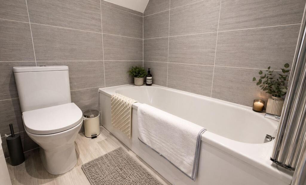
Upstairs, the landing is spacious enough to accommodate a study area and leads to four bedrooms and a family bathroom. The principal bedroom benefits from a dressing area and en-suite facilities.
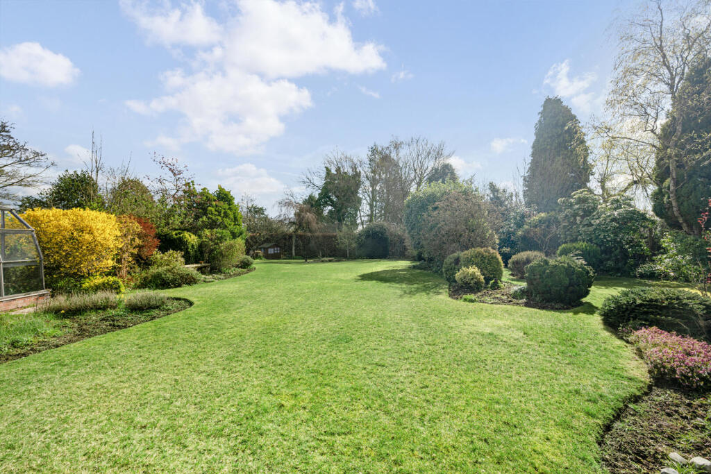
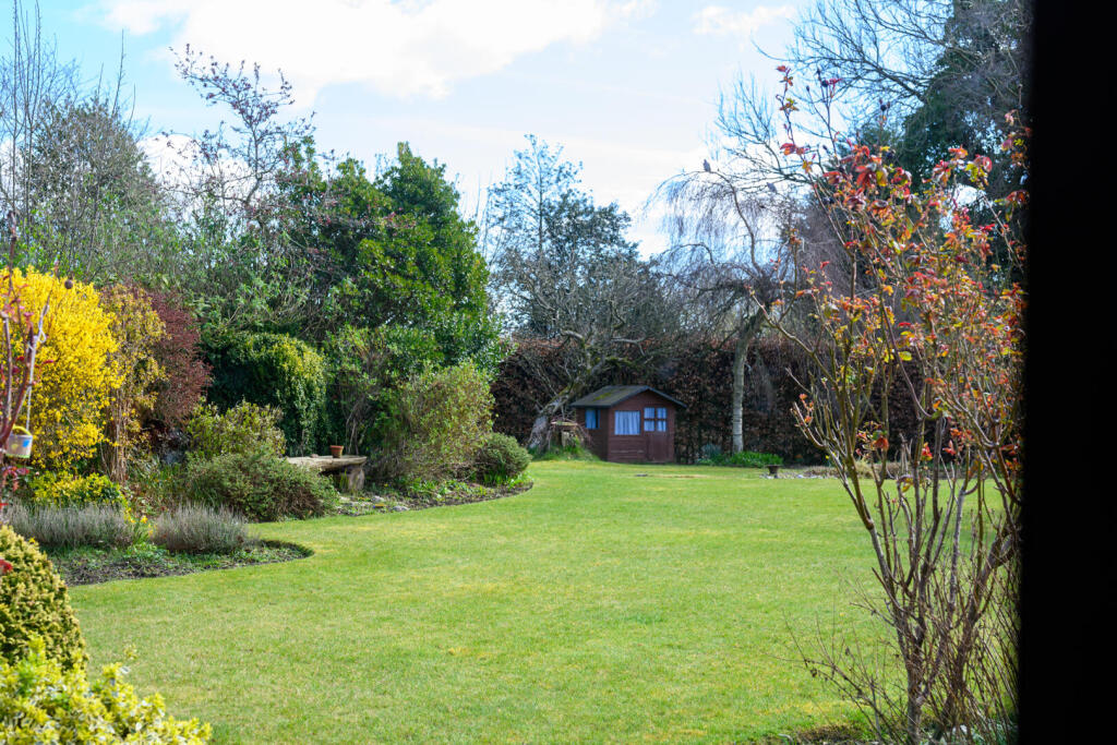
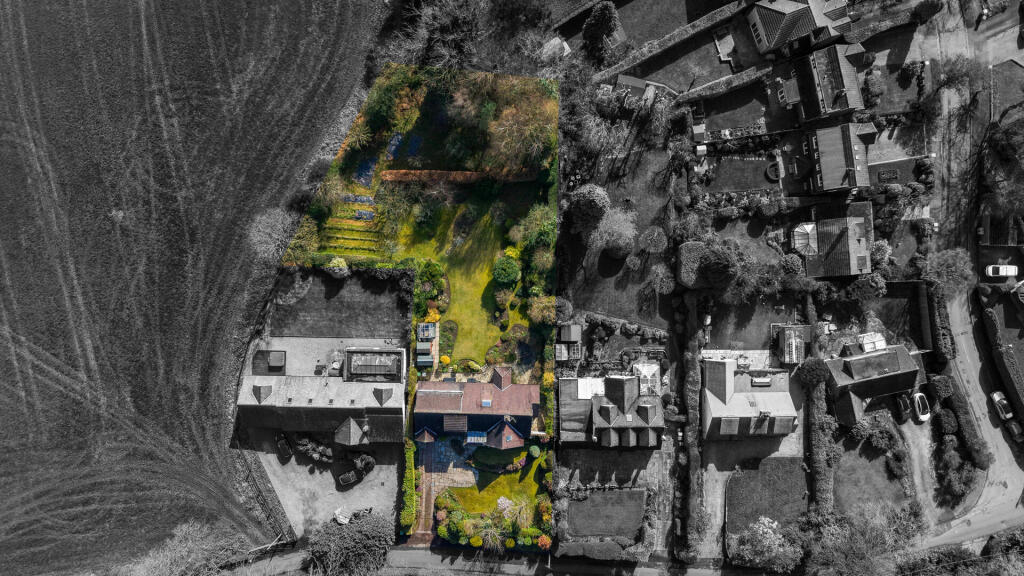
Outside, the property sits on an impressive plot with a lawned frontage and a driveway leading to a tandem garage. The rear garden is a real highlight, both expansive and private, offering plenty of potential for landscaping or future enhancement.
The property also comes with approved planning permission (ref: 23/4511M), providing an exciting opportunity to extend and further increase the living space.
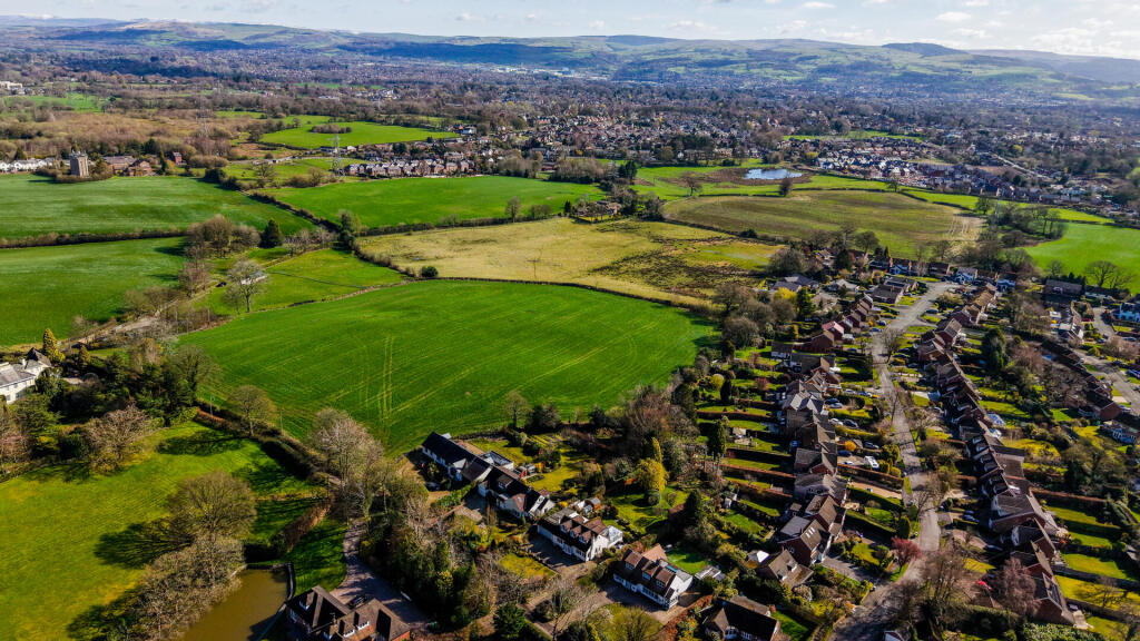
Situated in a semi-rural yet accessible location, the property is within easy reach of Alderley Edge and Macclesfield, with the latter offering mainline rail connections to Manchester and London. The area is also set to benefit from a nearby school development, adding to its long-term appeal.
Listed by
Macclesfield
Rostons
Reference: 174910670
EPC Rating & Upgrade Cost
Current rating: D
Potential rating: C
Inspection date: 20/03/2019
Expiry date: 19/03/2029
Current heating cost: £1,638/year
Potential heating cost: £1,555/year
Recommendations
- Floor insulation (solid floor) (6,000)
- Low energy lighting for all fixed outlets (80)
- Solar water heating (6,000)
- Solar photovoltaic panels, 2.5 kWp (8,000)
Flood risk
Zone: 1
Risk: Low
Job (default Low)
Floorplans
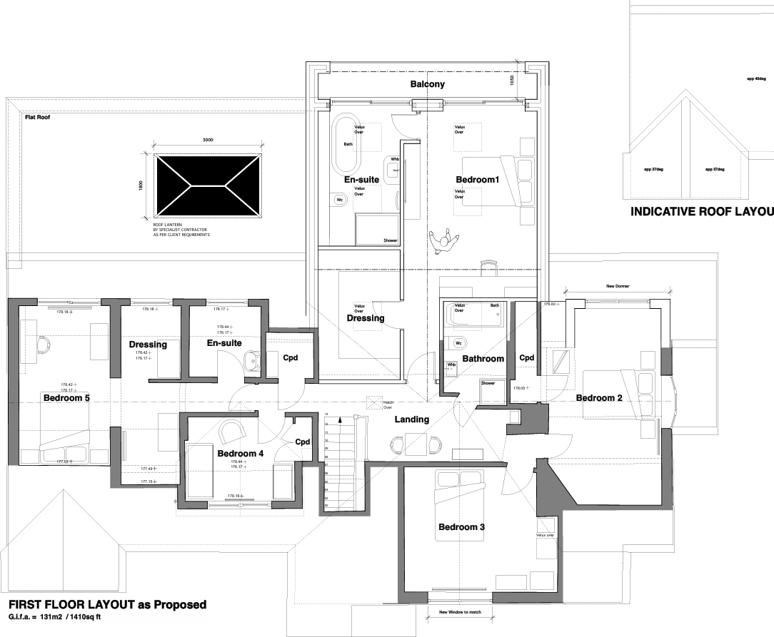
Planning Permission
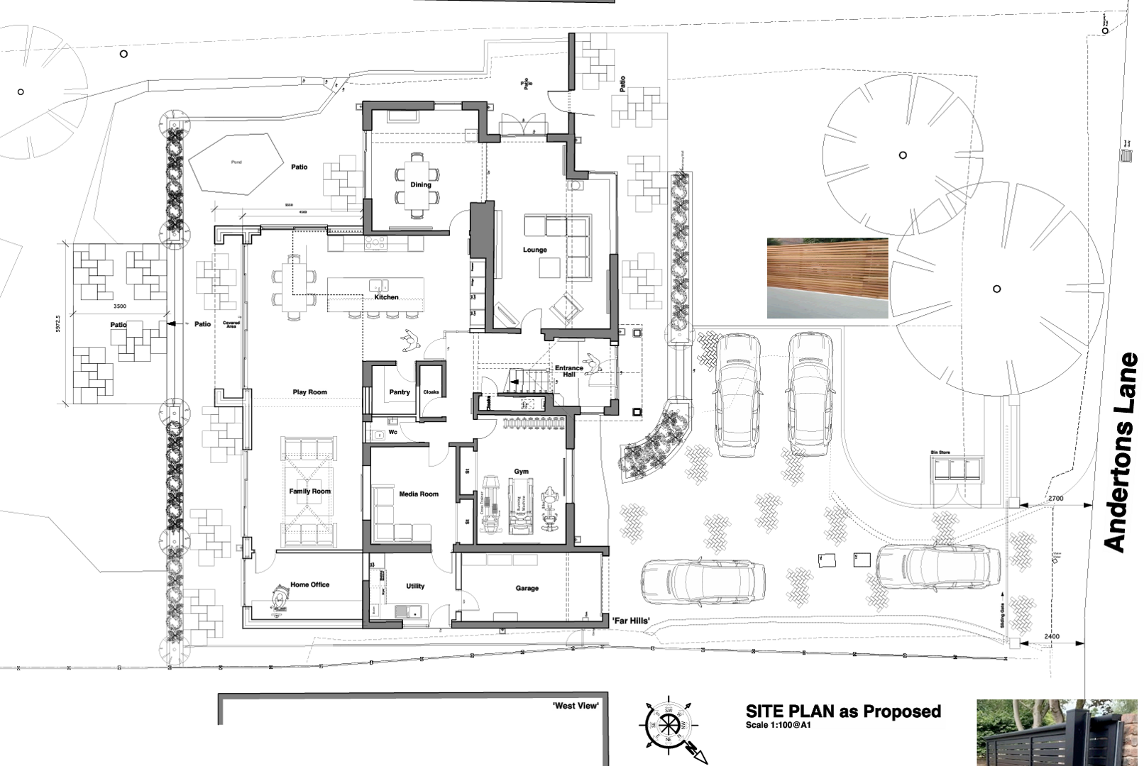
Planning Permission
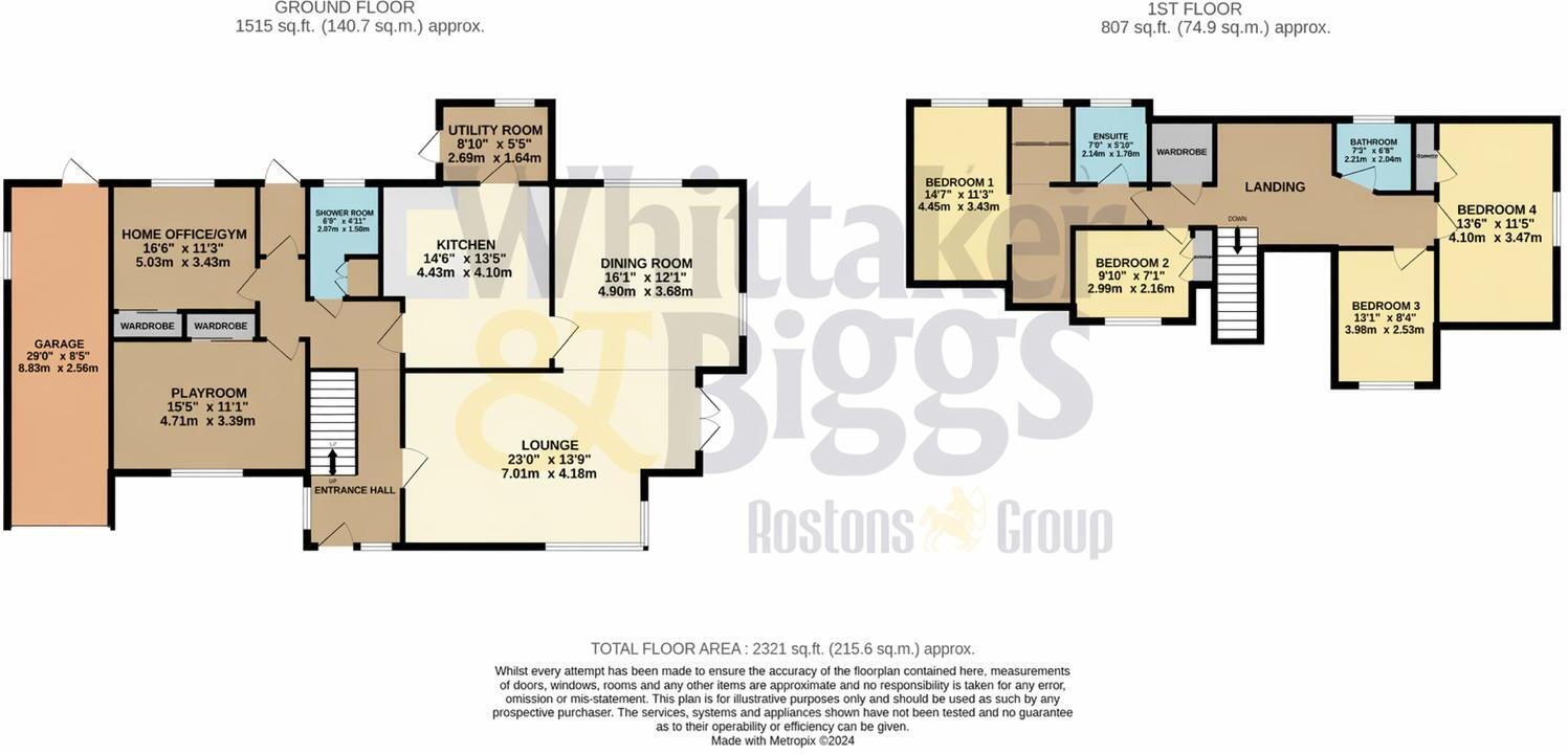
Floor Plan
Price history
| Event | Date | Price | % change |
|---|---|---|---|
| Listed for sale | — | £875,000 | +50.9% |
| Sold | 22/07/2019 (6 years ago) | £580,000 | — |
Source: HM Land Registry Price Paid Data. Crown copyright.
Sold Comparables
Same street and nearby sales within 0.25 miles (last 5 years). Data from Land Registry Price Paid.
| Address | Price | Date | Type |
|---|---|---|---|
| 6 EDGEWAY, HENBURY, MACCLESFIELD, CHESHIRE EAST, SK11 9PA | £665,000 | 09/01/2026 | Detached |
| 28 CHURCH LANE, HENBURY, MACCLESFIELD, CHESHIRE EAST, SK11 9NN | £705,000 | 30/08/2024 | Detached |
| BEECH COTTAGE CHURCH LANE, HENBURY, MACCLESFIELD, CHESHIRE EAST, SK11 9NN | £480,000 | 11/03/2024 | Detached |
| 5 EDGEWAY, HENBURY, MACCLESFIELD, CHESHIRE EAST, SK11 9PA | £465,000 | 28/10/2022 | Detached |
| Same street GLENCREE ANDERTONS LANE, HENBURY, MACCLESFIELD, CHESHIRE EAST, SK11 9PB | £509,000 | 28/09/2022 | Other |
| 13 WORTHINGTON CLOSE, HENBURY, MACCLESFIELD, CHESHIRE EAST, SK11 9NS | £475,000 | 01/08/2022 | Detached |
| BIRCH TREE COTTAGE ANDERTONS LANE, HENBURY, MACCLESFIELD, CHESHIRE EAST, SK10 4RW | £650,000 | 10/12/2021 | Detached |
Street average: £509,000 (1 sale)
Area average: £573,333 (6 sales)
Capital growth trend
Land Registry outcode average: last 12 months vs 5y and 10y ago (from sold prices).
House Price Index (HM Land Registry — official index, not sold-price averages): Cheshire East. Series: Detached. As of April 2026.
Rental Range
Estimated market rent for Cheshire East. Low = conservative, Realistic = average, Optimistic = best case.
Based on Local Authority from postcode lookup → Cheshire East.
LHA (30th percentile) floor for East Cheshire: £1,745/mo (Apr 2025 – Mar 2026)
Location
Address
Andertons Lane
Nearby
Nearest stations, universities and amenities (distance from property).
| Type | Name | Distance |
|---|---|---|
| Bus stop | Henbury, Chelford Road / Blacksmith's Arms PH | 0.3 miles |
| Shop | Gulf Store | 0.3 miles |
| Shop | Quirkydo | 0.9 miles |
| Hospital | Rosemount Resource Centre | 1.5 miles |
| Train station | Macclesfield | 2.5 miles |
| Train station | Prestbury | 2.6 miles |
| Hospital | John Munroe Hospital | 10.4 miles |
| University | University of Derby, Buxton | 11.0 miles |
Street-level crime
| Category | Count |
|---|---|
| Other crime | 3 |
| Violence and sexual offences | 3 |
| Anti-social behaviour | 2 |
| Burglary | 1 |
| Criminal damage and arson | 1 |
| Drugs | 1 |
| Other theft | 1 |
| Public order | 1 |
| Vehicle crime | 1 |
| Total incidents | 14 |
Within 1 mile during May 2026. Source: data.police.uk (England & Wales).
Schools nearby
Nearest open schools with Ofsted ratings (England). Closed schools are not shown. Data from Get Information about Schools and Ofsted.
| Name | Type | Distance | Ofsted |
|---|---|---|---|
| Whirley Primary School | Primary | 0.4 miles | Good — 14 Apr 2011 |
| Eden School | Other | 0.6 miles | Good — 10 Mar 2024 |
| The Fallibroome Academy | Secondary | 1.0 miles | Good — 16 Feb 2023 |
| Broken Cross Primary Academy and Nursery | Primary | 1.0 miles | Good — 17 Jun 2019 |
| St Alban's Catholic Primary School, A Voluntary Academy | Primary | 1.1 miles | Outstanding — 26 Nov 2014 |
Rental Comparables
Rental listings exist nearby, but none matched the 5-bedroom count for this property.
Rent-driven metrics
Based on Area rent estimate.
- Rent ratio — Monthly rent ÷ purchase price (1% rule). 1%+ = strong, 0.8–1% = okay, <0.8% = weak for cashflow.
- Max investor price — Rent ÷ 0.8%; the price at which rent would be 0.8% of price (Stoke-style target).
- Target investor price — Rent ÷ 1%; the price at which rent would be 1% of price (strong cashflow band).
- Gross yield — Annual rent as % of purchase price (no costs).