10 ST ANNES COURT
LIVERPOOL, LIVERPOOL, MERSEYSIDE L3 3JP
£375 pcm
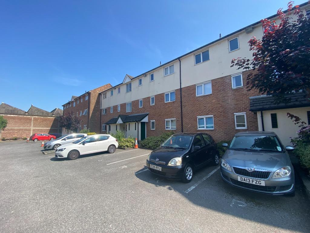
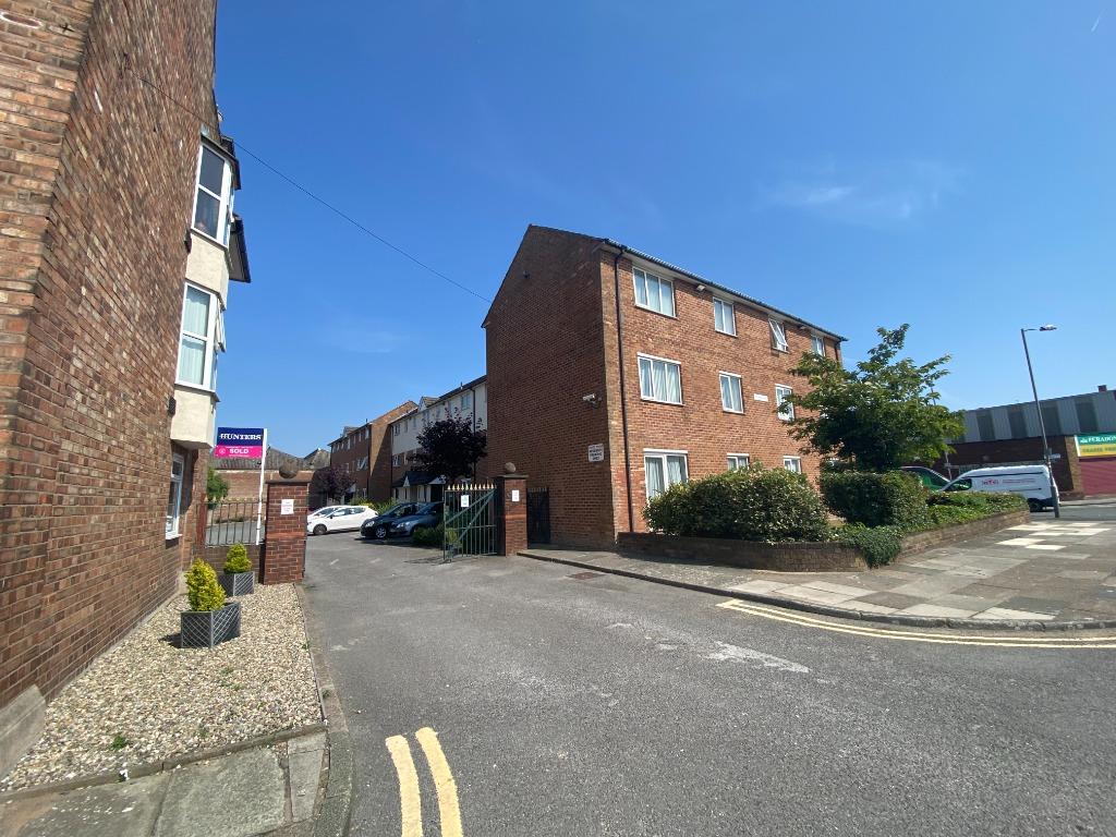
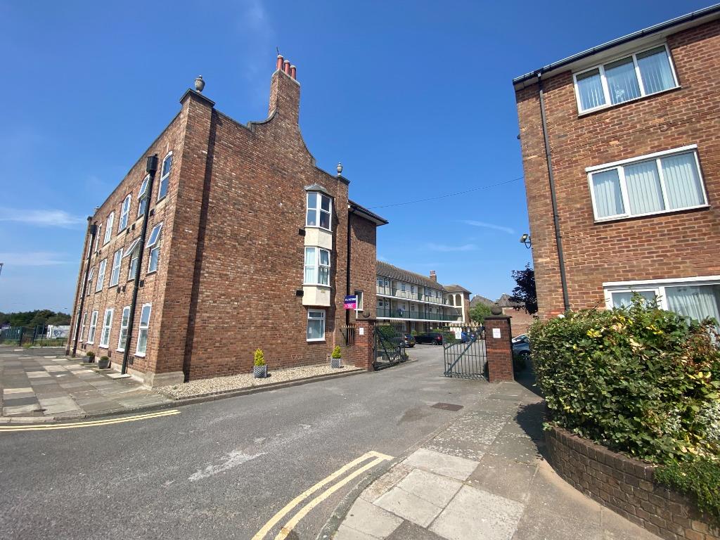
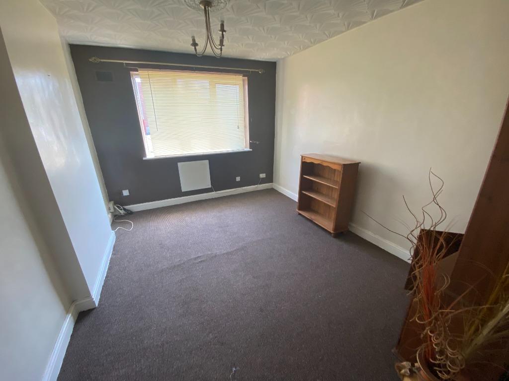
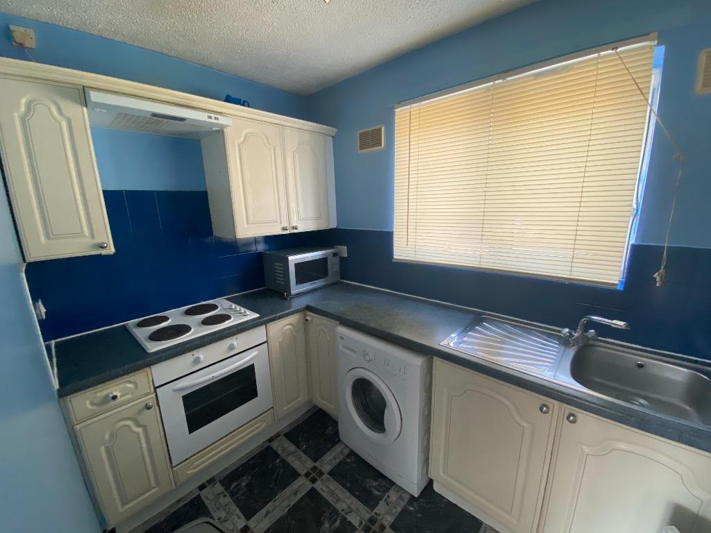
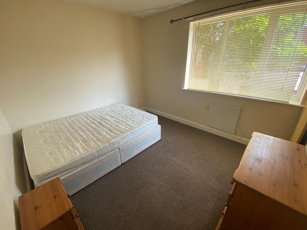
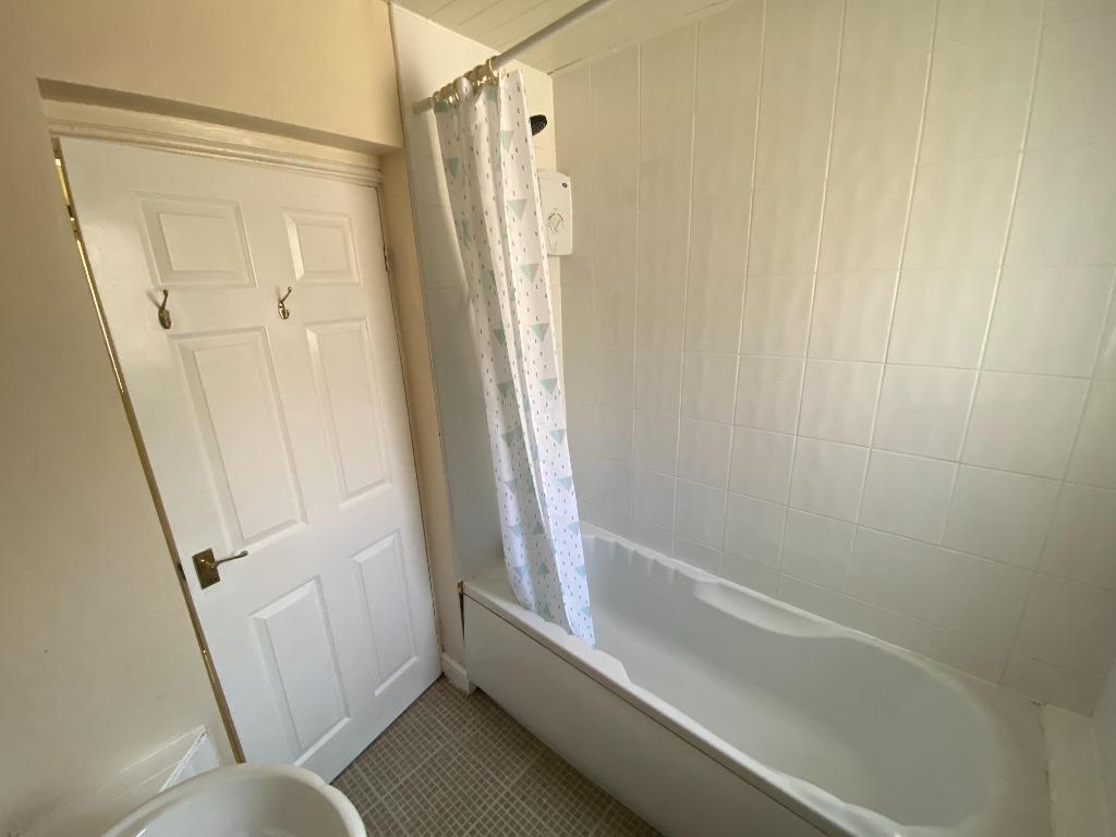
Photo 1 Photo 2 Photo 3 Photo 4 Photo 5 Photo 6 Photo 7 Photo 8
/ 8
Property details
Deprivation
Decile 2 (4,846 of 33,755)
Street crime
1700 incidents within 1 mile (Apr 2026)
Additional details
- Parking
- Yes
- Garden
- Private garden
Description
The property comprises of an LIVING AREA with seperate KITCHEN with APPLIANCES, DOUBLE BEDROOM and a BATHROOM with BATH and SHOWER. The development has a SECURE INTERCOM SYSTEM and SECURE ALLOCATED PARKING.
Close to transport links, Liverpool city centre and Liverpool's universities and hospitals. The property further benefits from PARKING SPACE, COMMUNAL GARDENS AND gas central heating.
Early Viewing Recommended Call us on for more information. Follow Belvoir Liverpool Central on Facebook: facebook.com/BelvoirLiverpoolCentral, Twitter: @BelvoirLpool and Instagram @belvoir_liverpool. EPC E EPC rating: E. Council tax band: X,
Listed by
Liverpool
The Property Franchise Group
Reference: 125653019
EPC Rating & Upgrade Cost
Fetching EPC data… Refresh this page in a moment.
Flood risk
Zone: 1
Risk: Low
Job (default Low)
EPC Graphs

EPC Certificate
Rental Range
Estimated market rent for Liverpool. Low = conservative, Realistic = average, Optimistic = best case.
Based on Local Authority from postcode lookup → Liverpool.
LHA (30th percentile) floor for Greater Liverpool: £499/mo (Apr 2025 – Mar 2026)
Location
Nearby
Nearest stations, universities and amenities (distance from property).
| Type | Name | Distance |
|---|---|---|
| Bus stop | ST ANNE STREET/JUVENAL STREET | 0.1 miles |
| Bus stop | ST ANNE STREET/POLICE STATION | 0.1 miles |
| Shop | Weatherspoons | 0.2 miles |
| Shop | Bestway Cash and Carry | 0.2 miles |
| University | Liverpool John Moores University City Campus | 0.4 miles |
| University | Liverpool Hope University | 0.4 miles |
| Train station | Liverpool Lime Street | 0.5 miles |
| Train station | Moorfields | 0.6 miles |
| Hospital | Royal Liverpool University Hospital | 0.7 miles |
| Hospital | Breckfield and North Everton | 0.9 miles |
Street-level crime
| Category | Count |
|---|---|
| Violence and sexual offences | 508 |
| Drugs | 305 |
| Shoplifting | 201 |
| Public order | 170 |
| Anti-social behaviour | 158 |
| Other theft | 93 |
| Criminal damage and arson | 82 |
| Burglary | 48 |
| Other crime | 37 |
| Vehicle crime | 35 |
| Theft from the person | 25 |
| Possession of weapons | 17 |
| Robbery | 13 |
| Bicycle theft | 8 |
| Total incidents | 1700 |
Within 1 mile during Apr 2026. Source: data.police.uk (England & Wales).
Schools nearby
Nearest open schools with Ofsted ratings (England). Closed schools are not shown. Data from Get Information about Schools and Ofsted.
| Name | Type | Distance | Ofsted |
|---|---|---|---|
| Millstead School | Other | 0.3 miles | Outstanding — 28 Mar 2013 |
| Faith Primary Academy | Primary | 0.3 miles | Good — 14 Jan 2019 |
| Holy Cross Catholic Primary School | Primary | 0.3 miles | Good — 17 Apr 2018 |
| The Trinity Catholic Academy | Primary | 0.5 miles | Inadequate — 13 May 2019 |
| Everton Nursery School and Family Centre | Nursery | 0.5 miles | Outstanding — 17 Jun 2014 |
Rental Comparables
Residential lets from OpenRent and Rightmove for the area (same bedroom count). Use to validate rent estimates. Student lets are excluded.
| Title | Rent | Beds | Distance | As seen on |
|---|---|---|---|---|
| 1 Bed Flat, London Road, L3 | £850/mo | 1 | 0.37 miles | OpenRent |
Average rent: £850/mo (1 listing)