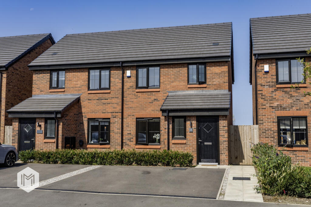
7 WELDERS DRIVE
BOLTON, HORWICH, GREATER MANCHESTER BL6 5WR


Property details
Tenure
FREEHOLD
Floor area
98 m²
Council tax band
B
Last sold
£248,000 Mar 2026
Local average
£258,317 (-3.2%)
Street crime
3 incidents within 1 mile (Apr 2026)
Additional details
- Parking
- Yes
- Garden
- Yes
Description
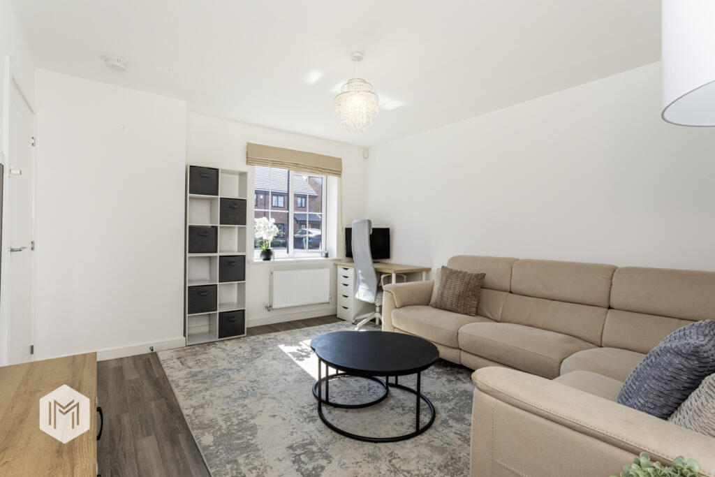
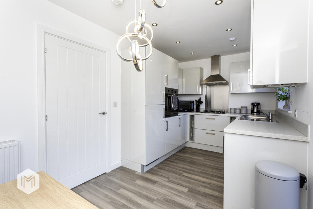
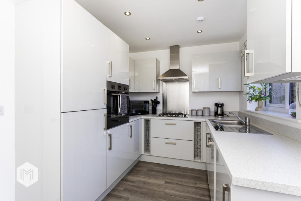
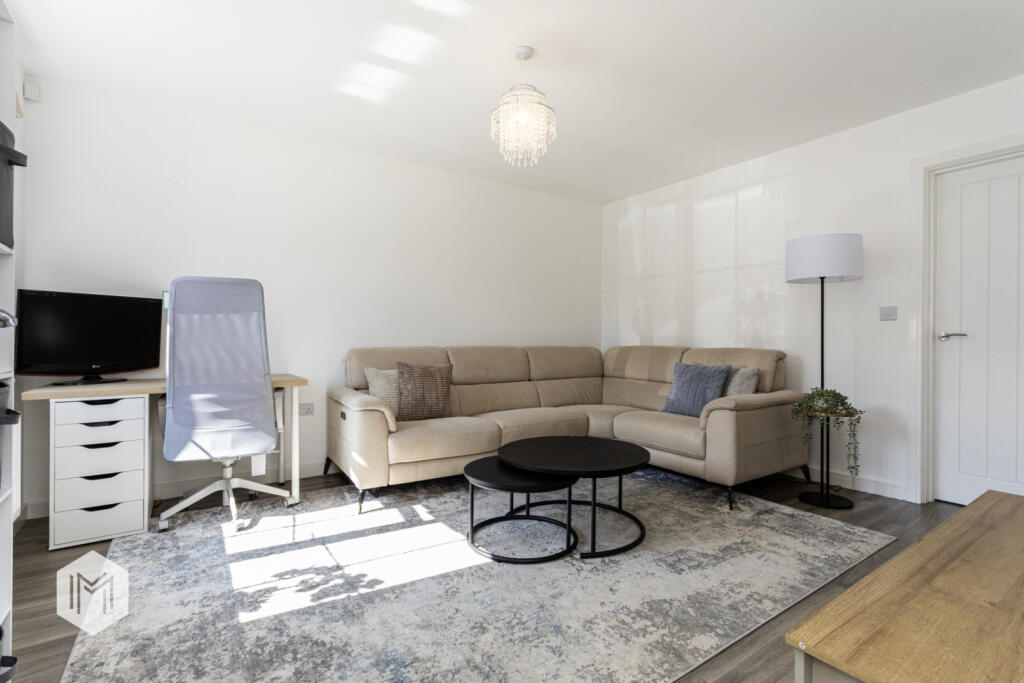
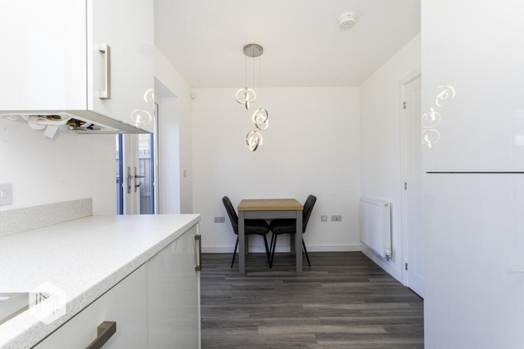
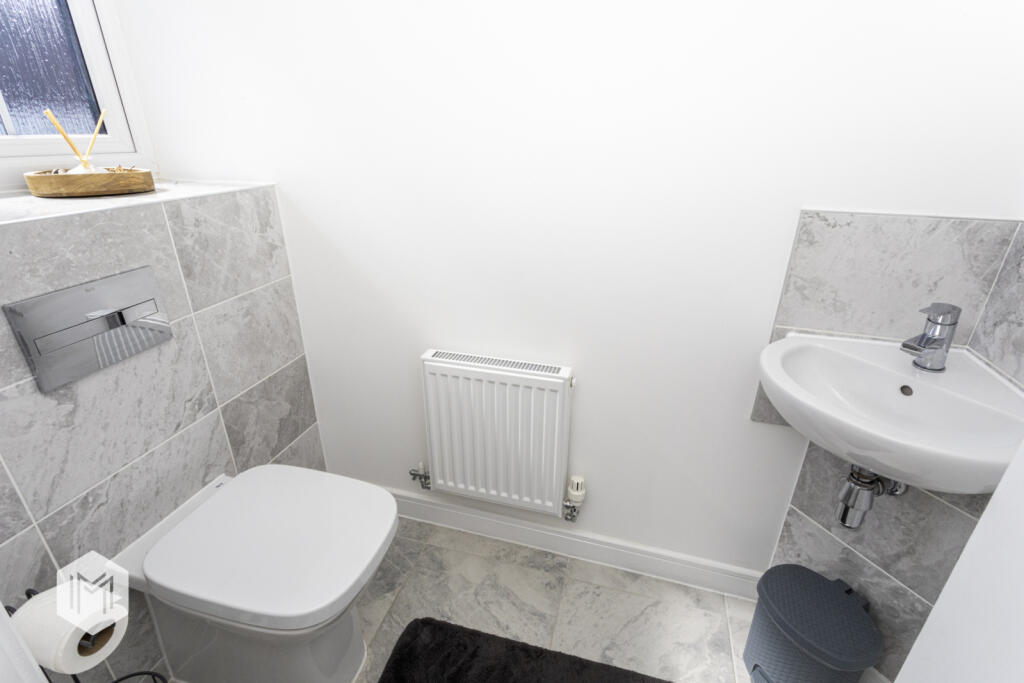
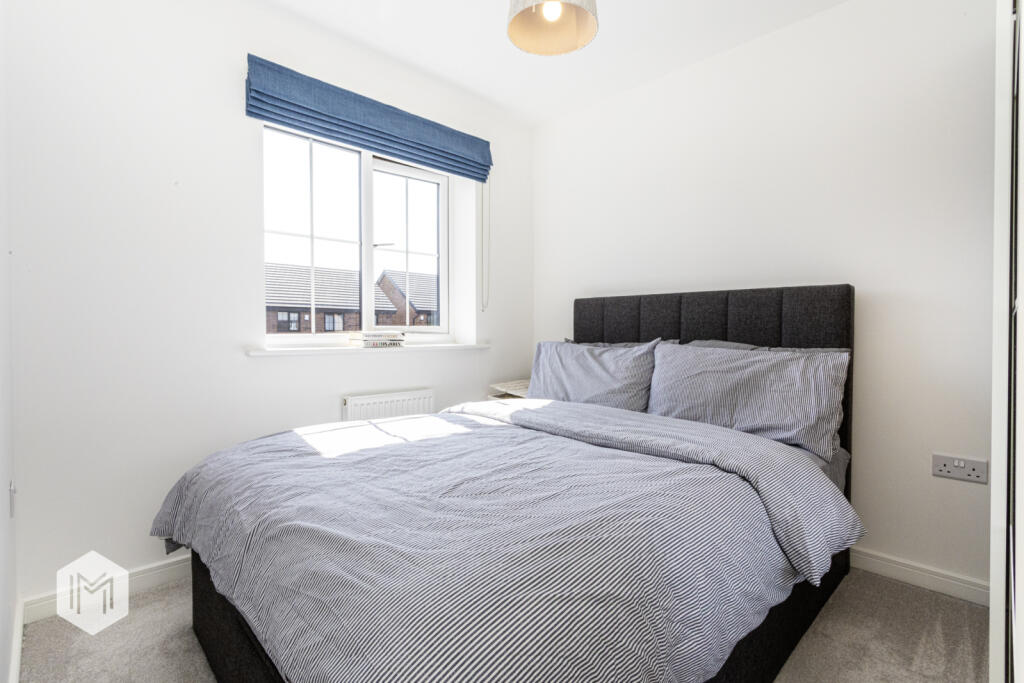
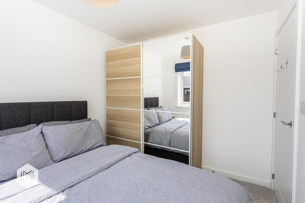
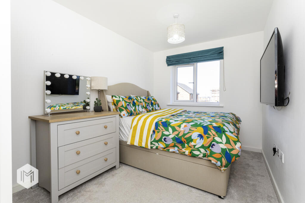
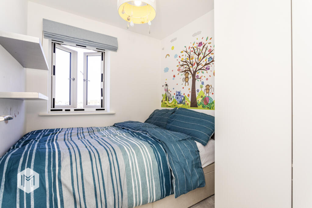
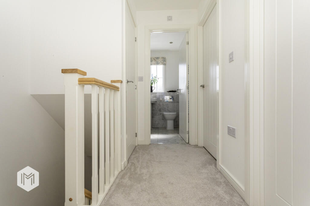
Designed with modern living in mind, the property boasts a bright and welcoming interior, styled with a neutral finish throughout. The layout is ideal for families, offering a generous living room filled with natural light, a convenient ground floor WC, and a stylish open-plan kitchen and dining space to the rear—perfect for everyday living and entertaining alike. Upstairs, you’ll find three well-proportioned bedrooms alongside a contemporary family bathroom.
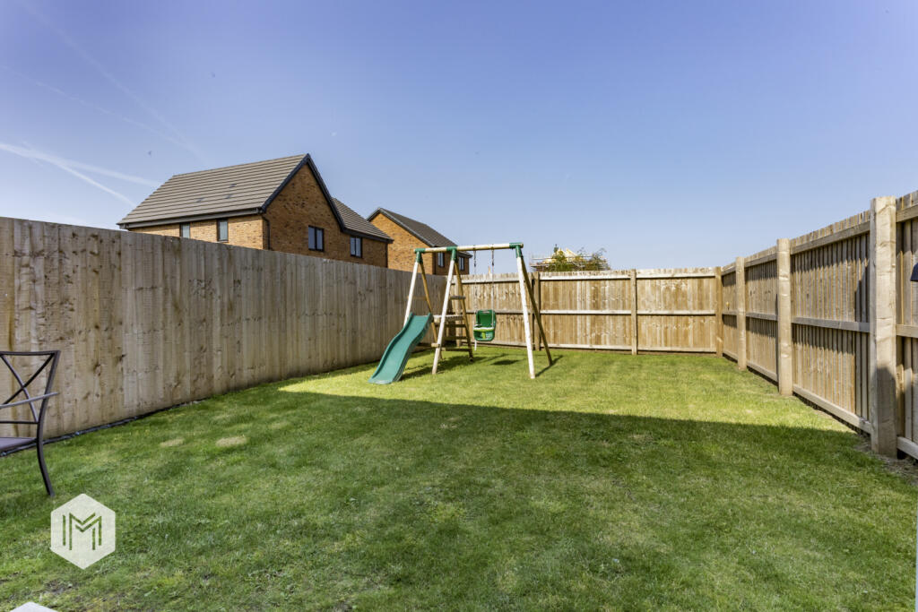
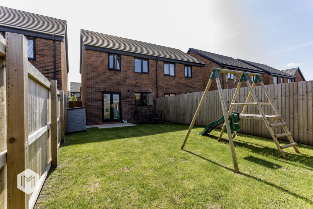
Externally, the home offers off-road parking for two vehicles to the front, while the rear garden is neatly maintained with a lawned area providing a private outdoor retreat.
Welders Drive enjoys an excellent location within Horwich, just off Chorley New Road. Local amenities including schools, shops, leisure facilities, and bars are all within walking distance. Middlebrook Retail Park is only a short drive away, while nearby motorway and rail links make commuting into Manchester and beyond both quick and convenient.
In accordance with our regulatory obligations, we are required to carry out Anti-Money Laundering (AML) checks on all relevant individuals. A fee of £25 per person will be charged to cover the cost of conducting these checks. This fee is non-refundable.
Listed by
Bolton
Miller North West Ltd
Reference: 166013726
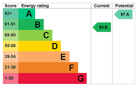
EPC Rating & Upgrade Cost
Fetching EPC data… Refresh this page in a moment.
Flood risk
Zone: 1
Risk: Low
Job (default Low)
Floorplans
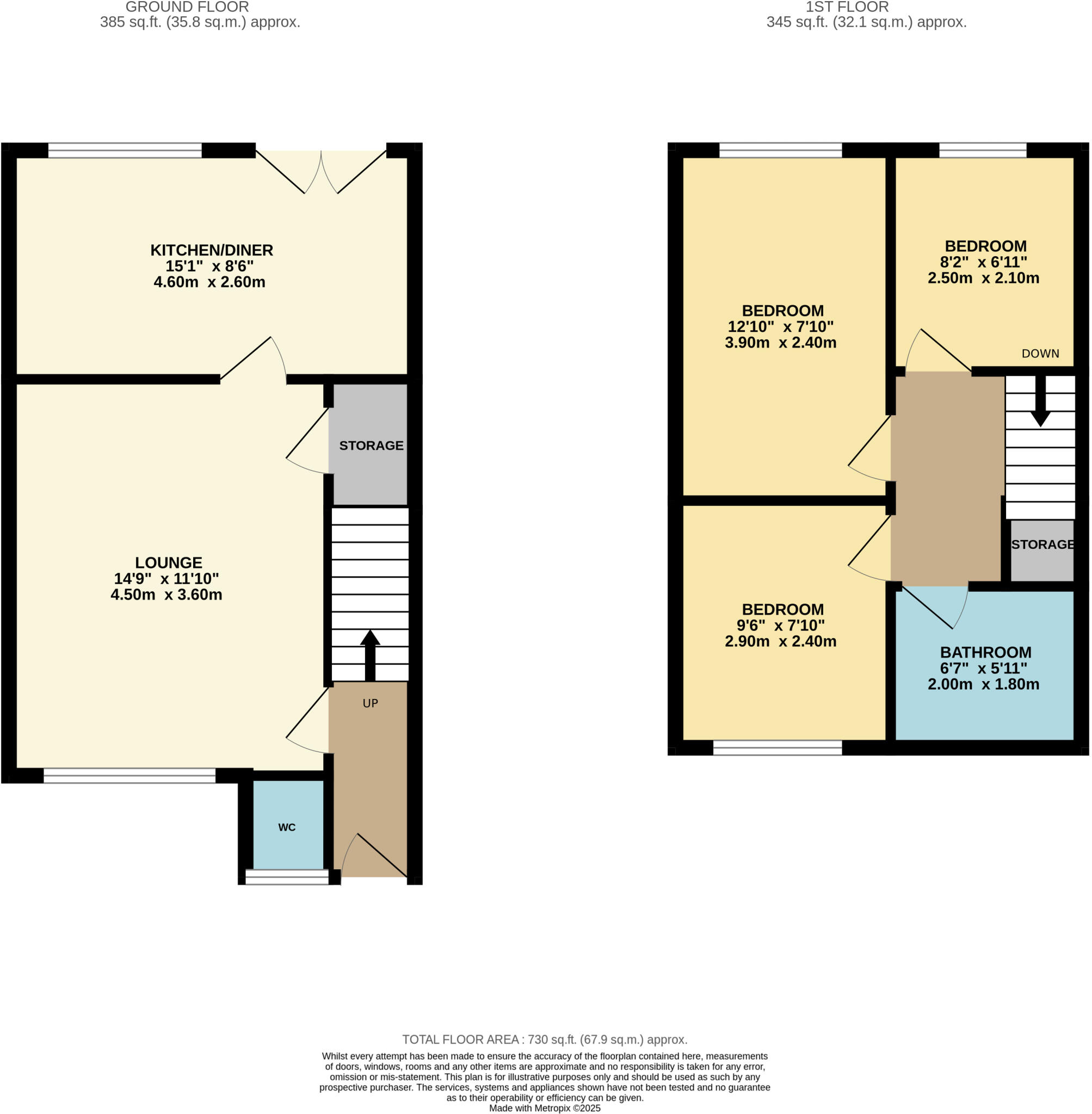
Floorplan
EPC Graphs
EPC Rating Graph
Price history
-1% since 2023
| Event | Date | Price | % change |
|---|---|---|---|
| Sold | 06/03/2026 (3 months ago) | £248,000 | -0.8% |
| Sold | 21/07/2023 (2 years ago) | £249,995 | — |
Source: HM Land Registry Price Paid Data. Crown copyright.
Sold Comparables
Same street and nearby sales within 0.25 miles (last 5 years). Data from Land Registry Price Paid.
| Address | Price | Date | Type |
|---|---|---|---|
| Same street 29 WELDERS DRIVE, HORWICH, BOLTON, GREATER MANCHESTER, BL6 5WR | £262,995 | 27/10/2023 | Semi-detached |
| 44 RAILWAY ROAD, HORWICH, BOLTON, GREATER MANCHESTER, BL6 5WL | £254,595 | 18/08/2023 | Semi-detached |
| Same street 17 WELDERS DRIVE, HORWICH, BOLTON, GREATER MANCHESTER, BL6 5WR | £306,995 | 21/07/2023 | Detached |
| 38 RAILWAY ROAD, HORWICH, BOLTON, GREATER MANCHESTER, BL6 5WL | £254,596 | 19/07/2023 | Semi-detached |
| Same street 5 WELDERS DRIVE, HORWICH, BOLTON, GREATER MANCHESTER, BL6 5WR | £249,995 | 14/07/2023 | Semi-detached |
| 36 RAILWAY ROAD, HORWICH, BOLTON, GREATER MANCHESTER, BL6 5WL | £267,995 | 28/04/2023 | Semi-detached |
| 26 RAILWAY ROAD, HORWICH, BOLTON, GREATER MANCHESTER, BL6 5WL | £211,995 | 30/09/2021 | Semi-detached |
Street average: £273,328 (3 sales)
Area average: £247,295 (4 sales)
Capital growth trend
Land Registry outcode average: last 12 months vs 5y and 10y ago (from sold prices).
House Price Index (HM Land Registry — official index, not sold-price averages): North West. Series: Semi-detached. As of March 2026.
Rental Range
Estimated market rent for North West. Low = conservative, Realistic = average, Optimistic = best case.
Based on Postcode area BL → North West.
LHA (30th percentile) floor for Bolton and Bury: £698/mo (Apr 2025 – Mar 2026)
Location
Nearby
Nearest stations, universities and amenities (distance from property).
| Type | Name | Distance |
|---|---|---|
| Bus stop | Chorley New Rd/Stephenson Street | 0.2 miles |
| Bus stop | Chorley New Rd/Aspinall Court | 0.2 miles |
| Shop | Beauty Box | 0.5 miles |
| Shop | Affordable Cars Horwich | 0.5 miles |
| Train station | Blackrod | 0.9 miles |
| Train station | Horwich Parkway | 1.0 miles |
| Hospital | Bolton Hospice | 4.4 miles |
| University | University of Greater Manchester | 4.7 miles |
| University | University of Bolton Orlando Village Residence | 5.2 miles |
| Hospital | Leigh Health Centre | 6.2 miles |
Street-level crime
| Category | Count |
|---|---|
| Criminal damage and arson | 2 |
| Other theft | 1 |
| Total incidents | 3 |
Within 1 mile during Apr 2026. Source: data.police.uk (England & Wales).
Schools nearby
Nearest open schools with Ofsted ratings (England). Closed schools are not shown. Data from Get Information about Schools and Ofsted.
| Name | Type | Distance | Ofsted |
|---|---|---|---|
| St Catherine's CofE Primary School | Primary | 0.4 miles | Good — 9 Jun 2014 |
| Lever Park School | Other | 0.4 miles | Good — 20 May 2019 |
| Chorley New Road Primary Academy | Primary | 0.5 miles | Good — 11 Jan 2018 |
| St Mary's RC Primary School | Primary | 0.5 miles | Good — 12 May 2020 |
| Horwich Parish CofE Primary School | Primary | 0.6 miles | Good — 1 Dec 2016 |
Rental Comparables
Rental listings exist nearby, but none matched the 3-bedroom count for this property.
Rent-driven metrics
Based on Area rent estimate.
- Rent ratio — Monthly rent ÷ purchase price (1% rule). 1%+ = strong, 0.8–1% = okay, <0.8% = weak for cashflow.
- Max investor price — Rent ÷ 0.8%; the price at which rent would be 0.8% of price (Stoke-style target).
- Target investor price — Rent ÷ 1%; the price at which rent would be 1% of price (strong cashflow band).
- Gross yield — Annual rent as % of purchase price (no costs).