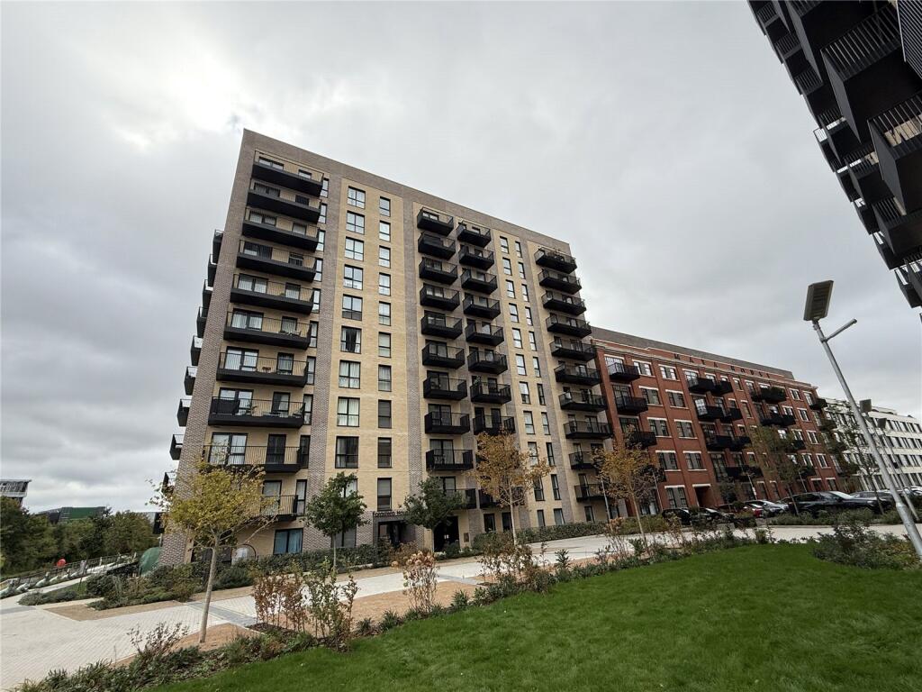
FLAT 53
FORASTERO HOUSE, 24, FARINE AVENUE, HAYES, GREATER LONDON UB3 4GE
Property details
Floor area
39 m²
Council tax band
TBC
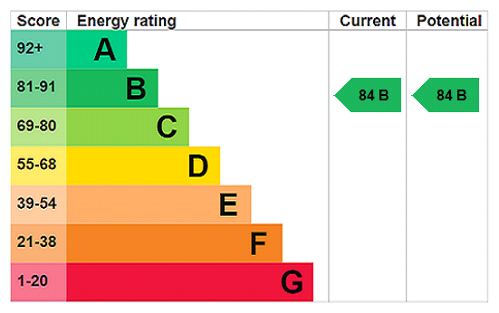
EPC rating
B
Street crime
441 incidents within 1 mile (Apr 2026)
Additional details
- Parking
- No parking
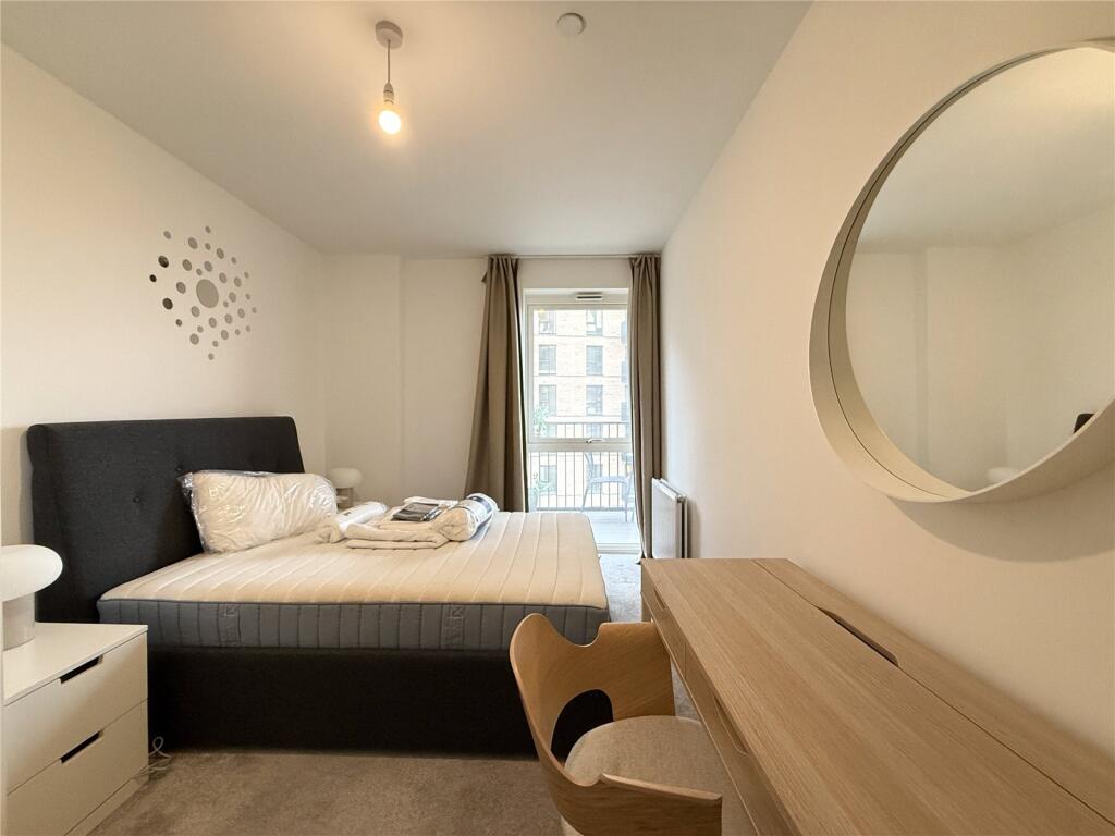
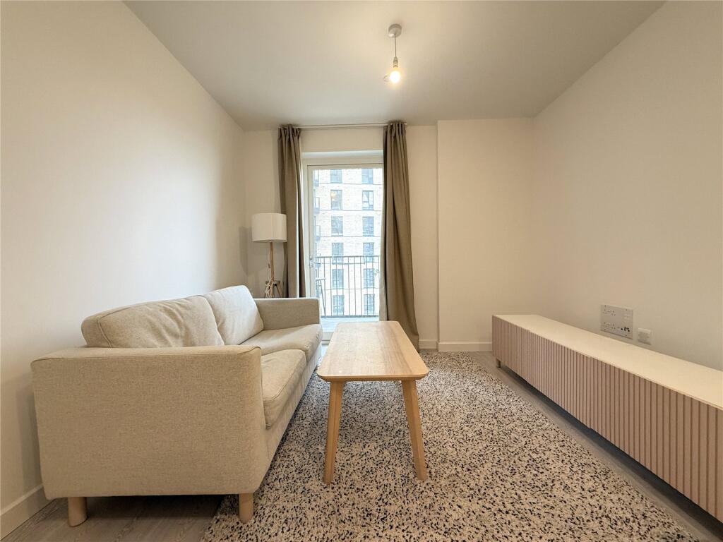
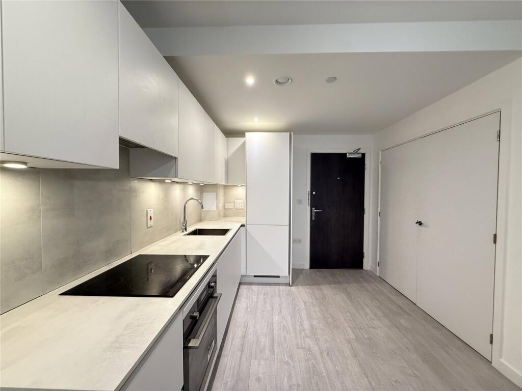
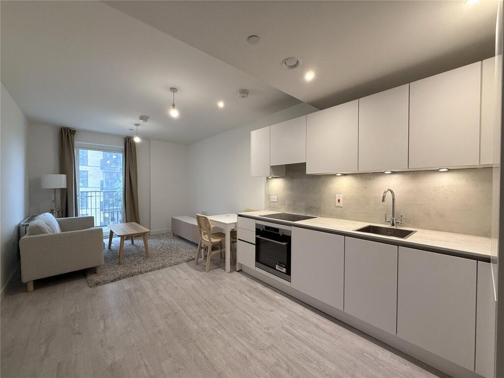
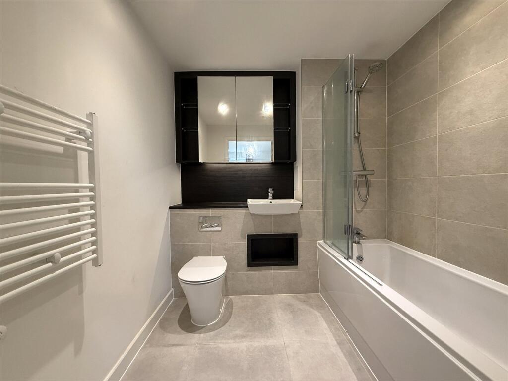
Description
Fully Furnished. 420 Sq Ft. Council Tax Band - C. EPC Rating - B.
1 Week’ Rent as Holding Deposit. 5 Weeks' Rent as Security Deposit. Subject to Contract.
Parking is NOT included
Utilities Bills such as Electricity, Water, Heating, Broadband are not included in the rent.
Listed by
London
CHENG GONG REAL ESTATE LIMITED
Reference: 89335968
EPC Rating & Upgrade Cost
Current rating: B
Potential rating: B
Inspection date: 12/04/2023
Expiry date: 11/04/2033
Current heating cost: £139/year
Potential heating cost: £139/year
Flood risk
Zone: 1
Risk: Low
Job (default Low)
EPC Graphs
EPC Rating Graph
Rental Range
Estimated market rent for London. Low = conservative, Realistic = average, Optimistic = best case.
Based on Postcode area UB → London.
LHA (30th percentile) floor for South West Herts: £947/mo (Apr 2025 – Mar 2026)
Location
Address
14 Nestle's Avenue
Nearby
Nearest stations, universities and amenities (distance from property).
| Type | Name | Distance |
|---|---|---|
| Train station | Hayes and Harlington | 0.2 miles |
| Shop | Tesco Express | 0.2 miles |
| Bus stop | Harold Avenue | 0.2 miles |
| Shop | Station Kiosk | 0.3 miles |
| Bus stop | Hayes & Harlington Station | 0.3 miles |
| Train station | Southall | 1.6 miles |
| Hospital | Hounslow Medical Centre | 2.8 miles |
| University | University of West London | 4.6 miles |
| University | University of West London - Hellenic Institute Of Maritime Studies | 4.6 miles |
| Hospital | Wexham Park Hospital | 7.1 miles |
Street-level crime
| Category | Count |
|---|---|
| Violence and sexual offences | 141 |
| Anti-social behaviour | 81 |
| Vehicle crime | 38 |
| Shoplifting | 37 |
| Criminal damage and arson | 30 |
| Other theft | 27 |
| Burglary | 19 |
| Theft from the person | 18 |
| Public order | 15 |
| Robbery | 14 |
| Drugs | 12 |
| Bicycle theft | 4 |
| Other crime | 3 |
| Possession of weapons | 2 |
| Total incidents | 441 |
Within 1 mile during Apr 2026. Source: data.police.uk (England & Wales).
Schools nearby
Nearest open schools with Ofsted ratings (England). Closed schools are not shown. Data from Get Information about Schools and Ofsted.
| Name | Type | Distance | Ofsted |
|---|---|---|---|
| Botwell House Catholic Primary School | Primary | 0.5 miles | Good — 5 Nov 2014 |
| Cranford Park Academy | Primary | 0.5 miles | Good — 12 Jul 2013 |
| Global Academy | Secondary | 0.6 miles | Good — 10 Jun 2019 |
| Minet Junior School | Primary | 0.7 miles | Good — 12 Oct 2015 |
| Minet Infant and Nursery School | Primary | 0.7 miles | Good — 13 Jan 2014 |
Rental Comparables
Residential lets from OpenRent and Rightmove for the area (same bedroom count). Use to validate rent estimates. Student lets are excluded.
| Title | Rent | Beds | Distance | As seen on |
|---|---|---|---|---|
| Forastero House, Hayes, UB3 4 | £1,600/mo | 1 | 0 miles | Rightmove |
| Studio Flat, Station Road, UB3 | £1,375/mo | 1 | 0.26 miles | OpenRent |
| Studio Flat, Trident House, UB3 | £1,425/mo | 1 | 0.27 miles | OpenRent |
| 1 Bed Flat, Blyth Road, UB3 | £1,300/mo | 1 | 0.29 miles | OpenRent |
| 1 Bed Semi-Detached House, Crowland Avenue, UB3 | £725/mo | 1 | 0.44 miles | OpenRent |
| 1 Bed Flat, Gramophone Lane, UB3 | £1,500/mo | 1 | 0.54 miles | OpenRent |
| 1 Bed Flat, Station Road, UB3 | £1,250/mo | 1 | 0.6 miles | OpenRent |
| 1 Bed Flat, Harlington, UB3 | £1,100/mo | 1 | 1.03 miles | OpenRent |
Average rent: £1,284/mo (8 listings)