2 LORING STREET
MANCHESTER, GREATER MANCHESTER M40 1WU
£550 pcm
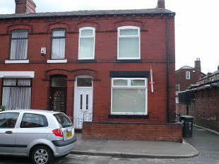
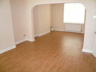
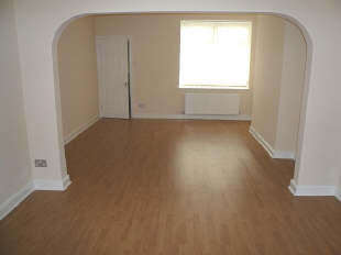

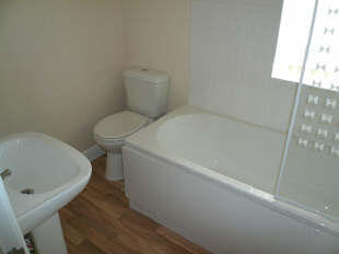
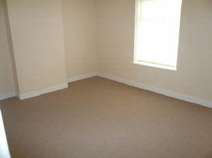
Photo 1 Photo 2 Photo 3 Photo 4 Photo 5 Photo 6
/ 6
Property details
Floor area
97 m²
EPC rating
D
Year built
England and Wales: 1900-1929
Deprivation
Decile 1 (1,837 of 33,755)
Street crime
1 incident within 1 mile (Mar 2026)
Description
Listed by
Manchester
NP Estates
Reference: 20125119
EPC Rating & Upgrade Cost
Current rating: D
Potential rating: B
Inspection date: 06/06/2023
Current heating cost: £719/year
Potential heating cost: £532/year
Est. upgrade cost to C: £11,500
Recommendations
- Cavity wall insulation (£500 - £1,500)
- Floor insulation (suspended floor) (£800 - £1,200)
- Solar water heating (£4,000 - £6,000)
- Solar photovoltaic panels, 2.5 kWp (£3,500 - £5,500)
Flood risk
Zone: 1
Risk: Low
Job (default Low)
Rental Range
Estimated market rent for Manchester. Low = conservative, Realistic = average, Optimistic = best case.
Based on Local Authority from postcode lookup → Manchester.
LHA (30th percentile) floor for West Pennine: £504/mo (Apr 2025 – Mar 2026)
Location
Nearby
Nearest stations, universities and amenities (distance from property).
| Type | Name | Distance |
|---|---|---|
| Bus stop | Newton Heath, Droylsden Road / near Loring Street | 0.1 miles |
| Bus stop | Newton Heath, Droylsden Road / opposite Loring Street | 0.1 miles |
| Shop | Asda | 0.2 miles |
| Shop | Iceland | 0.2 miles |
| Train station | Moston | 1.6 miles |
| Train station | Ashburys | 2.1 miles |
| University | UCEN Manchester (Shena Simon Campus) | 3.0 miles |
| University | UCEN Manchester (City Campus) | 3.0 miles |
| Hospital | Shiv Lodge Medical Centre | 3.3 miles |
| Hospital | The Ailsa Craig Medical Practise | 3.5 miles |
Street-level crime
| Category | Count |
|---|---|
| Violence and sexual offences | 1 |
| Total incidents | 1 |
Within 1 mile during Mar 2026. Source: data.police.uk (England & Wales).
Schools nearby
Nearest open schools with Ofsted ratings (England). Closed schools are not shown. Data from Get Information about Schools and Ofsted.
| Name | Type | Distance | Ofsted |
|---|---|---|---|
| The Greens ENS | Other | 0.1 miles | Good — 26 Sep 2023 |
| All Saints C of E Primary School | Primary | 0.1 miles | Good — 1 Mar 2014 |
| Christ The King RC Primary School Manchester | Primary | 0.2 miles | Good — 17 Oct 2017 |
| St Wilfrid's CofE Junior and Infant School | Primary | 0.2 miles | Good — 8 Nov 2023 |
| Briscoe Lane Academy | Primary | 0.5 miles | Good — 8 Oct 2014 |
Rental Comparables
Residential lets from OpenRent and Rightmove for the area (same bedroom count). Use to validate rent estimates. Student lets are excluded.
| Title | Rent | Beds | Distance | As seen on |
|---|---|---|---|---|
| 3 Bed Terraced House, Briscoe Lane, M40 | £1,800/mo | 3 | 0.23 miles | OpenRent |
| 3 Bed Semi-Detached House, Miriam St, M35 | £1,100/mo | 3 | 0.24 miles | OpenRent |
| 3 Bed Terraced House, Oldham Road, M40 | £650/mo | 3 | 0.25 miles | OpenRent |
| 3 Bed Semi-Detached House, Scotland Hall Road, M40 | £1,400/mo | 3 | 0.47 miles | OpenRent |
| 3 Bed Semi-Detached House, Rose Bank Road, M40 | £1,250/mo | 3 | 0.64 miles | OpenRent |
| 3 Bed Semi-Detached House, Alan Avenue, M35 | £2,700/mo | 3 | 0.81 miles | OpenRent |
| 3 Bed Semi-Detached House, Manchester, M11 | £1,200/mo | 3 | 0.87 miles | OpenRent |
| 3 Bed Semi-Detached House, Repton Avenue, M43 | £1,195/mo | 3 | 0.89 miles | OpenRent |
| 3 Bed Terraced House, Briarwood Avenue, M43 | £1,095/mo | 3 | 0.95 miles | OpenRent |
| 3 Bed Semi-Detached House, Brendon Avenue, M40 | £1,500/mo | 3 | 1.02 miles | OpenRent |
| 3 Bed Semi-Detached House, Whiteley Street, M11 | £1,900/mo | 3 | 1.04 miles | OpenRent |
| 3 Bed Terraced House, Cambridge Road, M43 | £1,250/mo | 3 | 1.04 miles | OpenRent |
| 3 Bed Terraced House, North Road, M11 | £1,495/mo | 3 | 1.04 miles | OpenRent |
Average rent: £1,426/mo (13 listings)