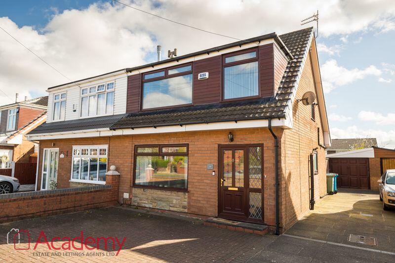
110 BARROWS GREEN LANE
WIDNES, HALTON WA8 3JJ
£1,250 pcm
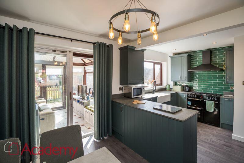
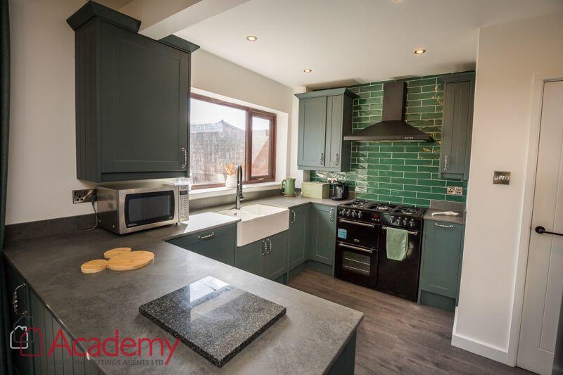
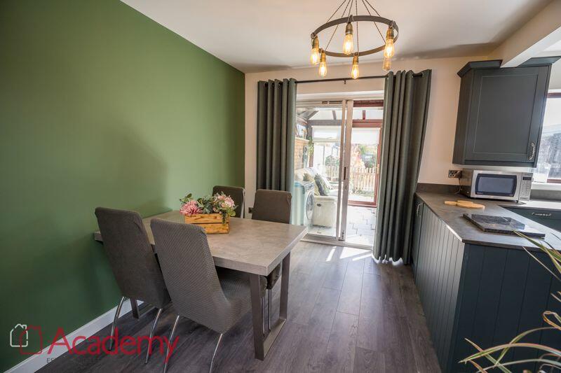
Property details
Floor area
91 m²
Council tax band
C
Deprivation
Decile 5 (15,452 of 33,755)
Street crime
76 incidents within 1 mile (Mar 2026)
Key features
- THREE BEDROOMS
- WELL PRESENTED THROUGHOUT
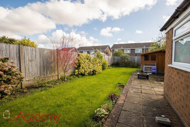
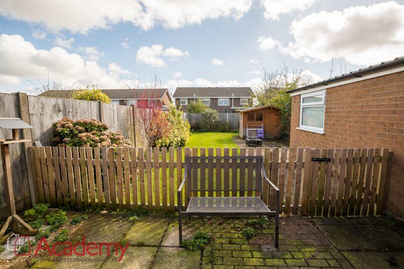
- GOOD SIZED REAR GARDEN
- OFF ROAD PARKING
- PERFECT FAMILY HOME
- MUCH SOUGHT AFTER AREA
- VIEWINGS ESSENTIAL
- EPC GRADE D
Additional details
- Parking
- Yes
- Garden
- Yes
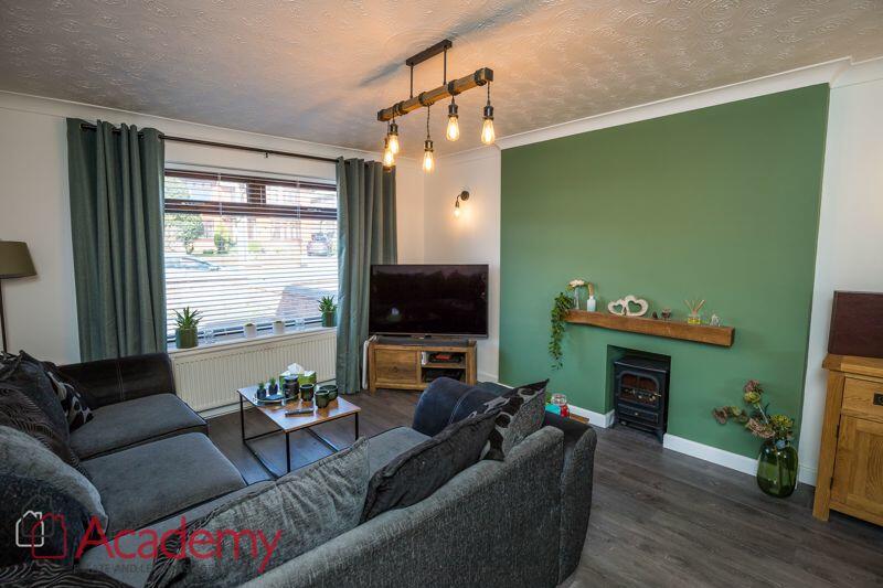
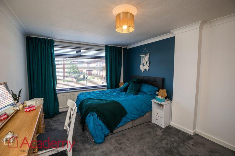
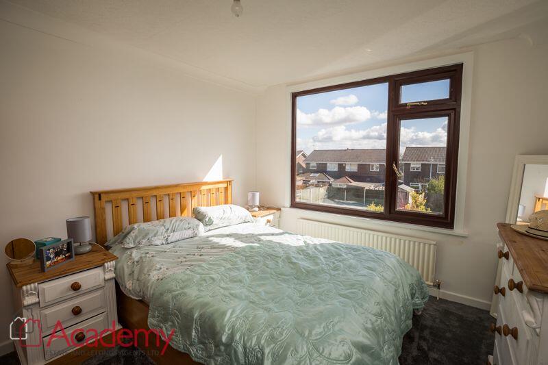
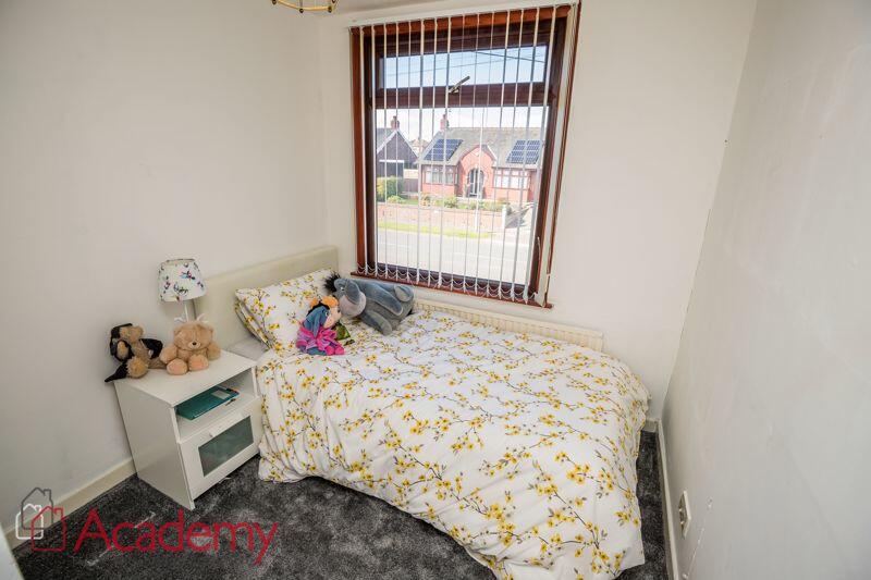
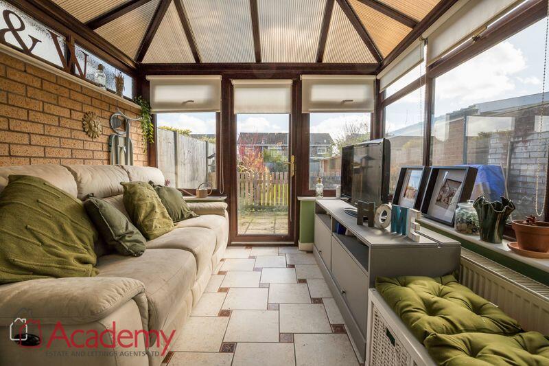
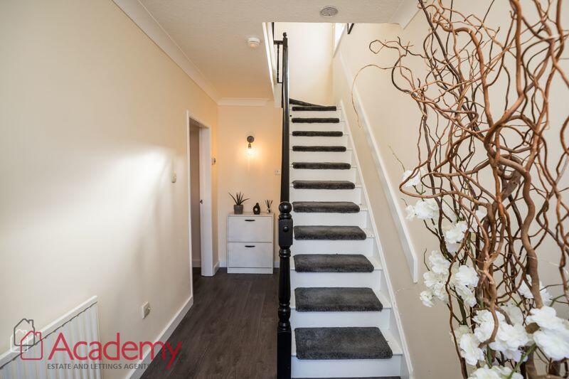
Description
Listed by
Widnes
Academy Estate and Letting Agent Ltd
Reference: 151337387
EPC Rating & Upgrade Cost
Fetching EPC data… Refresh this page in a moment.
Flood risk
Zone: 1
Risk: Low
Job (default Low)
Floorplans
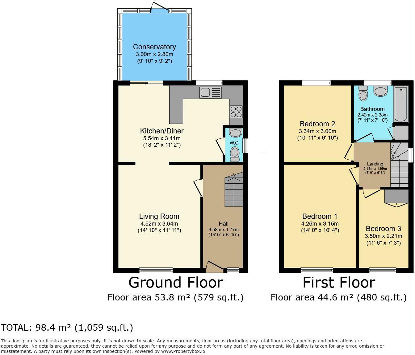
Floorplan 1
FENSA Certificates
This property has 1 FENSA certificate(s) on record, indicating window/door installations by FENSA-approved installers.
FENSA Certificate #13195197
Property Details
Street: 110 Barrows Green Lane
Town: WIDNES
Postcode: WA8 3JJ
Installation Details
Items: 1 window
Certificate Issued: 22/10/2018
Work Completed: 28/09/2018
This certificate data was retrieved from FENSA's database
What is FENSA? FENSA (Fenestration Self-Assessment Scheme) is a government-authorised scheme that monitors building regulation compliance for replacement windows and doors. Certificates indicate that work was completed by FENSA-approved installers.
Rental Range
Estimated market rent for Halton. Low = conservative, Realistic = average, Optimistic = best case.
Based on Local Authority from postcode lookup → Halton.
LHA (30th percentile) floor for North Cheshire: £693/mo (Apr 2025 – Mar 2026)
Location
Nearby
Nearest stations, universities and amenities (distance from property).
| Type | Name | Distance |
|---|---|---|
| Shop | Unknown | 0.2 miles |
| Bus stop | Chorleys Lane | 0.2 miles |
| Shop | Londis | 0.5 miles |
| Train station | Widnes | 1.2 miles |
| Train station | Sankey for Penketh | 2.4 miles |
| Hospital | Elizabeth Court Care Centre | 3.6 miles |
| Hospital | Halton General Hospital | 4.0 miles |
| University | University of Chester - Warrington Campus | 6.9 miles |
| University | Liverpool Hope University | 7.7 miles |
Street-level crime
| Category | Count |
|---|---|
| Violence and sexual offences | 41 |
| Public order | 10 |
| Anti-social behaviour | 7 |
| Drugs | 4 |
| Other crime | 4 |
| Criminal damage and arson | 3 |
| Other theft | 3 |
| Bicycle theft | 2 |
| Vehicle crime | 2 |
| Total incidents | 76 |
Within 1 mile during Mar 2026. Source: data.police.uk (England & Wales).
Schools nearby
Nearest open schools with Ofsted ratings (England). Closed schools are not shown. Data from Get Information about Schools and Ofsted.
| Name | Type | Distance | Ofsted |
|---|---|---|---|
| Moorfield Primary School | Primary | 0.2 miles | Good — 4 Nov 2019 |
| Brookfields School | Other | 0.4 miles | — (Inspected (no overall grade)) |
| St John Fisher Catholic Primary School | Primary | 0.6 miles | Good — 4 Dec 2013 |
| The Raise Academy | Other | 0.7 miles | — (No rating) |
| Aspiring Foundations Federated Nursery Schools - Warrington Road Nursery School | Nursery | 0.8 miles | Outstanding — 10 Nov 2014 |
Rental Comparables
Residential lets from OpenRent and Rightmove for the area (same bedroom count). Use to validate rent estimates. Student lets are excluded.
| Title | Rent | Beds | Distance | As seen on |
|---|---|---|---|---|
| 3 Bed Semi-Detached House, Grove Street, WA8 | £1,050/mo | 3 | 0.96 miles | OpenRent |
Average rent: £1,050/mo (1 listing)