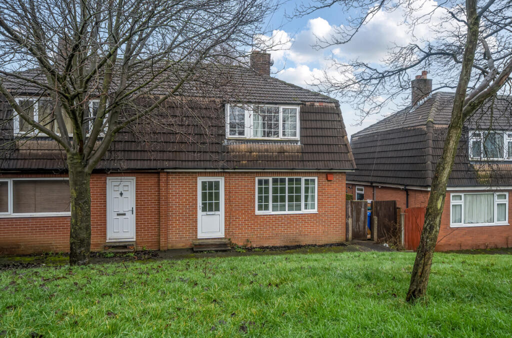
Blackthorn Place
Newcastle, ST5 7BE
£100,000
1395375-2-696e1c1... 1395375-11-696e1e... 1395375-5-696e1c7... 1395375-9-696e1d8... 1395375-8-696e1d6... 1395375-10-696e1d... 1395375-12-696e1e... 1395375-13-696e1e... 1395375-14-696e1e... 1395375-15-696e1e... 1395375-16-696e1f... 1395375-17-696e1f... 1395375-18-696e20... 1395375-20-696e20... 1395375-19-696e20... 1395375-6-696e1d4... 1395375-7-696e1d5... 1395375-1-696e1c0... 1395375-3-696e1c6... 1395375-4-696e1c6...
/ 20
Property details
Tenure
FREEHOLD
Council tax band
A
Local average
£455,953 (-78.1%)
Deprivation
Decile 2 (4,910 of 33,755)
Street crime
171 incidents within 1 mile (May 2026)
Key features
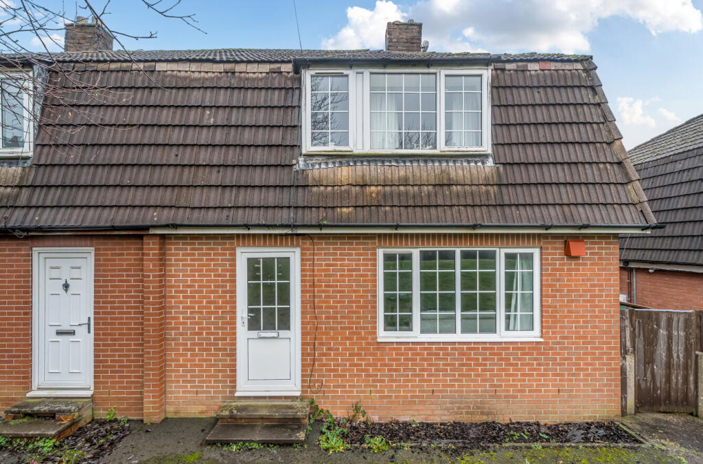
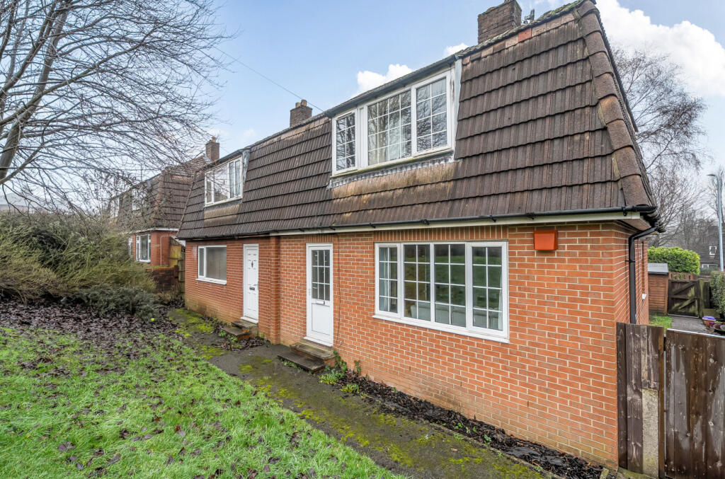
- Three Bedrooms
- Semi Detached
- Popular Location
- No Upward Chain
- Freehold
- Viewing Essential
Additional details
- Electricity
- Mains supply
- Water
- Mains supply
- Sewerage
- Mains supply
- Heating
- Central, Gas central
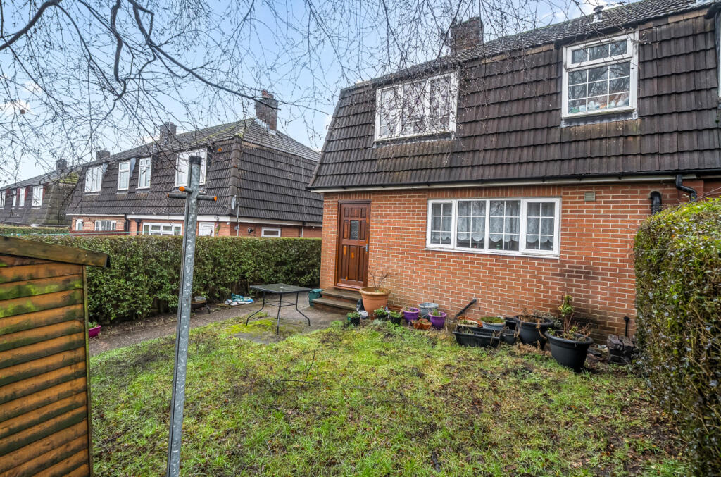
- Garden
- Yes
- Listed property
- No
- Required access
- No
- Flooded in last 5 years
- No
Description
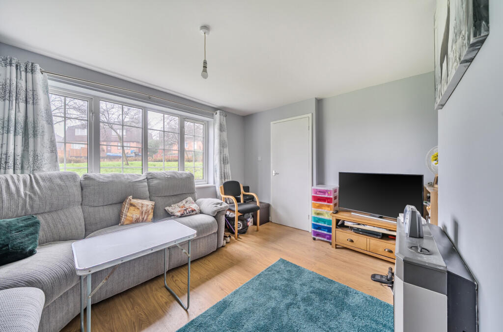
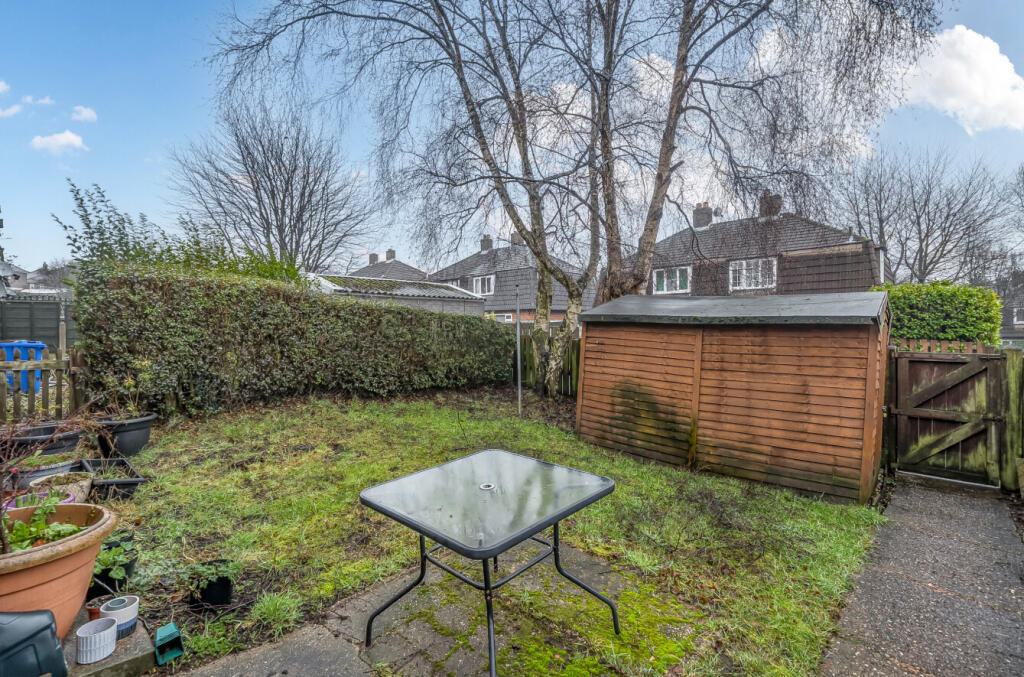
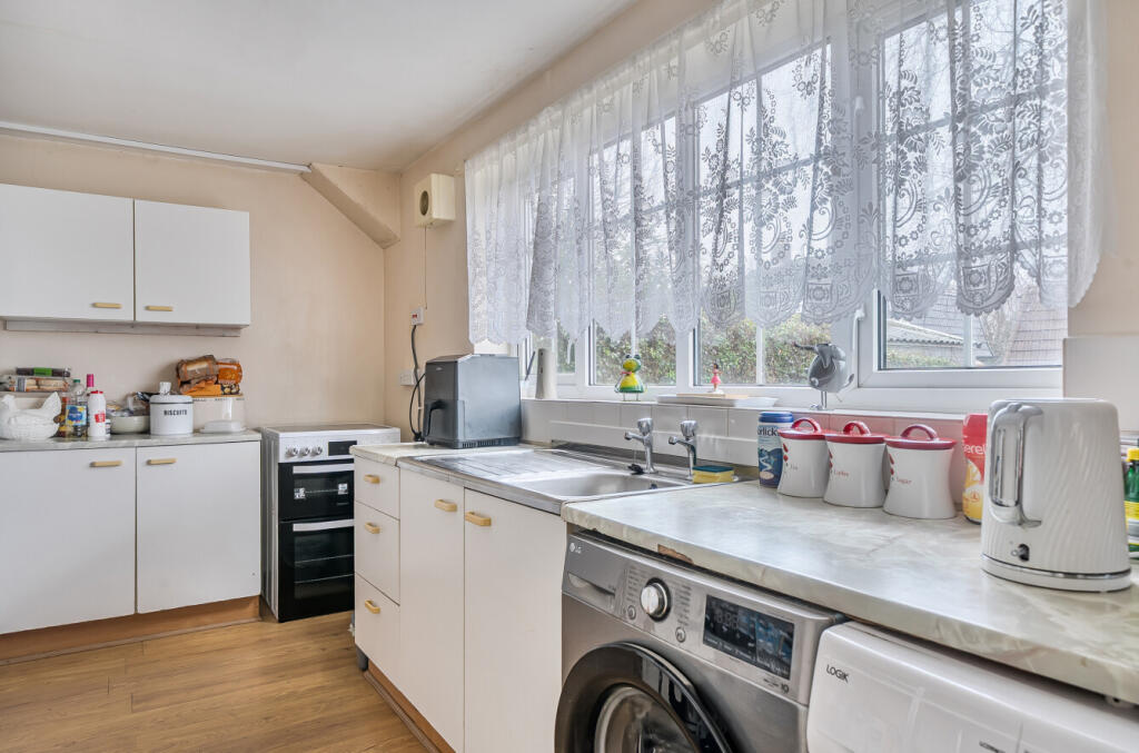
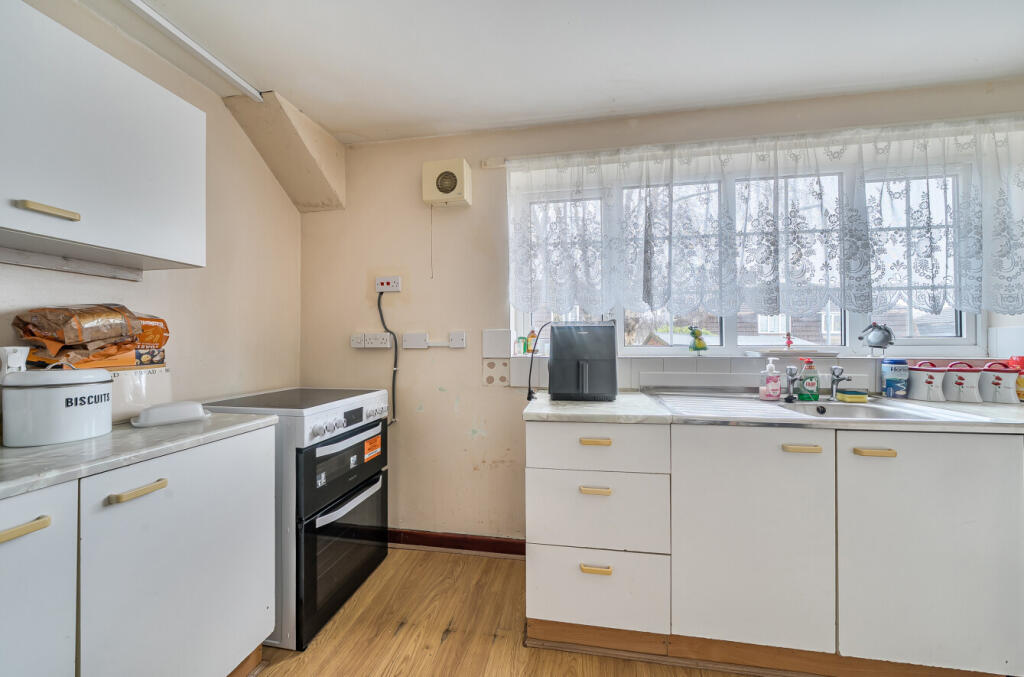
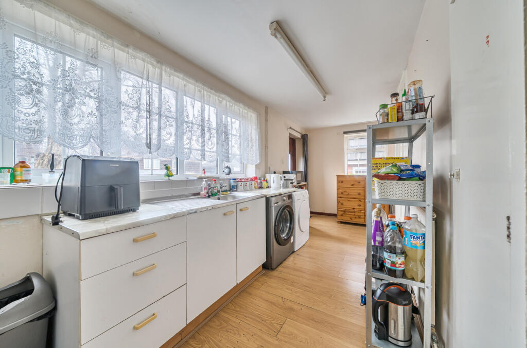
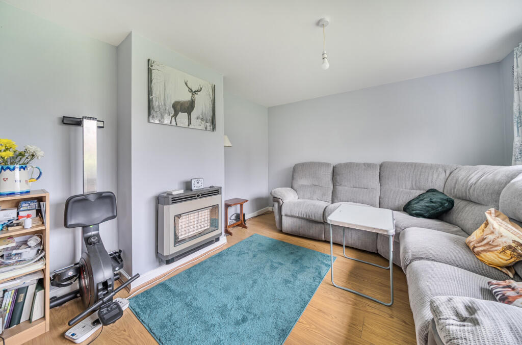
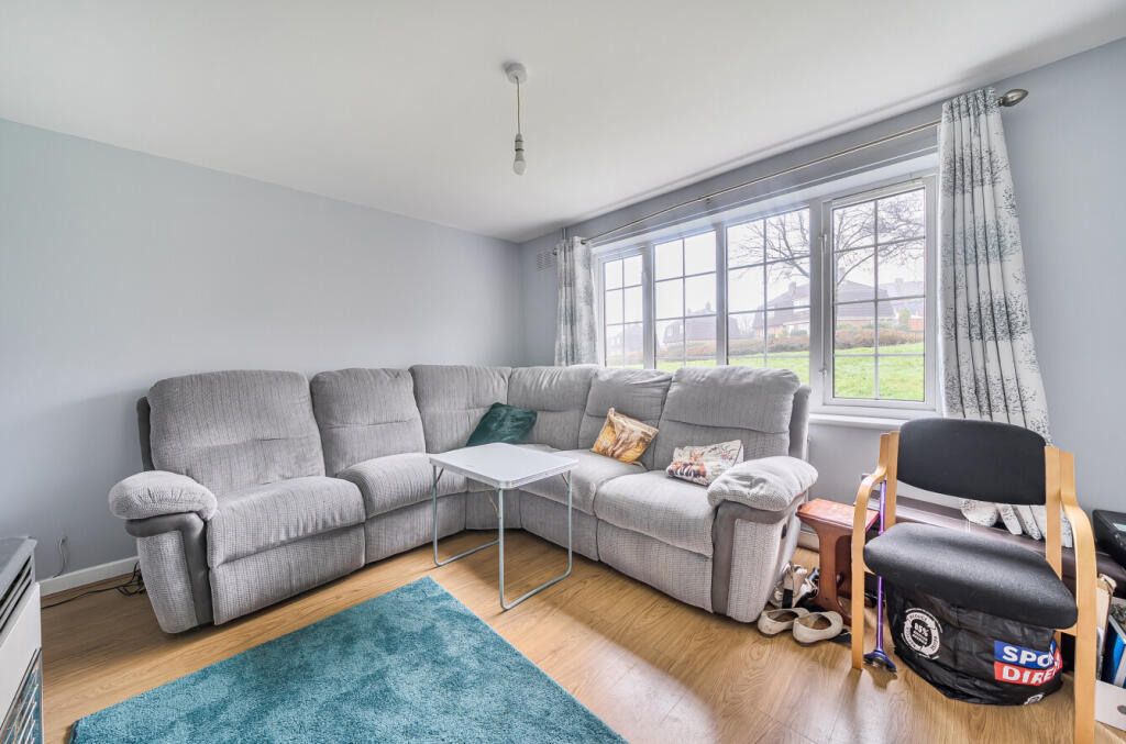
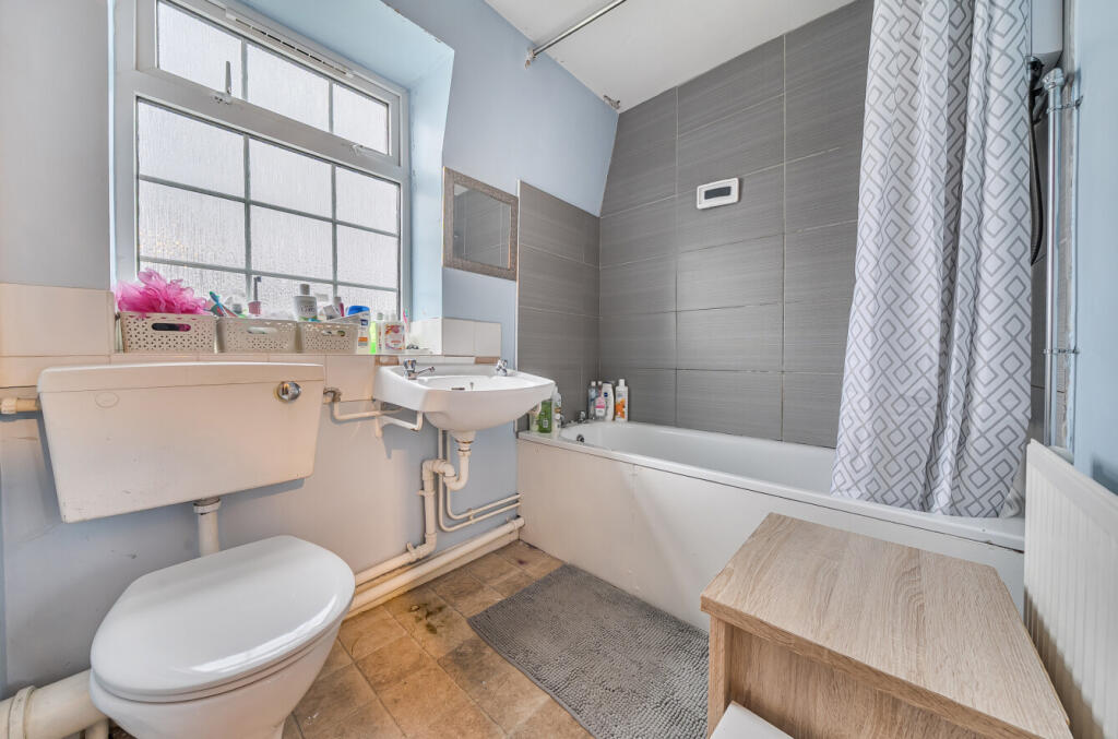
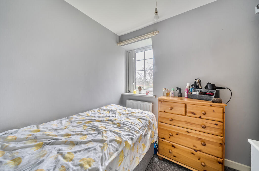
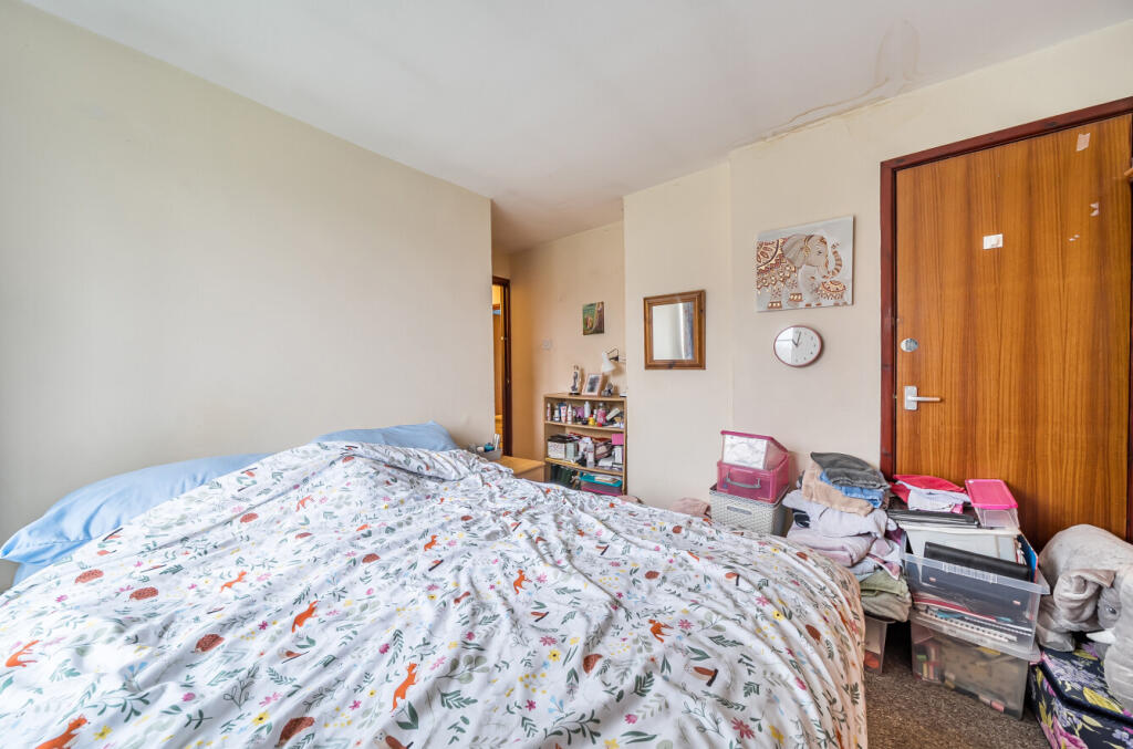
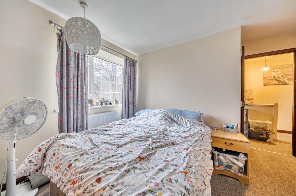
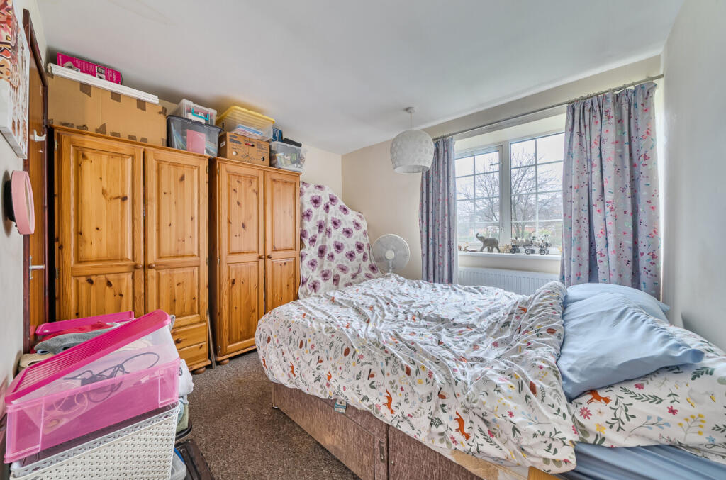
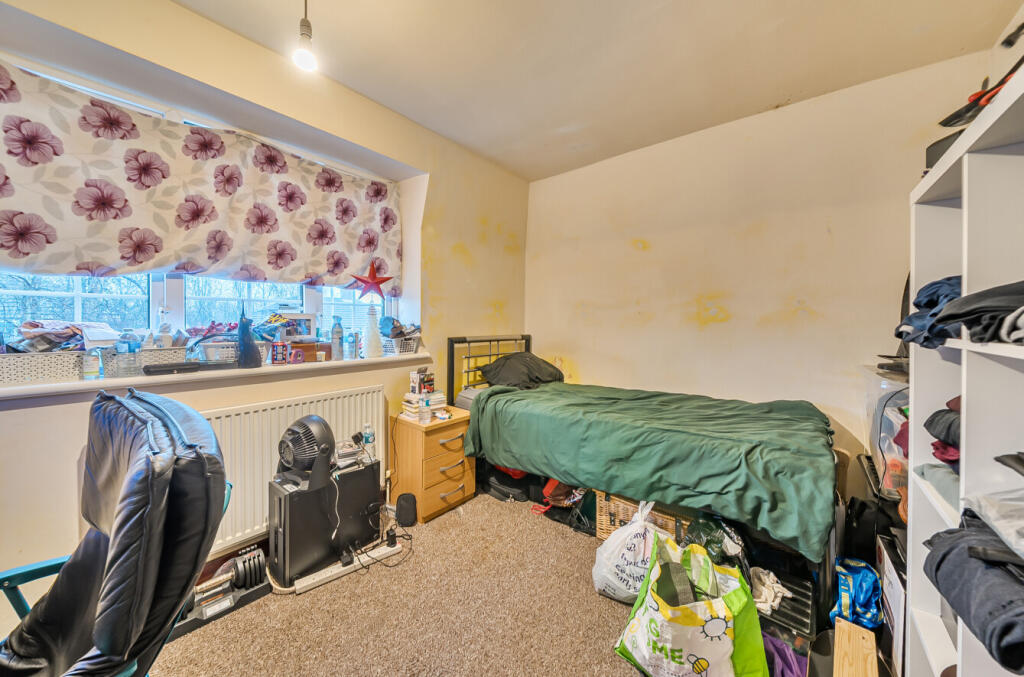
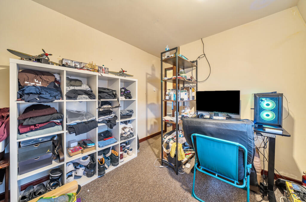
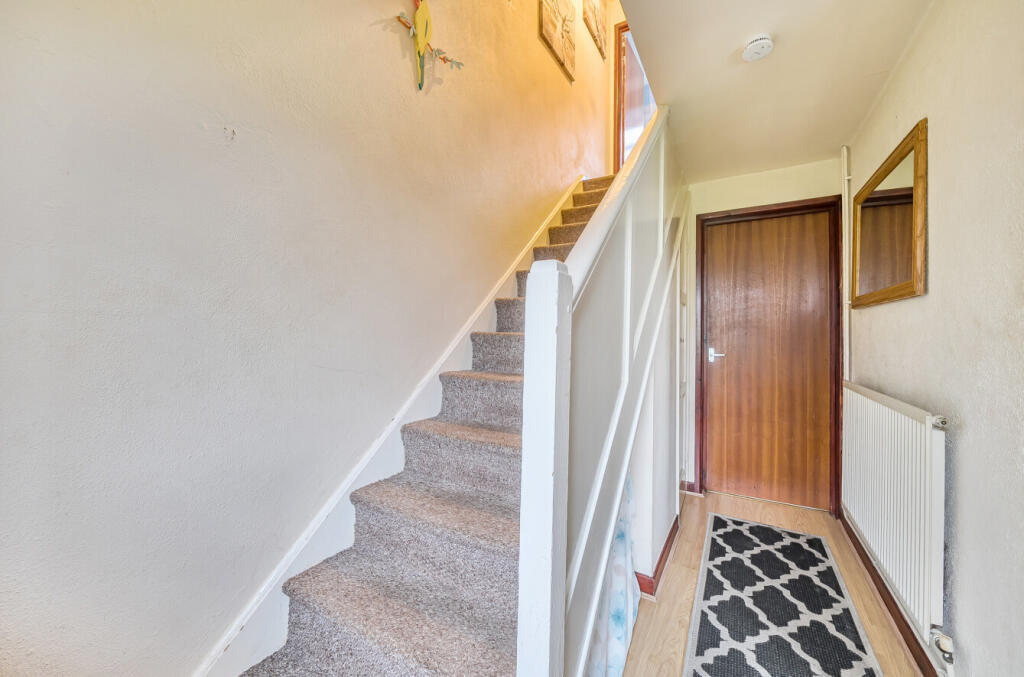
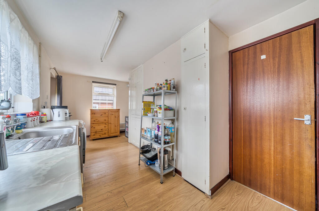
The accommodation briefly comprises of: hall, lounge and kitchen/dining room downstairs. While upstairs there are 2 double bedrooms, a good sized single third bedroom and a family bathroom. Outside there are front and rear gardens with mature trees and boarders.
Set in an elevated position in a quiet street with local amenities, schools and transport links nearby, and offered to the market with no onward chain, viewing is highly recommended.
For more information or to arrange a viewing please contact Leaders at your earliest convenience.
The property benefits from a recently obtained PRC (Precast Reinforced Concrete) certificate, confirming approved structural works. This is available upon request.
Key details:
Freehold
EPC - D
Council tax band A
PRC available
Listed by
Crewe
Leaders and Romans Group
Reference: 174066203
EPC ratings on this postcode
We don't have a matched EPC for this property yet. Below are efficiency scores and details for other addresses on this postcode.
| Address | Current | Potential | Floor area | Age band | Type |
|---|---|---|---|---|---|
| 1, Blackthorn Place, NEWCASTLE | 73 | 87 | 72 m² | England and Wales: 1991-1995 | Detached |
| 10 Blackthorn Place, NEWCASTLE | 66 | 84 | 76 m² | England and Wales: 1967-1975 | Detached |
| 10, Blackthorn Place, NEWCASTLE | 61 | 84 | 74 m² | England and Wales: 1950-1966 | Detached |
| 11, Blackthorn Place, NEWCASTLE | 58 | 78 | 76 m² | England and Wales: 1930-1949 | Detached |
| 12, Blackthorn Place, NEWCASTLE | 71 | 85 | 78 m² | England and Wales: 1991-1995 | Detached |
| 13, Blackthorn Place, NEWCASTLE | 57 | 84 | 73 m² | England and Wales: 1930-1949 | Detached |
| 17 BLACKTHORN PLACE, NEWCASTLE UNDER LYME, NEWCASTLE UNDER LYME | 69 | 86 | 74 m² | England and Wales: 1950-1966 | Detached |
| 19, Blackthorn Place, NEWCASTLE | 43 | 77 | 73 m² | England and Wales: 1930-1949 | Detached |
| 19, Blackthorn Place, NEWCASTLE | 52 | 85 | 73 m² | England and Wales: 1930-1949 | Detached |
| 21, Blackthorn Place, NEWCASTLE | 50 | 83 | 74 m² | England and Wales: 1950-1966 | Detached |
| 23, Blackthorn Place, NEWCASTLE | 66 | 88 | 69 m² | England and Wales: 1950-1966 | Detached |
| 25 Blackthorn Place, NEWCASTLE | 70 | 84 | 76 m² | England and Wales: 1967-1975 | Detached |
| 27 Blackthorn Place, NEWCASTLE | 72 | 86 | 74 m² | England and Wales: 1991-1995 | Detached |
| 27 Blackthorn Place, NEWCASTLE | 34 | 86 | 76 m² | England and Wales: 1967-1975 | Detached |
| 29 Blackthorn Place, NEWCASTLE | 72 | 85 | 84 m² | England and Wales: 1950-1966 | Terraced |
Flood risk
Zone: 1
Risk: Low
Job (default Low)
Floorplans
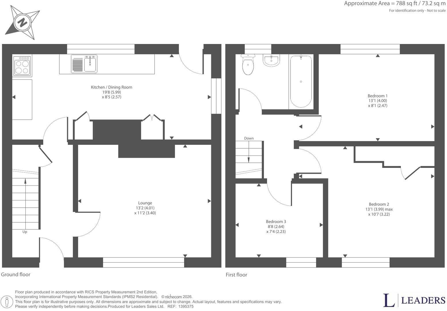
1395375 L-1.jpg
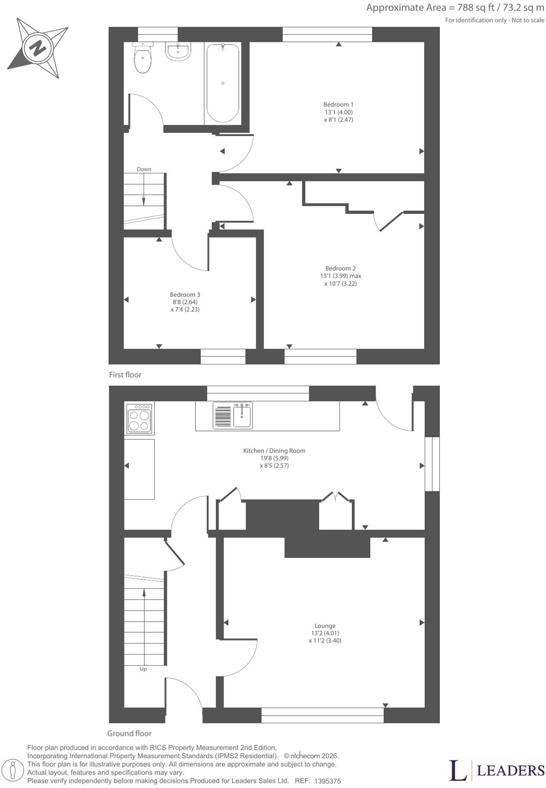
1395375 p-1.jpg
EPC Graphs
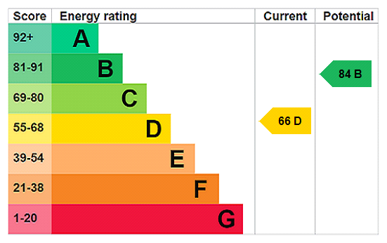
EPC Rating Graph
Price history
| Event | Date | Price | % change |
|---|---|---|---|
| Listed for sale | — | £100,000 | — |
Source: HM Land Registry Price Paid Data. Crown copyright.
Sold Comparables
Same street and nearby sales within 0.25 miles (last 5 years). Data from Land Registry Price Paid.
| Address | Price | Date | Type |
|---|---|---|---|
| Same street 25 BLACKTHORN PLACE, NEWCASTLE, NEWCASTLE-UNDER-LYME, STAFFORDSHIRE, ST5 7BE | £67,500 | 30/07/2025 | Semi-detached |
| Same street 35 BLACKTHORN PLACE, NEWCASTLE, NEWCASTLE-UNDER-LYME, STAFFORDSHIRE, ST5 7BE | £120,000 | 19/10/2022 | Semi-detached |
| UNIT 16-17 HAMMOND ROAD, PARKHOUSE INDUSTRIAL ESTATE WEST, NEWCASTLE, NEWCASTLE-UNDER-LYME, STAFFORDSHIRE, ST5 7RX | £3,586,000 | 21/01/2022 | Other |
Street average: £93,750 (2 sales)
Area average: £3,586,000 (1 sale)
Capital growth trend
Land Registry outcode average: last 12 months vs 5y and 10y ago (from sold prices).
House Price Index (HM Land Registry — official index, not sold-price averages): Newcastle-under-Lyme. Series: All dwelling types. As of April 2026.
Rental Range
Estimated market rent for Newcastle-under-Lyme. Low = conservative, Realistic = average, Optimistic = best case.
Based on Local Authority from postcode lookup → Newcastle-under-Lyme.
LHA (30th percentile) floor for Staffordshire North: £593/mo (Apr 2025 – Mar 2026)
Location
Address
Blackthorn Place
Nearby
Nearest stations, universities and amenities (distance from property).
| Type | Name | Distance |
|---|---|---|
| Bus stop | Oakwood Place | 0.1 miles |
| Shop | The Co-operative Food | 0.3 miles |
| Hospital | Bradwell Hospital | 0.8 miles |
| Train station | Apedale Road | 0.9 miles |
| Train station | Silverdale | 1.1 miles |
| Hospital | Haywood Hospital | 2.7 miles |
| University | Keele University | 3.3 miles |
| University | University of Staffordshire Stoke Campus | 4.0 miles |
Street-level crime
| Category | Count |
|---|---|
| Violence and sexual offences | 74 |
| Anti-social behaviour | 33 |
| Criminal damage and arson | 18 |
| Public order | 12 |
| Shoplifting | 10 |
| Vehicle crime | 10 |
| Other theft | 6 |
| Burglary | 2 |
| Drugs | 2 |
| Possession of weapons | 2 |
| Other crime | 1 |
| Robbery | 1 |
| Total incidents | 171 |
Within 1 mile during May 2026. Source: data.police.uk (England & Wales).
Schools nearby
Nearest open schools with Ofsted ratings (England). Closed schools are not shown. Data from Get Information about Schools and Ofsted.
| Name | Type | Distance | Ofsted |
|---|---|---|---|
| Crackley Bank Primary School | Primary | 0.1 miles | Good — 21 May 2023 |
| St Chad's CofE (C) Primary School | Primary | 0.5 miles | Good — 10 Apr 2014 |
| Chesterton Primary School | Primary | 0.5 miles | Good — 8 Jul 2021 |
| Chesterton Community Sports College | Secondary | 0.6 miles | Good — 13 Nov 2022 |
| Churchfields Primary School | Primary | 0.8 miles | Outstanding — 15 Sep 2015 |
Rental Comparables
Residential lets from OpenRent and Rightmove for the area (same bedroom count). Use to validate rent estimates. Student lets are excluded.
Average rent: £1,127/mo (40 listings)
Rent-driven metrics
Based on OpenRent comparables.
- Rent ratio — Monthly rent ÷ purchase price (1% rule). 1%+ = strong, 0.8–1% = okay, <0.8% = weak for cashflow.
- Max investor price — Rent ÷ 0.8%; the price at which rent would be 0.8% of price (Stoke-style target).
- Target investor price — Rent ÷ 1%; the price at which rent would be 1% of price (strong cashflow band).
- Gross yield — Annual rent as % of purchase price (no costs).
- Cost-to-rent — Price ÷ annual rent (from OpenRent comparables). Under 14× = strong, 14–16× = acceptable, 17×+ = compressed.
- Cashflow — Rent minus mortgage, 10% maintenance, £25/mo compliance. Assumes 75% LTV, 3.95% APR (5yr fixed), 25yr term.
- ROI — Annual profit ÷ cash in (deposit + 4% purchase costs).
Enter House Number
Enter the house number to help us retrieve more accurate pricing history and property data.
Please log in to submit or correct the house number for this listing.
Log in to continue