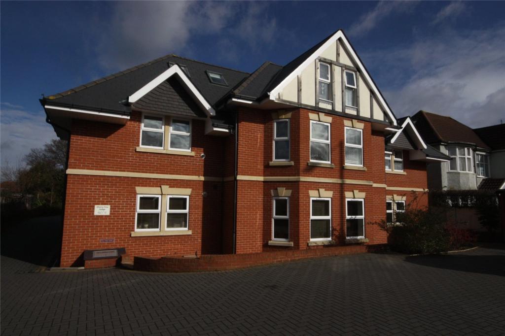
2 CHERRY TREE LODGE
289 CASTLE LANE WEST, BOURNEMOUTH, BOURNEMOUTH, CHRISTCHURCH AND POOLE BH8 9TG
£825 pcm
Property details
Floor area
47 m²
Council tax band
B
EPC rating
C
Year built
England and Wales: 2007-2011
Deprivation
Decile 7 (21,150 of 33,755)
Street crime
195 incidents within 1 mile (Apr 2026)
Key features
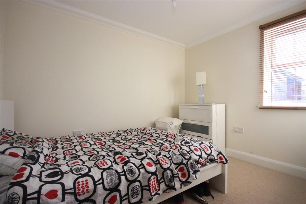
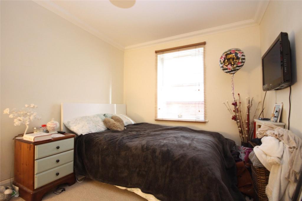
- Ground floor
- Two double bedrooms
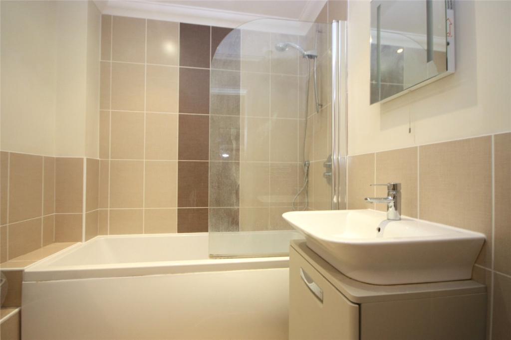
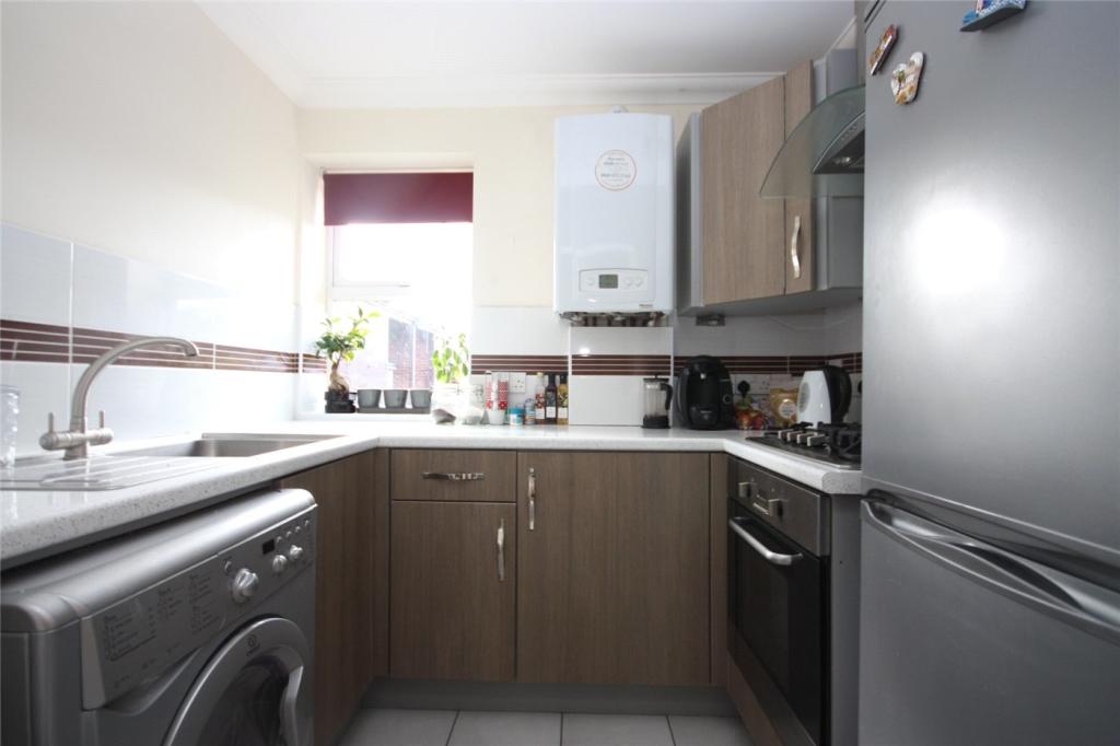
- Modern kitchen and bathroom
- Lounge diner
- Fitted kitchen
- Allocated parking
Additional details
- Parking
- Yes
Description
Listed by
Westbourne
Winkworth
Reference: 127353404
EPC Rating & Upgrade Cost
Current rating: C
Potential rating: C
Inspection date: 17/02/2022
Expiry date: 16/02/2032
Current heating cost: £189/year
Potential heating cost: £189/year
Flood risk
Zone: 1
Risk: Low
Job (default Low)
EPC Graphs
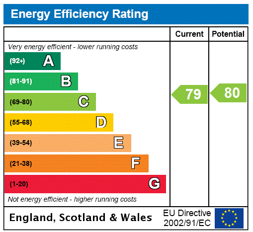
EPC Rating Graph
Rental Range
Estimated market rent for Bournemouth, Christchurch and Poole. Low = conservative, Realistic = average, Optimistic = best case.
Based on Local Authority from postcode lookup → Bournemouth, Christchurch and Poole.
Location
Nearby
Nearest stations, universities and amenities (distance from property).
| Type | Name | Distance |
|---|---|---|
| Bus stop | Broadway Tavern, Castle Lane West | 0.1 miles |
| Bus stop | Broadway Tavern, Charminster Road | 0.1 miles |
| Shop | The Co-operative Food | 0.1 miles |
| Shop | Pets Corner | 0.1 miles |
| Hospital | Nuffield Health Bournemouth Hospital | 1.8 miles |
| Train station | Bournemouth | 1.9 miles |
| University | Bournemouth University (Talbot Campus) | 1.9 miles |
| University | Bournemouth University | 1.9 miles |
| Train station | Pokesdown | 2.0 miles |
| Hospital | Christchurch Hospital | 2.9 miles |
Street-level crime
| Category | Count |
|---|---|
| Shoplifting | 61 |
| Violence and sexual offences | 54 |
| Anti-social behaviour | 33 |
| Vehicle crime | 16 |
| Other theft | 8 |
| Burglary | 6 |
| Robbery | 4 |
| Criminal damage and arson | 3 |
| Public order | 3 |
| Bicycle theft | 2 |
| Drugs | 2 |
| Possession of weapons | 2 |
| Other crime | 1 |
| Total incidents | 195 |
Within 1 mile during Apr 2026. Source: data.police.uk (England & Wales).
Schools nearby
Nearest open schools with Ofsted ratings (England). Closed schools are not shown. Data from Get Information about Schools and Ofsted.
| Name | Type | Distance | Ofsted |
|---|---|---|---|
| Bournemouth School for Girls | Secondary | 0.2 miles | Outstanding — 17 Jun 2024 |
| Bournemouth School | Secondary | 0.4 miles | Outstanding — 2 May 2024 |
| Muscliff Primary School | Primary | 0.4 miles | Good — 2 Jul 2024 |
| Queen's Park Infant Academy | Primary | 0.4 miles | Good — 24 Jul 2013 |
| The Bishop of Winchester Academy | Secondary | 0.5 miles | Good — 4 May 2023 |
Rental Comparables
Residential lets from OpenRent and Rightmove for the area (same bedroom count). Use to validate rent estimates. Student lets are excluded.
| Title | Rent | Beds | Distance | As seen on |
|---|---|---|---|---|
| 2 Bed Flat, Francis Court, BH8 | £1,050/mo | 2 | 1.27 miles | OpenRent |
Average rent: £1,050/mo (1 listing)