APARTMENT 103
7 LYONS PLACE, LONDON, GREATER LONDON NW8 8NL
£3,198 pcm
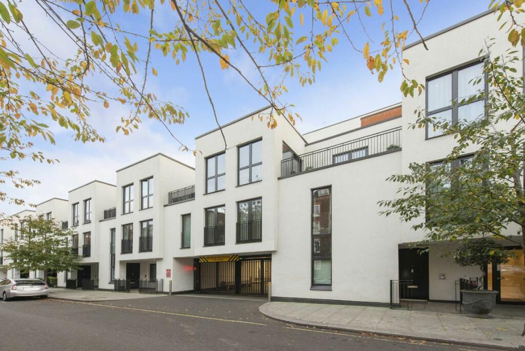
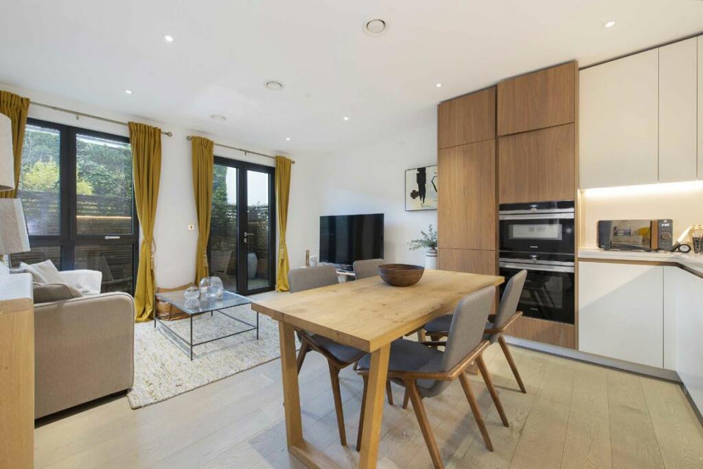
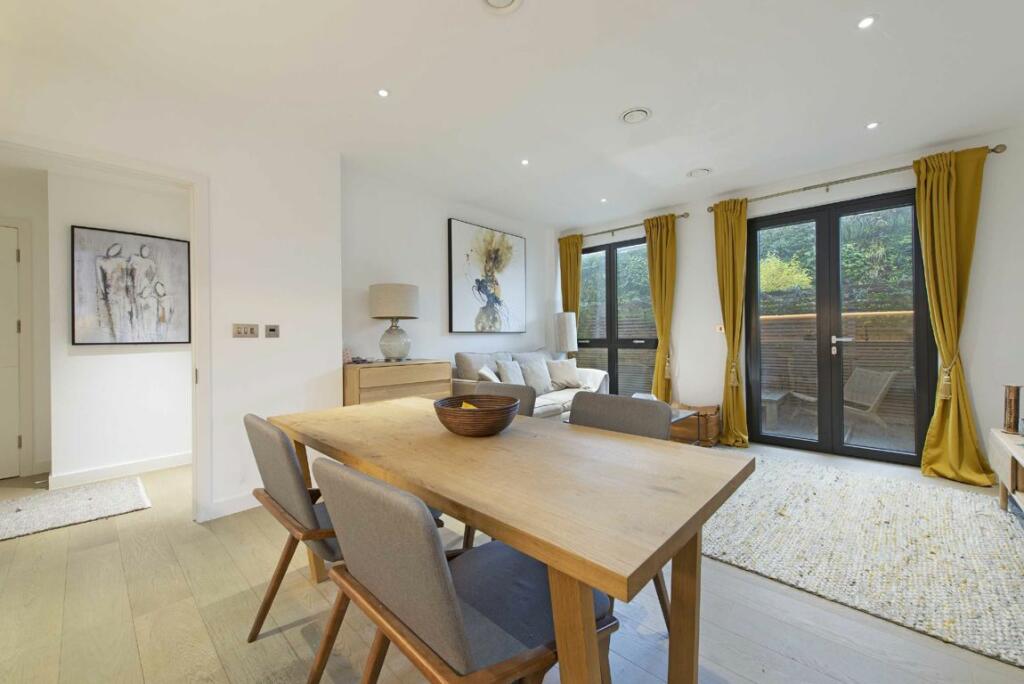

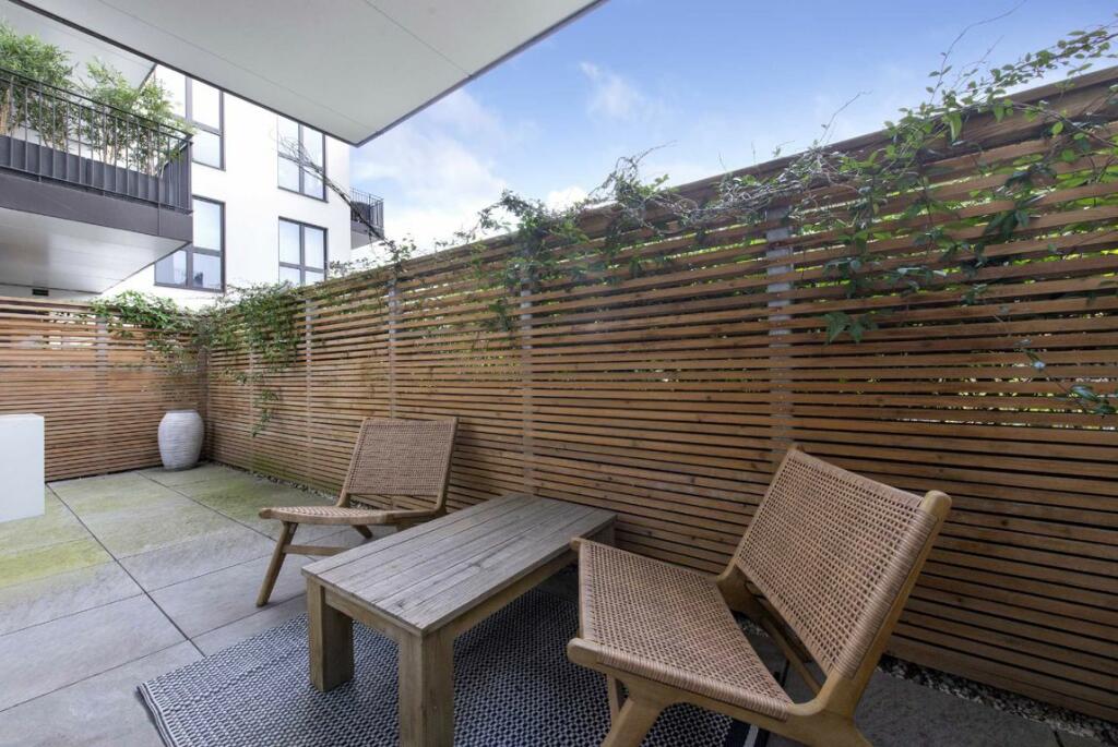
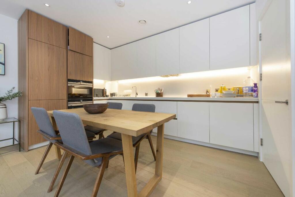

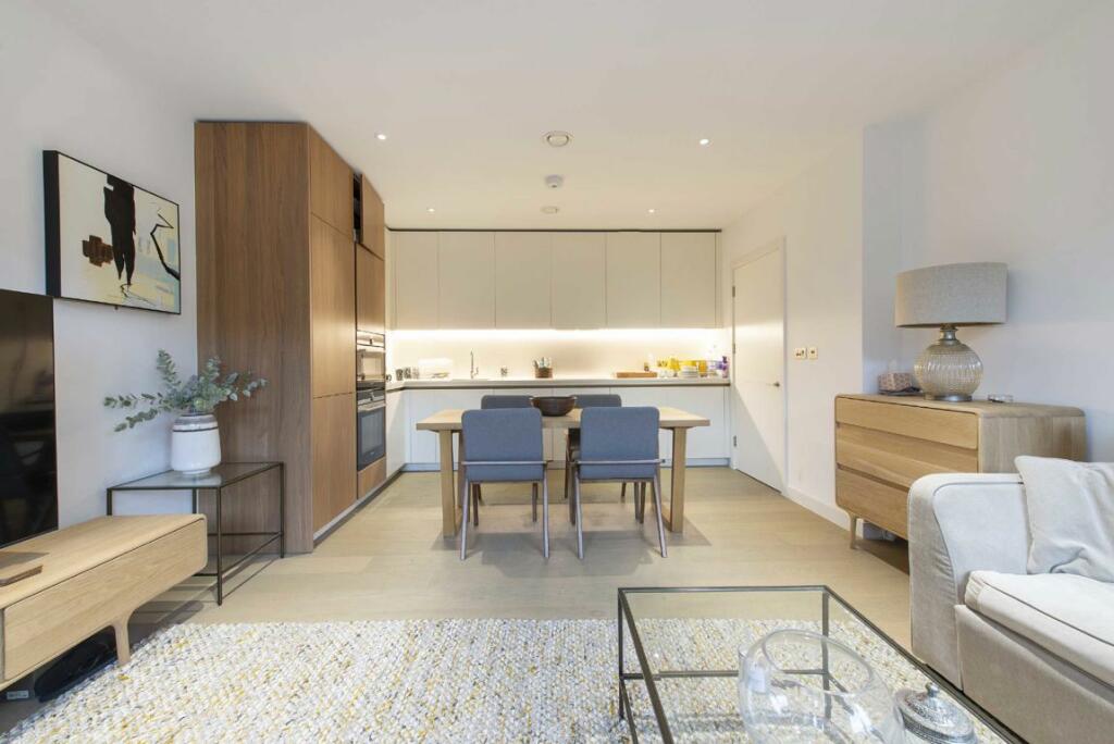
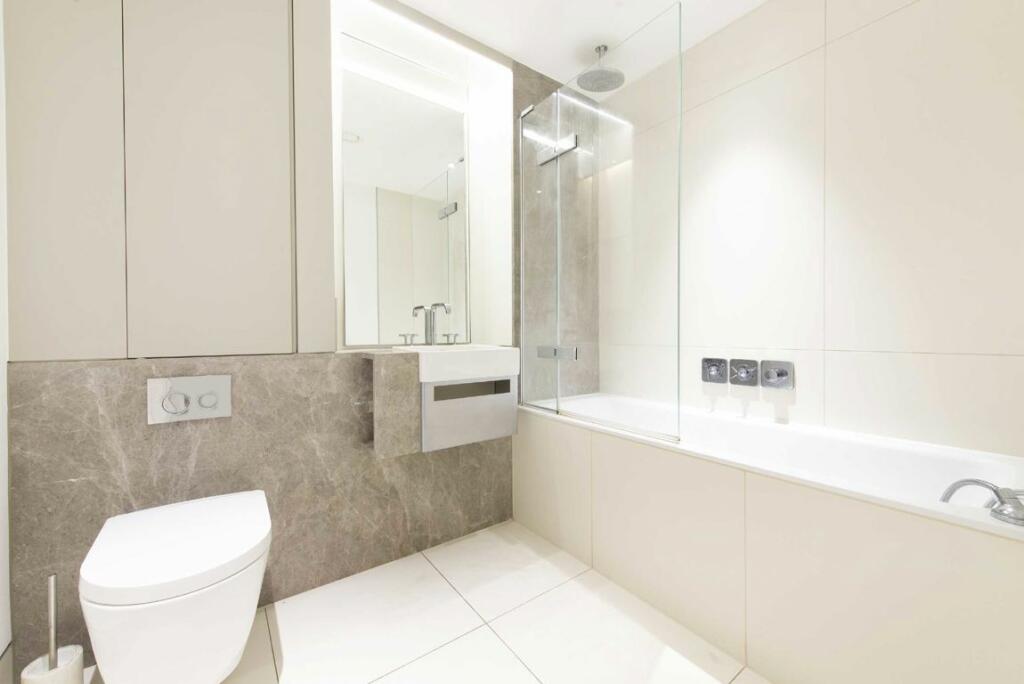
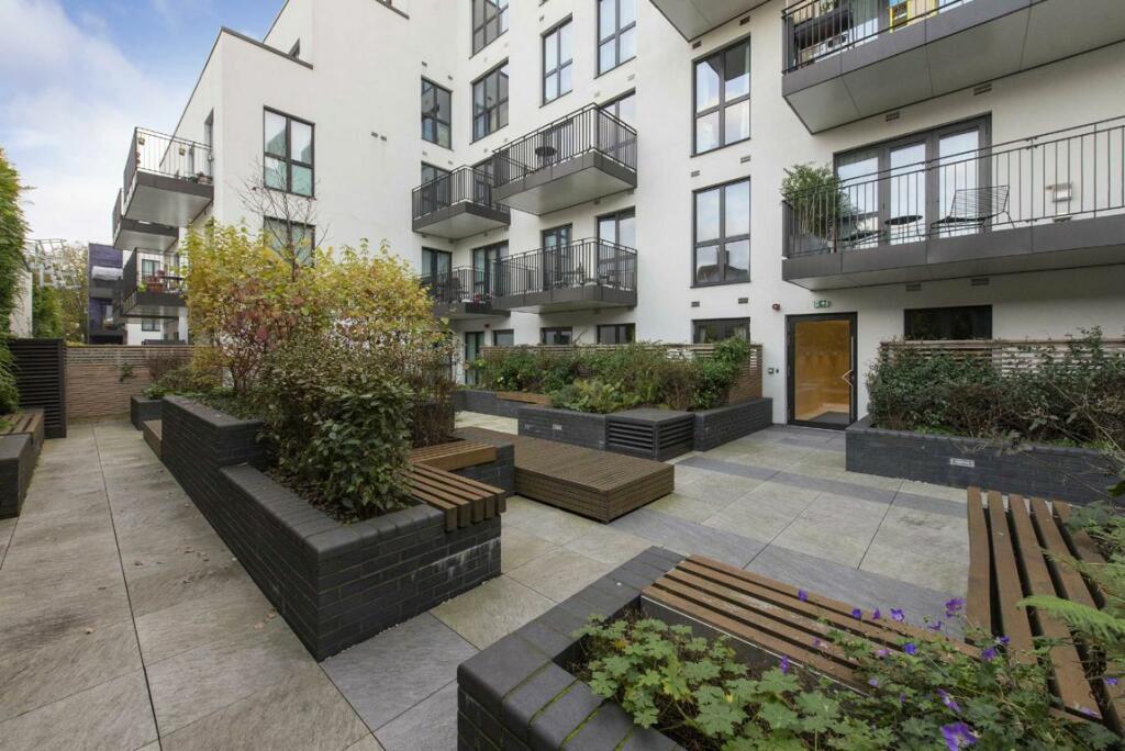
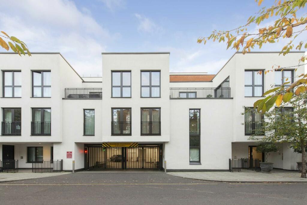
Photo 1 Photo 2 Photo 3 Photo 4 Photo 5 Photo 6 Photo 7 Photo 8 Photo 9 Photo 10 Photo 11
/ 11
Property details
Floor area
53 m²
Deprivation
Decile 1 (2,336 of 33,755)
Street crime
1586 incidents within 1 mile (Apr 2026)
Key features
- First Floor With Lift
- Private Balcony
- Communal Courtyard
- Concierge
- Siemens Appliances
- Great Storage Throughout
- Central Location
Description
Lyons Place is ideally situated, equidistant from both Hyde Park and Regent's Park, offering a prime location nestled between St John's Wood, Maida Vale, and Little Venice. These charming neighbourhood are connected by the serene beauty of Regent's Canal. St John's Wood, a peaceful, leafy area, provides a tranquil retreat just minutes away from the vibrant West End.
Security Deposit: £3,690
Council Tax Band: F
Listed by
St. Johns Wood
Dexters
Reference: 154544498
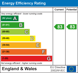
EPC Rating & Upgrade Cost
Fetching EPC data… Refresh this page in a moment.
Flood risk
Zone: 1
Risk: Low
Job (default Low)
Floorplans
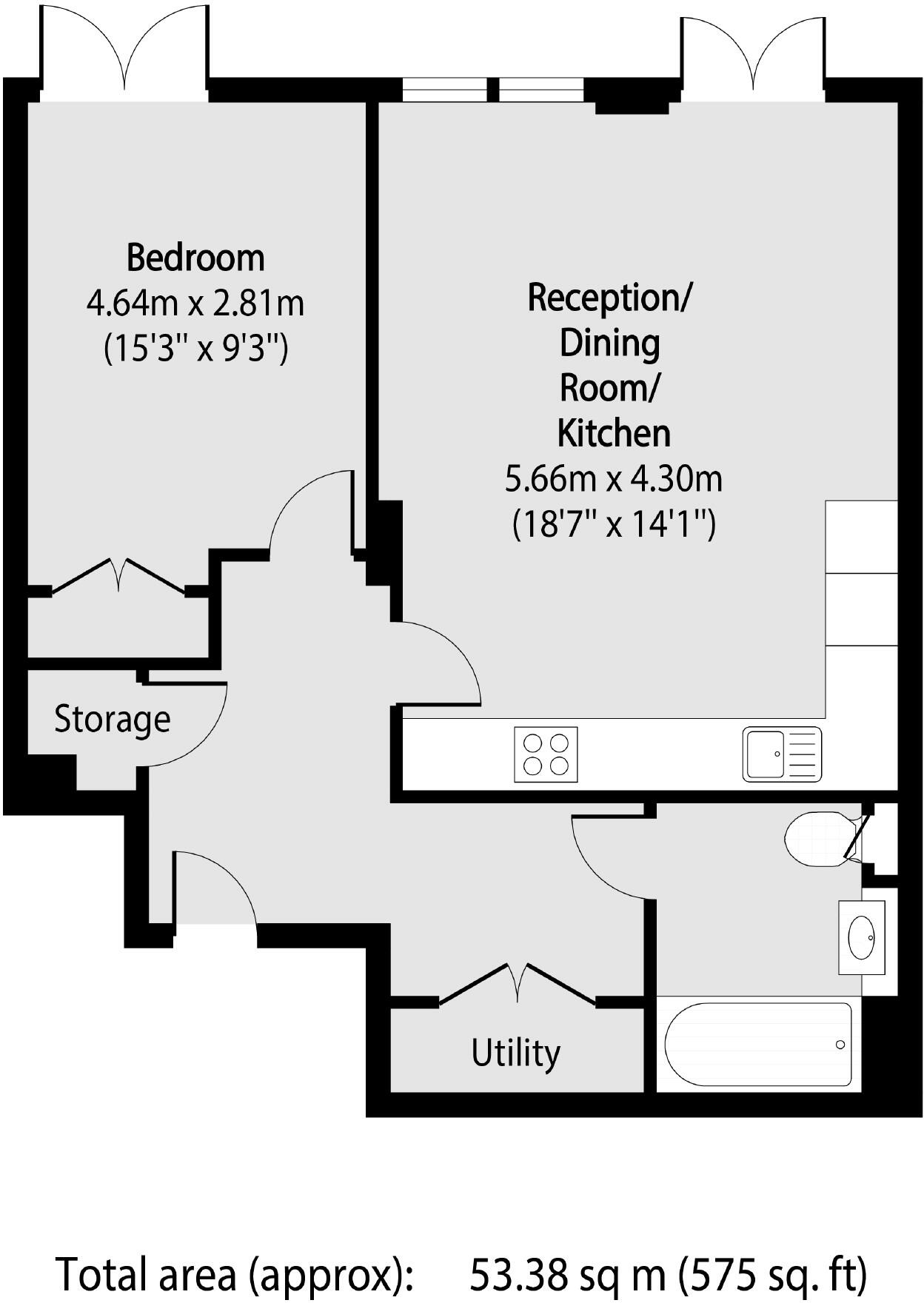
Floorplan 1
EPC Graphs
EPC 1
Company ownership
Registered legal owner is a company.
Rental Range
Estimated market rent for Westminster. Low = conservative, Realistic = average, Optimistic = best case.
Based on Local Authority from postcode lookup → Westminster.
LHA (30th percentile) floor for Central London: £1,436/mo (Apr 2025 – Mar 2026)
Location
Nearby
Nearest stations, universities and amenities (distance from property).
| Type | Name | Distance |
|---|---|---|
| Shop | Aldi | 0.0 miles |
| Shop | Infinity Hair | 0.0 miles |
| Bus stop | Orchardson Street | 0.0 miles |
| Train station | Warwick Avenue | 0.4 miles |
| Train station | Edgware Road | 0.4 miles |
| University | LBS Behaviour Lab | 0.7 miles |
| University | Kennet West Skills Centre | 1.1 miles |
| Hospital | The Portland Hospital | 1.4 miles |
| Hospital | Sleep & Health Clinic | 1.5 miles |
Street-level crime
| Category | Count |
|---|---|
| Anti-social behaviour | 352 |
| Violence and sexual offences | 307 |
| Other theft | 182 |
| Theft from the person | 146 |
| Shoplifting | 134 |
| Burglary | 82 |
| Drugs | 77 |
| Public order | 76 |
| Vehicle crime | 74 |
| Criminal damage and arson | 56 |
| Robbery | 43 |
| Bicycle theft | 32 |
| Possession of weapons | 16 |
| Other crime | 9 |
| Total incidents | 1586 |
Within 1 mile during Apr 2026. Source: data.police.uk (England & Wales).
Schools nearby
Nearest open schools with Ofsted ratings (England). Closed schools are not shown. Data from Get Information about Schools and Ofsted.
| Name | Type | Distance | Ofsted |
|---|---|---|---|
| Gateway Academy | Primary | 0.2 miles | Good — 14 Nov 2022 |
| United Colleges Group | Other | 0.2 miles | — (No rating) |
| L'Ecole Bilingue Elementaire | Other | 0.2 miles | Outstanding — 24 Mar 2019 |
| Ark King Solomon Academy | Other | 0.4 miles | Outstanding — 4 Feb 2024 |
| Portman Early Childhood Centre | Nursery | 0.4 miles | Outstanding — 14 Jul 2024 |
Rental Comparables
Residential lets from OpenRent and Rightmove for the area (same bedroom count). Use to validate rent estimates. Student lets are excluded.
| Title | Rent | Beds | Distance | As seen on |
|---|---|---|---|---|
| 1 Bed Flat, Belvedere Heights, NW8 | £2,650/mo | 1 | 0.25 miles | OpenRent |
Average rent: £2,650/mo (1 listing)