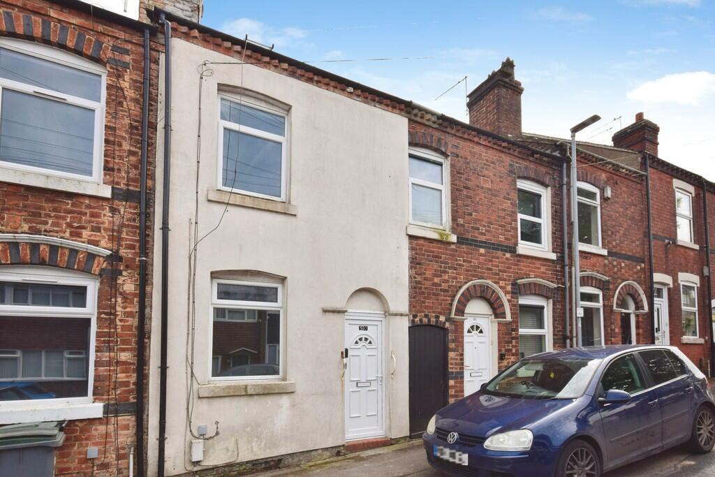
50 BROOM STREET
STOKE-ON-TRENT, STOKE-ON-TRENT, STOKE-ON-TRENT ST1 2EL
£700 pcm
Property details
Floor area
62 m²
Council tax band
A
Deprivation
Decile 1 (364 of 33,755)
Street crime
524 incidents within 1 mile (Apr 2026)
Key features
- Mid Terraced House
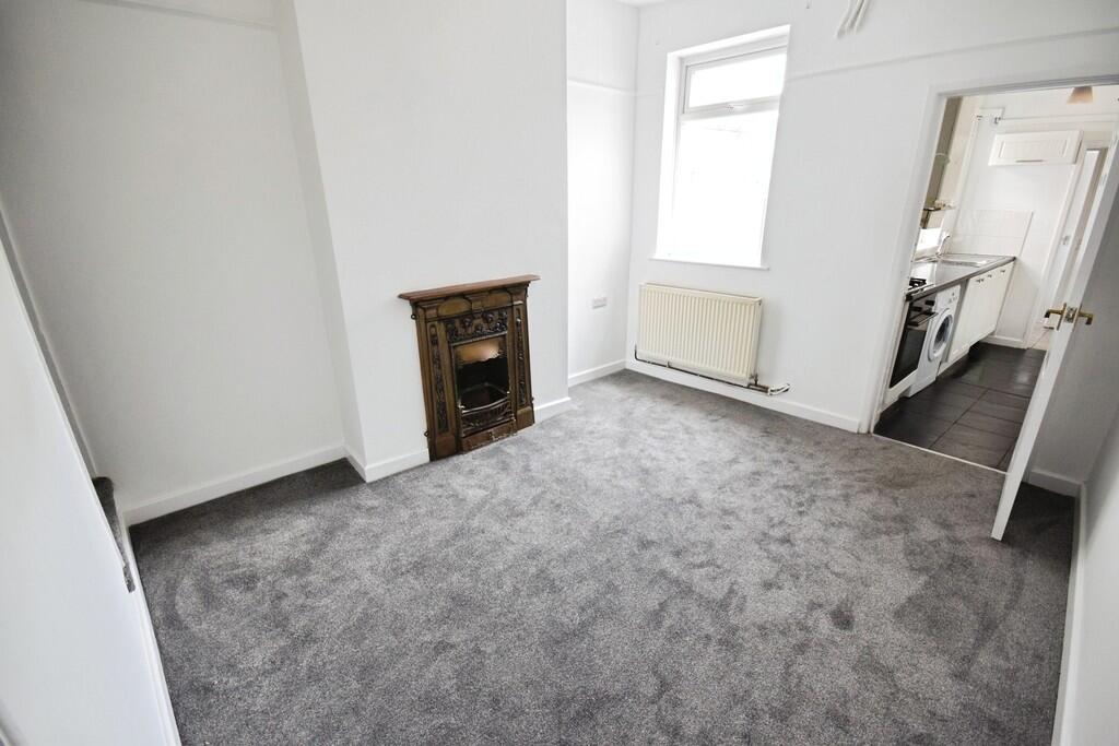
- Two reception rooms
- Walking distance of Hanley Town Centre
- Small rear yard
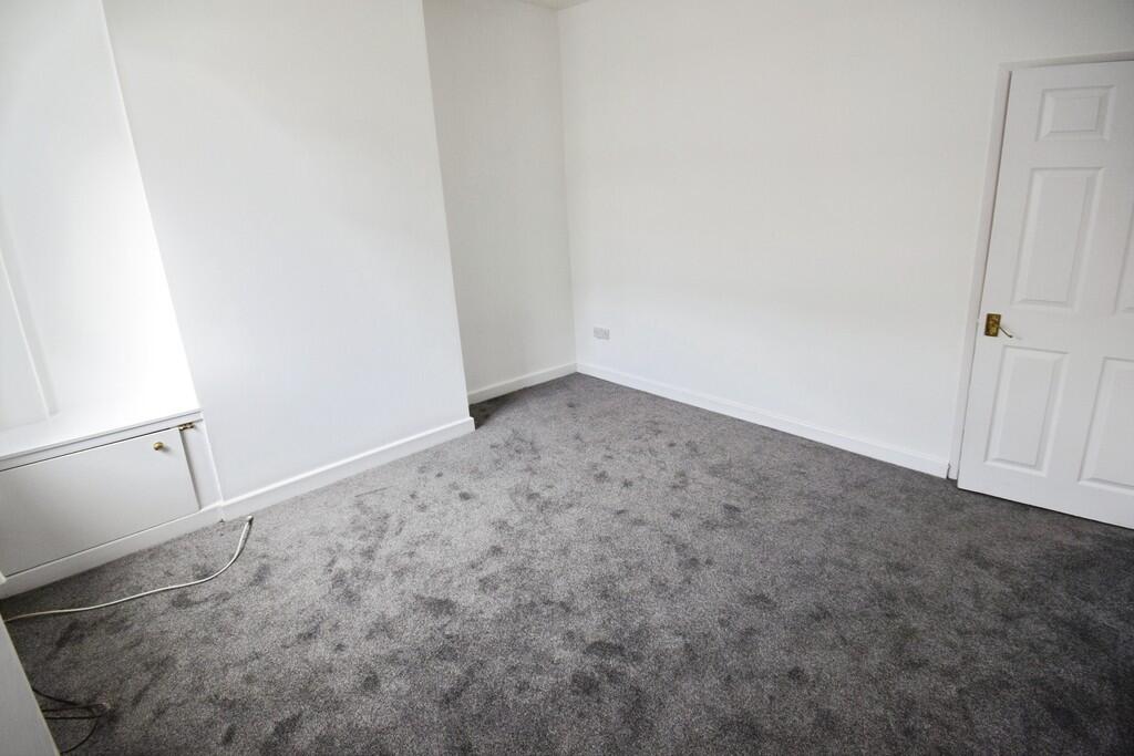
- 2 Bedrooms
- Bathroom
- Council Tax Band A
Additional details
- Heating
- Gas central
- Parking
- On street
- Garden
- Yes
Description
LOUNGE Entered via UPVC door with carpeted flooring and wall mounted radiator.
RECEPTION ROOM Carpeted flooring, wall mounted radiator, UPVC double glazed window and feature cast iron fireplace.
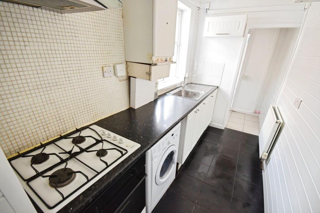
KITCHEN Fitted kitchen comprising of stainless steel sink and drainer and a range of base and wall units with worktop over. Gas hob, electric oven with extractor over, wall mounted radiator, tiled splash backs, tiled flooring, wooden door leading to rear yard and UPVC double glazed window to side elevation.
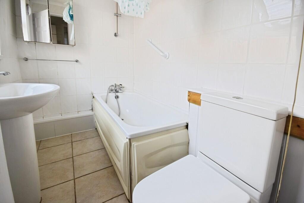
BATHROOM White three piece suite comprising of WC, wash hand basin and bath. Wall mounted radiator, tiled floor, tiled walls and UPVC frosted double glazed window to side elevation.
STAIRS AND LANDING Carpeted flooring.
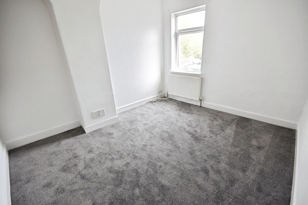
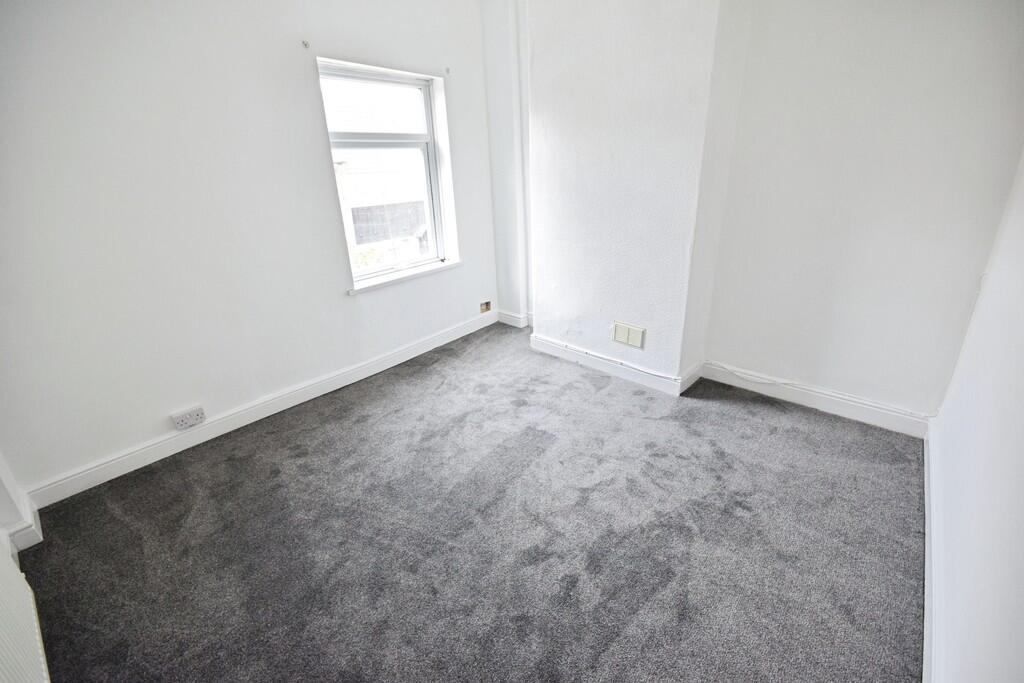
BEDROOM Carpeted flooring, wall mounted radiator and UPVC double glazed window to front elevation.
BEDROOM ** Carpeted flooring, wall mounted radiator and UPVC double glazed window to rear elevation.
Listed by
Stoke On Trent
The Property Franchise Group
Reference: 89055456
EPC Rating & Upgrade Cost
Fetching EPC data… Refresh this page in a moment.
Flood risk
Zone: 1
Risk: Low
Job (default Low)
EPC Graphs

EPC 1
Rental Range
Estimated market rent for Stoke-on-Trent. Low = conservative, Realistic = average, Optimistic = best case.
Based on Local Authority from postcode lookup → Stoke-on-Trent.
LHA (30th percentile) floor for Staffordshire North: £479/mo (Apr 2025 – Mar 2026)
Location
Nearby
Nearest stations, universities and amenities (distance from property).
| Type | Name | Distance |
|---|---|---|
| Bus stop | Dundas Street | 0.1 miles |
| Bus stop | Grove School | 0.1 miles |
| Shop | Blinkin-ink! | 0.3 miles |
| Shop | Project Groove | 0.4 miles |
| Train station | Stoke-on-Trent | 1.6 miles |
| Hospital | Haywood Hospital Walk-in Centre | 2.0 miles |
| Train station | Longport | 2.1 miles |
| Hospital | Royal Stoke University Hospital | 2.6 miles |
| University | Keele University | 4.7 miles |
| University | Buxton & Leek College | 8.1 miles |
Street-level crime
| Category | Count |
|---|---|
| Violence and sexual offences | 139 |
| Anti-social behaviour | 114 |
| Public order | 51 |
| Shoplifting | 51 |
| Criminal damage and arson | 34 |
| Vehicle crime | 34 |
| Other theft | 28 |
| Burglary | 20 |
| Drugs | 14 |
| Robbery | 12 |
| Possession of weapons | 10 |
| Other crime | 9 |
| Bicycle theft | 6 |
| Theft from the person | 2 |
| Total incidents | 524 |
Within 1 mile during Apr 2026. Source: data.police.uk (England & Wales).
Schools nearby
Nearest open schools with Ofsted ratings (England). Closed schools are not shown. Data from Get Information about Schools and Ofsted.
| Name | Type | Distance | Ofsted |
|---|---|---|---|
| Grove Academy | Primary | 0.1 miles | Good — 15 Jul 2024 |
| St George and St Martin's Catholic Academy | Primary | 0.2 miles | Good — 29 May 2015 |
| Northwood Broom Academy | Primary | 0.3 miles | Good — 4 Mar 2013 |
| Hamilton Academy | Primary | 0.3 miles | Good — 23 Oct 2014 |
| Hanley St Luke's Church of England Academy | Primary | 0.5 miles | Good — 23 Nov 2022 |
Rental Comparables
Residential lets from OpenRent and Rightmove for the area (same bedroom count). Use to validate rent estimates. Student lets are excluded.
Average rent: £810/mo (62 listings)