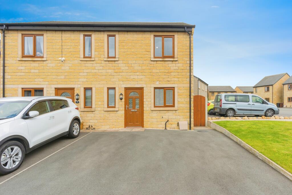
9 MAYFIELD DRIVE
BUXTON, DOVE HOLES, DERBYSHIRE SK17 8FT


Property details
Tenure
FREEHOLD
Floor area
75 m²
Council tax band
B
Last sold
£216,000 Feb 2025
Price per m²
£2,933/m²
Local average
£316,864 (-30.6%)
Deprivation
Decile 5 (14,785 of 33,755)
Street crime
3 incidents within 1 mile (Apr 2026)
Key features
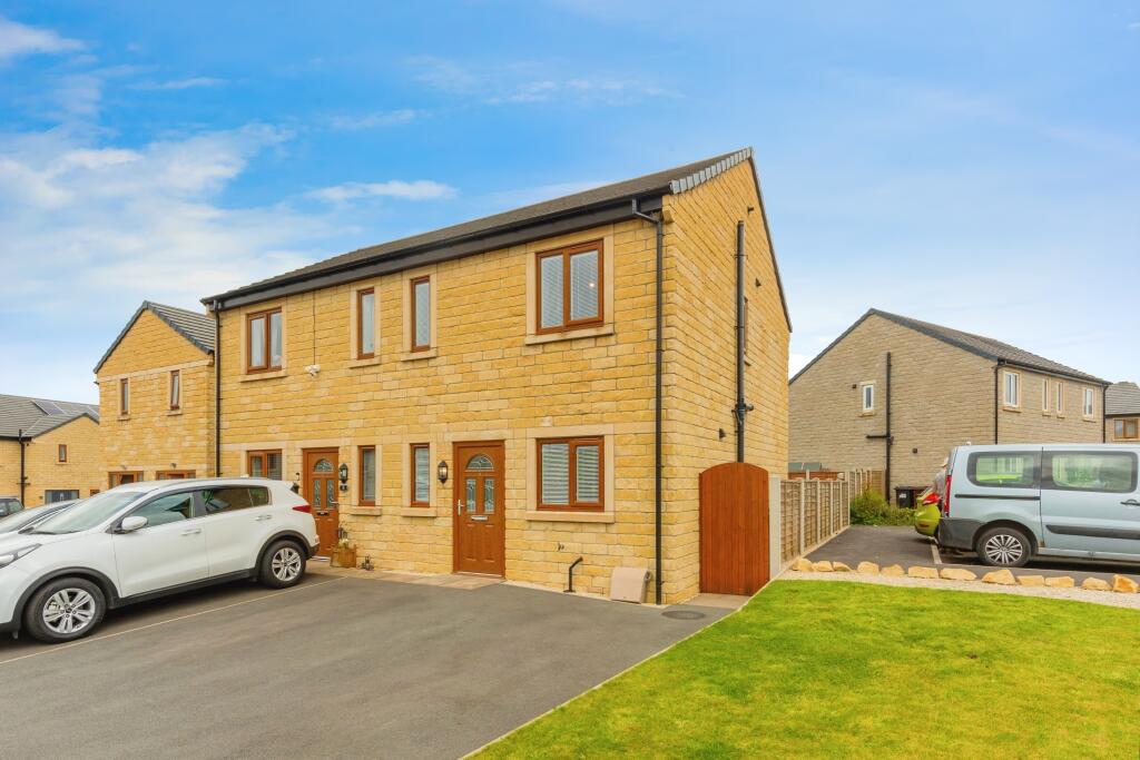
- Quiet cul-de-sac location
- Offered chain free
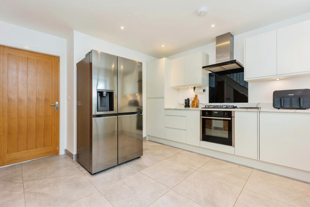
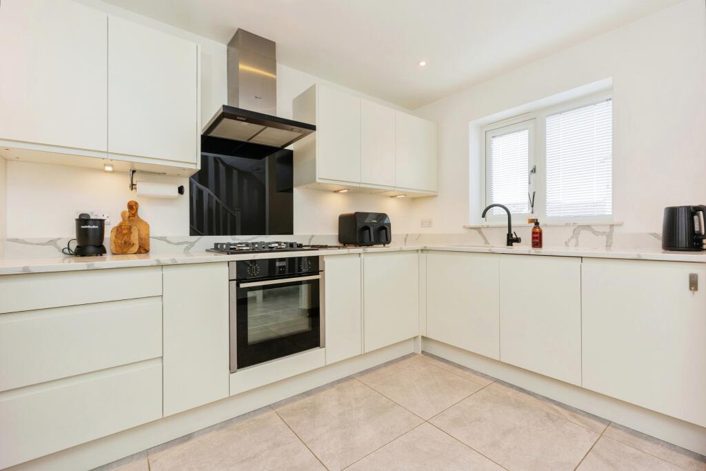
- Modern fitted kitchen
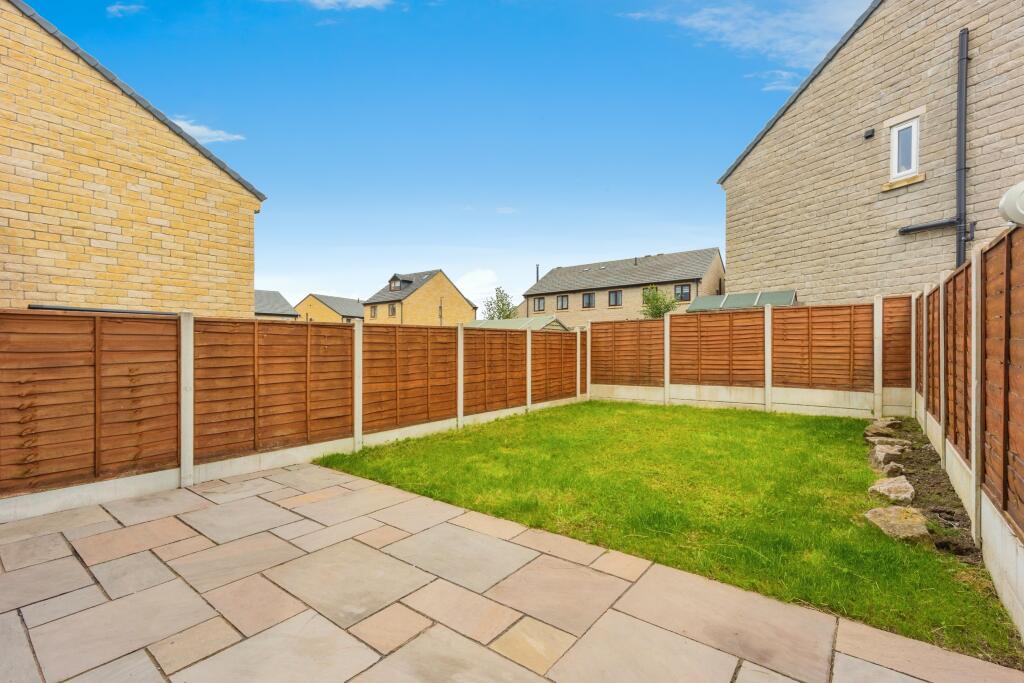
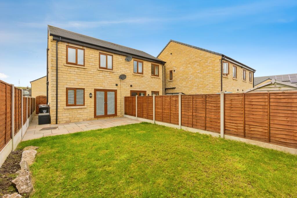
- Spacious enclosed rear garden
- Driveway parking for two cars
Additional details
- Parking
- Yes
- Garden
- Yes
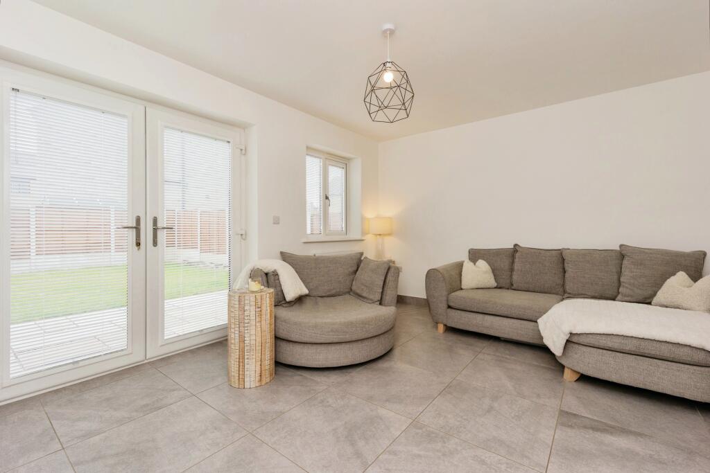
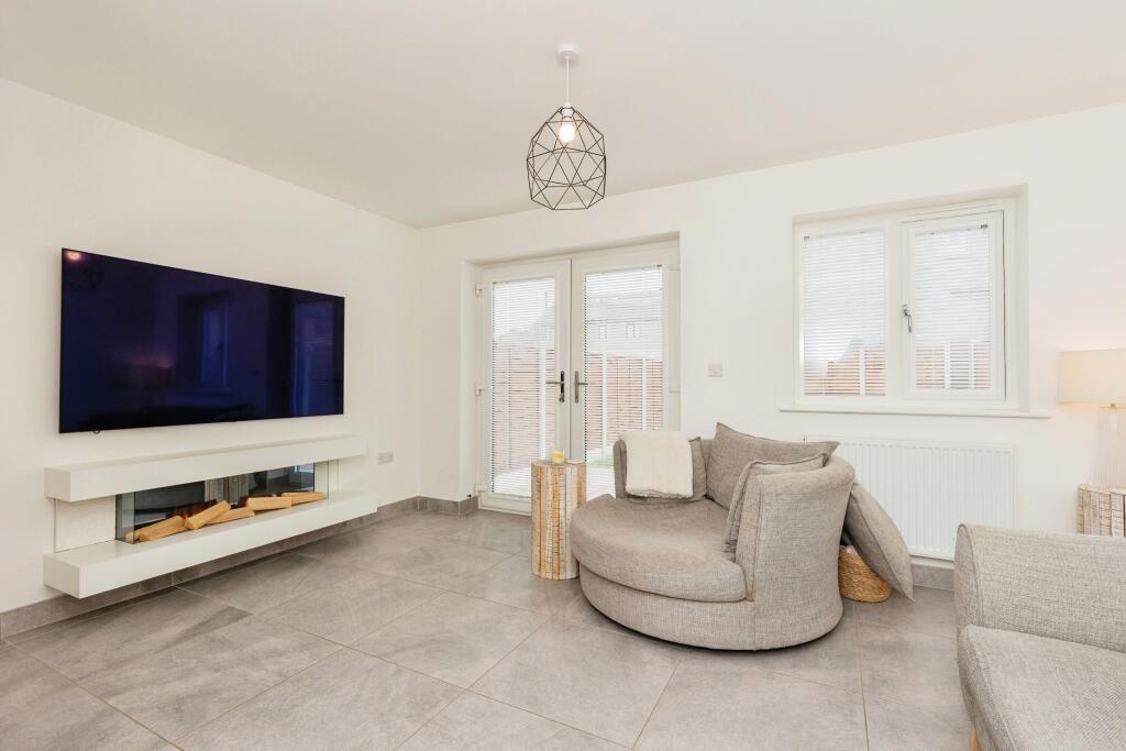
Description
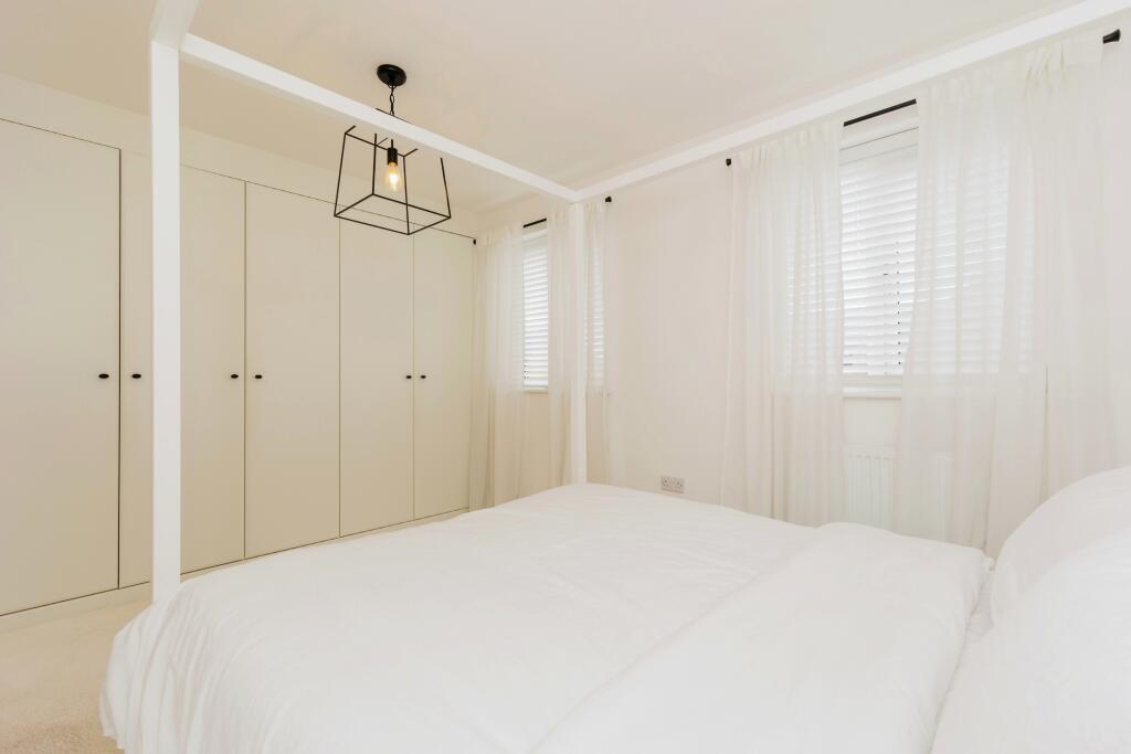
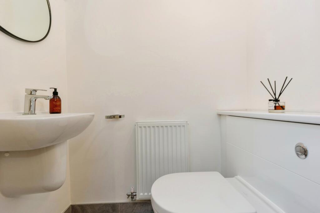
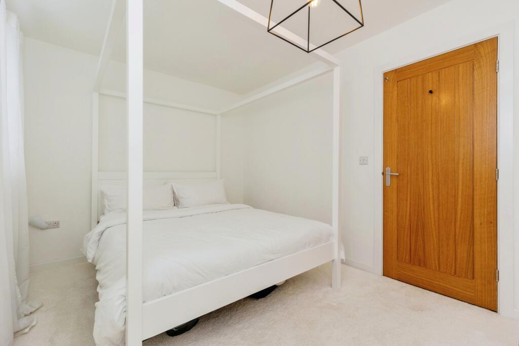
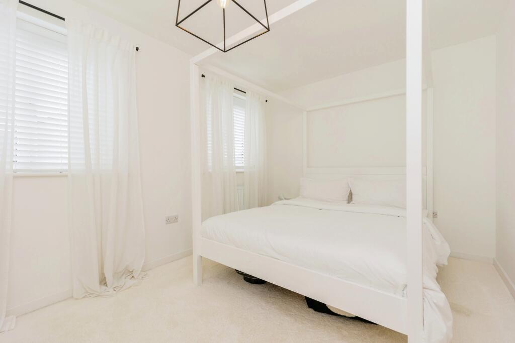
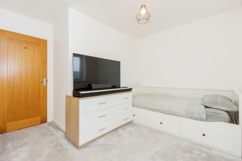
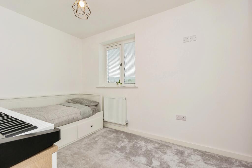
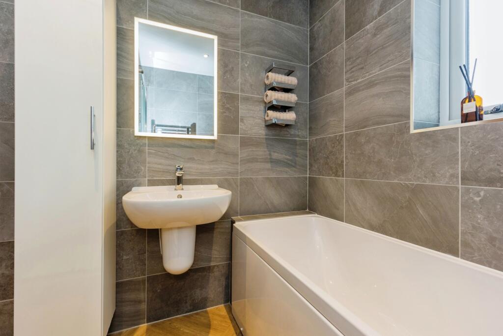
The first floor comprises two generous bedrooms, with the master featuring fitted wardrobes, and a well-appointed bathroom including a separate shower cubicle. Externally, the property boasts driveway parking for two cars and a front garden. Offered chain free, viewing is essential to appreciate this delightful home.
Listed by
Buxton
Countrywide UK Sales - Connells
Reference: 150709814
EPC Rating & Upgrade Cost
Fetching EPC data… Refresh this page in a moment.
Flood risk
Zone: 1
Risk: Low
Job (default Low)
Floorplans
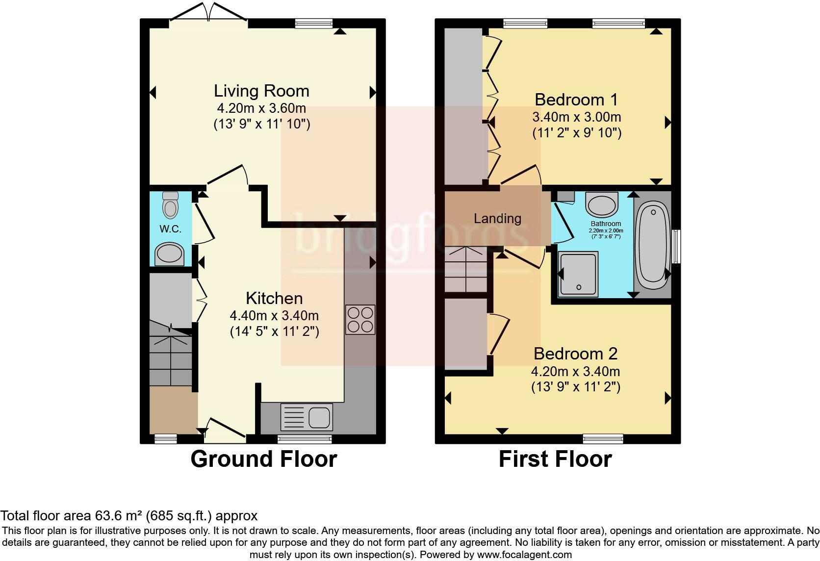
FLOOR-PLAN
EPC Graphs
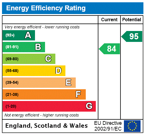
EPC Rating Graph
Price history
31% since 2021
| Event | Date | Price | % change |
|---|---|---|---|
| Sold | 17/02/2025 (1 year ago) | £216,000 | +30.9% |
| Sold | 30/12/2021 (4 years ago) | £165,000 | — |
Source: HM Land Registry Price Paid Data. Crown copyright.
Sold Comparables
Same street and nearby sales within 0.25 miles (last 5 years). Data from Land Registry Price Paid.
| Address | Price | Date | Type |
|---|---|---|---|
| 7 LIMESTONE COURT, DOVE HOLES, BUXTON, HIGH PEAK, DERBYSHIRE, SK17 8FP | £255,000 | 14/12/2023 | Semi-detached |
| Same street 35 MAYFIELD DRIVE, DOVE HOLES, BUXTON, HIGH PEAK, DERBYSHIRE, SK17 8FT | £267,500 | 12/06/2023 | Detached |
| Same street 28 MAYFIELD DRIVE, DOVE HOLES, BUXTON, HIGH PEAK, DERBYSHIRE, SK17 8FT | £138,320 | 31/03/2022 | Other |
| Same street 22 MAYFIELD DRIVE, DOVE HOLES, BUXTON, HIGH PEAK, DERBYSHIRE, SK17 8FT | £117,106 | 31/03/2022 | Other |
| Same street 6 MAYFIELD DRIVE, DOVE HOLES, BUXTON, HIGH PEAK, DERBYSHIRE, SK17 8FT | £245,000 | 23/12/2021 | Semi-detached |
| Same street 7 MAYFIELD DRIVE, DOVE HOLES, BUXTON, HIGH PEAK, DERBYSHIRE, SK17 8FT | £217,000 | 20/12/2021 | Semi-detached |
| 3 BEAUMONT DRIVE, DOVE HOLES, BUXTON, HIGH PEAK, DERBYSHIRE, SK17 8BB | £225,000 | 25/11/2021 | Semi-detached |
| 27 WALKER BROW, DOVE HOLES, BUXTON, HIGH PEAK, DERBYSHIRE, SK17 8DY | £230,000 | 19/11/2021 | Semi-detached |
| Same street 8 MAYFIELD DRIVE, DOVE HOLES, BUXTON, HIGH PEAK, DERBYSHIRE, SK17 8FT | £165,000 | 05/10/2021 | Semi-detached |
| 5 BLACK EDGE CLOSE, DOVE HOLES, BUXTON, HIGH PEAK, DERBYSHIRE, SK17 8FU | £235,000 | 02/09/2021 | Semi-detached |
| 4 BLACK EDGE CLOSE, DOVE HOLES, BUXTON, HIGH PEAK, DERBYSHIRE, SK17 8FU | £235,000 | 12/07/2021 | Semi-detached |
| 2 KILN CLOSE, DOVE HOLES, BUXTON, HIGH PEAK, DERBYSHIRE, SK17 8FQ | £212,500 | 29/06/2021 | Semi-detached |
Street average: £191,654 (6 sales)
Area average: £232,083 (6 sales)
Capital growth trend
Land Registry outcode average: last 12 months vs 5y and 10y ago (from sold prices).
House Price Index (HM Land Registry — official index, not sold-price averages): High Peak. Series: Semi-detached. As of March 2026.
Rental Range
Estimated market rent for High Peak. Low = conservative, Realistic = average, Optimistic = best case.
Based on Local Authority from postcode lookup → High Peak.
LHA (30th percentile) floor for Peaks & Dales: £593/mo (Apr 2025 – Mar 2026)
Location
Nearby
Nearest stations, universities and amenities (distance from property).
| Type | Name | Distance |
|---|---|---|
| Bus stop | Dove Holes, Hallsteads / adjacent Brickrow Cottages | 0.1 miles |
| Bus stop | Dove Holes, Hallsteads / opposite Brickrow Cottages | 0.1 miles |
| Train station | Dove Holes | 0.4 miles |
| Train station | Chapel-en-le-Frith | 1.5 miles |
| Shop | Hall's Mica | 1.8 miles |
| Shop | Chapel Garage | 1.8 miles |
| Hospital | Corbar hall | 3.2 miles |
| University | University of Derby, Buxton | 3.3 miles |
| Hospital | Buxton Hospital & Corbar Birth Centre | 4.0 miles |
Street-level crime
| Category | Count |
|---|---|
| Anti-social behaviour | 1 |
| Other theft | 1 |
| Violence and sexual offences | 1 |
| Total incidents | 3 |
Within 1 mile during Apr 2026. Source: data.police.uk (England & Wales).
Schools nearby
Nearest open schools with Ofsted ratings (England). Closed schools are not shown. Data from Get Information about Schools and Ofsted.
| Name | Type | Distance | Ofsted |
|---|---|---|---|
| Dove Holes CofE Primary School | Primary | 0.3 miles | Good — 17 Mar 2024 |
| The Meadows | Other | 0.5 miles | Good — 10 Jul 2023 |
| Peak Dale Primary School | Primary | 1.5 miles | — (Inspected (no overall grade)) |
| Chapel-en-le-Frith CofE VC Primary School | Primary | 1.7 miles | Good — 15 Nov 2023 |
| Chapel-en-le-Frith High School | Secondary | 1.9 miles | — (Inspected (no overall grade)) |
Rental Comparables
Loading rental comparables for this postcode. Refresh in a few minutes.
Rent-driven metrics
Based on Area rent estimate.
- Rent ratio — Monthly rent ÷ purchase price (1% rule). 1%+ = strong, 0.8–1% = okay, <0.8% = weak for cashflow.
- Max investor price — Rent ÷ 0.8%; the price at which rent would be 0.8% of price (Stoke-style target).
- Target investor price — Rent ÷ 1%; the price at which rent would be 1% of price (strong cashflow band).
- Gross yield — Annual rent as % of purchase price (no costs).