19 HAWKE ROAD
STAFFORD, STAFFORD, STAFFORDSHIRE ST16 1PZ
£650 pcm
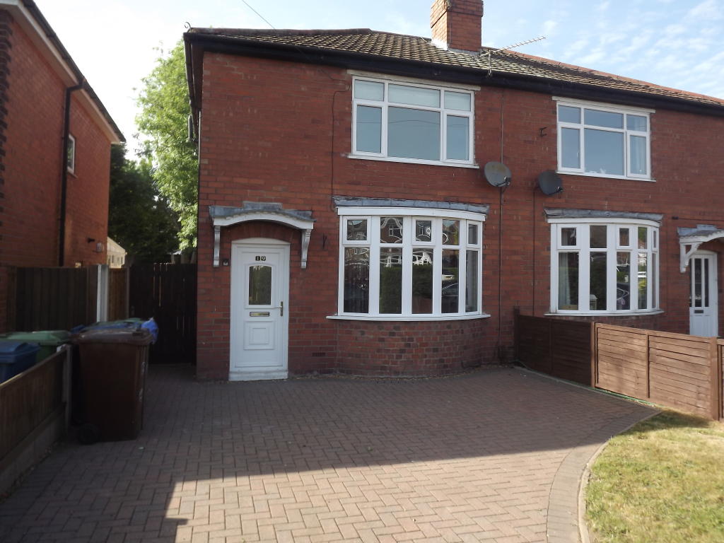
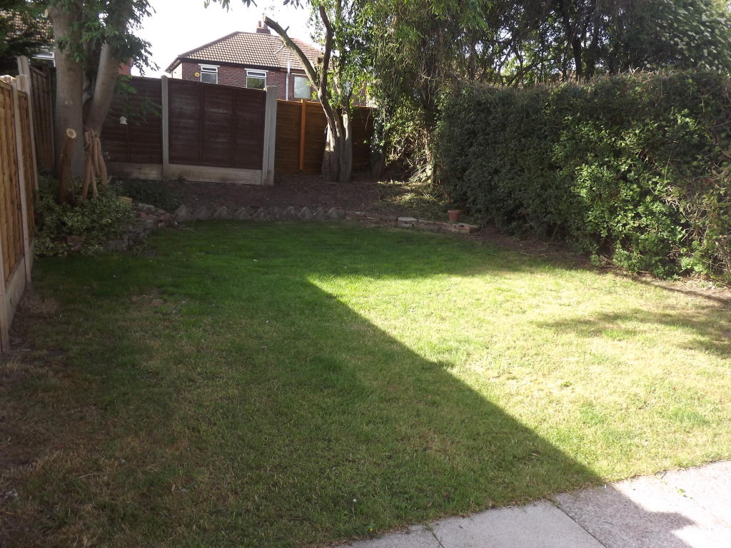
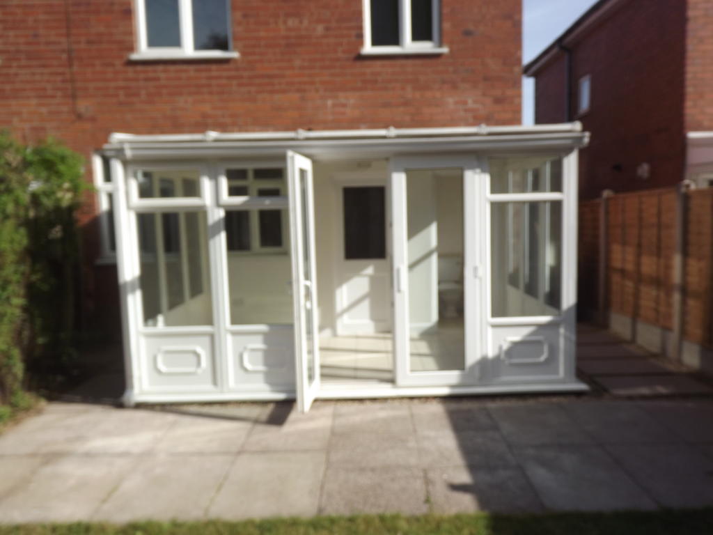
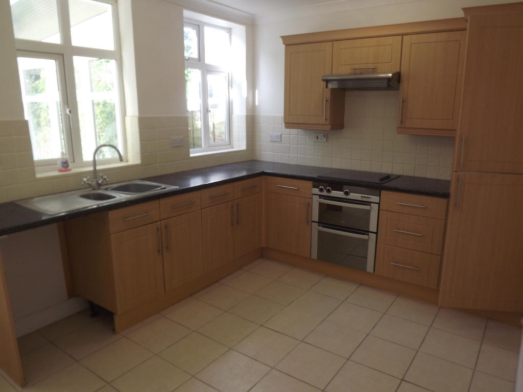
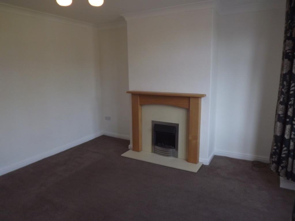
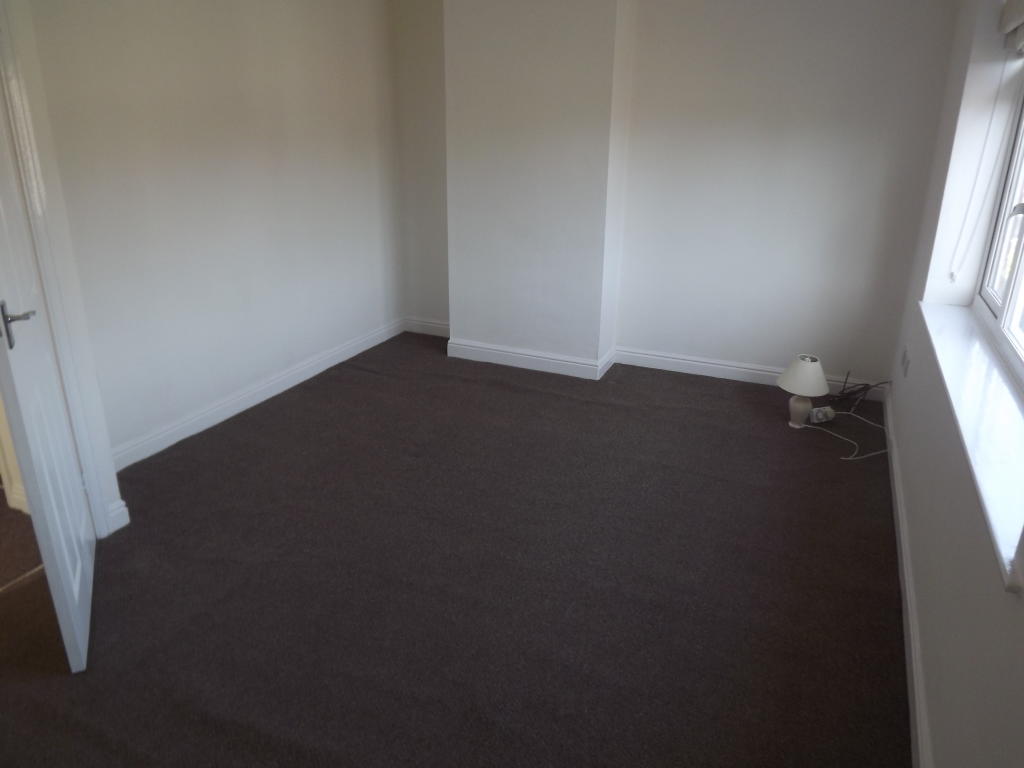
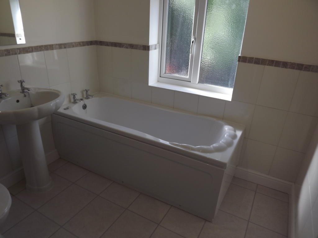
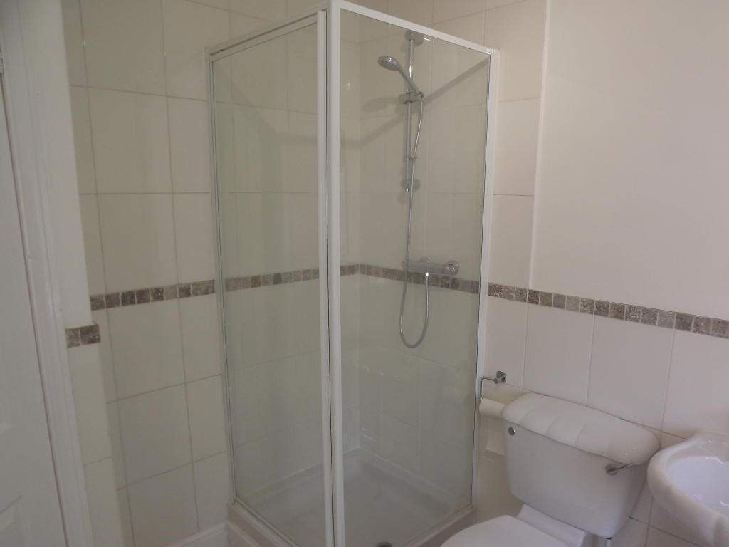
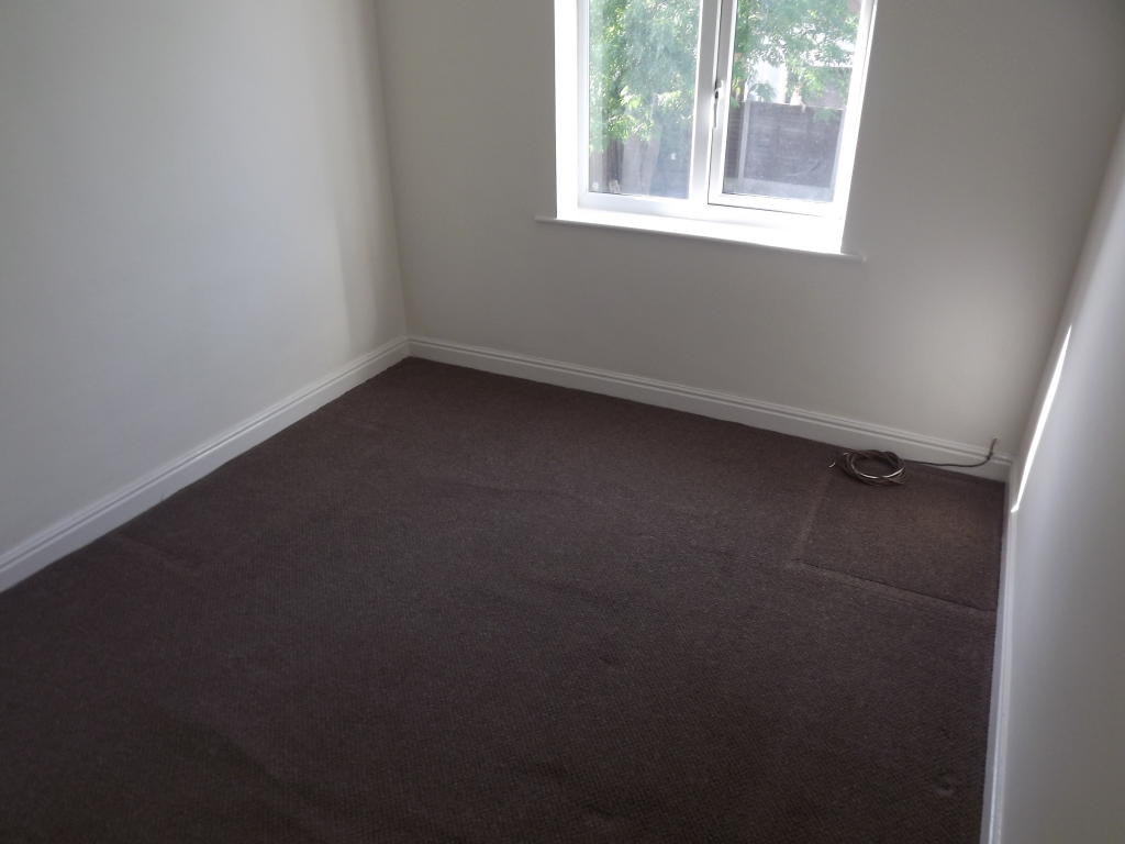
Photo 1 Photo 2 Photo 3 Photo 4 Photo 5 Photo 6 Photo 7 Photo 8 Photo 9
/ 9
Property details
Floor area
70 m²
Deprivation
Decile 8 (26,025 of 33,755)
Street crime
128 incidents within 1 mile (Apr 2026)
Key features
- House
- 2 Bedrooms
- 2 Reception Rooms
- Unfurnished
- Heating: Gas Central Heating
- Driveway
- Redecorated throughout
- Bath and seperate shower cubicle
Additional details
- Parking
- Yes
- Garden
- Yes
Description
Parking to the front for two cars and enclosed garden to the rear with the added advantage of a conservatory.
Entrance hall to the property with good sized lounge and additional coal effect fire.
Good sized kitchen with ample room for a dining room table and good selection of fitted cupboards and built in cooker and fridge/freezer.
To the rear we have a conservatory with access to the garden and added advantage of a downstairs toilet .
Upstairs we have two double bedrooms and bathroom with bath and a seperate shower cubicle.
Listed by
Stafford
Countrywide UK Lettings - Connells
Reference: 80218102
EPC Rating & Upgrade Cost
Fetching EPC data… Refresh this page in a moment.
Flood risk
Zone: 1
Risk: Low
Job (default Low)
EPC Graphs
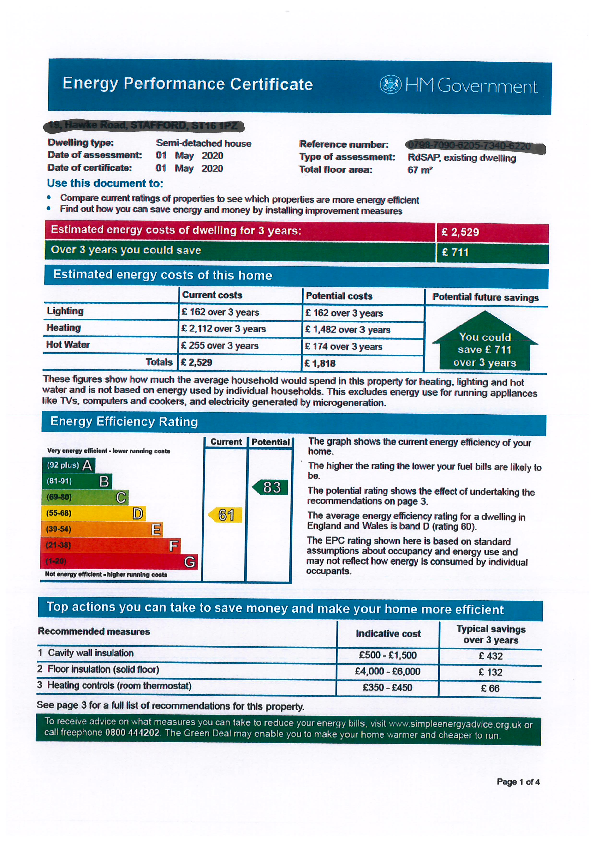
EPC Image
FENSA Certificates
This property has 1 FENSA certificate(s) on record, indicating window/door installations by FENSA-approved installers.
FENSA Certificate #4312619
Property Details
Street: 19 Hawke Road
Town: STAFFORD
Postcode: ST16 1PZ
Installation Details
Items: 9 windows
Certificate Issued: 12/12/2006
Work Completed: 01/12/2006
This certificate data was retrieved from FENSA's database
What is FENSA? FENSA (Fenestration Self-Assessment Scheme) is a government-authorised scheme that monitors building regulation compliance for replacement windows and doors. Certificates indicate that work was completed by FENSA-approved installers.
Rental Range
Estimated market rent for Stafford. Low = conservative, Realistic = average, Optimistic = best case.
Based on Local Authority from postcode lookup → Stafford.
LHA (30th percentile) floor for Mid Staffs: £623/mo (Apr 2025 – Mar 2026)
Location
Nearby
Nearest stations, universities and amenities (distance from property).
| Type | Name | Distance |
|---|---|---|
| Bus stop | Hawke Road | 0.1 miles |
| Bus stop | Craddock Road | 0.1 miles |
| Shop | Plumbing Point Ltd | 0.1 miles |
| Shop | Clean Express | 0.2 miles |
| Hospital | St George's Hospital | 1.3 miles |
| Train station | Stafford | 1.5 miles |
| Hospital | County Hospital | 1.8 miles |
| University | Staffordshire University Blackheath Lane Site | 2.6 miles |
| Train station | Unknown | 5.0 miles |
Street-level crime
| Category | Count |
|---|---|
| Violence and sexual offences | 54 |
| Anti-social behaviour | 22 |
| Other theft | 10 |
| Shoplifting | 10 |
| Public order | 9 |
| Criminal damage and arson | 6 |
| Other crime | 5 |
| Burglary | 4 |
| Drugs | 3 |
| Vehicle crime | 3 |
| Bicycle theft | 2 |
| Total incidents | 128 |
Within 1 mile during Apr 2026. Source: data.police.uk (England & Wales).
Schools nearby
Nearest open schools with Ofsted ratings (England). Closed schools are not shown. Data from Get Information about Schools and Ofsted.
| Name | Type | Distance | Ofsted |
|---|---|---|---|
| Tillington Manor Primary School | Primary | 0.2 miles | Requires improvement — 12 Jun 2023 |
| Greenhall | Other | 0.3 miles | Outstanding — 1 Feb 2013 |
| Marshlands School | Other | 0.3 miles | Good — 17 Dec 2014 |
| Sir Graham Balfour High School | Secondary | 0.4 miles | Good — 6 Jun 2014 |
| Parkside Primary School | Primary | 0.5 miles | Good — 27 Sep 2022 |
Rental Comparables
Loading rental comparables for this postcode. Refresh in a few minutes.