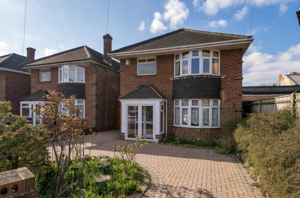
129 ST JAMES ROAD
SOUTHAMPTON, SHIRLEY, SOUTHAMPTON SO15 5QF
Property details
Tenure
FREEHOLD
Council tax band
D
Last sold
£425,000 Jun 2023
Local average
£517,227 (-15.9%)
Deprivation
Decile 5 (15,442 of 33,755)
Street crime
498 incidents within 1 mile (Apr 2026)
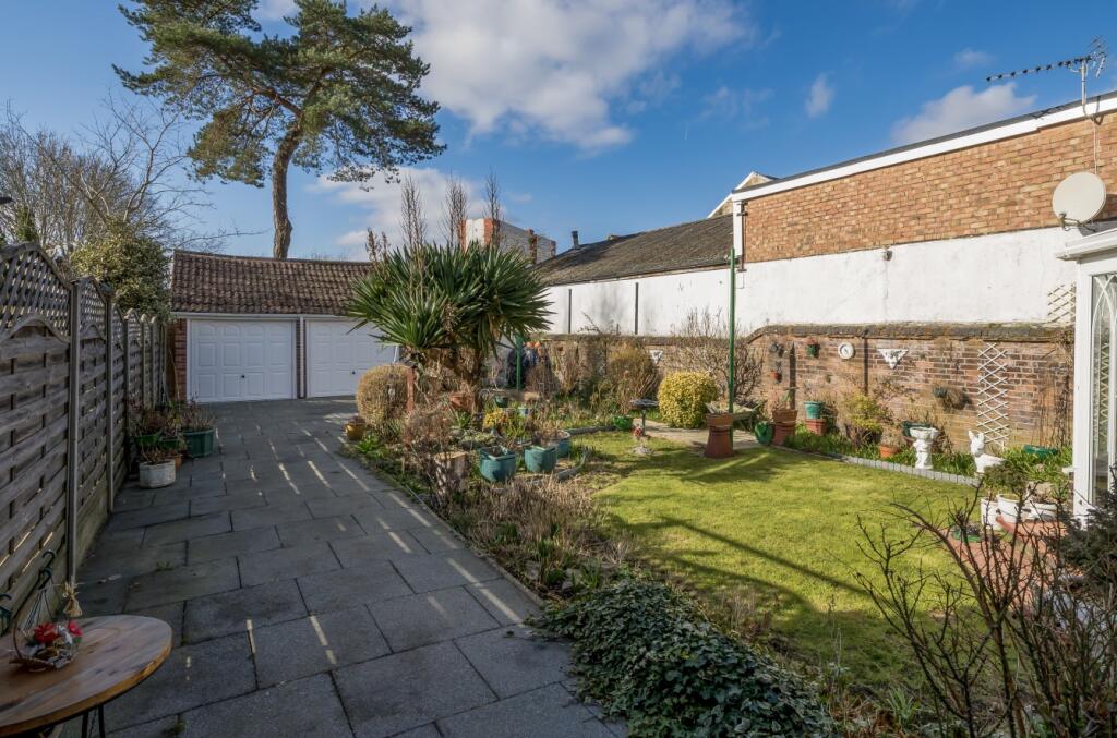
Key features
- No forward chain
- Driveway parking
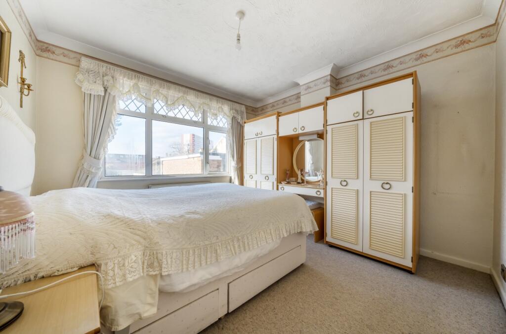
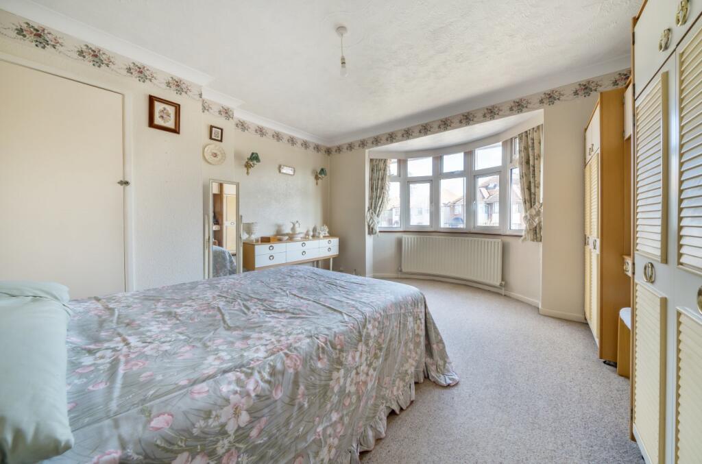
- Three well-proportioned bedrooms
- Easy reach of the general hospital
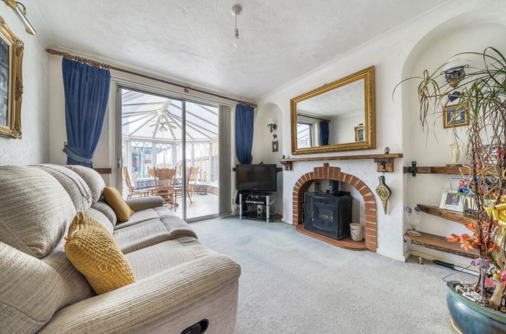
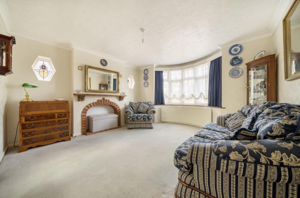
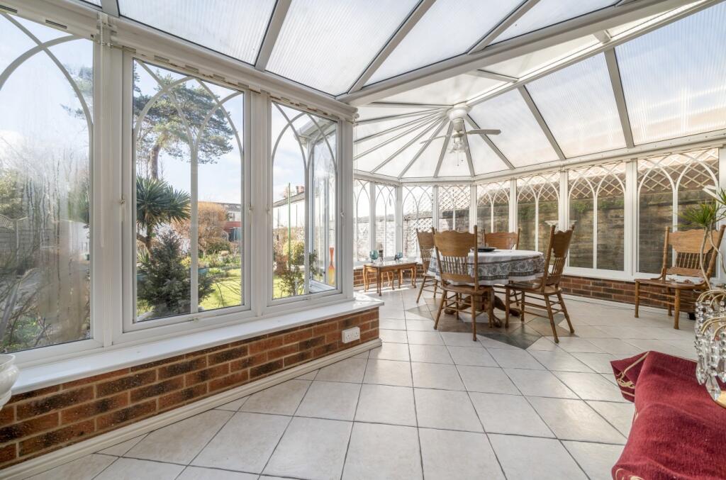
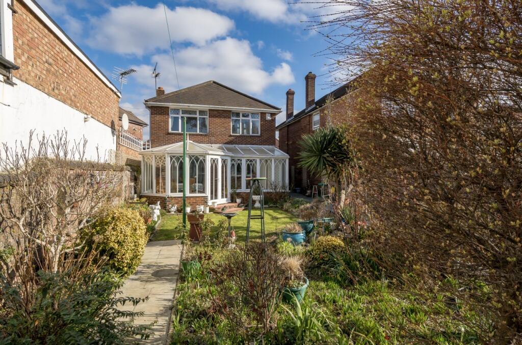
- Two reception rooms plus conservatory
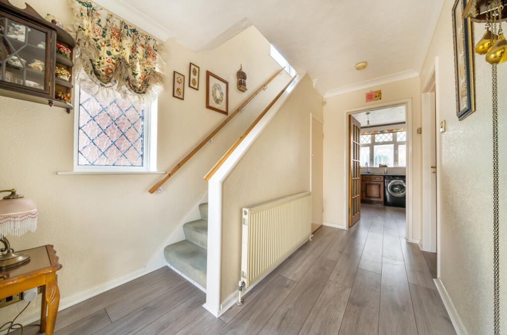
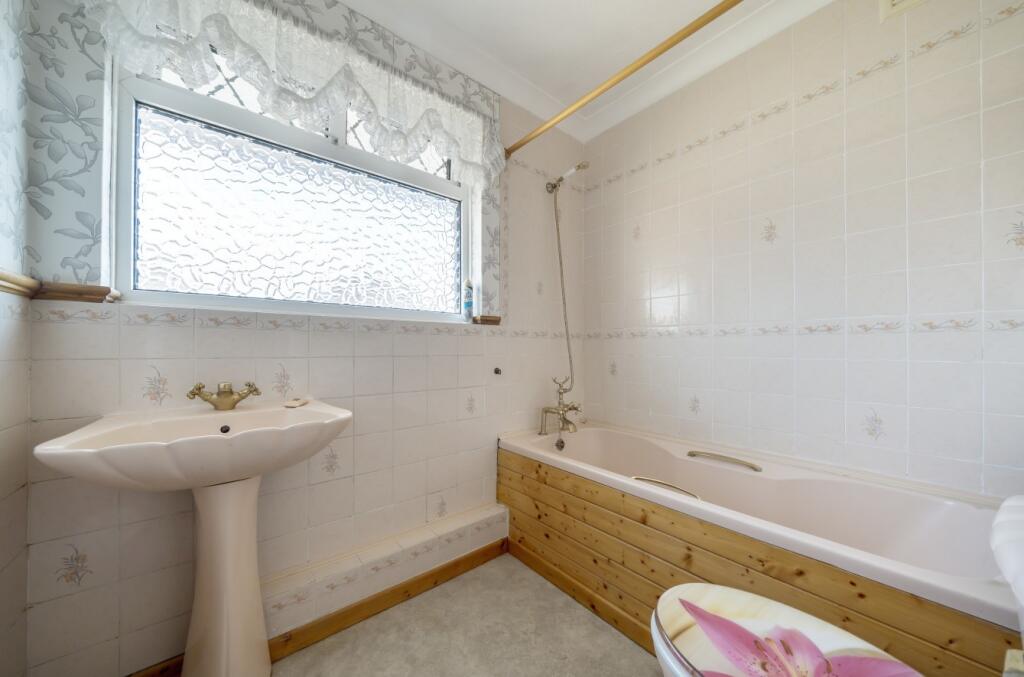
- Ground floor shower room & WC
Additional details
- Parking
- Yes
- Garden
- Yes
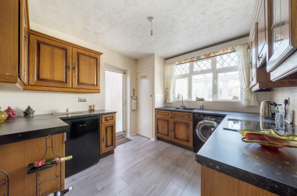
Description
Council Tax Band D
Upper Shirley is a popular residential area with Hill Lane on its eastern boundary bordering The Common and Winchester Road on its western boundary leading to St James Park, both of which provide excellent recreational facilities and acres of green open space. Comprising predominantly 1930s characterful traditional houses, the area offers all styles of properties to suit every purchaser ranging from terraced and semi-detached houses to substantial detached family homes. It is also home to some of Southampton’s finest eateries, pubs and schooling in both the state and private sectors as well as sixth form colleges.
Listed by
Southampton
The Lomond Group
Reference: 132374279
EPC Rating & Upgrade Cost
Fetching EPC data… Refresh this page in a moment.
Flood risk
Zone: 1
Risk: Low
Job (default Low)
Floorplans
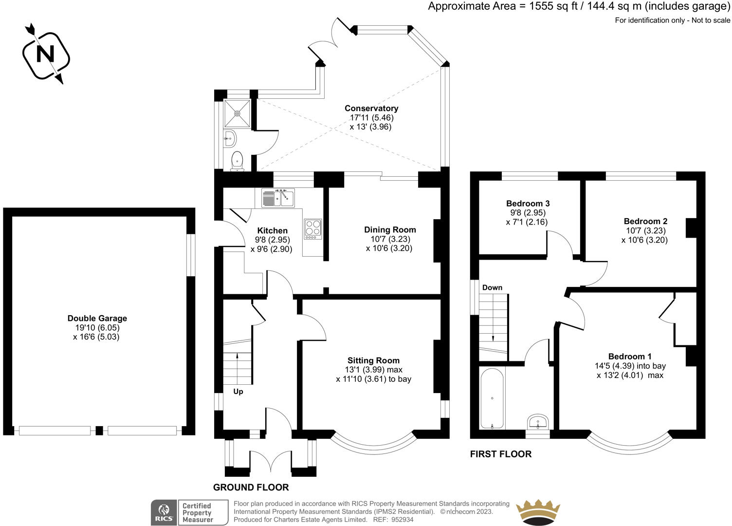
952934 L.jpg
EPC Graphs
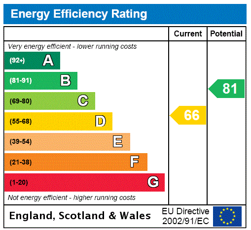
EPC Rating Graph
FENSA Certificates
This property has 2 FENSA certificate(s) on record, indicating window/door installations by FENSA-approved installers.
FENSA Certificate #15990979 Recent
Property Details
Street: 129 St. James Road
Town: SOUTHAMPTON
Postcode: SO15 5QF
Installation Details
Items: 1 door
Certificate Issued: 08/10/2023
Work Completed: 02/10/2023
This certificate data was retrieved from FENSA's database
FENSA Certificate #17156107 Recent
Property Details
Street: 129 St. James Road
Town: SOUTHAMPTON
Postcode: SO15 5QF
Installation Details
Items: 7 windows
Certificate Issued: 08/02/2026
Work Completed: 27/01/2026
This certificate data was retrieved from FENSA's database
What is FENSA? FENSA (Fenestration Self-Assessment Scheme) is a government-authorised scheme that monitors building regulation compliance for replacement windows and doors. Certificates indicate that work was completed by FENSA-approved installers.
Price history
| Event | Date | Price | % change |
|---|---|---|---|
| Sold | 21/06/2023 (2 years ago) | £425,000 | — |
Source: HM Land Registry Price Paid Data. Crown copyright.
Sold Comparables
Same street and nearby sales within 0.25 miles (last 5 years). Data from Land Registry Price Paid.
| Address | Price | Date | Type |
|---|---|---|---|
| 54 SHIRLEY AVENUE, SOUTHAMPTON, SO15 5NJ | £590,000 | 12/01/2026 | Detached |
| 128 ST JAMES ROAD, SHIRLEY, SOUTHAMPTON, SO15 5QG | £449,000 | 14/10/2022 | Detached |
| 64 SHIRLEY AVENUE, SOUTHAMPTON, SO15 5NJ | £395,000 | 08/09/2022 | Detached |
| 146A ST JAMES ROAD, SHIRLEY, SOUTHAMPTON, SO15 5LZ | £381,000 | 24/08/2021 | Detached |
Area average: £453,750 (4 sales)
Capital growth trend
Land Registry outcode average: last 12 months vs 5y and 10y ago (from sold prices).
House Price Index (HM Land Registry — official index, not sold-price averages): Southampton. Series: Detached. As of March 2026.
Rental Range
Estimated market rent for Southampton. Low = conservative, Realistic = average, Optimistic = best case.
Based on Local Authority from postcode lookup → Southampton.
LHA (30th percentile) floor for Cherwell Valley: £1,182/mo (Apr 2025 – Mar 2026)
Location
Nearby
Nearest stations, universities and amenities (distance from property).
| Type | Name | Distance |
|---|---|---|
| Bus stop | Shirley Avenue | 0.1 miles |
| Shop | The DJ Shop | 0.3 miles |
| Shop | Jak Booze | 0.3 miles |
| University | South Academic Block | 0.6 miles |
| Train station | Millbrook | 1.0 miles |
| University | Boldrewood Innovation Campus | 1.3 miles |
| Train station | Southampton Central | 1.4 miles |
| Hospital | Royal South Hants Urgent Treatment Centre | 1.6 miles |
Street-level crime
| Category | Count |
|---|---|
| Violence and sexual offences | 172 |
| Shoplifting | 66 |
| Anti-social behaviour | 54 |
| Public order | 43 |
| Criminal damage and arson | 35 |
| Other theft | 34 |
| Burglary | 20 |
| Vehicle crime | 19 |
| Drugs | 16 |
| Other crime | 11 |
| Robbery | 10 |
| Possession of weapons | 9 |
| Bicycle theft | 5 |
| Theft from the person | 4 |
| Total incidents | 498 |
Within 1 mile during Apr 2026. Source: data.police.uk (England & Wales).
Schools nearby
Nearest open schools with Ofsted ratings (England). Closed schools are not shown. Data from Get Information about Schools and Ofsted.
| Name | Type | Distance | Ofsted |
|---|---|---|---|
| Wordsworth Primary and Nursery School | Primary | 0.2 miles | Requires improvement — 23 May 2023 |
| Shirley Infant School | Primary | 0.2 miles | Good — 8 Jun 2011 |
| Shirley Junior School | Primary | 0.2 miles | Good — 7 Jul 2017 |
| Upper Shirley High School | Secondary | 0.3 miles | Good — 13 Nov 2019 |
| Southampton Hospital School | Other | 0.5 miles | Good — 4 Jan 2012 |
Rental Comparables
Rental listings exist nearby, but none matched the 3-bedroom count for this property.
Rent-driven metrics
Based on Area rent estimate.
- Rent ratio — Monthly rent ÷ purchase price (1% rule). 1%+ = strong, 0.8–1% = okay, <0.8% = weak for cashflow.
- Max investor price — Rent ÷ 0.8%; the price at which rent would be 0.8% of price (Stoke-style target).
- Target investor price — Rent ÷ 1%; the price at which rent would be 1% of price (strong cashflow band).
- Gross yield — Annual rent as % of purchase price (no costs).