207B
LATCHMERE ROAD, LONDON, BATTERSEA, GREATER LONDON SW11 2LA
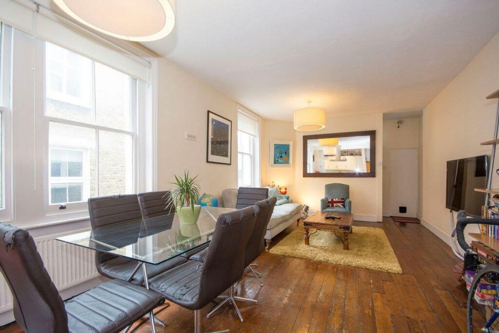
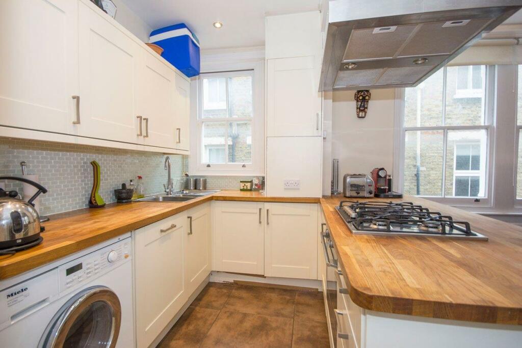
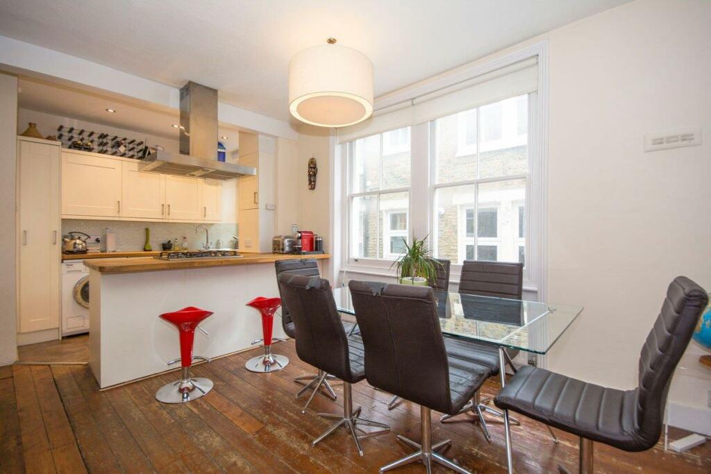
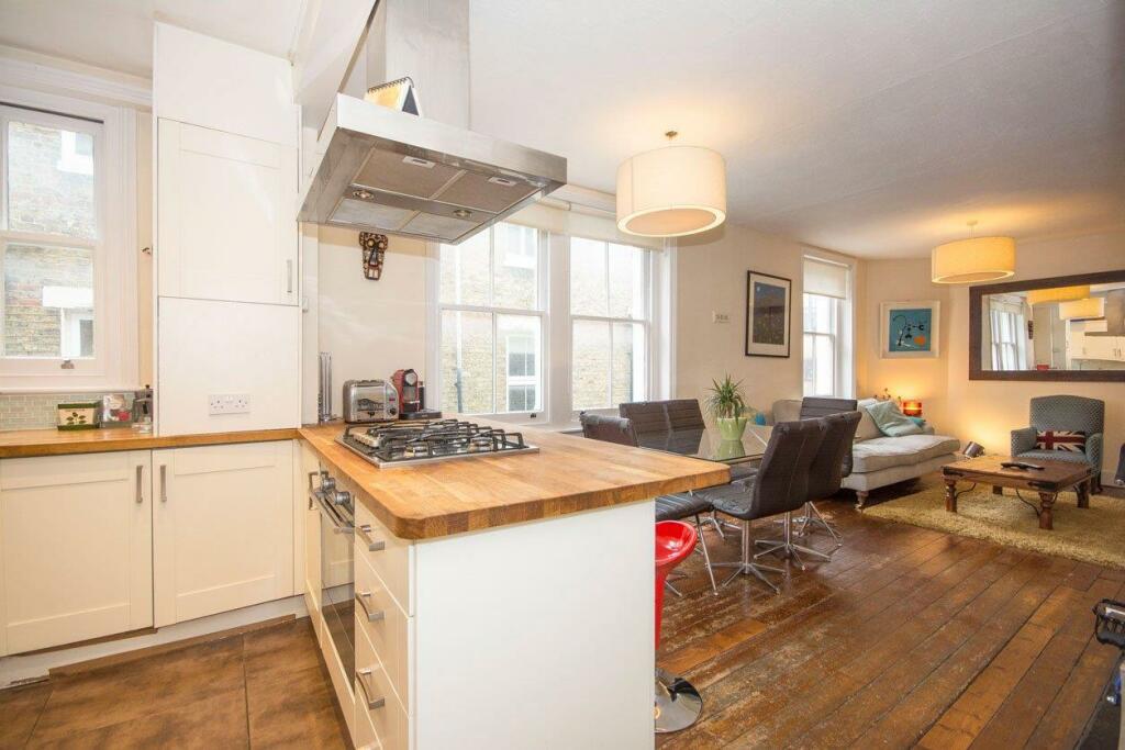
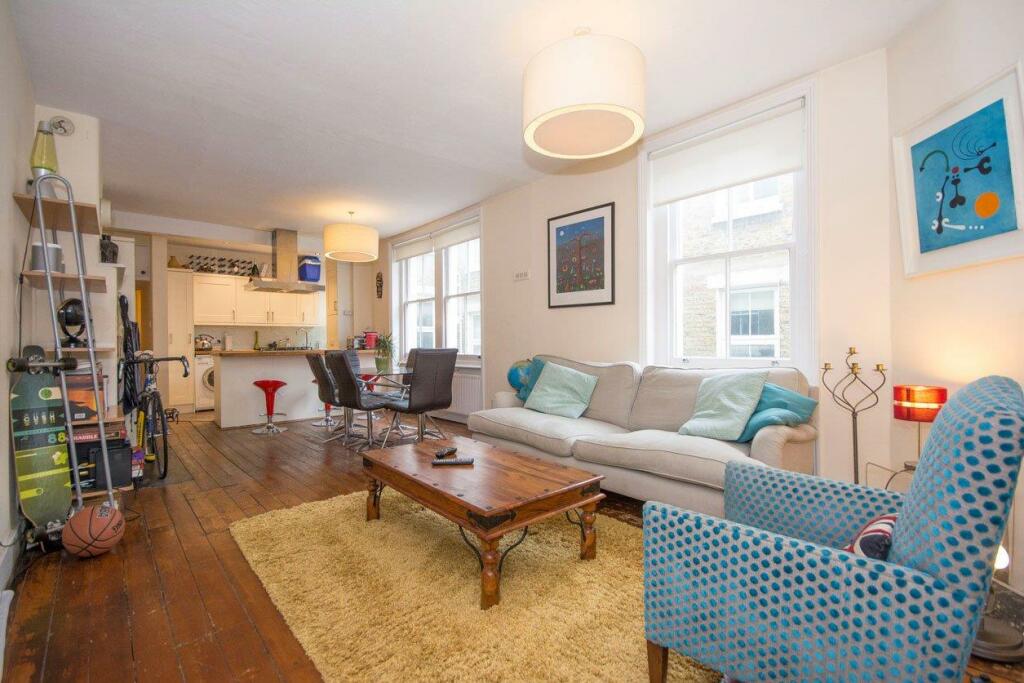
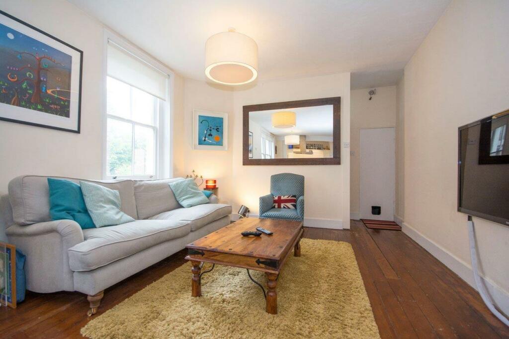
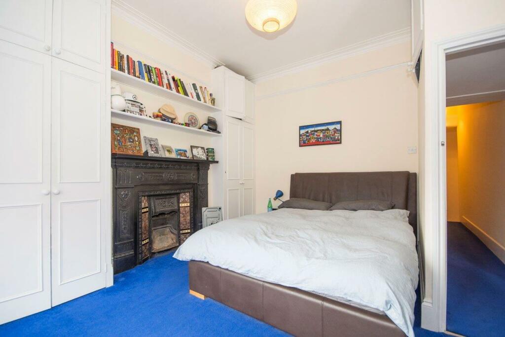
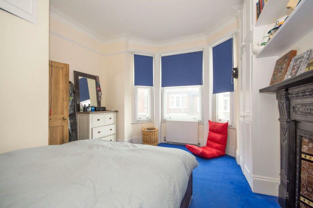
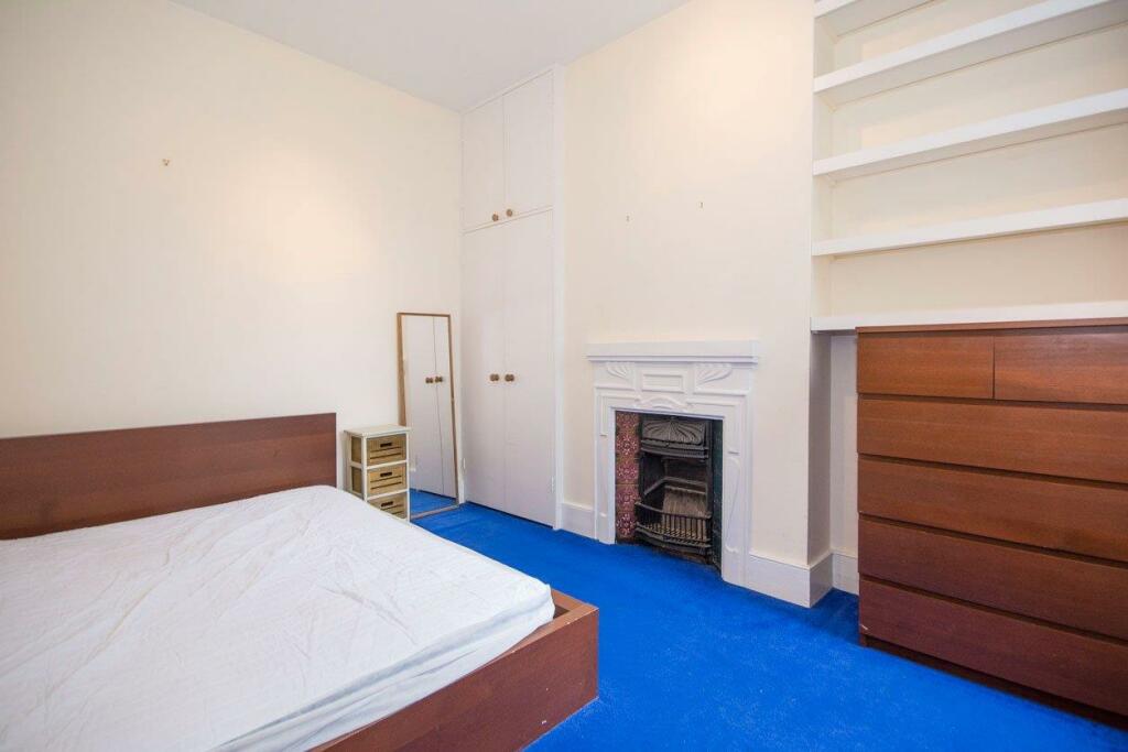
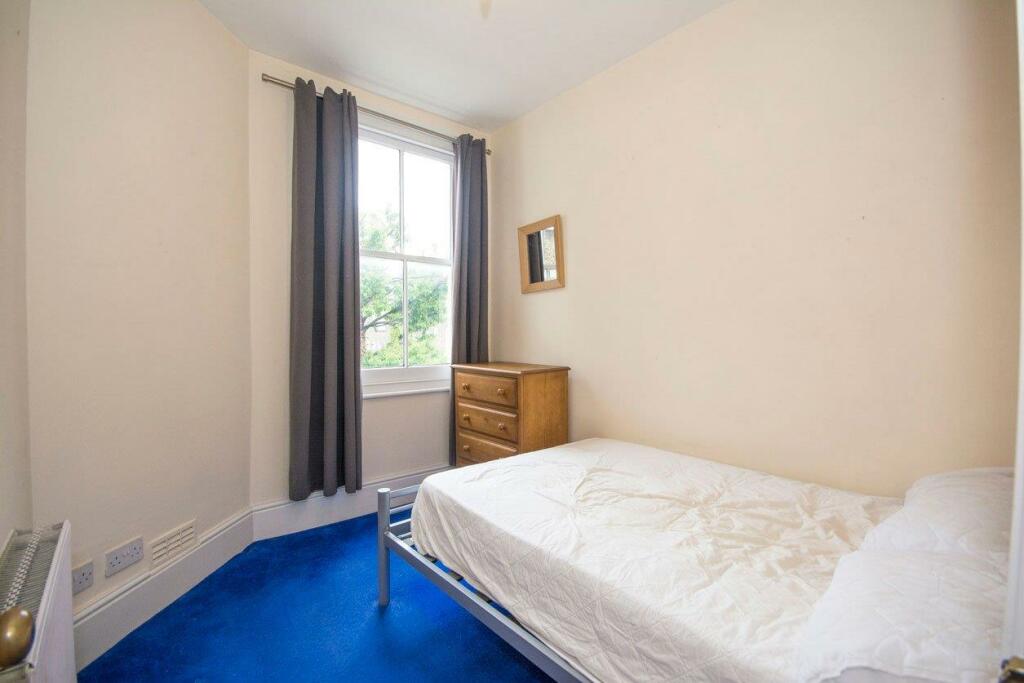
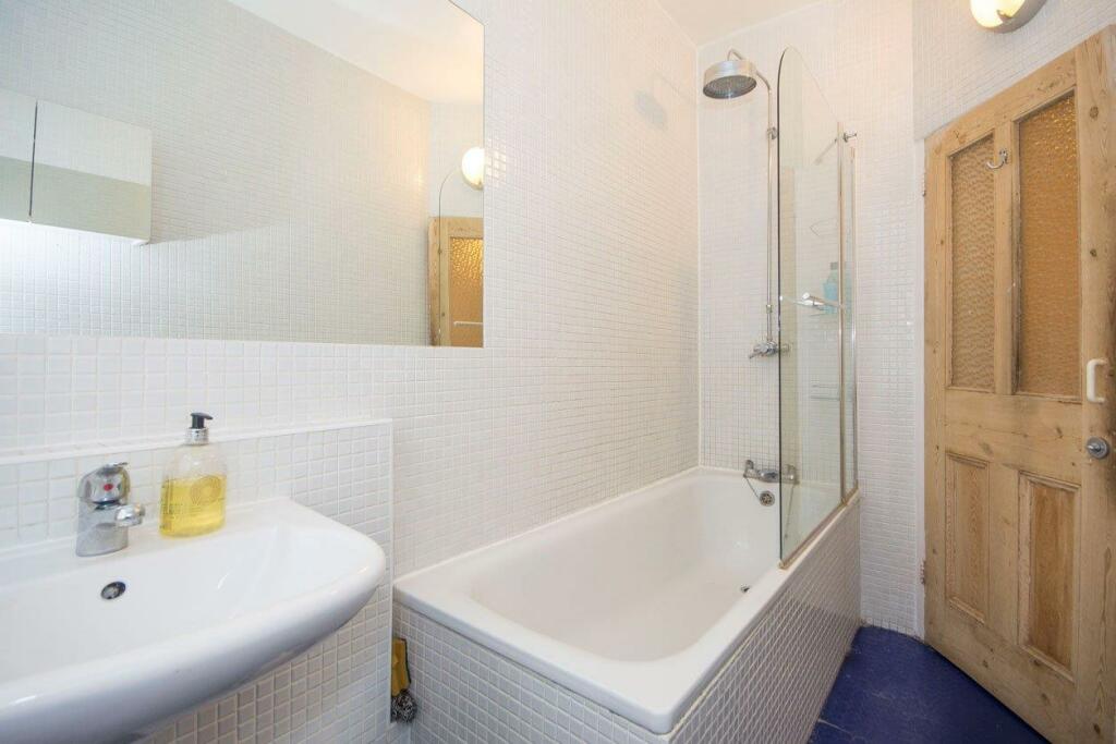
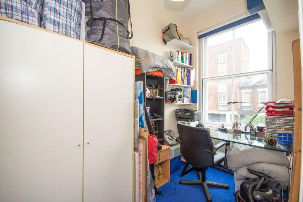
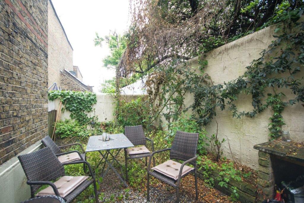
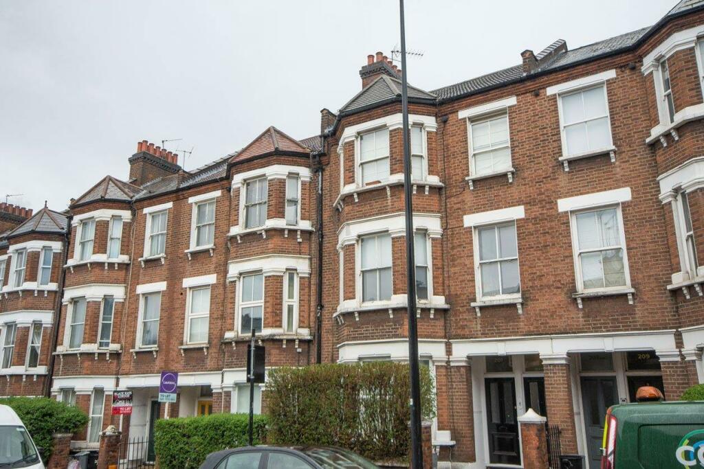
Photo 1 Photo 2 Photo 3 Photo 4 Photo 5 Photo 6 Photo 7 Photo 8 Photo 9 Photo 10 Photo 11 Photo 12 Photo 13 Photo 14
/ 14
Property details
Floor area
114 m²
Council tax band
D
Deprivation
Decile 7 (22,890 of 33,755)
Street crime
822 incidents within 1 mile (Mar 2026)
Key features
- Well Presented
- Three Double Bedrooms
- Fourth Room ideal as Home Office
- Stairs Leading Down to Patio garden
- Open Plan Living Space
- Separate WC
- First Floor Flat
- Short Walk to Clapham Junction Station
- Wandsworth Council Tax
Additional details
- Garden
- Yes
Description
Latchmere Road is ideally located a short walk to Clapham Junction rail station and the local amenities, bars and restaurants of Lavender Hill are on the doorstep.
Listed by
London
Urban Lettings.com
Reference: 146129138
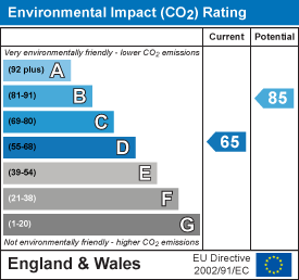
EPC Rating & Upgrade Cost
Fetching EPC data… Refresh this page in a moment.
Flood risk
Zone: 1
Risk: Low
Job (default Low)
Floorplans
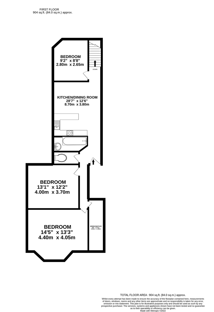
Floorplan 1
EPC Graphs
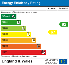
EE Rating
EI Rating
Rental Range
Estimated market rent for Wandsworth. Low = conservative, Realistic = average, Optimistic = best case.
Based on Local Authority from postcode lookup → Wandsworth.
LHA (30th percentile) floor for Stevenage & North Herts: £1,247/mo (Apr 2025 – Mar 2026)
Location
Nearby
Nearest stations, universities and amenities (distance from property).
| Type | Name | Distance |
|---|---|---|
| Shop | Costcutter | 0.1 miles |
| Shop | The Print Design | 0.1 miles |
| Bus stop | Battersea Arts Centre | 0.1 miles |
| Bus stop | Lavender Hill Police Station | 0.1 miles |
| Train station | Clapham Junction | 0.4 miles |
| Hospital | Bridge Lane Health Centre | 0.6 miles |
| Train station | Queenstown Road | 1.0 miles |
| University | National Heart and Lung Institute | 1.5 miles |
| University | BIMM Institute London | 1.8 miles |
| Hospital | King's College Hospital Emergency Department | 3.0 miles |
Street-level crime
| Category | Count |
|---|---|
| Anti-social behaviour | 208 |
| Violence and sexual offences | 183 |
| Other theft | 73 |
| Vehicle crime | 68 |
| Shoplifting | 60 |
| Burglary | 58 |
| Public order | 43 |
| Criminal damage and arson | 31 |
| Bicycle theft | 27 |
| Theft from the person | 21 |
| Robbery | 19 |
| Drugs | 17 |
| Other crime | 10 |
| Possession of weapons | 4 |
| Total incidents | 822 |
Within 1 mile during Mar 2026. Source: data.police.uk (England & Wales).
Schools nearby
Nearest open schools with Ofsted ratings (England). Closed schools are not shown. Data from Get Information about Schools and Ofsted.
| Name | Type | Distance | Ofsted |
|---|---|---|---|
| Shaftesbury Park Primary School | Primary | 0.3 miles | Good — 29 Nov 2013 |
| Sacred Heart Catholic Primary School, Battersea | Primary | 0.4 miles | Good — 26 Sep 2023 |
| Parkgate House School | Other | 0.4 miles | Outstanding — 28 Apr 2022 |
| Belleville Wix Academy | Primary | 0.5 miles | Good — 2 Dec 2019 |
| John Burns Primary School | Primary | 0.5 miles | Good — 6 Feb 2018 |
Rental Comparables
Residential lets from OpenRent and Rightmove for the area (same bedroom count). Use to validate rent estimates. Student lets are excluded.
| Title | Rent | Beds | Distance | As seen on |
|---|---|---|---|---|
| 3 Bed Maisonette, Sabine Road, SW11 | £3,500/mo | 3 | 0.24 miles | OpenRent |
| 3 Bed Flat, St. John's Road, SW11 | £2,500/mo | 3 | 0.37 miles | OpenRent |
| 3 Bed Terraced House, Dunston Road, SW11 | £3,500/mo | 3 | 0.49 miles | OpenRent |
Average rent: £3,167/mo (3 listings)