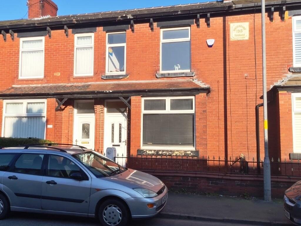
Edge Lane
Droylsden, M43 6JJ
Property details
Tenure
LEASEHOLD (887 years remaining on lease)
Council tax band
A
Local average
£202,696 (+3.6%)
Deprivation
Decile 4 (11,281 of 33,755)
Street crime
0 incidents within 1 mile (Apr 2026)
Key features
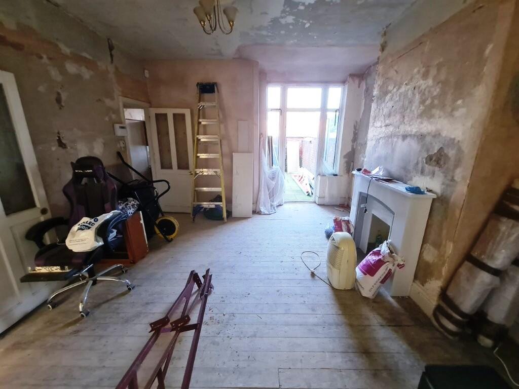
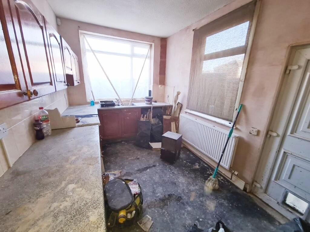
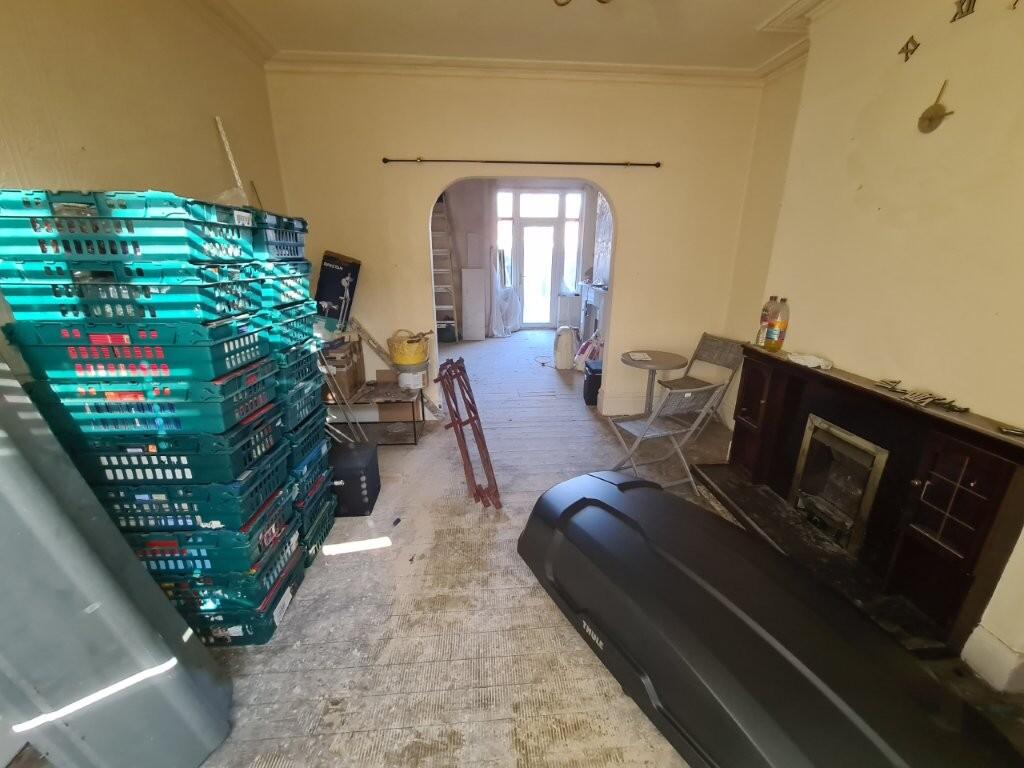
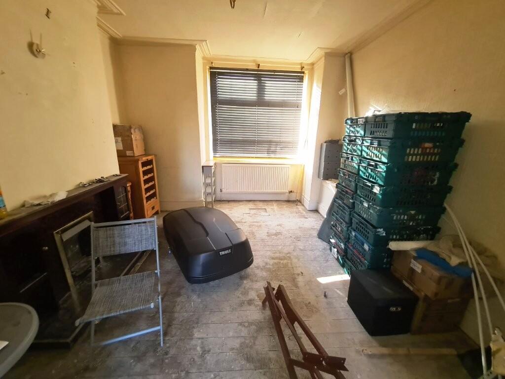
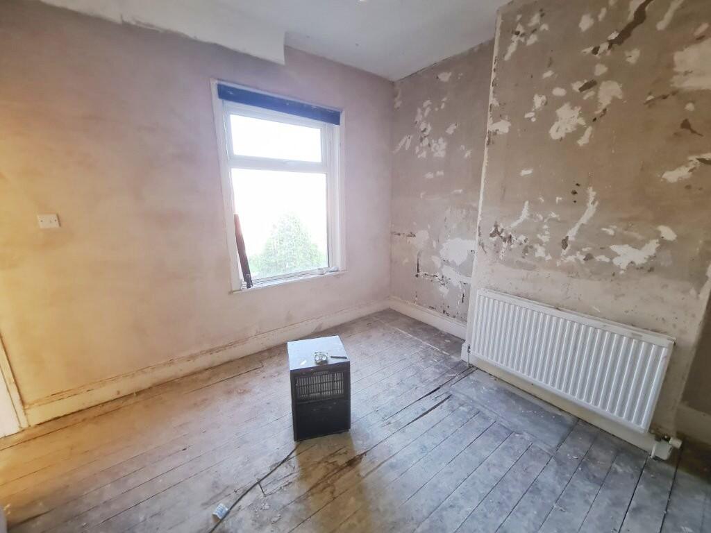
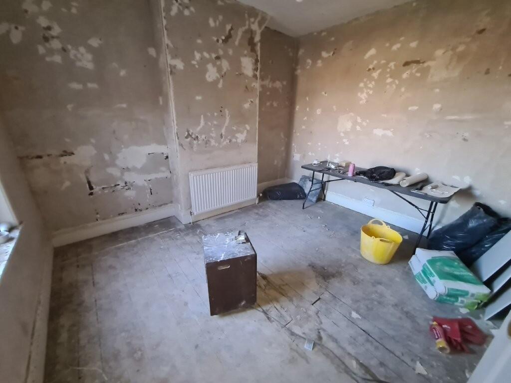
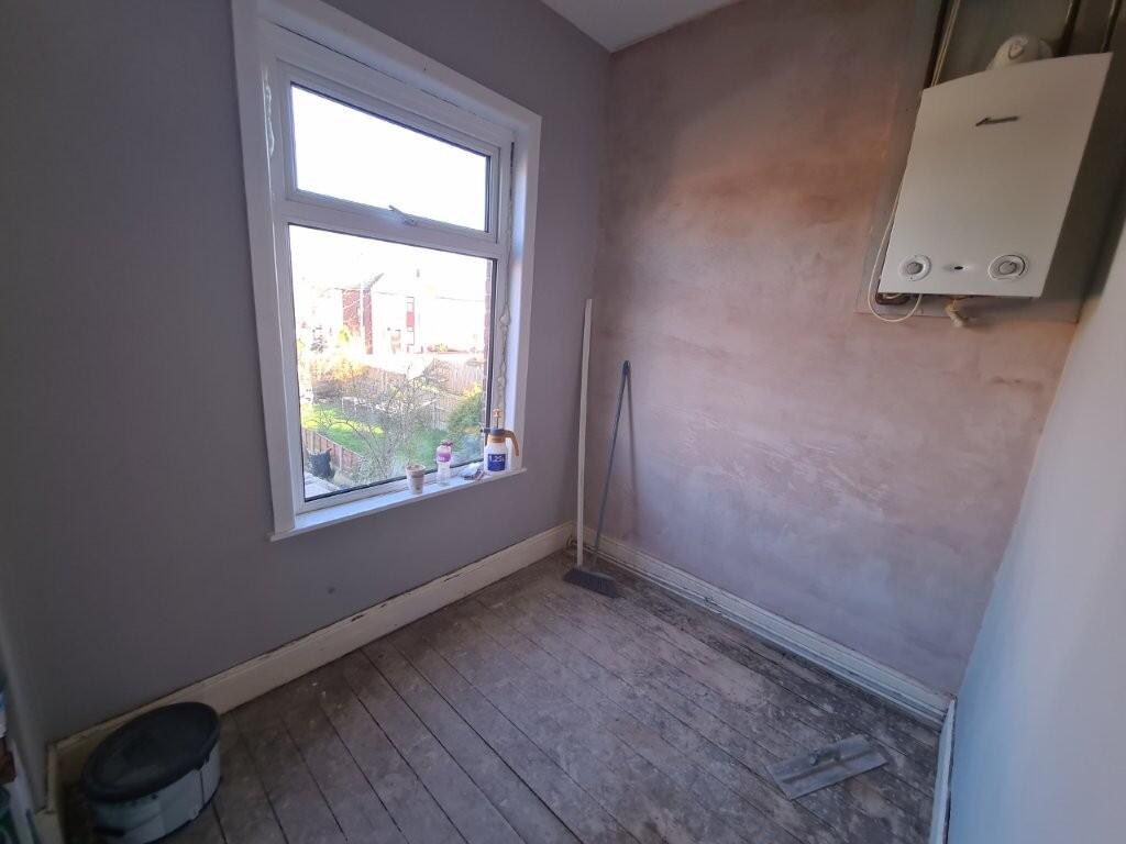
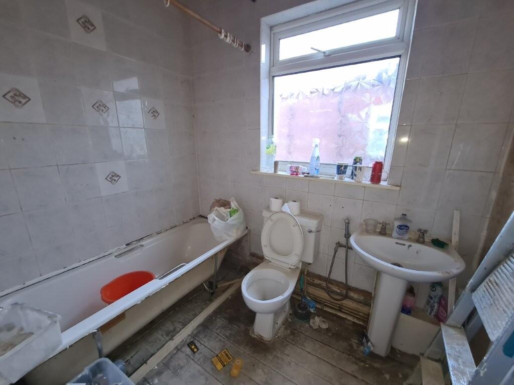
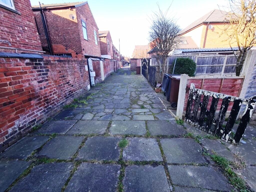
- No vendor chain.
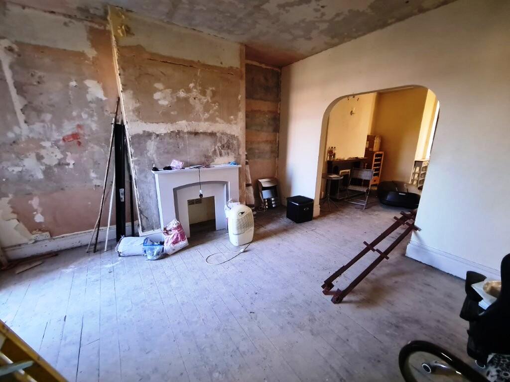
- Excellent potential.
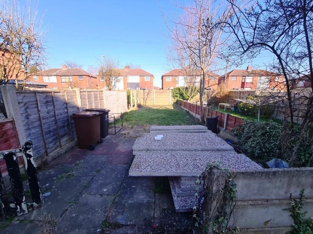
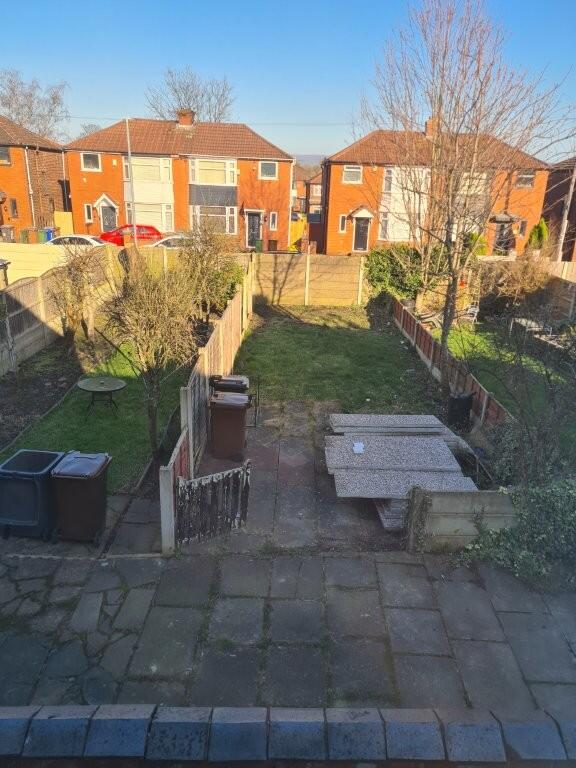
- Gardens-Parking.
- GCH & Double Glazed.
- Close to local amenities.
- Walking distance to the Metrolink.
Additional details
- Parking
- Off street
- Garden
- Back garden
Description
Listed by
Droylsden
Edward Mellor Ltd
Reference: 172936004
EPC ratings on this postcode
We don't have a matched EPC for this property yet. Below are efficiency scores and details for other addresses on this postcode.
| Address | Current | Potential | Floor area | Age band | Type |
|---|---|---|---|---|---|
| 340 Edge Lane, Droylsden, MANCHESTER | 59 | 79 | 80 m² | England and Wales: 1900-1929 | Terraced |
| 342, Edge Lane, Droylsden, MANCHESTER | 58 | 83 | 79 m² | England and Wales: 1930-1949 | Terraced |
| 344 Edge Lane, Droylsden, MANCHESTER | 72 | 86 | 84 m² | England and Wales: 1950-1966 | Terraced |
| 344 Edge Lane, Droylsden, MANCHESTER | 61 | 78 | 90 m² | England and Wales: 1900-1929 | Terraced |
| 344, Edge Lane, Droylsden, MANCHESTER | 55 | 84 | 90 m² | England and Wales: 1900-1929 | Terraced |
| 346 Edge Lane, Droylsden, MANCHESTER | 65 | 80 | 82 m² | England and Wales: 1900-1929 | Terraced |
| 346, Edge Lane, Droylsden, MANCHESTER | 64 | 81 | 79 m² | England and Wales: 1900-1929 | Terraced |
| 348, Edge Lane, Droylsden, MANCHESTER | 39 | 79 | 47 m² | England and Wales: 1930-1949 | Terraced |
| 350, Edge Lane, Droylsden, MANCHESTER | 53 | 75 | 83 m² | England and Wales: before 1900 | Terraced |
| 354 Edge Lane, Droylsden, MANCHESTER | 76 | 83 | 90 m² | England and Wales: 1900-1929 | Terraced |
| 354, Edge Lane, Droylsden, MANCHESTER | 77 | 90 | 87 m² | England and Wales: 1930-1949 | Terraced |
| 354, Edge Lane, Droylsden, MANCHESTER | 61 | 84 | 87 m² | England and Wales: 1900-1929 | Terraced |
| 356 EDGE LANE, DROYLSDEN, DROYLSDEN | 63 | 86 | 98 m² | England and Wales: 1930-1949 | Terraced |
| 358, Edge Lane, Droylsden, MANCHESTER | 64 | 88 | 72 m² | England and Wales: 1900-1929 | Terraced |
| 358, Edge Lane, Droylsden, MANCHESTER | 68 | 85 | 99 m² | England and Wales: 1900-1929 | Terraced |
Flood risk
Zone: 1
Risk: Low
Job (default Low)
Floorplans
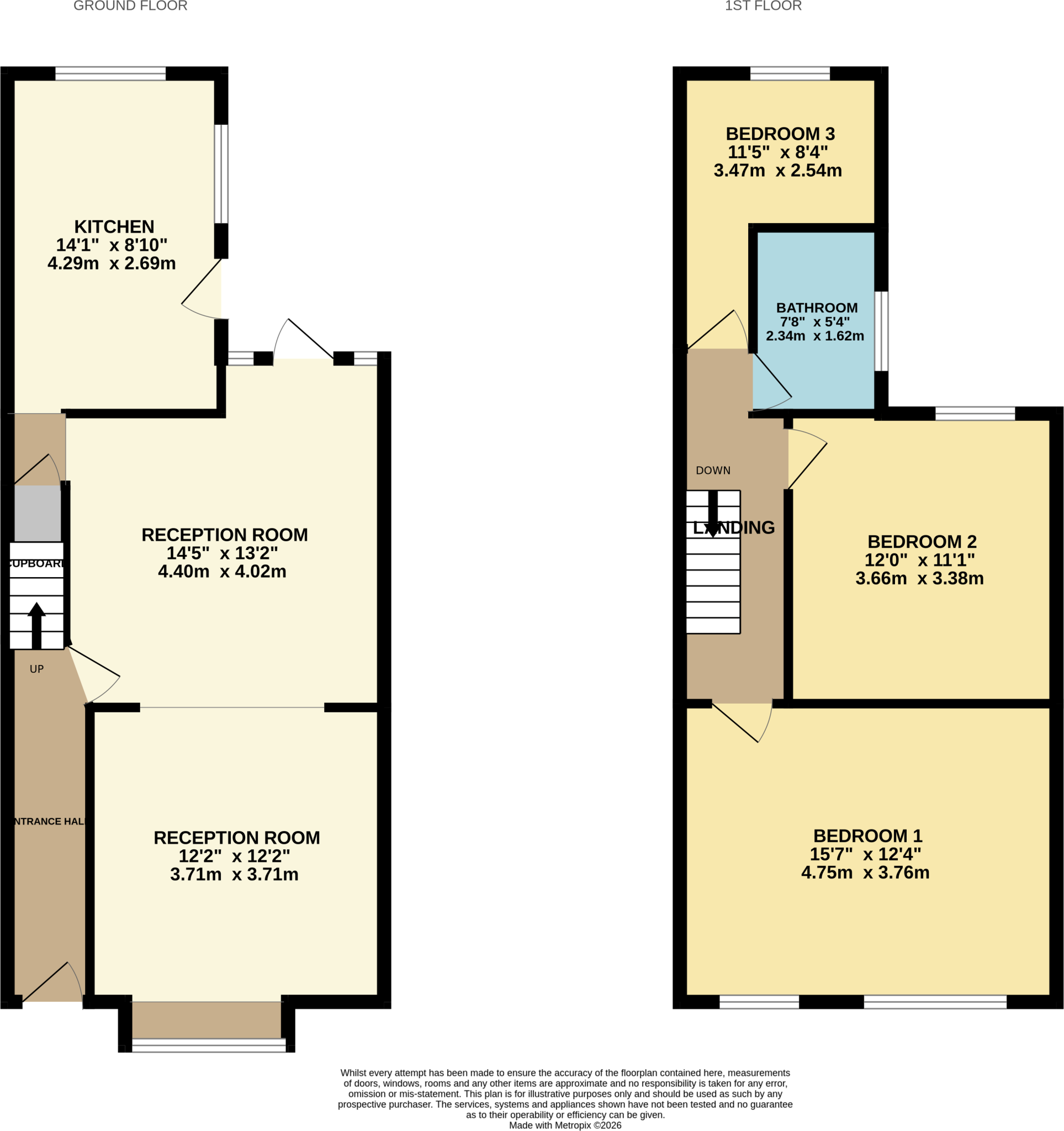
364EdgeLane-High.png
Price history
No sales history found for this property in Land Registry Price Paid data.
Sold Comparables
Same street and nearby sales within 0.25 miles (last 5 years). Data from Land Registry Price Paid.
| Address | Price | Date | Type |
|---|---|---|---|
| 54 LYNWOOD GROVE, AUDENSHAW, MANCHESTER, TAMESIDE, GREATER MANCHESTER, M34 5TE | £300,000 | 25/07/2025 | Terraced |
| 57 KERSHAW LANE, AUDENSHAW, MANCHESTER, TAMESIDE, GREATER MANCHESTER, M34 5GS | £181,450 | 25/08/2023 | Terraced |
| 92 DROYLSDEN ROAD, AUDENSHAW, MANCHESTER, TAMESIDE, GREATER MANCHESTER, M34 5SW | £155,000 | 22/11/2022 | Terraced |
| 158 DROYLSDEN ROAD, AUDENSHAW, MANCHESTER, TAMESIDE, GREATER MANCHESTER, M34 5QU | £250,000 | 11/11/2022 | Terraced |
| 55 DROYLSDEN ROAD, AUDENSHAW, MANCHESTER, TAMESIDE, GREATER MANCHESTER, M34 5SP | £172,500 | 15/07/2022 | Terraced |
| 19 WILLOW FOLD, DROYLSDEN, MANCHESTER, TAMESIDE, GREATER MANCHESTER, M43 7BY | £245,000 | 11/04/2022 | Terraced |
| 1 WILLOW FOLD, DROYLSDEN, MANCHESTER, TAMESIDE, GREATER MANCHESTER, M43 7BY | £236,000 | 28/02/2022 | Terraced |
| 120 LUMB LANE, AUDENSHAW, MANCHESTER, TAMESIDE, GREATER MANCHESTER, M34 5RU | £170,000 | 13/01/2022 | Terraced |
| Same street 428 EDGE LANE, DROYLSDEN, MANCHESTER, TAMESIDE, GREATER MANCHESTER, M43 6JJ | £125,000 | 16/12/2021 | Terraced |
| 106 DROYLSDEN ROAD, AUDENSHAW, MANCHESTER, TAMESIDE, GREATER MANCHESTER, M34 5SN | £110,000 | 09/12/2021 | Terraced |
| 50 DROYLSDEN ROAD, AUDENSHAW, MANCHESTER, TAMESIDE, GREATER MANCHESTER, M34 5SW | £185,000 | 24/09/2021 | Terraced |
| 81 DROYLSDEN ROAD, AUDENSHAW, MANCHESTER, TAMESIDE, GREATER MANCHESTER, M34 5SP | £159,500 | 30/07/2021 | Terraced |
Street average: £125,000 (1 sale)
Area average: £196,768 (11 sales)
Capital growth trend
Land Registry outcode average: last 12 months vs 5y and 10y ago (from sold prices).
House Price Index (HM Land Registry — official index, not sold-price averages): Tameside. Series: Terraced. As of March 2026.
Rental Range
Estimated market rent for Tameside. Low = conservative, Realistic = average, Optimistic = best case.
Based on Local Authority from postcode lookup → Tameside.
LHA (30th percentile) floor for Richmond & Hambleton: £648/mo (Apr 2025 – Mar 2026)
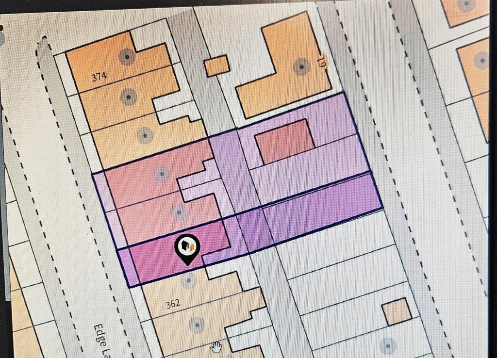
Location
Address
Maple Avenue
Nearby
Nearest stations, universities and amenities (distance from property).
| Type | Name | Distance |
|---|---|---|
| Bus stop | Fairfield, Droylsden Road / near Kershaw Lane | 0.0 miles |
| Shop | Nisa | 0.1 miles |
| Bus stop | Fairfield, Droylsden Road / adjacent Kershaw Lane | 0.1 miles |
| Shop | Home Bargains | 0.4 miles |
| Train station | Fairfield | 0.6 miles |
| Train station | Guide Bridge | 1.0 miles |
| University | UK Management College | 1.2 miles |
| Hospital | Tameside General Hospital | 2.9 miles |
| Hospital | Shiv Lodge Medical Centre | 3.1 miles |
| University | University of Manchester Fallowfield Campus | 3.9 miles |
Street-level crime
| Category | Count |
|---|---|
| Total incidents | 0 |
Within 1 mile during Apr 2026. Source: data.police.uk (England & Wales).
Schools nearby
Nearest open schools with Ofsted ratings (England). Closed schools are not shown. Data from Get Information about Schools and Ofsted.
| Name | Type | Distance | Ofsted |
|---|---|---|---|
| Aldwyn Primary School | Primary | 0.2 miles | Good — 21 Feb 2013 |
| St Mary's CofE Primary School | Primary | 0.3 miles | Good — 9 Oct 2014 |
| Moorside Primary School | Primary | 0.3 miles | Good — 10 Sep 2024 |
| St Stephen's RC Primary School, a Voluntary Academy | Primary | 0.6 miles | Good — 15 Jun 2022 |
| Audenshaw Primary School | Primary | 0.6 miles | Requires improvement — 20 Nov 2023 |
Rental Comparables
Residential lets from OpenRent and Rightmove for the area (same bedroom count). Use to validate rent estimates. Student lets are excluded.
| Title | Rent | Beds | Distance | As seen on |
|---|---|---|---|---|
| 3 Bed Semi-Detached House, Repton Avenue, M43 | £1,295/mo | 3 | 1.43 miles | OpenRent |
| 3 Bed Semi-Detached House, Manchester, M11 | £1,200/mo | 3 | 1.78 miles | OpenRent |
Average rent: £1,248/mo (2 listings)
Rent-driven metrics
Based on OpenRent comparables.
- Rent ratio — Monthly rent ÷ purchase price (1% rule). 1%+ = strong, 0.8–1% = okay, <0.8% = weak for cashflow.
- Max investor price — Rent ÷ 0.8%; the price at which rent would be 0.8% of price (Stoke-style target).
- Target investor price — Rent ÷ 1%; the price at which rent would be 1% of price (strong cashflow band).
- Gross yield — Annual rent as % of purchase price (no costs).
- Cost-to-rent — Price ÷ annual rent (from OpenRent comparables). Under 14× = strong, 14–16× = acceptable, 17×+ = compressed.
- Cashflow — Rent minus mortgage, 10% maintenance, £25/mo compliance. Assumes 75% LTV, 3.95% APR (5yr fixed), 25yr term.
- ROI — Annual profit ÷ cash in (deposit + 4% purchase costs).
Enter House Number
Enter the house number to help us retrieve more accurate pricing history and property data.
Please log in to submit or correct the house number for this listing.
Log in to continue