17 KINSEY STREET
NEWCASTLE, STAFFORDSHIRE ST5 6JL
£780 pcm
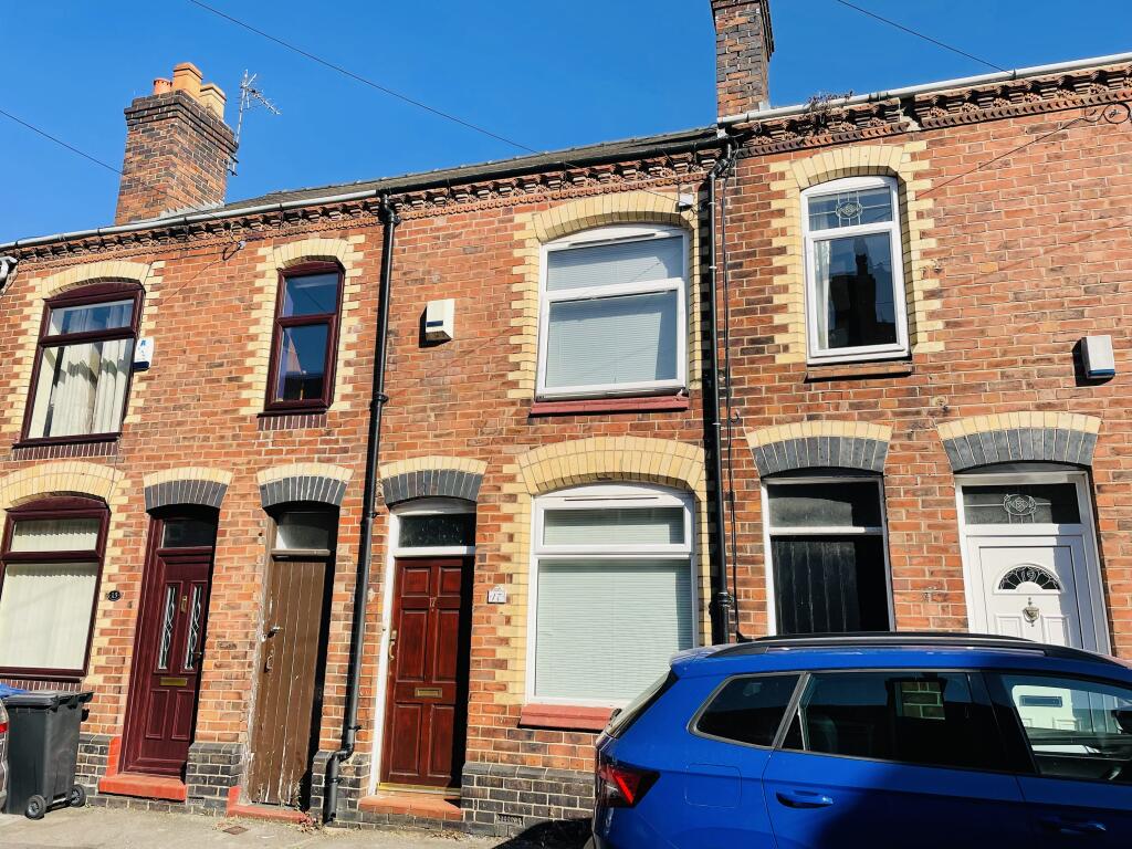
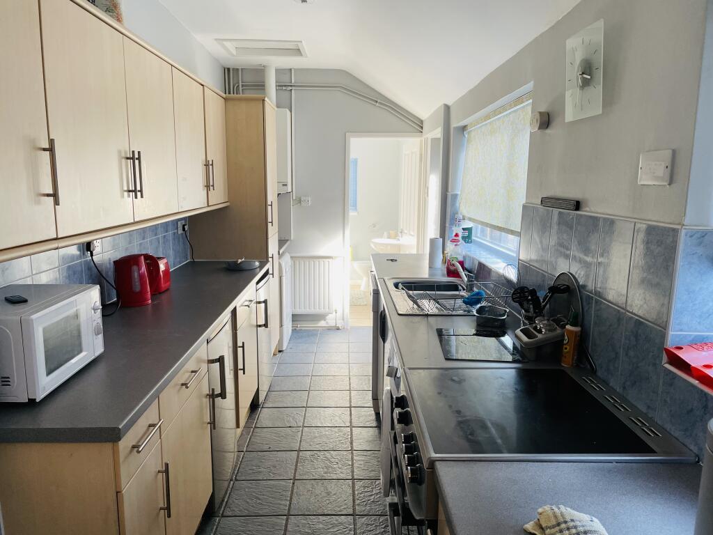
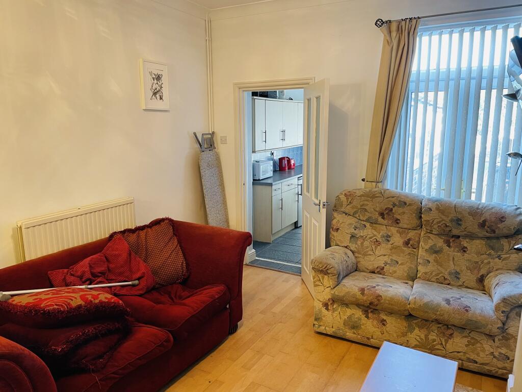
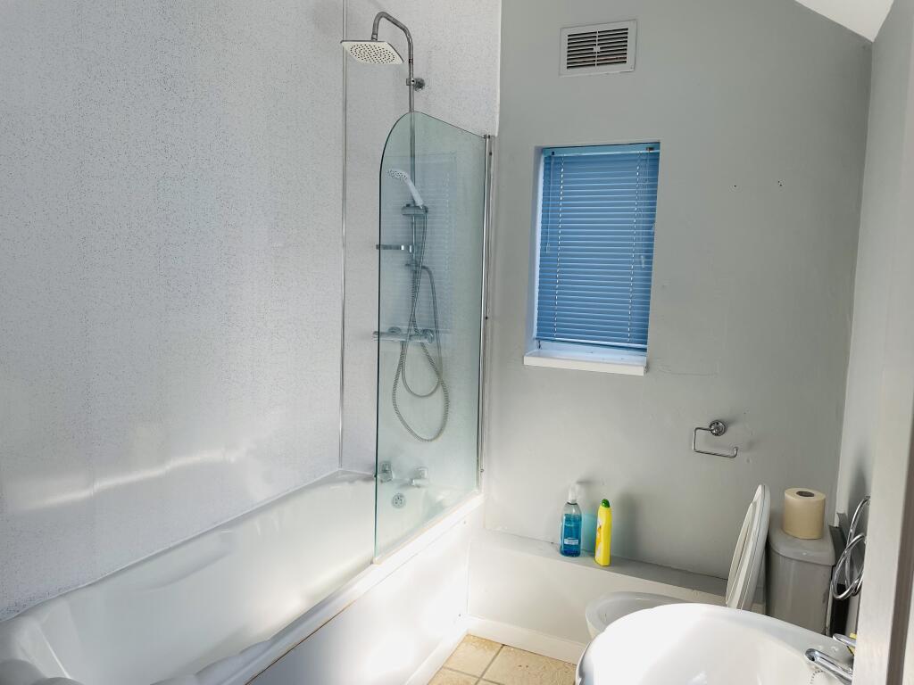
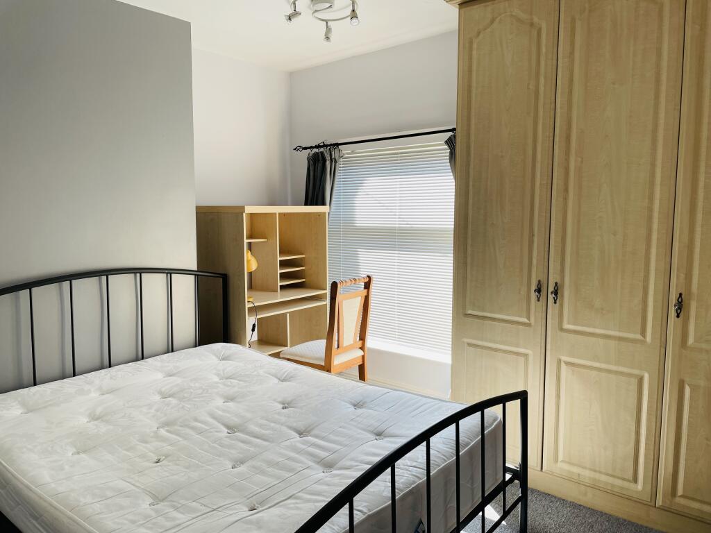
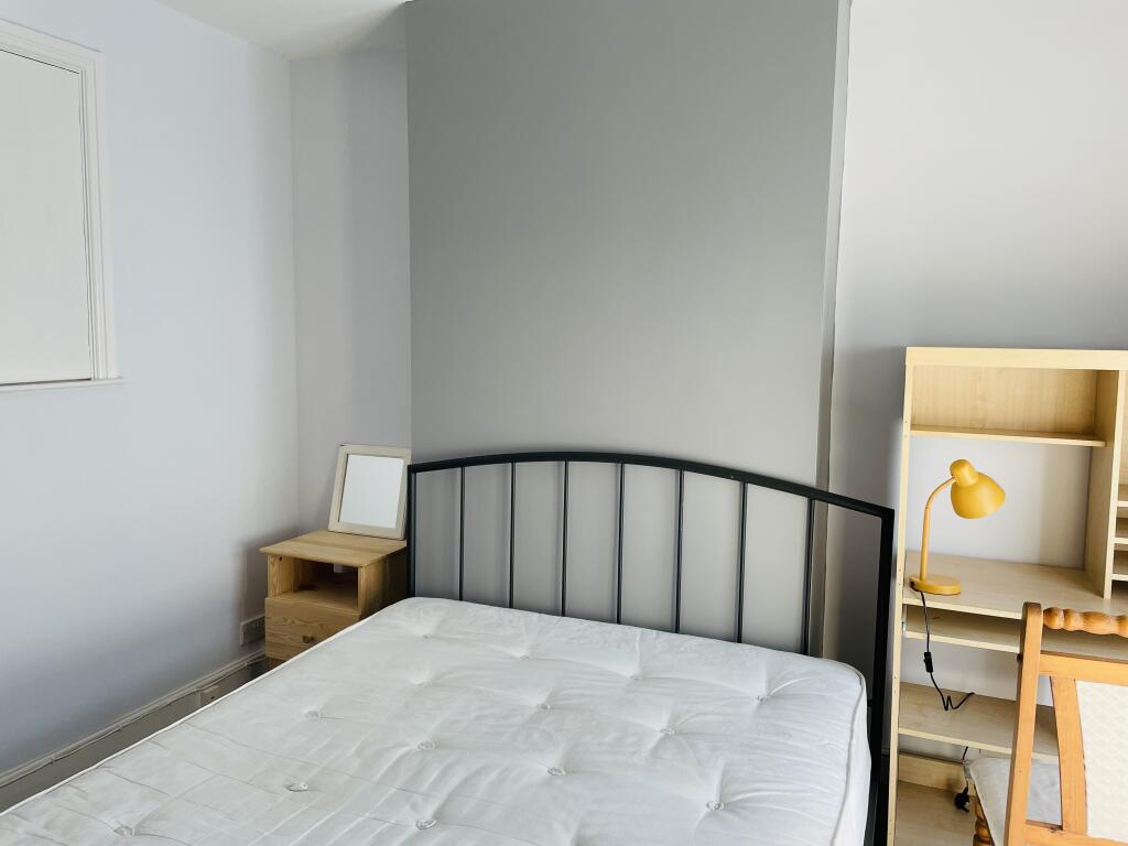
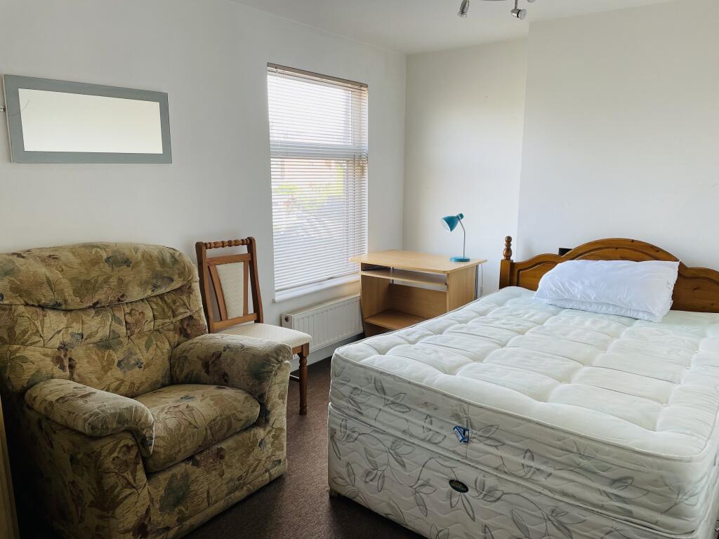
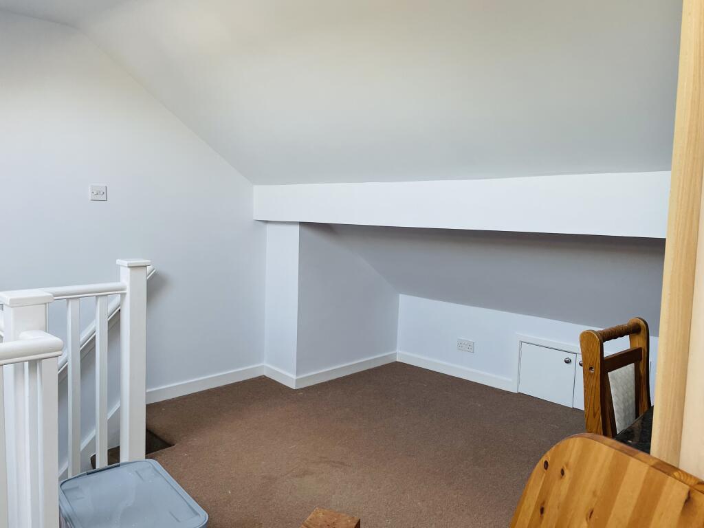
Photo 1 Photo 2 Photo 3 Photo 4 Photo 5 Photo 6 Photo 7 Photo 8
/ 8
Property details
Floor area
93 m²
Council tax band
A
Deprivation
Decile 4 (11,023 of 33,755)
Street crime
71 incidents within 1 mile (Apr 2026)
Key features
- Two Bedroom mid terrace
- Two reception rooms
- Popular residential location Silverdale
- Attic room
- Rear garden
- Council Tax Band - A
Additional details
- Garden
- Yes
Description
Bridgfords are pleased to present this two bedroom mid terraced property with a spacious loft set in the residential area of Silverdale, close to the local amenities.
This fantastic two bedroom terrace home is not as it first seems from the outside. It has great room sizes, two double bedrooms with a great loft room with its own staircase, windows and lighting. To the rear there is a large garden.
Property consists in brief:
Two reception rooms
Kitchen
Family bathroom
Two double bedrooms
Loft storage room with staircase access
Enclosed rear garden
Council Tax Band - A
Viewing is recommended to appreciate all that this fantastic property has to offer please call our friendly team to arrange your viewing. Council Tax Band: A Holding Deposit: £180.00
Listed by
Newcastle Under Lyme
Countrywide UK Lettings - Connells
Reference: 174661604
EPC Rating & Upgrade Cost
Fetching EPC data… Refresh this page in a moment.
Flood risk
Zone: 1
Risk: Low
Job (default Low)
Rental Range
Estimated market rent for Newcastle-under-Lyme. Low = conservative, Realistic = average, Optimistic = best case.
Based on Local Authority from postcode lookup → Newcastle-under-Lyme.
LHA (30th percentile) floor for Staffordshire North: £479/mo (Apr 2025 – Mar 2026)
Location
Nearby
Nearest stations, universities and amenities (distance from property).
| Type | Name | Distance |
|---|---|---|
| Shop | One Stop | 0.1 miles |
| Bus stop | St Luke's Church | 0.1 miles |
| Shop | Co-op Food | 0.2 miles |
| University | Keele University | 1.0 miles |
| Train station | Silverdale | 1.2 miles |
| Train station | Apedale Road | 1.4 miles |
| Hospital | Bradwell Hospital | 2.1 miles |
| Hospital | Hartshill Medical Centre | 2.6 miles |
| University | University of Staffordshire Stoke Campus | 3.9 miles |
Street-level crime
| Category | Count |
|---|---|
| Violence and sexual offences | 32 |
| Anti-social behaviour | 15 |
| Criminal damage and arson | 6 |
| Other theft | 6 |
| Public order | 4 |
| Burglary | 3 |
| Drugs | 2 |
| Possession of weapons | 2 |
| Other crime | 1 |
| Total incidents | 71 |
Within 1 mile during Apr 2026. Source: data.police.uk (England & Wales).
Schools nearby
Nearest open schools with Ofsted ratings (England). Closed schools are not shown. Data from Get Information about Schools and Ofsted.
| Name | Type | Distance | Ofsted |
|---|---|---|---|
| St Luke's CofE (C) Primary School | Primary | 0.4 miles | Requires improvement — 26 Jan 2023 |
| Silverdale Primary Academy | Primary | 0.4 miles | Good — 29 Nov 2023 |
| University of Keele | Other | 0.8 miles | — (No rating) |
| St John's CofE (C) Primary School | Primary | 0.9 miles | Requires improvement — 13 Jul 2023 |
| Knutton St Marys CofE Academy | Primary | 1.0 miles | Good — 4 Jun 2019 |
Rental Comparables
Residential lets from OpenRent and Rightmove for the area (same bedroom count). Use to validate rent estimates. Student lets are excluded.
Average rent: £842/mo (54 listings)