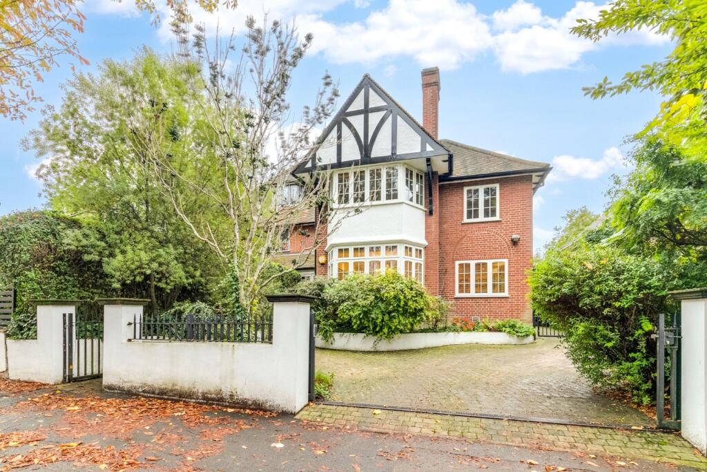
29 WEST HEATH AVENUE
LONDON, GREATER LONDON NW11 7QJ

Property details
Tenure
FREEHOLD
Floor area
325 m²
Council tax band
H
Last sold
£3,850,000 Dec 2024
Local average
£1,485,412 (+165.9%)
Deprivation
Decile 8 (25,507 of 33,755)
Street crime
449 incidents within 1 mile (Mar 2026)
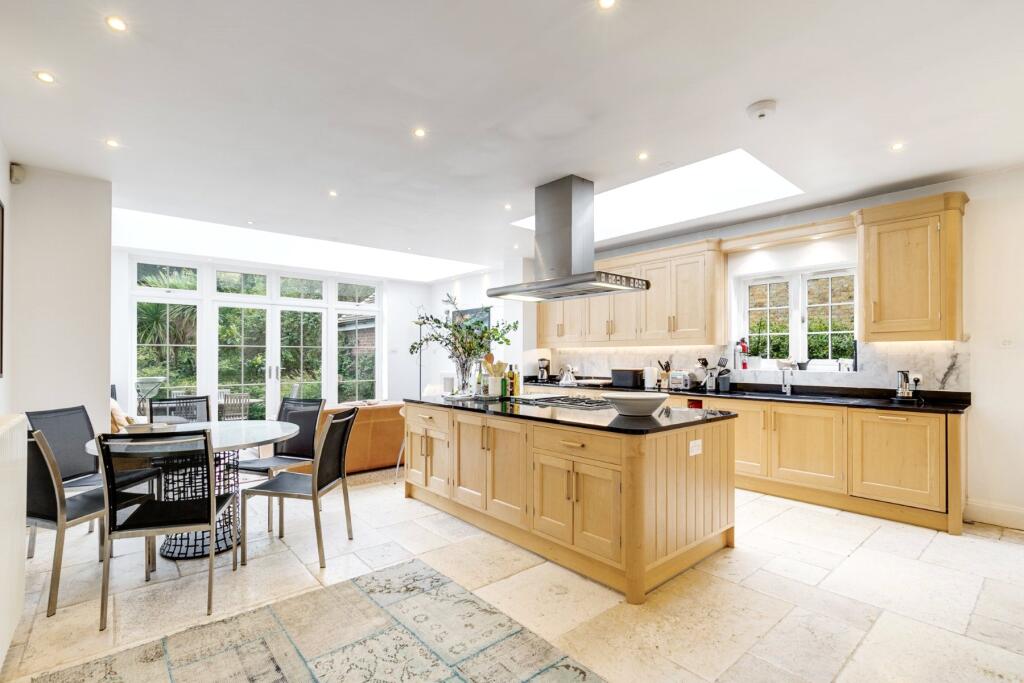
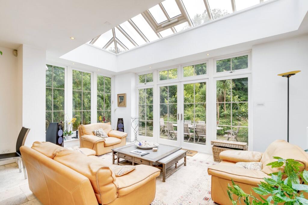
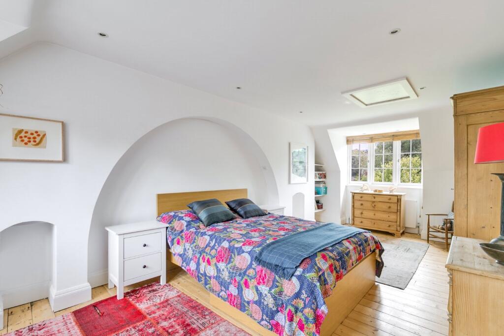
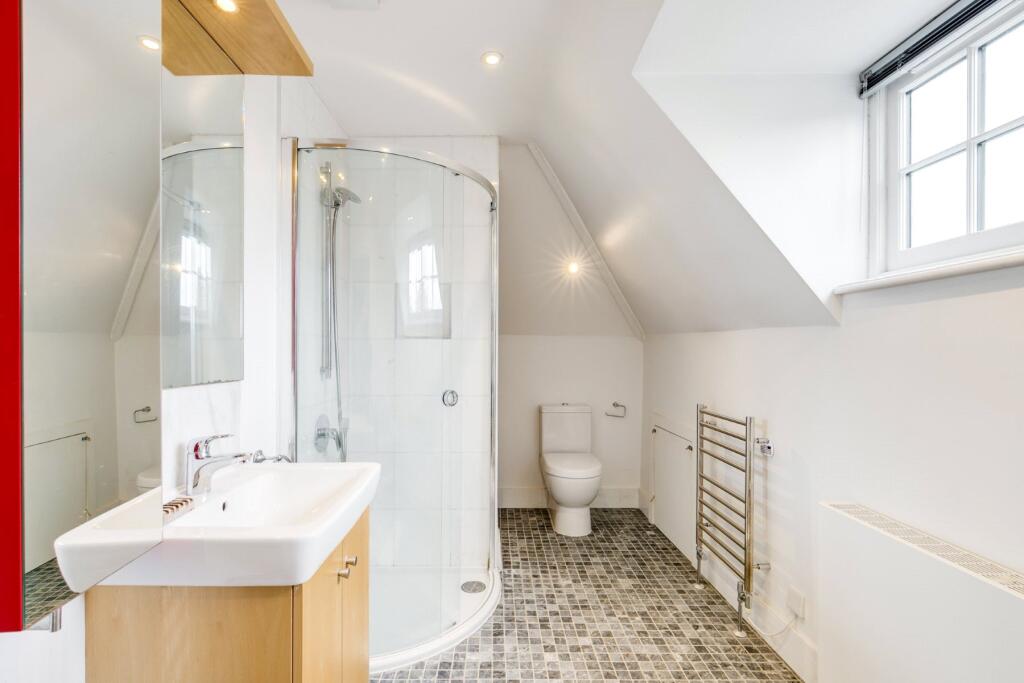
Key features
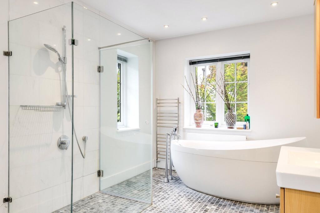
- 3 Bathrooms
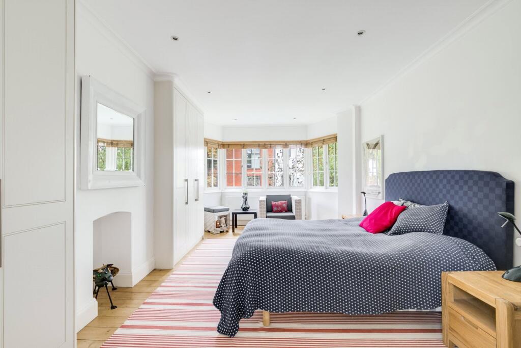
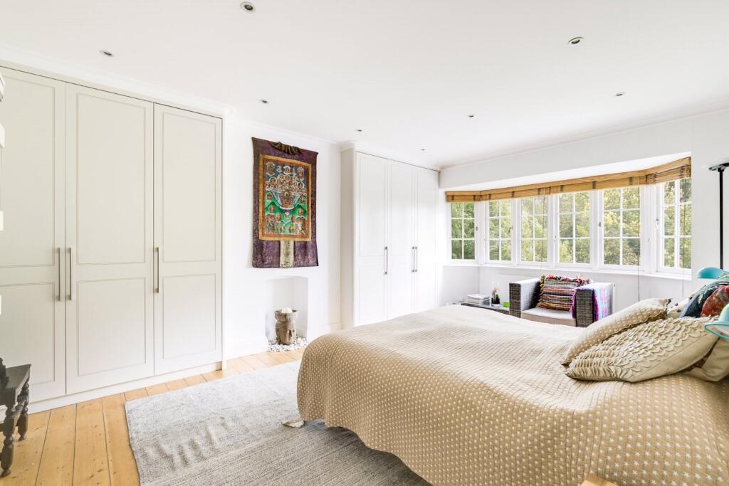
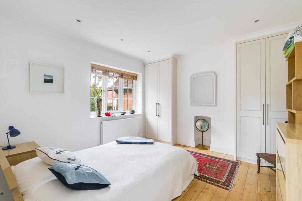
- 4 Bedrooms
- 3 Receptions
- House
- Semi Detached
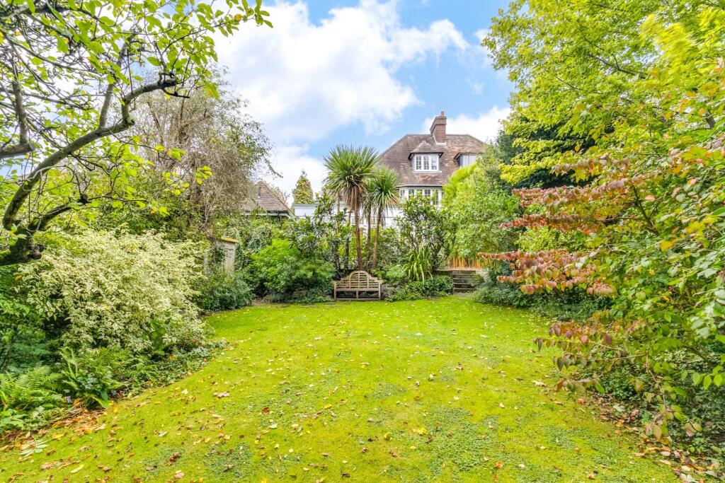
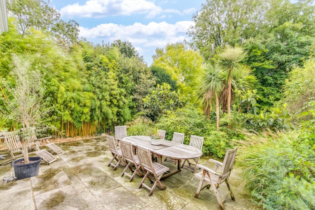
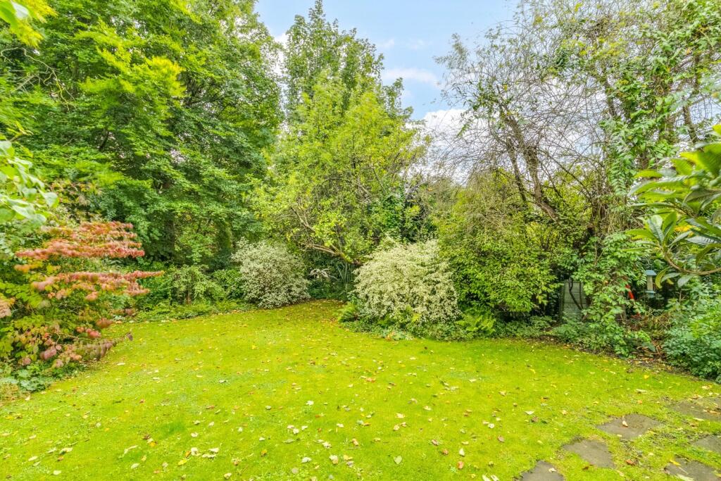
- Garden
- Off Street Parking
- Garage
- 3691 Approx Sq Ft
- Freehold
Additional details
- Parking
- Yes
- Garden
- Yes
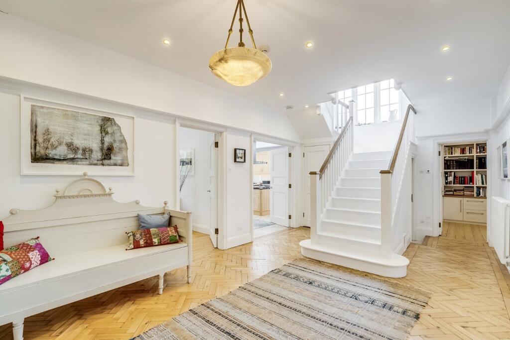
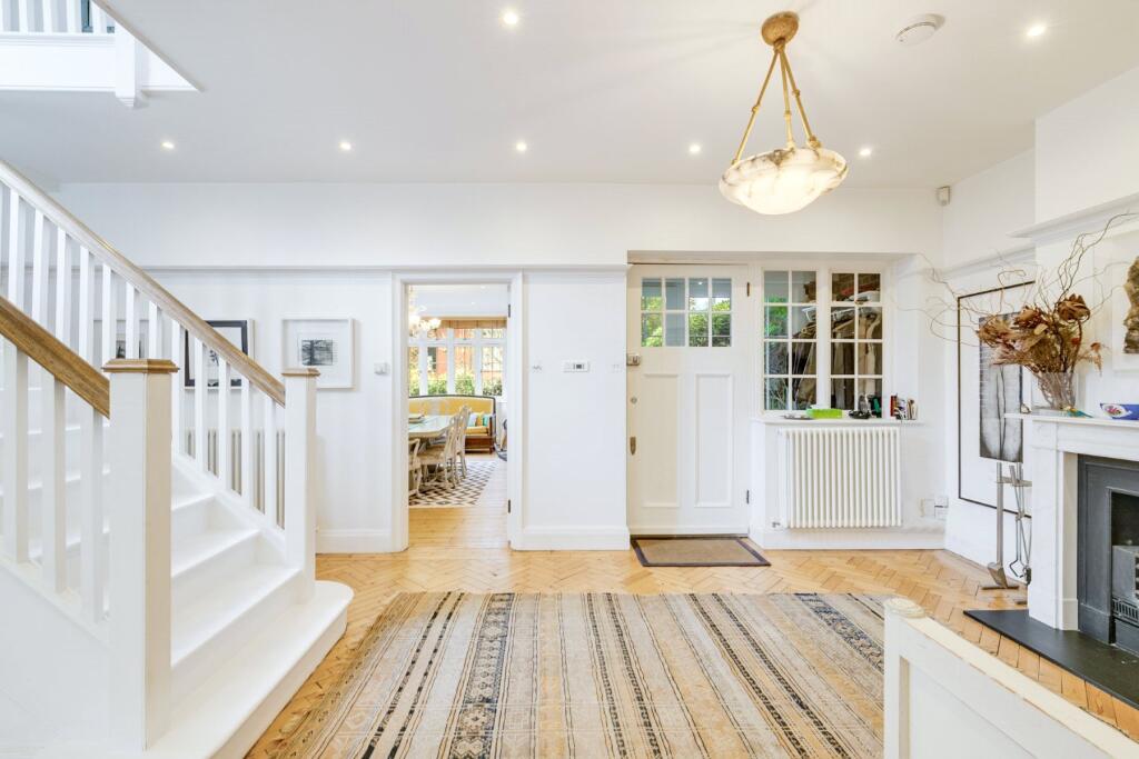
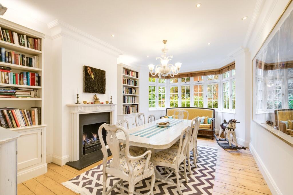
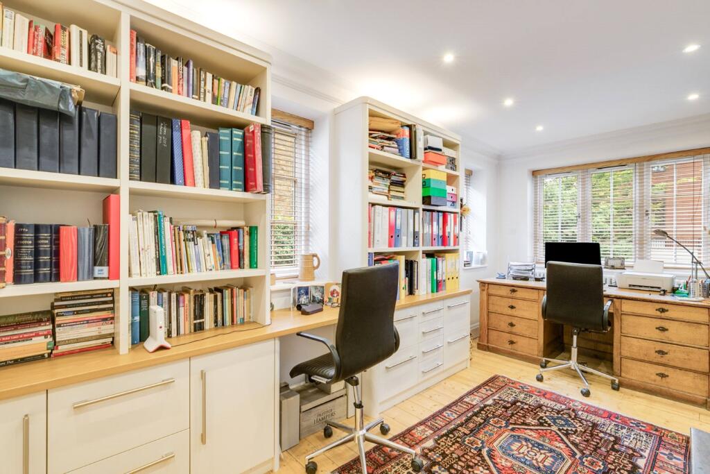
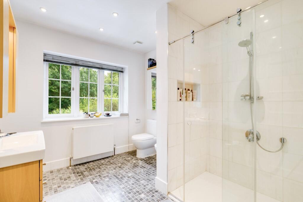
Description
For viewings please contact either the Hampstead Office on or Temple Fortune Office .
NB: These images represent the property during a previous occupancy.
Council Tax band H
Listed by
Hampstead - Sales
Goldschmidt & Howland
Reference: 165110972
EPC Rating & Upgrade Cost
Fetching EPC data… Refresh this page in a moment.
Flood risk
Zone: 1
Risk: Low
Job (default Low)
Floorplans
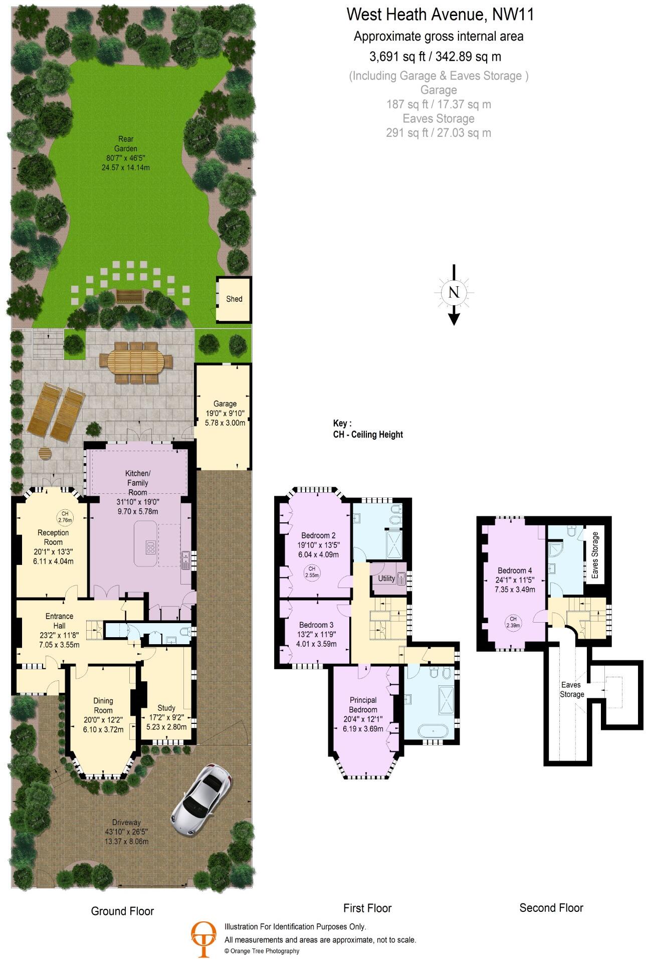
Floorplan
EPC Graphs
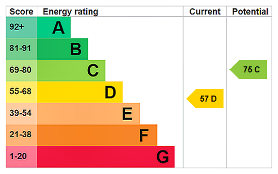
EPC Rating Graph
FENSA Certificates
This property has 1 FENSA certificate(s) on record, indicating window/door installations by FENSA-approved installers.
FENSA Certificate #7523126
Property Details
Street: 29 West Heath Avenue
Town: LONDON
Postcode: NW11 7QJ
Installation Details
Items: 1 door
Certificate Issued: 21/07/2010
Work Completed: 09/07/2010
This certificate data was retrieved from FENSA's database
What is FENSA? FENSA (Fenestration Self-Assessment Scheme) is a government-authorised scheme that monitors building regulation compliance for replacement windows and doors. Certificates indicate that work was completed by FENSA-approved installers.
Price history
83% since 2010
| Event | Date | Price | % change |
|---|---|---|---|
| Sold | 20/12/2024 (1 year ago) | £3,850,000 | +83.2% |
| Sold | 01/09/2010 (15 years ago) | £2,101,000 | — |
Source: HM Land Registry Price Paid Data. Crown copyright.
Sold Comparables
Same street and nearby sales within 0.25 miles (last 5 years). Data from Land Registry Price Paid.
| Address | Price | Date | Type |
|---|---|---|---|
| 45 WEST HEATH DRIVE, LONDON, BARNET, GREATER LONDON, NW11 7QG | £2,375,000 | 09/01/2026 | Semi-detached |
| 26 DUNSTAN ROAD, LONDON, BARNET, GREATER LONDON, NW11 8AA | £1,967,000 | 17/09/2025 | Semi-detached |
| 35 WEST HEATH DRIVE, LONDON, BARNET, GREATER LONDON, NW11 7QG | £2,700,000 | 16/09/2025 | Semi-detached |
| Same street 31 WEST HEATH AVENUE, LONDON, BARNET, GREATER LONDON, NW11 7QJ | £4,600,000 | 29/06/2023 | Detached |
| 813 FINCHLEY ROAD, LONDON, BARNET, GREATER LONDON, NW11 8AJ | £1,700,000 | 24/06/2022 | Semi-detached |
| 39 DUNSTAN ROAD, LONDON, BARNET, GREATER LONDON, NW11 8AG | £1,580,000 | 02/03/2022 | Semi-detached |
| 23 DUNSTAN ROAD, LONDON, BARNET, GREATER LONDON, NW11 8AG | £2,100,000 | 14/01/2022 | Semi-detached |
| 12 WYCOMBE GARDENS, LONDON, BARNET, GREATER LONDON, NW11 8AL | £2,080,000 | 14/12/2021 | Semi-detached |
| 1 DUNSTAN ROAD, LONDON, BARNET, GREATER LONDON, NW11 8AG | £1,725,000 | 12/11/2021 | Semi-detached |
| 15B WYCOMBE GARDENS, LONDON, BARNET, GREATER LONDON, NW11 8AN | £1,910,000 | 20/10/2021 | Semi-detached |
| 25 WEST HEATH DRIVE, LONDON, BARNET, GREATER LONDON, NW11 7QG | £2,181,000 | 25/08/2021 | Semi-detached |
| 13 WEST HEATH DRIVE, LONDON, BARNET, GREATER LONDON, NW11 7QG | £2,250,000 | 23/06/2021 | Semi-detached |
Street average: £4,600,000 (1 sale)
Area average: £2,051,636 (11 sales)
Capital growth trend
Land Registry outcode average: last 12 months vs 5y and 10y ago (from sold prices).
House Price Index (HM Land Registry — official index, not sold-price averages): Barnet. Series: Semi-detached. As of February 2026.
Rental Range
Estimated market rent for Barnet. Low = conservative, Realistic = average, Optimistic = best case.
Based on Local Authority from postcode lookup → Barnet.
LHA (30th percentile) floor for Inner North London: £3,052/mo (Apr 2025 – Mar 2026)
Location
Nearby
Nearest stations, universities and amenities (distance from property).
| Type | Name | Distance |
|---|---|---|
| Bus stop | Dunstan Road | 0.1 miles |
| Shop | Art Barber Shop | 0.2 miles |
| Shop | The Candy Box | 0.2 miles |
| Train station | Golders Green | 0.3 miles |
| Train station | Hampstead | 1.0 miles |
| University | Central Belsize Square | 1.8 miles |
| University | Flood Hazard Research Centre | 2.8 miles |
| Hospital | The Portland Hospital | 3.8 miles |
| Hospital | Sleep & Health Clinic | 3.9 miles |
Street-level crime
| Category | Count |
|---|---|
| Anti-social behaviour | 125 |
| Violence and sexual offences | 94 |
| Vehicle crime | 41 |
| Other theft | 32 |
| Shoplifting | 31 |
| Burglary | 30 |
| Public order | 25 |
| Criminal damage and arson | 23 |
| Drugs | 21 |
| Theft from the person | 12 |
| Robbery | 5 |
| Bicycle theft | 4 |
| Other crime | 4 |
| Possession of weapons | 2 |
| Total incidents | 449 |
Within 1 mile during Mar 2026. Source: data.police.uk (England & Wales).
Schools nearby
Nearest open schools with Ofsted ratings (England). Closed schools are not shown. Data from Get Information about Schools and Ofsted.
| Name | Type | Distance | Ofsted |
|---|---|---|---|
| Ivy House School | Other | 0.4 miles | — (No rating) |
| Rimon Jewish Primary School | Primary | 0.4 miles | Good — 6 May 2014 |
| The King Alfred School | Other | 0.4 miles | — (No rating) |
| All Saints' CofE Primary School NW2 | Primary | 0.5 miles | Good — 1 Jul 2019 |
| St Luke's Church of England School | Primary | 0.7 miles | Good — 24 Jul 2013 |
Rental Comparables
Rental listings exist nearby, but none matched the 4-bedroom estimate from EPC for this property.
Rent-driven metrics
Based on Area rent estimate.
- Rent ratio — Monthly rent ÷ purchase price (1% rule). 1%+ = strong, 0.8–1% = okay, <0.8% = weak for cashflow.
- Max investor price — Rent ÷ 0.8%; the price at which rent would be 0.8% of price (Stoke-style target).
- Target investor price — Rent ÷ 1%; the price at which rent would be 1% of price (strong cashflow band).
- Gross yield — Annual rent as % of purchase price (no costs).