Coppice Road
Rugeley, WS15 1LT
CAM01407G0-PR0139-STILL012.jpg CAM01407G0-PR0139-STILL007.jpg CAM01407G0-PR0139-STILL008.jpg CAM01407G0-PR0139-STILL005.jpg CAM01407G0-PR0139-STILL006.jpg CAM01407G0-PR0139-STILL001.jpg CAM01407G0-PR0139-STILL002.jpg CAM01407G0-PR0139-STILL003.jpg CAM01407G0-PR0139-STILL004.jpg CAM01407G0-PR0139-STILL009.jpg CAM01407G0-PR0139-STILL010.jpg CAM01407G0-PR0139-STILL011.jpg
/ 12
Property details
Tenure
FREEHOLD
Council tax band
A
Local average
£418,333 (-66.5%)
Deprivation
Decile 5 (14,196 of 33,755)
Street crime
156 incidents within 1 mile (May 2026)
Key features
- NO CHAIN
- IN NEED OF MODERNISATION
- POPULAR LOCATION
- IDEAL FOR FIRST TIME BUYERS
- THREE BEDROOMS
- CLOSE TO SCHOOLS & AMENITIES
- OFF ROAD PARKING
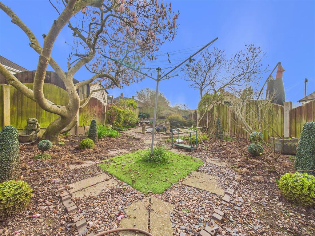
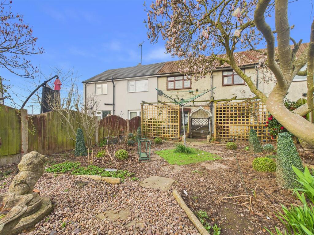
- REAR GARDEN
Additional details
- Parking
- Yes
- Garden
- Yes
Description
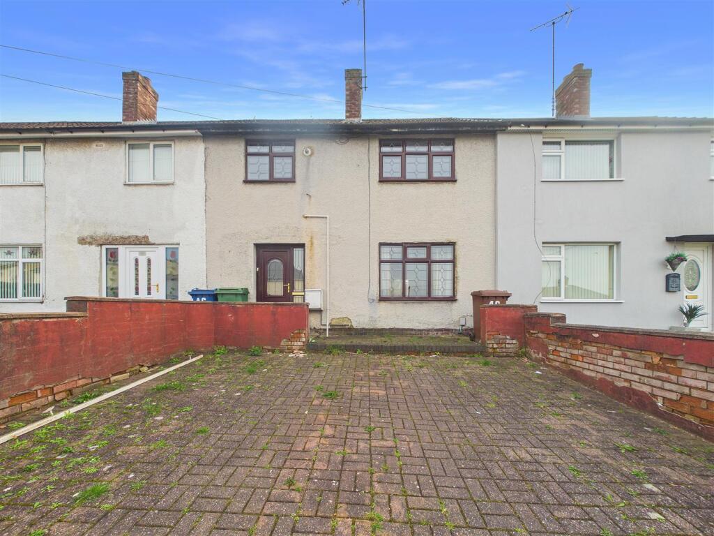
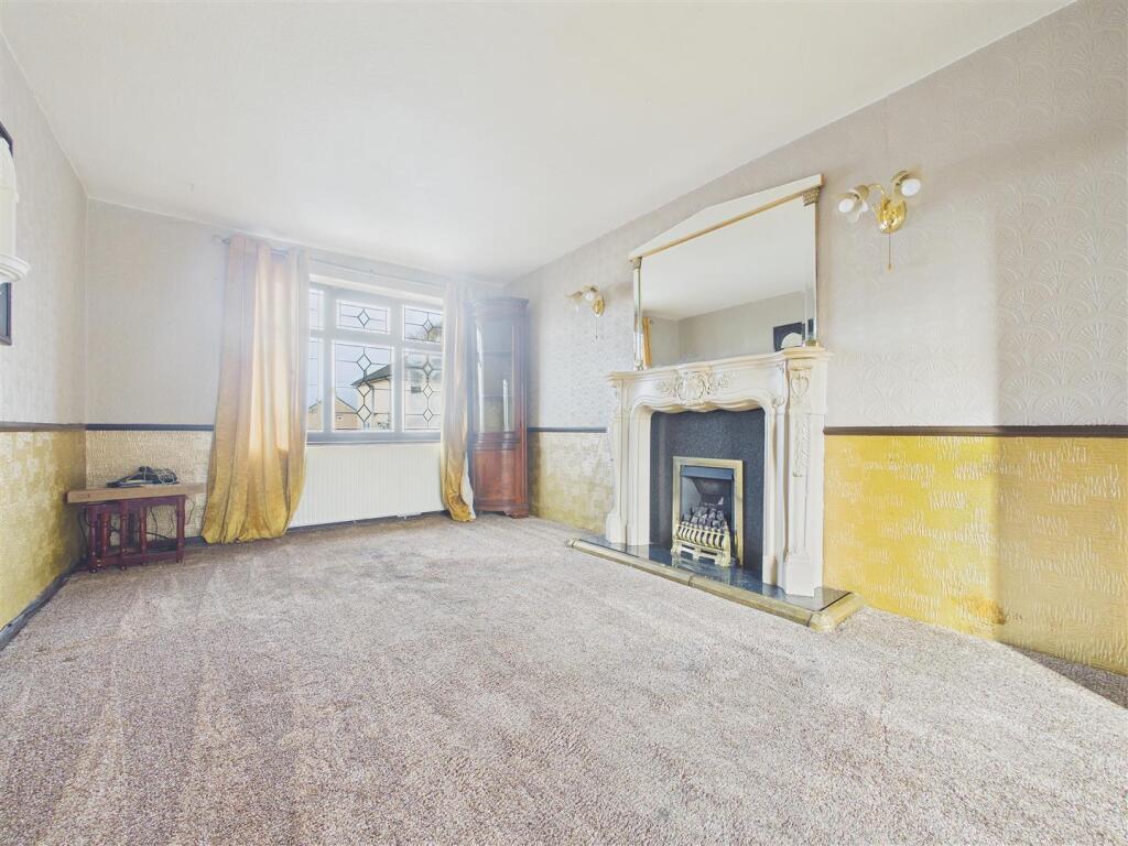
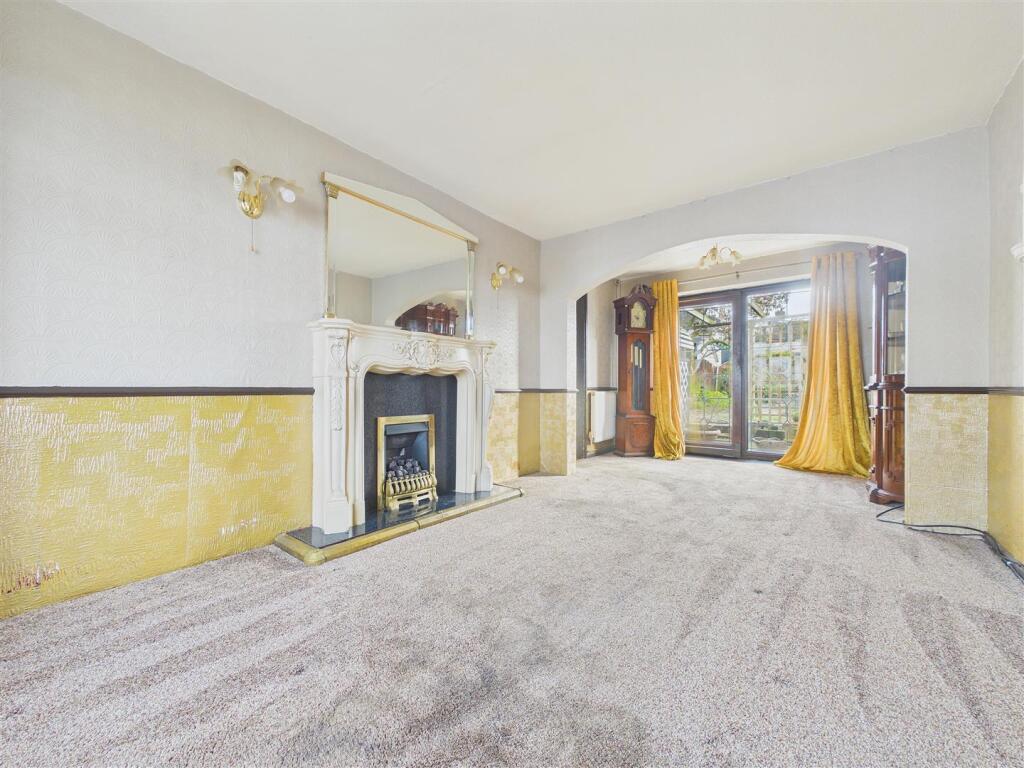
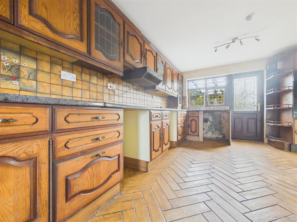
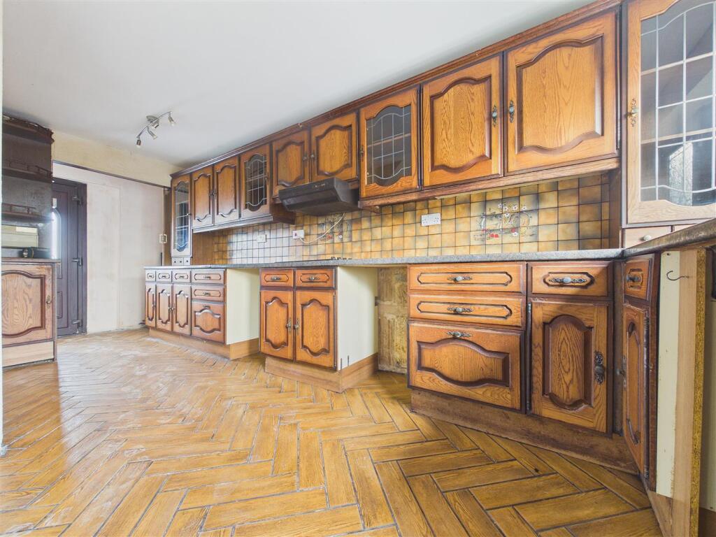
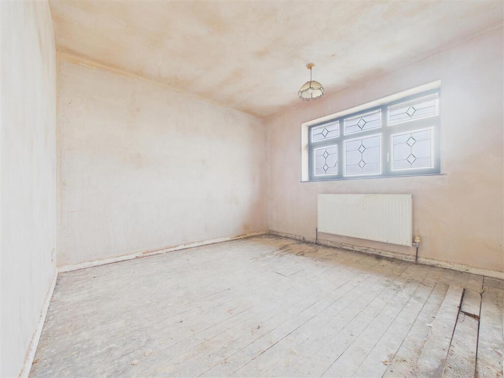
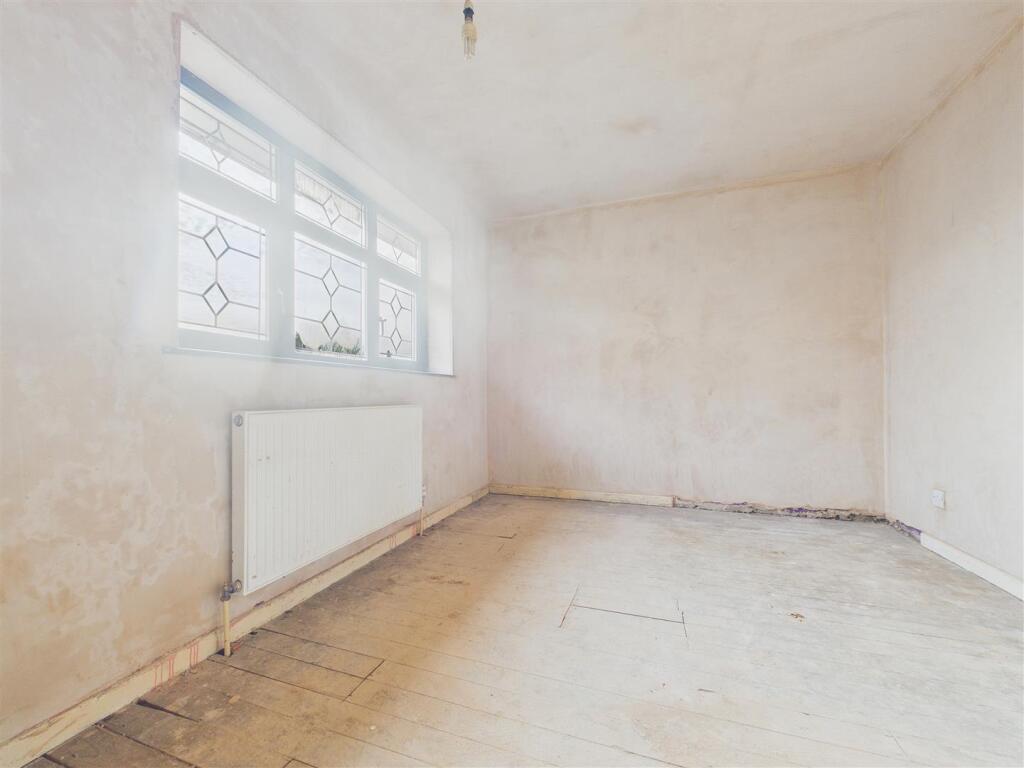
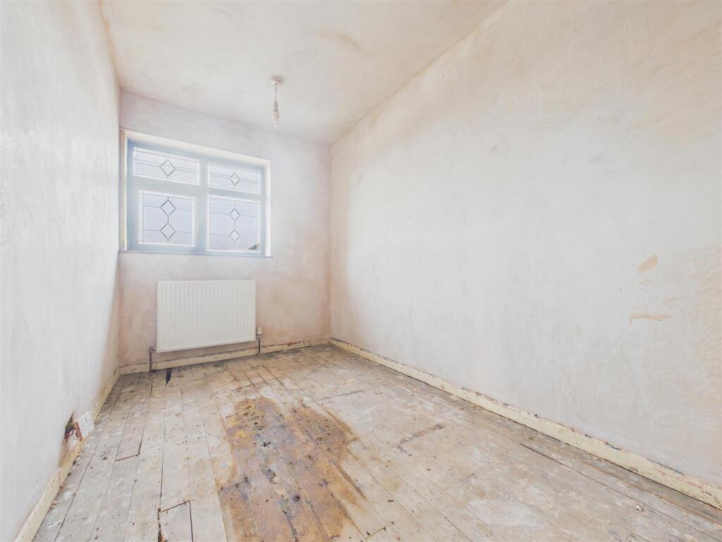
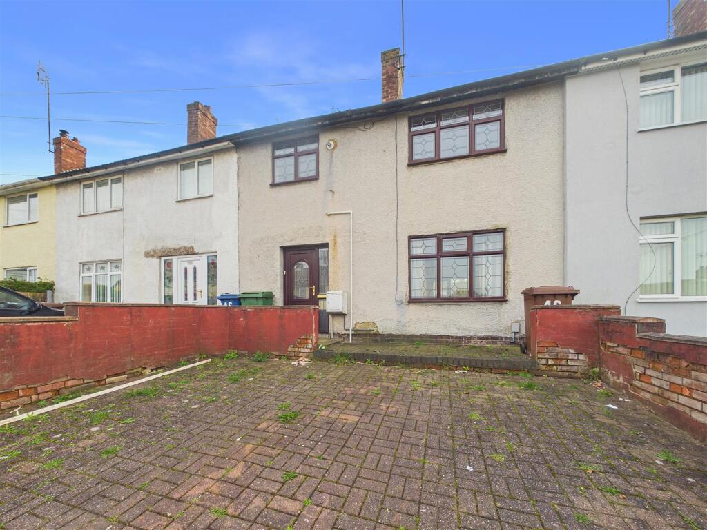
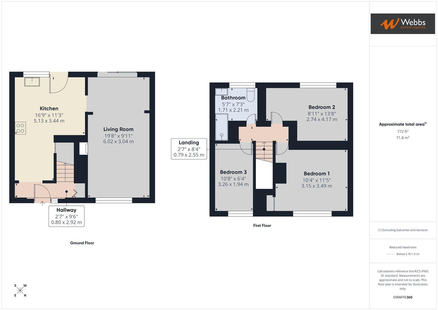
WEBBS ESTATE AGENTS are pleased to market this three bedroom, mid terrace property on a popular part of the Pear Tree Estate on Coppice Road. The property is in need of moderniastion and would ideally suit a first time buyer looking to get their foot on the property ladder. Located close to amenities, schools, useful transport links and much more! The internal accommodation briefly comprises; entrance hall, kitchen, living/ dining room, three bedrooms and a family bathroom. The property also benefits from a good size rear garden and and the added benefit of off road parking.
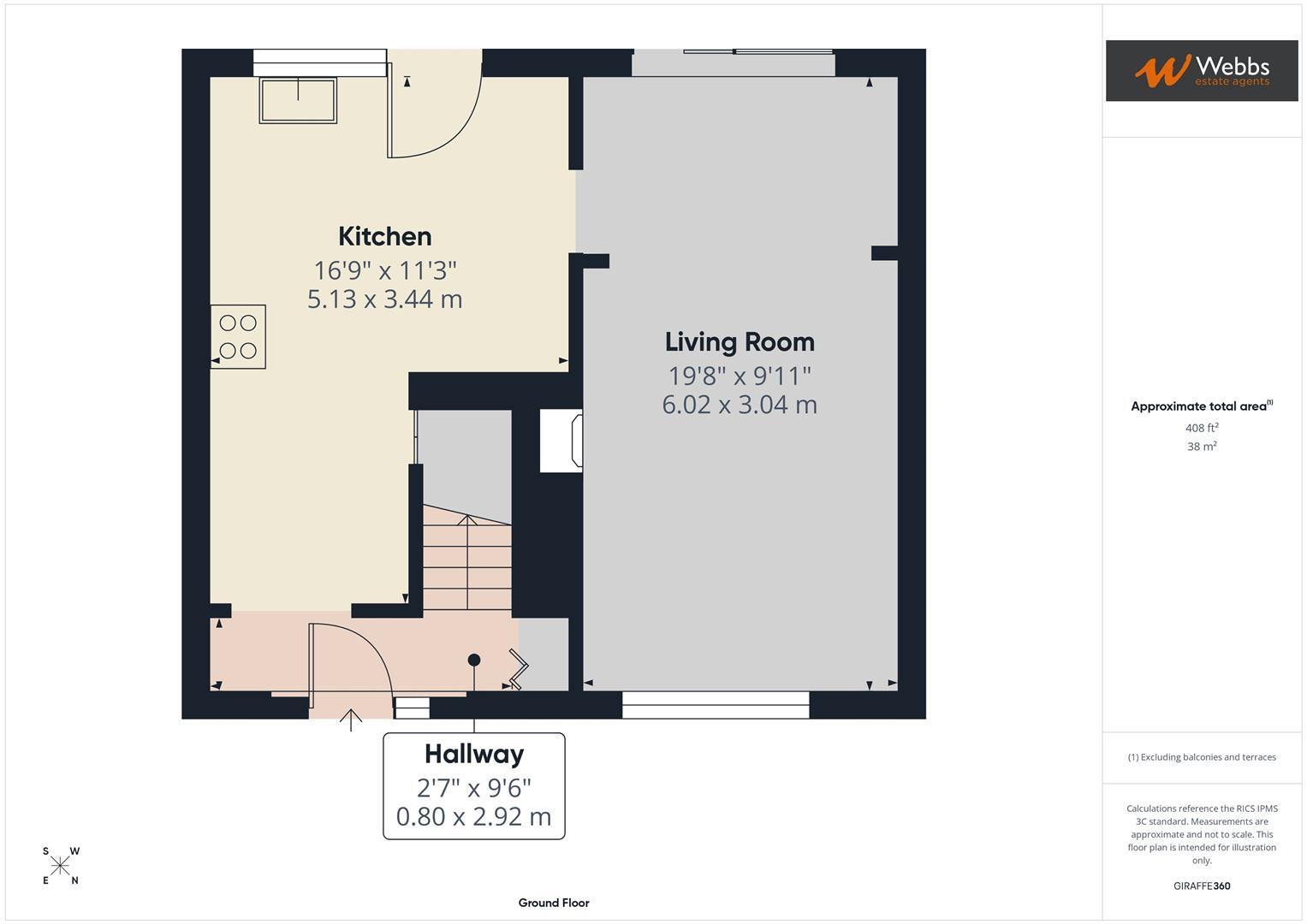
Hallway -
Living Room - 5.99m x 3.02m (19'8 x 9'11) -
Kitchen - 5.11m x 3.43m (16'9 x 11'3) -
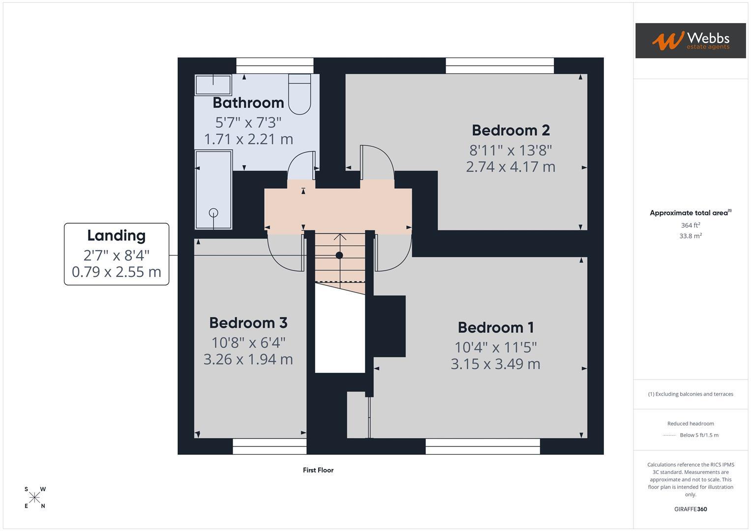
Landing -
Bedroom 1 - 3.15m x 3.48m (10'4 x 11'5) -
Bedroom 2 - 2.72m x 4.17m (8'11 x 13'8) -
Bedroom 3 - 3.25m x 1.93m (10'8 x 6'4) -
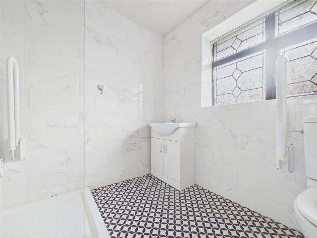
Bathroom - 1.70m x 2.21m (5'7 x 7'3) -
Rear Garden** -
Listed by
Rugeley
Webbs Estate Agents
Reference: 174130196
EPC ratings on this postcode
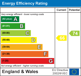
We don't have a matched EPC for this property yet. Below are efficiency scores and details for other addresses on this postcode.
| Address | Current | Potential | Floor area | Age band | Type |
|---|---|---|---|---|---|
| 25 Coppice Road, RUGELEY | 74 | 88 | 70 m² | England and Wales: 1950-1966 | Detached |
| 25, Coppice Road, RUGELEY | 51 | 73 | 79 m² | England and Wales: 1930-1949 | Detached |
| 27 Coppice Road, RUGELEY | 62 | 75 | 83 m² | England and Wales: 1950-1966 | Detached |
| 27, Coppice Road, RUGELEY | 61 | 77 | 81 m² | England and Wales: 1930-1949 | Detached |
| 29 Coppice Road, RUGELEY | 64 | 78 | 78 m² | England and Wales: 1950-1966 | Detached |
| 31 Coppice Road, RUGELEY | 68 | 81 | 79 m² | England and Wales: 1950-1966 | Terraced |
| 33, Coppice Road, RUGELEY | 71 | 82 | 79 m² | England and Wales: 1950-1966 | Terraced |
| 35 Coppice Road, RUGELEY | 66 | 72 | 76 m² | England and Wales: 1950-1966 | Terraced |
| 36 Coppice Road, RUGELEY | 68 | 74 | 108 m² | England and Wales: 1950-1966 | Detached |
| 36, Coppice Road, RUGELEY | 68 | 79 | 111 m² | England and Wales: 1950-1966 | Detached |
| 38 Coppice Road, RUGELEY | 63 | 70 | 78 m² | England and Wales: 1950-1966 | Detached |
| 38, Coppice Road, RUGELEY | 54 | 74 | 78 m² | England and Wales: 1950-1966 | Detached |
| 38, Coppice Road, RUGELEY | 50 | 72 | 78 m² | England and Wales: 1950-1966 | Detached |
| 39, Coppice Road, RUGELEY | 63 | 78 | 79 m² | England and Wales: 1930-1949 | Detached |
| 40 COPPICE ROAD, RUGELEY, RUGELEY | 29 | 76 | 78 m² | England and Wales: 1950-1966 | Detached |
Flood risk
Zone: 1
Risk: Low
Job (default Low)
Floorplans
CAM01407G0-PR0139-BUILD01.jpg
CAM01407G0-PR0139-BUILD01-FLOOR01.jpg
CAM01407G0-PR0139-BUILD01-FLOOR00.jpg
EPC Graphs
EE Rating
Price history
| Event | Date | Price | % change |
|---|---|---|---|
| Listed for sale | — | £140,000 | — |
Source: HM Land Registry Price Paid Data. Crown copyright.
Sold Comparables
Same street and nearby sales within 0.25 miles (last 5 years). Data from Land Registry Price Paid.
| Address | Price | Date | Type |
|---|---|---|---|
| BRERETON FIELDS FARM GORSE LANE, BRERETON, RUGELEY, CANNOCK CHASE, STAFFORDSHIRE, WS15 1BD | £315,000 | 28/02/2025 | Other |
| Same street 65 COPPICE ROAD, RUGELEY, CANNOCK CHASE, STAFFORDSHIRE, WS15 1LT | £115,000 | 20/10/2023 | Semi-detached |
| Same street 75 COPPICE ROAD, RUGELEY, CANNOCK CHASE, STAFFORDSHIRE, WS15 1LT | £155,000 | 13/09/2022 | Semi-detached |
| GARAGE HEDNESFORD ROAD, RUGELEY, CANNOCK CHASE, STAFFORDSHIRE, WS15 1JS | £207,500 | 11/02/2022 | Other |
Street average: £135,000 (2 sales)
Area average: £261,250 (2 sales)
Capital growth trend
Land Registry outcode average: last 12 months vs 5y and 10y ago (from sold prices).
House Price Index (HM Land Registry — official index, not sold-price averages): Cannock Chase. Series: All dwelling types. As of April 2026.
Rental Range
Estimated market rent for Cannock Chase. Low = conservative, Realistic = average, Optimistic = best case.
Based on Local Authority from postcode lookup → Cannock Chase.
LHA (30th percentile) floor for Mid Staffs: £738/mo (Apr 2025 – Mar 2026)
Location
Address
Coppice Road
Nearby
Nearest stations, universities and amenities (distance from property).
| Type | Name | Distance |
|---|---|---|
| Bus stop | Chetwynd Close | 0.0 miles |
| Bus stop | Lansbury Road | 0.1 miles |
| Shop | The Co-operative Food | 0.2 miles |
| Train station | Rugeley Town | 0.5 miles |
| Shop | Rachel Lamey | 0.6 miles |
| Train station | Rugeley Trent Valley | 1.5 miles |
| Hospital | Cannock Chase Hospital | 5.4 miles |
| Hospital | Samuel Johnson Community Hospital | 6.8 miles |
| University | Staffordshire University Blackheath Lane Site | 7.1 miles |
Street-level crime
| Category | Count |
|---|---|
| Violence and sexual offences | 67 |
| Anti-social behaviour | 19 |
| Criminal damage and arson | 19 |
| Public order | 18 |
| Drugs | 6 |
| Other crime | 6 |
| Shoplifting | 6 |
| Other theft | 4 |
| Vehicle crime | 4 |
| Bicycle theft | 2 |
| Burglary | 2 |
| Theft from the person | 2 |
| Robbery | 1 |
| Total incidents | 156 |
Within 1 mile during May 2026. Source: data.police.uk (England & Wales).
Schools nearby
Nearest open schools with Ofsted ratings (England). Closed schools are not shown. Data from Get Information about Schools and Ofsted.
| Name | Type | Distance | Ofsted |
|---|---|---|---|
| Chase View Community Primary School | Primary | 0.1 miles | Good — 28 Jun 2022 |
| St Joseph's Catholic Primary School | Primary | 0.4 miles | Good — 13 Jun 2013 |
| Redbrook Hayes Community Primary School | Primary | 0.5 miles | Good — 22 Feb 2016 |
| Churchfield CofE Primary Academy | Primary | 0.6 miles | Good — 15 Nov 2023 |
| The Hart School | Secondary | 0.8 miles | Good — 27 Apr 2018 |
Rental Comparables
Loading rental comparables for this postcode. Refresh in a few minutes.
Rent-driven metrics
Based on Area rent estimate.
- Rent ratio — Monthly rent ÷ purchase price (1% rule). 1%+ = strong, 0.8–1% = okay, <0.8% = weak for cashflow.
- Max investor price — Rent ÷ 0.8%; the price at which rent would be 0.8% of price (Stoke-style target).
- Target investor price — Rent ÷ 1%; the price at which rent would be 1% of price (strong cashflow band).
- Gross yield — Annual rent as % of purchase price (no costs).
Enter House Number
Enter the house number to help us retrieve more accurate pricing history and property data.
Please log in to submit or correct the house number for this listing.
Log in to continue