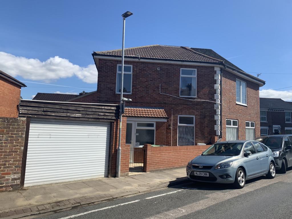
2A
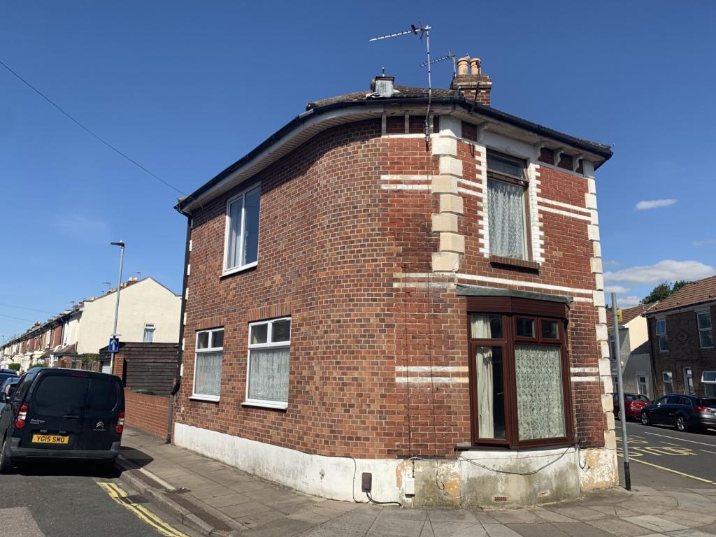
WALDEN ROAD, PORTSMOUTH, STAMSHAW, PORTSMOUTH PO2 8PJ
Property details
Floor area
88 m²
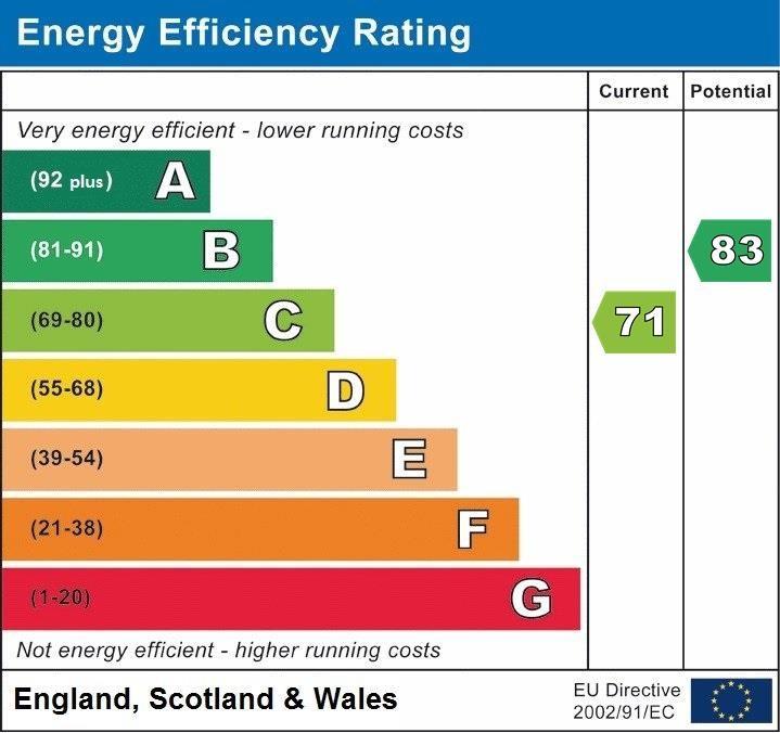
EPC rating
C
Year built
England and Wales: 1983-1990
Last sold
£201,000 Feb 2021
Price per m²
£2,330/m²
Local average
£319,393 (-35.8%)
Deprivation
Decile 4 (11,446 of 33,755)
Street crime
342 incidents within 1 mile (Apr 2026)
Key features
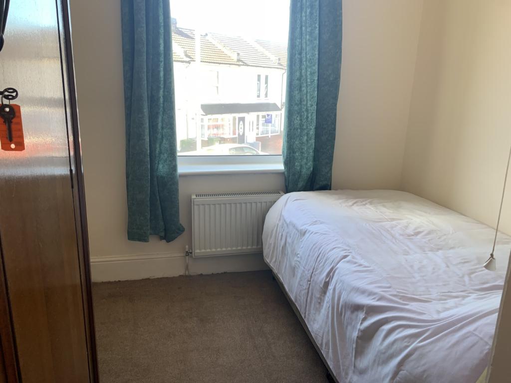
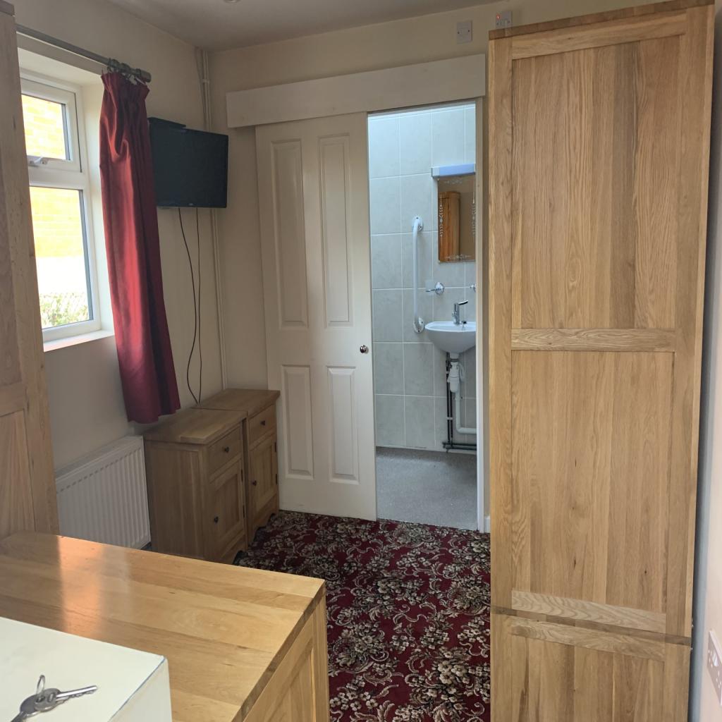
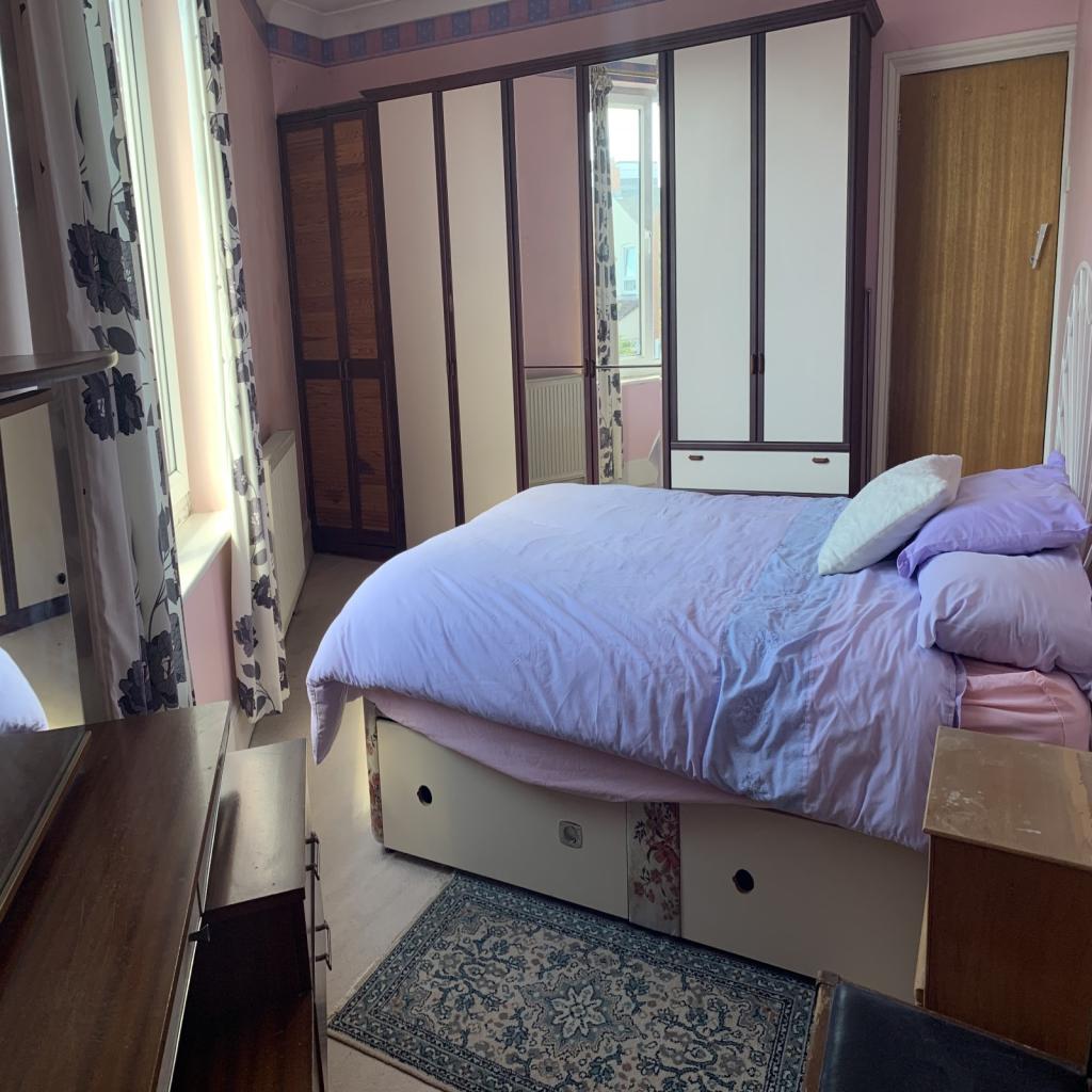
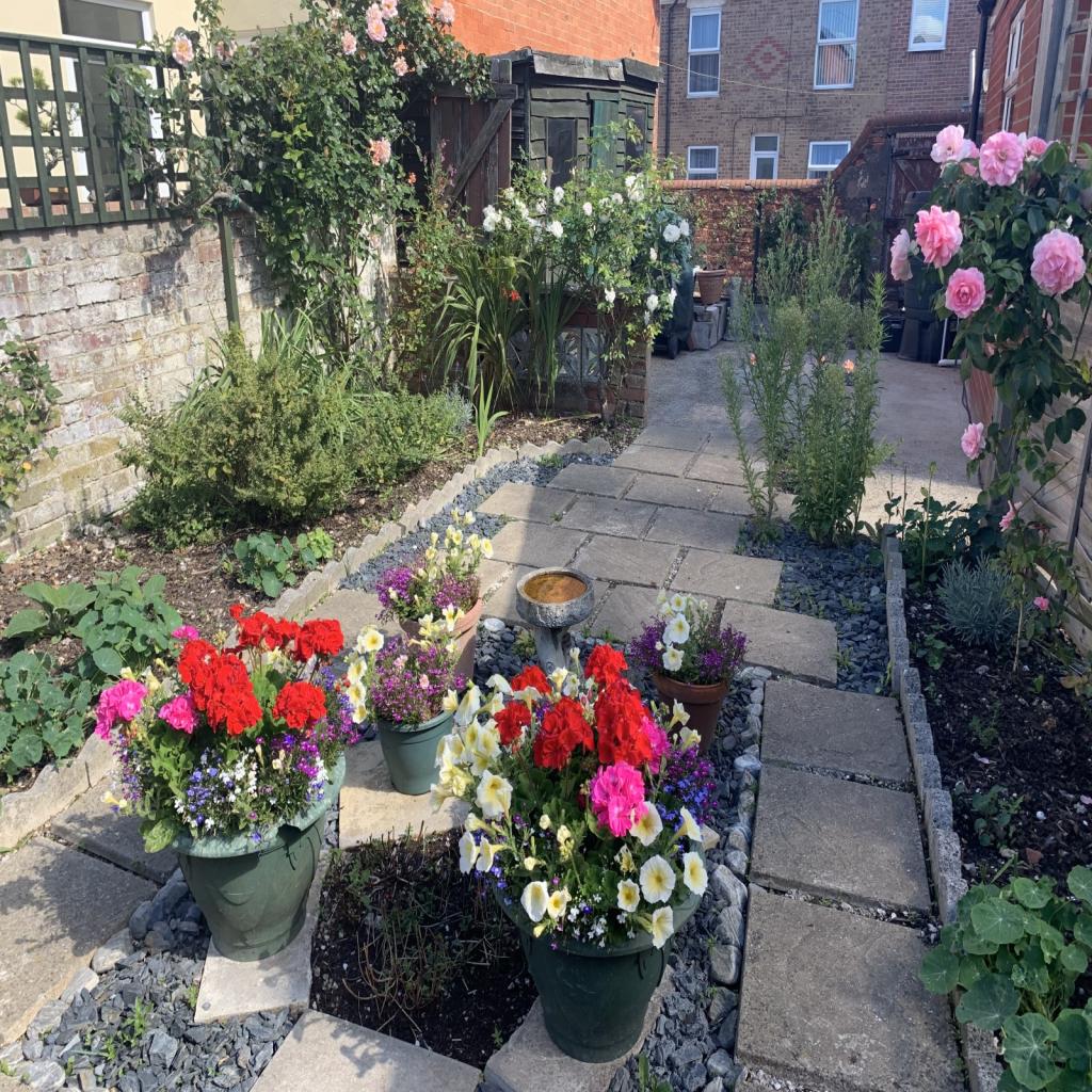
- Unusual four bedroom semi detached family home
- Versatile accommodation
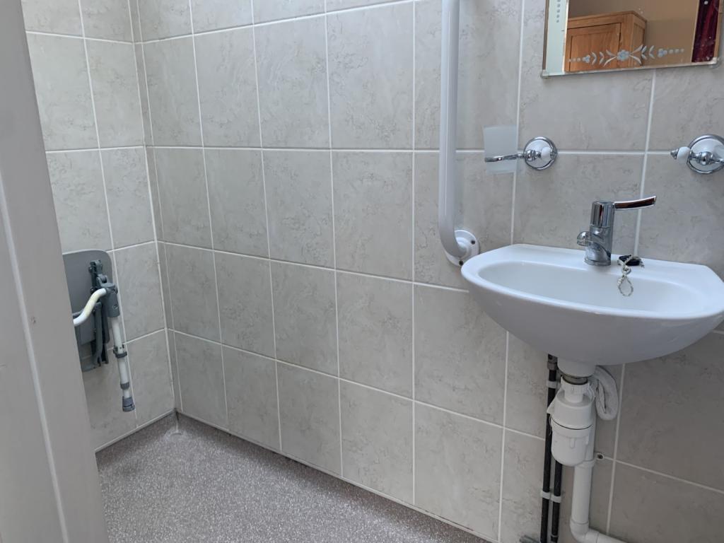
- Downstairs bedroom with en-suite wet room
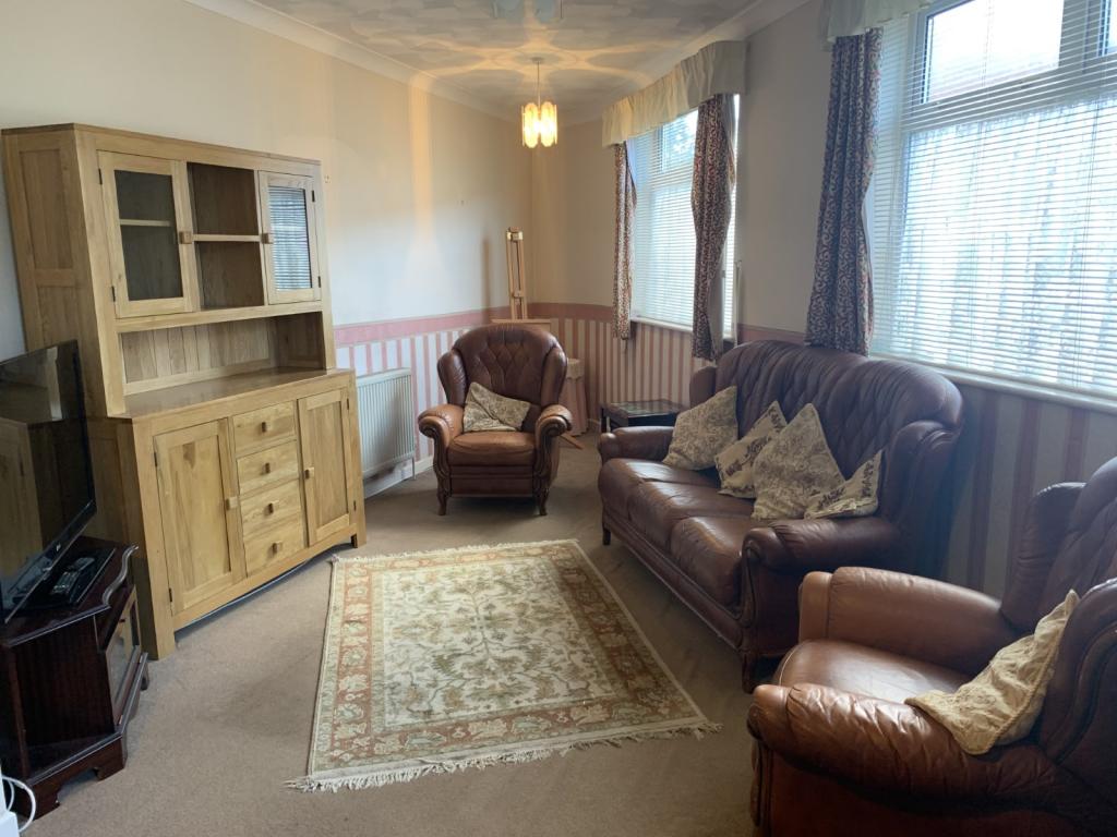
- Lounge/diner and fitted kitchen
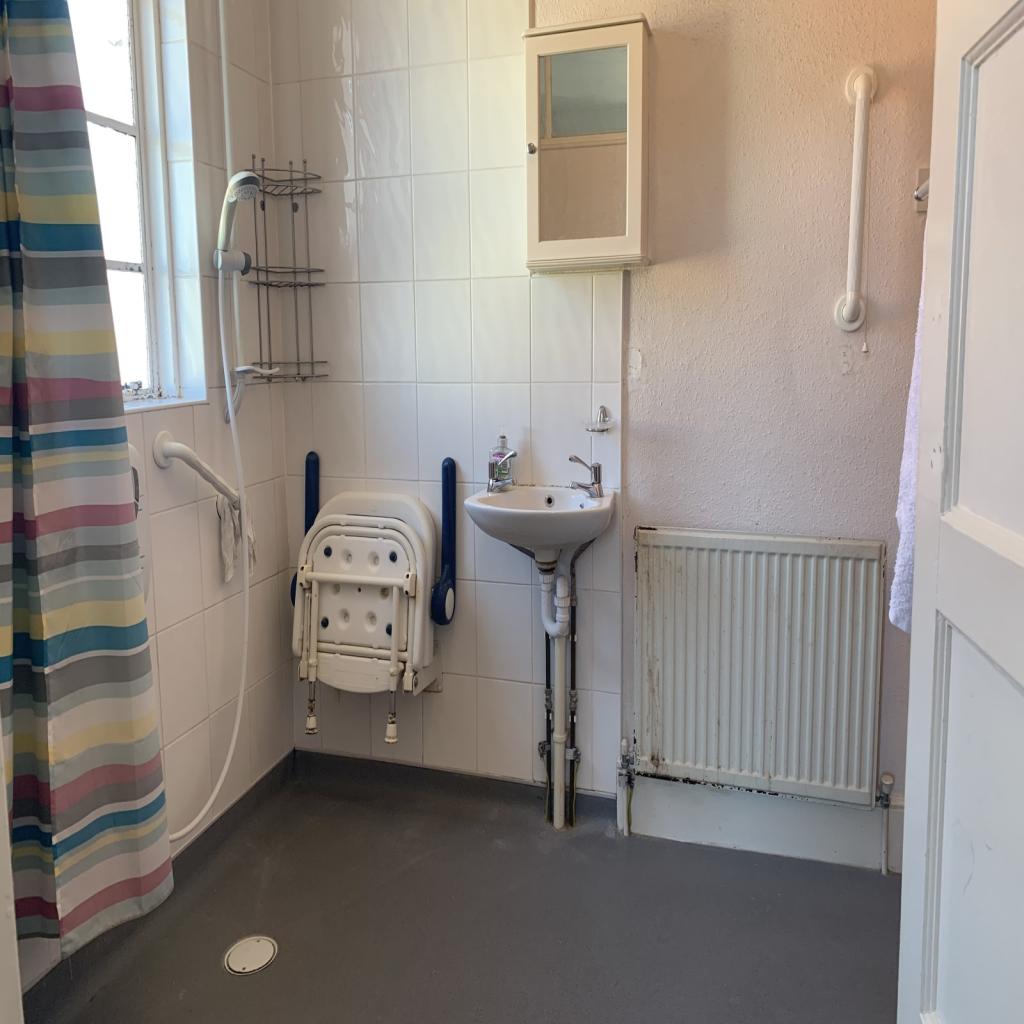
- Upstairs wet room with access to bedroom four
- Garage door leading to parking area
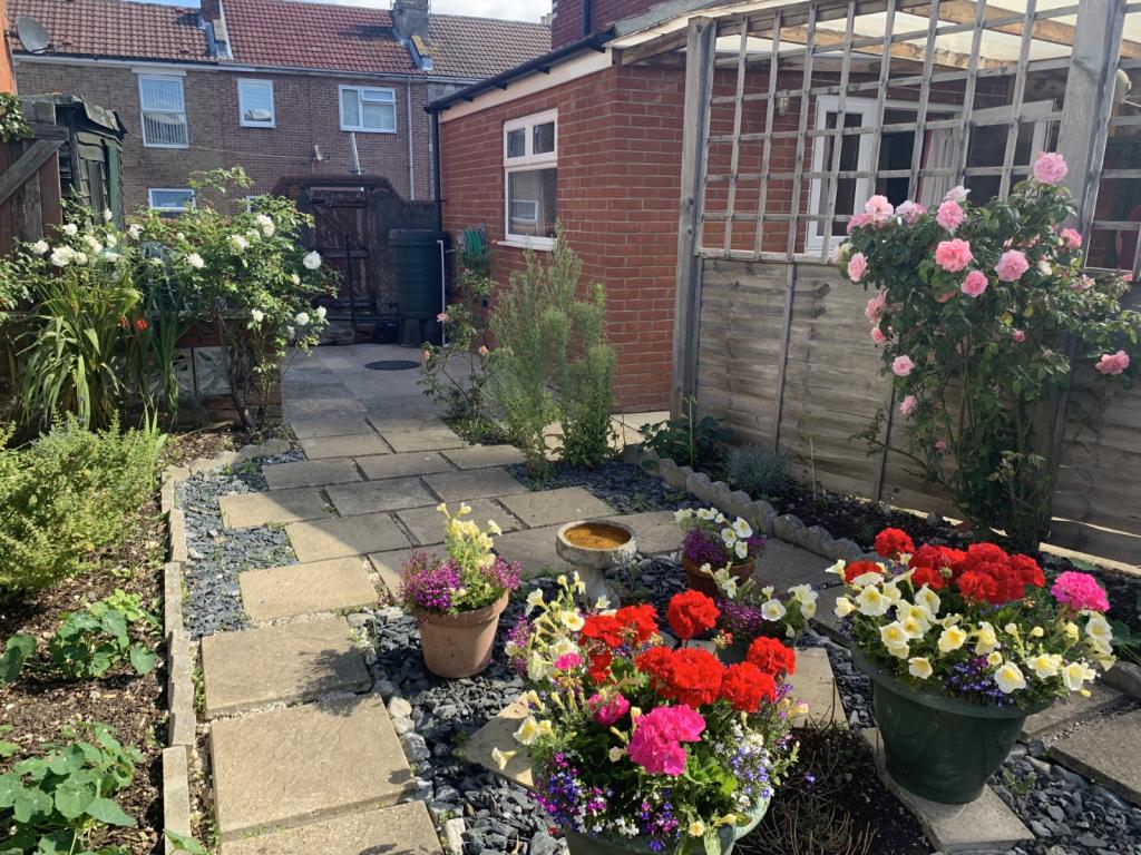
- Mature rear garden
- No onward chain
Additional details
- Parking
- Yes
- Garden
- Yes
Description
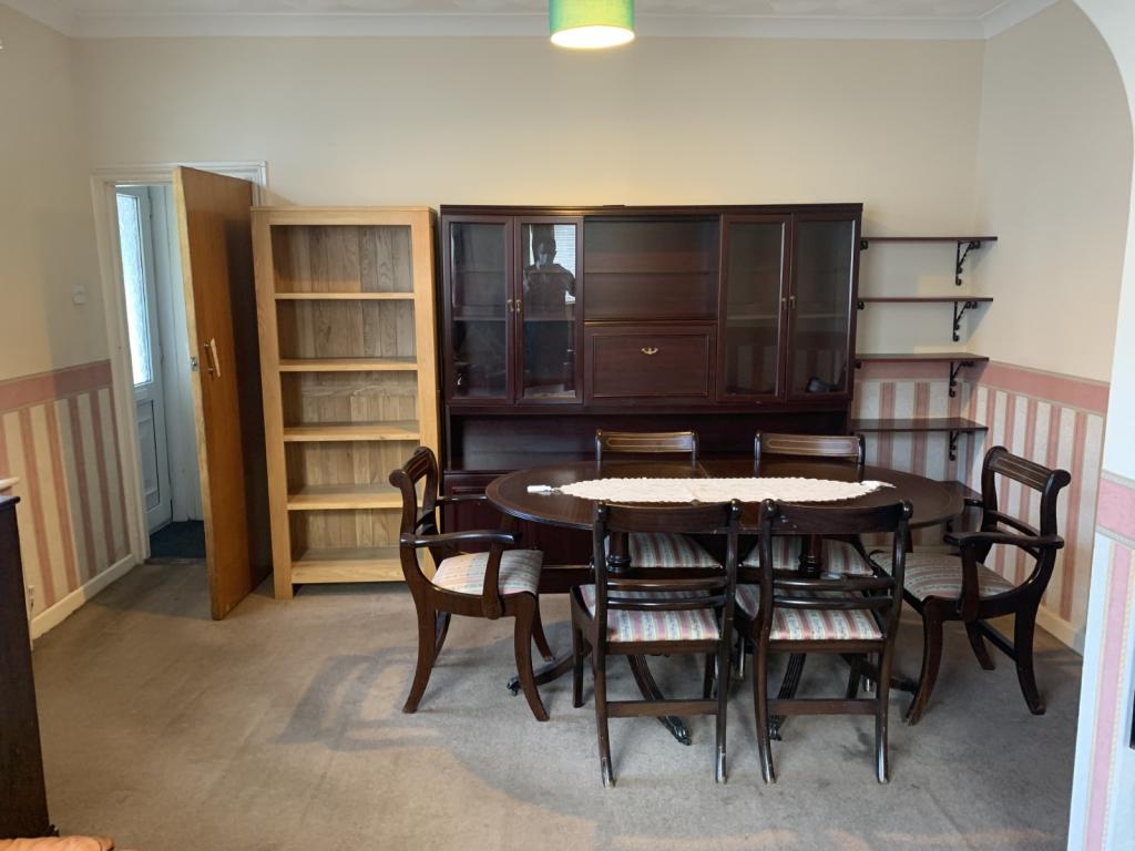
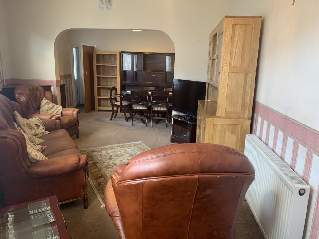
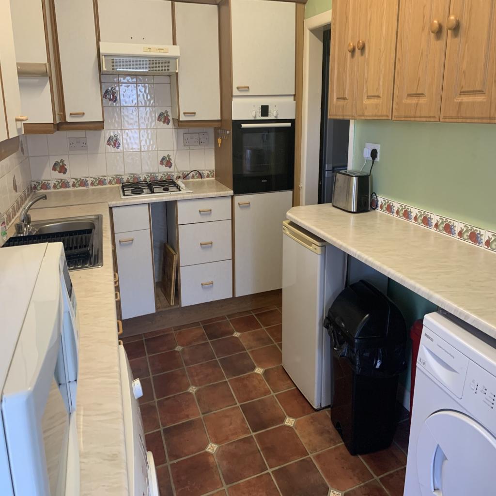
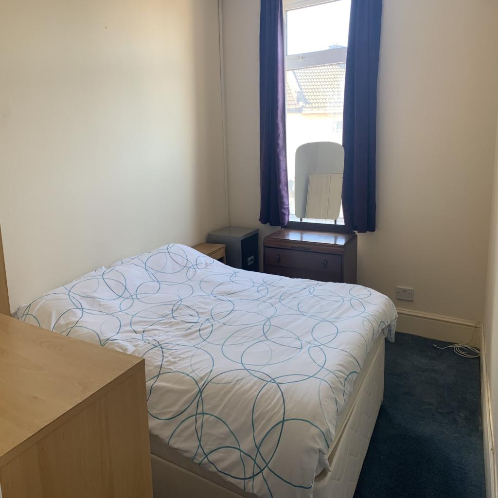
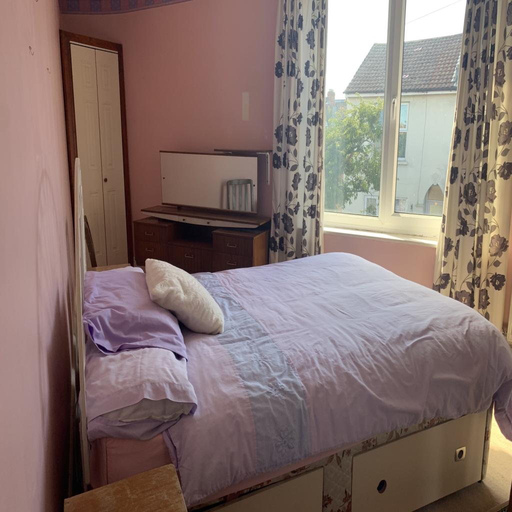
Four bedroom semi detached family home offering versatile accommodation. You must view this property to appreciate the size on offer. The property comprises: entrance porch, fitted kitchen, lounge/dining room, and bedroom with Wet room. To the 1st floor there are two double bedrooms and a wet room leading to bedroom four. Externally there is a garden and parking accessed via garage door. Offered with no onward chain and updating is required. View now…
Listed by
Portsmouth
Countrywide UK Sales - Connells
Reference: 72261162
EPC Rating & Upgrade Cost
Current rating: C
Potential rating: B
Inspection date: 05/07/2017
Expiry date: 04/07/2027
Current heating cost: £448/year
Potential heating cost: £452/year
Recommendations
- Low energy lighting for all fixed outlets (30)
- Solar water heating (6,000)
- Solar photovoltaic panels, 2.5 kWp (8,000)
Flood risk
Zone: 1
Risk: Low
Job (default Low)
Floorplans
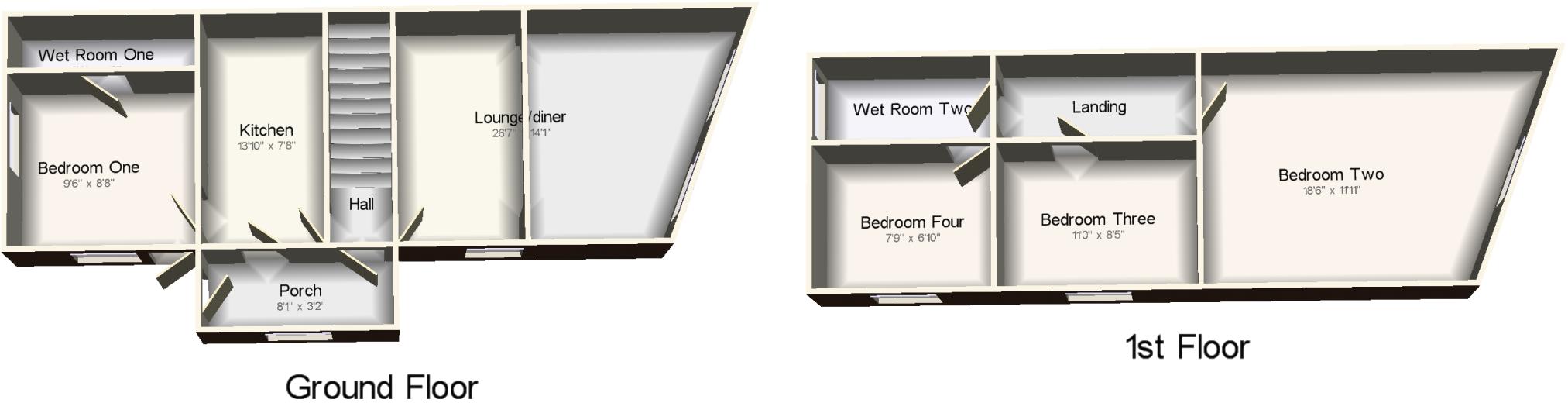
CWQuickSketch.jpg
EPC Graphs

EPC
EPC.jpg
Price history
| Event | Date | Price | % change |
|---|---|---|---|
| Sold | 01/02/2021 (5 years ago) | £201,000 | — |
Source: HM Land Registry Price Paid Data. Crown copyright.
Sold Comparables
Same street and nearby sales within 0.25 miles (last 5 years). Data from Land Registry Price Paid.
| Address | Price | Date | Type |
|---|---|---|---|
| 300 TWYFORD AVENUE, PORTSMOUTH, PO2 8NT | £320,000 | 19/12/2025 | Semi-detached |
| Same street 44 WALDEN ROAD, STAMSHAW, PORTSMOUTH, PO2 8PJ | £228,000 | 31/03/2025 | Terraced |
| Same street 62 WALDEN ROAD, STAMSHAW, PORTSMOUTH, PO2 8PJ | £227,000 | 30/08/2024 | Terraced |
| Same street 6 WALDEN ROAD, STAMSHAW, PORTSMOUTH, PO2 8PJ | £225,000 | 14/06/2023 | Terraced |
| Same street 82 WALDEN ROAD, STAMSHAW, PORTSMOUTH, PO2 8PJ | £245,000 | 26/05/2023 | Terraced |
| Same street 80 WALDEN ROAD, STAMSHAW, PORTSMOUTH, PO2 8PJ | £180,000 | 24/03/2023 | Terraced |
| Same street 58 WALDEN ROAD, STAMSHAW, PORTSMOUTH, PO2 8PJ | £207,000 | 14/01/2022 | Terraced |
Street average: £218,667 (6 sales)
Area average: £320,000 (1 sale)
Capital growth trend
Land Registry outcode average: last 12 months vs 5y and 10y ago (from sold prices).
House Price Index (HM Land Registry — official index, not sold-price averages): Portsmouth. Series: Semi-detached. As of March 2026.
Rental Range
Estimated market rent for Portsmouth. Low = conservative, Realistic = average, Optimistic = best case.
Based on Local Authority from postcode lookup → Portsmouth.
LHA (30th percentile) floor for Portsmouth: £1,296/mo (Apr 2025 – Mar 2026)
Location
Nearby
Nearest stations, universities and amenities (distance from property).
| Type | Name | Distance |
|---|---|---|
| Bus stop | Stamshaw School | 0.0 miles |
| Bus stop | Twyford Avenue | 0.1 miles |
| Shop | Widley Food & Wine | 0.1 miles |
| Shop | The Co-operative Food | 0.2 miles |
| Train station | Hilsea | 1.3 miles |
| Train station | Portsmouth and Southsea | 1.6 miles |
| University | Careers and Employability Service | 1.8 miles |
| University | St Andrew's Court Information Centre | 1.8 miles |
| Hospital | Forton Medical Centre | 2.9 miles |
| Hospital | Elmleigh Hospital | 5.5 miles |
Street-level crime
| Category | Count |
|---|---|
| Violence and sexual offences | 114 |
| Shoplifting | 45 |
| Vehicle crime | 40 |
| Anti-social behaviour | 34 |
| Public order | 29 |
| Criminal damage and arson | 25 |
| Other theft | 18 |
| Drugs | 12 |
| Other crime | 9 |
| Burglary | 7 |
| Possession of weapons | 4 |
| Robbery | 3 |
| Bicycle theft | 2 |
| Total incidents | 342 |
Within 1 mile during Apr 2026. Source: data.police.uk (England & Wales).
Schools nearby
Nearest open schools with Ofsted ratings (England). Closed schools are not shown. Data from Get Information about Schools and Ofsted.
| Name | Type | Distance | Ofsted |
|---|---|---|---|
| Stamshaw Junior School | Primary | 0.1 miles | Good — 15 Jan 2024 |
| The Harbour School | Other | 0.2 miles | — (Inspected (no overall grade)) |
| Stamshaw Infant Academy | Primary | 0.2 miles | Good — 8 Jan 2015 |
| Corpus Christi Catholic Primary School | Primary | 0.3 miles | Good — 23 Jun 2024 |
| King's Academy Northern Parade (Infant) | Primary | 0.6 miles | — (Inspected (no overall grade)) |
Rental Comparables
Rental listings exist nearby, but none matched the 4-bedroom count for this property.
Rent-driven metrics
Based on Area rent estimate.
- Rent ratio — Monthly rent ÷ purchase price (1% rule). 1%+ = strong, 0.8–1% = okay, <0.8% = weak for cashflow.
- Max investor price — Rent ÷ 0.8%; the price at which rent would be 0.8% of price (Stoke-style target).
- Target investor price — Rent ÷ 1%; the price at which rent would be 1% of price (strong cashflow band).
- Gross yield — Annual rent as % of purchase price (no costs).