29 ICKNIELD DRIVE
ILFORD, ILFORD, GREATER LONDON IG2 6SE
Property details
Floor area
81 m²
Council tax band
D
EPC rating
D
Year built
England and Wales: 1930-1949
Deprivation
Decile 7 (20,930 of 33,755)
Street crime
403 incidents within 1 mile (Apr 2026)
Additional details
- Parking
- Yes
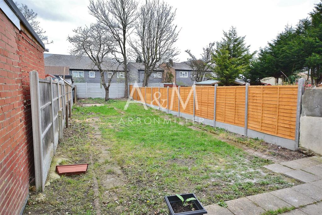
- Garden
- Yes
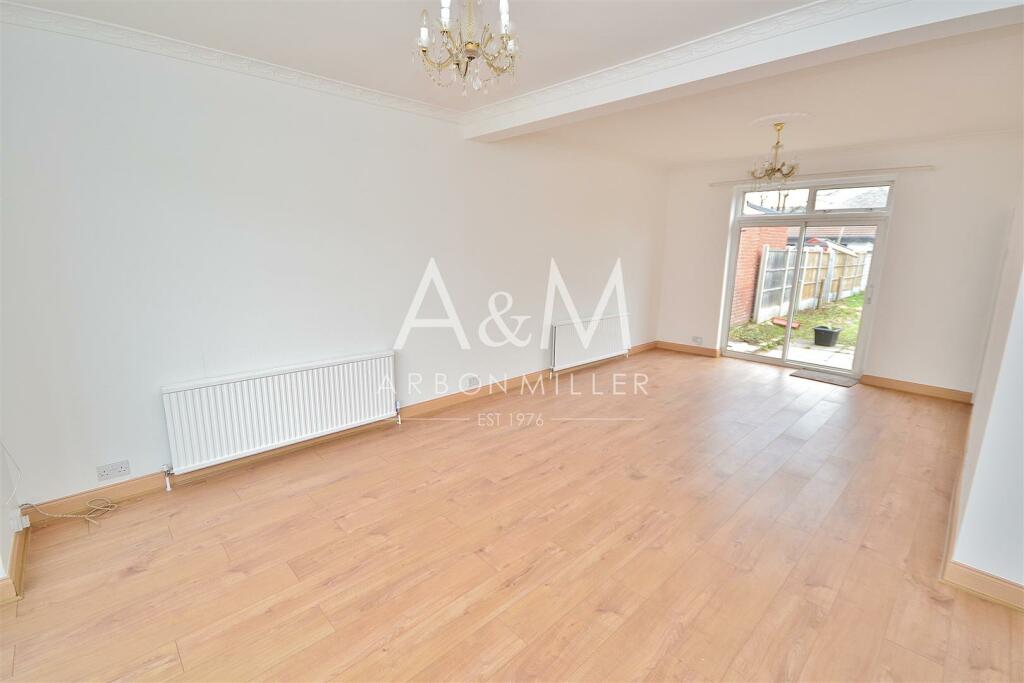
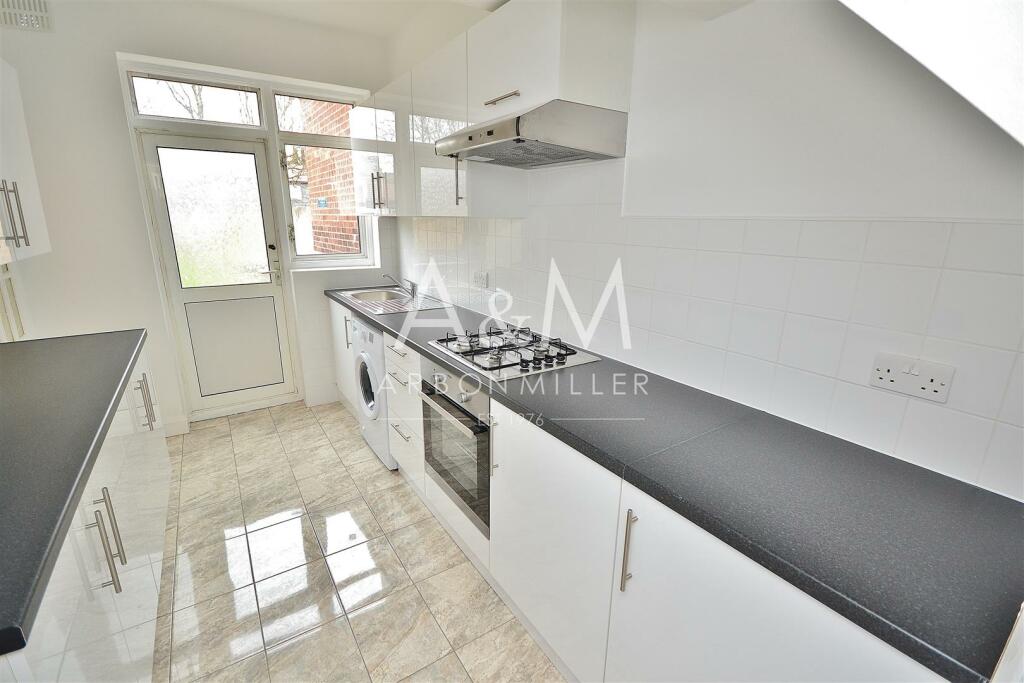
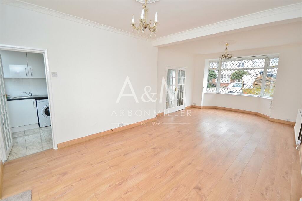
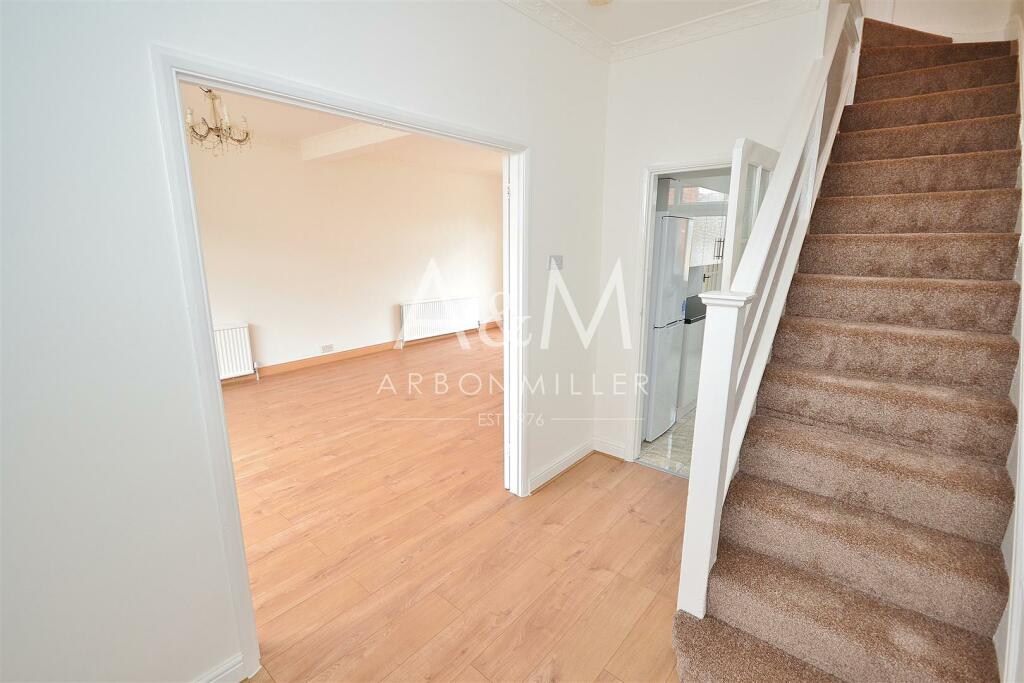
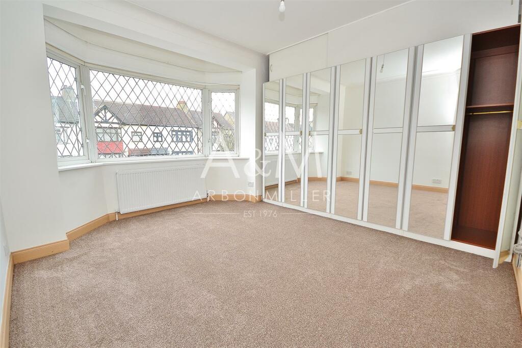
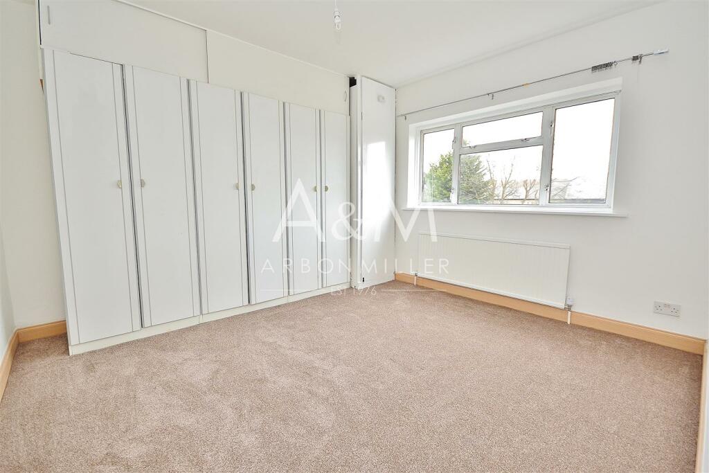
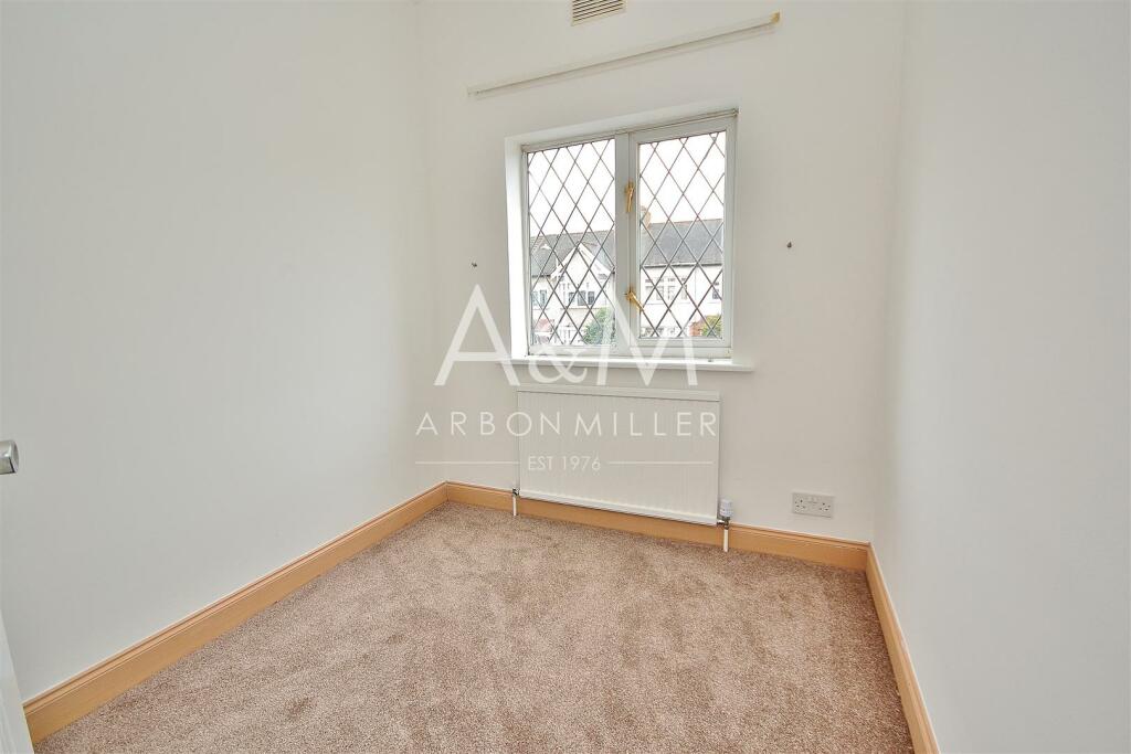
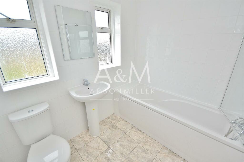
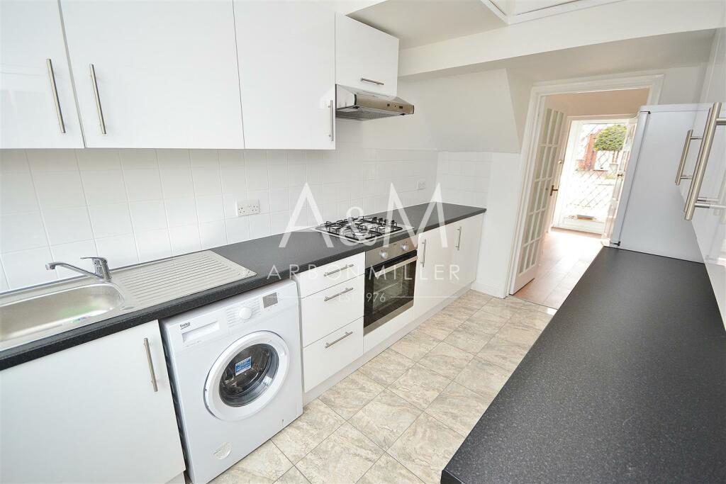
Description
Listed by
Barkingside
Arbon & Miller
Reference: 138650138
EPC Rating & Upgrade Cost
Current rating: D
Potential rating: B
Inspection date: 14/11/2018
Expiry date: 13/11/2028
Recommendations
- 50 mm internal or external wall insulation (14,000)
- Floor insulation (suspended floor) (1,200)
- Low energy lighting for all fixed outlets (15)
- Upgrade heating controls (450)
- Replace boiler with new condensing boiler (3,000)
- Flue gas heat recovery in conjunction with boiler (900)
- Solar water heating (6,000)
- Solar photovoltaic panels, 2.5 kWp (8,000)
Flood risk
Zone: 1
Risk: Low
Job (default Low)
Floorplans
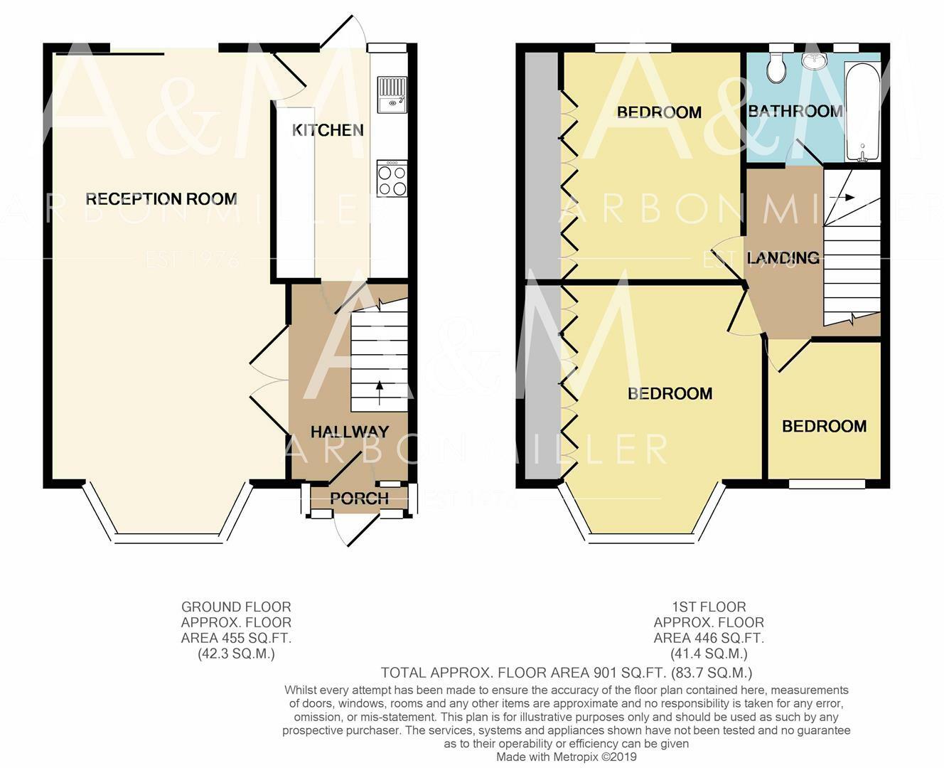
IcknieldDrive-printw.jpg
EPC Graphs
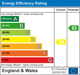
EE Rating
FENSA Certificates
This property has 2 FENSA certificate(s) on record, indicating window/door installations by FENSA-approved installers.
FENSA Certificate #13655443
Property Details
Street: 29 Icknield Drive
Town: ILFORD
Postcode: IG2 6SE
Installation Details
Items: 2 windows and 1 door
Certificate Issued: 15/07/2019
Work Completed: 07/07/2019
This certificate data was retrieved from FENSA's database
FENSA Certificate #2407902
Property Details
Street: 29 Icknield Drive
Town: ILFORD
Postcode: IG2 6SE
Installation Details
Items: 2 doors
Certificate Issued: 17/01/2005
Work Completed: 21/12/2004
This certificate data was retrieved from FENSA's database
What is FENSA? FENSA (Fenestration Self-Assessment Scheme) is a government-authorised scheme that monitors building regulation compliance for replacement windows and doors. Certificates indicate that work was completed by FENSA-approved installers.
Rental Range
Estimated market rent for Redbridge. Low = conservative, Realistic = average, Optimistic = best case.
Based on Local Authority from postcode lookup → Redbridge.
LHA (30th percentile) floor for Outer North East London: £1,496/mo (Apr 2025 – Mar 2026)
Location
Nearby
Nearest stations, universities and amenities (distance from property).
| Type | Name | Distance |
|---|---|---|
| Bus stop | Icknield Drive | 0.1 miles |
| Bus stop | Gantshill Crescent | 0.1 miles |
| Shop | Sakthi Cash & Carry | 0.2 miles |
| Shop | Tesco Express | 0.3 miles |
| Train station | Gants Hill | 0.5 miles |
| Train station | Newbury Park | 0.7 miles |
| University | University of Portsmouth Walthamstow Campus | 4.0 miles |
| Hospital | Neonatal Unit, L1 Z2 | 4.2 miles |
| Hospital | Rainbow Ward | 4.2 miles |
| University | Arden University Stratford Campus | 4.5 miles |
Street-level crime
| Category | Count |
|---|---|
| Violence and sexual offences | 123 |
| Anti-social behaviour | 77 |
| Shoplifting | 38 |
| Vehicle crime | 35 |
| Criminal damage and arson | 26 |
| Public order | 24 |
| Other theft | 23 |
| Drugs | 17 |
| Burglary | 10 |
| Robbery | 10 |
| Theft from the person | 9 |
| Other crime | 7 |
| Possession of weapons | 3 |
| Bicycle theft | 1 |
| Total incidents | 403 |
Within 1 mile during Apr 2026. Source: data.police.uk (England & Wales).
Schools nearby
Nearest open schools with Ofsted ratings (England). Closed schools are not shown. Data from Get Information about Schools and Ofsted.
| Name | Type | Distance | Ofsted |
|---|---|---|---|
| St Augustine's Catholic Primary School | Primary | 0.1 miles | Good — 4 Feb 2016 |
| Gearies Primary School | Primary | 0.2 miles | — (Inspected (no overall grade)) |
| Fullwood Primary School | Primary | 0.4 miles | Outstanding — 17 Jun 2024 |
| Newbury Park Primary School | Primary | 0.5 miles | — (Inspected (no overall grade)) |
| Valentines High School | Secondary | 0.5 miles | Outstanding — 21 Nov 2021 |
Rental Comparables
Rental listings exist nearby, but none matched the 3-bedroom count for this property.