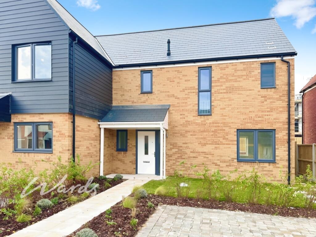
Citronella Road Chestfield Ct5
CT5 3RW
£1,500 pcm
Property details
Council tax band
C
Deprivation
Decile 8 (24,338 of 33,755)
Street crime
67 incidents within 1 mile (Mar 2026)
Key features
- Fabulous interior
- Open plan living
- Contemporary styling
- Master en suite
- Driveway parking
- Private garden
Additional details
- Electricity
- Mains supply
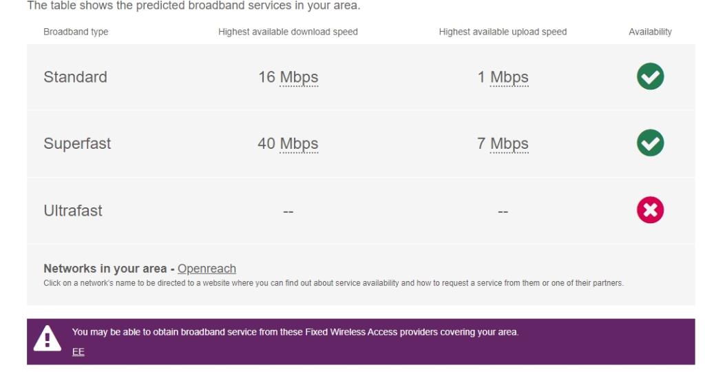
- Broadband
- None
- Water
- Mains supply
- Sewerage
- Mains supply
- Heating
- Gas central
- Accessibility
- No wheelchair access
- Parking
- Allocated
- Garden
- Private garden
- Listed property
- No
- Restrictions
- No
- Rights of way
- No
- Flooded in last 5 years
- No
Description
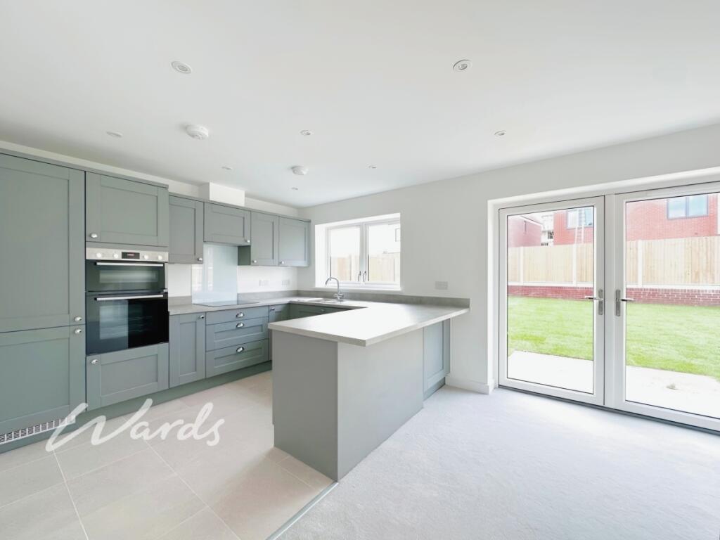
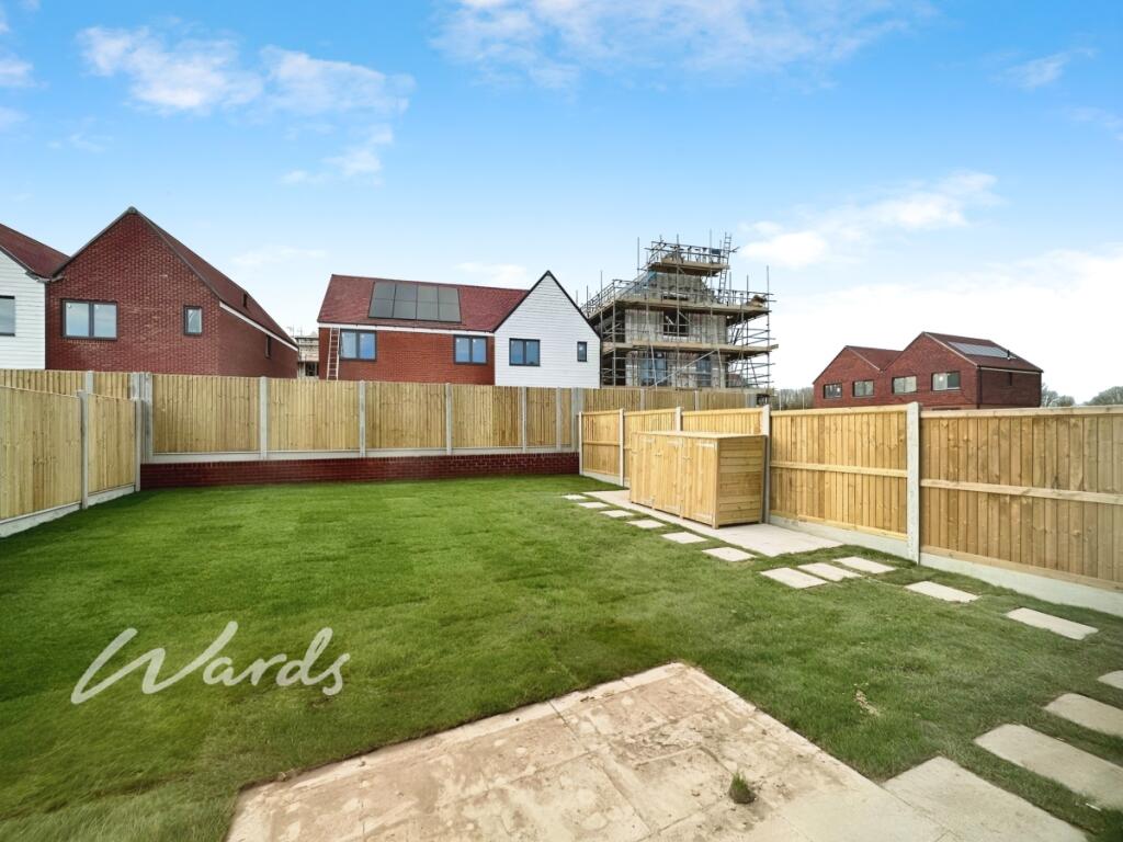
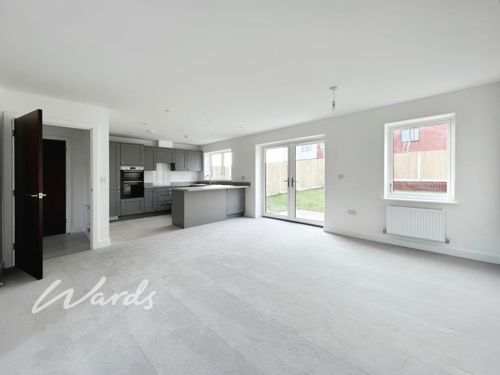
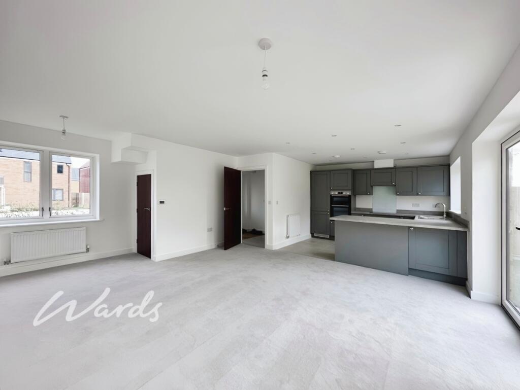
The property features a spacious entrance hallway, cloakroom, and a beautifully designed open-plan living area with useful under-stairs storage and French doors leading out to a private enclosed rear garden — perfect for relaxing or entertaining.
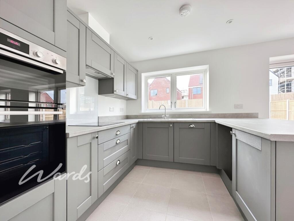
The modern kitchen comes fully equipped with an integrated oven, hob, fridge/freezer, and dishwasher, blending style and practicality seamlessly.
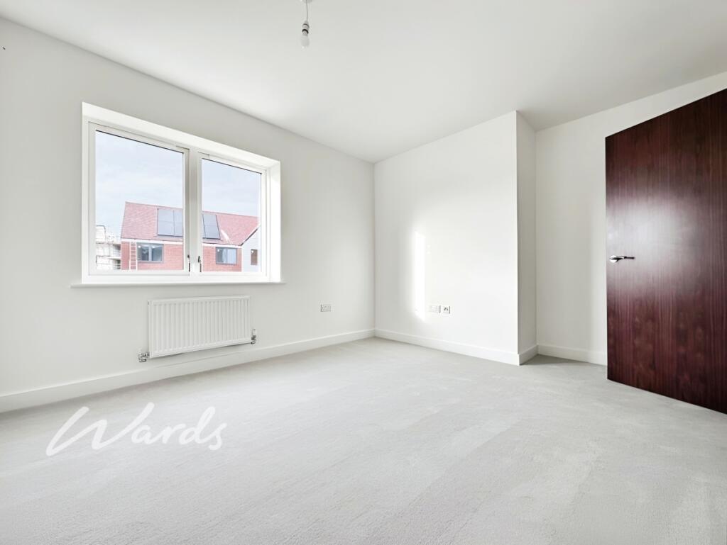
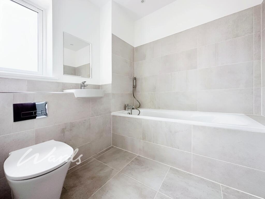
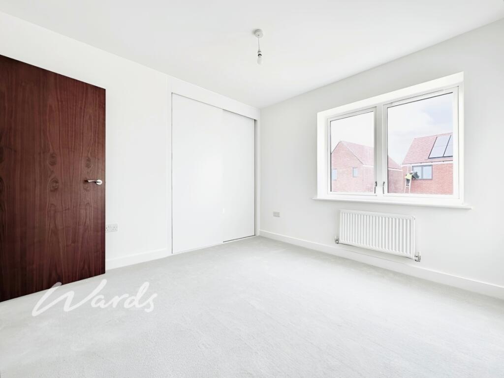
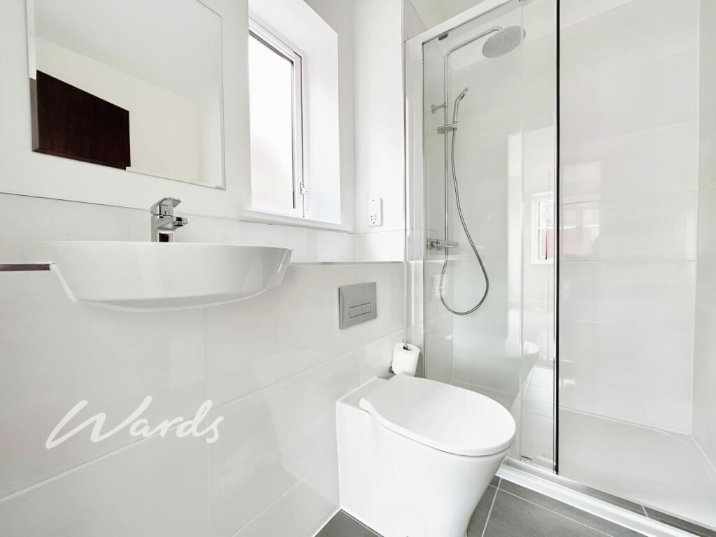
Upstairs, the master bedroom benefits from built-in wardrobes and a luxurious en suite shower room, while the second double bedroom is served by a well-appointed family bathroom.
Outside, the property boasts a private rear garden and driveway parking.
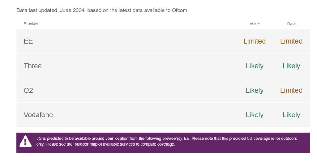
Situated on a fabulous development with excellent access to the surrounding area and within easy reach of Chestfield & Swalecliffe mainline train station, this property perfectly combines convenience and comfort. To check broadband and mobile phone coverage please visit Ofcom here ofcom.org.uk/phones-telecoms-and-internet/advice-for-consumers/advice/ofcom-checker
Listed by
Whitstable
Arun Estates
Reference: 168522386
EPC ratings on this postcode
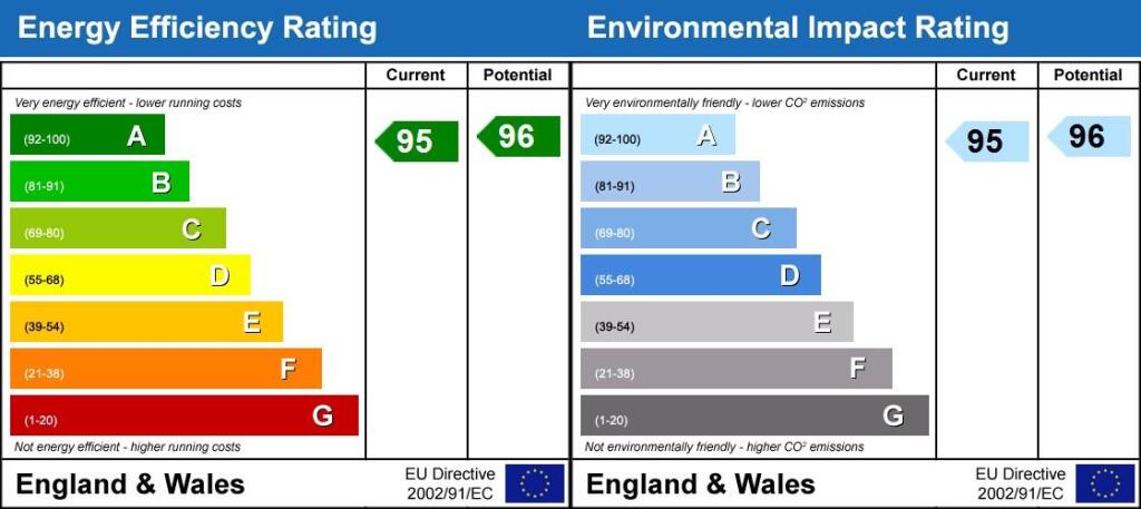
We don't have a matched EPC for this property yet. Below are efficiency scores and details for other addresses on this postcode.
| Address | Current | Potential | Floor area | Age band | Type |
|---|---|---|---|---|---|
| 1 Citronella Road, Chestfield, WHITSTABLE | 95 | 96 | 162 m² | — | Detached |
| 10 Citronella Road, Chestfield, WHITSTABLE | 95 | 96 | 162 m² | — | Detached |
| 11 Citronella Road, Chestfield, WHITSTABLE | 97 | 98 | 98 m² | — | Detached |
| 12 Citronella Road, Chestfield, WHITSTABLE | 96 | 98 | 98 m² | — | Detached |
| 13 Citronella Road, Chestfield, WHITSTABLE | 95 | 96 | 162 m² | — | Detached |
| 14 Citronella Road, Chestfield, WHITSTABLE | 95 | 96 | 86 m² | — | Detached |
| 15 Citronella Road, Chestfield, WHITSTABLE | 84 | 96 | 80 m² | — | Detached |
| 16 Citronella Road, Chestfield, WHITSTABLE | 84 | 96 | 80 m² | — | Detached |
| 17 Citronella Road, Chestfield, WHITSTABLE | 95 | 96 | 86 m² | — | Detached |
| 18 Citronella Road, Chestfield, WHITSTABLE | 95 | 96 | 162 m² | — | Detached |
| 19 Citronella Road, Chestfield, WHITSTABLE | 97 | 98 | 98 m² | — | Detached |
| 2 Citronella Road, Chestfield, WHITSTABLE | 96 | 97 | 95 m² | — | Detached |
| 3 Citronella Road, Chestfield, WHITSTABLE | 84 | 96 | 80 m² | — | Detached |
| 4 Citronella Road, Chestfield, WHITSTABLE | 84 | 96 | 80 m² | — | Detached |
| 5 Citronella Road, Chestfield, WHITSTABLE | 95 | 96 | 86 m² | — | Detached |
Flood risk
Zone: 1
Risk: Low
Job (default Low)
Floorplans
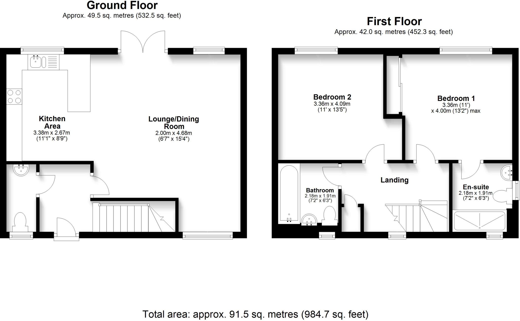
FP Citronella
EPC Graphs
Energy Performanc...
Rental Range
Estimated market rent for Canterbury. Low = conservative, Realistic = average, Optimistic = best case.
Based on Local Authority from postcode lookup → Canterbury.
LHA (30th percentile) floor for Colchester: £793/mo (Apr 2025 – Mar 2026)
Location
Address
Bermuda Road
Nearby
Nearest stations, universities and amenities (distance from property).
| Type | Name | Distance |
|---|---|---|
| Shop | Screwfix | 0.1 miles |
| Shop | B&Q | 0.3 miles |
| Bus stop | Highgate Road | 0.3 miles |
| Hospital | Whitstable and Tankerton Hospital | 0.6 miles |
| Train station | Chestfield & Swalecliffe | 0.6 miles |
| Train station | Whitstable | 1.1 miles |
| Hospital | Estuary View Medical Centre | 2.1 miles |
| University | Nexus (Templeman) | 3.9 miles |
| University | Skills for Academic Success | 4.0 miles |
Street-level crime
| Category | Count |
|---|---|
| Violence and sexual offences | 22 |
| Anti-social behaviour | 11 |
| Vehicle crime | 9 |
| Shoplifting | 6 |
| Burglary | 5 |
| Other theft | 5 |
| Criminal damage and arson | 3 |
| Drugs | 2 |
| Other crime | 2 |
| Public order | 2 |
| Total incidents | 67 |
Within 1 mile during Mar 2026. Source: data.police.uk (England & Wales).
Schools nearby
Nearest open schools with Ofsted ratings (England). Closed schools are not shown. Data from Get Information about Schools and Ofsted.
| Name | Type | Distance | Ofsted |
|---|---|---|---|
| Swalecliffe Community Primary School | Primary | 0.5 miles | Good — 19 Jul 2013 |
| The Whitstable School | Secondary | 0.9 miles | Good — 24 Apr 2024 |
| St Mary's Catholic Primary School, Whitstable | Primary | 1.0 miles | Good — 8 Jun 2015 |
| Westmeads Community Infant School | Primary | 1.3 miles | Requires improvement — 6 Jul 2022 |
| Whitstable and Seasalter Endowed Church of England Junior School | Primary | 1.4 miles | Outstanding — 24 Feb 2017 |
Rental Comparables
Loading rental comparables for this postcode. Refresh in a few minutes.
Enter House Number
Enter the house number to help us retrieve more accurate pricing history and property data.
Please log in to submit or correct the house number for this listing.
Log in to continue