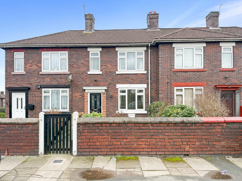
Vivian Road
Fenton, Stoke-on-Trent, ST4 3JQ
Property details
Council tax band
A
Deprivation
Decile 2 (3,491 of 33,755)
Street crime
232 incidents within 1 mile (May 2026)
Key features
- Mid Town House
- Two Bedrooms
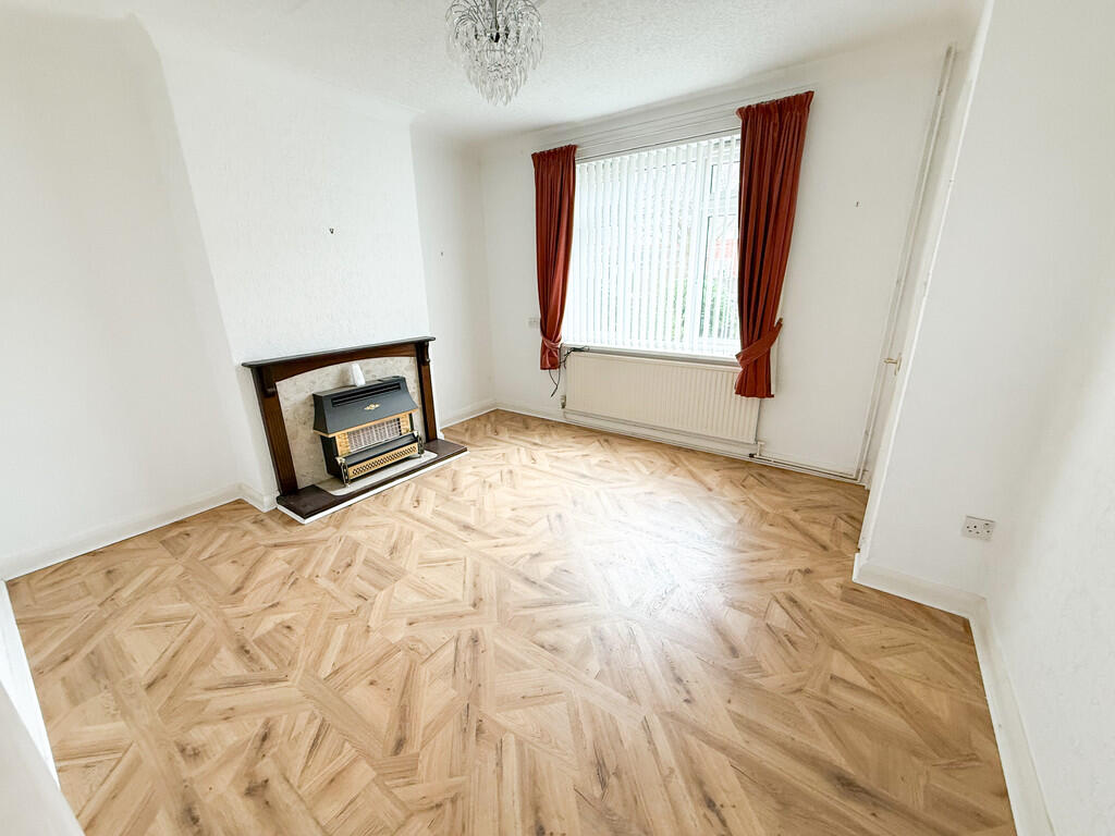
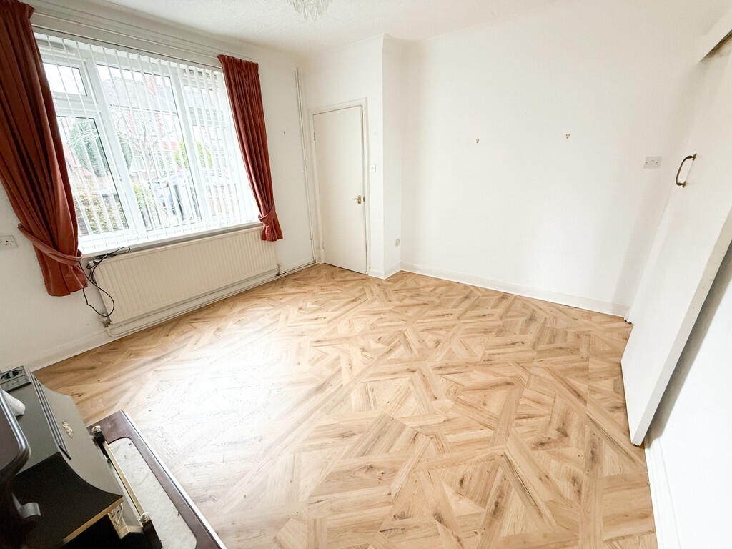
- Lounge
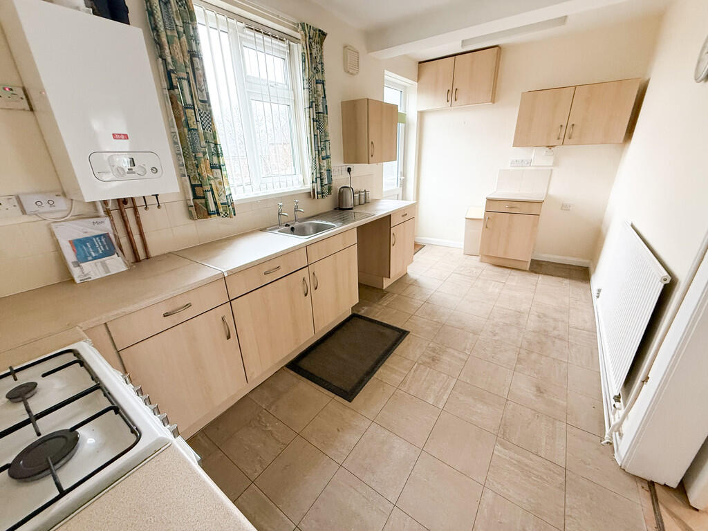
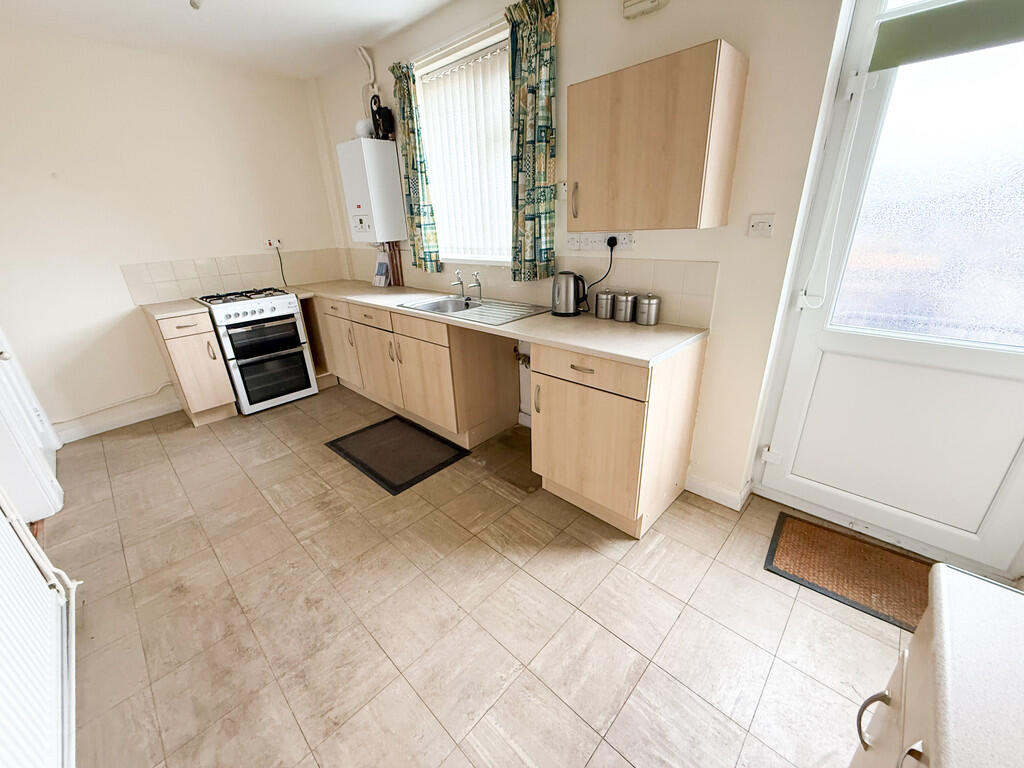
- Kitchen Diner
- New Fitted Bathroom
- New Combi GCH
- Rear Garden
- Deposit £951.92
- Council Tax Band A
- A Must View
Additional details
- Electricity
- Mains supply
- Water
- Mains supply
- Sewerage
- Mains supply
- Heating
- Gas central
- Parking
- On street
- Garden
- Yes
Description
ENTRANCE HALL Composite double glazed entrance door, stairs leading to the first floor. Door into:
LOUNGE 13' 0" x 12' 1" (3.96m x 3.68m) Feature fireplace with marble effect inset and hearth and gas fire. Sliding door opening into:
KITCHEN DINER 16' 3" x 7' 9" (4.95m x 2.36m) Fitted kitchen, under stairs storage cupboard, newly fitted combi boiler. UPVC double glazed door leading to the garden.
FIRST FLOOR
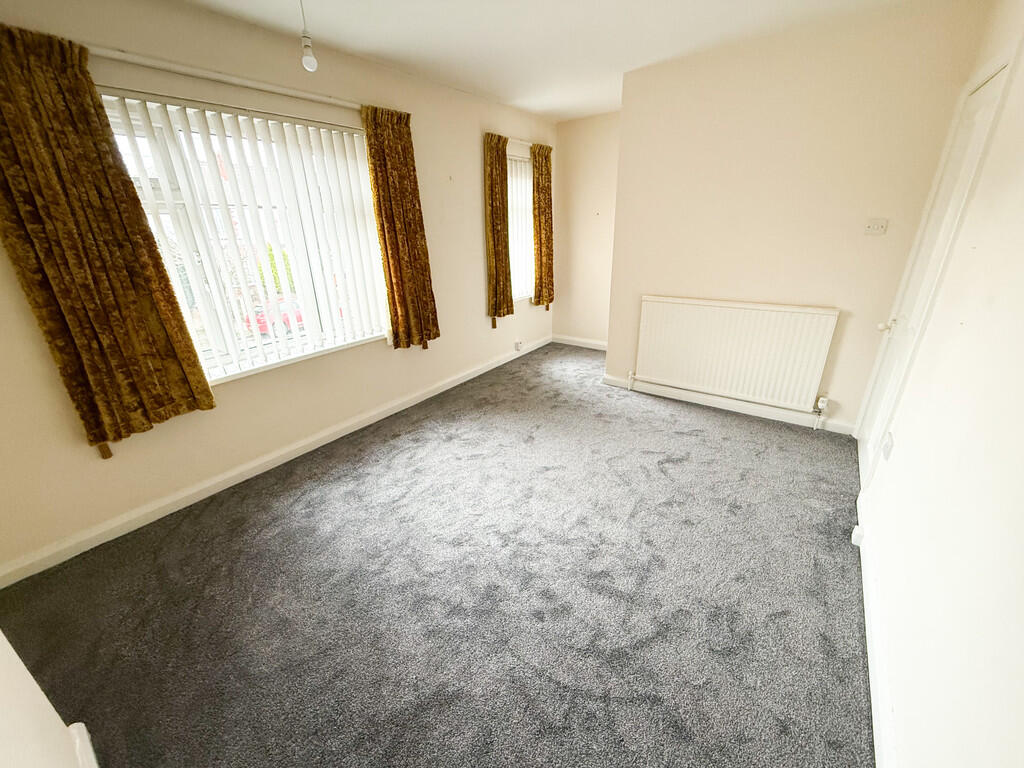
LANDING Access to the loft, doors leading into the bedrooms and bathroom. Newly fitted carpet.
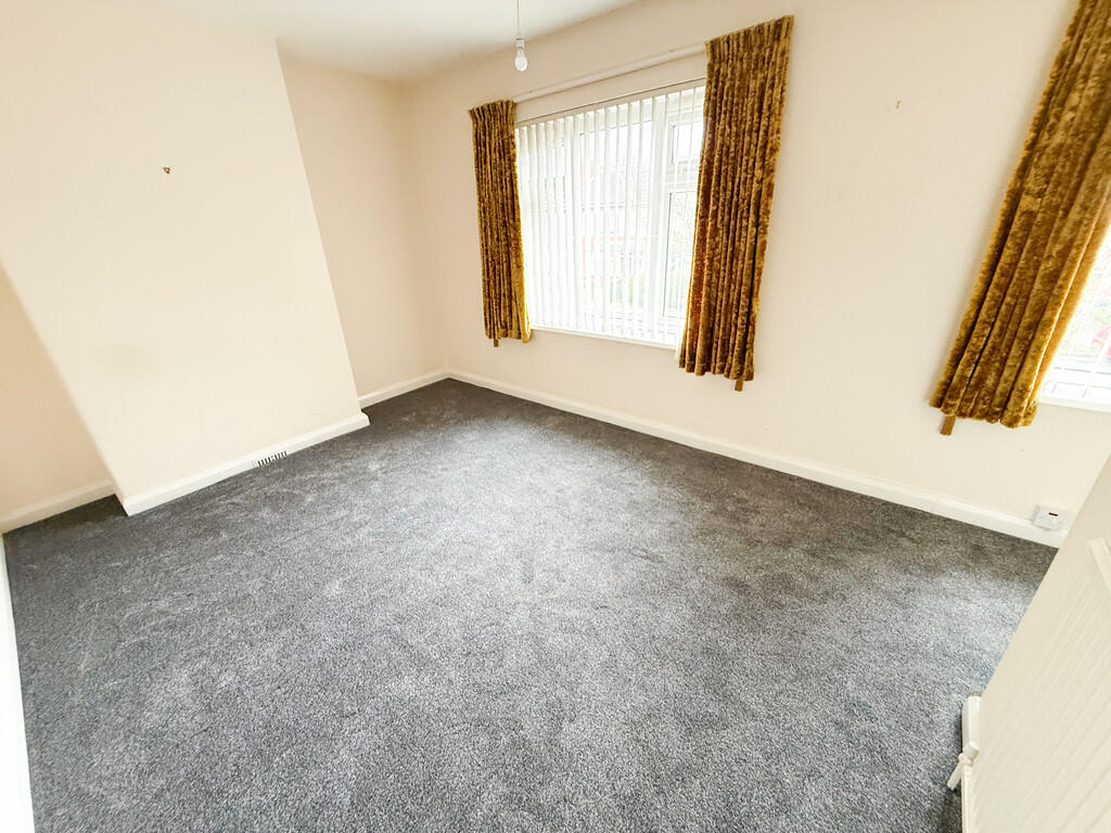
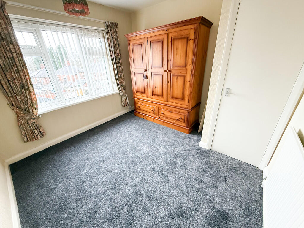
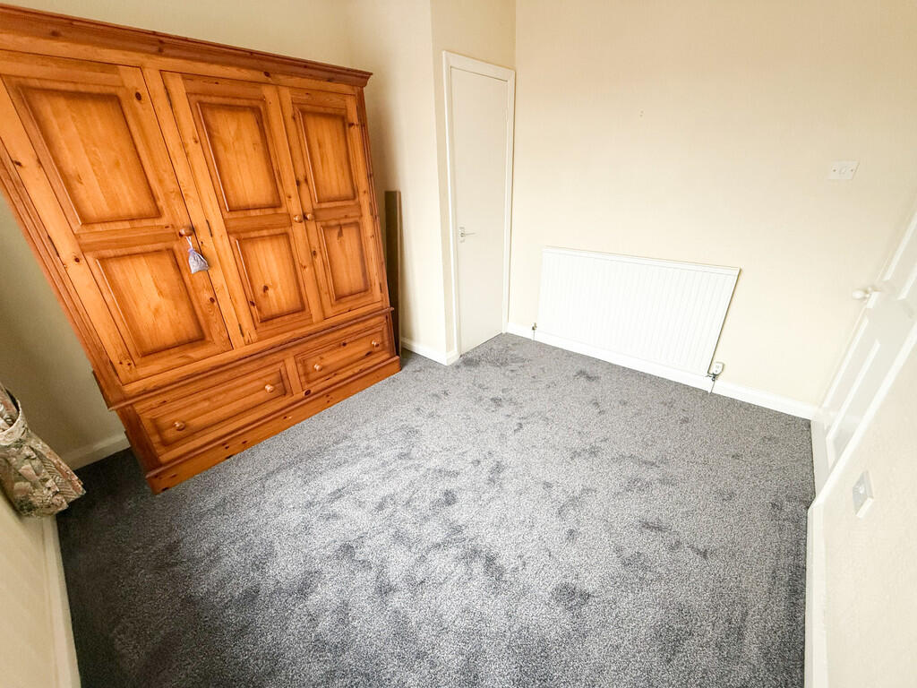
BEDROOM 16' 3" Max x 9' 10" (4.95m x 3m) Built in cupboard. Newly fitted carpet.
BEDROOM 10' 2" x 9' 9" (3.1m x 2.97m) Built in cupboard. Newly fitted carpet.
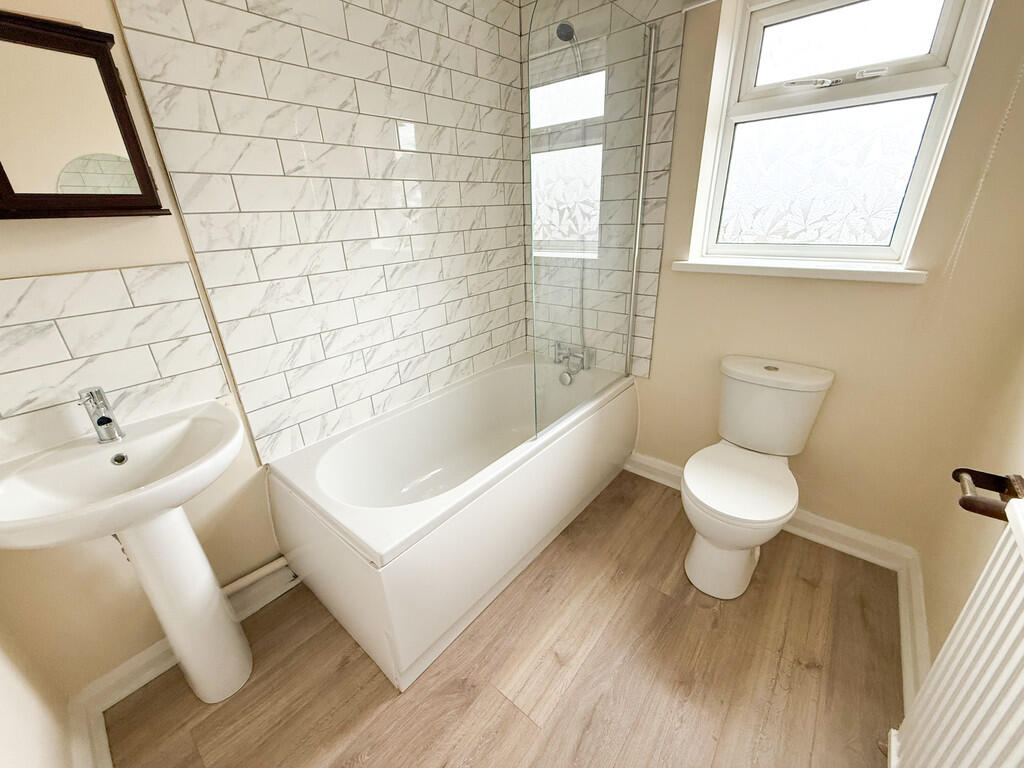
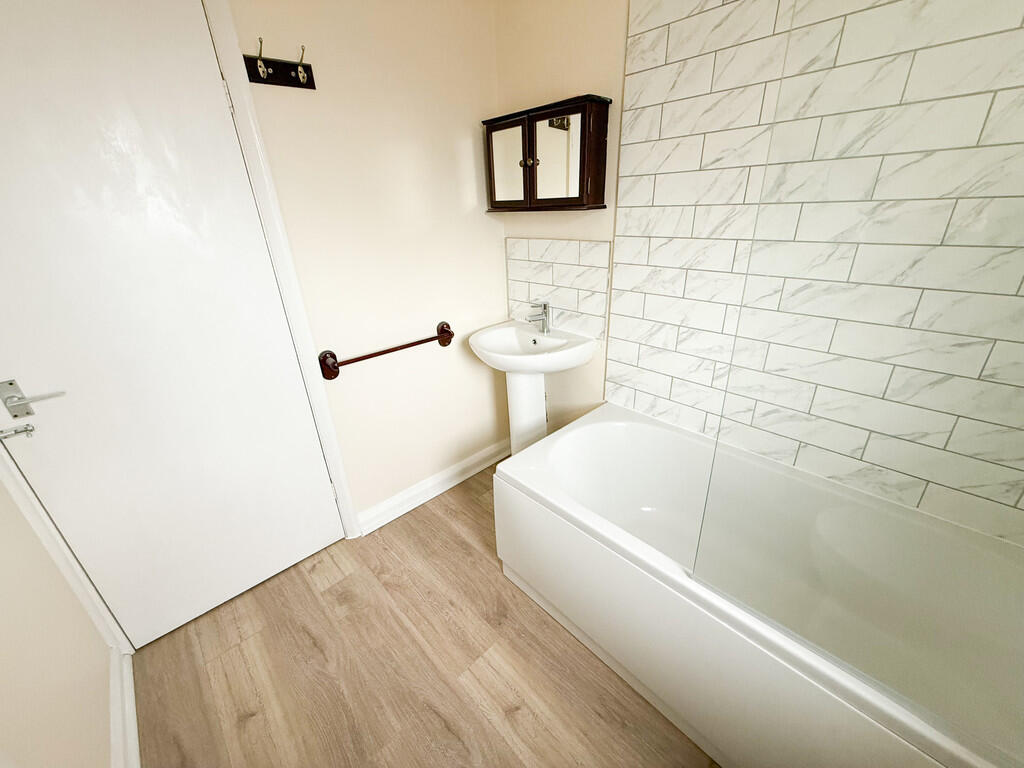
BATHROOM 7' 1" x 6' 1" (2.16m x 1.85m) Newly fitted bathroom with three piece white suite consisting of panelled bath with shower over, WC and hand basin. Part tiled walls.
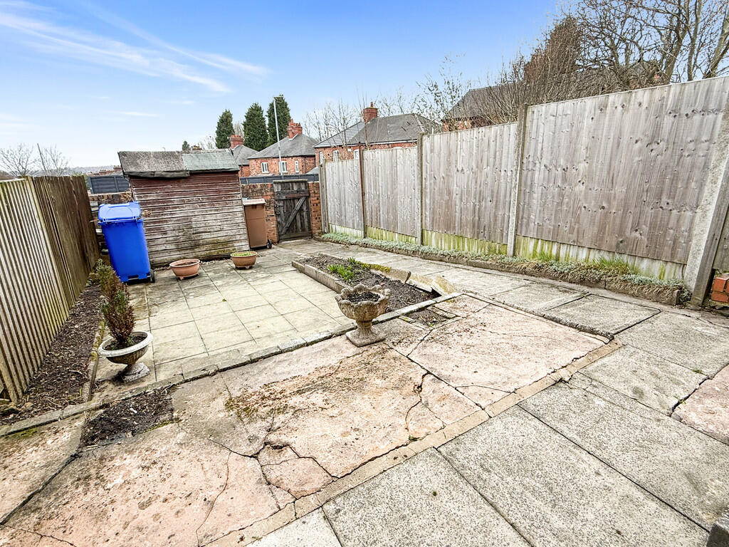
EXTERIOR ** There are low maintenance gardens to the front and rear.
Listed by
Stoke-on-Trent
Findahome Online
Reference: 172699913
EPC ratings on this postcode
We don't have a matched EPC for this property yet. Below are efficiency scores and details for other addresses on this postcode.
| Address | Current | Potential | Floor area | Age band | Type |
|---|---|---|---|---|---|
| 10 Vivian Road, STOKE-ON-TRENT | 72 | 88 | 59 m² | England and Wales: 2003-2006 | Terraced |
| 100, Vivian Road, STOKE-ON-TRENT | 69 | 86 | 70 m² | England and Wales: 1930-1949 | Terraced |
| 102 VIVIAN ROAD, FENTON, STOKE-ON-TRENT | 66 | 82 | 61 m² | England and Wales: 1930-1949 | Terraced |
| 104, Vivian Road, STOKE-ON-TRENT | 65 | 85 | 63 m² | England and Wales: 1950-1966 | Terraced |
| 106, Vivian Road, STOKE-ON-TRENT | 66 | 82 | 62 m² | England and Wales: 1930-1949 | Terraced |
| 110 Vivian Road, STOKE-ON-TRENT | 73 | 90 | 62 m² | England and Wales: 1930-1949 | Terraced |
| 114 Vivian Road, STOKE-ON-TRENT | 54 | 79 | 84 m² | England and Wales: 1950-1966 | Detached |
| 116, Vivian Road, STOKE-ON-TRENT | 71 | 86 | 70 m² | England and Wales: 1930-1949 | Terraced |
| 118, Vivian Road, STOKE-ON-TRENT | 72 | 89 | 67 m² | England and Wales: 1930-1949 | Terraced |
| 120 Vivian Road, STOKE-ON-TRENT | 84 | 89 | 73 m² | England and Wales: 1930-1949 | Terraced |
| 120, Vivian Road, STOKE-ON-TRENT | 71 | 87 | 62 m² | England and Wales: 1930-1949 | Terraced |
| 122 VIVIAN ROAD, FENTON, STOKE-ON-TRENT | 67 | 82 | 62 m² | England and Wales: 1930-1949 | Terraced |
| 126 Vivian Road, STOKE-ON-TRENT | 73 | 89 | 73 m² | England and Wales: 1930-1949 | Terraced |
| 126, Vivian Road, STOKE-ON-TRENT | 51 | 90 | 64 m² | England and Wales: 1930-1949 | Terraced |
| 126, Vivian Road, STOKE-ON-TRENT | 44 | 81 | 67 m² | England and Wales: 1930-1949 | Terraced |
Flood risk
Zone: 1
Risk: Low
Job (default Low)
EPC Graphs

EPC Front Page
Rental Range
Estimated market rent for Stoke-on-Trent. Low = conservative, Realistic = average, Optimistic = best case.
Based on Local Authority from postcode lookup → Stoke-on-Trent.
LHA (30th percentile) floor for Staffordshire North: £479/mo (Apr 2025 – Mar 2026)
Location
Address
Elliot Road
Nearby
Nearest stations, universities and amenities (distance from property).
| Type | Name | Distance |
|---|---|---|
| Shop | KTF Kitchens | 0.2 miles |
| Bus stop | Unknown | 0.2 miles |
| Shop | Spar | 0.4 miles |
| Train station | Longton | 1.0 miles |
| Train station | Stoke-on-Trent | 1.2 miles |
| Hospital | Royal Stoke University Hospital | 2.4 miles |
| Hospital | North Staffordshire Nuffield Hospital | 3.0 miles |
| University | Keele University | 4.8 miles |
| University | Buxton & Leek College | 9.2 miles |
Street-level crime
| Category | Count |
|---|---|
| Violence and sexual offences | 80 |
| Anti-social behaviour | 54 |
| Criminal damage and arson | 22 |
| Shoplifting | 19 |
| Other theft | 14 |
| Public order | 13 |
| Drugs | 6 |
| Possession of weapons | 6 |
| Robbery | 5 |
| Burglary | 4 |
| Other crime | 4 |
| Vehicle crime | 3 |
| Theft from the person | 2 |
| Total incidents | 232 |
Within 1 mile during May 2026. Source: data.police.uk (England & Wales).
Schools nearby
Nearest open schools with Ofsted ratings (England). Closed schools are not shown. Data from Get Information about Schools and Ofsted.
| Name | Type | Distance | Ofsted |
|---|---|---|---|
| Co-op Academy Glebe | Primary | 0.1 miles | Outstanding — 16 Jul 2024 |
| Christ Church CofE Primary Academy | Primary | 0.4 miles | Good — 14 Jun 2023 |
| Our Lady's Catholic Academy | Primary | 0.5 miles | Good — 21 May 2015 |
| St Peter's CofE Academy | Secondary | 0.7 miles | Requires improvement — 28 Mar 2023 |
| Glebedale School | Other | 0.7 miles | Good — 25 Jan 2023 |
Rental Comparables
Residential lets from OpenRent and Rightmove for the area (same bedroom count). Use to validate rent estimates. Student lets are excluded.
Average rent: £785/mo (74 listings)
Enter House Number
Enter the house number to help us retrieve more accurate pricing history and property data.
Please log in to submit or correct the house number for this listing.
Log in to continue