Cannon Street
Preston, PR1 3NR
£595 pcm

Property details
Deprivation
Decile 2 (5,778 of 33,755)
Street crime
652 incidents within 1 mile (Apr 2026)
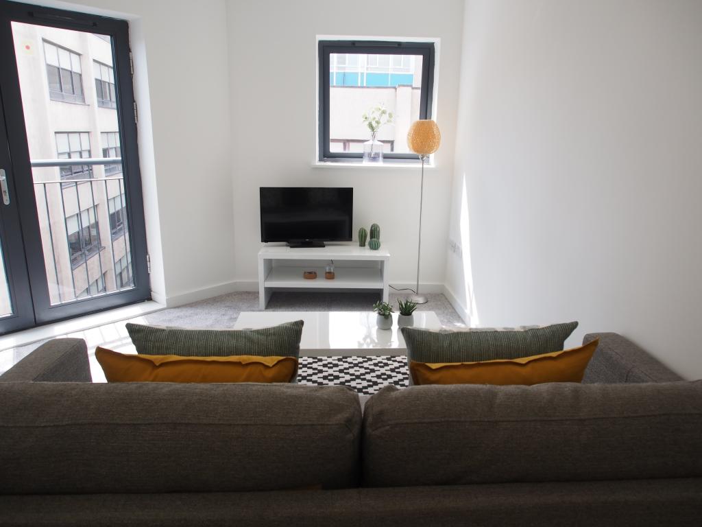
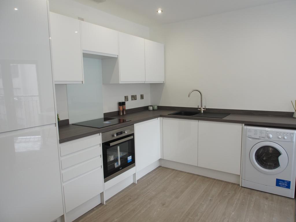
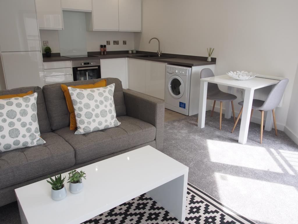
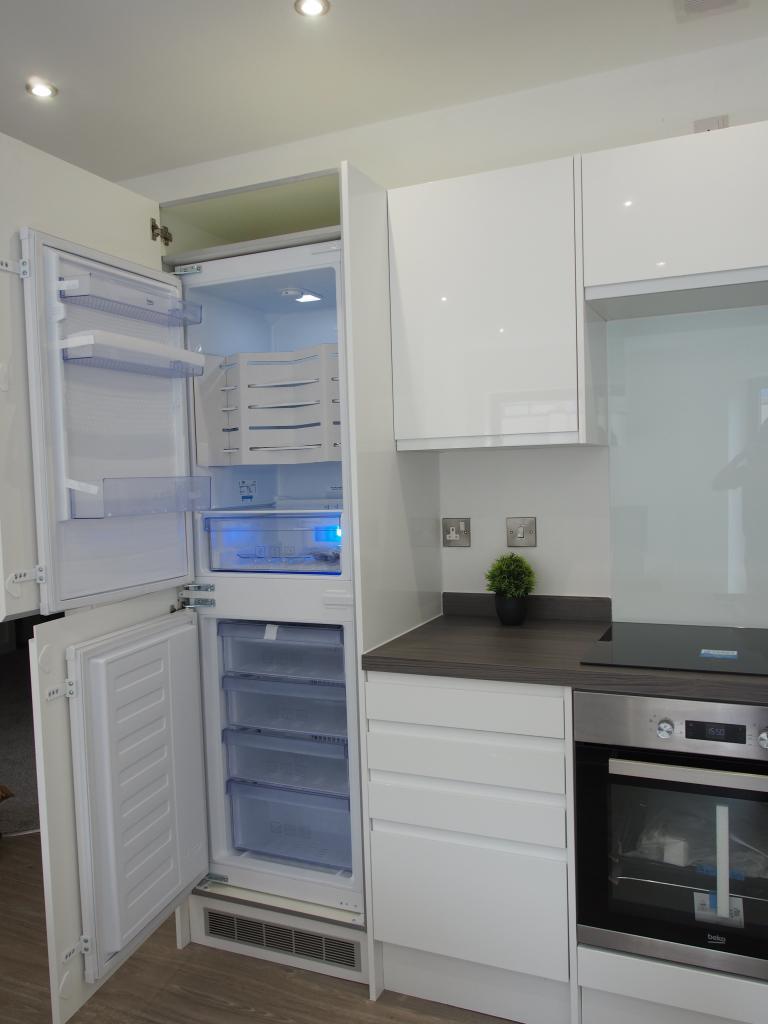
Description
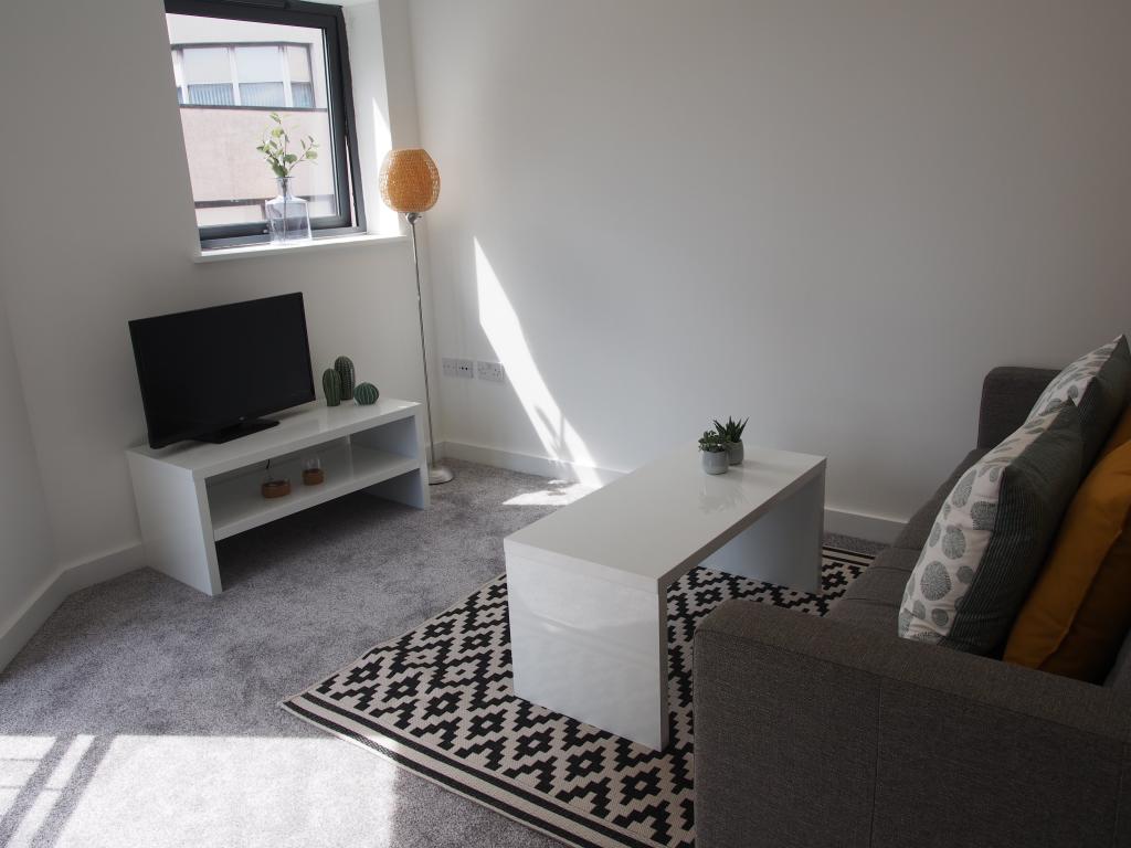
This 1 bed apartment offers stunning ultra modern living. The new development is located in the heart of Preston just minutes away from the main shopping area, restaurants and train station.,
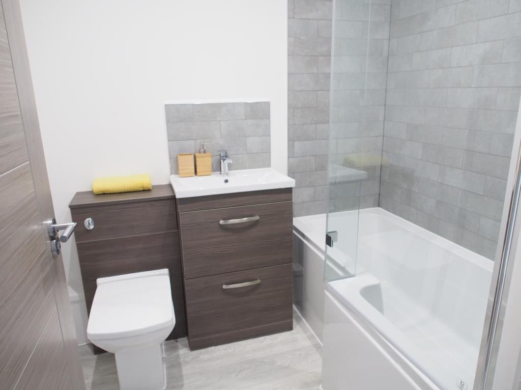
Comprising of spacious lounge with modern kitchen diner, 1 bedroom & bathroom.The neutral decor will compliment any furnishings.
EARLY VIEWING HIGHLY RECOMMENDED!
Listed by
Wigan
HG Premier Lettings
Reference: 105836729
EPC Rating & Upgrade Cost
Fetching EPC data… Refresh this page in a moment.
Flood risk
Zone: 1
Risk: Low
Job (default Low)
EPC Graphs
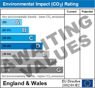
Environment Impact
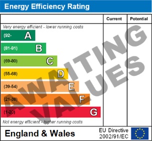
Energy Efficiency
Rental Range
Estimated market rent for Preston. Low = conservative, Realistic = average, Optimistic = best case.
Based on Local Authority from postcode lookup → Preston.
LHA (30th percentile) floor for Central Lancs: £449/mo (Apr 2025 – Mar 2026)
Location
Address
9 Cross Street
Nearby
Nearest stations, universities and amenities (distance from property).
| Type | Name | Distance |
|---|---|---|
| Shop | Waterstones | 0.1 miles |
| Shop | Slaters | 0.1 miles |
| Bus stop | Fishergate Stop E / Boots | 0.1 miles |
| Bus stop | Preston Waterstones (Stand F) | 0.1 miles |
| Train station | Preston | 0.3 miles |
| University | University of Lancashire | 0.7 miles |
| Hospital | Ramsay Fulwood Hall Hospital | 2.2 miles |
| Train station | Preston Riverside | 2.3 miles |
| Hospital | Royal Preston Hospital | 2.3 miles |
| University | Westleigh Conference Centre | 3.2 miles |
Street-level crime
| Category | Count |
|---|---|
| Violence and sexual offences | 232 |
| Anti-social behaviour | 108 |
| Public order | 55 |
| Shoplifting | 51 |
| Criminal damage and arson | 46 |
| Other theft | 45 |
| Drugs | 26 |
| Vehicle crime | 26 |
| Burglary | 16 |
| Other crime | 13 |
| Bicycle theft | 11 |
| Possession of weapons | 11 |
| Robbery | 7 |
| Theft from the person | 5 |
| Total incidents | 652 |
Within 1 mile during Apr 2026. Source: data.police.uk (England & Wales).
Schools nearby
Nearest open schools with Ofsted ratings (England). Closed schools are not shown. Data from Get Information about Schools and Ofsted.
| Name | Type | Distance | Ofsted |
|---|---|---|---|
| Imam Muhammad Zakariya School | Other | 0.1 miles | Good — 2 Apr 2024 |
| Stoneygate Nursery School | Nursery | 0.2 miles | Good — 9 Jun 2019 |
| St Augustine's Catholic Primary School, Preston | Primary | 0.3 miles | Good — 27 Feb 2012 |
| Cardinal Newman College | Other | 0.4 miles | — (No rating) |
| Frenchwood Community Primary School | Primary | 0.4 miles | Requires improvement — 14 Sep 2023 |
Rental Comparables
Residential lets from OpenRent and Rightmove for the area (same bedroom count). Use to validate rent estimates. Student lets are excluded.
| Title | Rent | Beds | Distance | As seen on |
|---|---|---|---|---|
| 1 Bed Terraced House, Stanley Place, PR1 | £875/mo | 1 | 0.43 miles | OpenRent |
Average rent: £875/mo (1 listing)