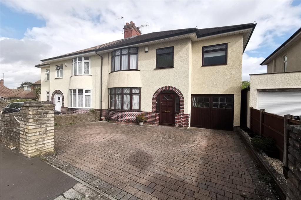
172 WELLINGTON HILL WEST
BRISTOL, CITY OF BRISTOL BS9 4QP
£525,000
Property details
Floor area
119 m²
EPC rating
D
Year built
England and Wales: 1930-1949
Last sold
£520,000 Apr 2020
Price per m²
£4,412/m²
Local average
£684,012 (-23.2%)
Deprivation
Decile 8 (25,013 of 33,755)
Street crime
448 incidents within 1 mile (Mar 2026)
Key features
- Offered With A Complete Chain
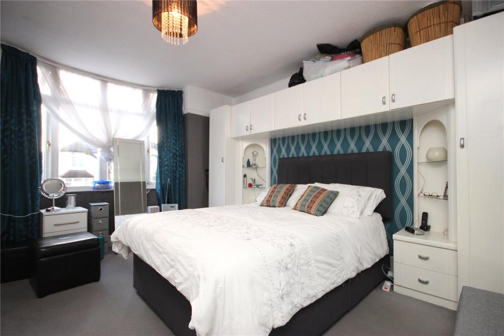
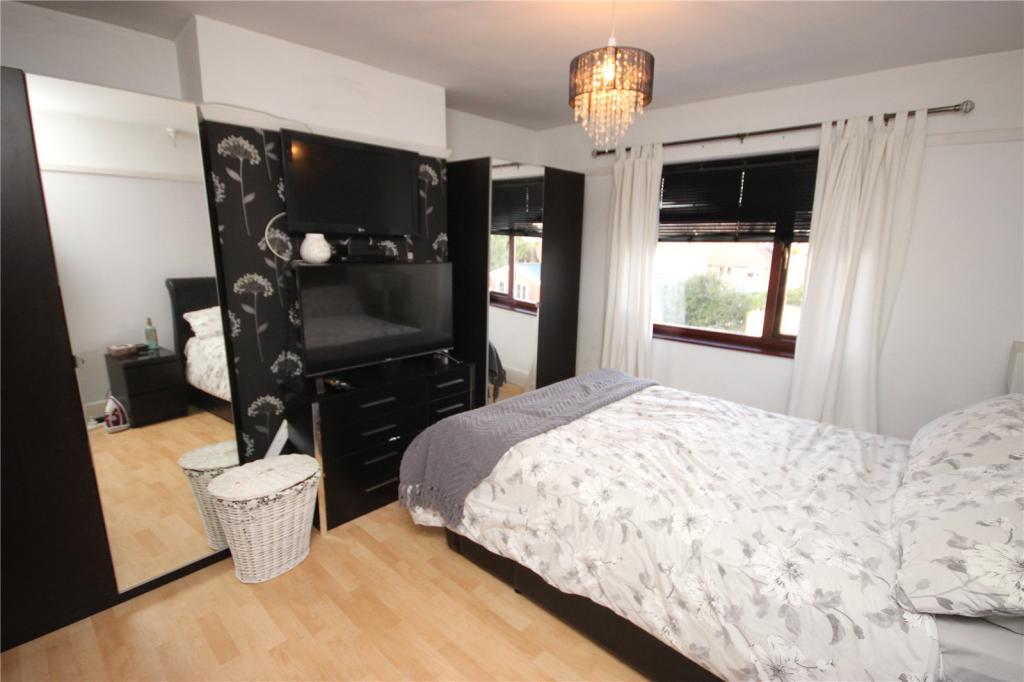
- Four Spacious Bedrooms
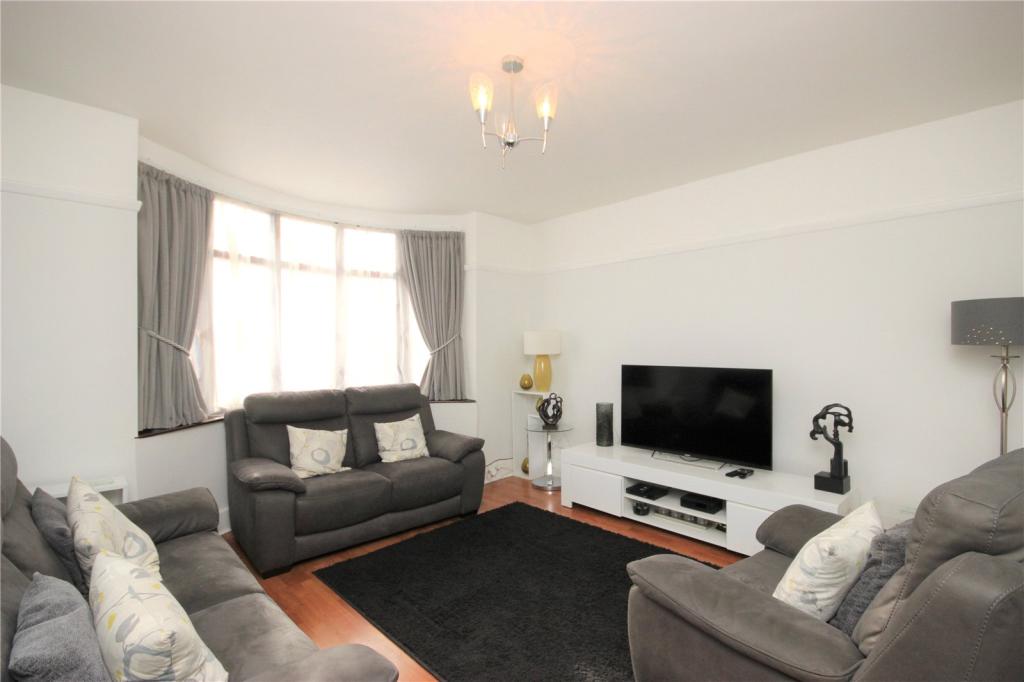
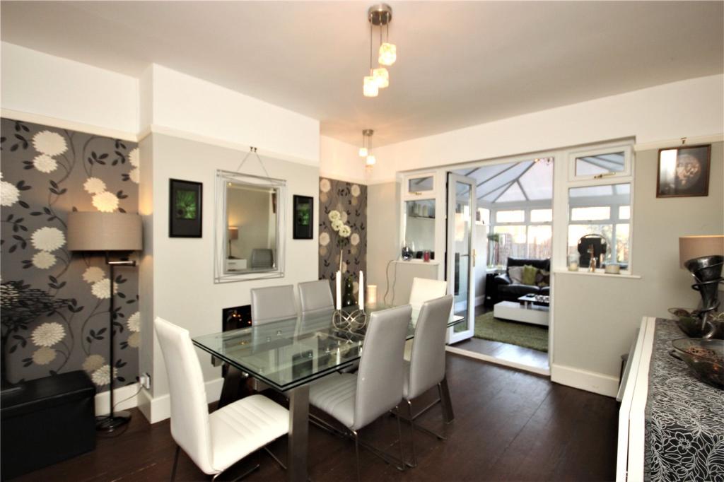
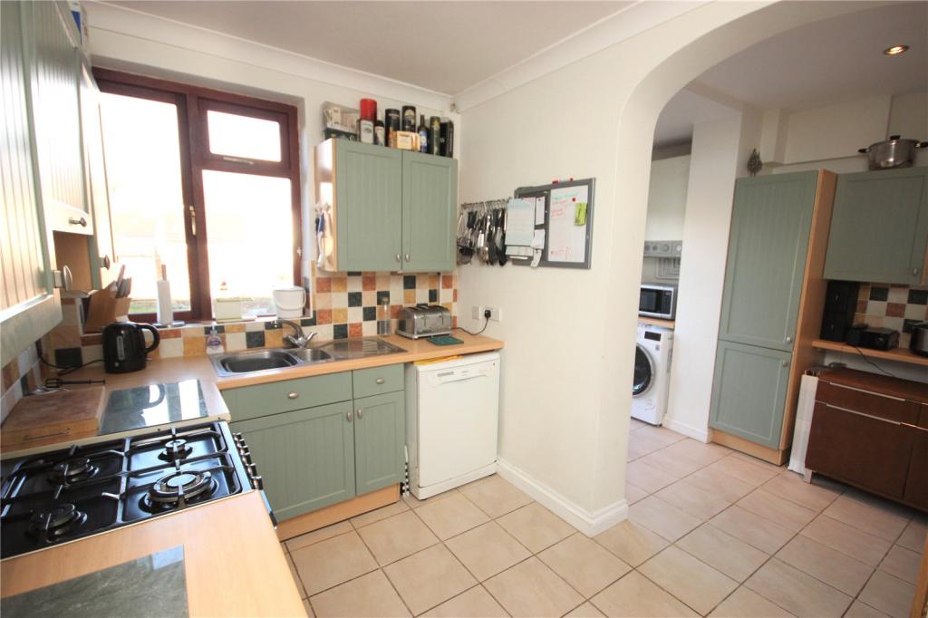
- Two Receptions
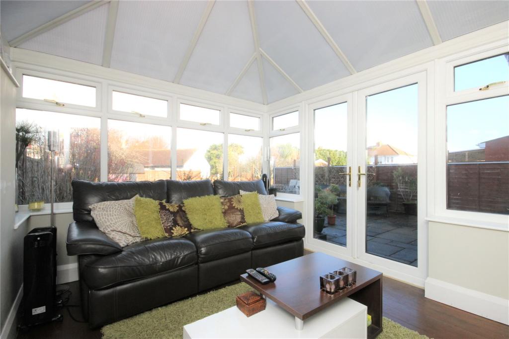
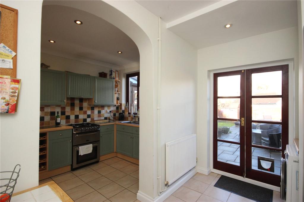
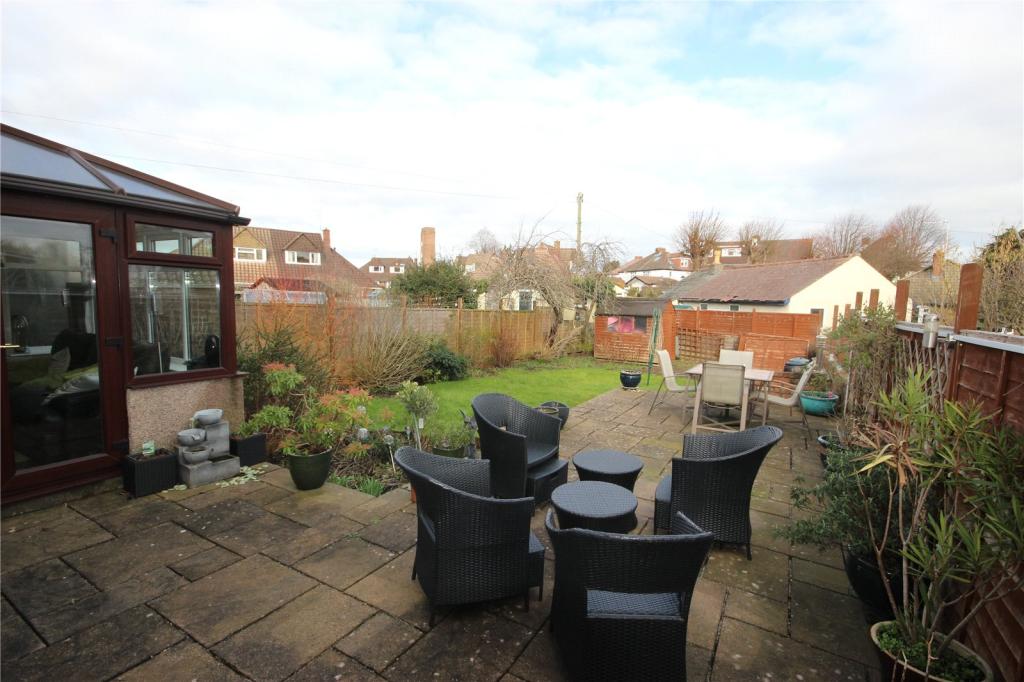
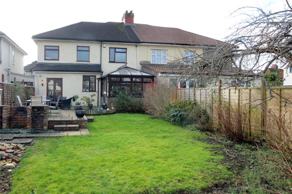
- Conservatory
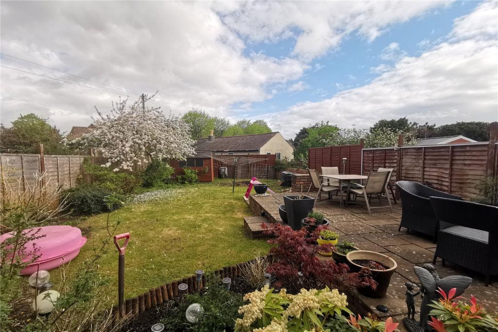
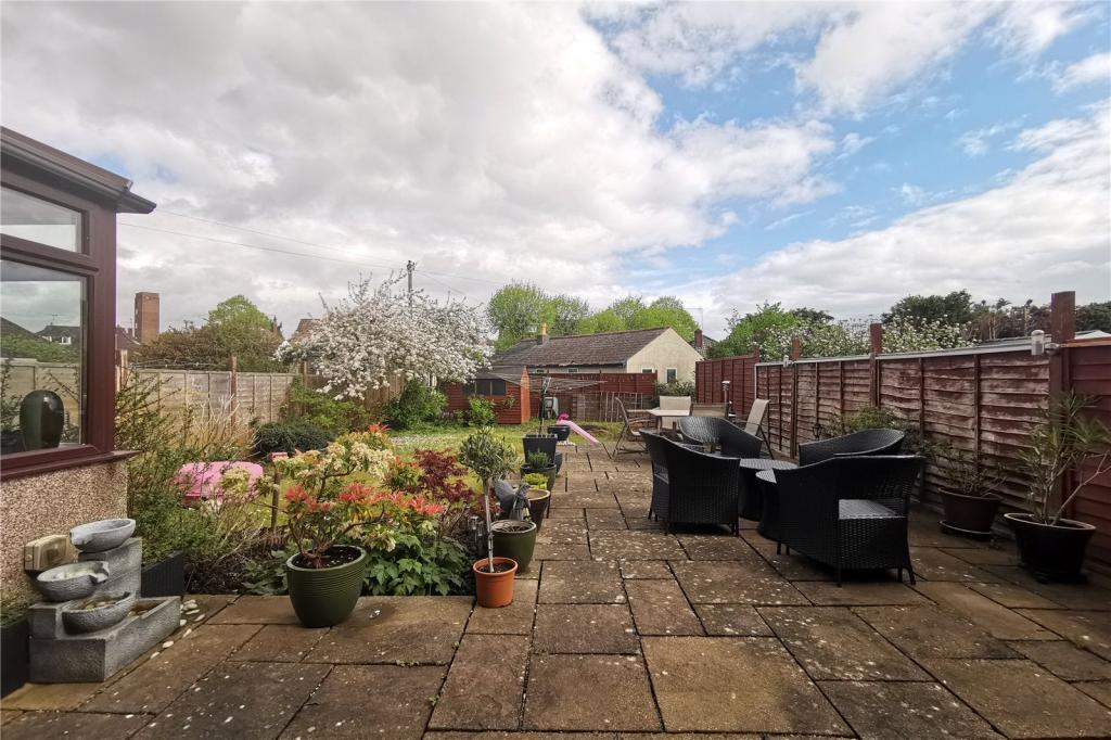
- Rear Garden
- Integral Garage & Driveway
Additional details
- Parking
- Yes
- Garden
- Yes
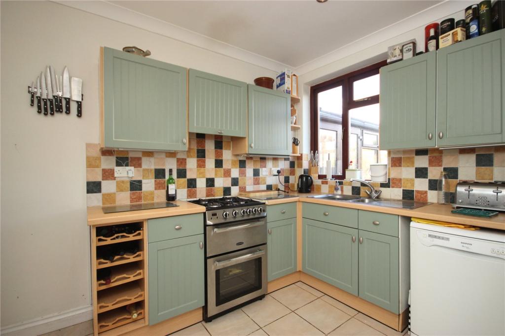
Description
Listed by
Henleaze
The Property Franchise Group
Reference: 77272012
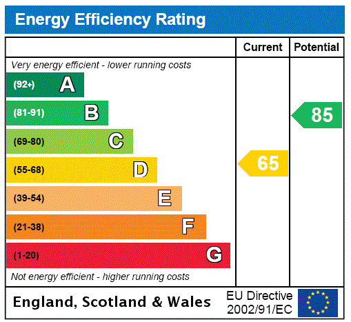
EPC Rating & Upgrade Cost
Current rating: D
Potential rating: B
Inspection date: 07/02/2019
Current heating cost: £718/year
Potential heating cost: £489/year
Recommendations
- 50 mm internal or external wall insulation (14,000)
- Floor insulation (suspended floor) (1,200)
- Low energy lighting for all fixed outlets (35)
- Upgrade heating controls (450)
- Replace boiler with new condensing boiler (3,000)
- Solar water heating (6,000)
- Solar photovoltaic panels, 2.5 kWp (8,000)
Flood risk
Zone: 1
Risk: Low
Job (default Low)
Floorplans
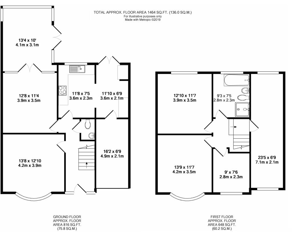
Floorplan
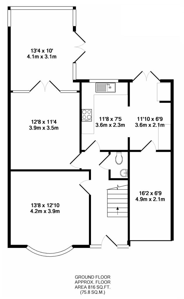
Floorplan
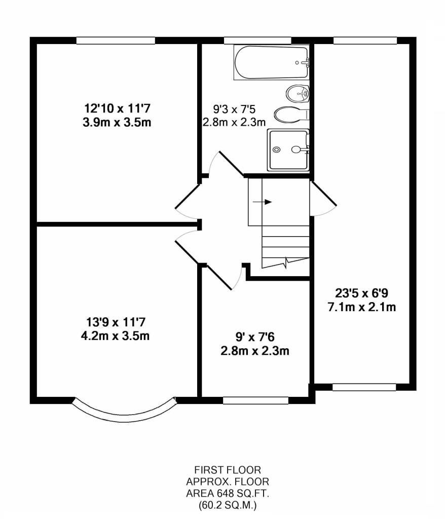
Floorplan
EPC Graphs
EPC Rating Graph
FENSA Certificates
This property has 1 FENSA certificate(s) on record, indicating window/door installations by FENSA-approved installers.
FENSA Certificate #15885135 Recent
Property Details
Street: 172 Wellington Hill West
Town: BRISTOL
Postcode: BS9 4QP
Installation Details
Items: 8 windows and 2 doors
Certificate Issued: 06/08/2023
Work Completed: 11/07/2023
This certificate data was retrieved from FENSA's database
What is FENSA? FENSA (Fenestration Self-Assessment Scheme) is a government-authorised scheme that monitors building regulation compliance for replacement windows and doors. Certificates indicate that work was completed by FENSA-approved installers.
Price history
| Event | Date | Price | % change |
|---|---|---|---|
| Sold | 29/04/2020 (6 years ago) | £520,000 | — |
Source: HM Land Registry Price Paid Data. Crown copyright.
Sold Comparables
Same street and nearby sales within 0.25 miles (last 5 years). Data from Land Registry Price Paid.
| Address | Price | Date | Type |
|---|---|---|---|
| 9 KENDON DRIVE, BRISTOL, CITY OF BRISTOL, BS10 5BP | £450,000 | 16/04/2025 | Semi-detached |
| 41A WELLINGTON WALK, BRISTOL, CITY OF BRISTOL, BS10 5EU | £650,000 | 31/03/2025 | Semi-detached |
| 164 SOUTHMEAD ROAD, WESTBURY ON TRYM, BRISTOL, CITY OF BRISTOL, BS10 5DR | £513,500 | 30/11/2023 | Semi-detached |
| 9 CRANSLEY CRESCENT, BRISTOL, CITY OF BRISTOL, BS9 4PH | £530,000 | 28/11/2023 | Semi-detached |
| 2 WEST CROFT, BRISTOL, CITY OF BRISTOL, BS9 4PQ | £700,000 | 23/11/2023 | Semi-detached |
| 79 THE CRESCENT, HENLEAZE, BRISTOL, CITY OF BRISTOL, BS9 4RY | £760,000 | 07/08/2023 | Semi-detached |
| Same street ROOKWOOD, 164B WELLINGTON HILL WEST, BRISTOL, CITY OF BRISTOL, BS9 4QP | £575,000 | 23/05/2023 | Detached |
| 44 WELLINGTON WALK, BRISTOL, CITY OF BRISTOL, BS10 5EU | £625,000 | 31/03/2023 | Semi-detached |
| Same street 162 WELLINGTON HILL WEST, BRISTOL, CITY OF BRISTOL, BS9 4QP | £540,000 | 12/01/2023 | Detached |
| 7 CHARIS AVENUE, BRISTOL, CITY OF BRISTOL, BS10 5JD | £550,000 | 05/01/2023 | Semi-detached |
| 27 SOUTH CROFT, BRISTOL, CITY OF BRISTOL, BS9 4PS | £212,820 | 20/12/2022 | Semi-detached |
| 188 SOUTHMEAD ROAD, WESTBURY ON TRYM, BRISTOL, CITY OF BRISTOL, BS10 5EA | £335,000 | 16/12/2022 | Semi-detached |
| 11 SOUTH CROFT, BRISTOL, CITY OF BRISTOL, BS9 4PS | £875,000 | 28/11/2022 | Semi-detached |
| 149 SOUTHMEAD ROAD, WESTBURY ON TRYM, BRISTOL, CITY OF BRISTOL, BS10 5DW | £462,500 | 07/11/2022 | Semi-detached |
| 35 CHERINGTON ROAD, WESTBURY ON TRYM, BRISTOL, CITY OF BRISTOL, BS10 5BL | £677,000 | 23/09/2022 | Semi-detached |
| 3 CRANSLEY CRESCENT, BRISTOL, CITY OF BRISTOL, BS9 4PH | £735,000 | 13/09/2022 | Semi-detached |
| 8 WHITELEAZE, BRISTOL, CITY OF BRISTOL, BS10 5ED | £387,500 | 22/07/2022 | Semi-detached |
| 3 WATERDALE GARDENS, BRISTOL, CITY OF BRISTOL, BS9 4QR | £590,000 | 31/05/2022 | Semi-detached |
| 4 CHARIS AVENUE, BRISTOL, CITY OF BRISTOL, BS10 5JD | £525,000 | 29/04/2022 | Semi-detached |
| 149 SOUTHMEAD ROAD, WESTBURY ON TRYM, BRISTOL, CITY OF BRISTOL, BS10 5DW | £225,000 | 01/04/2022 | Semi-detached |
| 20 HARBURY ROAD, BRISTOL, CITY OF BRISTOL, BS9 4PL | £736,000 | 06/01/2022 | Semi-detached |
| 167 WELLINGTON HILL WEST, BRISTOL, CITY OF BRISTOL, BS9 4QW | £524,500 | 09/12/2021 | Semi-detached |
Street average: £557,500 (2 sales)
Area average: £553,191 (20 sales)
Capital growth trend
Land Registry outcode average: last 12 months vs 5y and 10y ago (from sold prices).
House Price Index (HM Land Registry — official index, not sold-price averages): City of Bristol. Series: Semi-detached. As of February 2026.
Rental Range
Estimated market rent for Bristol, City of. Low = conservative, Realistic = average, Optimistic = best case.
Based on Local Authority from postcode lookup → Bristol, City of.
LHA (30th percentile) floor for Bristol: £1,845/mo (Apr 2025 – Mar 2026)
Location
Nearby
Nearest stations, universities and amenities (distance from property).
| Type | Name | Distance |
|---|---|---|
| Bus stop | Cherington Road | 0.1 miles |
| Bus stop | Waterdale Gardens | 0.1 miles |
| Shop | M&S Food | 0.5 miles |
| Shop | Unknown | 0.5 miles |
| Train station | Ashley Down | 1.4 miles |
| Hospital | Spire Bristol | 1.5 miles |
| Train station | Redland | 1.7 miles |
| Hospital | South West Regional Laboratories | 2.3 miles |
| University | 5 Priory Road, Life Sciences | 2.3 miles |
| University | School of Architecture and Environment | 2.3 miles |
Street-level crime
| Category | Count |
|---|---|
| Violence and sexual offences | 158 |
| Shoplifting | 51 |
| Vehicle crime | 49 |
| Public order | 44 |
| Anti-social behaviour | 36 |
| Criminal damage and arson | 34 |
| Burglary | 23 |
| Other theft | 19 |
| Other crime | 13 |
| Drugs | 11 |
| Possession of weapons | 4 |
| Robbery | 4 |
| Bicycle theft | 2 |
| Total incidents | 448 |
Within 1 mile during Mar 2026. Source: data.police.uk (England & Wales).
Schools nearby
Nearest open schools with Ofsted ratings (England). Closed schools are not shown. Data from Get Information about Schools and Ofsted.
| Name | Type | Distance | Ofsted |
|---|---|---|---|
| Horfield Church of England Primary School | Primary | 0.3 miles | Requires improvement — 22 May 2024 |
| Badocks Wood E-ACT Academy | Primary | 0.6 miles | Good — 22 Jan 2023 |
| Claremont School | Other | 0.6 miles | Good — 20 Mar 2013 |
| Redmaids' High School | Other | 0.6 miles | — (No rating) |
| Westbury-On-Trym Church of England Academy | Primary | 0.6 miles | Good — 17 Feb 2016 |
Rental Comparables
Rental listings exist nearby, but none matched the 4-bedroom estimate from EPC for this property.
Rent-driven metrics
Based on Area rent estimate.
- Rent ratio — Monthly rent ÷ purchase price (1% rule). 1%+ = strong, 0.8–1% = okay, <0.8% = weak for cashflow.
- Max investor price — Rent ÷ 0.8%; the price at which rent would be 0.8% of price (Stoke-style target).
- Target investor price — Rent ÷ 1%; the price at which rent would be 1% of price (strong cashflow band).
- Gross yield — Annual rent as % of purchase price (no costs).