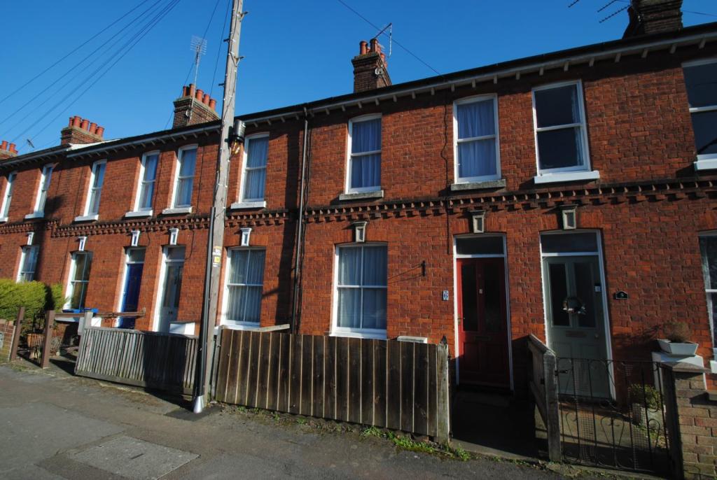
6 CORNFIELD ROAD
BURY ST EDMUNDS, SUFFOLK IP33 3BN
£995 pcm

Property details
Council tax band
B
Deprivation
Decile 6 (18,325 of 33,755)
Street crime
177 incidents within 1 mile (Apr 2026)
Key features
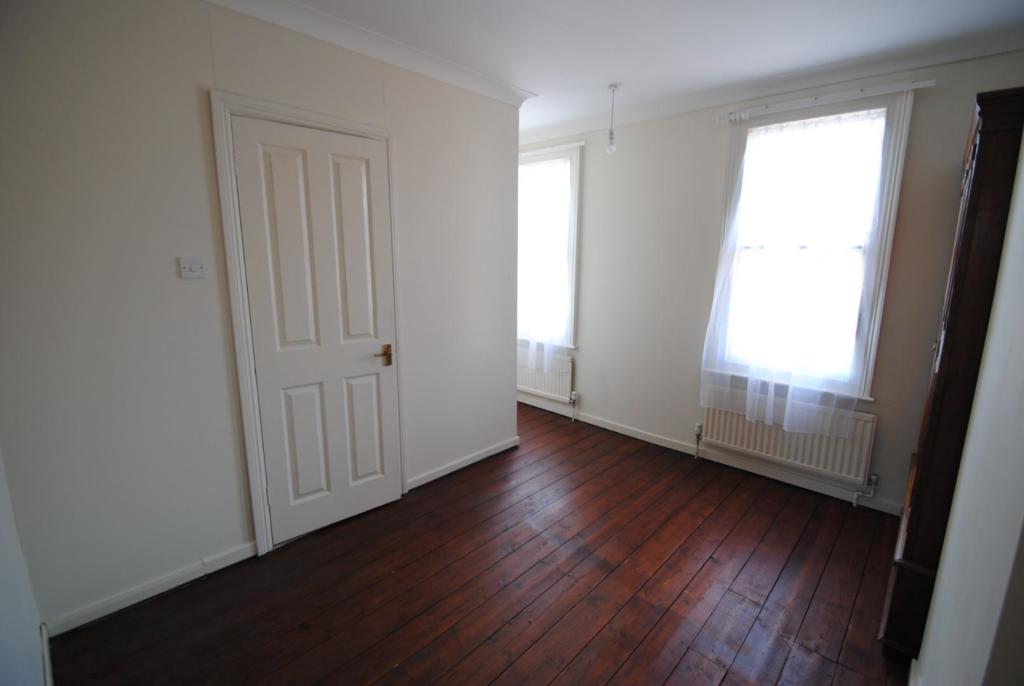
- ATTRACTIVE PERIOD PROPERTY
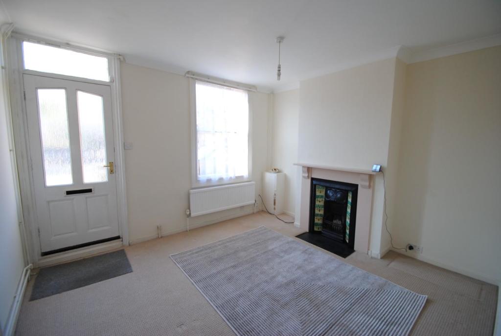
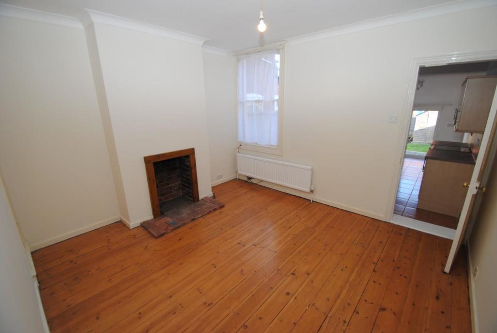
- SITTING ROOM AND DINING ROOM
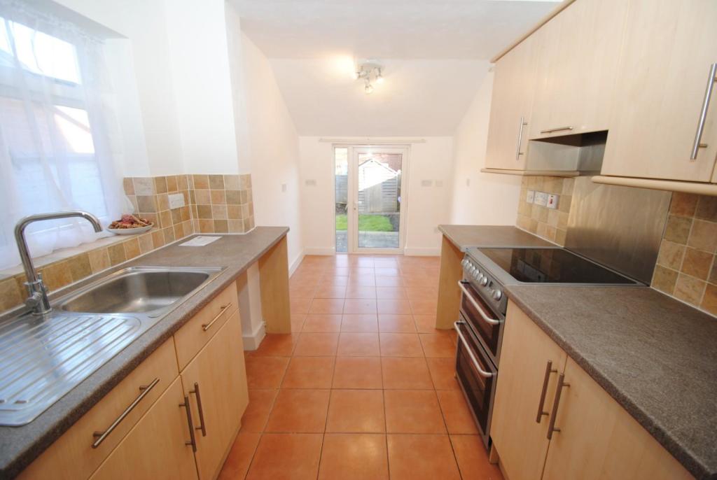
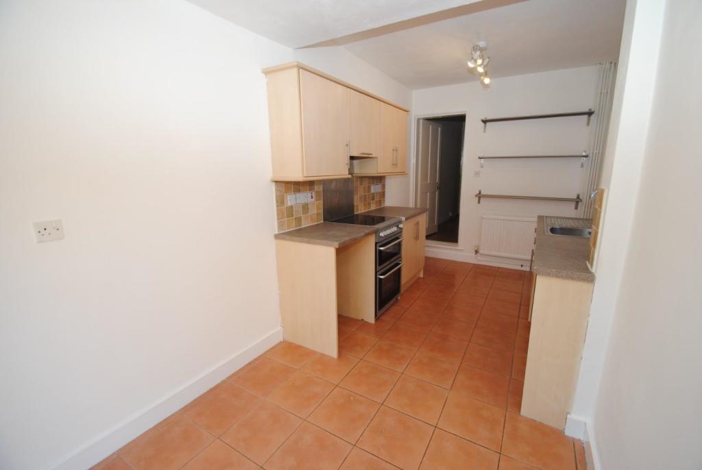
- KITCHEN WITH ELECTRIC COOKER
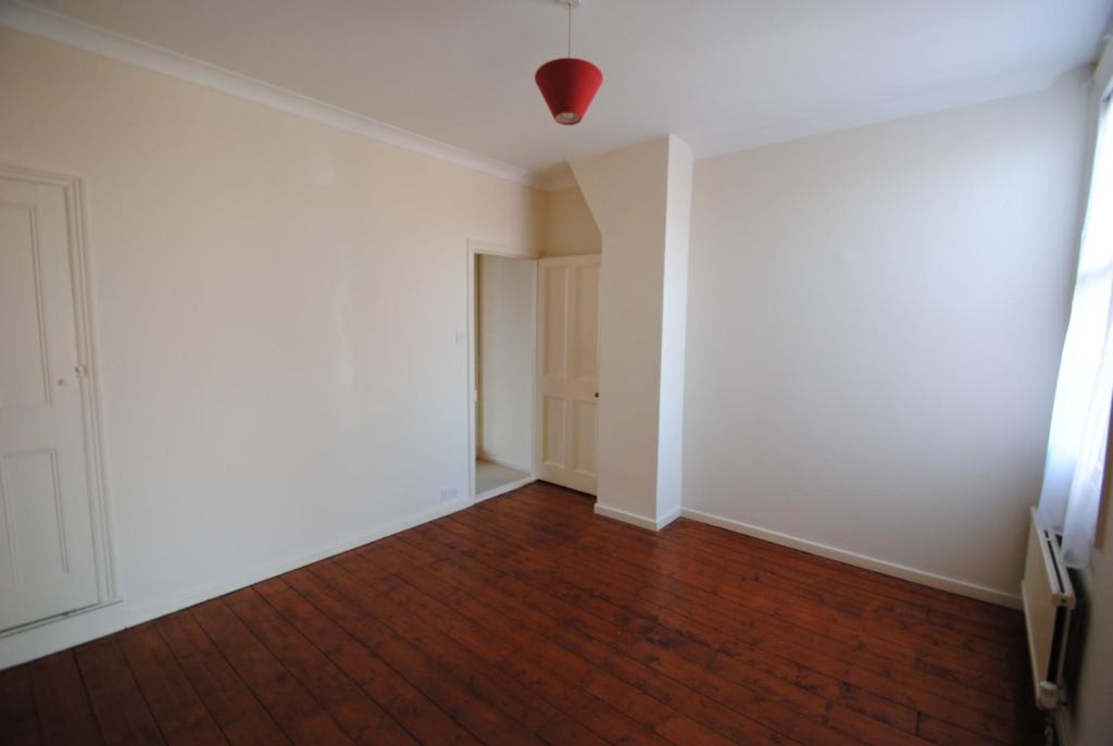
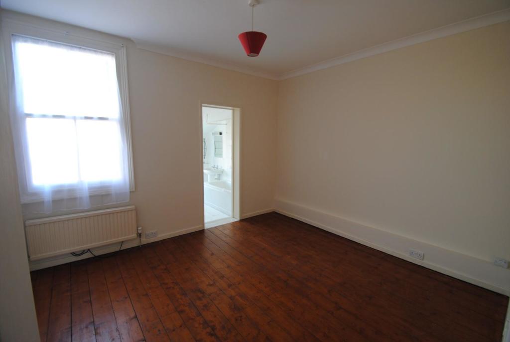
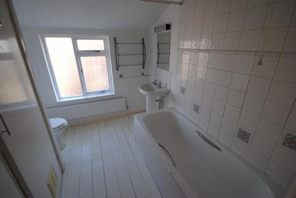
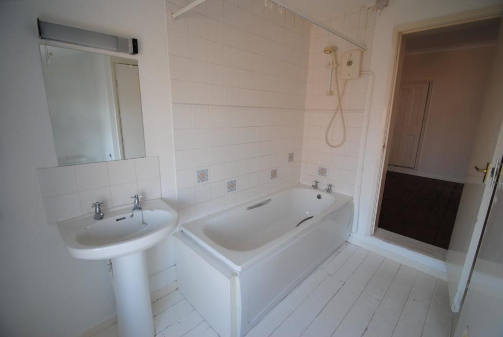
- MASTER BEDROOM WITH EN-SUITE BATHROOM
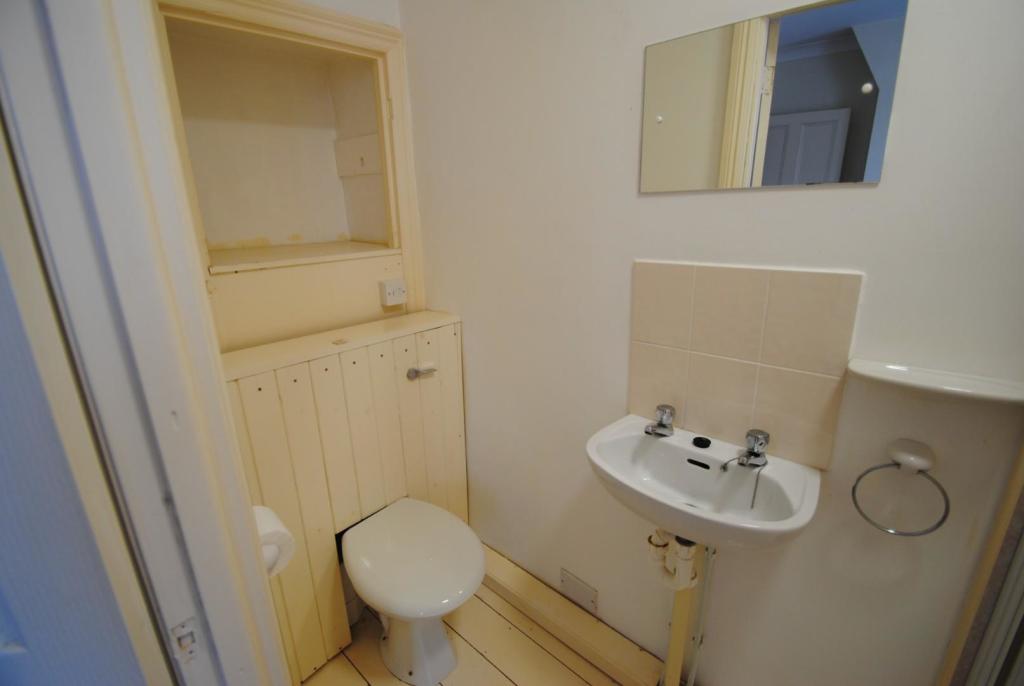
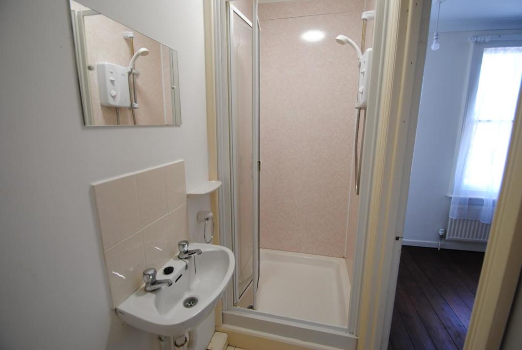
- SECOND DOUBLE BEDROOM WITH EN-SUITE SHOWER ROOM
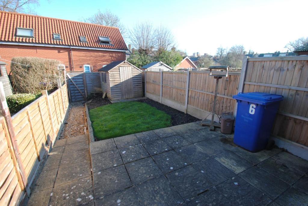
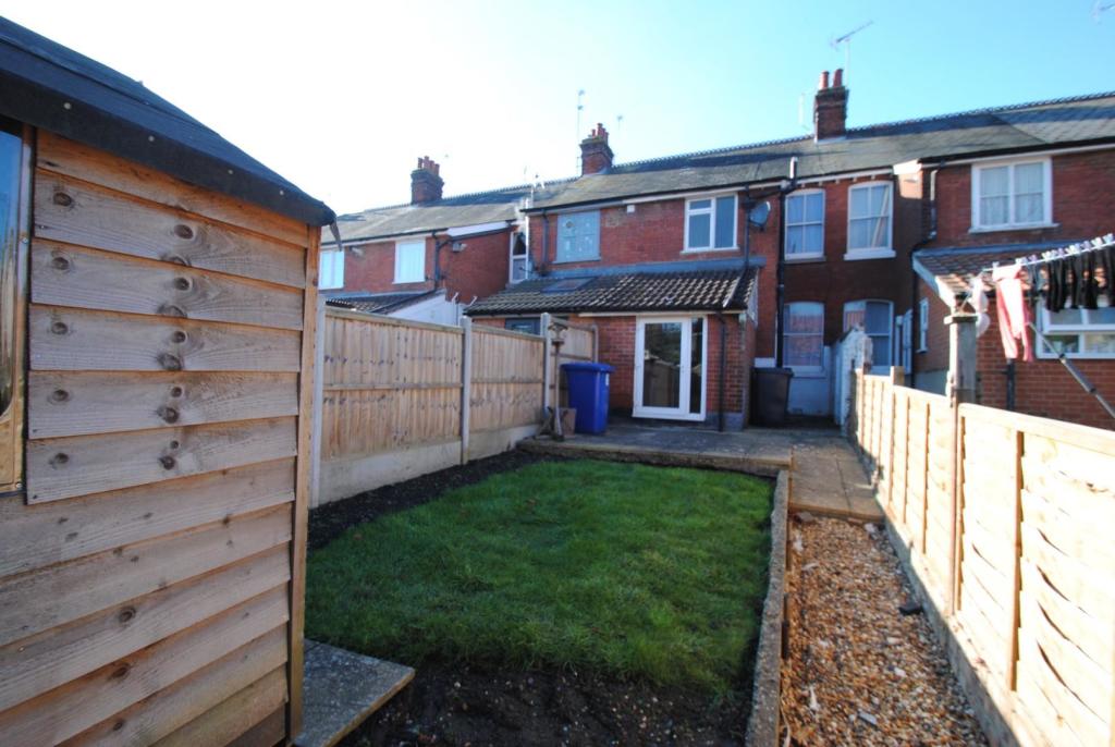
- REAR GARDEN WITH SHED
- GAS FIRED HEATING
- COUNCIL TAX BAND B
- MINIMUM TERM TENANCY OF TWELVE MONTHS
- UNFURNISHED, EPC 58, D
Additional details
- Garden
- Yes
Description
Listed by
Bury St Edmunds
Abbey Sales and Lettings
Reference: 85992582
Flood risk
Zone: 1
Risk: Low
Job (default Low)
EPC Graphs
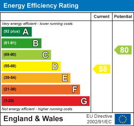
EE Rating
Rental Range
Estimated market rent for West Suffolk. Low = conservative, Realistic = average, Optimistic = best case.
Based on Local Authority from postcode lookup → West Suffolk.
LHA (30th percentile) floor for Bury St Edmunds: £773/mo (Apr 2025 – Mar 2026)
Location
Nearby
Nearest stations, universities and amenities (distance from property).
| Type | Name | Distance |
|---|---|---|
| Shop | Peter Watts Domestic Appliance Centre | 0.1 miles |
| Bus stop | Falcon | 0.1 miles |
| Shop | Top Cuts | 0.2 miles |
| Train station | Bury St Edmunds | 0.5 miles |
| Hospital | West Suffolk Hospital | 1.2 miles |
| Train station | Thurston | 4.4 miles |
Street-level crime
| Category | Count |
|---|---|
| Violence and sexual offences | 68 |
| Criminal damage and arson | 19 |
| Shoplifting | 19 |
| Anti-social behaviour | 17 |
| Public order | 16 |
| Burglary | 10 |
| Other theft | 10 |
| Drugs | 5 |
| Vehicle crime | 4 |
| Bicycle theft | 3 |
| Other crime | 2 |
| Robbery | 2 |
| Possession of weapons | 1 |
| Theft from the person | 1 |
| Total incidents | 177 |
Within 1 mile during Apr 2026. Source: data.police.uk (England & Wales).
Schools nearby
Nearest open schools with Ofsted ratings (England). Closed schools are not shown. Data from Get Information about Schools and Ofsted.
| Name | Type | Distance | Ofsted |
|---|---|---|---|
| St Edmundsbury CofE Primary Academy | Primary | 0.1 miles | Requires improvement — 13 May 2024 |
| West Suffolk College | Other | 0.2 miles | — (No rating) |
| King Edward VI CEVC School | Secondary | 0.2 miles | Good — 28 Mar 2019 |
| Abbeygate Sixth Form College | Other | 0.2 miles | — (No rating) |
| Bury St Edmunds County High School | Secondary | 0.6 miles | Good — 15 May 2022 |
Rental Comparables
Residential lets from OpenRent and Rightmove for the area (same bedroom count). Use to validate rent estimates. Student lets are excluded.
| Title | Rent | Beds | Distance | As seen on |
|---|---|---|---|---|
| 2 Bed Flat, The Beeches, IP33 | £925/mo | 2 | 0.23 miles | OpenRent |
| 2 Bed Flat, Outrisbygate, IP33 | £1,500/mo | 2 | 0.24 miles | OpenRent |
| 2 Bed Terraced House, Bishops Road, IP33 | £1,500/mo | 2 | 0.27 miles | OpenRent |
| 2 Bed Flat, Gosnold Street, IP33 | £1,275/mo | 2 | 0.35 miles | OpenRent |
| 2 Bed Flat, Saint Johns Street, IP33 | £1,300/mo | 2 | 0.35 miles | OpenRent |
| 2 Bed Terraced House, St Johns St, IP33 | £1,275/mo | 2 | 0.35 miles | OpenRent |
| 2 Bed Terraced House, St. Johns Street, IP33 | £1,250/mo | 2 | 0.36 miles | OpenRent |
| 2 Bed Flat, St Andrews Street South, IP33 | £1,250/mo | 2 | 0.41 miles | OpenRent |
| 2 Bed Semi-Detached House, Bullen Close, IP33 | £1,200/mo | 2 | 0.46 miles | OpenRent |
| 2 Bed Flat, St Andrews Street South, IP33 | £1,100/mo | 2 | 0.57 miles | OpenRent |
| 2 Bed Terraced House, Crown Street, IP33 | £1,300/mo | 2 | 0.7 miles | OpenRent |
| 2 Bed Flat, Phoenix House, IP33 | £900/mo | 2 | 0.91 miles | OpenRent |
Average rent: £1,231/mo (12 listings)