FLAT 8
THANET LODGE, 10, MAPESBURY ROAD, LONDON, GREATER LONDON NW2 4JA
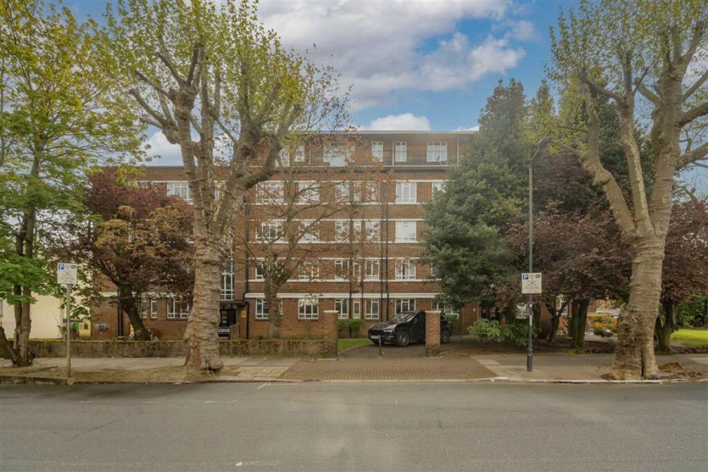
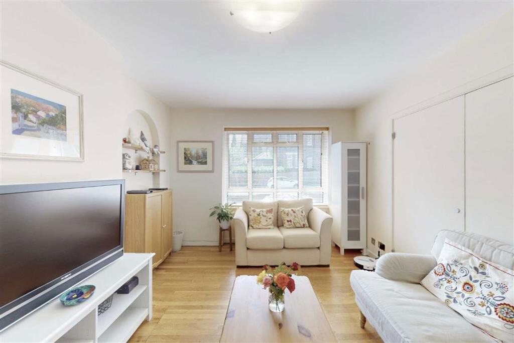
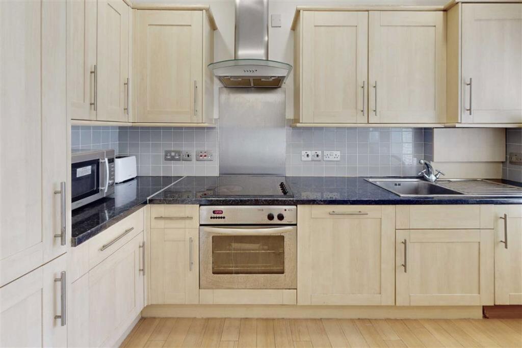
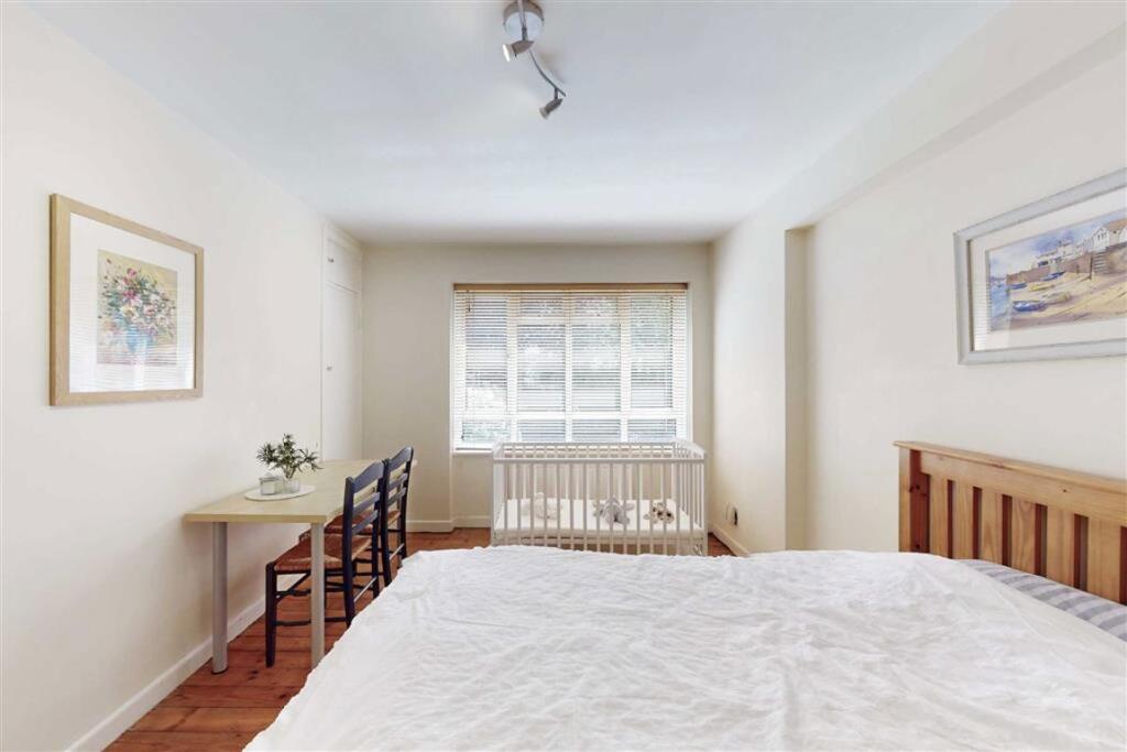
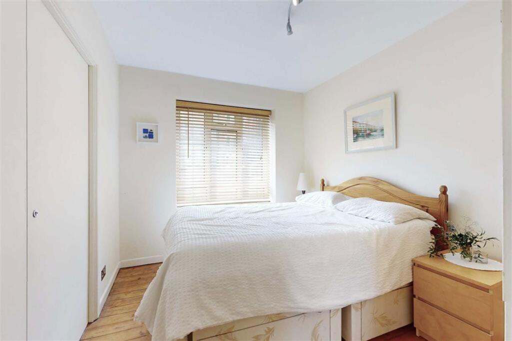
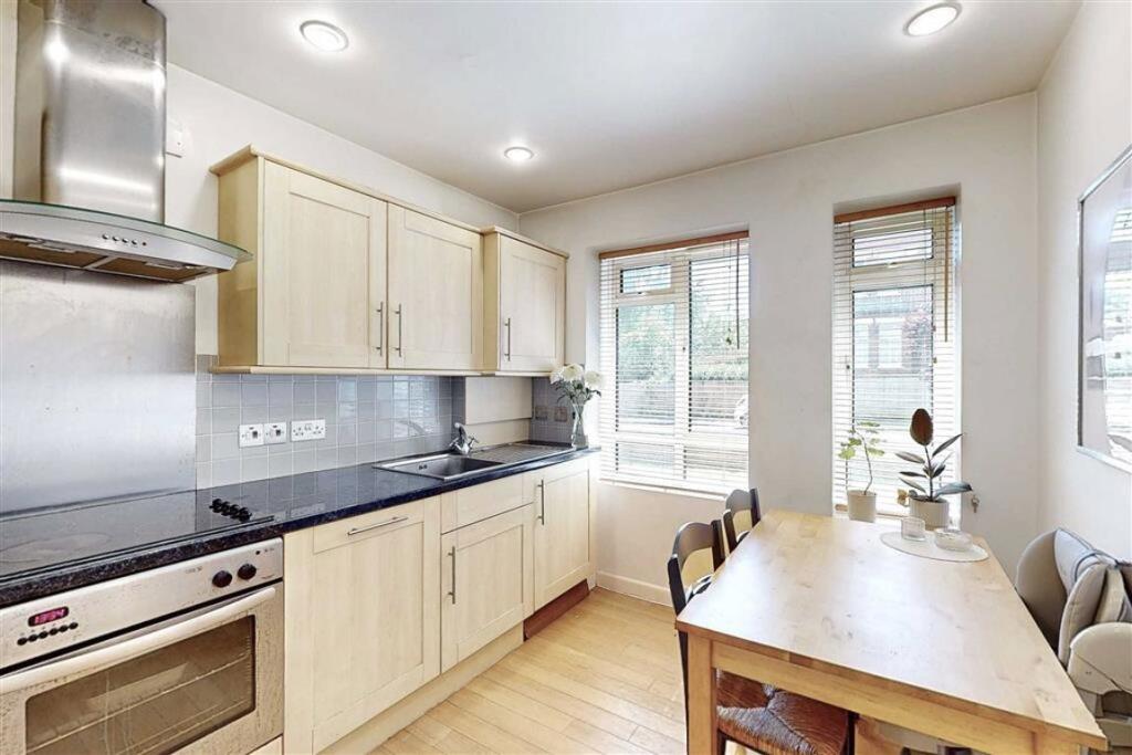
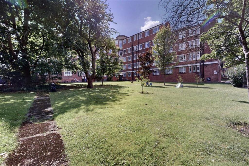
Photo 1 Photo 2 Photo 3 Photo 4 Photo 5 Photo 6 Photo 7
/ 7
Property details
Tenure
LEASEHOLD
Floor area
68 m²
EPC rating
D
Year built
England and Wales: before 1900
Last sold
£360,000 Dec 2025
Price per m²
£5,515/m²
Local average
£503,911 (-25.6%)
Deprivation
Decile 3 (7,854 of 33,755)
Street crime
1162 incidents within 1 mile (Mar 2026)
Key features
- Three Bedrooms
- Separate Kitchen
- Ground Floor Flat
- Communal Gardens
- Leasehold
- Great Location
Description
Thanet Lodge is set on a residential tree lined street, located in Brondesbury Park and is a short distance from the Kilburn, Brondesbury, and Queens Park stations, with a range of shops, cafes, and restaurants nearby.
Tenure: Leasehold Lease Years Remaining: 956
Service Charge: £6,027 (Yearly)
Annual Ground Rent: £50
Council Tax Band: D
Information contained within this listing is for guidance only and should be checked and confirmed (prior to proceeding).
Listed by
Cricklewood
Dexters
Reference: 164103044
EPC Rating & Upgrade Cost
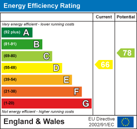
Current rating: D
Potential rating: C
Inspection date: 03/04/2024
Current heating cost: £900/year
Potential heating cost: £458/year
Est. upgrade cost to C: £10,000
Recommendations
- 50 mm internal or external wall insulation (£4,000 - £14,000)
- Floor insulation (suspended floor) (£800 - £1,200)
Flood risk
Zone: 1
Risk: Low
Job (default Low)
Floorplans
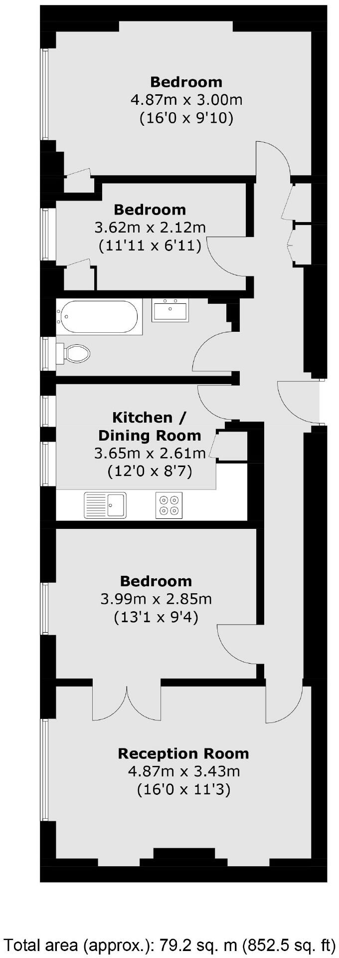
Floorplan 1
EPC Graphs
EPC 1
Price history
114% since 2000
| Event | Date | Price | % change |
|---|---|---|---|
| Sold | 15/12/2025 (5 months ago) | £360,000 | +114.3% |
| Sold | 18/05/2000 (26 years ago) | £168,000 | — |
Source: HM Land Registry Price Paid Data. Crown copyright.
Sold Comparables
Same street and nearby sales within 0.25 miles (last 5 years). Data from Land Registry Price Paid.
| Address | Price | Date | Type |
|---|---|---|---|
| 12B CHATSWORTH ROAD, LONDON, BRENT, GREATER LONDON, NW2 4BN | £650,000 | 07/08/2025 | Flat |
| BEECHWORTH, 179 FLAT 14 WILLESDEN LANE, LONDON, BRENT, GREATER LONDON, NW6 7YZ | £520,000 | 31/07/2025 | Flat |
| 23C CHATSWORTH ROAD, LONDON, BRENT, GREATER LONDON, NW2 4BJ | £350,000 | 11/03/2025 | Flat |
| 2 FLAT 3 CHATSWORTH ROAD, LONDON, BRENT, GREATER LONDON, NW2 4BN | £505,000 | 20/02/2025 | Flat |
| 2 FLAT 3 CHATSWORTH ROAD, LONDON, BRENT, GREATER LONDON, NW2 4BN | £505,000 | 20/02/2025 | Flat |
| 13B MAPESBURY ROAD, LONDON, BRENT, GREATER LONDON, NW2 4HX | £1,255,000 | 20/12/2023 | Flat |
| BEECHWORTH, 179 FLAT 35 WILLESDEN LANE, LONDON, BRENT, GREATER LONDON, NW6 7YZ | £675,000 | 19/12/2023 | Flat |
| 45 GARDEN FLOOR FLAT CHRISTCHURCH AVENUE, LONDON, BRENT, GREATER LONDON, NW6 7BB | £875,000 | 29/11/2023 | Flat |
| 9 FLAT 5 CHATSWORTH ROAD, LONDON, BRENT, GREATER LONDON, NW2 4BJ | £580,000 | 24/11/2023 | Flat |
| 27C CHATSWORTH ROAD, LONDON, BRENT, GREATER LONDON, NW2 4BJ | £510,000 | 22/11/2023 | Flat |
| Same street THANET LODGE, 10 FLAT 33 MAPESBURY ROAD, LONDON, BRENT, GREATER LONDON, NW2 4JA | £430,000 | 20/11/2023 | Flat |
| SHERWOOD, 172 - 174 FLAT 1 WILLESDEN LANE, LONDON, BRENT, GREATER LONDON, NW6 7PJ | £375,500 | 20/11/2023 | Flat |
| 40A CHRISTCHURCH AVENUE, LONDON, BRENT, GREATER LONDON, NW6 7BE | £745,000 | 08/11/2023 | Flat |
| 35D CHATSWORTH ROAD, LONDON, BRENT, GREATER LONDON, NW2 4BL | £660,000 | 27/10/2023 | Flat |
| CHRISTCHURCH COURT FLAT 10 WILLESDEN LANE, LONDON, BRENT, GREATER LONDON, NW6 7XF | £375,000 | 02/10/2023 | Flat |
| 21 FLAT 3 DARTMOUTH ROAD, LONDON, BRENT, GREATER LONDON, NW2 4ET | £410,000 | 29/09/2023 | Flat |
| TARRANBRAE FLAT 37 WILLESDEN LANE, LONDON, BRENT, GREATER LONDON, NW6 7PN | £715,000 | 28/09/2023 | Flat |
| Same street THANET LODGE, 10 FLAT 26 MAPESBURY ROAD, LONDON, BRENT, GREATER LONDON, NW2 4JA | £320,000 | 01/08/2023 | Flat |
| 184 FLAT 4 WILLESDEN LANE, LONDON, BRENT, GREATER LONDON, NW6 7PP | £558,000 | 27/07/2023 | Flat |
| TARRANBRAE FLAT 63 WILLESDEN LANE, LONDON, BRENT, GREATER LONDON, NW6 7PW | £656,100 | 30/06/2023 | Flat |
| 41C MOWBRAY ROAD, LONDON, BRENT, GREATER LONDON, NW6 7QS | £600,000 | 12/06/2023 | Flat |
| TARRANBRAE FLAT 38 WILLESDEN LANE, LONDON, BRENT, GREATER LONDON, NW6 7PN | £375,000 | 05/05/2023 | Flat |
| Same street THANET LODGE, 10 FLAT 10 MAPESBURY ROAD, LONDON, BRENT, GREATER LONDON, NW2 4JA | £500,000 | 27/05/2022 | Flat |
| Same street THANET LODGE, 10 FLAT 20 MAPESBURY ROAD, LONDON, BRENT, GREATER LONDON, NW2 4JA | £540,000 | 28/05/2021 | Flat |
Street average: £447,500 (4 sales)
Area average: £594,730 (20 sales)
Capital growth trend
Land Registry outcode average: last 12 months vs 5y and 10y ago (from sold prices).
House Price Index (HM Land Registry — official index, not sold-price averages): Brent. Series: Flats and maisonettes. As of February 2026.
Rental Range
Estimated market rent for Brent. Low = conservative, Realistic = average, Optimistic = best case.
Based on Local Authority from postcode lookup → Brent.
LHA (30th percentile) floor for Inner North London: £2,154/mo (Apr 2025 – Mar 2026)
Location
Address
45 Mowbray Road
Nearby
Nearest stations, universities and amenities (distance from property).
| Type | Name | Distance |
|---|---|---|
| Bus stop | Christchurch | 0.1 miles |
| Bus stop | Coverdale Road | 0.1 miles |
| Train station | Kilburn | 0.2 miles |
| Train station | Brondesbury | 0.3 miles |
| Shop | Fone House | 0.3 miles |
| Shop | The Corner Shop | 0.4 miles |
| University | Kennet West Skills Centre | 1.4 miles |
| University | Central Belsize Square | 1.7 miles |
| Hospital | The Portland Hospital | 3.3 miles |
| Hospital | Sleep & Health Clinic | 3.4 miles |
Street-level crime
| Category | Count |
|---|---|
| Anti-social behaviour | 281 |
| Violence and sexual offences | 258 |
| Other theft | 88 |
| Shoplifting | 79 |
| Vehicle crime | 77 |
| Burglary | 73 |
| Theft from the person | 71 |
| Public order | 55 |
| Criminal damage and arson | 54 |
| Drugs | 47 |
| Robbery | 42 |
| Bicycle theft | 19 |
| Other crime | 9 |
| Possession of weapons | 9 |
| Total incidents | 1162 |
Within 1 mile during Mar 2026. Source: data.police.uk (England & Wales).
Schools nearby
Nearest open schools with Ofsted ratings (England). Closed schools are not shown. Data from Get Information about Schools and Ofsted.
| Name | Type | Distance | Ofsted |
|---|---|---|---|
| North West London Jewish Day School | Primary | 0.1 miles | Good — 7 Sep 2017 |
| Brondesbury College London | Other | 0.2 miles | Outstanding — 23 Apr 2018 |
| Malorees Infant School | Primary | 0.3 miles | Good — 23 Jan 2023 |
| Malorees Junior School | Primary | 0.3 miles | Good — 12 Jun 2017 |
| Christ Church CofE Primary School | Primary | 0.4 miles | Good — 21 May 2024 |
Rental Comparables
Loading rental comparables for this postcode. Refresh in a few minutes.
Rent-driven metrics
Based on Area rent estimate.
- Rent ratio — Monthly rent ÷ purchase price (1% rule). 1%+ = strong, 0.8–1% = okay, <0.8% = weak for cashflow.
- Max investor price — Rent ÷ 0.8%; the price at which rent would be 0.8% of price (Stoke-style target).
- Target investor price — Rent ÷ 1%; the price at which rent would be 1% of price (strong cashflow band).
- Gross yield — Annual rent as % of purchase price (no costs).