22 OVAL ROAD
CROYDON, CROYDON, GREATER LONDON CR0 6BG
£1,300 pcm
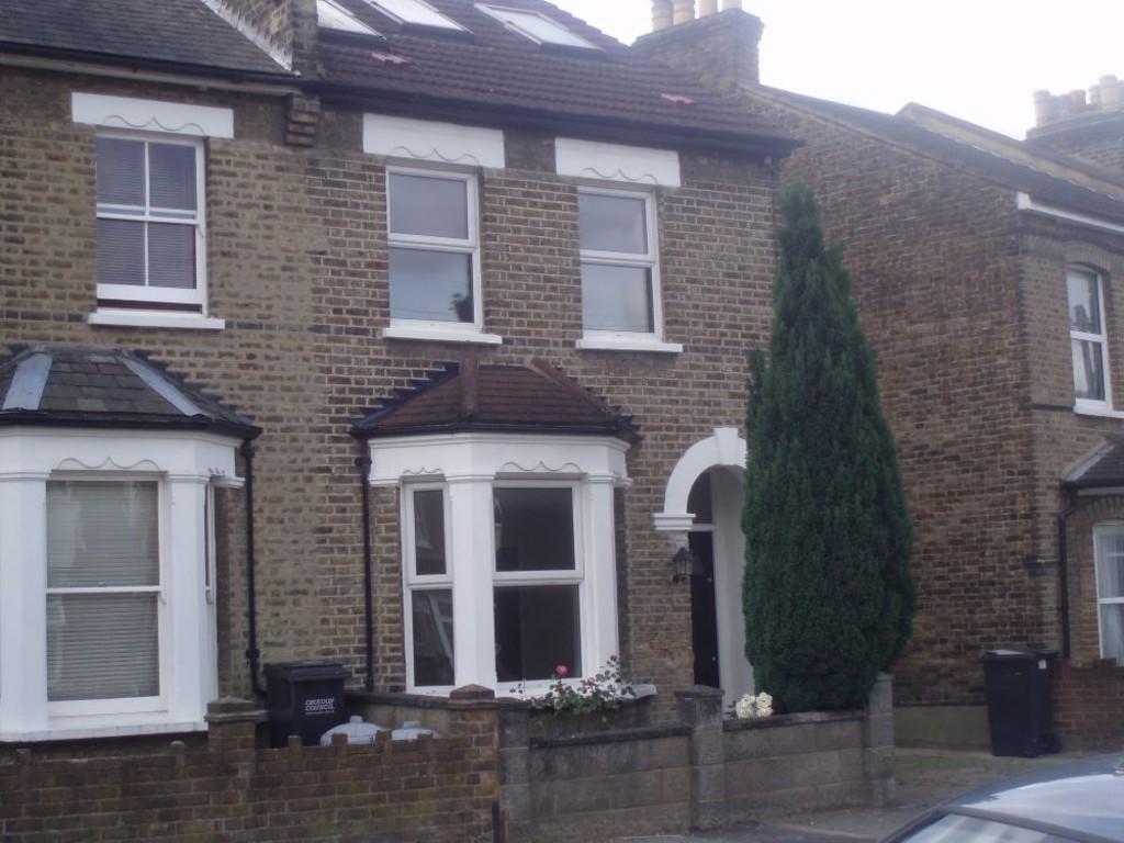
Photo 1
/ 1
Property details
Floor area
113 m²
Deprivation
Decile 5 (16,505 of 33,755)
Street crime
1221 incidents within 1 mile (Apr 2026)
Key features
- Three Bedrooms & One Small Single Bedroom/Study, Lounge, Fitted Kitchen inc Fridge & W/M, Mo
Additional details
- Garden
- Yes
Description
Bedroom Double Bedroom
Bedroom Double Bedroom
Bedroom Small Double Bedroom
Bedroom Small Bedroom/Study
Kitchen Fitted Kitchen inc. Fridge & W/M
Bathroom Modern Bathroom
Garden ** Garden
Listed by
Croydon
Benson & Partners
Reference: 54034536
EPC Rating & Upgrade Cost
Fetching EPC data… Refresh this page in a moment.
Flood risk
Zone: 1
Risk: Low
Job (default Low)
Rental Range
Estimated market rent for Croydon. Low = conservative, Realistic = average, Optimistic = best case.
Based on Local Authority from postcode lookup → Croydon.
LHA (30th percentile) floor for Outer South London: £1,945/mo (Apr 2025 – Mar 2026)
Location
Nearby
Nearest stations, universities and amenities (distance from property).
| Type | Name | Distance |
|---|---|---|
| Shop | Oscar Dahling Antiques | 0.1 miles |
| Shop | Store / Atelier Amalthea | 0.1 miles |
| Bus stop | Leslie Grove | 0.1 miles |
| Bus stop | Cross Road | 0.1 miles |
| Train station | East Croydon | 0.3 miles |
| Train station | West Croydon | 0.6 miles |
| Hospital | Diabetic Department | 1.1 miles |
| Hospital | Patient Advice and Liaison Service (PALS) | 1.2 miles |
| University | Horton Halls Reception | 5.6 miles |
| University | University of Wales Trinity Saint David London Campus | 7.1 miles |
Street-level crime
| Category | Count |
|---|---|
| Violence and sexual offences | 338 |
| Anti-social behaviour | 251 |
| Shoplifting | 172 |
| Vehicle crime | 77 |
| Drugs | 70 |
| Other theft | 65 |
| Public order | 62 |
| Criminal damage and arson | 53 |
| Burglary | 40 |
| Theft from the person | 28 |
| Possession of weapons | 23 |
| Robbery | 22 |
| Other crime | 11 |
| Bicycle theft | 9 |
| Total incidents | 1221 |
Within 1 mile during Apr 2026. Source: data.police.uk (England & Wales).
Schools nearby
Nearest open schools with Ofsted ratings (England). Closed schools are not shown. Data from Get Information about Schools and Ofsted.
| Name | Type | Distance | Ofsted |
|---|---|---|---|
| Ark Oval Primary Academy | Primary | 0.1 miles | Good — 11 Jan 2013 |
| Al-Khair Secondary Girls | Other | 0.1 miles | Good — 9 Jul 2024 |
| Al-Khair School | Other | 0.1 miles | Good — 24 Nov 2021 |
| Tunstall Nursery School | Nursery | 0.2 miles | Outstanding — 16 Mar 2016 |
| Ark Blake Academy | Secondary | 0.3 miles | Good — 26 Apr 2023 |
Rental Comparables
Rental listings exist nearby, but none matched the 4-bedroom count for this property.