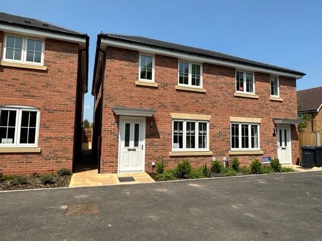
4 BATTALION DRIVE
SUTTON COLDFIELD, WEST MIDLANDS B75 7DN
£1,500 pcm

Property details
Floor area
125 m²
Council tax band
D
Street crime
142 incidents within 1 mile (Mar 2026)
Key features
- STUNNING SEMI SET IN A NEW BUILD DEVELOPMENT
- PRESENTED TO A HIGH SPECIFICATION THROUGHOUT
- INTEGRATED FRIDGE FREEZER
- SPACIOUS GARDEN
- LINKS TO TOWN CENTRE
- LARGE DOUBLE BEDROOMS
- TANDEM PARKING
- SOUGHT AFTER SCHOOL CATCHMENT
- EPC RATING B
- AVAILABLE EARLY MARCH
Additional details
- Parking
- Yes
- Garden
- Yes
Description
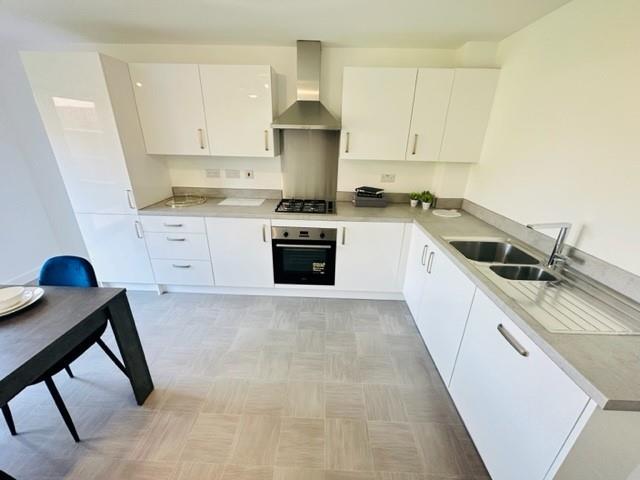
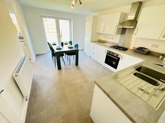
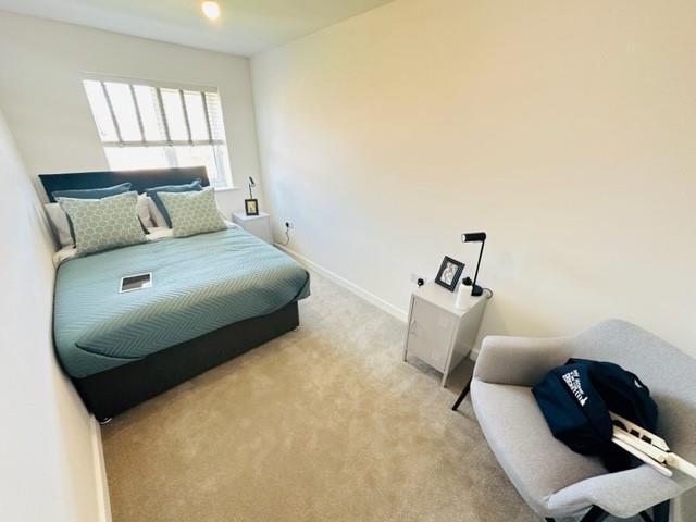
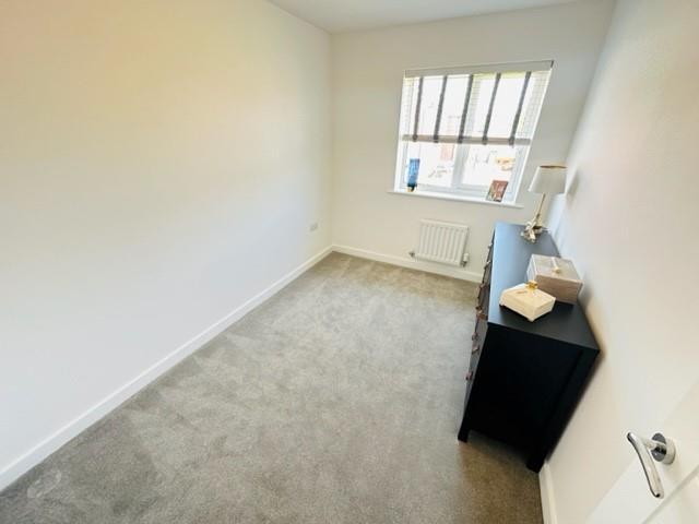
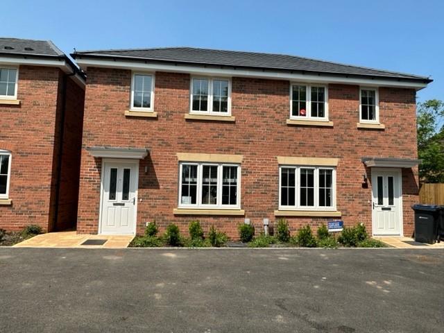
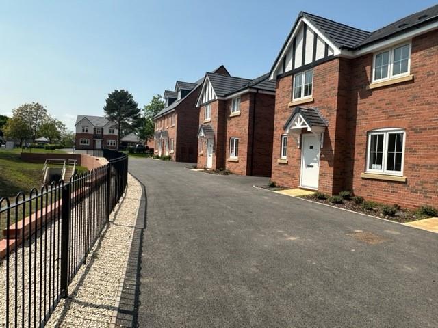
Set within a brand new development, in a highly sought after residential location close to Sutton Coldfield town centre, sought after schools, Good Hope Hospital and transport links, the property, which is presented to a very high specification, comprises;
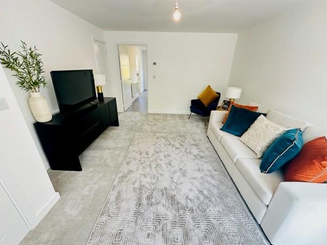
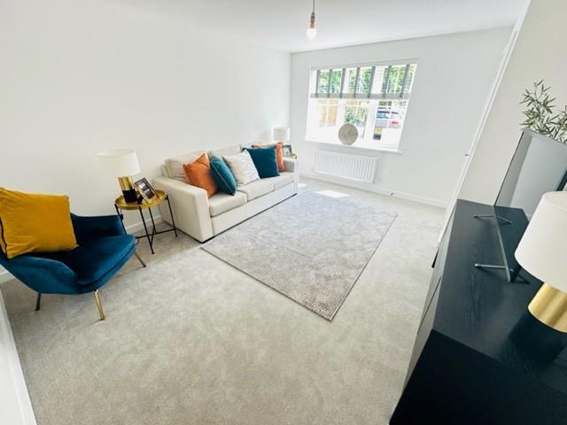
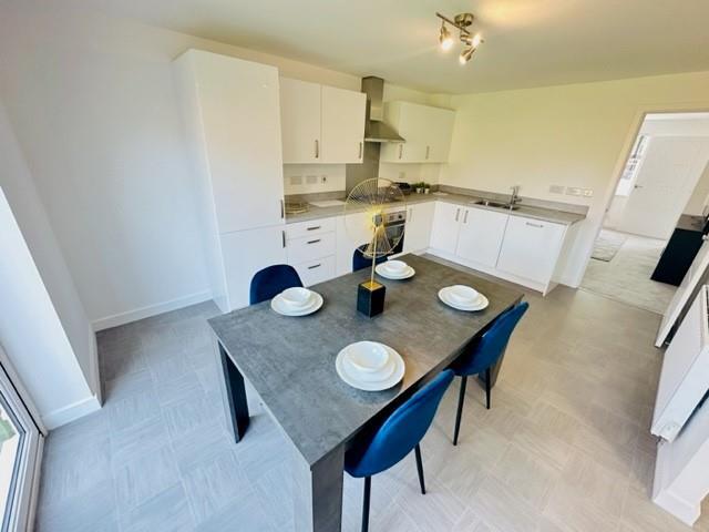
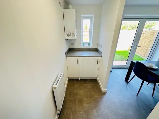
Entrance hall, lounge with storage, modern fitted dining kitchen with separate utility area and downstairs W.C.
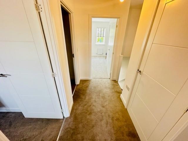
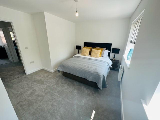
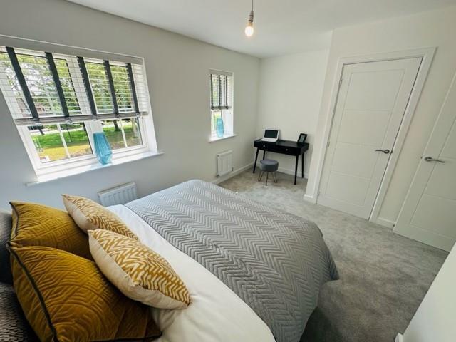
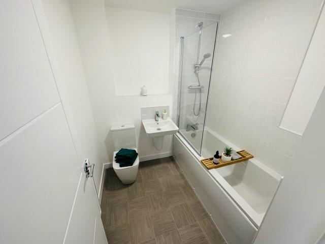
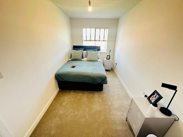
To the first floor there are two double bedrooms, a generous single/ home office and a modern fitted family bathroom.
The property also benefits from tandem off road parking with electric charging point, side access and a low maintenance rear garden.
Viewing is highly recommended and by appointment only.
Available early March
Listed by
Sutton Coldfield
Hunters Property Group Ltd
Reference: 171161435
EPC Rating & Upgrade Cost
Fetching EPC data… Refresh this page in a moment.
Flood risk
Zone: 2
Risk: In flood risk area
Environment Agency Flood Risk Areas (APSFR)
Rental Range
Estimated market rent for West Midlands. Low = conservative, Realistic = average, Optimistic = best case.
Based on Postcode area B → West Midlands.
LHA (30th percentile) floor for Birmingham: £823/mo (Apr 2025 – Mar 2026)
Location
Nearby
Nearest stations, universities and amenities (distance from property).
| Type | Name | Distance |
|---|---|---|
| Bus stop | Rectory Rd / St Georges Close | 0.0 miles |
| Shop | Cutting Station | 0.2 miles |
| Shop | Asda Express Churchill Road | 0.3 miles |
| Hospital | Good Hope Hospital | 0.7 miles |
| Train station | Sutton Coldfield | 1.3 miles |
| Hospital | Sutton Coldfield Cottage Hospital | 1.4 miles |
| Train station | Four Oaks | 1.6 miles |
| University | Maryvale Institute | 4.3 miles |
| University | BCU Oscott Gardens | 5.4 miles |
Street-level crime
| Category | Count |
|---|---|
| Violence and sexual offences | 53 |
| Vehicle crime | 27 |
| Other theft | 14 |
| Criminal damage and arson | 12 |
| Shoplifting | 9 |
| Public order | 7 |
| Burglary | 6 |
| Anti-social behaviour | 4 |
| Possession of weapons | 4 |
| Drugs | 2 |
| Other crime | 2 |
| Theft from the person | 2 |
| Total incidents | 142 |
Within 1 mile during Mar 2026. Source: data.police.uk (England & Wales).
Schools nearby
Nearest open schools with Ofsted ratings (England). Closed schools are not shown. Data from Get Information about Schools and Ofsted.
| Name | Type | Distance | Ofsted |
|---|---|---|---|
| Fairfax | Secondary | 0.5 miles | Good — 16 Jun 2024 |
| Hollyfield Primary School | Primary | 0.5 miles | Good — 28 May 2013 |
| The Royal Sutton School | Secondary | 0.5 miles | Good — 21 Jan 2024 |
| New Hall Primary School | Primary | 0.6 miles | Good — 19 Oct 2012 |
| Trinity Specialist College | Other | 0.6 miles | — (No rating) |
Rental Comparables
Rental listings exist nearby, but none matched the 3-bedroom estimate from EPC for this property.