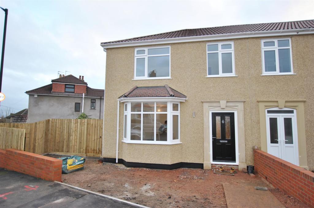
18A
RAEBURN ROAD, BRISTOL, CITY OF BRISTOL BS5 8PS

Property details
Floor area
79 m²
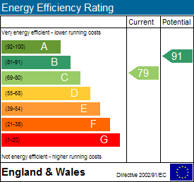
EPC rating
B
Last sold
£279,000 Mar 2017
Price per m²
£3,481/m²
Local average
£343,764 (-20%)
Deprivation
Decile 7 (22,154 of 33,755)
Street crime
373 incidents within 1 mile (Apr 2026)
Key features
- Energy Rating - C
- New Build End of Terrace
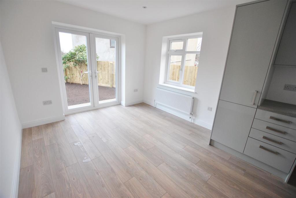
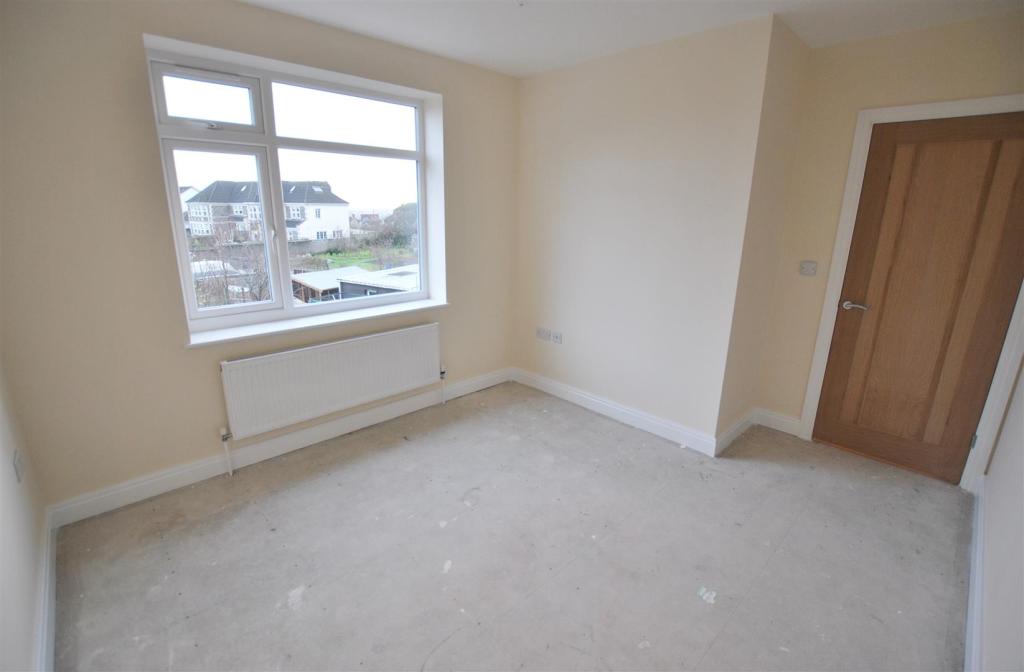
- Bay Fronted Lounge
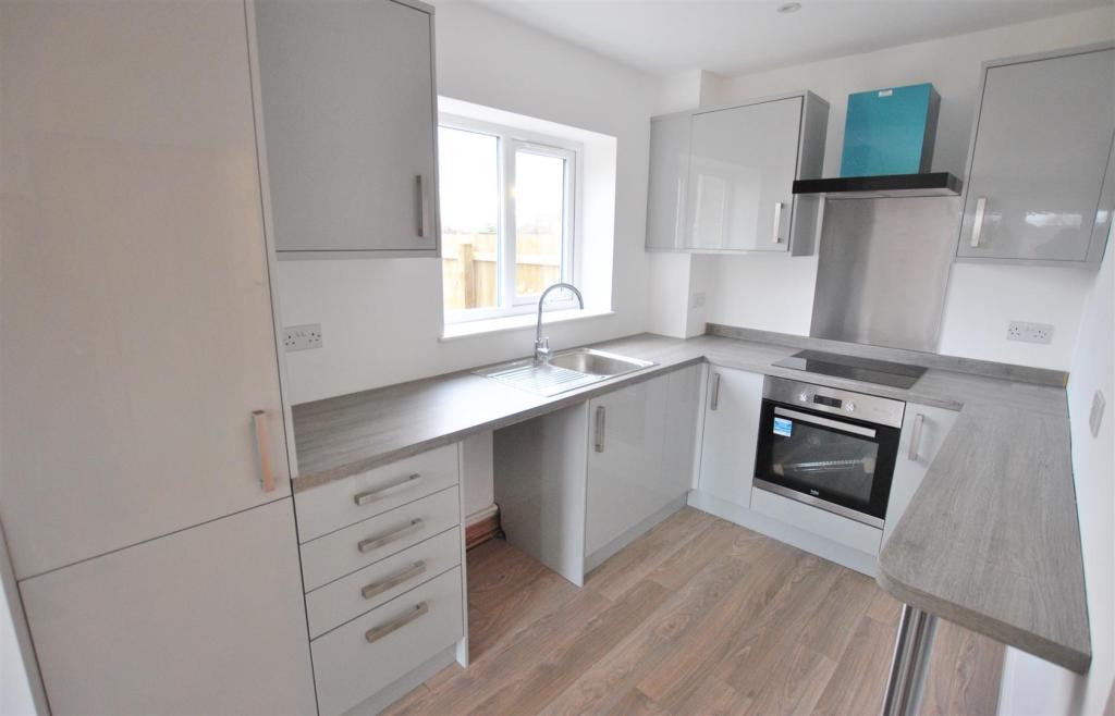
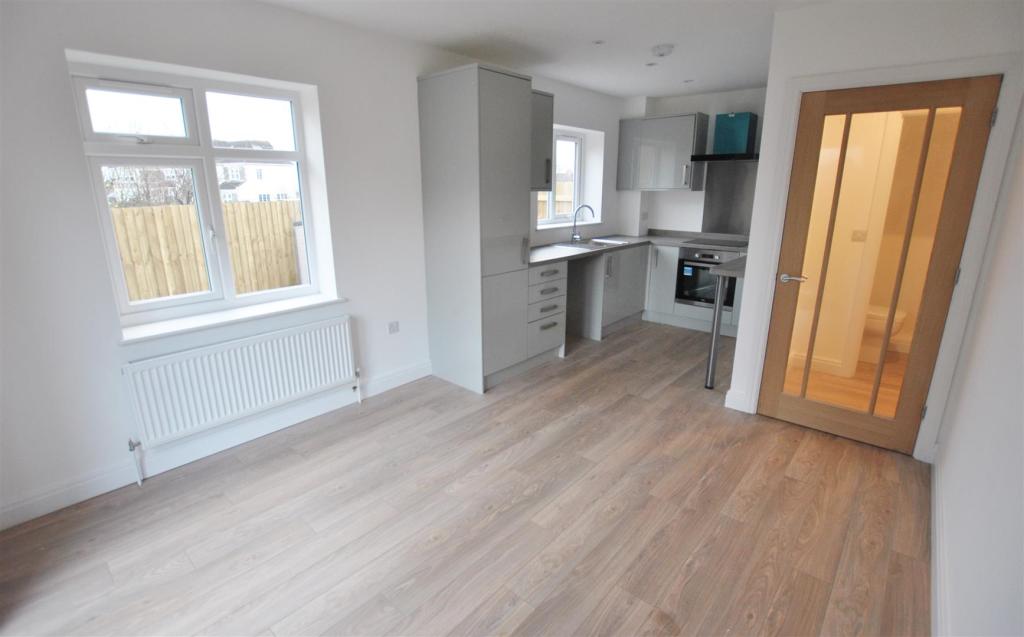
- Kitchen/Diner
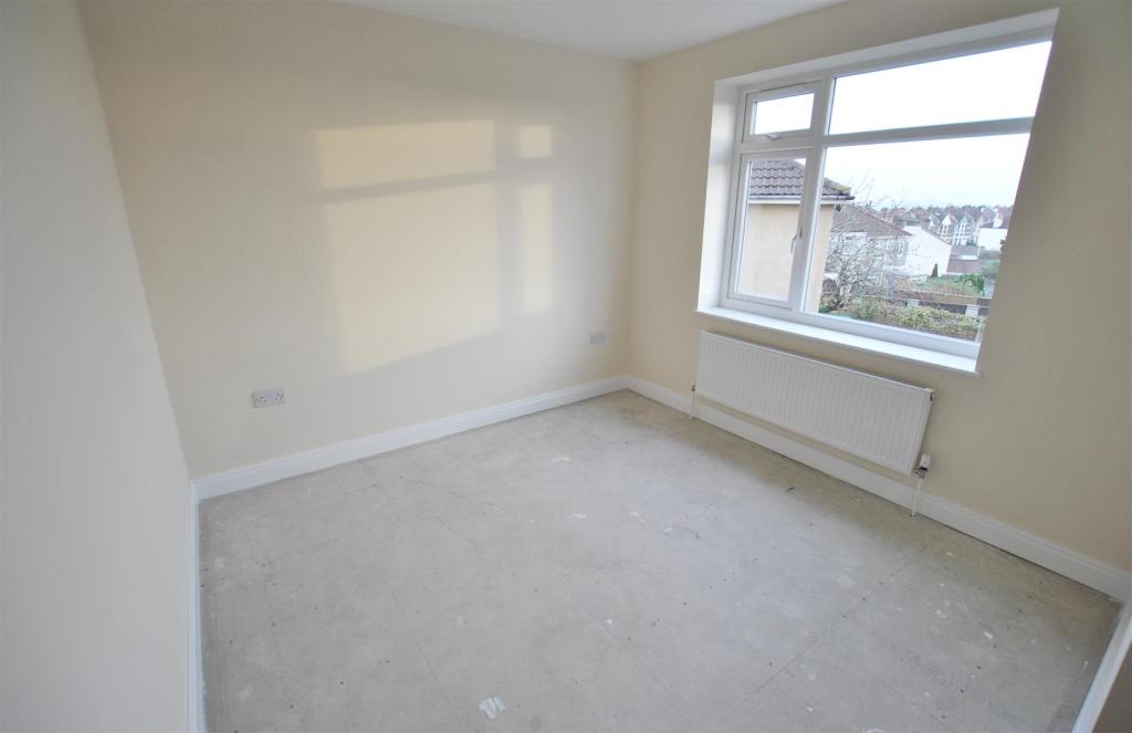
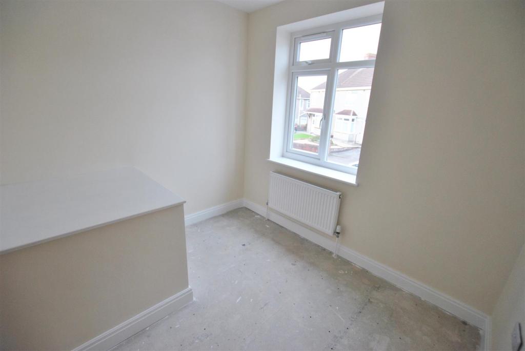
- Three Bedrooms
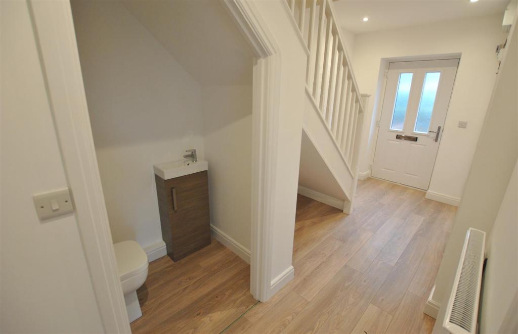
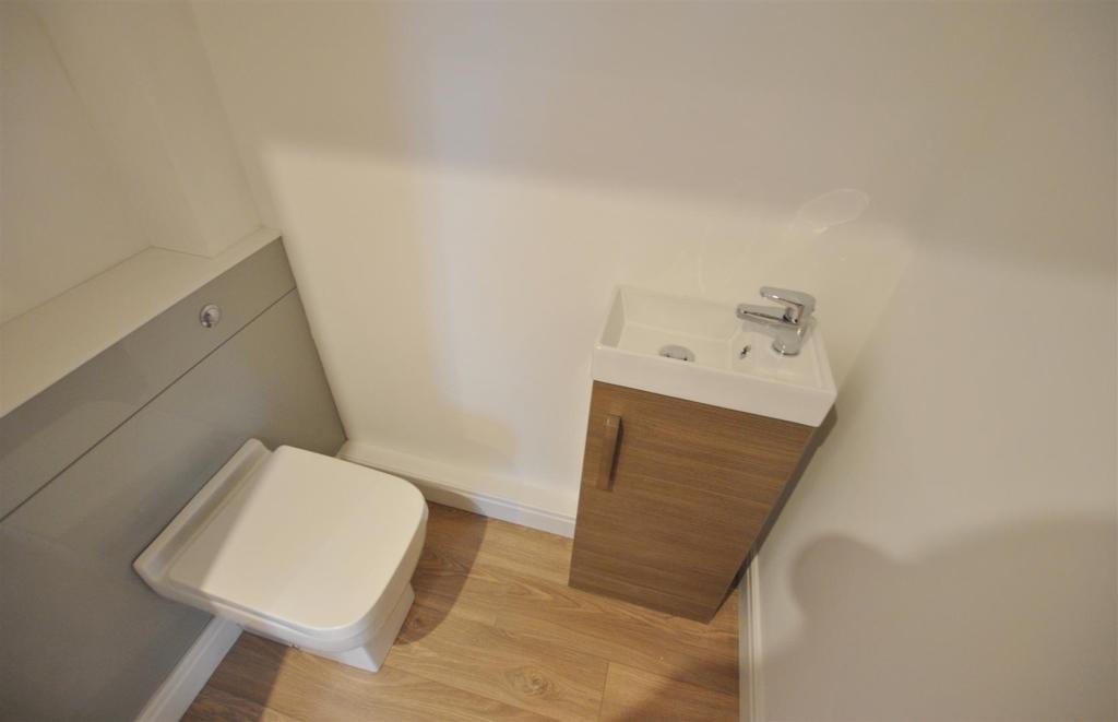
- Ground Floor WC
- Gas C/H & Upvc D/Glazing
- Off Street Parking
Additional details
- Parking
- Yes
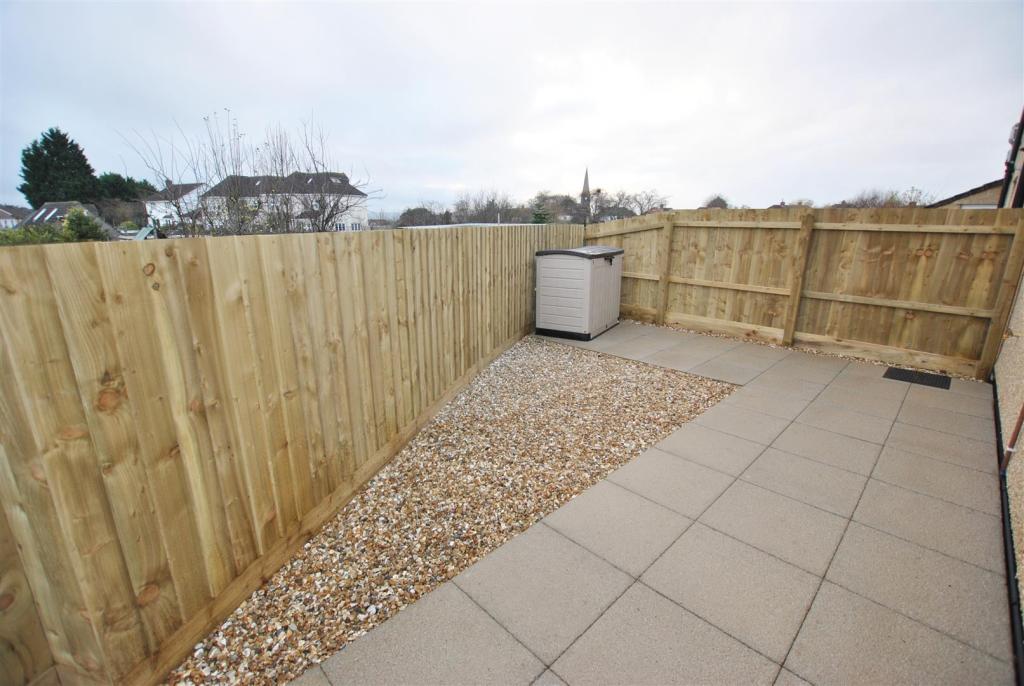
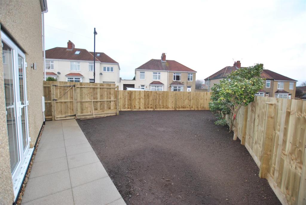
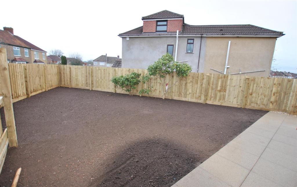
- Garden
- Yes
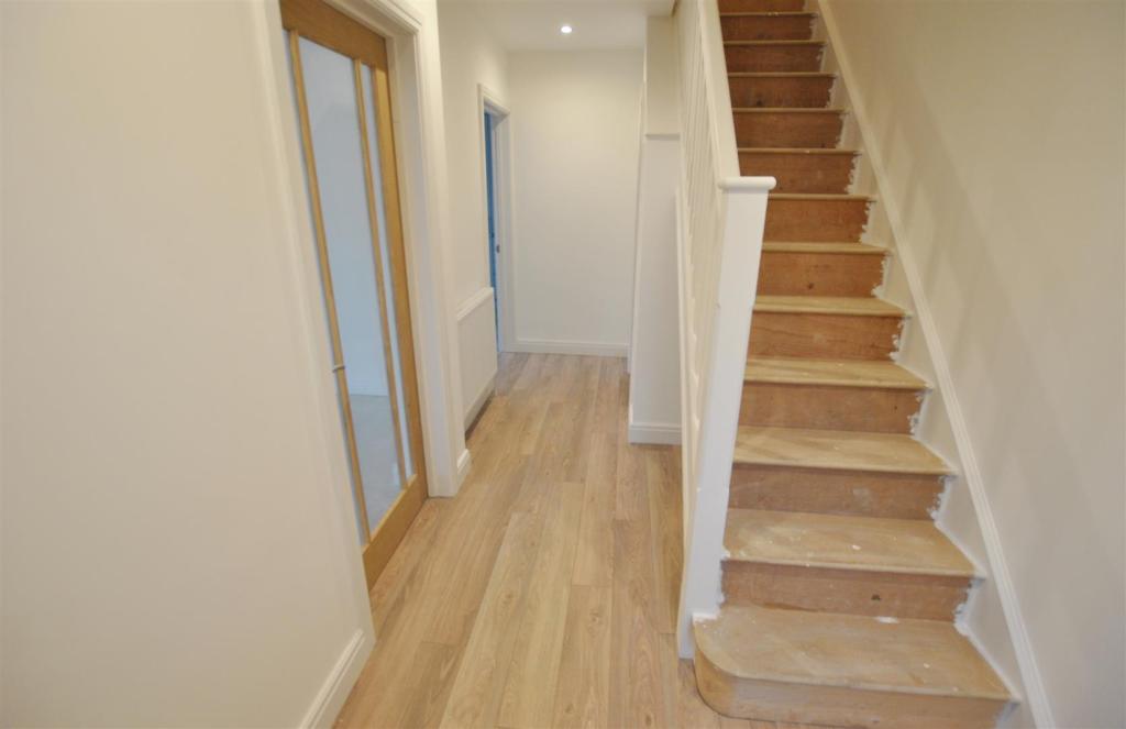
Description
Lounge - 3.76m(into bay) x 3.68m (12'04"(into bay) x 12'01" -
Kitchen/Diner - 5.74m x 3.15m(max) (18'10" x 10'04"(max)) -
Ground Floor W/C - 1.50m x 0.91m (4'11" x 3'00") -
Bedroom One - 3.73m(max) x 3.40m (12'03"(max) x 11'02) -
Bedroom Two - 3.73m(max) x 3.05m (12'03"(max) x 10'00") -
Bedroom Three - 2.67m x 2.36m (8'09" x 7'09") -
Bathroom - 2.57m x 1.68m (8'05" x 5'06") -
Listed by
Whitchurch
Greenwoods Property Centre
Reference: 63516131
EPC Rating & Upgrade Cost
Current rating: B
Potential rating: A
Inspection date: 01/01/2017
Expiry date: 31/12/2026
Est. upgrade cost to C: £11,500
Recommendations
- Solar water heating (£4,000 - £6,000)
- Solar photovoltaic panels, 2.5 kWp (£5,000 - £8,000)
Flood risk
Zone: 1
Risk: Low
Job (default Low)
Floorplans
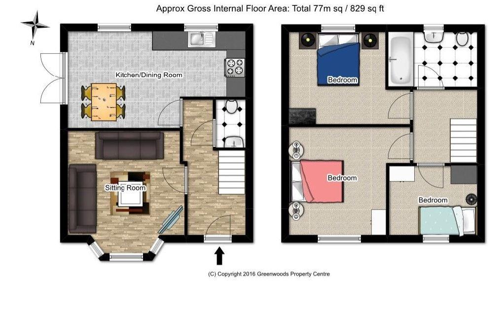
18a Raeburn Road.JPG
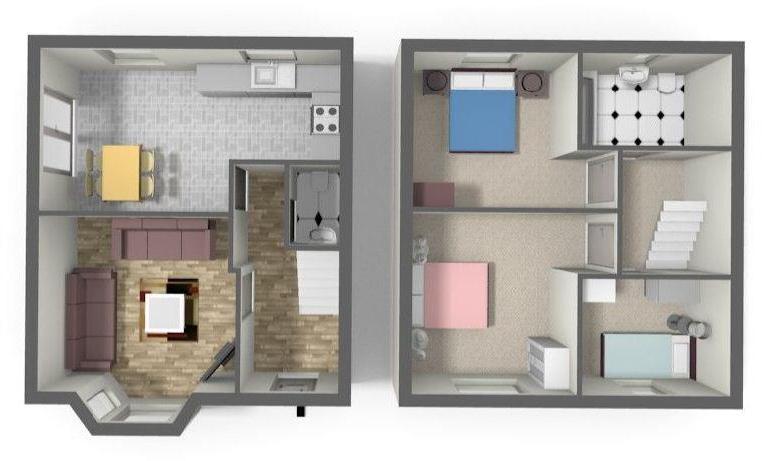
18a Reaburn Road 3D.
EPC Graphs
EE Rating
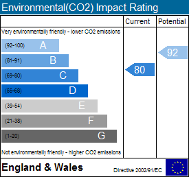
EI Rating
Price history
| Event | Date | Price | % change |
|---|---|---|---|
| Sold | 27/03/2017 (9 years ago) | £279,000 | — |
Source: HM Land Registry Price Paid Data. Crown copyright.
Sold Comparables
Same street and nearby sales within 0.25 miles (last 5 years). Data from Land Registry Price Paid.
| Address | Price | Date | Type |
|---|---|---|---|
| 6 STRADBROOK AVENUE, BRISTOL, CITY OF BRISTOL, BS5 8PH | £390,000 | 15/12/2025 | Terraced |
| 7 FURBER VALE, BRISTOL, CITY OF BRISTOL, BS5 8PZ | £301,500 | 28/11/2025 | Terraced |
| 28 ST ANNES ROAD, ST GEORGE, BRISTOL, CITY OF BRISTOL, BS5 8RE | £310,000 | 28/10/2025 | Terraced |
| 4 NORTHFIELD ROAD, BRISTOL, CITY OF BRISTOL, BS5 8PB | £357,400 | 18/12/2023 | Terraced |
| 155 BRYANTS HILL, BRISTOL, CITY OF BRISTOL, BS5 8RQ | £285,000 | 17/11/2023 | Terraced |
| Same street 6A RAEBURN ROAD, BRISTOL, CITY OF BRISTOL, BS5 8PS | £490,000 | 20/10/2023 | Terraced |
| 188 KINGSWAY, ST GEORGE, BRISTOL, CITY OF BRISTOL, BS5 8NX | £338,000 | 15/09/2023 | Terraced |
| 13 ROSSITERS LANE, BRISTOL, CITY OF BRISTOL, BS5 8TN | £250,000 | 30/08/2023 | Terraced |
| 15 WINDSOR AVENUE, BRISTOL, CITY OF BRISTOL, BS5 8RF | £358,500 | 18/08/2023 | Terraced |
| 97 FURBER ROAD, BRISTOL, CITY OF BRISTOL, BS5 8PT | £355,250 | 26/05/2023 | Terraced |
| 67 ST AIDANS ROAD, BRISTOL, CITY OF BRISTOL, BS5 8RW | £262,500 | 06/04/2023 | Terraced |
| 32 ST ANNES ROAD, ST GEORGE, BRISTOL, CITY OF BRISTOL, BS5 8RE | £350,000 | 20/12/2022 | Terraced |
| 19 NORTHFIELD ROAD, BRISTOL, CITY OF BRISTOL, BS5 8PA | £312,000 | 15/12/2022 | Terraced |
| 71A ST AIDANS ROAD, BRISTOL, CITY OF BRISTOL, BS5 8RW | £365,000 | 05/12/2022 | Terraced |
| 3 ST ANNES ROAD, ST GEORGE, BRISTOL, CITY OF BRISTOL, BS5 8RB | £325,000 | 02/12/2022 | Terraced |
| 71B ST AIDANS ROAD, BRISTOL, CITY OF BRISTOL, BS5 8RW | £370,000 | 29/11/2022 | Terraced |
| 27 ROSSITERS LANE, BRISTOL, CITY OF BRISTOL, BS5 8TN | £312,250 | 25/11/2022 | Terraced |
| 128 NAGS HEAD HILL, BRISTOL, CITY OF BRISTOL, BS5 8QP | £317,200 | 04/11/2022 | Terraced |
| Same street 12 RAEBURN ROAD, BRISTOL, CITY OF BRISTOL, BS5 8PS | £370,000 | 21/10/2022 | Semi-detached |
| 8 HEADFORD AVENUE, ST GEORGE, BRISTOL, CITY OF BRISTOL, BS5 8PF | £365,000 | 26/09/2022 | Terraced |
| 14 SHELDARE BARTON, BRISTOL, CITY OF BRISTOL, BS5 8PN | £350,000 | 16/09/2022 | Terraced |
| 84 BRYANTS HILL, BRISTOL, CITY OF BRISTOL, BS5 8QT | £332,500 | 16/09/2022 | Terraced |
| Same street 17 RAEBURN ROAD, BRISTOL, CITY OF BRISTOL, BS5 8PS | £400,000 | 25/01/2022 | Semi-detached |
| Same street 17 RAEBURN ROAD, BRISTOL, CITY OF BRISTOL, BS5 8PS | £400,000 | 25/01/2022 | Semi-detached |
Street average: £415,000 (4 sales)
Area average: £330,355 (20 sales)
Capital growth trend
Land Registry outcode average: last 12 months vs 5y and 10y ago (from sold prices).
House Price Index (HM Land Registry — official index, not sold-price averages): City of Bristol. Series: Terraced. As of March 2026.
Rental Range
Estimated market rent for Bristol, City of. Low = conservative, Realistic = average, Optimistic = best case.
Based on Local Authority from postcode lookup → Bristol, City of.
LHA (30th percentile) floor for Bristol: £1,296/mo (Apr 2025 – Mar 2026)
Location
Nearby
Nearest stations, universities and amenities (distance from property).
| Type | Name | Distance |
|---|---|---|
| Bus stop | Kingsway Shops | 0.1 miles |
| Bus stop | Bryants Hill | 0.1 miles |
| Shop | KSK News | 0.3 miles |
| Shop | Bargain Beer | 0.5 miles |
| Train station | Lawrence Hill | 1.8 miles |
| Train station | Stapleton Road | 2.1 miles |
| University | Bristol Digital Futures Institute | 2.3 miles |
| University | dBs Institute Bristol Campus | 2.8 miles |
| Hospital | South West Regional Laboratories | 3.4 miles |
| Hospital | Spire Bristol | 4.1 miles |
Street-level crime
| Category | Count |
|---|---|
| Violence and sexual offences | 134 |
| Anti-social behaviour | 52 |
| Public order | 34 |
| Shoplifting | 33 |
| Burglary | 28 |
| Criminal damage and arson | 26 |
| Vehicle crime | 24 |
| Other theft | 20 |
| Other crime | 11 |
| Robbery | 5 |
| Drugs | 3 |
| Bicycle theft | 2 |
| Theft from the person | 1 |
| Total incidents | 373 |
Within 1 mile during Apr 2026. Source: data.police.uk (England & Wales).
Schools nearby
Nearest open schools with Ofsted ratings (England). Closed schools are not shown. Data from Get Information about Schools and Ofsted.
| Name | Type | Distance | Ofsted |
|---|---|---|---|
| John Cabot Academy | Secondary | 0.4 miles | — (Inspected (no overall grade)) |
| Air Balloon Hill Primary School | Primary | 0.4 miles | Good — 21 May 2018 |
| Two Mile Hill Primary School | Primary | 0.5 miles | Requires improvement — 21 Sep 2022 |
| Beacon Rise Primary School | Primary | 0.6 miles | Outstanding — 29 Jan 2024 |
| Samuel White's Infant School | Primary | 0.7 miles | Good — 31 Jan 2023 |
Rental Comparables
Rental listings exist nearby, but none matched the 3-bedroom count for this property.
Rent-driven metrics
Based on Area rent estimate.
- Rent ratio — Monthly rent ÷ purchase price (1% rule). 1%+ = strong, 0.8–1% = okay, <0.8% = weak for cashflow.
- Max investor price — Rent ÷ 0.8%; the price at which rent would be 0.8% of price (Stoke-style target).
- Target investor price — Rent ÷ 1%; the price at which rent would be 1% of price (strong cashflow band).
- Gross yield — Annual rent as % of purchase price (no costs).