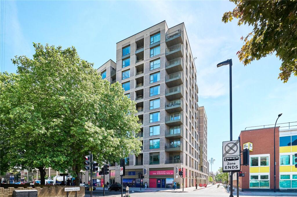
FLAT 18
281 KENNINGTON LANE, LONDON, GREATER LONDON SE11 5AQ
Property details
Council tax band
E
Street crime
1698 incidents within 1 mile (Apr 2026)
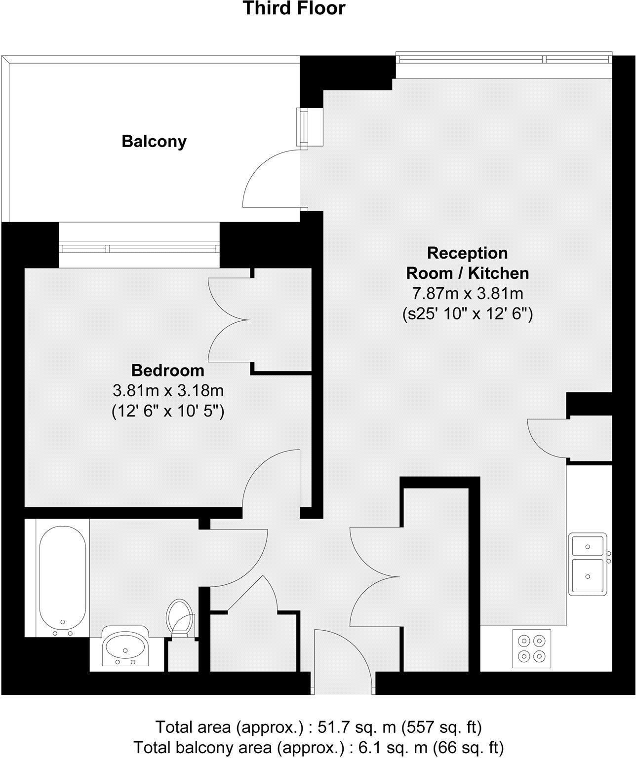
Key features
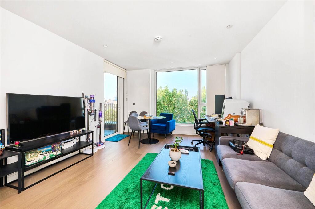
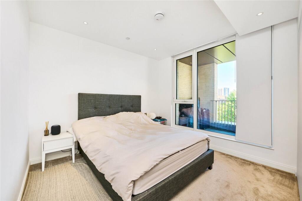
- One Bedroom
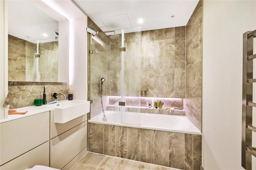
- One Bathroom
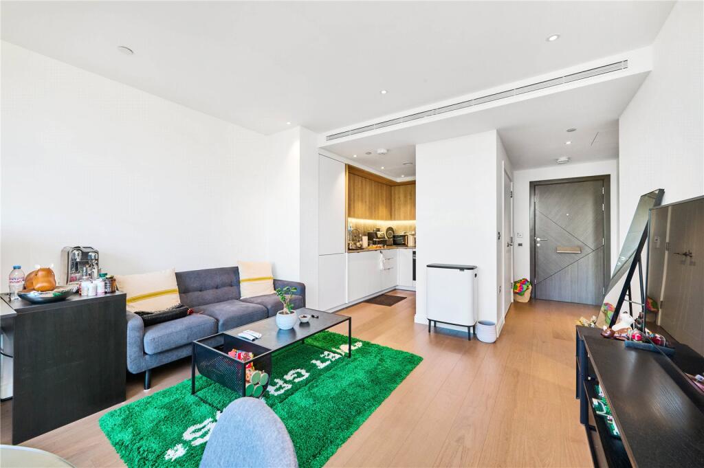
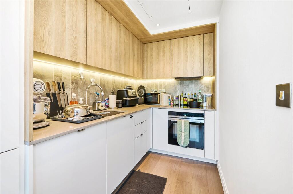
- Open Plan Living Area
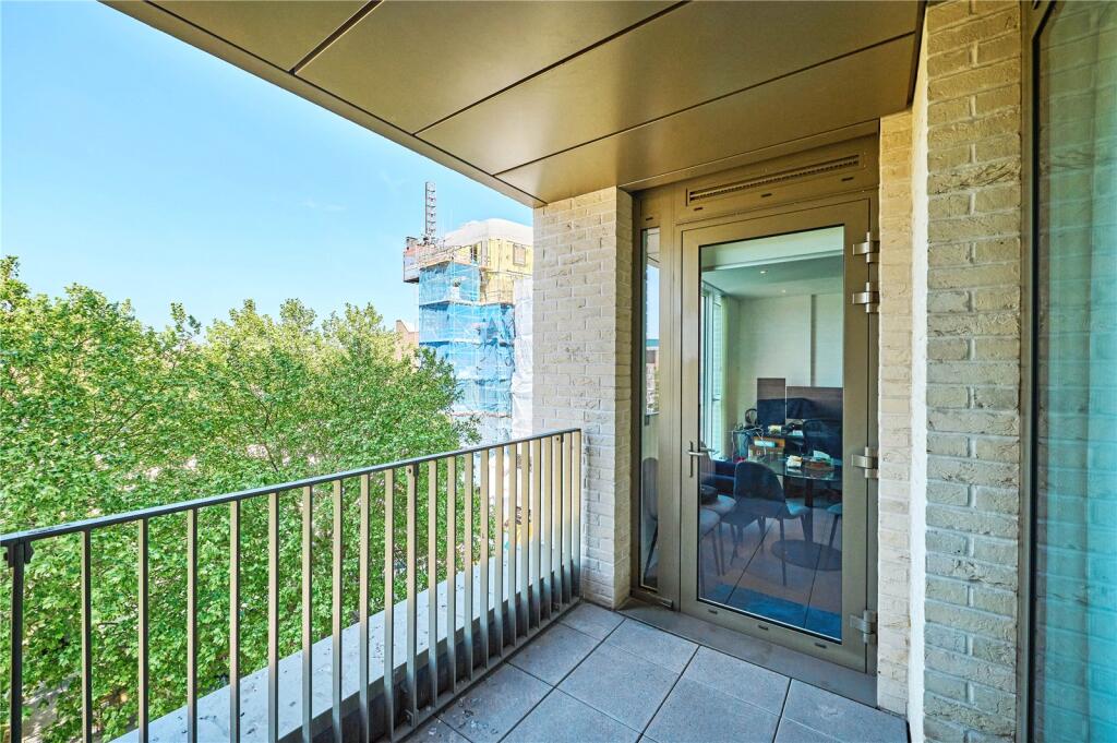
- Private Balcony
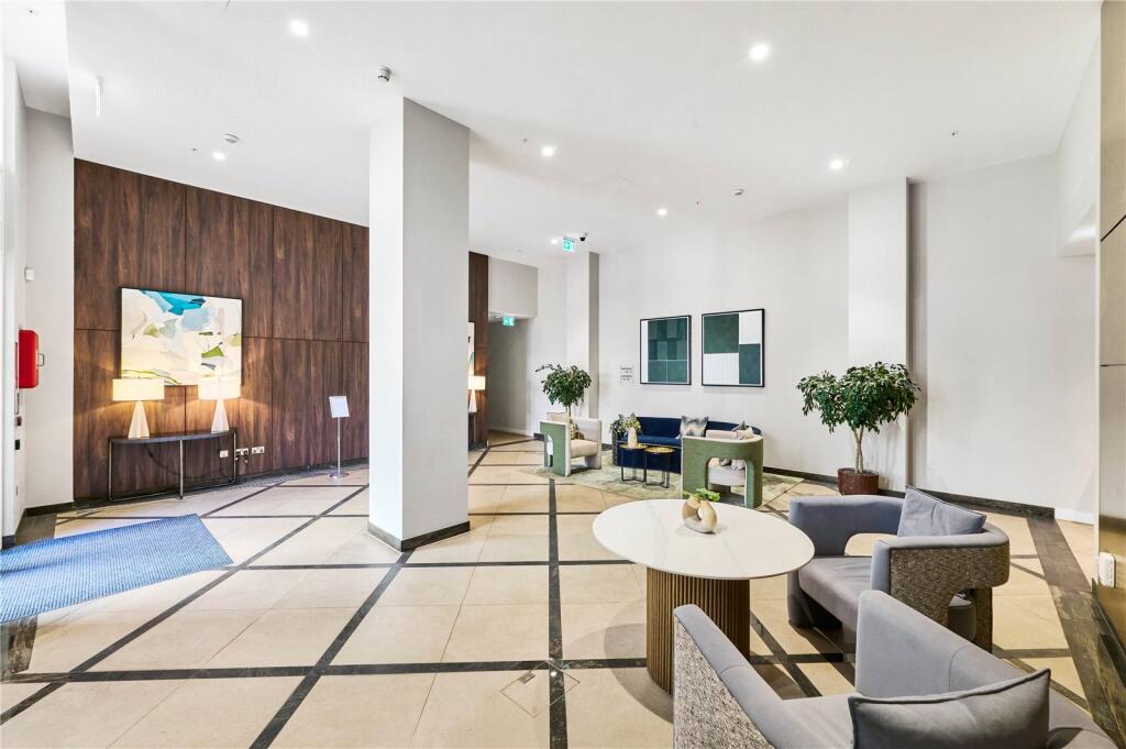
- 24 Hours Concierge
- Close To Vauxall Station
Description
It is within easy walking distance of Vauxhall station, a major transport hub providing swift access to the Victoria line, National Rail services and extensive bus routes across the capital. The vibrant cultural scene and iconic views of the River Thames are also just a few minutes' walk away.
The building's superb location is complemented by a 24-hour concierge service and exclusive access to high-quality residents' amenities, including a well-equipped gym. This means you can live in comfort and be close to everything you need. This truly is an ideal residence for those seeking the pinnacle of central London living.
Listed by
London
Dexters
Reference: 162119879
EPC Rating & Upgrade Cost
Fetching EPC data… Refresh this page in a moment.
Flood risk
Zone: 1
Risk: Low
Job (default Low)
Floorplans
Picture No. 23
EPC Graphs
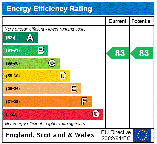
EPC Rating Graph
Company ownership
Registered legal owner is a company.
Rental Range
Estimated market rent for London. Low = conservative, Realistic = average, Optimistic = best case.
Based on Postcode area SE → London.
LHA (30th percentile) floor for Stevenage & North Herts: £773/mo (Apr 2025 – Mar 2026)
Location
Nearby
Nearest stations, universities and amenities (distance from property).
| Type | Name | Distance |
|---|---|---|
| Bus stop | Loughborough Street | 0.0 miles |
| Shop | Wex Rental London | 0.0 miles |
| Shop | Big Yellow Self Storage | 0.0 miles |
| Bus stop | Durham Street | 0.1 miles |
| Train station | Vauxhall | 0.3 miles |
| Train station | Oval | 0.4 miles |
| University | University of Wales Trinity Saint David London Campus | 0.6 miles |
| Hospital | Cambian Churchill | 0.8 miles |
| University | London College of Communication | 0.8 miles |
| Hospital | Evelina London Children's Hospital | 0.8 miles |
Street-level crime
| Category | Count |
|---|---|
| Violence and sexual offences | 389 |
| Anti-social behaviour | 305 |
| Theft from the person | 242 |
| Shoplifting | 160 |
| Other theft | 156 |
| Public order | 96 |
| Robbery | 74 |
| Criminal damage and arson | 72 |
| Drugs | 60 |
| Burglary | 53 |
| Bicycle theft | 41 |
| Vehicle crime | 26 |
| Other crime | 17 |
| Possession of weapons | 7 |
| Total incidents | 1698 |
Within 1 mile during Apr 2026. Source: data.police.uk (England & Wales).
Schools nearby
Nearest open schools with Ofsted ratings (England). Closed schools are not shown. Data from Get Information about Schools and Ofsted.
| Name | Type | Distance | Ofsted |
|---|---|---|---|
| Lilian Baylis Technology School | Secondary | 0.1 miles | Outstanding — 10 May 2023 |
| St Mark's Church of England Primary School | Primary | 0.2 miles | Good — 14 Oct 2019 |
| St Anne's Catholic Primary School | Primary | 0.2 miles | Requires improvement — 3 Sep 2023 |
| Vauxhall Primary School | Primary | 0.2 miles | Good — 18 Jan 2024 |
| Henry Fawcett Primary School | Primary | 0.2 miles | Good — 9 Sep 2024 |
Rental Comparables
Rental listings exist nearby, but none matched the 1-bedroom count for this property.