20 GEORGE ELIOT STREET
NUNEATON, WARWICKSHIRE CV11 4NW
£650 pcm
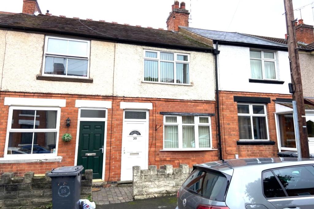
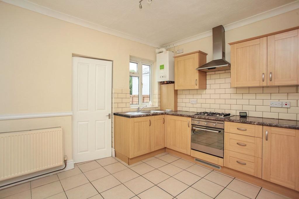
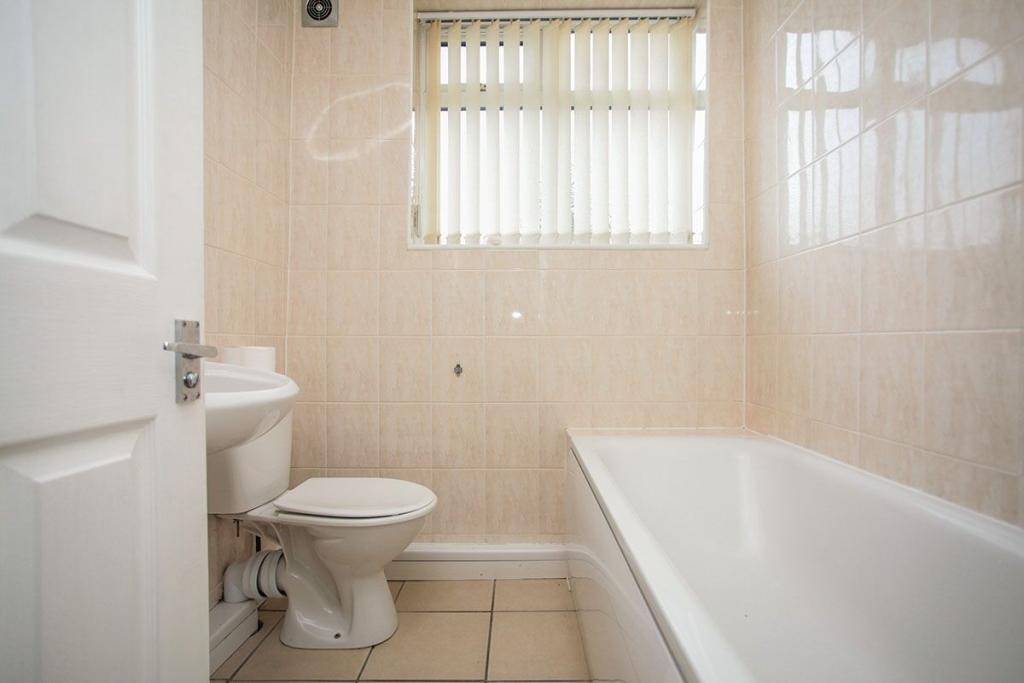
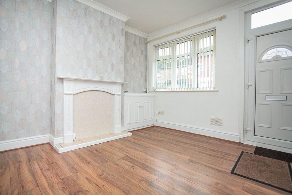
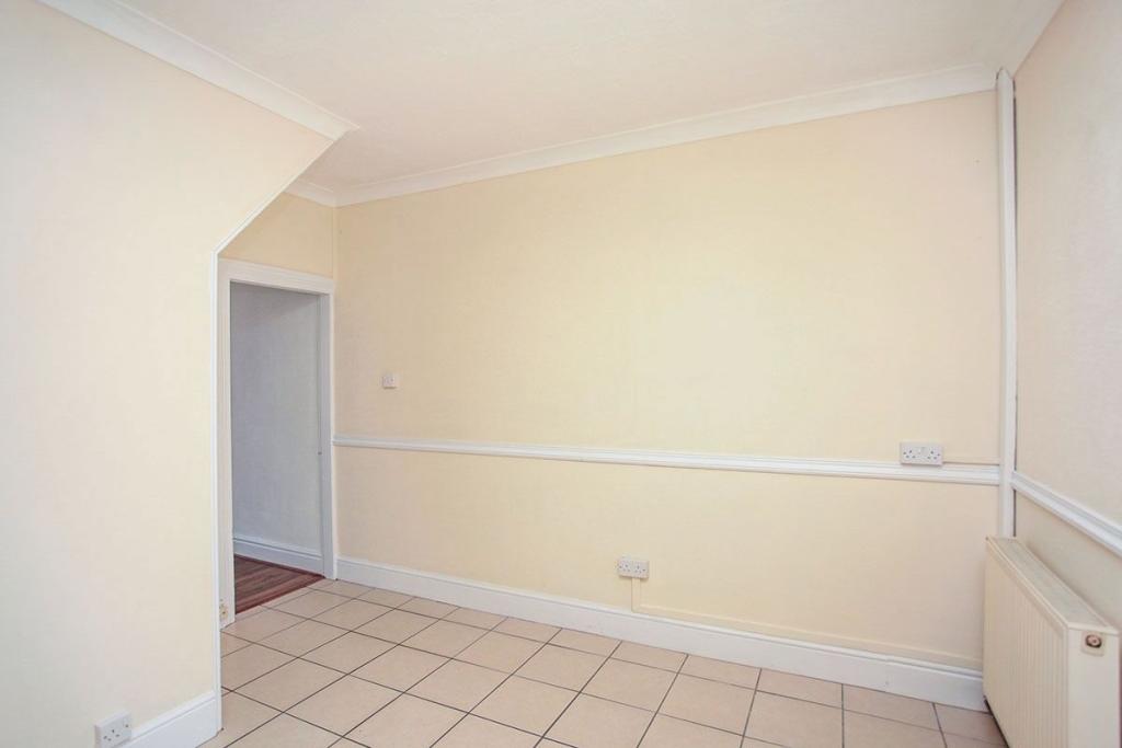
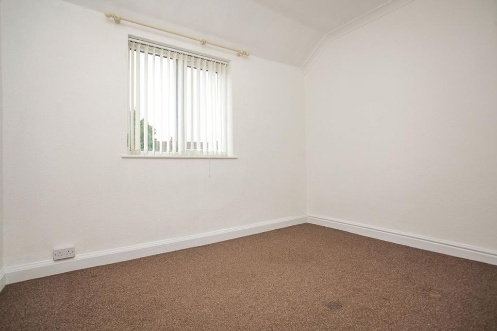
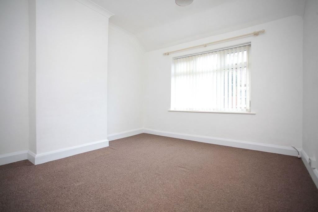
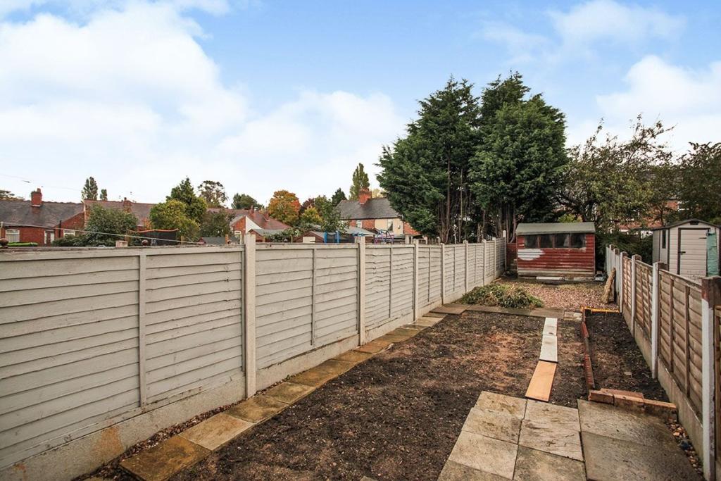
Photo 1 Photo 2 Bathroom / Shower Room / WC Lounge Dining Kitchen Bedroom Bedroom Rear Garden
/ 8
Property details
Floor area
55 m²
EPC rating
C
Year built
England and Wales: 1900-1929
Deprivation
Decile 3 (9,844 of 33,755)
Street crime
432 incidents within 1 mile (Apr 2026)
Additional details
- Garden
- Yes
Description
LocationGeorge Elliot Street is located just off Coventry Road in Nuneaton providing good access to the A444 and is within walking distance to the town centre.
Our ViewThis property would be ideal for couples, singles, professionals, families.
Lounge
Dining Kitchen
Bathroom / Shower Room / WC
First Floor Landing
Bedroom
Bedroom
Outside
Rear Garden
/2
Listed by
Nuneaton
National Home Move - LSL Franchise
Reference: 74040204
EPC Rating & Upgrade Cost
Current rating: C
Potential rating: C
Inspection date: 16/10/2025
Current heating cost: £679/year
Potential heating cost: £499/year
Est. upgrade cost to C: £19,300
Recommendations
- Flat roof or sloping ceiling insulation (£900 - £1,200)
- 50 mm internal or external wall insulation (£7,500 - £11,000)
- Solar photovoltaic panels, 2.5 kWp (£8,000 - £10,000)
Flood risk
Zone: 1
Risk: Low
Job (default Low)
Floorplans
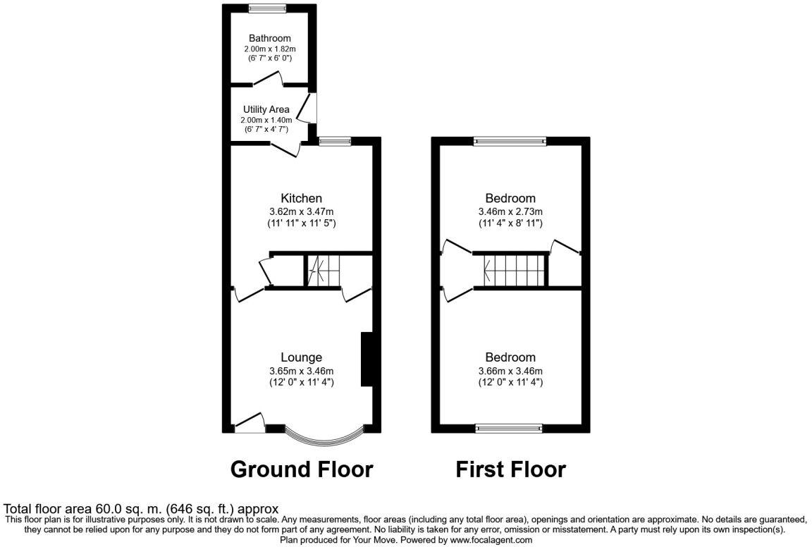
Floorplan 1
EPC Graphs
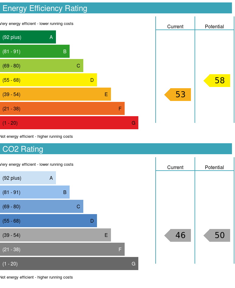
EPC 1
Rental Range
Estimated market rent for Nuneaton and Bedworth. Low = conservative, Realistic = average, Optimistic = best case.
Based on Local Authority from postcode lookup → Nuneaton and Bedworth.
LHA (30th percentile) floor for Coventry: £673/mo (Apr 2025 – Mar 2026)
Location
Nearby
Nearest stations, universities and amenities (distance from property).
| Type | Name | Distance |
|---|---|---|
| Bus stop | Featherstone Close | 0.0 miles |
| Shop | Best-one | 0.2 miles |
| Hospital | George Eliot Hospital | 0.3 miles |
| Shop | Research Garage | 0.4 miles |
| Train station | Bermuda Park | 0.6 miles |
| Train station | Nuneaton | 1.0 miles |
| Hospital | The Manor | 1.1 miles |
| University | Coventry University - Foleshill Studios | 6.5 miles |
| University | Coventry University | 7.3 miles |
Street-level crime
| Category | Count |
|---|---|
| Violence and sexual offences | 142 |
| Anti-social behaviour | 101 |
| Criminal damage and arson | 39 |
| Shoplifting | 27 |
| Vehicle crime | 25 |
| Public order | 23 |
| Burglary | 15 |
| Other theft | 15 |
| Possession of weapons | 12 |
| Drugs | 10 |
| Bicycle theft | 9 |
| Robbery | 6 |
| Other crime | 5 |
| Theft from the person | 3 |
| Total incidents | 432 |
Within 1 mile during Apr 2026. Source: data.police.uk (England & Wales).
Schools nearby
Nearest open schools with Ofsted ratings (England). Closed schools are not shown. Data from Get Information about Schools and Ofsted.
| Name | Type | Distance | Ofsted |
|---|---|---|---|
| Middlemarch School | Primary | 0.1 miles | Good — 9 Sep 2015 |
| All Saints CofE Primary School and Nursery, Nuneaton | Primary | 0.3 miles | Good — 1 Mar 2016 |
| Wembrook Primary School | Primary | 0.3 miles | Good — 11 May 2020 |
| Oak Wood Primary School | Other | 0.4 miles | Good — 19 Jul 2013 |
| Oak Wood Secondary School | Other | 0.4 miles | Good — 19 Jul 2013 |
Rental Comparables
Rental listings exist nearby, but none matched the 2-bedroom count for this property.