195 HENDON WAY
LONDON, LONDON, GREATER LONDON NW2 1JJ
£477 pcm
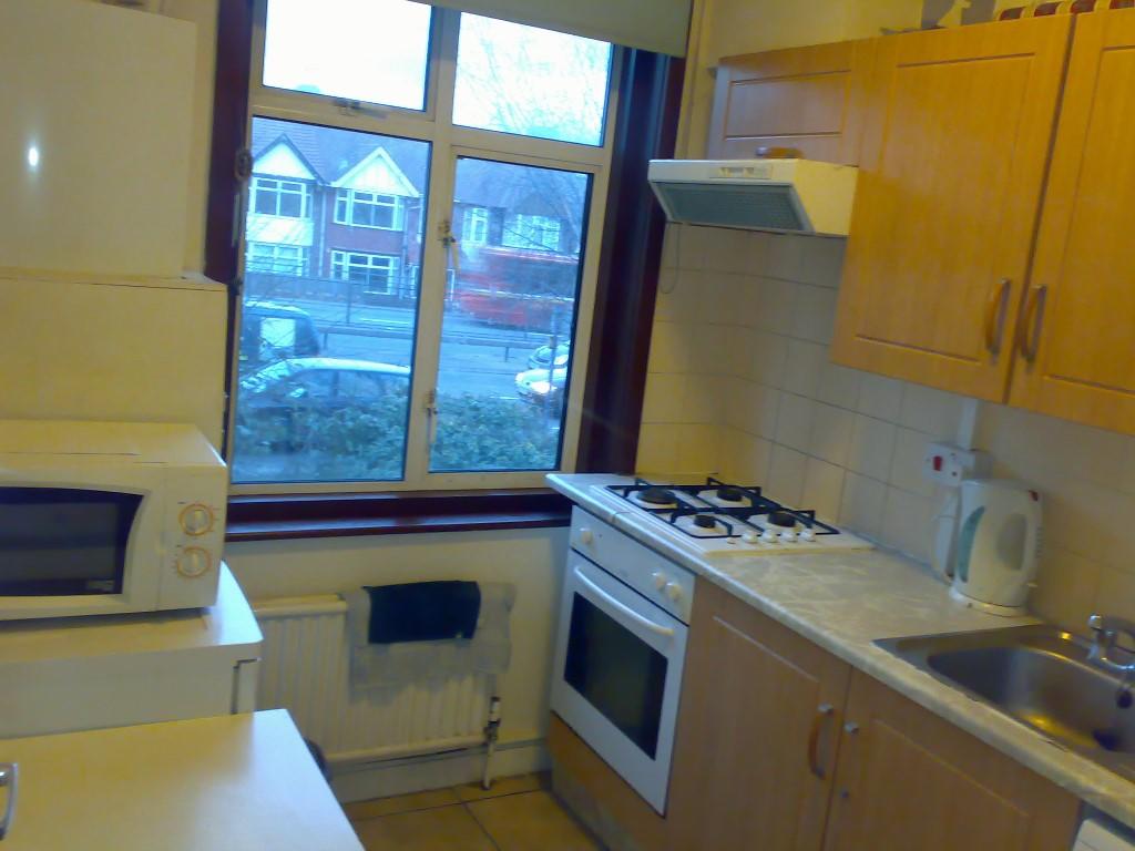
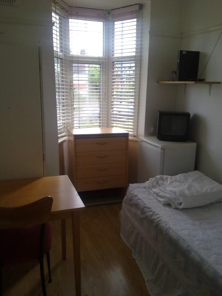
Photo 1 Photo 2
/ 2
Property details
Deprivation
Decile 3 (9,546 of 33,755)
Street crime
633 incidents within 1 mile (Apr 2026)
Additional details
- Heating
- Central
Description
Listed by
London
Easylet International Ltd
Reference: 58618619
EPC Rating & Upgrade Cost
Fetching EPC data… Refresh this page in a moment.
Flood risk
Zone: 1
Risk: Low
Job (default Low)
FENSA Certificates
This property has 1 FENSA certificate(s) on record, indicating window/door installations by FENSA-approved installers.
FENSA Certificate #10043788
Property Details
Street: 195 Hendon Way
Town: LONDON
Postcode: NW2 1JJ
Installation Details
Items: 2 windows and 1 door
Certificate Issued: 20/01/2014
Work Completed: 05/12/2013
This certificate data was retrieved from FENSA's database
What is FENSA? FENSA (Fenestration Self-Assessment Scheme) is a government-authorised scheme that monitors building regulation compliance for replacement windows and doors. Certificates indicate that work was completed by FENSA-approved installers.
Rental Range
Estimated market rent for Barnet. Low = conservative, Realistic = average, Optimistic = best case.
Based on Local Authority from postcode lookup → Barnet.
LHA (30th percentile) floor for Inner North London: Apr 2025 – Mar 2026
Location
Nearby
Nearest stations, universities and amenities (distance from property).
| Type | Name | Distance |
|---|---|---|
| Bus stop | Wessex Gardens | 0.0 miles |
| Shop | A/F/G | 0.4 miles |
| Shop | Karma Bread | 0.4 miles |
| Train station | Brent Cross | 0.4 miles |
| Train station | Brent Cross West | 0.7 miles |
| University | Flood Hazard Research Centre | 2.2 miles |
| University | Middlesex University | 2.2 miles |
| Hospital | The Portland Hospital | 4.4 miles |
| Hospital | Sleep & Health Clinic | 4.5 miles |
Street-level crime
| Category | Count |
|---|---|
| Violence and sexual offences | 161 |
| Anti-social behaviour | 150 |
| Shoplifting | 74 |
| Vehicle crime | 63 |
| Other theft | 40 |
| Public order | 40 |
| Burglary | 29 |
| Drugs | 23 |
| Criminal damage and arson | 17 |
| Theft from the person | 12 |
| Other crime | 8 |
| Robbery | 8 |
| Possession of weapons | 6 |
| Bicycle theft | 2 |
| Total incidents | 633 |
Within 1 mile during Apr 2026. Source: data.police.uk (England & Wales).
Schools nearby
Nearest open schools with Ofsted ratings (England). Closed schools are not shown. Data from Get Information about Schools and Ofsted.
| Name | Type | Distance | Ofsted |
|---|---|---|---|
| Wessex Gardens Primary School | Primary | 0.1 miles | Requires improvement — 26 Apr 2023 |
| Peninim | Other | 0.3 miles | Good — 23 Jul 2024 |
| Menorah Primary School for Girls | Primary | 0.3 miles | Outstanding — 23 Jun 2024 |
| Menorah Primary School for Boys | Primary | 0.3 miles | — (No rating) |
| Rimon Jewish Primary School | Primary | 0.4 miles | Good — 6 May 2014 |
Rental Comparables
Residential lets from OpenRent and Rightmove for the area. Bedroom counts vary — use the Beds column to compare like-for-like lets. Student lets are excluded.
| Title | Rent | Beds | Distance | As seen on |
|---|---|---|---|---|
| 2 Bed Flat, Hamilton Road, NW11 | £2,300/mo | 2 | 0.29 miles | OpenRent |
| 2 Bed Flat, Hamilton Road, NW11 | £1,950/mo | 2 | 0.3 miles | OpenRent |
Average rent: £2,125/mo (2 listings)