APARTMENT 7
98 BAKER STREET, LONDON, GREATER LONDON W1U 6TJ

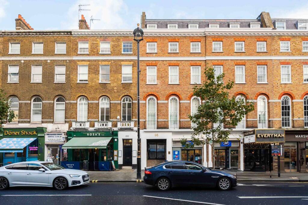
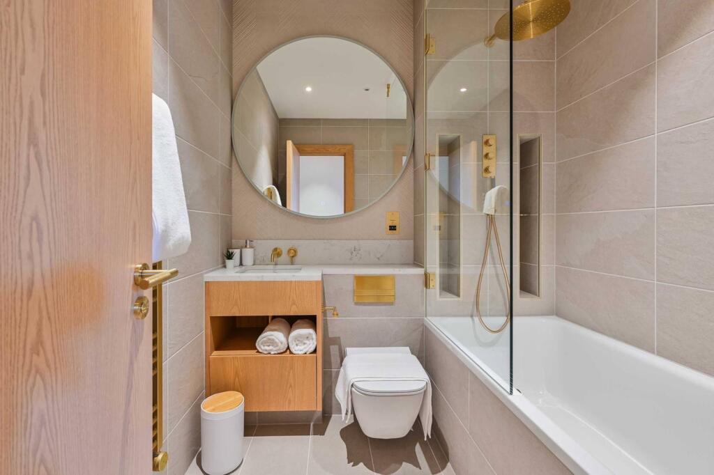
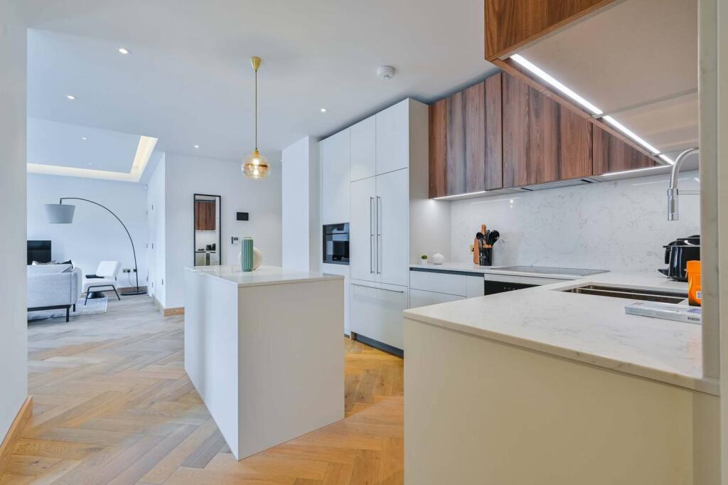
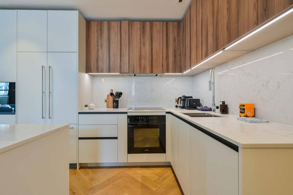
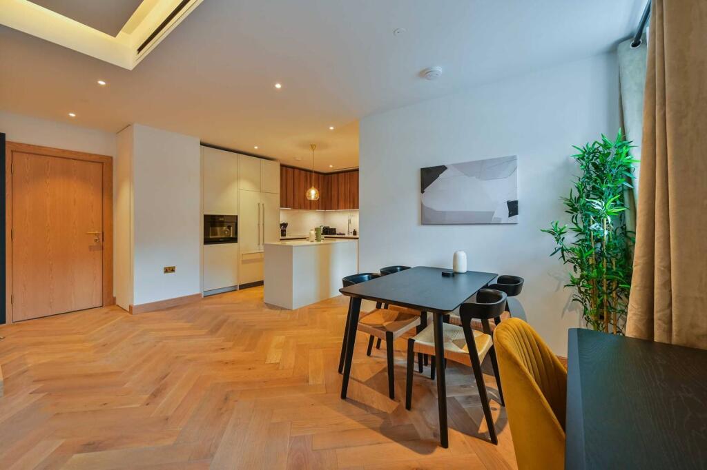
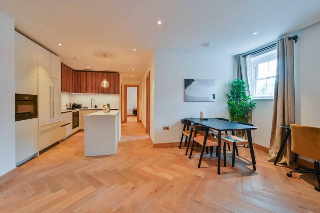
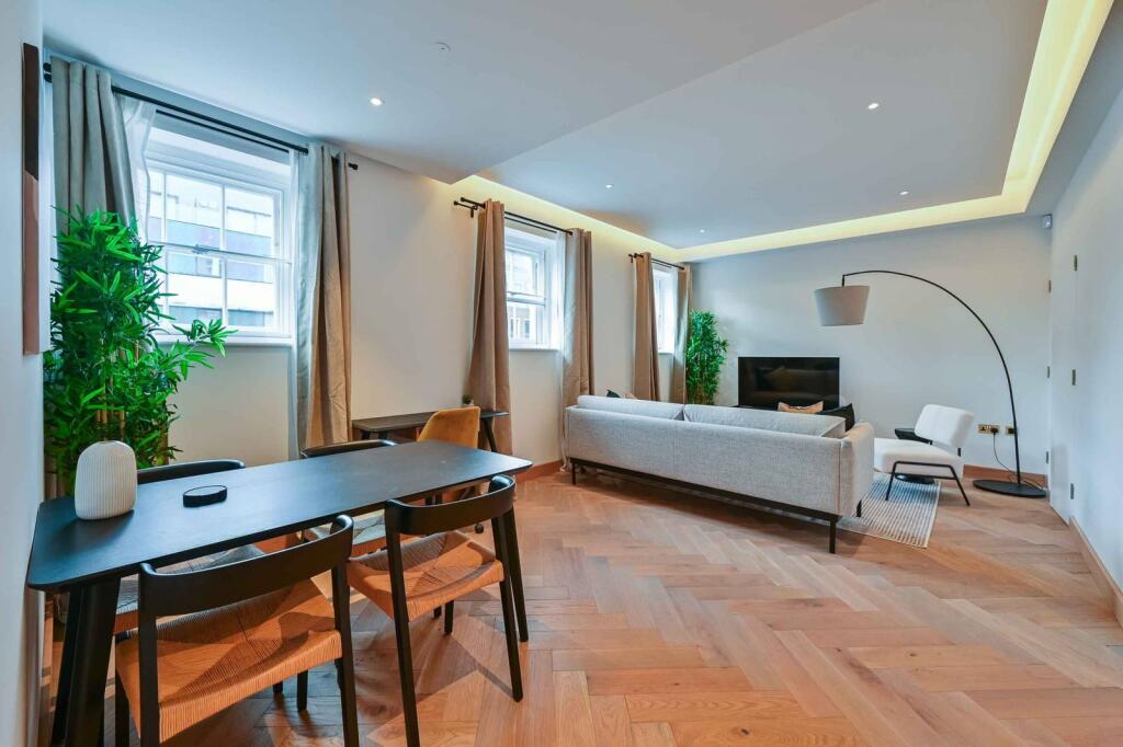
Photo 1 Photo 2 Photo 3 Photo 4 Photo 5 Photo 6 Photo 7 Photo 8
/ 8
Property details
Deprivation
Decile 7 (21,777 of 33,755)
Street crime
2869 incidents within 1 mile (Apr 2026)
Key features
- Stylish two bedroom, third floor apartment with lift access
- Beautiful open plan reception with feature windows and stunning hard wood floor
- Immaculately styled modern kitchen high spec equipment
- Two well proportioned double bedrooms with built in wardrobe space and one en suite shower room
- Well presented bathroom
- Abundant storage and mood lighting throughout
- Moments from Baker Street and Marylebone stations
- Offers easy access to Hyde Park, Marylebone, Euston and Oxford Street
- Available with Zero Deposit
Description
Only a few moments from Baker Street underground station, offering direct access to the city, Baker Street is full of a fabulous array of shops and eateries and leads directly to beautiful Hyde Park and Oxford Streets abundance of amenities.
Please use the reference PTNY5244396 when contacting Foxtons.
Listed by
Marylebone
Foxtons
Reference: 167389523
EPC Rating & Upgrade Cost
Fetching EPC data… Refresh this page in a moment.
Flood risk
Zone: 1
Risk: Low
Job (default Low)
Floorplans
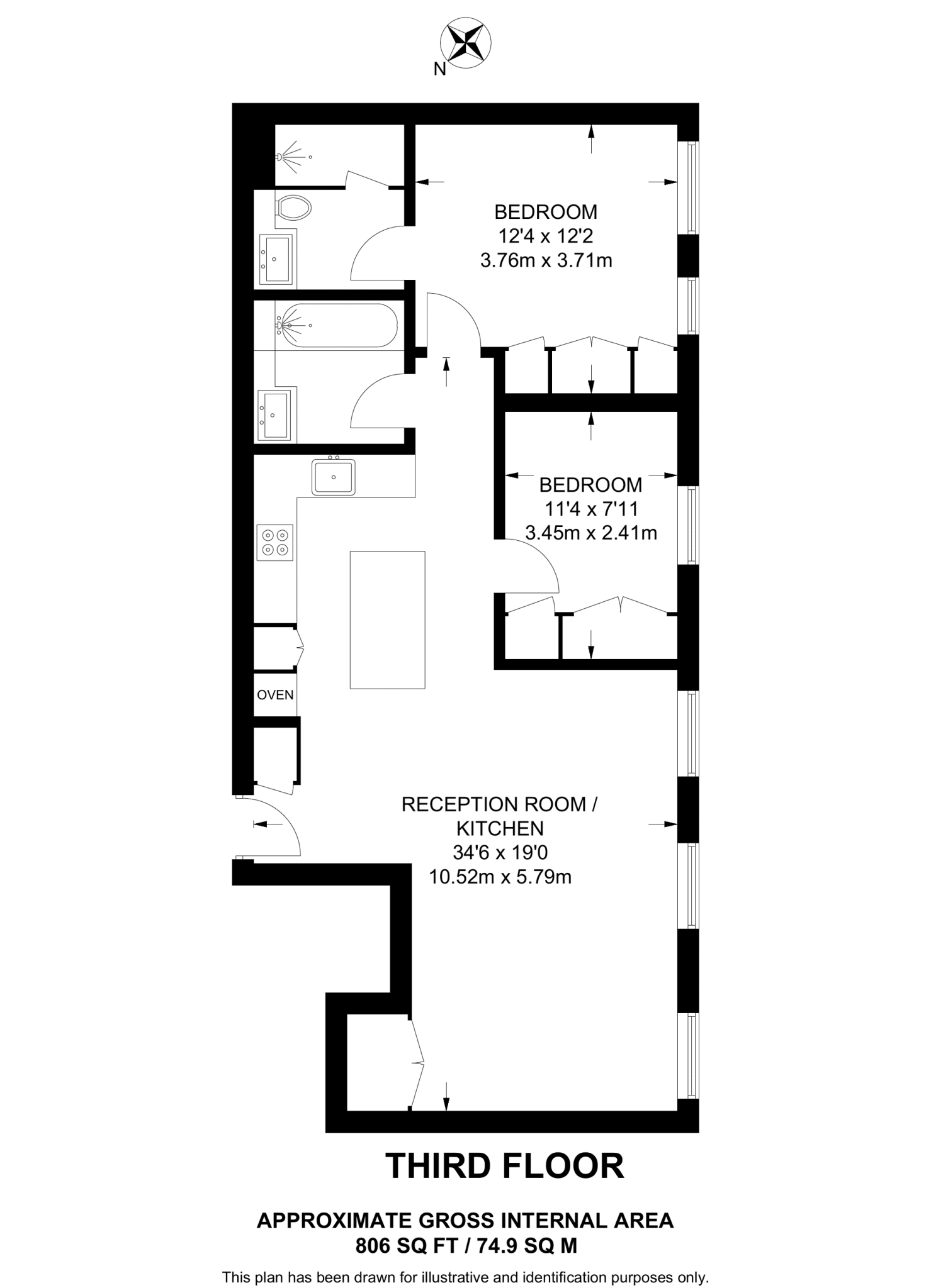
Floorplan area for info only, not for £/sq. ft valuation

Floorplan 2
EPC Graphs
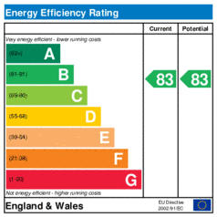
EER
Company ownership
Registered legal owner is a company.
Rental Range
Estimated market rent for Westminster. Low = conservative, Realistic = average, Optimistic = best case.
Based on Local Authority from postcode lookup → Westminster.
LHA (30th percentile) floor for Central London: £1,789/mo (Apr 2025 – Mar 2026)
Location
Nearby
Nearest stations, universities and amenities (distance from property).
| Type | Name | Distance |
|---|---|---|
| Shop | Masaj | 0.0 miles |
| Shop | Boon Sappaya Thai Massage | 0.0 miles |
| Bus stop | York Street | 0.0 miles |
| Bus stop | Dorset Street | 0.0 miles |
| Train station | Baker Street | 0.1 miles |
| Train station | Marylebone | 0.3 miles |
| University | LBS Behaviour Lab | 0.4 miles |
| Hospital | The Portland Hospital | 0.6 miles |
| Hospital | Sleep & Health Clinic | 0.7 miles |
| University | Department of Geography | 1.0 miles |
Street-level crime
| Category | Count |
|---|---|
| Theft from the person | 599 |
| Other theft | 486 |
| Shoplifting | 392 |
| Violence and sexual offences | 365 |
| Anti-social behaviour | 335 |
| Drugs | 202 |
| Public order | 101 |
| Burglary | 93 |
| Robbery | 83 |
| Vehicle crime | 76 |
| Criminal damage and arson | 59 |
| Bicycle theft | 40 |
| Other crime | 19 |
| Possession of weapons | 19 |
| Total incidents | 2869 |
Within 1 mile during Apr 2026. Source: data.police.uk (England & Wales).
Schools nearby
Nearest open schools with Ofsted ratings (England). Closed schools are not shown. Data from Get Information about Schools and Ofsted.
| Name | Type | Distance | Ofsted |
|---|---|---|---|
| ICS London | Other | 0.2 miles | — (No rating) |
| St Vincent's Catholic Primary School | Primary | 0.2 miles | Outstanding — 4 Feb 2024 |
| The St Marylebone CofE School | Secondary | 0.2 miles | Outstanding — 22 May 2014 |
| St Mary's Bryanston Square CofE School | Primary | 0.3 miles | Good — 2 Jul 2023 |
| Royal Academy of Music | Other | 0.3 miles | — (No rating) |
Rental Comparables
Loading rental comparables for this postcode. Refresh in a few minutes.