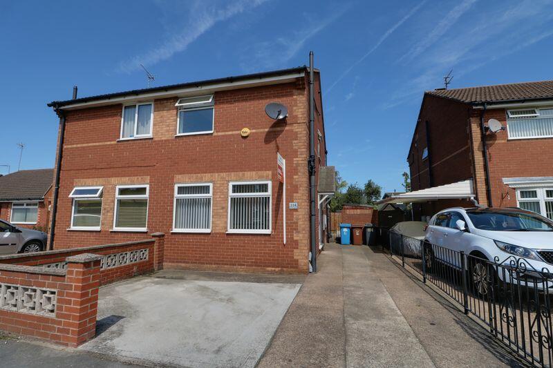
114 FOREDYKE AVENUE
HULL, CITY OF KINGSTON UPON HULL HU7 0DW
£625 pcm
Property details
Floor area
65 m²
Council tax band
B
EPC rating
C
Year built
England and Wales: 1983-1990
Deprivation
Decile 8 (26,800 of 33,755)
Street crime
184 incidents within 1 mile (Mar 2026)
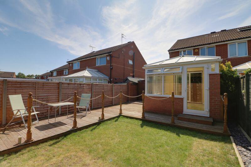
Key features
- 2 Bedroom Semi
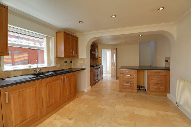
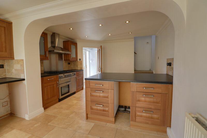
- Extended Kitchen
- Driveway Parking
- Conservatory
- EPC = C Council Tax Band= B
- Available early December
Additional details
- Parking
- Yes
- Garden
- Yes
Description
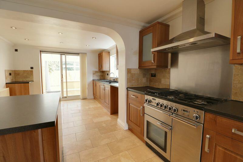
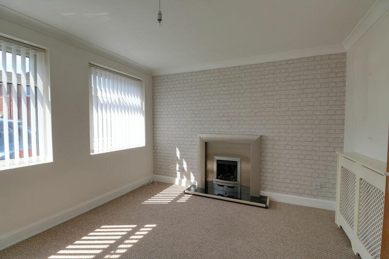
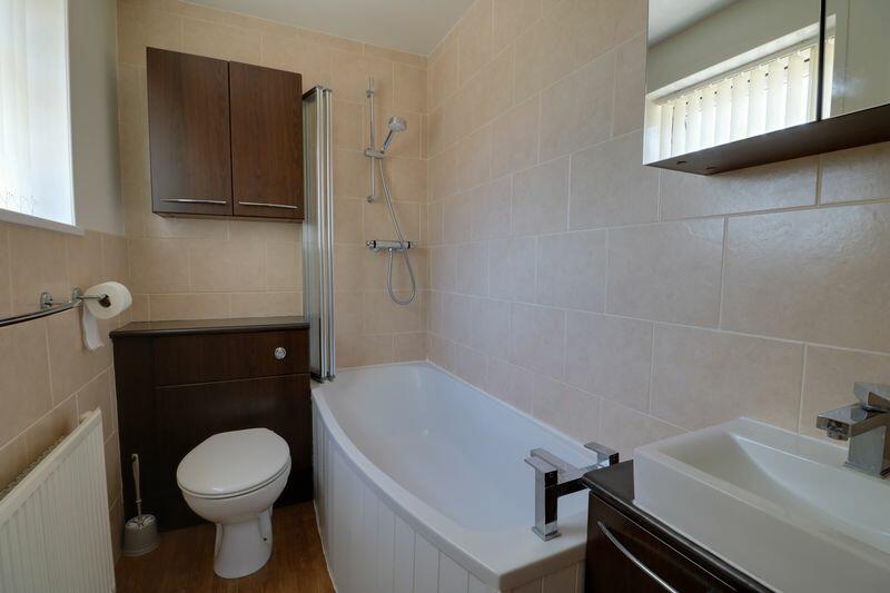
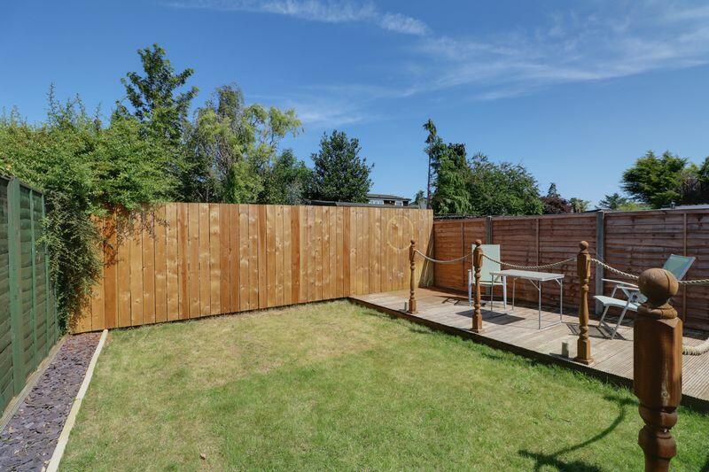
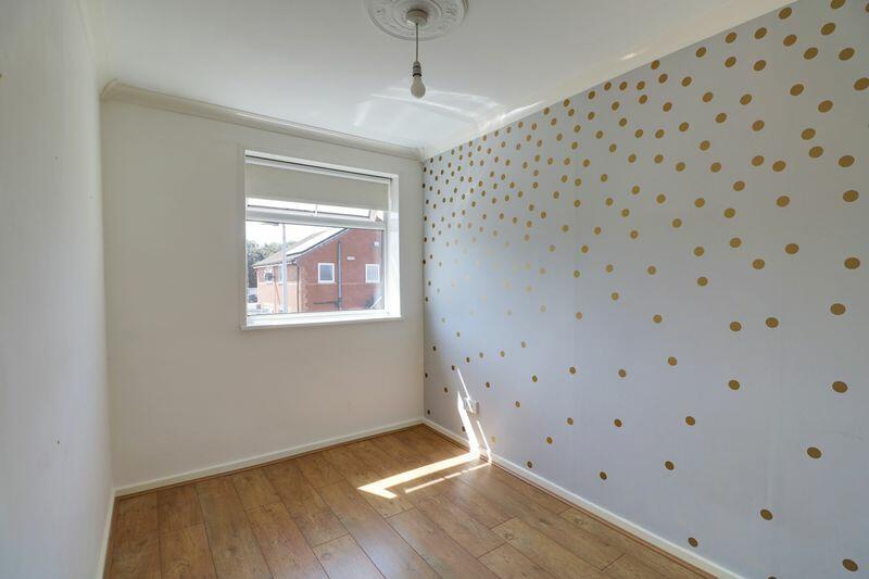
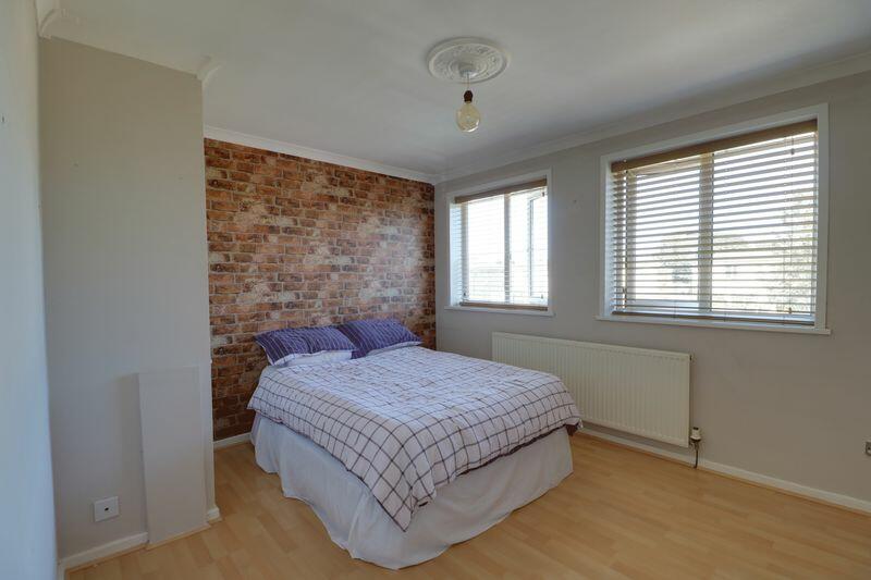
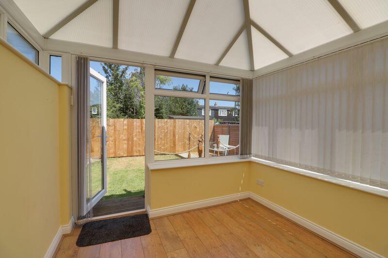
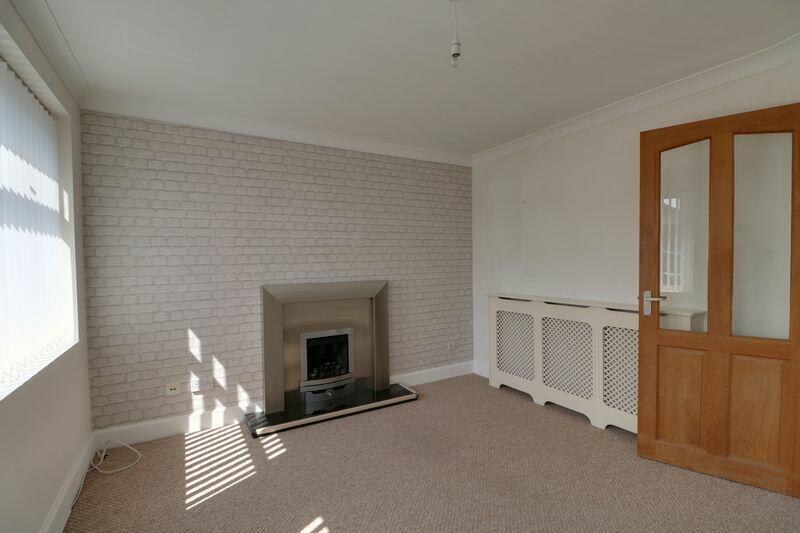
This is a well presented 2 bedroom semi detached house, located in the popular area of Stoneferry Estate near Sutton Fields., with good transport and road links into City centre. Briefly comprising an entrance hallway with storage cupboard leading to a kitchen diner with breakfast bar, dining area, and Rangemaster cooker. Also on the ground floor are a conservatory overlooking the garden and a lounge with gas fire. Upstairs are 2 good sized bedrooms and a modern family bathroom with an over bath shower. To the rear of the property is a garden with decking area, lawn and shed. There is driveway parking for 2 cars. All mains utilities are connected, and the property has gas central heating and double glazing. No pets preferred. Broadband - Standards and Ultrafast available form KCOM and Connexin. Mobile - Outdoor Likely from 4 networks and Indoor Likely from 2 networks. EPC = Council Tax Band = (Hull City Council) Rent £625 Deposit £721.15. A Holding deposit of £144.23 is payable to secure the property to be deducted from first months rent. Full details available from our Lettings Team.
Listed by
Hull
Oscars Estate Agents Limited
Reference: 155344085
EPC Rating & Upgrade Cost
Current rating: C
Potential rating: B
Inspection date: 22/11/2024
Current heating cost: £571/year
Potential heating cost: £525/year
Est. upgrade cost to C: £14,500
Recommendations
- Floor insulation (solid floor) (£4,000 - £6,000)
- Solar water heating (£4,000 - £6,000)
- Solar photovoltaic panels, 2.5 kWp (£3,500 - £5,500)
Flood risk
Zone: 2
Risk: In flood risk area
Environment Agency Flood Risk Areas (APSFR)
EPC Graphs

Energy Performance Certificate
Rental Range
Estimated market rent for Kingston upon Hull, City of. Low = conservative, Realistic = average, Optimistic = best case.
Based on Local Authority from postcode lookup → Kingston upon Hull, City of.
LHA (30th percentile) floor for Hull & East Riding: £474/mo (Apr 2025 – Mar 2026)
Location
Nearby
Nearest stations, universities and amenities (distance from property).
| Type | Name | Distance |
|---|---|---|
| Bus stop | Leads Road Holwell Road | 0.2 miles |
| Bus stop | Stoneferry Road Rix Road | 0.2 miles |
| Shop | B&Q | 0.3 miles |
| Shop | Aldi | 0.7 miles |
| Hospital | Windermere House | 1.5 miles |
| University | University of Hull | 1.9 miles |
| Train station | Hull Paragon Interchange | 2.1 miles |
| Train station | Cottingham | 3.5 miles |
| Hospital | Mill View | 4.8 miles |
Street-level crime
| Category | Count |
|---|---|
| Violence and sexual offences | 74 |
| Shoplifting | 26 |
| Public order | 19 |
| Criminal damage and arson | 18 |
| Other theft | 13 |
| Bicycle theft | 9 |
| Other crime | 7 |
| Anti-social behaviour | 6 |
| Burglary | 6 |
| Drugs | 3 |
| Vehicle crime | 3 |
| Total incidents | 184 |
Within 1 mile during Mar 2026. Source: data.police.uk (England & Wales).
Schools nearby
Nearest open schools with Ofsted ratings (England). Closed schools are not shown. Data from Get Information about Schools and Ofsted.
| Name | Type | Distance | Ofsted |
|---|---|---|---|
| Stoneferry Primary School | Primary | 0.2 miles | Good — 4 Dec 2022 |
| Westcott Primary School | Primary | 0.6 miles | Good — 8 Jul 2019 |
| St James' Church of England Academy | Primary | 0.8 miles | Good — 5 Feb 2018 |
| Mersey Primary Academy | Primary | 0.8 miles | Good — 15 Jul 2015 |
| Dorchester Primary School | Primary | 0.8 miles | Good — 22 Jul 2015 |
Rental Comparables
Rental listings exist nearby, but none matched the 2-bedroom estimate from EPC for this property.