71 CORNFIELD ROAD
BURY ST EDMUNDS, SUFFOLK IP33 3BN
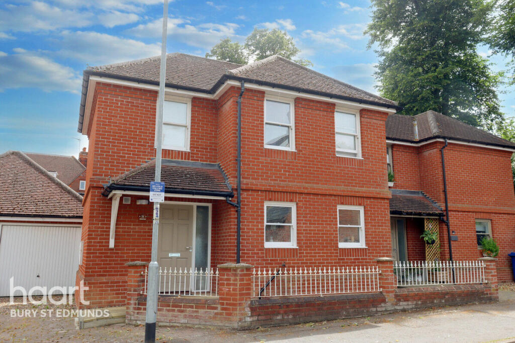
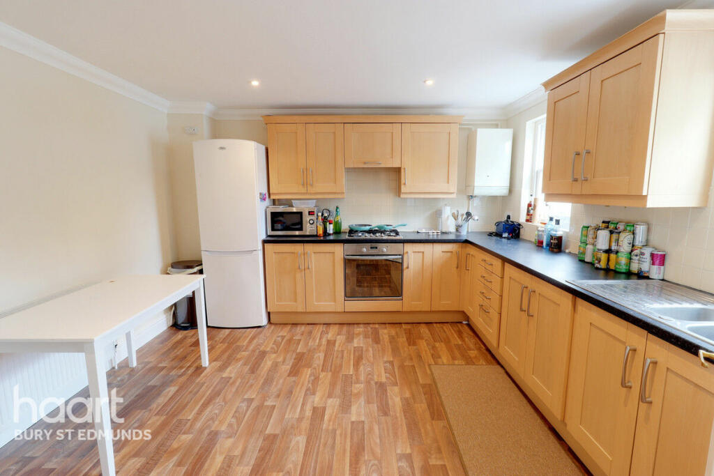
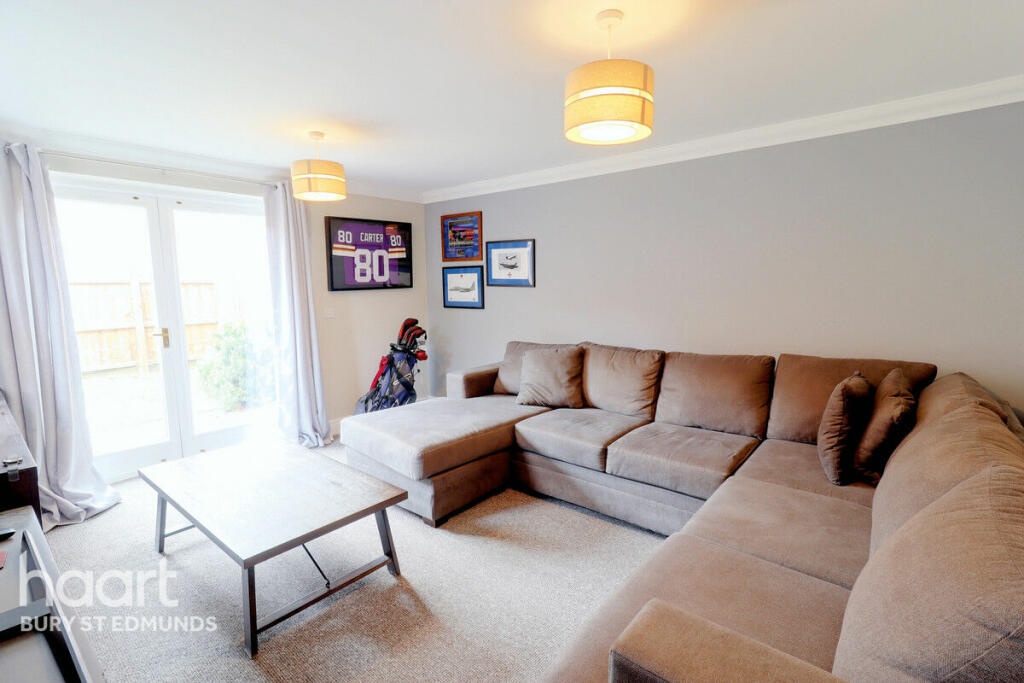

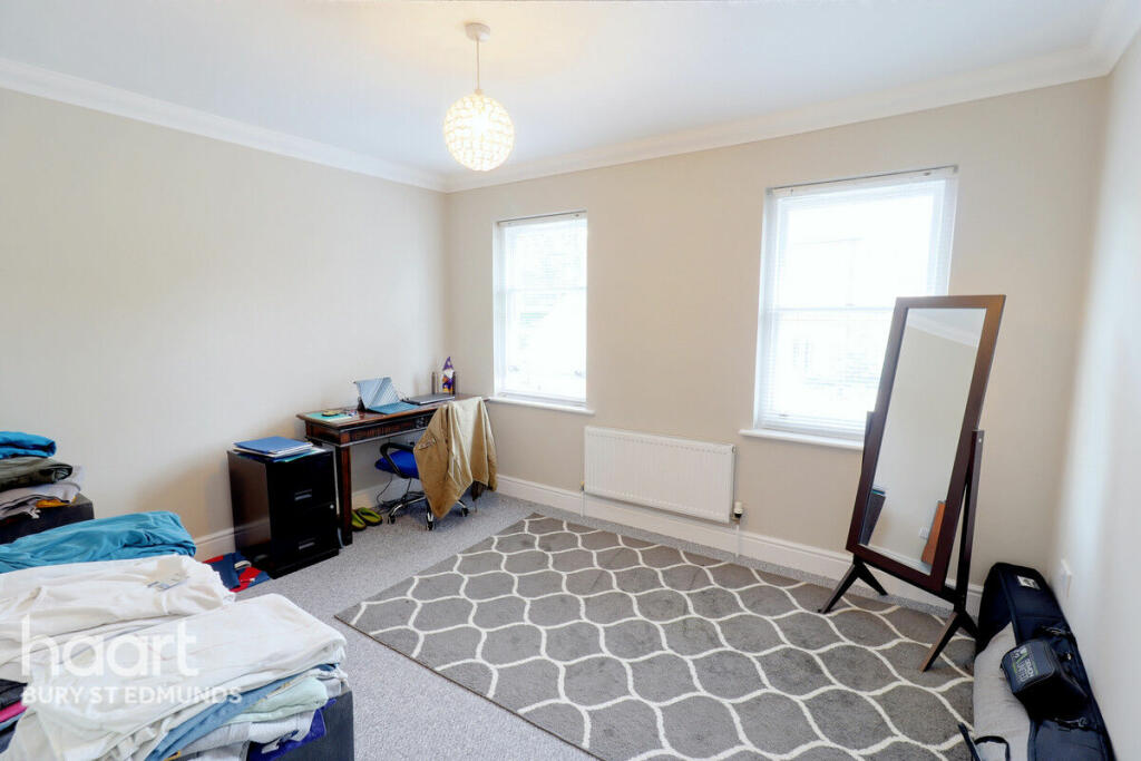
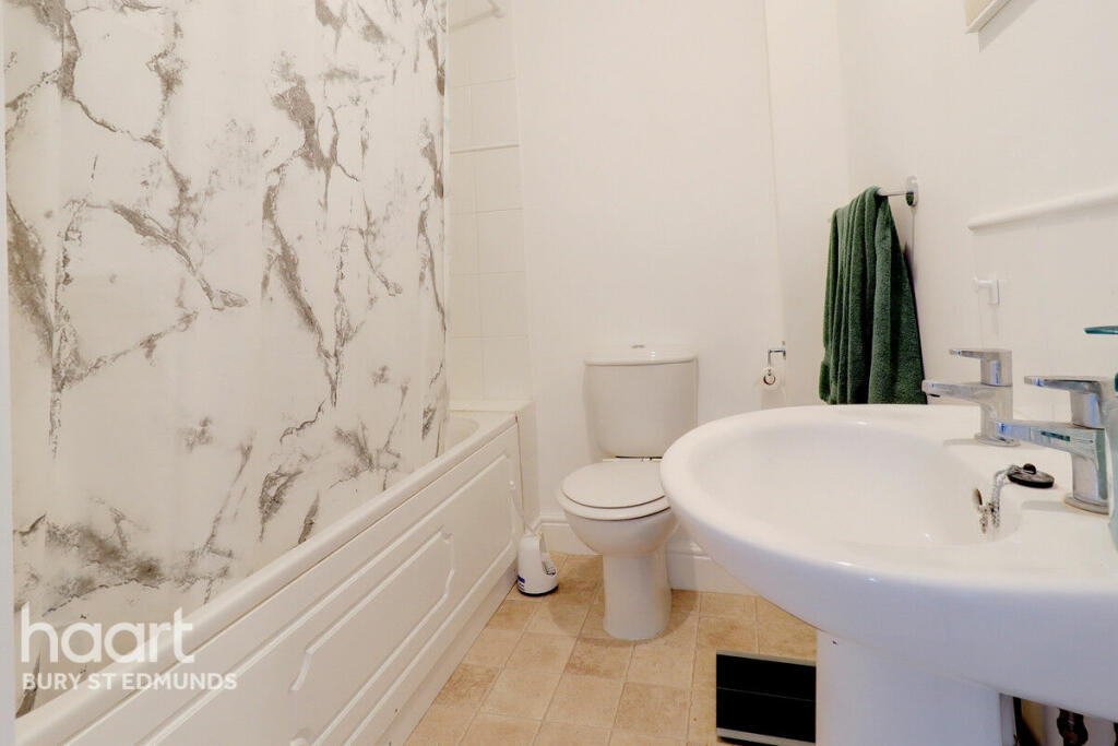
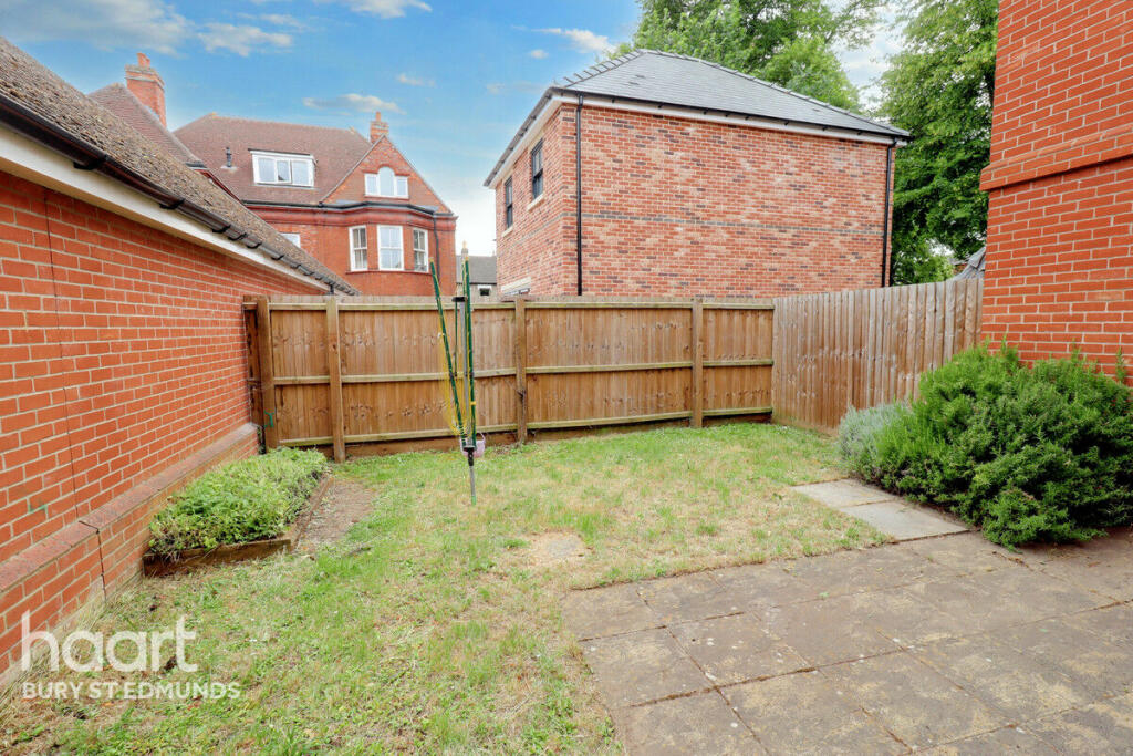
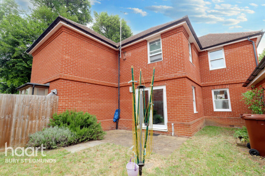
Photo 1 Photo 2 Photo 3 Photo 4 Photo 5 Photo 6 Photo 7 Photo 8
/ 8
Property details
Tenure
FREEHOLD
Floor area
84 m²
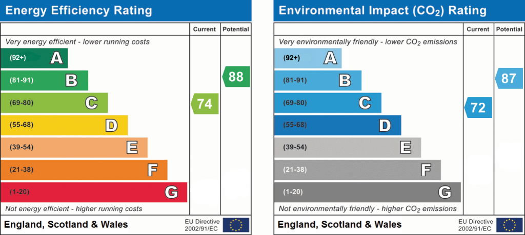
EPC rating
C
Last sold
£342,000 Feb 2024
Price per m²
£4,167/m²
Local average
£346,561 (+1%)
Deprivation
Decile 6 (18,325 of 33,755)
Street crime
178 incidents within 1 mile (Apr 2026)
Key features
- 3 Good Size Bedrooms
- Kitchen Diner
- Cloakroom
- Non Estate
- Gardens
- Gas Fired Central Heating
- Driveway & Garage
- Close To Town Centre
Additional details
- Parking
- Yes
- Garden
- Yes
Description
Listed by
Bury St. Edmunds
Spicerhaart
Reference: 137110850
EPC Rating & Upgrade Cost
Current rating: C
Potential rating: B
Inspection date: 25/09/2019
Expiry date: 24/09/2029
Recommendations
- Replace boiler with new condensing boiler (3,000)
- Solar water heating (6,000)
- Solar photovoltaic panels, 2.5 kWp (5,500)
Flood risk
Zone: 1
Risk: Low
Job (default Low)
Floorplans
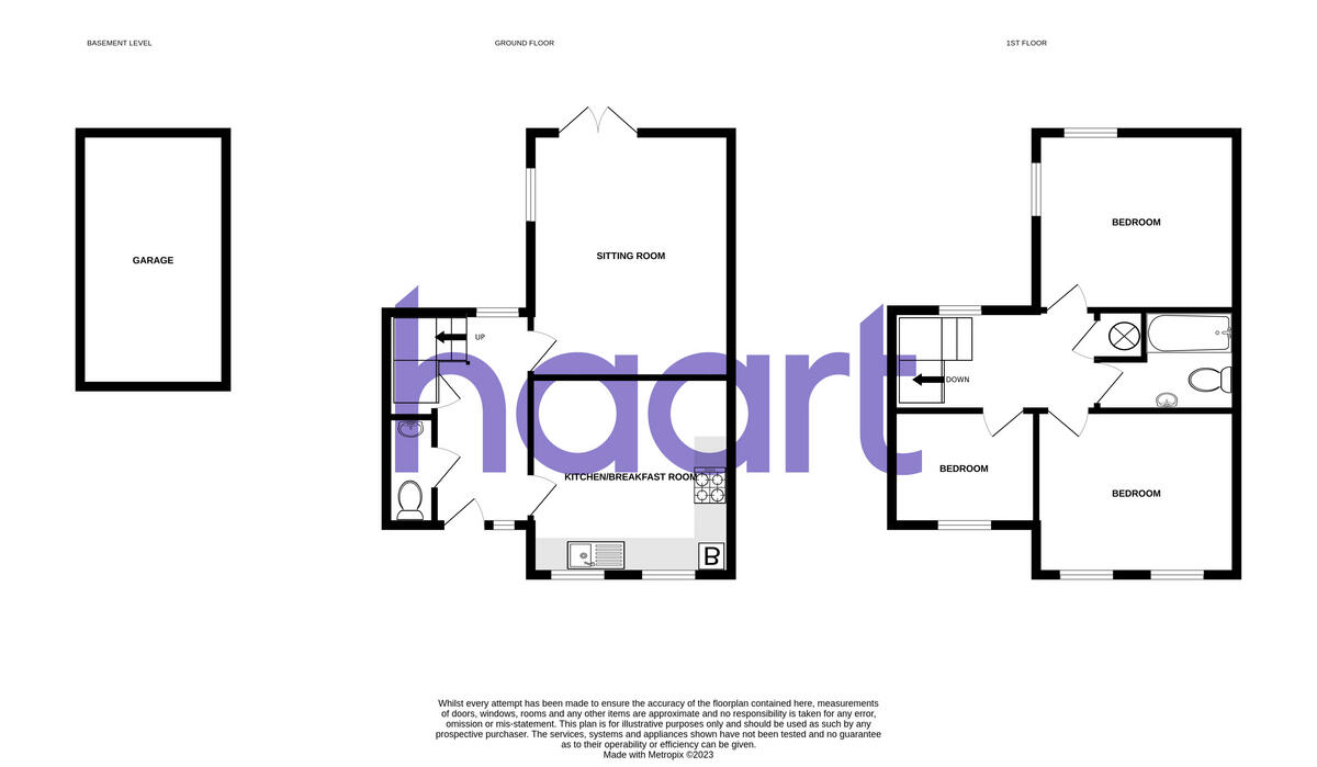
Floorplan 1
EPC Graphs
EPC 1
Price history
| Event | Date | Price | % change |
|---|---|---|---|
| Sold | 05/02/2024 (2 years ago) | £342,000 | — |
Source: HM Land Registry Price Paid Data. Crown copyright.
Sold Comparables
Same street and nearby sales within 0.25 miles (last 5 years). Data from Land Registry Price Paid.
| Address | Price | Date | Type |
|---|---|---|---|
| 22 CHANCELLERY MEWS, BURY ST EDMUNDS, WEST SUFFOLK, SUFFOLK, IP33 3AB | £550,000 | 24/11/2023 | Semi-detached |
| 4 YORK ROAD, BURY ST EDMUNDS, WEST SUFFOLK, SUFFOLK, IP33 3EE | £540,000 | 10/11/2023 | Semi-detached |
| 25 ALBERT STREET, BURY ST EDMUNDS, WEST SUFFOLK, SUFFOLK, IP33 3DZ | £495,000 | 04/05/2023 | Semi-detached |
| 86 SPRINGFIELD ROAD, BURY ST EDMUNDS, WEST SUFFOLK, SUFFOLK, IP33 3AR | £297,500 | 16/03/2023 | Semi-detached |
| Same street 66 CORNFIELD ROAD, BURY ST EDMUNDS, WEST SUFFOLK, SUFFOLK, IP33 3BN | £525,000 | 23/12/2022 | Detached |
| 15 OUT RISBYGATE, BURY ST EDMUNDS, WEST SUFFOLK, SUFFOLK, IP33 3RJ | £280,000 | 25/11/2022 | Semi-detached |
| 20 CHANCELLERY MEWS, BURY ST EDMUNDS, WEST SUFFOLK, SUFFOLK, IP33 3AB | £525,000 | 11/11/2022 | Semi-detached |
| 48 TRINITY MEWS, BURY ST EDMUNDS, WEST SUFFOLK, SUFFOLK, IP33 3AT | £160,000 | 20/10/2022 | Semi-detached |
| 15 GROVE PARK, BURY ST EDMUNDS, WEST SUFFOLK, SUFFOLK, IP33 3BG | £350,000 | 01/09/2022 | Semi-detached |
| 59 VICTORIA STREET, BURY ST EDMUNDS, WEST SUFFOLK, SUFFOLK, IP33 3BD | £575,000 | 14/04/2022 | Semi-detached |
| 12 VICTORIA STREET, BURY ST EDMUNDS, WEST SUFFOLK, SUFFOLK, IP33 3BB | £467,500 | 24/03/2022 | Semi-detached |
| Same street 12 CORNFIELD ROAD, BURY ST EDMUNDS, WEST SUFFOLK, SUFFOLK, IP33 3BN | £272,000 | 18/03/2022 | Terraced |
| 46 GROVE PARK, BURY ST EDMUNDS, WEST SUFFOLK, SUFFOLK, IP33 3BQ | £245,000 | 09/11/2021 | Semi-detached |
| Same street 11 CORNFIELD ROAD, BURY ST EDMUNDS, WEST SUFFOLK, SUFFOLK, IP33 3BN | £273,500 | 28/09/2021 | Terraced |
| 47 SPRINGFIELD ROAD, BURY ST EDMUNDS, WEST SUFFOLK, SUFFOLK, IP33 3AS | £335,000 | 27/08/2021 | Semi-detached |
Street average: £356,833 (3 sales)
Area average: £401,667 (12 sales)
Capital growth trend
Land Registry outcode average: last 12 months vs 5y and 10y ago (from sold prices).
House Price Index (HM Land Registry — official index, not sold-price averages): West Suffolk. Series: Semi-detached. As of March 2026.
Rental Range
Estimated market rent for West Suffolk. Low = conservative, Realistic = average, Optimistic = best case.
Based on Local Authority from postcode lookup → West Suffolk.
LHA (30th percentile) floor for Bury St Edmunds: £952/mo (Apr 2025 – Mar 2026)
Location
Nearby
Nearest stations, universities and amenities (distance from property).
| Type | Name | Distance |
|---|---|---|
| Shop | Peter Watts Domestic Appliance Centre | 0.0 miles |
| Bus stop | Falcon | 0.1 miles |
| Shop | Carters | 0.2 miles |
| Train station | Bury St Edmunds | 0.5 miles |
| Hospital | West Suffolk Hospital | 1.2 miles |
| Train station | Thurston | 4.5 miles |
Street-level crime
| Category | Count |
|---|---|
| Violence and sexual offences | 69 |
| Criminal damage and arson | 19 |
| Shoplifting | 19 |
| Anti-social behaviour | 17 |
| Public order | 16 |
| Burglary | 10 |
| Other theft | 10 |
| Drugs | 5 |
| Vehicle crime | 4 |
| Bicycle theft | 3 |
| Other crime | 2 |
| Robbery | 2 |
| Possession of weapons | 1 |
| Theft from the person | 1 |
| Total incidents | 178 |
Within 1 mile during Apr 2026. Source: data.police.uk (England & Wales).
Schools nearby
Nearest open schools with Ofsted ratings (England). Closed schools are not shown. Data from Get Information about Schools and Ofsted.
| Name | Type | Distance | Ofsted |
|---|---|---|---|
| St Edmundsbury CofE Primary Academy | Primary | 0.1 miles | Requires improvement — 13 May 2024 |
| West Suffolk College | Other | 0.2 miles | — (No rating) |
| Abbeygate Sixth Form College | Other | 0.2 miles | — (No rating) |
| King Edward VI CEVC School | Secondary | 0.2 miles | Good — 28 Mar 2019 |
| Westgate Community Primary School and Nursery | Primary | 0.6 miles | Good — 14 Feb 2022 |
Rental Comparables
Residential lets from OpenRent and Rightmove for the area (same bedroom count). Use to validate rent estimates. Student lets are excluded.
| Title | Rent | Beds | Distance | As seen on |
|---|---|---|---|---|
| 3 Bed Semi-Detached House, Waits Close, IP32 | £1,800/mo | 3 | 1.22 miles | OpenRent |
Average rent: £1,800/mo (1 listing)
Rent-driven metrics
Based on OpenRent comparables.
- Rent ratio — Monthly rent ÷ purchase price (1% rule). 1%+ = strong, 0.8–1% = okay, <0.8% = weak for cashflow.
- Max investor price — Rent ÷ 0.8%; the price at which rent would be 0.8% of price (Stoke-style target).
- Target investor price — Rent ÷ 1%; the price at which rent would be 1% of price (strong cashflow band).
- Gross yield — Annual rent as % of purchase price (no costs).
- Cost-to-rent — Price ÷ annual rent (from OpenRent comparables). Under 14× = strong, 14–16× = acceptable, 17×+ = compressed.
- Cashflow — Rent minus mortgage, 10% maintenance, £25/mo compliance. Assumes 75% LTV, 3.95% APR (5yr fixed), 25yr term.
- ROI — Annual profit ÷ cash in (deposit + 4% purchase costs).