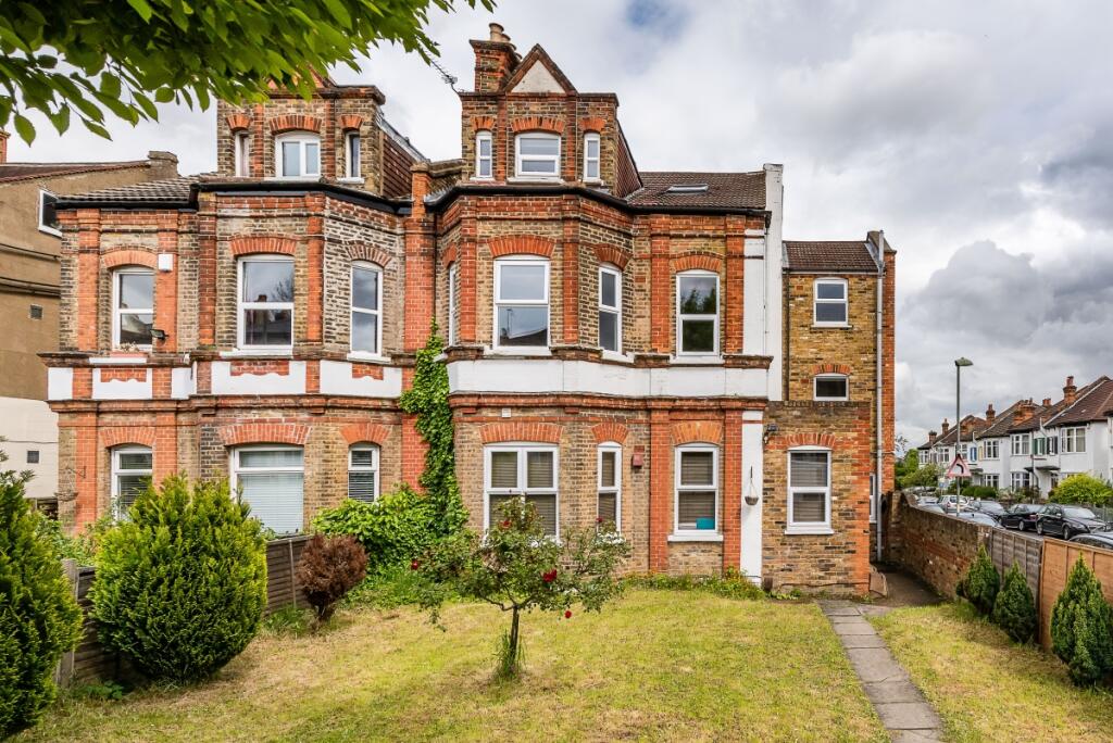
FLAT 4
46 NEWLANDS PARK, LONDON, GREATER LONDON SE26 5NE
£1,850 pcm

Property details
Floor area
58 m²
Year built
England and Wales: 1900-1929
Deprivation
Decile 5 (13,684 of 33,755)
Street crime
481 incidents within 1 mile (Apr 2026)
Key features
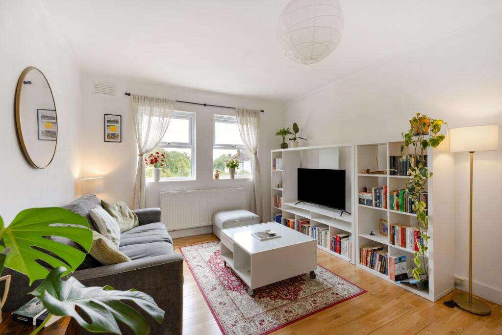
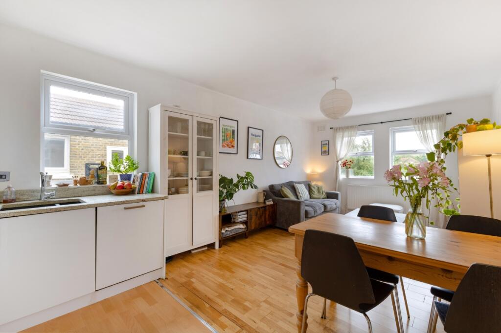
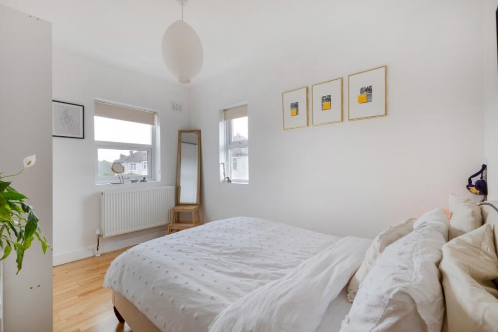
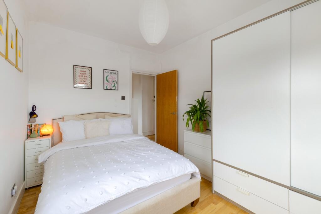
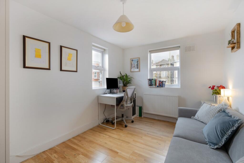
- Two bedrooms
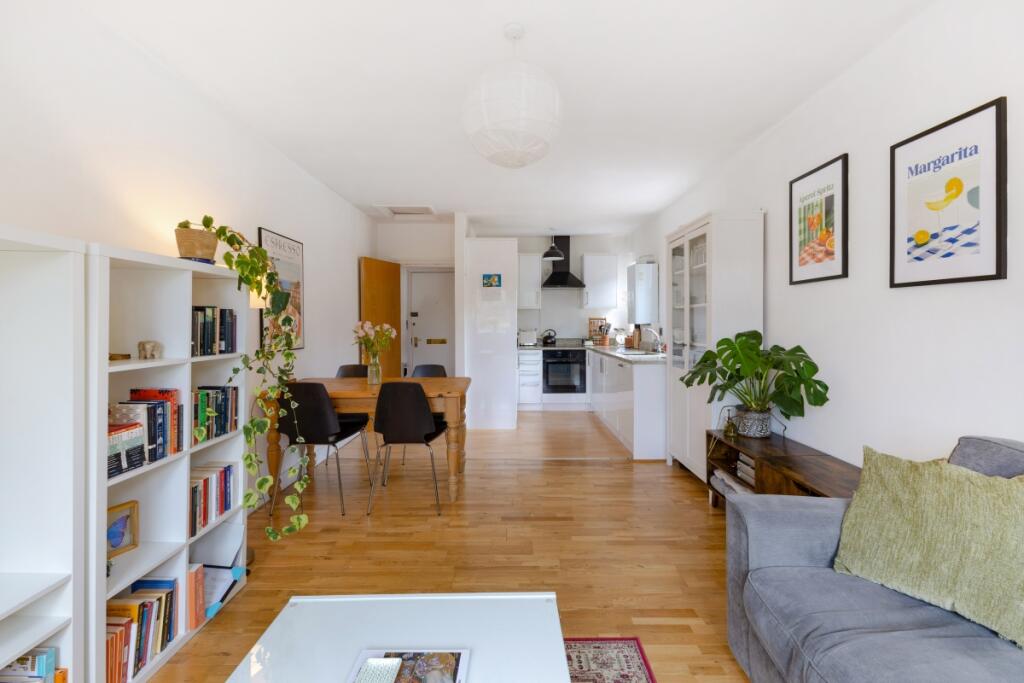
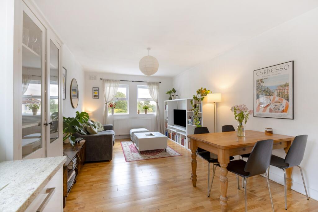
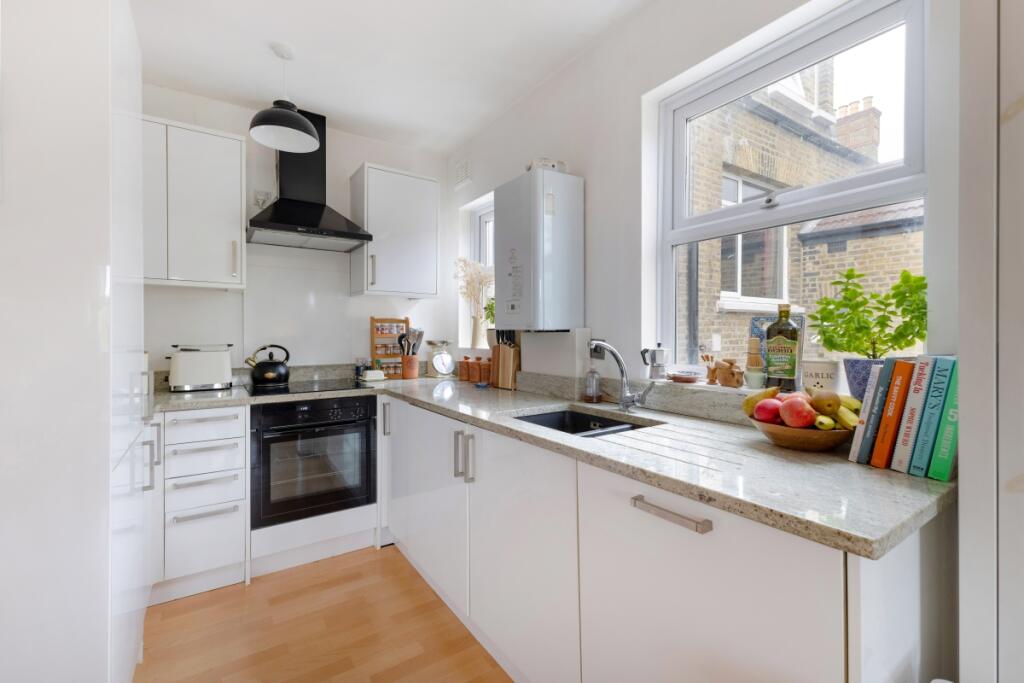
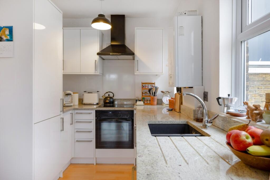
- Open plan kitchen/reception room
- Bright and airy
- Close to station
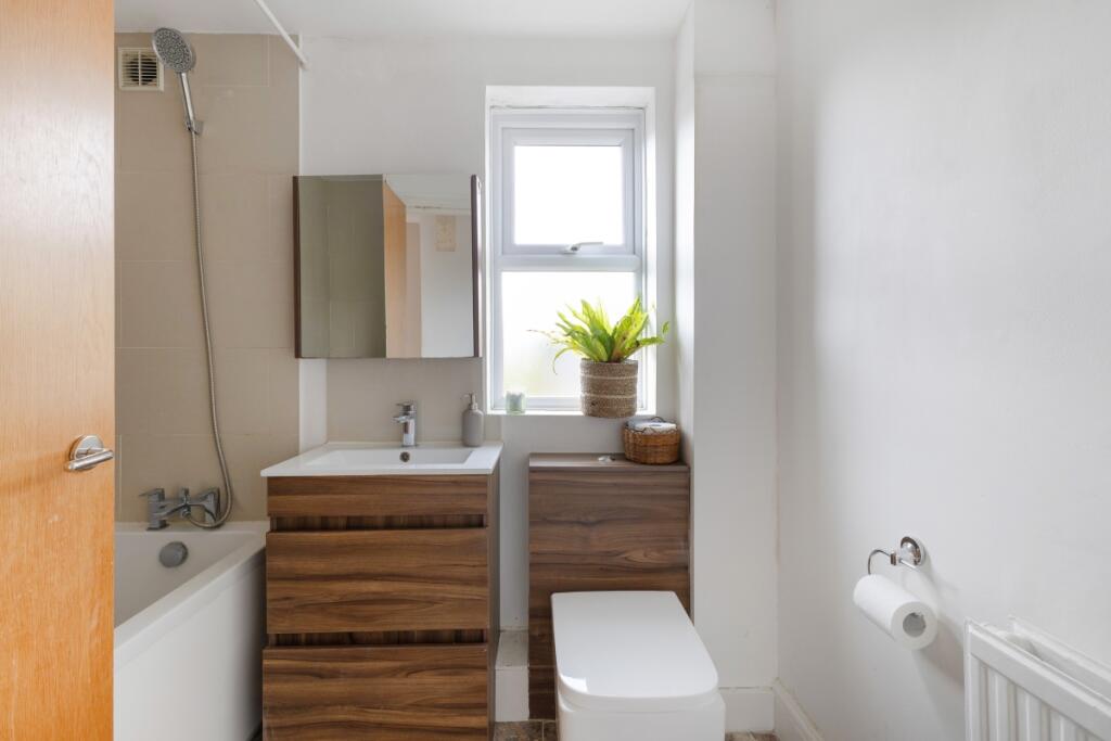
Description
Conveniently located just a short stroll from Sydenham High Street, the property offers easy access to a range of cafés and local shops. To check broadband and mobile phone coverage please visit Ofcom here ofcom.org.uk/phones-telecoms-and-internet/advice-for-consumers/advice/ofcom-checker
Listed by
Dulwich
Countrywide Hamptons Lettings - Connells
Reference: 164763824
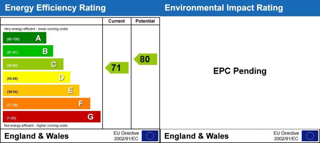
EPC Rating & Upgrade Cost
Fetching EPC data… Refresh this page in a moment.
Flood risk
Zone: 1
Risk: Low
Job (default Low)
Floorplans
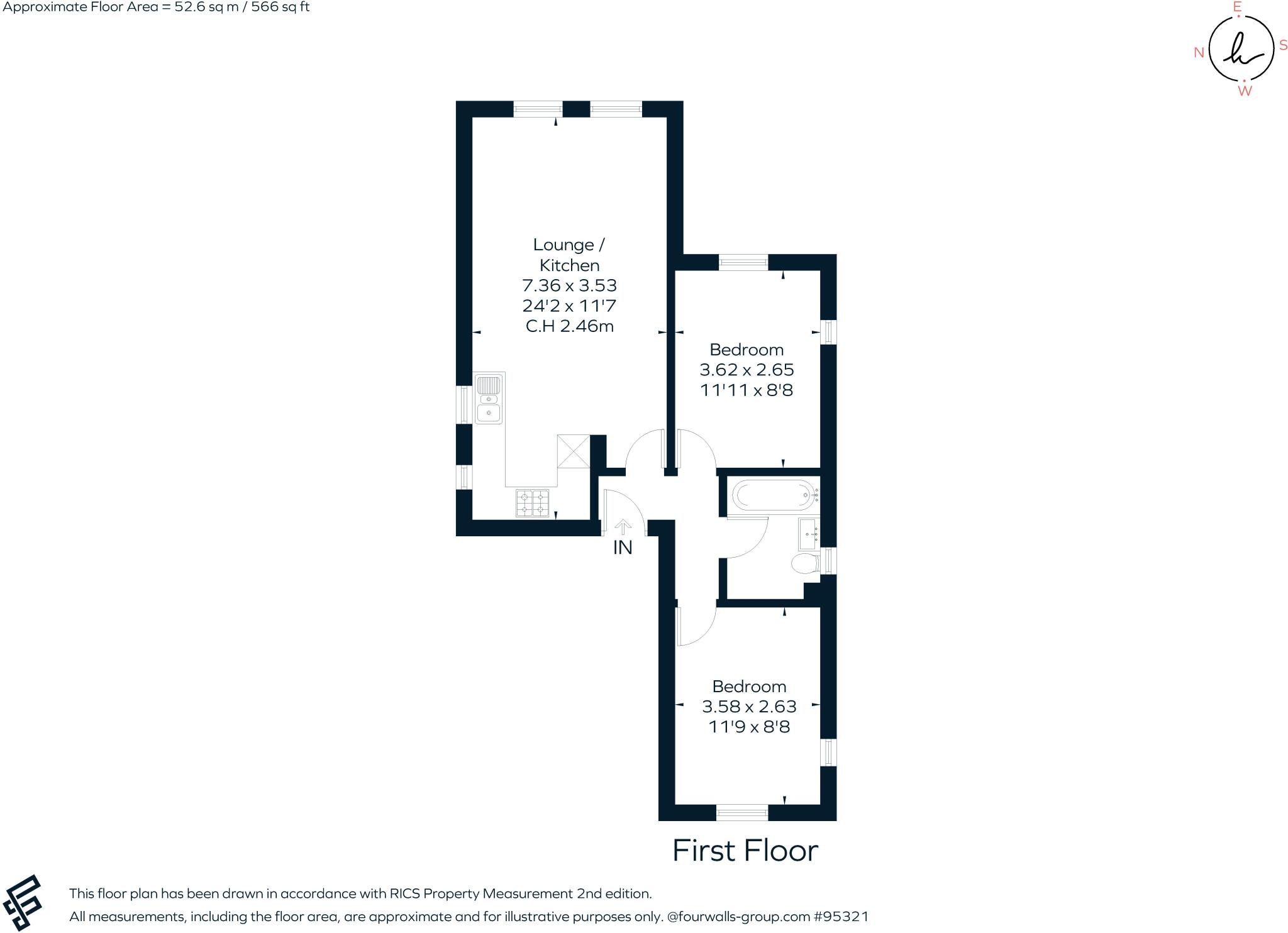
Final_1223074_Fla...
EPC Graphs
Energy Performanc...
Rental Range
Estimated market rent for Lewisham. Low = conservative, Realistic = average, Optimistic = best case.
Based on Local Authority from postcode lookup → Lewisham.
LHA (30th percentile) floor for Huntingdon: £793/mo (Apr 2025 – Mar 2026)
Location
Nearby
Nearest stations, universities and amenities (distance from property).
| Type | Name | Distance |
|---|---|---|
| Bus stop | Studland Road | 0.1 miles |
| Shop | Twice Sweet & Wine | 0.2 miles |
| Shop | Tops 'n' Tails Dry Cleaners | 0.2 miles |
| Train station | Penge East | 0.3 miles |
| Train station | Sydenham | 0.3 miles |
| Hospital | Sloane Hospital | 2.3 miles |
| Hospital | British Home & Hospital for Incurables | 2.4 miles |
| University | University of Greenwich | 4.5 miles |
| University | University of Wales Trinity Saint David London Campus | 4.6 miles |
Street-level crime
| Category | Count |
|---|---|
| Violence and sexual offences | 113 |
| Anti-social behaviour | 98 |
| Vehicle crime | 60 |
| Shoplifting | 50 |
| Criminal damage and arson | 39 |
| Other theft | 30 |
| Public order | 25 |
| Robbery | 18 |
| Burglary | 17 |
| Theft from the person | 12 |
| Drugs | 10 |
| Other crime | 4 |
| Possession of weapons | 3 |
| Bicycle theft | 2 |
| Total incidents | 481 |
Within 1 mile during Apr 2026. Source: data.police.uk (England & Wales).
Schools nearby
Nearest open schools with Ofsted ratings (England). Closed schools are not shown. Data from Get Information about Schools and Ofsted.
| Name | Type | Distance | Ofsted |
|---|---|---|---|
| Alexandra Junior School | Primary | 0.3 miles | Good — 6 Dec 2012 |
| Our Lady and St Philip Neri Catholic Primary School | Primary | 0.5 miles | Good — 2 Mar 2015 |
| St Bartholomews's Church of England Primary School | Primary | 0.6 miles | Good — 28 Sep 2023 |
| St Michael's Church of England Primary School | Primary | 0.6 miles | Good — 15 Jun 2011 |
| Harris Primary Academy Crystal Palace | Primary | 0.6 miles | Good — 21 May 2015 |
Rental Comparables
Residential lets from OpenRent and Rightmove for the area (same bedroom count). Use to validate rent estimates. Student lets are excluded.
| Title | Rent | Beds | Distance | As seen on |
|---|---|---|---|---|
| 2 Bed Flat, Bayes Close, SE26 | £1,700/mo | 2 | 0.24 miles | OpenRent |
Average rent: £1,700/mo (1 listing)