53 WATERLOO STREET
STOKE-ON-TRENT, STOKE-ON-TRENT ST1 3PR
£650 pcm
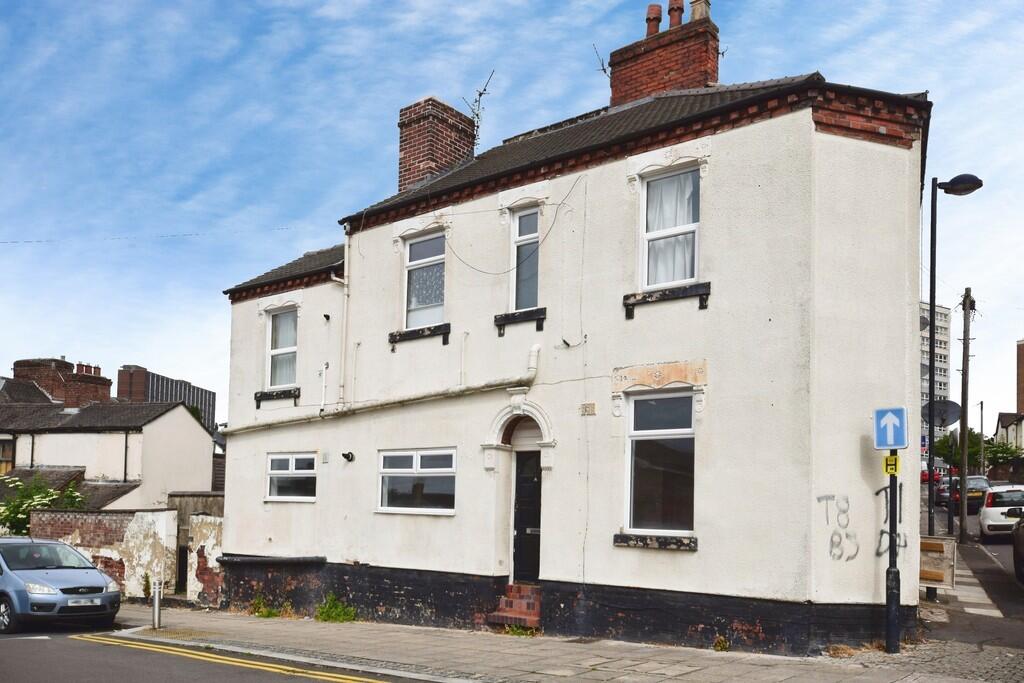
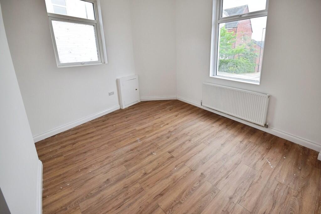
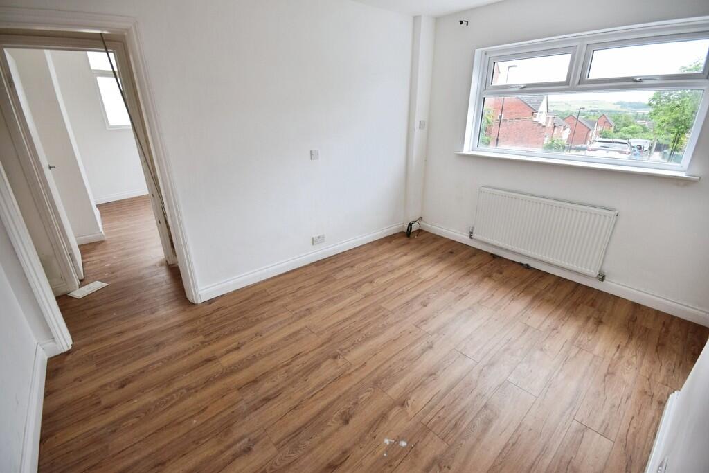
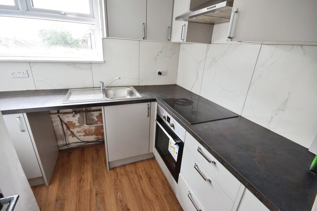
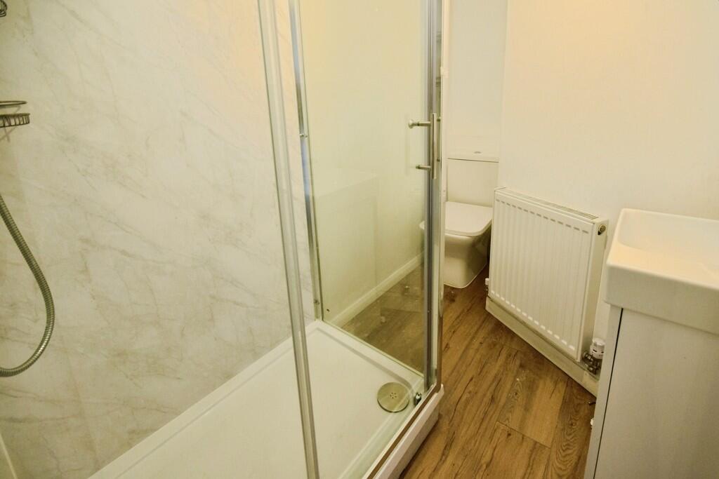
Photo 1 Photo 2 Photo 3 Photo 4 Photo 5
/ 5
Property details
Floor area
73 m²
EPC rating
C
Year built
England and Wales: 1900-1929
Street crime
551 incidents within 1 mile (Apr 2026)
Key features
- Ground floor flat
- Lounge
- Separate newly fitted kitchen
- Double bedroom
- Newly fitted shower room
- Walking distance from Hanley
- Council tax band A
Description
Listed by
Stoke On Trent
The Property Franchise Group
Reference: 89670150
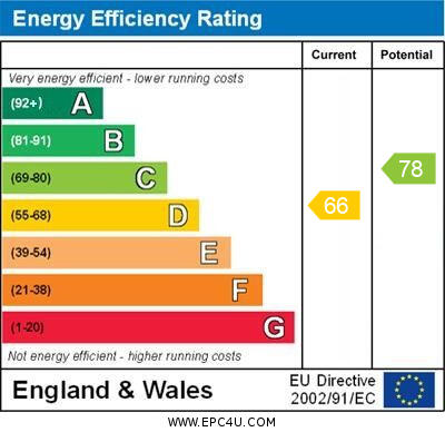
EPC Rating & Upgrade Cost
Current rating: C
Potential rating: B
Inspection date: 17/08/2023
Expiry date: 16/08/2033
Est. upgrade cost to C: £14,500
Recommendations
- Floor insulation (solid floor) (£4,000 - £6,000)
- Solar water heating (£4,000 - £6,000)
- Solar photovoltaic panels, 2.5 kWp (£3,500 - £5,500)
Flood risk
Zone: 1
Risk: Low
Job (default Low)
EPC Graphs
EPC 1
Rental Range
Estimated market rent for Stoke-on-Trent. Low = conservative, Realistic = average, Optimistic = best case.
Based on Local Authority from postcode lookup → Stoke-on-Trent.
LHA (30th percentile) floor for Staffordshire North: £424/mo (Apr 2025 – Mar 2026)
Location
Nearby
Nearest stations, universities and amenities (distance from property).
| Type | Name | Distance |
|---|---|---|
| Bus stop | Wellington Road | 0.1 miles |
| Bus stop | St Ann Street | 0.2 miles |
| Shop | Exodos | 0.2 miles |
| Shop | Blinkin-ink! | 0.2 miles |
| University | University of Staffordshire Stoke Campus | 1.1 miles |
| Train station | Stoke-on-Trent | 1.2 miles |
| Train station | Longport | 2.4 miles |
| Hospital | Haywood Hospital Walk-in Centre | 2.5 miles |
| Hospital | Longton Cottage Hospital | 3.7 miles |
| University | Buxton & Leek College | 8.3 miles |
Street-level crime
| Category | Count |
|---|---|
| Violence and sexual offences | 154 |
| Anti-social behaviour | 111 |
| Shoplifting | 61 |
| Public order | 52 |
| Criminal damage and arson | 41 |
| Other theft | 31 |
| Vehicle crime | 31 |
| Burglary | 21 |
| Drugs | 12 |
| Robbery | 12 |
| Possession of weapons | 10 |
| Bicycle theft | 7 |
| Other crime | 6 |
| Theft from the person | 2 |
| Total incidents | 551 |
Within 1 mile during Apr 2026. Source: data.police.uk (England & Wales).
Schools nearby
Nearest open schools with Ofsted ratings (England). Closed schools are not shown. Data from Get Information about Schools and Ofsted.
| Name | Type | Distance | Ofsted |
|---|---|---|---|
| Hanley St Luke's Church of England Academy | Primary | 0.1 miles | Good — 23 Nov 2022 |
| Waterside Primary School | Primary | 0.2 miles | Outstanding — 19 Jun 2019 |
| Want2Achieve The Academy | Other | 0.4 miles | Inadequate — 15 May 2023 |
| Northwood Broom Academy | Primary | 0.4 miles | Good — 4 Mar 2013 |
| Grove Academy | Primary | 0.6 miles | Good — 15 Jul 2024 |
Rental Comparables
Residential lets from OpenRent and Rightmove for the area (same bedroom count). Use to validate rent estimates. Student lets are excluded.
Average rent: £706/mo (49 listings)