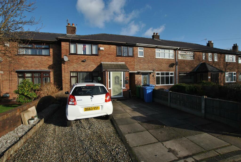
352 POPLARS AVENUE
WARRINGTON, WARRINGTON WA2 9UF
£160,000
Property details
Tenure
FREEHOLD
Floor area
82 m²
Council tax band
A
EPC rating
D
Year built
England and Wales: 1950-1966
Last sold
£155,800 May 2024
Price per m²
£1,951/m²
Local average
£171,667 (-6.8%)
Deprivation
Decile 2 (5,096 of 33,755)
Street crime
237 incidents within 1 mile (Mar 2026)
Key features
- SPACIOUS THREE BEDROOM TERRACE
- POPULAR LOCATION
- DRIVEWAY & ADDITIONAL PARKING TO REAR
- LOUNGE
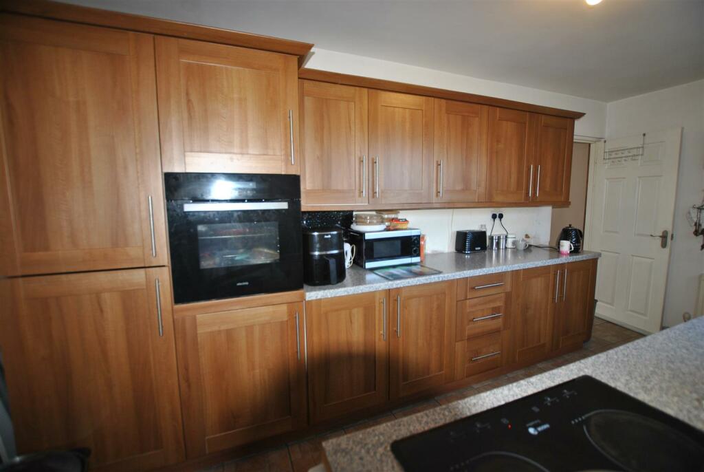
- FITTED KITCHEN
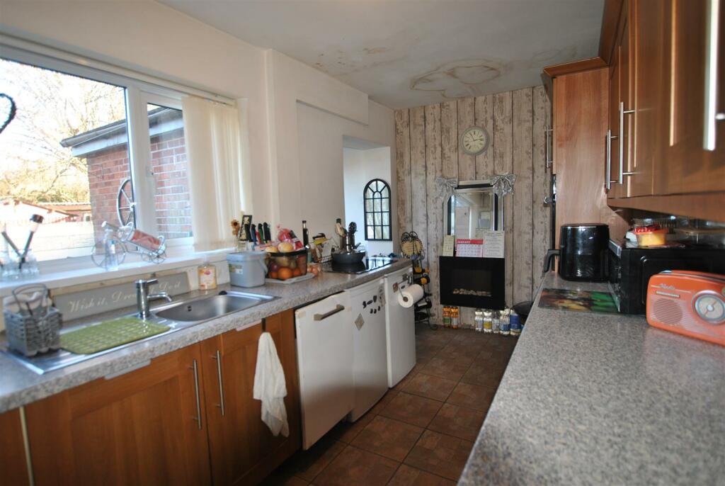
- DINING AREA
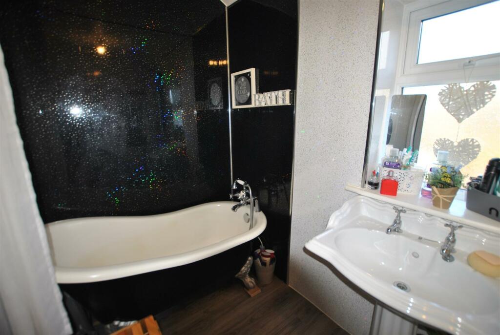
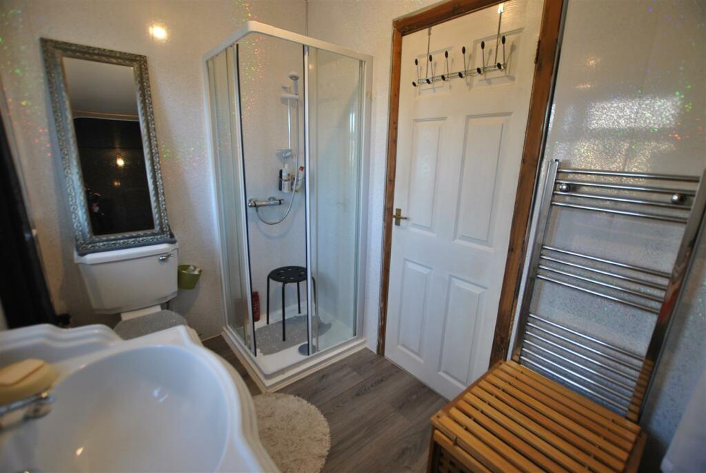
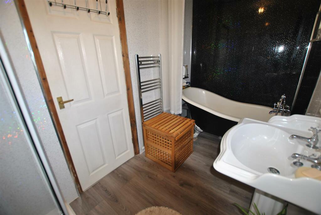
- FOUR PIECE BATHROOM
- NO ONWARD CHAIN
- FREEHOLD
Additional details
- Parking
- Yes
- Garden
- Yes
Description
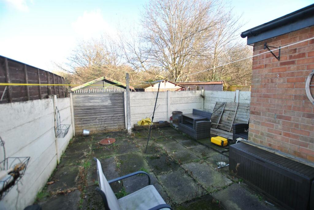
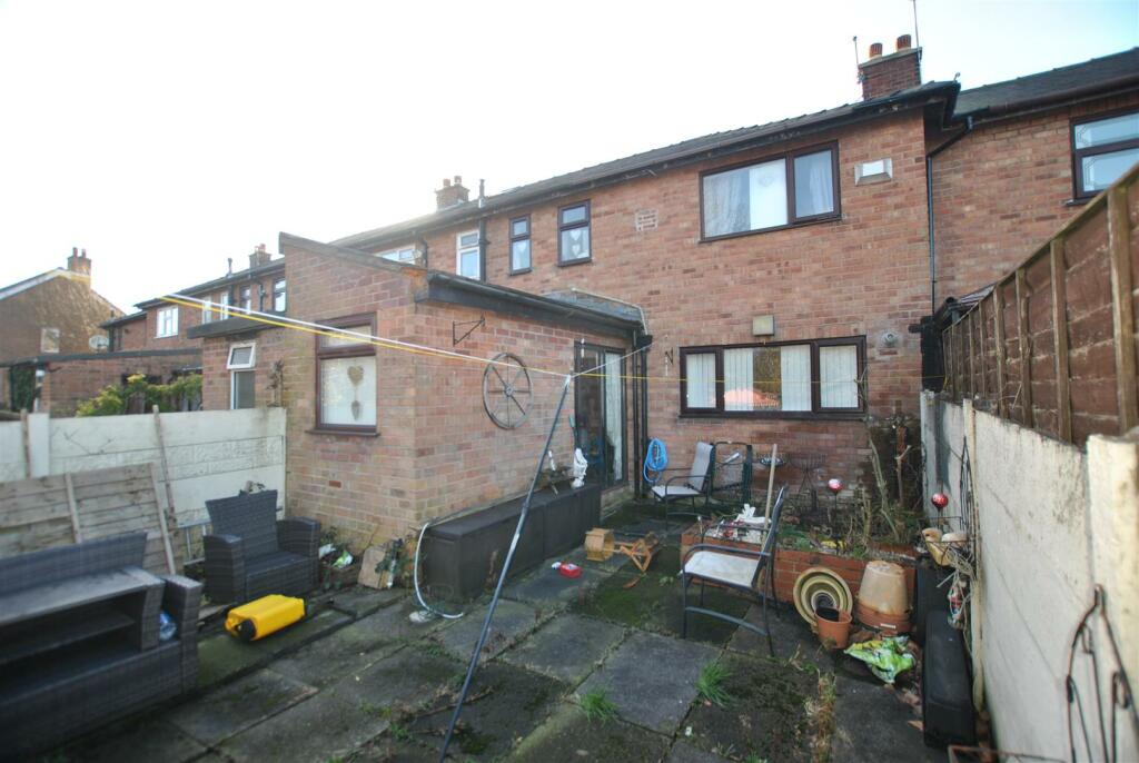
This Well Balanced Family Home has been lived in by the current owner for many years and would also work as a Buy to Let with a rental figure of around £900.00 PCM. Located on Poplars Avenue makes it great for access to local amenities, public transport, the retail parks and Motorway Links. The accommodation comprises Entrance Porch, Entrance Hallway, Lounge, Kitchen opening through to Dining Area, To the First Floor there are Three Bedrooms and a Four Piece Bathroom. Externally there is a Double Driveway to the front whilst to the rear there is a Low Maintenance Enclosed Garden with a gate leading to space for additional parking/garage.
Entrance Porch - 1.16 x 1.53 (3'9" x 5'0") -
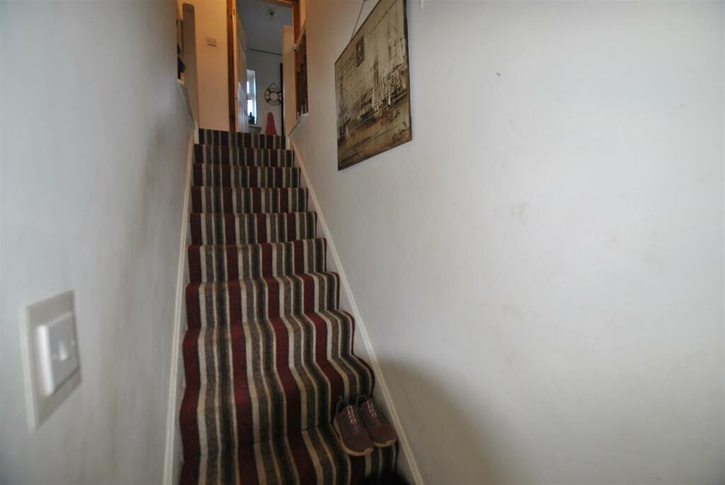
Entrance Hallway - 4.49 x 1.56 (14'8" x 5'1") -
Lounge - 4.58 x 3.87 (15'0" x 12'8") -
Kitchen - 2.28 x 4.47 (7'5" x 14'7") -
Dining Area - 3.76 x 1.48 (12'4" x 4'10") -
Landing - 1.52 x 3.17 (4'11" x 10'4") -
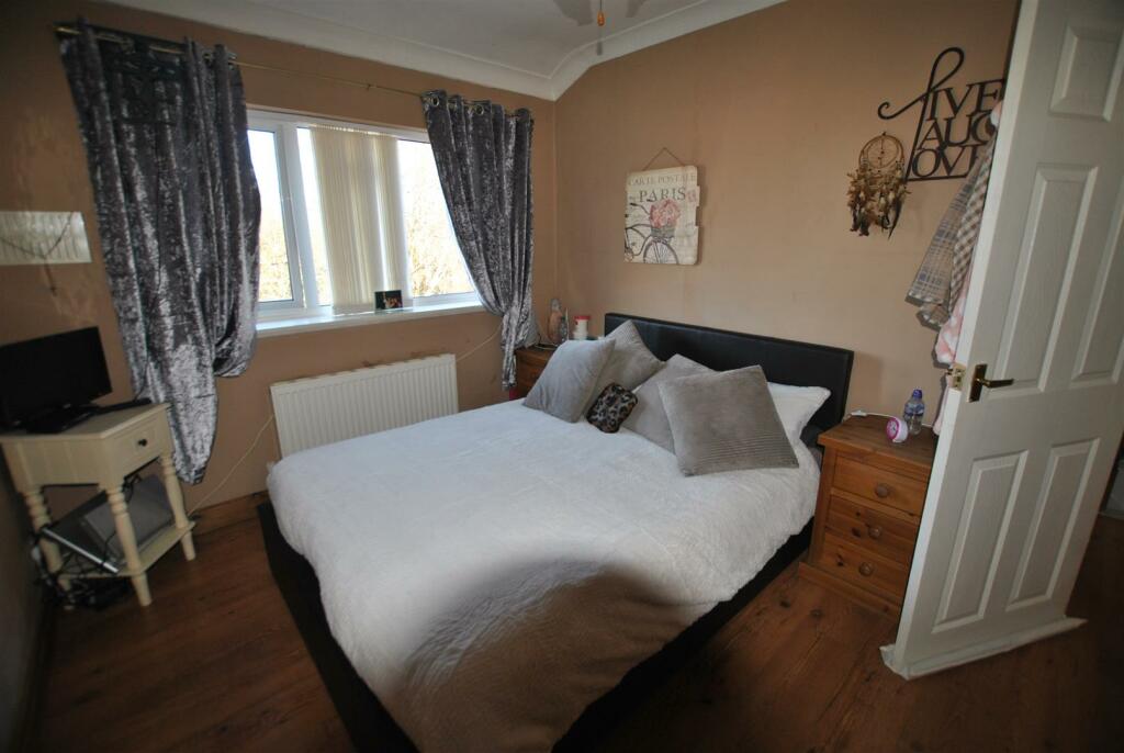
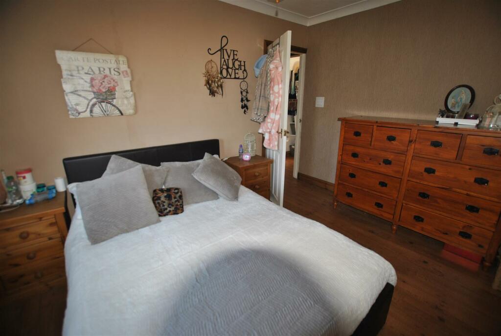
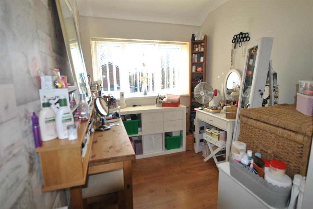
Master Bedroom - 3.34 x 3.92 (10'11" x 12'10") -
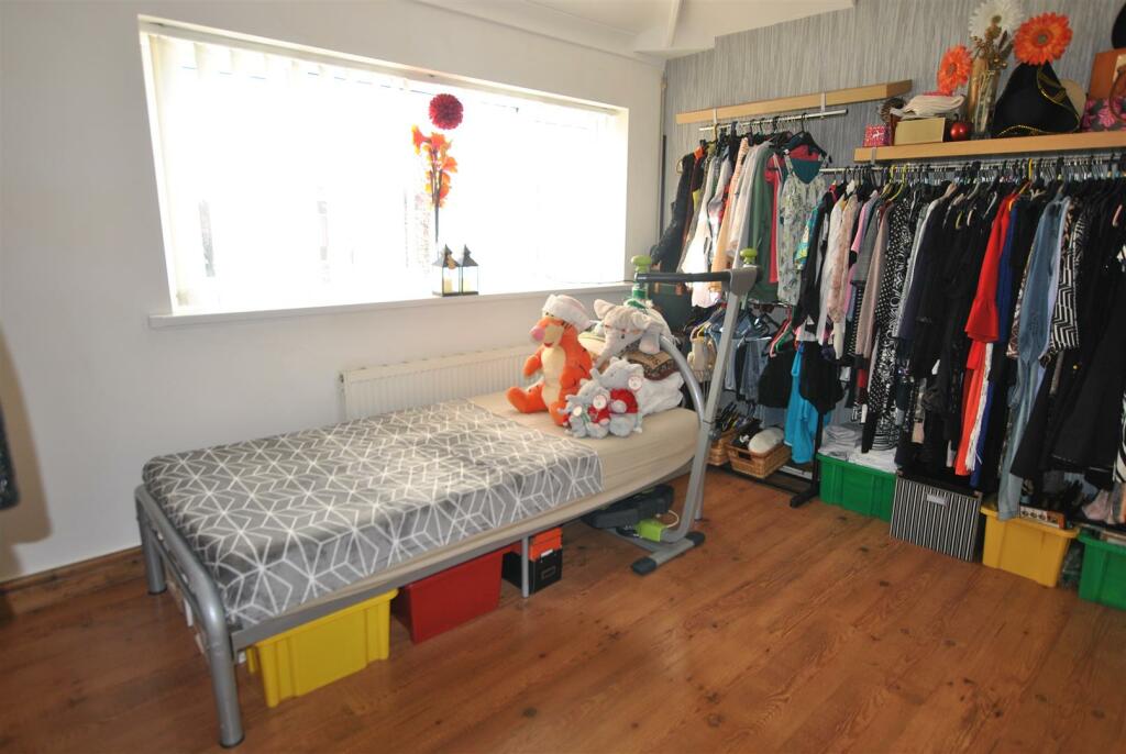
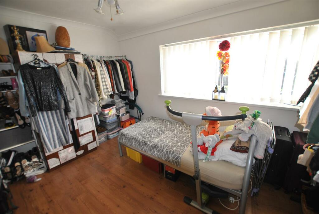
Bedroom Two - 3.58 x 2.75 (11'8" x 9'0") -
Bedroom Three - 3.34 x 2.05 (10'11" x 6'8") -
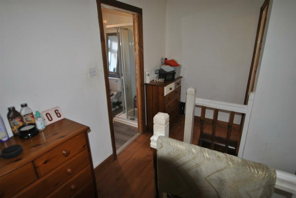
Bathroom - 1.66 x 3.17 (5'5" x 10'4") -
Outside -
Listed by
Covering Warrington
Let N Sell Limited
Reference: 144166628
EPC Rating & Upgrade Cost
Current rating: D
Potential rating: C
Inspection date: 06/08/2019
Current heating cost: £757/year
Potential heating cost: £679/year
Est. upgrade cost to C: £14,935
Recommendations
- Floor insulation (solid floor) (£4,000 - £6,000)
- Low energy lighting for all fixed outlets (£35)
- Upgrade heating controls (£350 - £450)
- Solar water heating (£4,000 - £6,000)
- Solar photovoltaic panels, 2.5 kWp (£3,500 - £5,500)
Flood risk
Zone: 1
Risk: Low
Job (default Low)
Floorplans
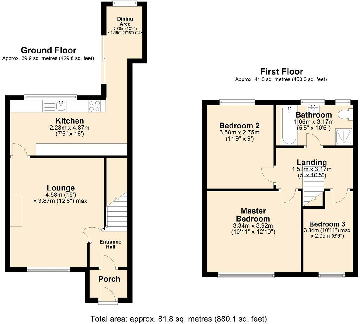
352 Poplars Avenue, Warrington.jpg
EPC Graphs

EE Rating
Price history
| Event | Date | Price | % change |
|---|---|---|---|
| Sold | 29/05/2024 (2 years ago) | £155,800 | — |
Source: HM Land Registry Price Paid Data. Crown copyright.
Sold Comparables
Same street and nearby sales within 0.25 miles (last 5 years). Data from Land Registry Price Paid.
| Address | Price | Date | Type |
|---|---|---|---|
| 6 NEWHAVEN ROAD, WARRINGTON, WA2 0NP | £170,000 | 12/01/2026 | Terraced |
| 11 HASTINGS AVENUE, WARRINGTON, WA2 0NW | £155,000 | 12/09/2025 | Terraced |
| 48 CLEVELAND ROAD, ORFORD, WARRINGTON, WA2 9JR | £200,000 | 08/08/2025 | Terraced |
| 32 NEWHAVEN ROAD, WARRINGTON, WA2 0NP | £160,000 | 03/07/2025 | Terraced |
| 45 MENDIP AVENUE, ORFORD, WARRINGTON, WA2 9JF | £237,500 | 13/11/2023 | Terraced |
| 42 AMBLESIDE CRESCENT, ORFORD, WARRINGTON, WA2 9NE | £163,000 | 21/09/2023 | Terraced |
| 125 WINDERMERE AVENUE, ORFORD, WARRINGTON, WA2 0NE | £85,000 | 09/06/2023 | Terraced |
| Same street 294 POPLARS AVENUE, WARRINGTON, WA2 9UF | £60,000 | 28/04/2023 | Terraced |
| 4 HASTINGS AVENUE, WARRINGTON, WA2 0NW | £126,000 | 31/03/2023 | Terraced |
| 14 THIRLMERE AVENUE, WARRINGTON, WA2 0NF | £135,500 | 13/12/2022 | Terraced |
| 264 POPLARS AVENUE, WARRINGTON, WA2 9TY | £140,000 | 12/12/2022 | Terraced |
| 11 PETWORTH AVENUE, ORFORD, WARRINGTON, WA2 9JG | £121,000 | 08/12/2022 | Terraced |
| 46 AMBLESIDE CRESCENT, ORFORD, WARRINGTON, WA2 9NE | £185,000 | 05/12/2022 | Terraced |
| 35 HOWSON ROAD, WARRINGTON, WA2 9UD | £150,000 | 28/11/2022 | Terraced |
| 278 POPLARS AVENUE, WARRINGTON, WA2 9TY | £260,000 | 25/11/2022 | Terraced |
| 10 MARDALE AVENUE, ORFORD, WARRINGTON, WA2 9HF | £170,000 | 21/10/2022 | Terraced |
| 27 MENDIP AVENUE, ORFORD, WARRINGTON, WA2 9JF | £140,000 | 07/10/2022 | Terraced |
| 52 PETWORTH AVENUE, ORFORD, WARRINGTON, WA2 9JG | £191,000 | 12/09/2022 | Terraced |
| Same street 344 POPLARS AVENUE, WARRINGTON, WA2 9UF | £300,000 | 30/08/2022 | Terraced |
| 6 HASTINGS AVENUE, WARRINGTON, WA2 0NW | £165,000 | 18/08/2022 | Terraced |
| 238 POPLARS AVENUE, WARRINGTON, WA2 9TY | £138,000 | 05/08/2022 | Terraced |
| 60 CLEVELAND ROAD, ORFORD, WARRINGTON, WA2 9JR | £172,000 | 03/08/2022 | Terraced |
| Same street 350 POPLARS AVENUE, WARRINGTON, WA2 9UF | £126,000 | 26/10/2021 | Terraced |
Street average: £162,000 (3 sales)
Area average: £163,200 (20 sales)
Capital growth trend
Land Registry outcode average: last 12 months vs 5y and 10y ago (from sold prices).
House Price Index (HM Land Registry — official index, not sold-price averages): Warrington. Series: Terraced. As of March 2026.
Rental Range
Estimated market rent for Warrington. Low = conservative, Realistic = average, Optimistic = best case.
Based on Local Authority from postcode lookup → Warrington.
LHA (30th percentile) floor for North Cheshire: £693/mo (Apr 2025 – Mar 2026)
Location
Nearby
Nearest stations, universities and amenities (distance from property).
| Type | Name | Distance |
|---|---|---|
| Bus stop | Brathay Close | 0.0 miles |
| Shop | One Stop | 0.3 miles |
| Shop | Two Brothers Barber Shop | 0.3 miles |
| Hospital | The Alders | 0.4 miles |
| Hospital | Saint Mary's Hospital | 0.8 miles |
| Train station | Padgate | 1.5 miles |
| University | University of Chester - Warrington Campus | 1.6 miles |
| Train station | Warrington Central | 1.8 miles |
| University | University of Bolton - Queen's Campus | 11.9 miles |
Street-level crime
| Category | Count |
|---|---|
| Violence and sexual offences | 127 |
| Anti-social behaviour | 24 |
| Public order | 21 |
| Criminal damage and arson | 14 |
| Other theft | 12 |
| Shoplifting | 12 |
| Other crime | 9 |
| Drugs | 7 |
| Vehicle crime | 6 |
| Burglary | 3 |
| Bicycle theft | 1 |
| Possession of weapons | 1 |
| Total incidents | 237 |
Within 1 mile during Mar 2026. Source: data.police.uk (England & Wales).
Schools nearby
Nearest open schools with Ofsted ratings (England). Closed schools are not shown. Data from Get Information about Schools and Ofsted.
| Name | Type | Distance | Ofsted |
|---|---|---|---|
| St Andrew's CofE Primary School | Primary | 0.1 miles | Good — 28 Sep 2023 |
| St Stephen's Catholic Primary School | Primary | 0.3 miles | Good — 3 Dec 2023 |
| Sandy Lane Nursery and Forest School | Nursery | 0.3 miles | Outstanding — 13 Dec 2012 |
| Meadowside Community Primary and Nursery School | Primary | 0.5 miles | Good — 27 Nov 2015 |
| St Margaret's CofE Voluntary Aided Primary School | Primary | 0.7 miles | Good — 4 Oct 2013 |
Rental Comparables
Loading rental comparables for this postcode. Refresh in a few minutes.
Rent-driven metrics
Based on Area rent estimate.
- Rent ratio — Monthly rent ÷ purchase price (1% rule). 1%+ = strong, 0.8–1% = okay, <0.8% = weak for cashflow.
- Max investor price — Rent ÷ 0.8%; the price at which rent would be 0.8% of price (Stoke-style target).
- Target investor price — Rent ÷ 1%; the price at which rent would be 1% of price (strong cashflow band).
- Gross yield — Annual rent as % of purchase price (no costs).