8 JOHNSTON TERRACE
LONDON, GREATER LONDON NW2 6QJ
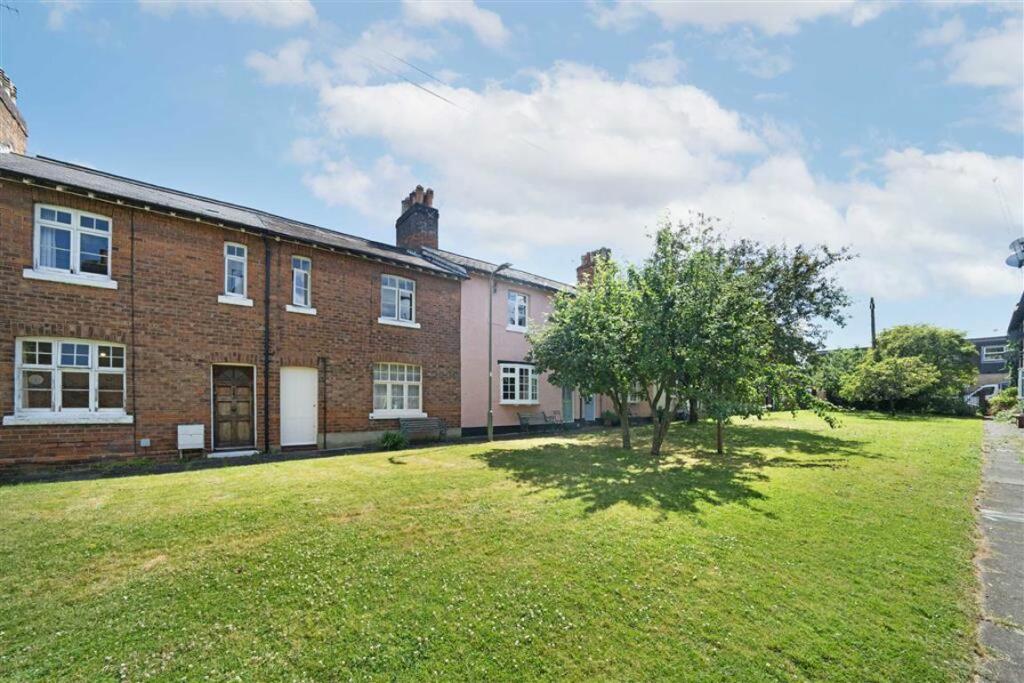
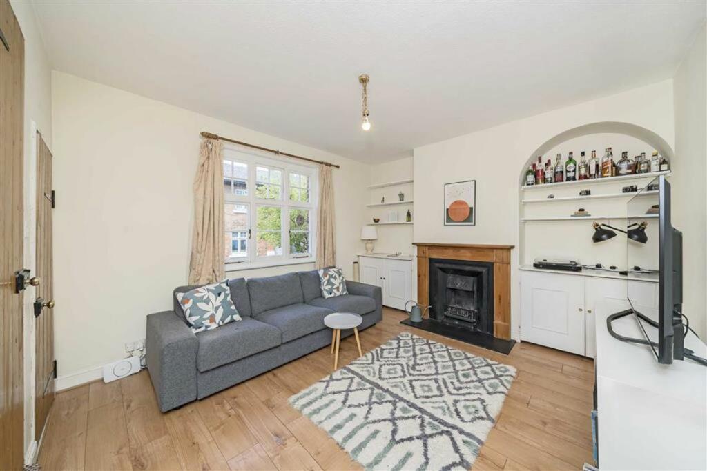
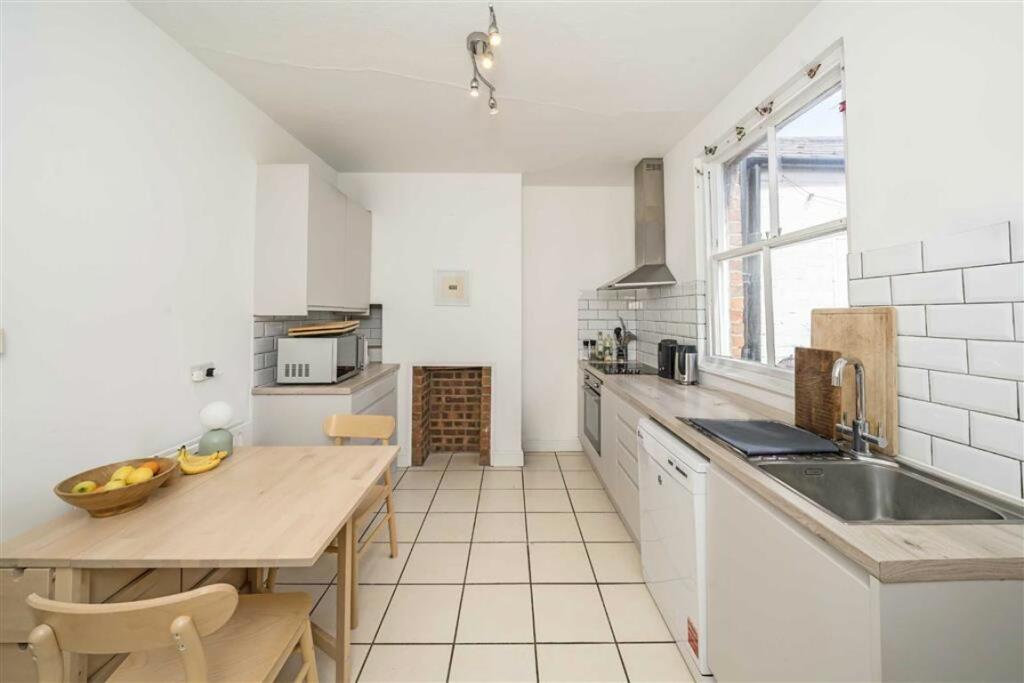
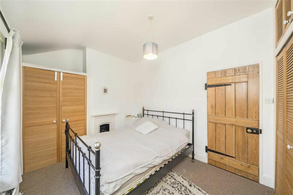
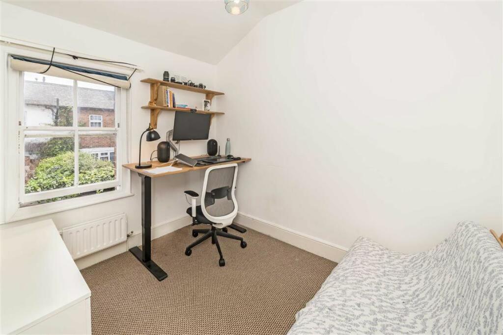
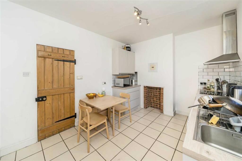
Photo 1 Photo 2 Photo 3 Photo 4 Photo 5 Photo 6
/ 6
Property details
Tenure
FREEHOLD
Floor area
77 m²
Last sold
£545,000 Mar 2025
Local average
£1,890,347 (-70.6%)
Deprivation
Decile 2 (4,170 of 33,755)
Street crime
652 incidents within 1 mile (Apr 2026)
Key features
- Three Bedrooms
- Railway Cottage
- Quiet Residential Area
- Freehold House
- Separate Reception
- Kitchen And Utility Room
Additional details
- Garden
- Yes
Description
Johnston Terrace is located at the heart of the quiet railway cottages 'The Terraces' and is part of a welcoming community. Numerous bus routes and Cricklewood station (Thameslink) are within easy reach for access to Central London.
Tenure: Freehold
Council Tax Band: D
Information contained within this listing is for guidance only and should be checked and confirmed (prior to proceeding).
Listed by
Cricklewood
Dexters
Reference: 150562736
EPC Rating & Upgrade Cost
Fetching EPC data… Refresh this page in a moment.
Flood risk
Zone: 1
Risk: Low
Job (default Low)
Floorplans
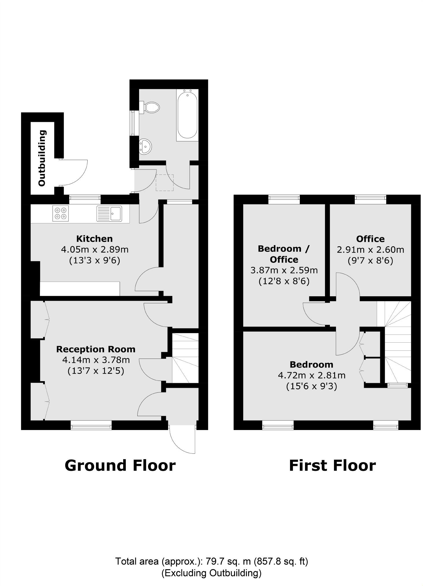
Floorplan 1
EPC Graphs
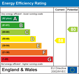
EPC 1
FENSA Certificates
This property has 1 FENSA certificate(s) on record, indicating window/door installations by FENSA-approved installers.
FENSA Certificate #17293305 Recent
Property Details
Street: 8 Johnston Terrace
Town: LONDON
Postcode: NW2 6QJ
Installation Details
Items: 1 window and 1 door
Certificate Issued: 17/05/2026
Work Completed: 29/04/2026
This certificate data was retrieved from FENSA's database
What is FENSA? FENSA (Fenestration Self-Assessment Scheme) is a government-authorised scheme that monitors building regulation compliance for replacement windows and doors. Certificates indicate that work was completed by FENSA-approved installers.
Price history
| Event | Date | Price | % change |
|---|---|---|---|
| Sold | 18/03/2025 (1 year ago) | £545,000 | — |
Source: HM Land Registry Price Paid Data. Crown copyright.
Sold Comparables
Same street and nearby sales within 0.25 miles (last 5 years). Data from Land Registry Price Paid.
| Address | Price | Date | Type |
|---|---|---|---|
| 8 MIDLAND TERRACE, LONDON, BARNET, GREATER LONDON, NW2 6QH | £610,000 | 08/12/2025 | Other |
| 1 - 2 BURLINGTON PARADE, LONDON, BARNET, GREATER LONDON, NW2 6QG | £3,900,000 | 26/11/2025 | Other |
| Same street 30 JOHNSTON TERRACE, LONDON, BARNET, GREATER LONDON, NW2 6QJ | £640,000 | 05/07/2023 | Semi-detached |
| 58A HASSOP ROAD, LONDON, BRENT, GREATER LONDON, NW2 6RX | £70,000 | 23/12/2022 | Other |
| Same street 40 JOHNSTON TERRACE, LONDON, BARNET, GREATER LONDON, NW2 6QJ | £590,000 | 01/08/2022 | Terraced |
| Same street 35 JOHNSTON TERRACE, LONDON, BARNET, GREATER LONDON, NW2 6QJ | £550,000 | 28/02/2022 | Semi-detached |
| Same street 10 JOHNSTON TERRACE, LONDON, BARNET, GREATER LONDON, NW2 6QJ | £540,000 | 23/07/2021 | Terraced |
| 76 HASSOP ROAD, LONDON, BRENT, GREATER LONDON, NW2 6RX | £21,000,000 | 05/07/2021 | Other |
Street average: £580,000 (4 sales)
Area average: £6,395,000 (4 sales)
Capital growth trend
Land Registry outcode average: last 12 months vs 5y and 10y ago (from sold prices).
House Price Index (HM Land Registry — official index, not sold-price averages): Barnet. Series: All dwelling types. As of March 2026.
Rental Range
Estimated market rent for Barnet. Low = conservative, Realistic = average, Optimistic = best case.
Based on Local Authority from postcode lookup → Barnet.
LHA (30th percentile) floor for Inner North London: £2,154/mo (Apr 2025 – Mar 2026)
Location
Nearby
Nearest stations, universities and amenities (distance from property).
| Type | Name | Distance |
|---|---|---|
| Shop | Arabian Perfumes | 0.1 miles |
| Shop | Modest Clothing | 0.1 miles |
| Bus stop | Mora Road | 0.1 miles |
| Train station | Cricklewood | 0.2 miles |
| Train station | Willesden Green | 0.8 miles |
| University | Central Belsize Square | 2.2 miles |
| University | Kennet West Skills Centre | 2.5 miles |
| Hospital | The Portland Hospital | 4.1 miles |
| Hospital | Sleep & Health Clinic | 4.1 miles |
Street-level crime
| Category | Count |
|---|---|
| Violence and sexual offences | 172 |
| Anti-social behaviour | 167 |
| Other theft | 59 |
| Vehicle crime | 56 |
| Public order | 40 |
| Shoplifting | 40 |
| Burglary | 28 |
| Drugs | 26 |
| Criminal damage and arson | 23 |
| Theft from the person | 18 |
| Robbery | 10 |
| Other crime | 7 |
| Possession of weapons | 4 |
| Bicycle theft | 2 |
| Total incidents | 652 |
Within 1 mile during Apr 2026. Source: data.police.uk (England & Wales).
Schools nearby
Nearest open schools with Ofsted ratings (England). Closed schools are not shown. Data from Get Information about Schools and Ofsted.
| Name | Type | Distance | Ofsted |
|---|---|---|---|
| St Agnes' Catholic Primary School | Primary | 0.3 miles | Outstanding — 13 Nov 2019 |
| Mora Primary School | Primary | 0.4 miles | Good — 8 Sep 2024 |
| Claremont Primary School | Primary | 0.4 miles | Good — 6 Feb 2019 |
| Anson Primary School | Primary | 0.4 miles | Good — 1 Jun 2015 |
| Our Lady of Grace RC Infant and Nursery School | Primary | 0.5 miles | Outstanding — 30 Jan 2024 |
Rental Comparables
Rental comparables are temporarily unavailable while listing-site fetches are paused. Try again later.
Rent-driven metrics
Based on Area rent estimate.
- Rent ratio — Monthly rent ÷ purchase price (1% rule). 1%+ = strong, 0.8–1% = okay, <0.8% = weak for cashflow.
- Max investor price — Rent ÷ 0.8%; the price at which rent would be 0.8% of price (Stoke-style target).
- Target investor price — Rent ÷ 1%; the price at which rent would be 1% of price (strong cashflow band).
- Gross yield — Annual rent as % of purchase price (no costs).