Porthill Bank
Porthill, Newcastle-under-Lyme, ST5, ST5 0AA
£800 pcm
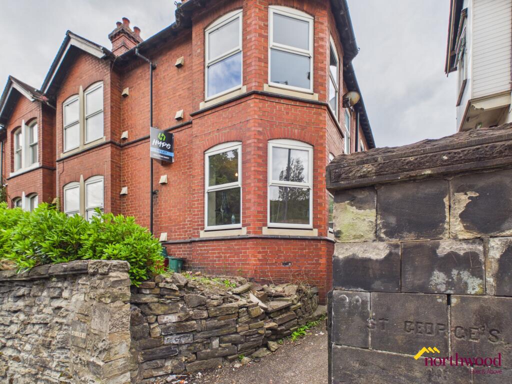
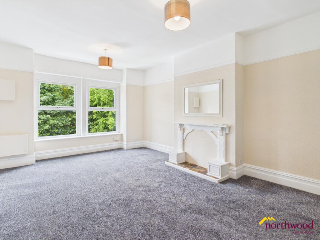
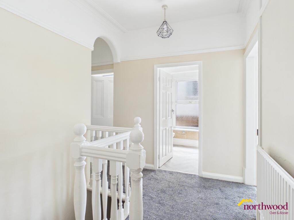
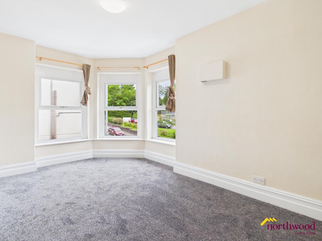
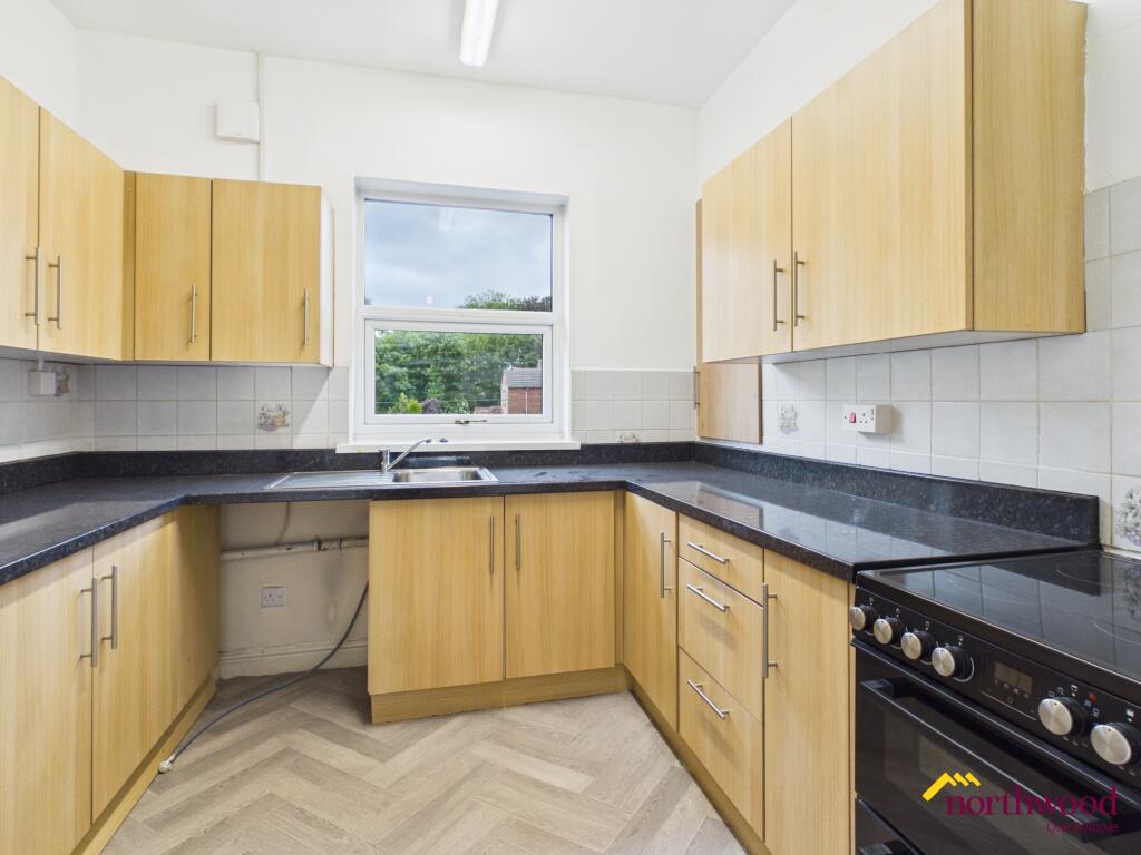
Photo 1 Photo 2 Photo 3 Photo 4 Photo 5 Photo 6 Photo 7 Photo 8
/ 8
Property details
Council tax band
A
Deprivation
Decile 7 (21,710 of 33,755)
Street crime
220 incidents within 1 mile (Apr 2026)
Key features
- Double glazing
Additional details
- Heating
- Double glazing, Gas central
Description
Residents will appreciate the convenience and thoughtful design found across the property, making it suitable for a variety of occupants. The building?s flat configuration is ideal for those preferring single-level living and easy access. The property will be available to move in from 3 June 2026.
Local area
Situated in the Porthill area, this property benefits from a location in Newcastle-under-Lyme, Staffordshire. The wider area offers a range of amenities, including local shops, reputable schools, and accessible transport links, all contributing to a practical and comfortable lifestyle. Proximity to recreational spaces and community facilities further enhances the appeal, offering residents an attractive balance between urban convenience and the tranquillity of surrounding neighbourhoods. EPC rating: C.
Listed by
Stoke-on-Trent
The Property Franchise Group
Reference: 89295366
EPC ratings on this postcode
We don't have a matched EPC for this property yet. Below are efficiency scores and details for other addresses on this postcode.
| Address | Current | Potential | Floor area | Age band | Type |
|---|---|---|---|---|---|
| 12 Porthill Bank, NEWCASTLE | 72 | 78 | 93 m² | England and Wales: 1950-1966 | Detached |
| 12, Porthill Bank, NEWCASTLE | 64 | 83 | 95 m² | England and Wales: 1930-1949 | Detached |
| 14, Porthill Bank, NEWCASTLE | 67 | 79 | 119 m² | England and Wales: 1930-1949 | Detached |
| 16, Porthill Bank, NEWCASTLE | 69 | 83 | 101 m² | England and Wales: 1930-1949 | Detached |
| 18 PORTHILL BANK, NEWCASTLE UNDER LYME, NEWCASTLE UNDER LYME | 58 | 80 | 172 m² | England and Wales: 1900-1929 | Detached |
| 22, Porthill Bank, NEWCASTLE | 56 | 83 | 133 m² | England and Wales: 1900-1929 | Terraced |
| 24 PORTHILL BANK, NEWCASTLE UNDER LYME, NEWCASTLE UNDER LYME | 52 | 68 | 150 m² | England and Wales: 1900-1929 | Terraced |
| 38a Porthill Bank, NEWCASTLE | 71 | 78 | 74 m² | England and Wales: 1900-1929 | Flat |
| 38a, Porthill Bank, NEWCASTLE | 66 | 79 | 88 m² | England and Wales: 1900-1929 | Flat |
| 4, Porthill Bank, NEWCASTLE | 62 | 81 | 113 m² | England and Wales: 1967-1975 | Detached |
| 4, Porthill Bank, NEWCASTLE | 55 | 77 | 123 m² | England and Wales: 1900-1929 | Detached |
| 42 Porthill Bank, NEWCASTLE | 72 | 82 | 99 m² | England and Wales: before 1900 | Detached |
| 44, Porthill Bank, NEWCASTLE | 59 | 85 | 115 m² | England and Wales: before 1900 | Detached |
| 6, Porthill Bank, NEWCASTLE | 67 | 81 | 104 m² | England and Wales: 1900-1929 | Detached |
| Flat 1, 30 Porthill Bank, NEWCASTLE | 69 | 74 | 35 m² | England and Wales: 1900-1929 | Flat |
Flood risk
Zone: 1
Risk: Low
Job (default Low)
Floorplans
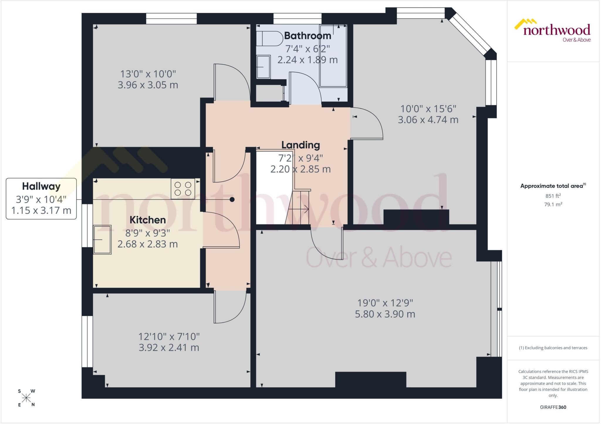
Floorplan
EPC Graphs

EPC Certificate
Rental Range
Estimated market rent for Newcastle-under-Lyme. Low = conservative, Realistic = average, Optimistic = best case.
Based on Local Authority from postcode lookup → Newcastle-under-Lyme.
LHA (30th percentile) floor for Staffordshire North: £593/mo (Apr 2025 – Mar 2026)
Location
Address
Porthill Bank
Nearby
Nearest stations, universities and amenities (distance from property).
| Type | Name | Distance |
|---|---|---|
| Bus stop | Vale View | 0.1 miles |
| Bus stop | Second Avenue | 0.1 miles |
| Train station | Longport | 0.3 miles |
| Shop | Unknown | 0.3 miles |
| Shop | Longport Convenience Store | 0.3 miles |
| Hospital | Haywood Hospital Walk-in Centre | 1.7 miles |
| Train station | Apedale Road | 2.0 miles |
| Hospital | Royal Stoke University Hospital | 2.4 miles |
| University | Keele University | 3.4 miles |
| University | University of Buckingham Crewe Campus | 9.3 miles |
Street-level crime
| Category | Count |
|---|---|
| Violence and sexual offences | 72 |
| Anti-social behaviour | 52 |
| Public order | 21 |
| Criminal damage and arson | 17 |
| Vehicle crime | 15 |
| Burglary | 12 |
| Other theft | 11 |
| Other crime | 8 |
| Shoplifting | 5 |
| Robbery | 3 |
| Bicycle theft | 1 |
| Drugs | 1 |
| Possession of weapons | 1 |
| Theft from the person | 1 |
| Total incidents | 220 |
Within 1 mile during Apr 2026. Source: data.police.uk (England & Wales).
Schools nearby
Nearest open schools with Ofsted ratings (England). Closed schools are not shown. Data from Get Information about Schools and Ofsted.
| Name | Type | Distance | Ofsted |
|---|---|---|---|
| Oaklands Nursery School | Nursery | 0.2 miles | Outstanding — 15 Feb 2013 |
| Kaleidoscope School | Other | 0.2 miles | Good — 10 Dec 2023 |
| Cedars - Newcastle, Moorlands and Darwin Bases | Other | 0.4 miles | Good — 26 Jun 2015 |
| Ellison Primary Academy | Primary | 0.4 miles | Good — 14 Sep 2023 |
| St Margaret's CofE (VC) Junior School | Primary | 0.7 miles | Good — 1 May 2014 |
Rental Comparables
Residential lets from OpenRent and Rightmove for the area (same bedroom count). Use to validate rent estimates. Student lets are excluded.
Average rent: £944/mo (38 listings)
Enter House Number
Enter the house number to help us retrieve more accurate pricing history and property data.
Please log in to submit or correct the house number for this listing.
Log in to continue