34 REGENT AVENUE
BOOTLE, MERSEYSIDE L30 6YG


Property details
Floor area
73 m²
Deprivation
Decile 2 (5,970 of 33,755)
Street crime
266 incidents within 1 mile (Apr 2026)
Key features
- Detached house
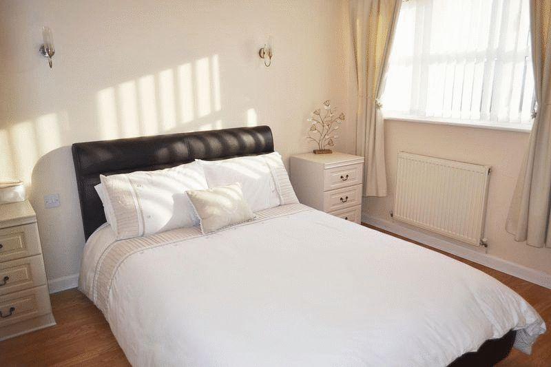
- Three bedrooms
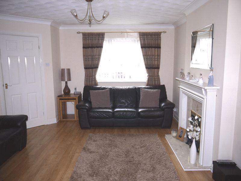
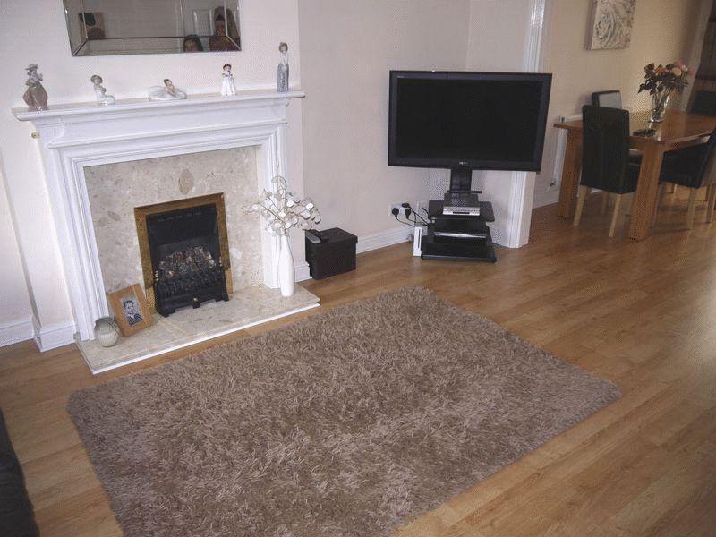
- Lounge
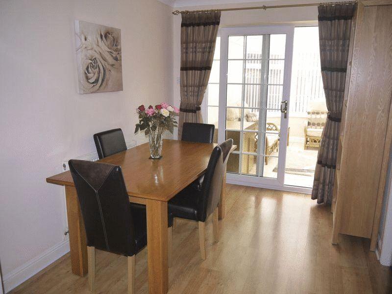
- Dining room
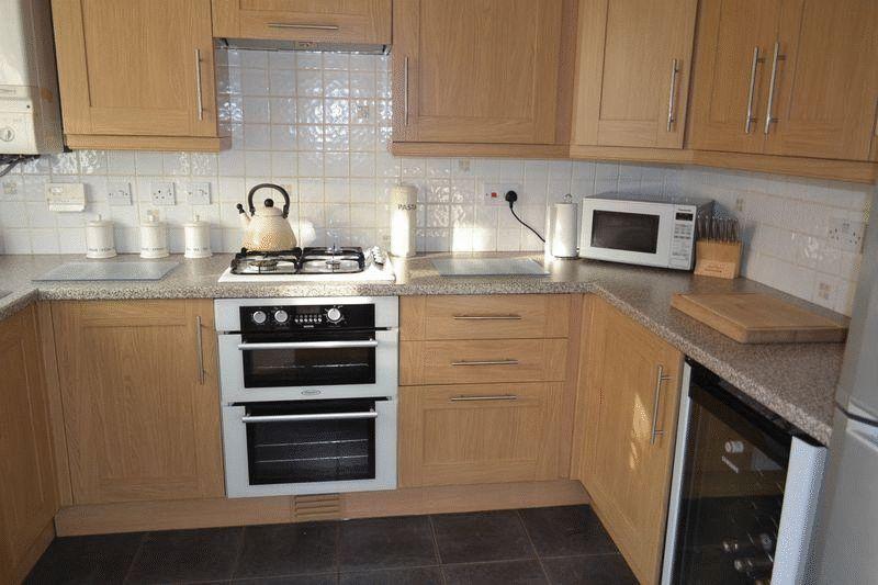
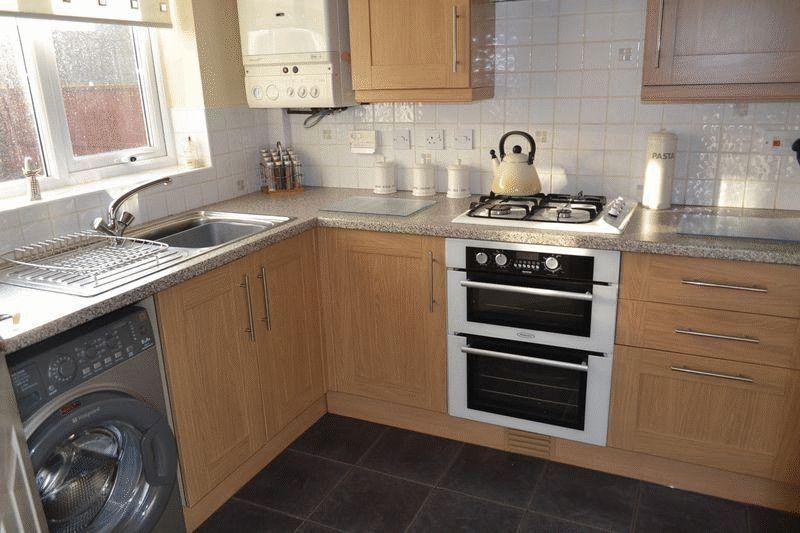
- Kitchen
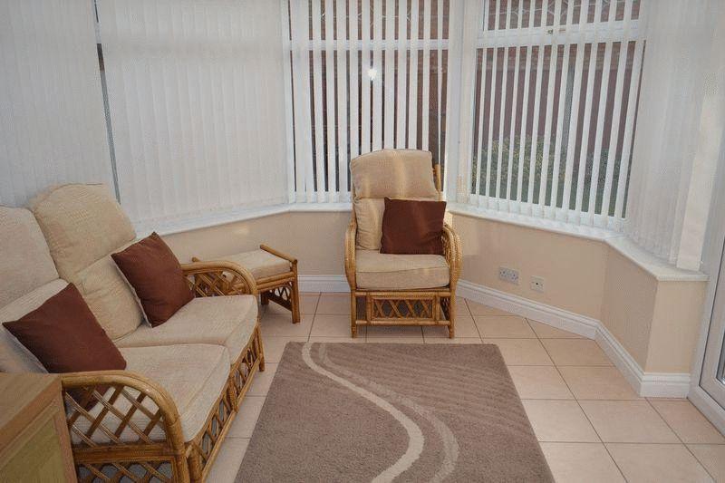
- Conservatory
- Double glazing
- Gas central heating
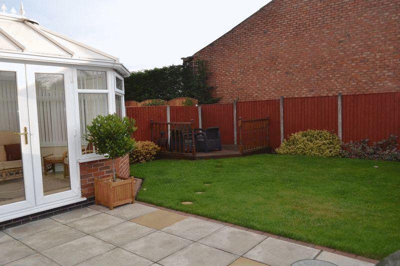
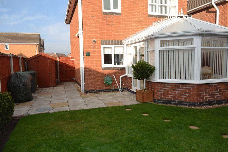
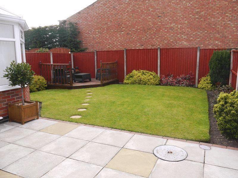
- Gardens
- Parking for 2 cars
Additional details
- Parking
- Yes
- Garden
- Yes
Description
Listed by
Maghull
Ian Crane
Reference: 36617490
EPC Rating & Upgrade Cost
Fetching EPC data… Refresh this page in a moment.
Flood risk
Zone: 1
Risk: Low
Job (default Low)
Floorplans
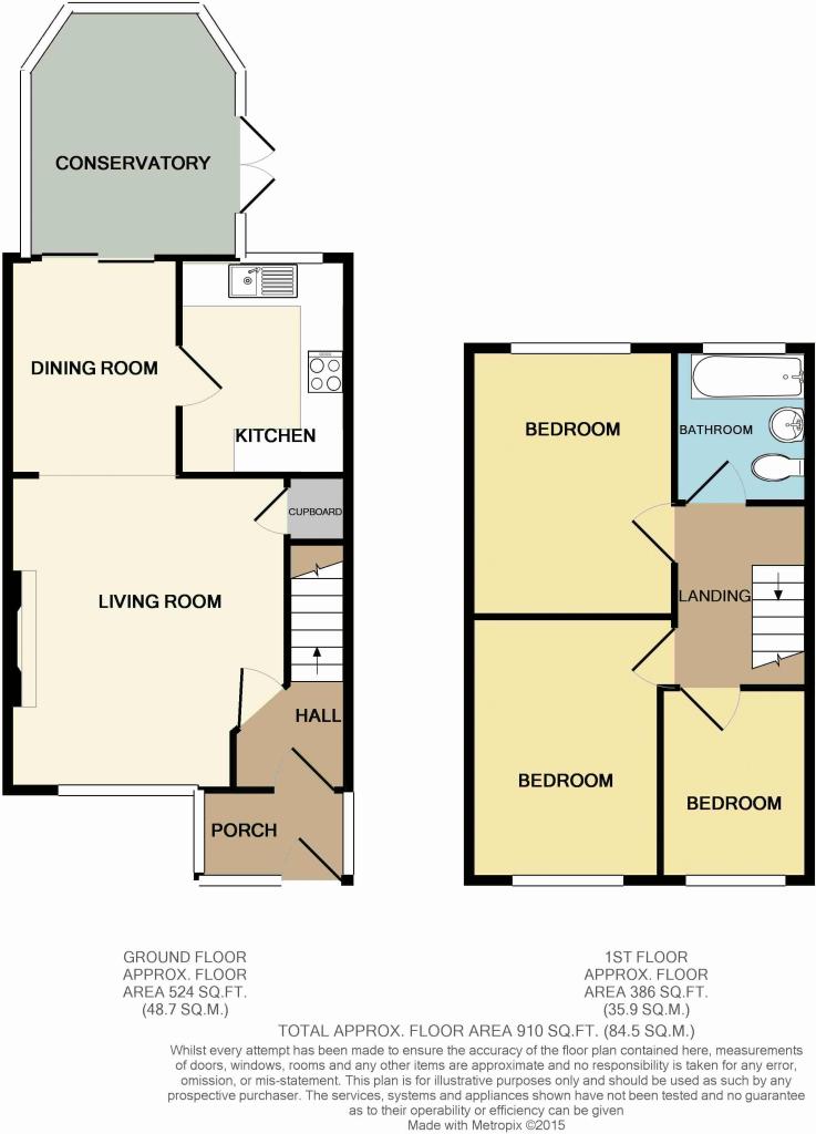
Regent Avenue
Rental Range
Estimated market rent for Sefton. Low = conservative, Realistic = average, Optimistic = best case.
Based on Local Authority from postcode lookup → Sefton.
LHA (30th percentile) floor for Greater Liverpool: £648/mo (Apr 2025 – Mar 2026)
Location
Nearby
Nearest stations, universities and amenities (distance from property).
| Type | Name | Distance |
|---|---|---|
| Bus stop | PARK LANE WEST/ST OSWALDS LANE | 0.1 miles |
| Shop | Aldi | 0.2 miles |
| Shop | Armadillo Liverpool Aintree | 0.2 miles |
| Train station | Old Roan | 0.8 miles |
| Train station | Aintree | 0.9 miles |
| Hospital | Unknown | 1.8 miles |
| Hospital | DRIVE THROUGH PHLEBOTOMY | 1.8 miles |
| University | Liverpool Hope University | 5.0 miles |
| University | Liverpool John Moores University City Campus | 5.1 miles |
Street-level crime
| Category | Count |
|---|---|
| Violence and sexual offences | 103 |
| Public order | 29 |
| Anti-social behaviour | 23 |
| Shoplifting | 22 |
| Criminal damage and arson | 21 |
| Drugs | 17 |
| Other theft | 17 |
| Vehicle crime | 8 |
| Possession of weapons | 7 |
| Burglary | 5 |
| Other crime | 5 |
| Theft from the person | 4 |
| Bicycle theft | 3 |
| Robbery | 2 |
| Total incidents | 266 |
Within 1 mile during Apr 2026. Source: data.police.uk (England & Wales).
Schools nearby
Nearest open schools with Ofsted ratings (England). Closed schools are not shown. Data from Get Information about Schools and Ofsted.
| Name | Type | Distance | Ofsted |
|---|---|---|---|
| St Oswald's Church of England Primary School | Primary | 0.1 miles | Good — 15 Jan 2023 |
| Our Lady of Walsingham Primary School | Primary | 0.2 miles | Requires improvement — 15 Jun 2022 |
| Netherton Moss Primary School | Primary | 0.5 miles | Good — 11 Feb 2015 |
| Holy Spirit Catholic Academy | Primary | 0.6 miles | — (Inspected (no overall grade)) |
| St Benedict's Catholic Primary School | Primary | 0.6 miles | Good — 25 Jun 2014 |
Rental Comparables
Residential lets from OpenRent and Rightmove for the area (same bedroom count). Use to validate rent estimates. Student lets are excluded.
| Title | Rent | Beds | Distance | As seen on |
|---|---|---|---|---|
| 3 Bed Semi-Detached House, Ennerdale Drive, L21 | £1,050/mo | 3 | 1.07 miles | OpenRent |
| 3 Bed Semi-Detached House, Osborne Road, L21 | £950/mo | 3 | 1.09 miles | OpenRent |
Average rent: £1,000/mo (2 listings)