St6 2Hs
ST6 2HS
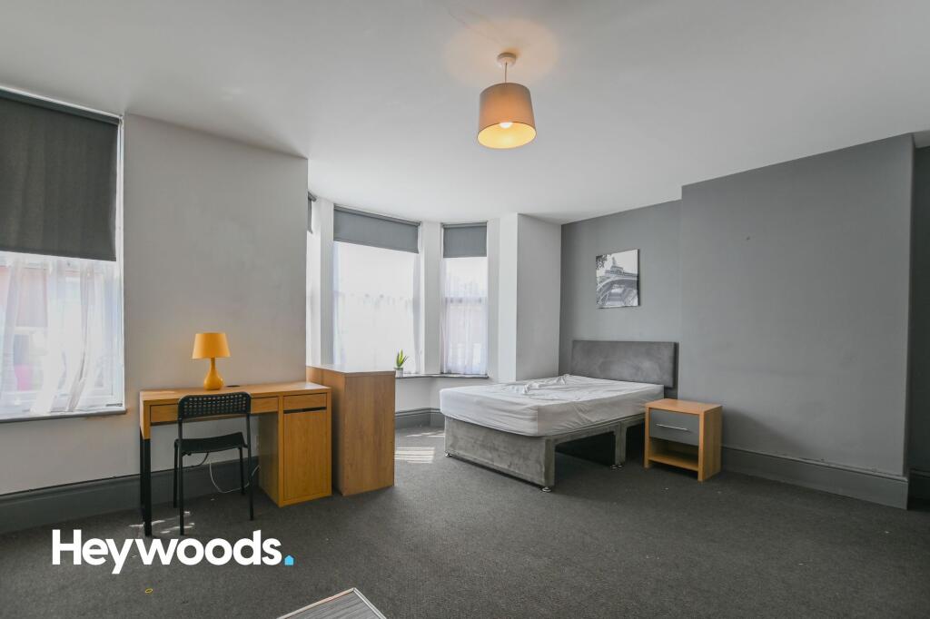
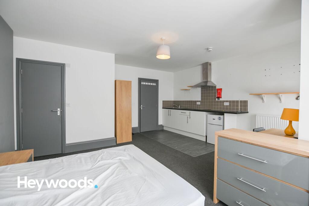
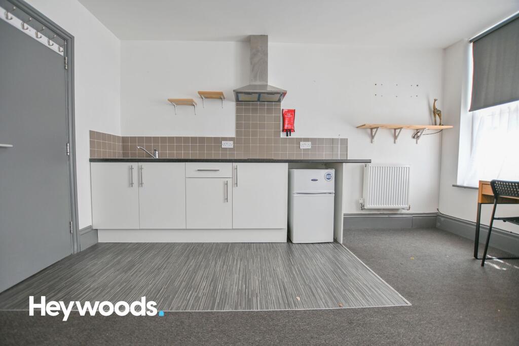
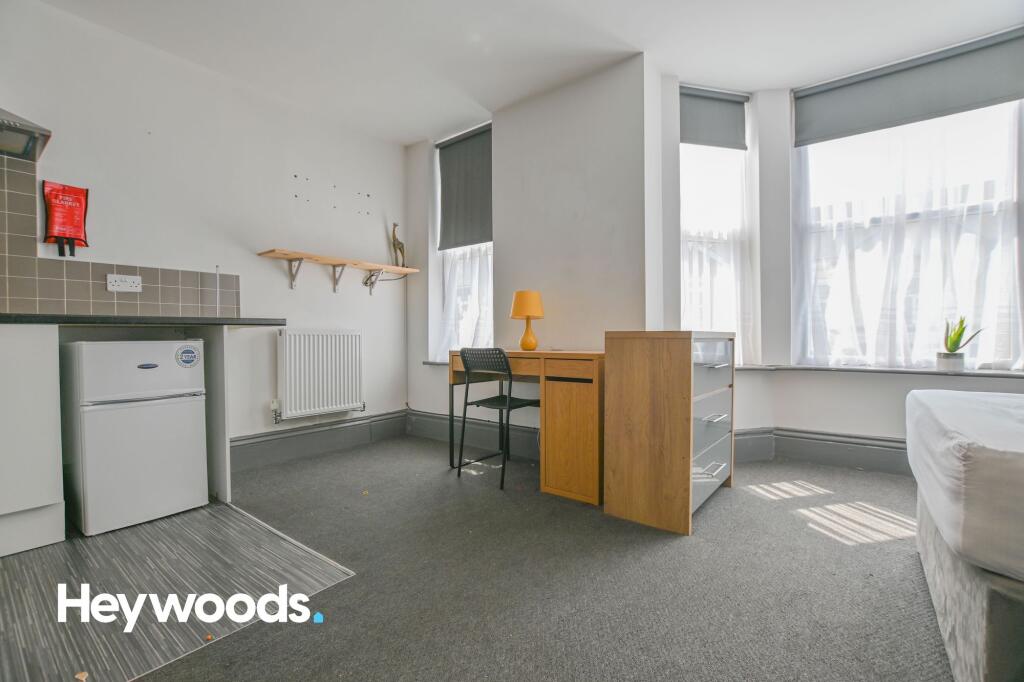
Photo 1 Photo 2 Photo 3 Photo 4
/ 4
Property details
Council tax band
B
Deprivation
Decile 1 (1,186 of 33,755)
EPC ratings on this postcode
We don't have a matched EPC for this property yet. Below are efficiency scores and details for other addresses on this postcode.
| Address | Current | Potential | Floor area | Age band | Type |
|---|---|---|---|---|---|
| 203 Waterloo Road, STOKE-ON-TRENT | 93 | 96 | 220 m² | England and Wales: 1900-1929 | Terraced |
| 203 Waterloo Road, STOKE-ON-TRENT | 66 | 80 | 244 m² | England and Wales: 1900-1929 | Terraced |
| 203 Waterloo Road, STOKE-ON-TRENT | 1 | 71 | 220 m² | England and Wales: before 1900 | Terraced |
| 207 Waterloo Road, STOKE-ON-TRENT | 78 | 84 | 321 m² | England and Wales: 1900-1929 | Terraced |
| 207, Waterloo Road, STOKE-ON-TRENT | 68 | 72 | 337 m² | England and Wales: before 1900 | Detached |
| 209 Waterloo Road, STOKE-ON-TRENT | 69 | 80 | 54 m² | England and Wales: 1900-1929 | Terraced |
| 209, Waterloo Road, STOKE-ON-TRENT | 67 | 90 | 53 m² | England and Wales: 1900-1929 | Terraced |
| 215 Waterloo Road, STOKE-ON-TRENT | 54 | 77 | 205 m² | England and Wales: before 1900 | Terraced |
| 217, Waterloo Road | 52 | 77 | 187 m² | England and Wales: 1900-1929 | House |
| 217, Waterloo Road, STOKE-ON-TRENT | 52 | 77 | 187 m² | England and Wales: 1900-1929 | Terraced |
| 217, Waterloo Road, STOKE-ON-TRENT | 35 | 81 | 201 m² | England and Wales: 1900-1929 | Terraced |
| 221, Waterloo Road, STOKE-ON-TRENT | 48 | 77 | 217 m² | England and Wales: 1900-1929 | Terraced |
| 221, Waterloo Road, STOKE-ON-TRENT | 52 | 78 | 186 m² | England and Wales: 1900-1929 | Terraced |
| 221, Waterloo Road, STOKE-ON-TRENT | 53 | 76 | 196 m² | England and Wales: before 1900 | Terraced |
| Elm House, 201 Waterloo Road, STOKE-ON-TRENT | 44 | 66 | 410 m² | England and Wales: before 1900 | Detached |
Flood risk
Zone: 1
Risk: Low
Not in Flood Risk Area (no data)
Rental Range
Estimated market rent for Stoke-on-Trent. Low = conservative, Realistic = average, Optimistic = best case.
Based on Local Authority from postcode lookup → Stoke-on-Trent.
LHA (30th percentile) floor for Staffordshire North: £424/mo (Apr 2025 – Mar 2026)
Location
Nearby
Nearest stations, universities and amenities (distance from property).
| Type | Name | Distance |
|---|---|---|
| Bus stop | Cobridge Barracks | 0.0 miles |
| Shop | Costcutter | 0.1 miles |
| Shop | Service UK | 0.1 miles |
| Bus stop | Unknown | 0.2 miles |
| Hospital | St Augustine's Hospital | 0.3 miles |
| Train station | Longport | 1.2 miles |
| Hospital | Haywood Hospital Walk-in Centre | 1.3 miles |
| University | University of Staffordshire Stoke Campus | 2.0 miles |
| Train station | Stoke-on-Trent | 2.1 miles |
Street-level crime
Crime data is not yet available for this property.
Rental Comparables
Residential lets from OpenRent and Rightmove for the area (same bedroom count). Use to validate rent estimates. Student lets are excluded.
| Title | Rent | Beds | As seen on |
|---|---|---|---|
| Wade Street, Burslem | £675/mo | 1 | Rightmove |
| Lingard Street, Burslem, Stoke-on-Trent, ST6 | £750/mo | — | Rightmove |
| The Boulevard, Stoke-on-Trent, ST6 | £595/mo | — | Rightmove |
| Kingsware Road, Stoke On Trent | £825/mo | 1 | Rightmove |
| Lancashire Court, Federation Road, Burslem, Stoke-on-Trent, ST6 | £600/mo | 1 | Rightmove |
| Newcastle Street, Stoke-on-Trent, Staffordshire, ST6 | £750/mo | 1 | Rightmove |
| High Street, Stoke-on-Trent, Staffordshire, ST6 | £550/mo | 1 | Rightmove |
| High Street, Tunstall | £550/mo | — | Rightmove |
| Westport Road, Stoke-On-Trent, ST6 | £625/mo | 1 | Rightmove |
| Kingsware Road, Burslem | £850/mo | 1 | Rightmove |
| Flat 1, 62 Scott Lidgett Road, Stoke-on Trent | £600/mo | 1 | Rightmove |
| Railway Inn Apartments, Stoke-On-Trent, ST6 | £425/mo | 1 | Rightmove |
Average rent: £650/mo (12 listings)
Enter House Number
Enter the house number to help us retrieve more accurate pricing history and property data.
Please log in to submit or correct the house number for this listing.
Log in to continue