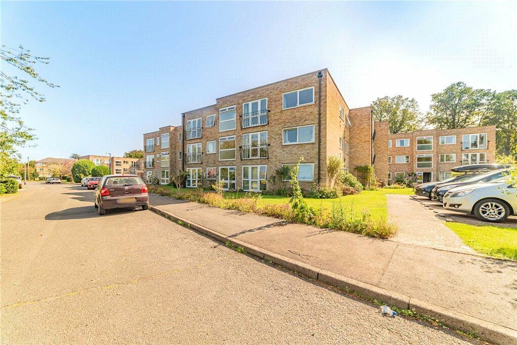
9 RISELEY ROAD
MAIDENHEAD, WINDSOR AND MAIDENHEAD SL6 6EP
Property details
Tenure
LEASEHOLD
Council tax band
C
Last sold
£255,000 Jun 2024
Local average
£315,514 (-17.6%)
Deprivation
Decile 10 (31,884 of 33,755)
Street crime
248 incidents within 1 mile (Apr 2026)
Key features
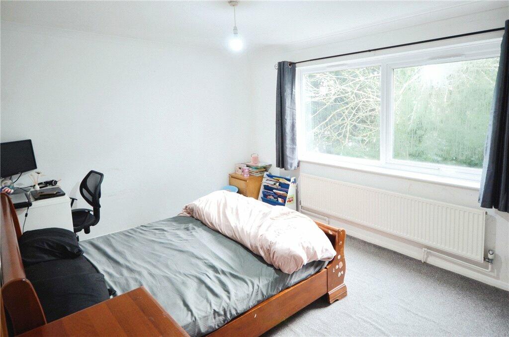
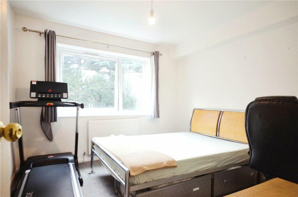
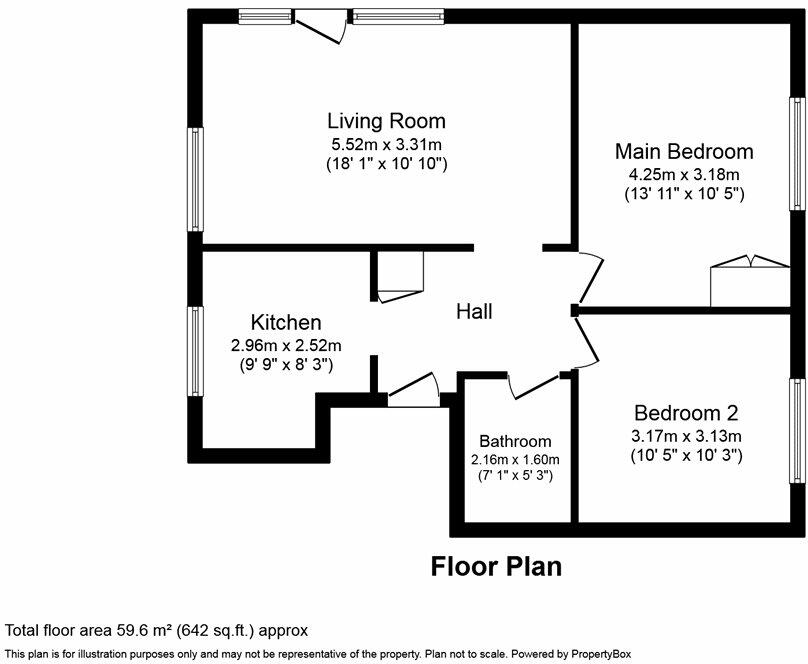
- Two double bedrooms
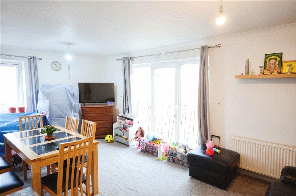
- 18' lounge
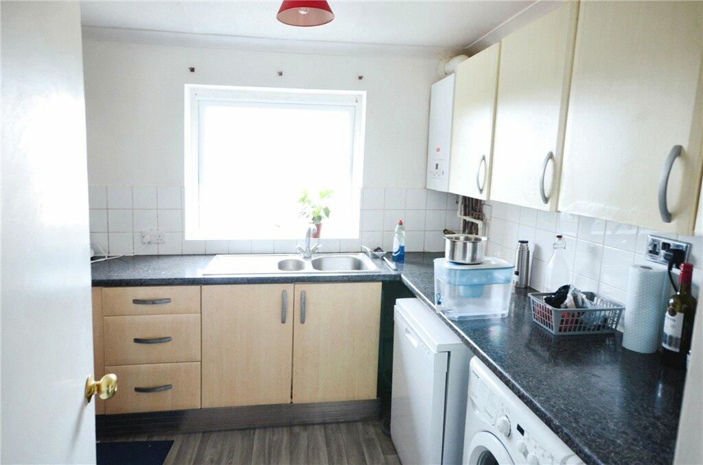
- Modern kitchen
- Second floor position
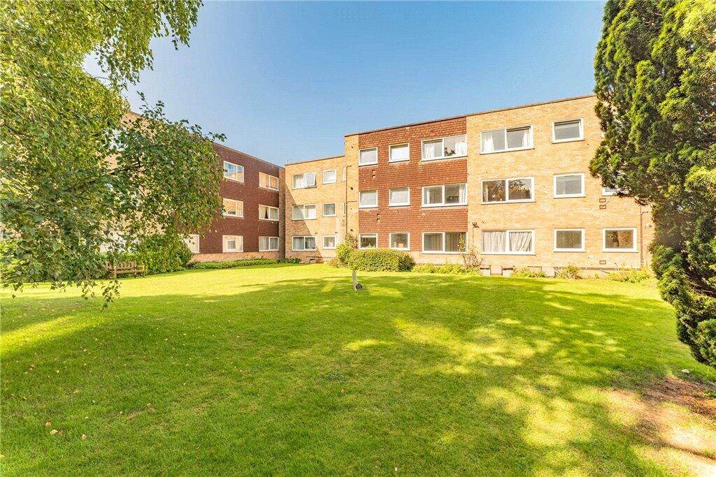
- Cul-de-sac location
- No chain
Additional details
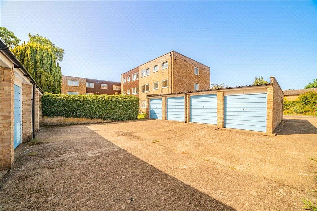
- Parking
- Yes
Description
A top floor apartment situated in this sought after development, offering excellent access to the town centre, main line train station and all major commuter links.
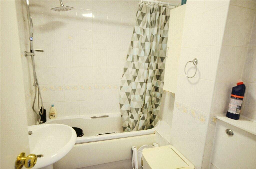
The property offers two well-proportioned bedrooms, large lounge, kitchen and family bathroom.
There is a garage in a block, and residents parking.
Listed by
Maidenhead
Leaders and Romans Group
Reference: 143521742
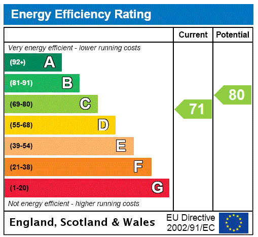
EPC Rating & Upgrade Cost
Fetching EPC data… Refresh this page in a moment.
Flood risk
Zone: 1
Risk: Low
Job (default Low)
Floorplans
Picture No. 10
EPC Graphs
EPC Rating Graph
Price history
| Event | Date | Price | % change |
|---|---|---|---|
| Sold | 19/06/2024 (2 years ago) | £255,000 | — |
Source: HM Land Registry Price Paid Data. Crown copyright.
Sold Comparables
Same street and nearby sales within 0.25 miles (last 5 years). Data from Land Registry Price Paid.
| Address | Price | Date | Type |
|---|---|---|---|
| DANES COURT 4 ALL SAINTS AVENUE, MAIDENHEAD, WINDSOR AND MAIDENHEAD, SL6 6EN | £280,000 | 16/01/2026 | Flat |
| 63 BATH ROAD, MAIDENHEAD, WINDSOR AND MAIDENHEAD, SL6 4AL | £255,000 | 09/06/2025 | Flat |
| BATH COURT 31 POWNEY ROAD, MAIDENHEAD, WINDSOR AND MAIDENHEAD, SL6 6ER | £200,000 | 19/09/2023 | Flat |
| 12 BOYN HILL CLOSE, MAIDENHEAD, WINDSOR AND MAIDENHEAD, SL6 4JD | £405,000 | 11/09/2023 | Flat |
| Same street 35 RISELEY ROAD, MAIDENHEAD, WINDSOR AND MAIDENHEAD, SL6 6EP | £270,000 | 27/01/2023 | Flat |
| 20 FAIRACRE, MAIDENHEAD, WINDSOR AND MAIDENHEAD, SL6 4AN | £310,000 | 16/08/2022 | Flat |
| BATH COURT 3 POWNEY ROAD, MAIDENHEAD, WINDSOR AND MAIDENHEAD, SL6 6ER | £265,000 | 20/07/2022 | Flat |
| 22 HEDINGHAM MEWS, MAIDENHEAD, WINDSOR AND MAIDENHEAD, SL6 6ET | £245,000 | 12/11/2021 | Flat |
| GROVE COURT FLAT 1 BATH ROAD, MAIDENHEAD, WINDSOR AND MAIDENHEAD, SL6 4JT | £283,000 | 28/10/2021 | Flat |
| Same street 14 RISELEY ROAD, MAIDENHEAD, WINDSOR AND MAIDENHEAD, SL6 6EP | £220,000 | 30/09/2021 | Flat |
| 30A POWNEY ROAD, MAIDENHEAD, WINDSOR AND MAIDENHEAD, SL6 6EQ | £275,000 | 17/09/2021 | Flat |
| 19 FAIRACRE, MAIDENHEAD, WINDSOR AND MAIDENHEAD, SL6 4AN | £300,000 | 17/09/2021 | Flat |
| BATH COURT 29 POWNEY ROAD, MAIDENHEAD, WINDSOR AND MAIDENHEAD, SL6 6ER | £175,000 | 31/08/2021 | Flat |
Street average: £245,000 (2 sales)
Area average: £272,091 (11 sales)
Capital growth trend
Land Registry outcode average: last 12 months vs 5y and 10y ago (from sold prices).
House Price Index (HM Land Registry — official index, not sold-price averages): Windsor and Maidenhead. Series: Flats and maisonettes. As of March 2026.
Company ownership
Registered legal owner is a company.
Rental Range
Estimated market rent for Windsor and Maidenhead. Low = conservative, Realistic = average, Optimistic = best case.
Based on Local Authority from postcode lookup → Windsor and Maidenhead.
LHA (30th percentile) floor for East Thames Valley: £1,197/mo (Apr 2025 – Mar 2026)
Location
Nearby
Nearest stations, universities and amenities (distance from property).
| Type | Name | Distance |
|---|---|---|
| Bus stop | All Saints Avenue | 0.0 miles |
| Shop | Tesco Express | 0.2 miles |
| Shop | Majestic | 0.2 miles |
| Train station | Maidenhead | 0.7 miles |
| Train station | Furze Platt | 0.9 miles |
| Hospital | Upton Hospital | 6.4 miles |
| Hospital | Wexham Park Hospital | 7.1 miles |
| University | National Film and Television School | 7.3 miles |
| University | Buckinghamshire New University (Wycombe Campus) | 7.4 miles |
Street-level crime
| Category | Count |
|---|---|
| Violence and sexual offences | 92 |
| Shoplifting | 34 |
| Anti-social behaviour | 24 |
| Criminal damage and arson | 22 |
| Public order | 20 |
| Other theft | 12 |
| Other crime | 10 |
| Vehicle crime | 10 |
| Drugs | 9 |
| Burglary | 8 |
| Robbery | 3 |
| Bicycle theft | 2 |
| Possession of weapons | 1 |
| Theft from the person | 1 |
| Total incidents | 248 |
Within 1 mile during Apr 2026. Source: data.police.uk (England & Wales).
Schools nearby
Nearest open schools with Ofsted ratings (England). Closed schools are not shown. Data from Get Information about Schools and Ofsted.
| Name | Type | Distance | Ofsted |
|---|---|---|---|
| Boyne Hill CofE Infant and Nursery School | Primary | 0.2 miles | — (Inspected (no overall grade)) |
| All Saints Church of England Junior School | Primary | 0.3 miles | Inadequate — 3 Apr 2022 |
| Claires Court Schools | Other | 0.4 miles | — (No rating) |
| Highfield Preparatory School Limited | Other | 0.4 miles | — (No rating) |
| Alwyn Infant School | Primary | 0.6 miles | Good — 17 Oct 2013 |
Rental Comparables
Loading rental comparables for this postcode. Refresh in a few minutes.
Rent-driven metrics
Based on Area rent estimate.
- Rent ratio — Monthly rent ÷ purchase price (1% rule). 1%+ = strong, 0.8–1% = okay, <0.8% = weak for cashflow.
- Max investor price — Rent ÷ 0.8%; the price at which rent would be 0.8% of price (Stoke-style target).
- Target investor price — Rent ÷ 1%; the price at which rent would be 1% of price (strong cashflow band).
- Gross yield — Annual rent as % of purchase price (no costs).