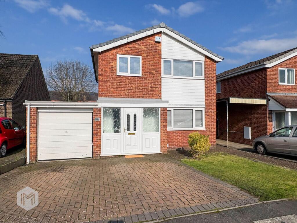
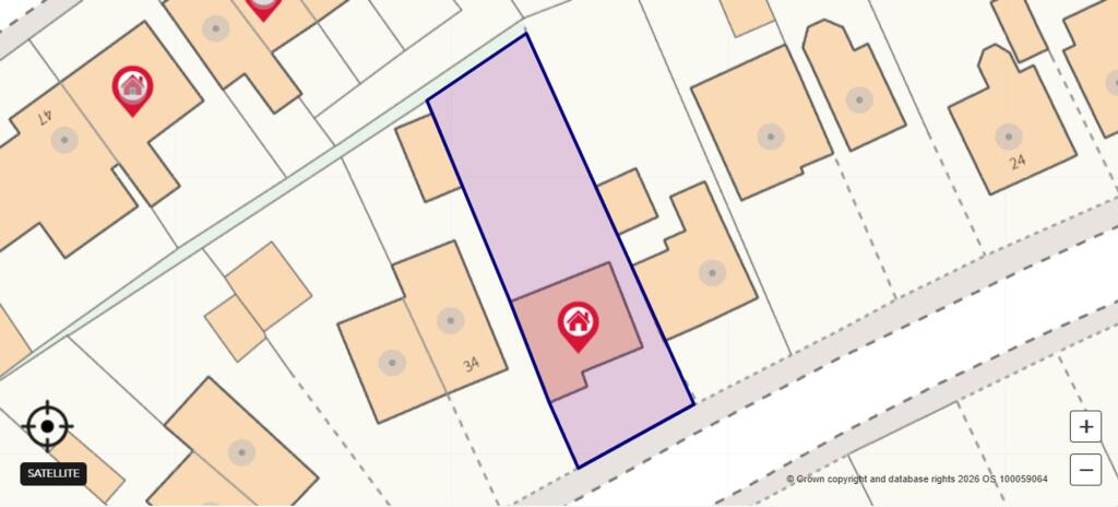
32 THOMPSON AVENUE
WARRINGTON, CULCHETH, WARRINGTON WA3 4EB

Property details
Tenure
FREEHOLD
Floor area
86 m²
Council tax band
D
EPC rating
D
Year built
England and Wales: 1967-1975
Last sold
£372,000 May 2022
Price per m²
£4,360/m²
Local average
£461,124 (-18.7%)
Deprivation
Decile 9 (30,033 of 33,755)
Street crime
27 incidents within 1 mile (Apr 2026)
Key features
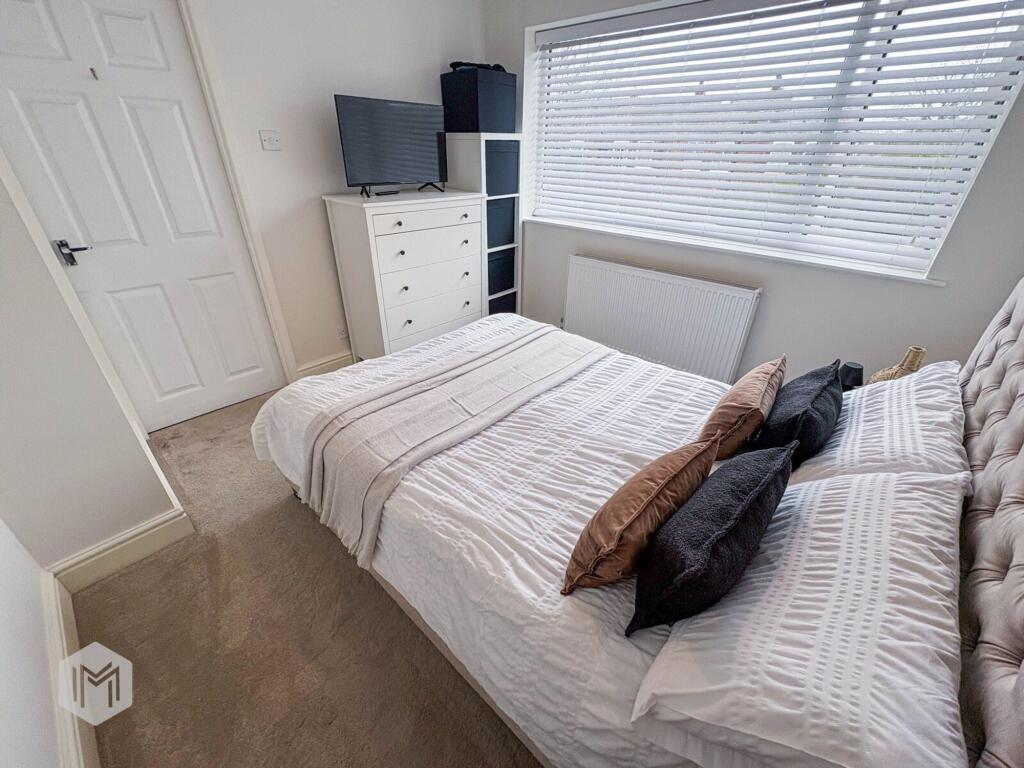
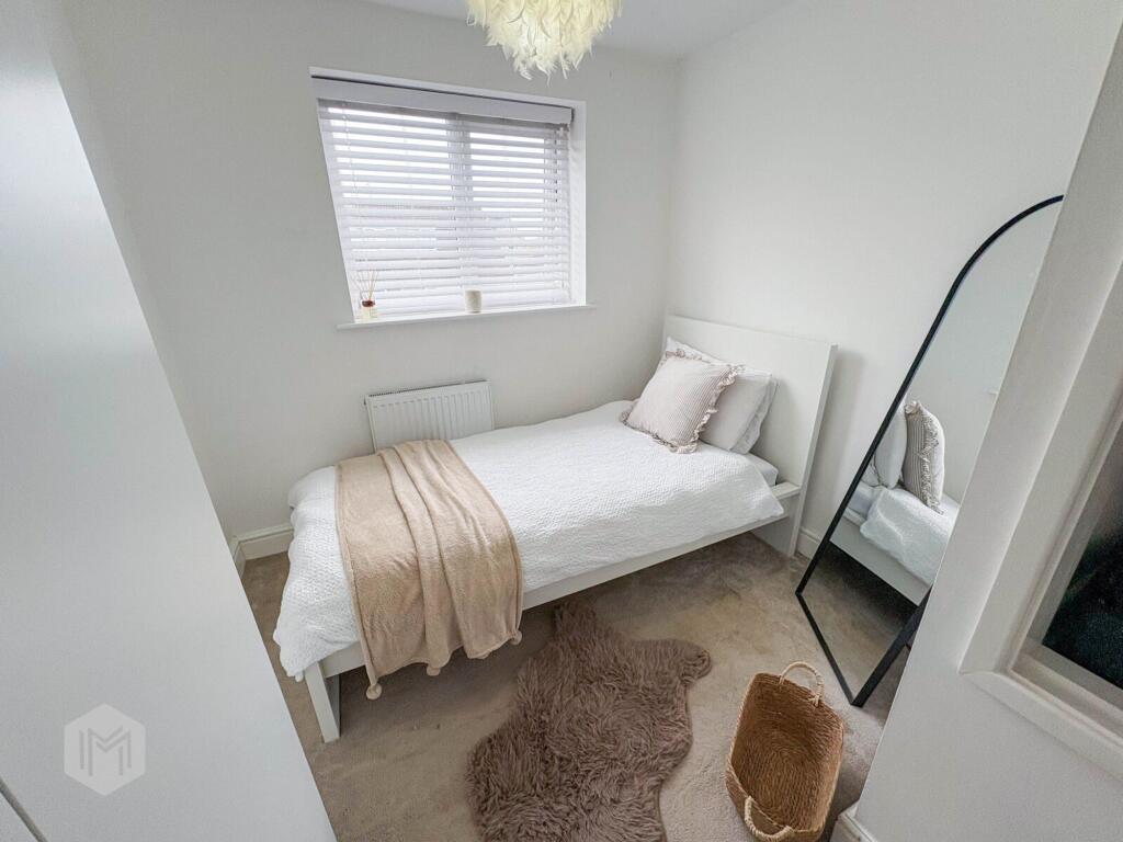
- GREAT POTENTIAL
- WALKING DISTANCE TO CULCHETH VILLAGE
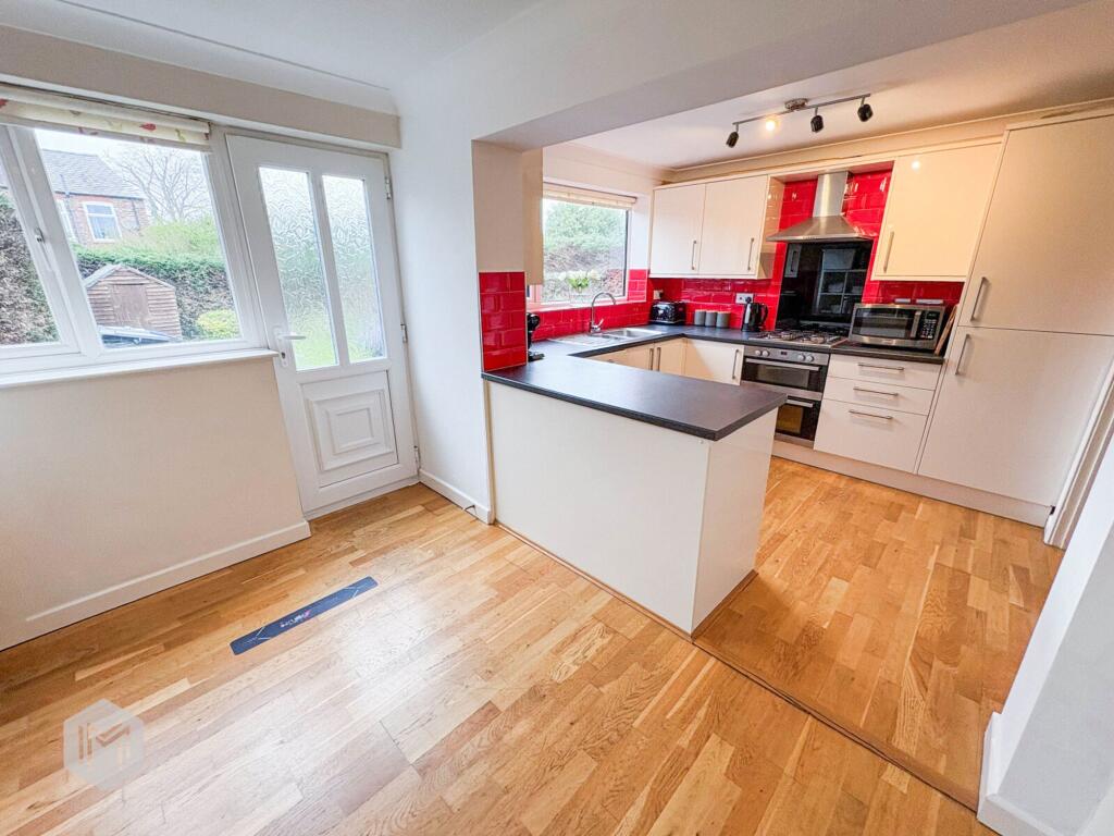
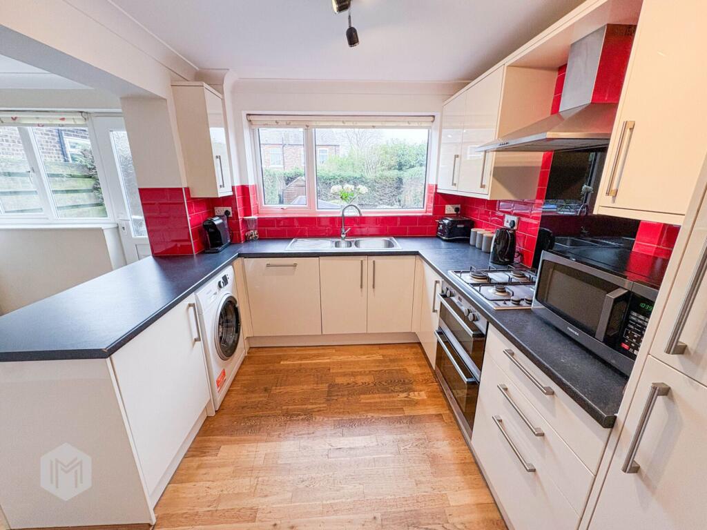
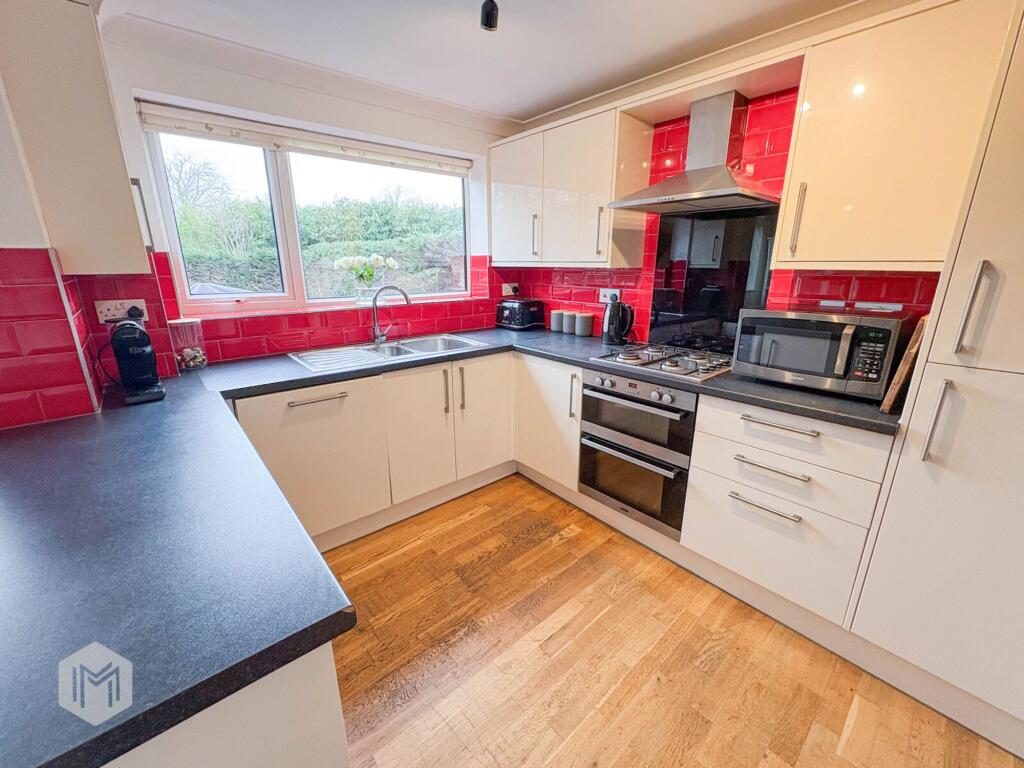
- FITTED KITCHEN
- SPACIOUS LOUNGE/DINER
Additional details
- Parking
- Yes
- Garden
- Yes
- Listed property
- No
- Restrictions
- No
- Required access
- No
- Rights of way
- No
- Flooded in last 5 years
- No
- Flood defences
- No
Description
EPC Rating: D
Listed by
Culcheth
Miller North West Ltd
Reference: 88640109
EPC Rating & Upgrade Cost
Current rating: D
Potential rating: B
Inspection date: 08/06/2021
Expiry date: 07/06/2031
Current heating cost: £726/year
Potential heating cost: £532/year
Est. upgrade cost to C: £15,500
Recommendations
- Cavity wall insulation (£500 - £1,500)
- Floor insulation (solid floor) (£4,000 - £6,000)
- Solar water heating (£4,000 - £6,000)
- Solar photovoltaic panels, 2.5 kWp (£3,500 - £5,500)
Flood risk
Zone: 1
Risk: Low
Job (default Low)
Floorplans
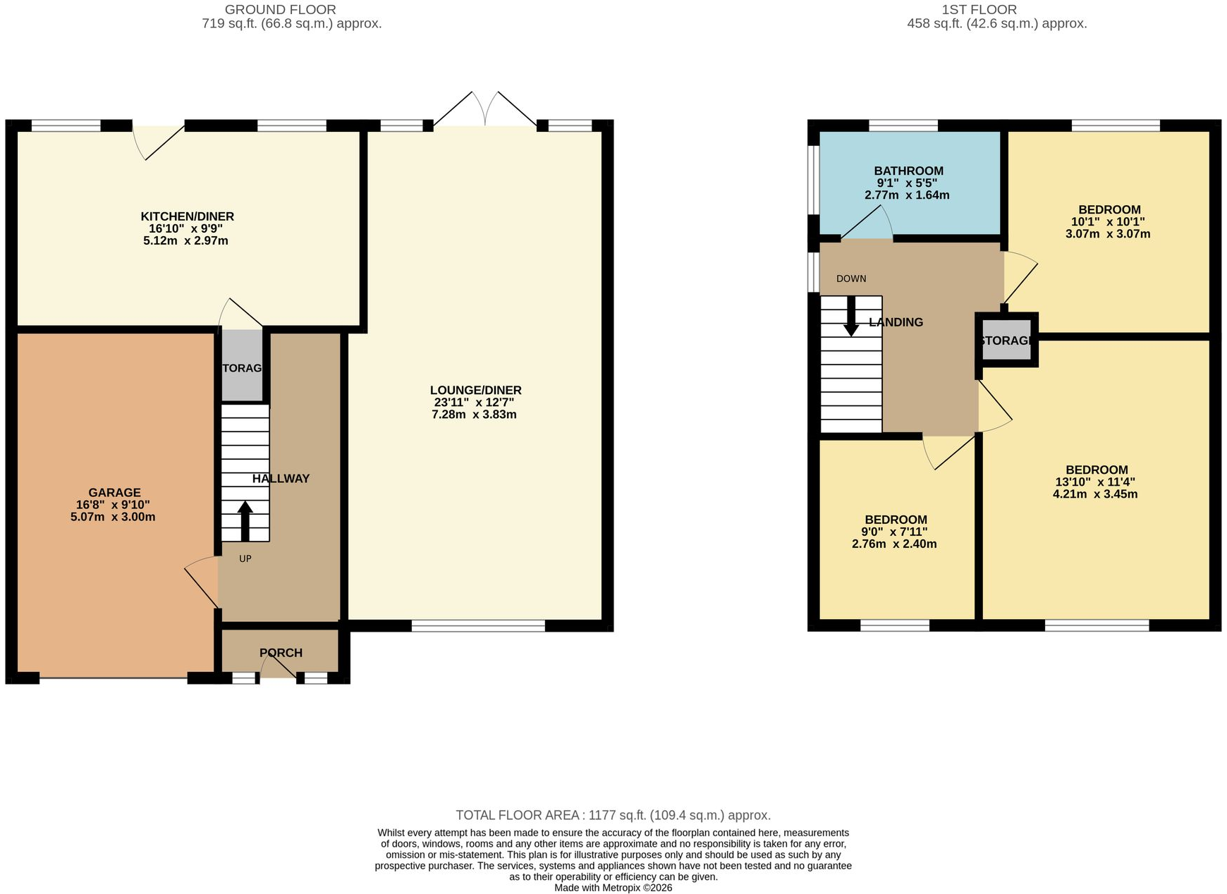
Floorplan 1
EPC Graphs
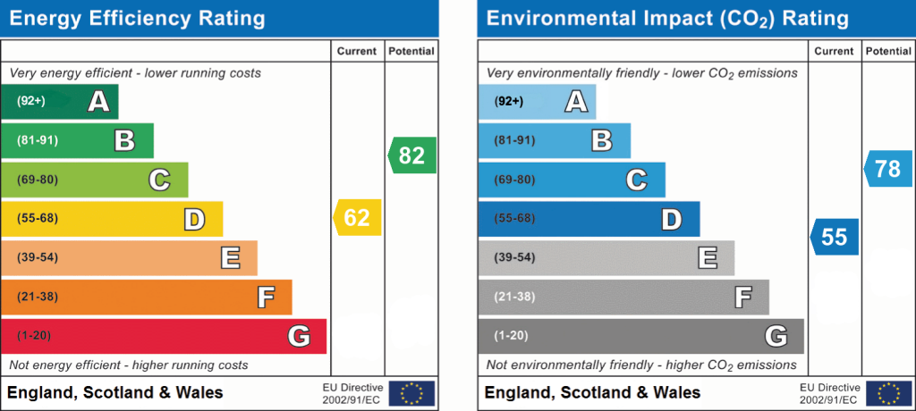
EPC 1
FENSA Certificates
This property has 1 FENSA certificate(s) on record, indicating window/door installations by FENSA-approved installers.
FENSA Certificate #2604848
Property Details
Street: 32 Thompson Avenue
Town: Culcheth
Postcode: WA3 4EB
Installation Details
Items: 1 window
Certificate Issued: 12/04/2005
Work Completed: 03/02/2005
This certificate data was retrieved from FENSA's database
What is FENSA? FENSA (Fenestration Self-Assessment Scheme) is a government-authorised scheme that monitors building regulation compliance for replacement windows and doors. Certificates indicate that work was completed by FENSA-approved installers.
Price history
| Event | Date | Price | % change |
|---|---|---|---|
| Listed for sale | — | £375,000 | +0.8% |
| Sold | 20/05/2022 (4 years ago) | £372,000 | — |
Source: HM Land Registry Price Paid Data. Crown copyright.
Sold Comparables
Same street and nearby sales within 0.25 miles (last 5 years). Data from Land Registry Price Paid.
| Address | Price | Date | Type |
|---|---|---|---|
| 19 HOB HEY LANE, CULCHETH, WARRINGTON, WA3 4NQ | £970,000 | 15/08/2025 | Detached |
| 2A SEPHTON AVENUE, CULCHETH, WARRINGTON, WA3 4LZ | £470,000 | 18/11/2022 | Detached |
| 14 RATHMELL CLOSE, CULCHETH, WARRINGTON, WA3 4DU | £300,000 | 06/10/2022 | Detached |
| 73 COMMON LANE, CULCHETH, WARRINGTON, WA3 4HB | £1,225,000 | 22/07/2022 | Detached |
| Same street 1 THOMPSON AVENUE, CULCHETH, WARRINGTON, WA3 4EB | £400,000 | 14/04/2022 | Detached |
| 4 WIGSHAW LANE, CULCHETH, WARRINGTON, WA3 4LY | £258,750 | 29/03/2022 | Detached |
| 24 JACKSON AVENUE, CULCHETH, WARRINGTON, WA3 4EL | £290,000 | 19/11/2021 | Detached |
| Same street 11 THOMPSON AVENUE, CULCHETH, WARRINGTON, WA3 4EB | £410,000 | 30/06/2021 | Detached |
Street average: £405,000 (2 sales)
Area average: £585,625 (6 sales)
Capital growth trend
Land Registry outcode average: last 12 months vs 5y and 10y ago (from sold prices).
House Price Index (HM Land Registry — official index, not sold-price averages): Warrington. Series: Detached. As of March 2026.
Rental Range
Estimated market rent for Warrington. Low = conservative, Realistic = average, Optimistic = best case.
Based on Local Authority from postcode lookup → Warrington.
LHA (30th percentile) floor for East Lancs: £593/mo (Apr 2025 – Mar 2026)
Location
Nearby
Nearest stations, universities and amenities (distance from property).
| Type | Name | Distance |
|---|---|---|
| Bus stop | The Cherry Tree | 0.1 miles |
| Shop | Boutique On The Green | 0.1 miles |
| Shop | Poyntons | 0.2 miles |
| University | University of Chester - Warrington Campus | 2.7 miles |
| Train station | Birchwood | 2.8 miles |
| Train station | Glazebrook | 3.2 miles |
| Hospital | Leigh Health Centre | 3.6 miles |
| Hospital | St Helens Hospital | 8.1 miles |
| University | University of Bolton | 8.7 miles |
Street-level crime
| Category | Count |
|---|---|
| Violence and sexual offences | 11 |
| Shoplifting | 5 |
| Anti-social behaviour | 4 |
| Public order | 3 |
| Criminal damage and arson | 2 |
| Drugs | 1 |
| Other crime | 1 |
| Total incidents | 27 |
Within 1 mile during Apr 2026. Source: data.police.uk (England & Wales).
Schools nearby
Nearest open schools with Ofsted ratings (England). Closed schools are not shown. Data from Get Information about Schools and Ofsted.
| Name | Type | Distance | Ofsted |
|---|---|---|---|
| Newchurch Community Primary School | Primary | 0.2 miles | — (Inspected (no overall grade)) |
| Twiss Green Community Primary School | Primary | 0.4 miles | Good — 22 Jan 2024 |
| Culcheth High School | Secondary | 0.6 miles | Good — 23 May 2014 |
| Culcheth Community Primary School | Primary | 0.6 miles | Good — 27 Dec 2012 |
| St Lewis Catholic Primary School | Primary | 1.0 miles | Good — 21 Jul 2014 |
Rental Comparables
Loading rental comparables for this postcode. Refresh in a few minutes.
Rent-driven metrics
Based on Area rent estimate.
- Rent ratio — Monthly rent ÷ purchase price (1% rule). 1%+ = strong, 0.8–1% = okay, <0.8% = weak for cashflow.
- Max investor price — Rent ÷ 0.8%; the price at which rent would be 0.8% of price (Stoke-style target).
- Target investor price — Rent ÷ 1%; the price at which rent would be 1% of price (strong cashflow band).
- Gross yield — Annual rent as % of purchase price (no costs).