FLAT B
142 COURTHILL ROAD, LONDON, GREATER LONDON SE13 6DR
£1,200 pcm
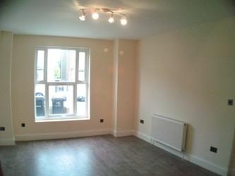
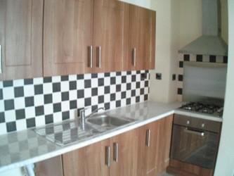
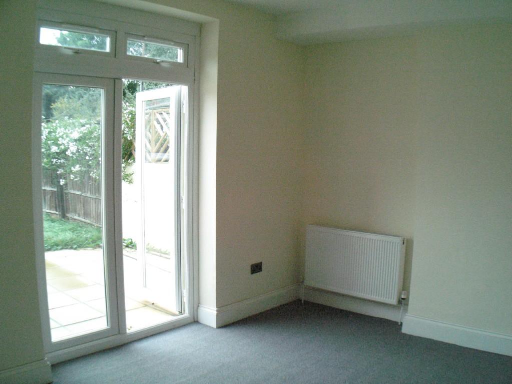
Photo 1 Photo 2 Photo 3 Photo 4
/ 4
Property details
Floor area
50 m²
EPC rating
D
Year built
England and Wales: 1900-1929
Deprivation
Decile 2 (3,734 of 33,755)
Street crime
1240 incidents within 1 mile (May 2026)
Key features
- White Goods
- Garden
- Laminate Flooring
- Double Glazed
- Central Heating
Additional details
- Garden
- Yes
Description
Listed by
Lewisham
La Casa Limited
Reference: 23433464
EPC Rating & Upgrade Cost
Current rating: D
Potential rating: C
Inspection date: 17/06/2020
Expiry date: 16/06/2030
Current heating cost: £401/year
Potential heating cost: £254/year
Est. upgrade cost to C: £9,030
Recommendations
- 50 mm internal or external wall insulation (£4,000 - £14,000)
- Low energy lighting for all fixed outlets (£30)
Flood risk
Zone: 1
Risk: Low
Job (default Low)
Rental Range
Estimated market rent for Lewisham. Low = conservative, Realistic = average, Optimistic = best case.
Based on Local Authority from postcode lookup → Lewisham.
LHA (30th percentile) floor for Cambridge: £1,122/mo (Apr 2025 – Mar 2026)
Location
Nearby
Nearest stations, universities and amenities (distance from property).
| Type | Name | Distance |
|---|---|---|
| Bus stop | Thornford Road | 0.1 miles |
| Shop | Lucky Store | 0.1 miles |
| Shop | Fire Blaze Barbershop | 0.1 miles |
| Train station | Hither Green | 0.4 miles |
| Train station | Ladywell | 0.5 miles |
| University | University of Greenwich | 1.9 miles |
| Hospital | Sloane Hospital | 3.2 miles |
| Hospital | King's College Hospital Emergency Department | 3.8 miles |
| University | Northeastern University London | 4.5 miles |
Street-level crime
| Category | Count |
|---|---|
| Violence and sexual offences | 375 |
| Anti-social behaviour | 242 |
| Shoplifting | 207 |
| Public order | 100 |
| Other theft | 65 |
| Drugs | 51 |
| Vehicle crime | 48 |
| Burglary | 43 |
| Robbery | 34 |
| Theft from the person | 29 |
| Bicycle theft | 25 |
| Possession of weapons | 10 |
| Other crime | 9 |
| Criminal damage and arson | 2 |
| Total incidents | 1240 |
Within 1 mile during May 2026. Source: data.police.uk (England & Wales).
Schools nearby
Nearest open schools with Ofsted ratings (England). Closed schools are not shown. Data from Get Information about Schools and Ofsted.
| Name | Type | Distance | Ofsted |
|---|---|---|---|
| Brindishe Green School | Primary | 0.3 miles | Good — 26 Nov 2023 |
| St Mary's Lewisham Church of England Primary School | Primary | 0.4 miles | Good — 25 Jan 2022 |
| St Saviour's Catholic Primary School | Primary | 0.4 miles | Good — 7 Sep 2011 |
| Brindishe Manor School | Primary | 0.5 miles | Outstanding — 26 Jun 2024 |
| St Margaret's Lee CofE Primary School | Primary | 0.6 miles | Outstanding — 11 Sep 2024 |
Rental Comparables
Rental listings exist nearby, but none matched the 3-bedroom count for this property.