No. 71
Arundel Drive, Carleton, Lancs FY6 7TE
£325,000
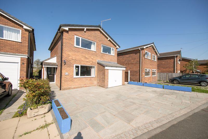
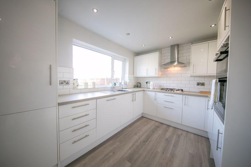
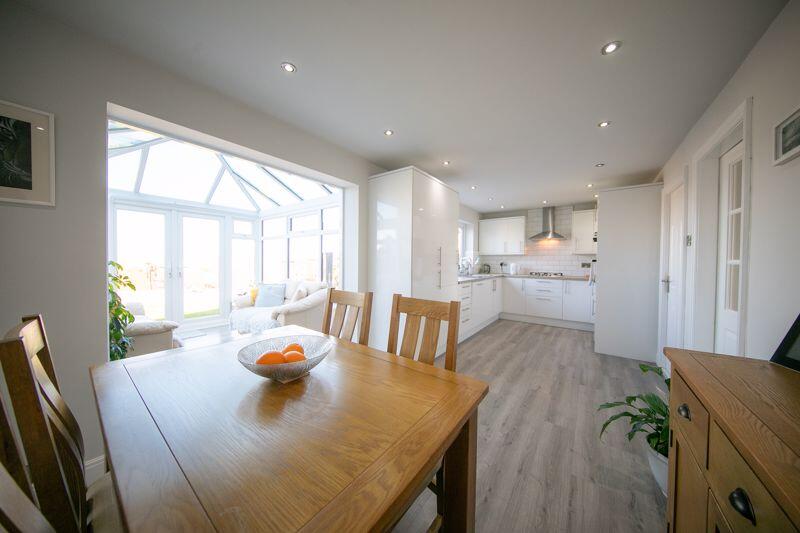
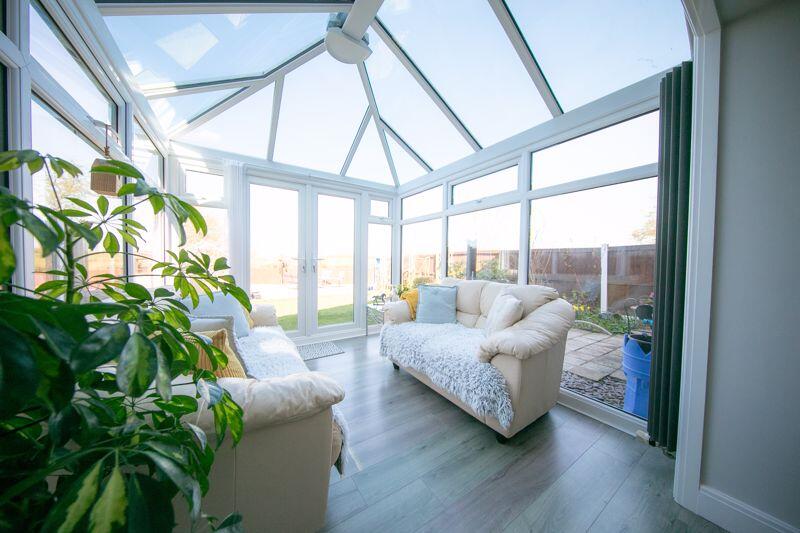
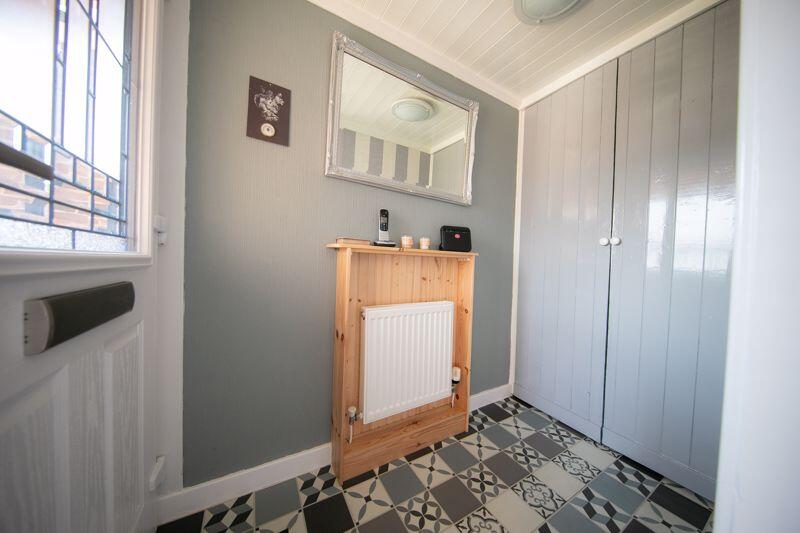
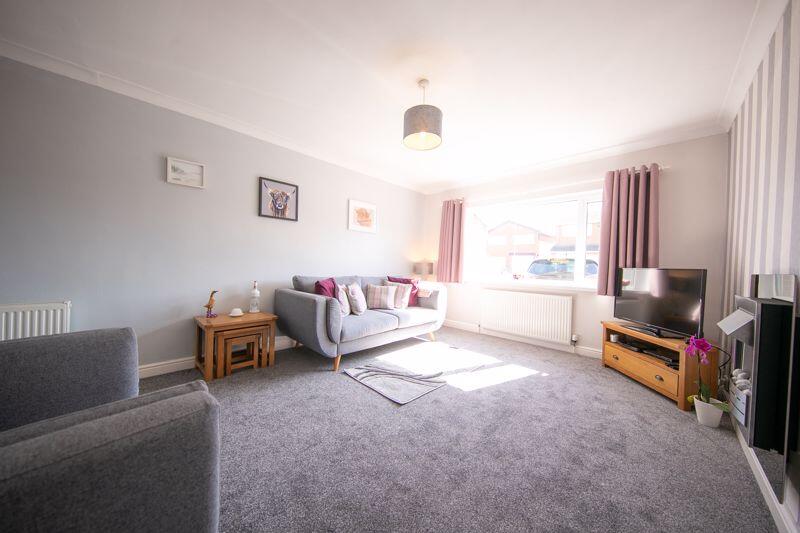
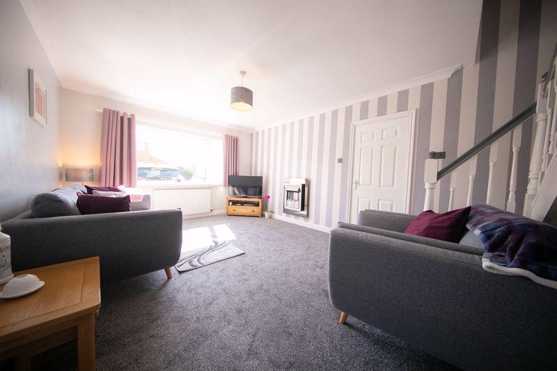
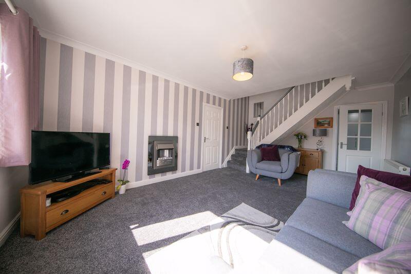
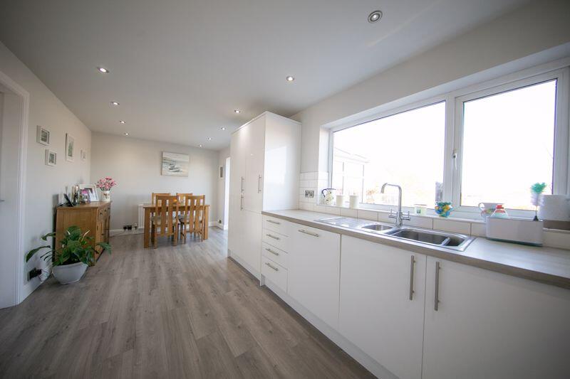
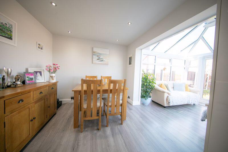
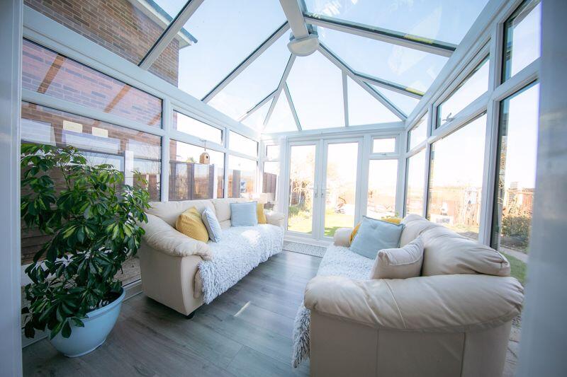
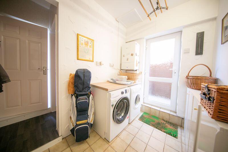
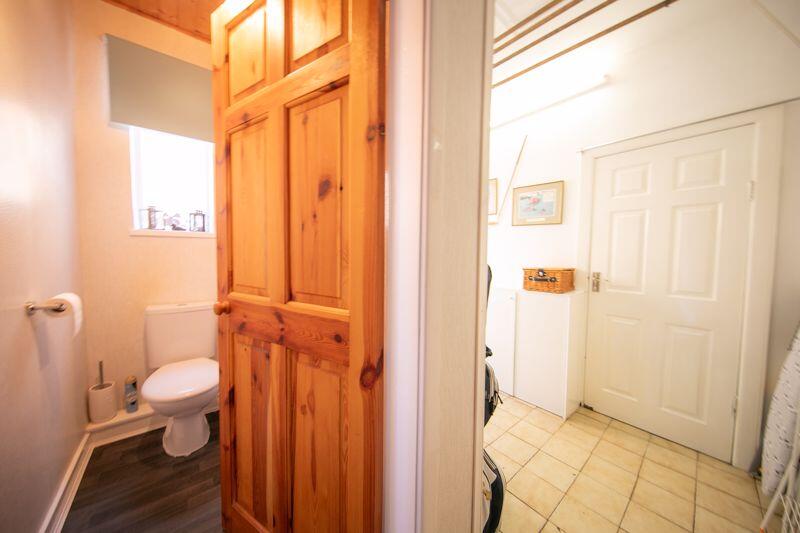
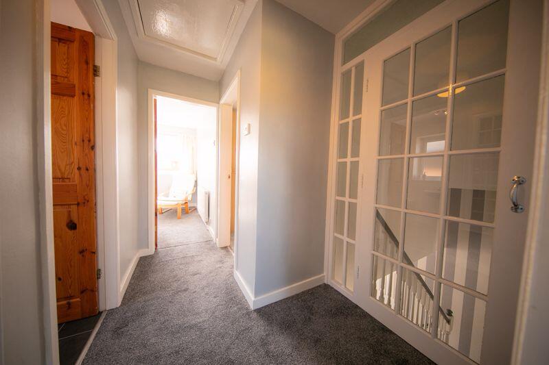
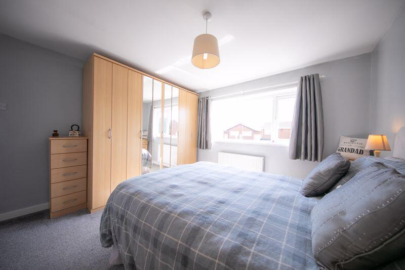
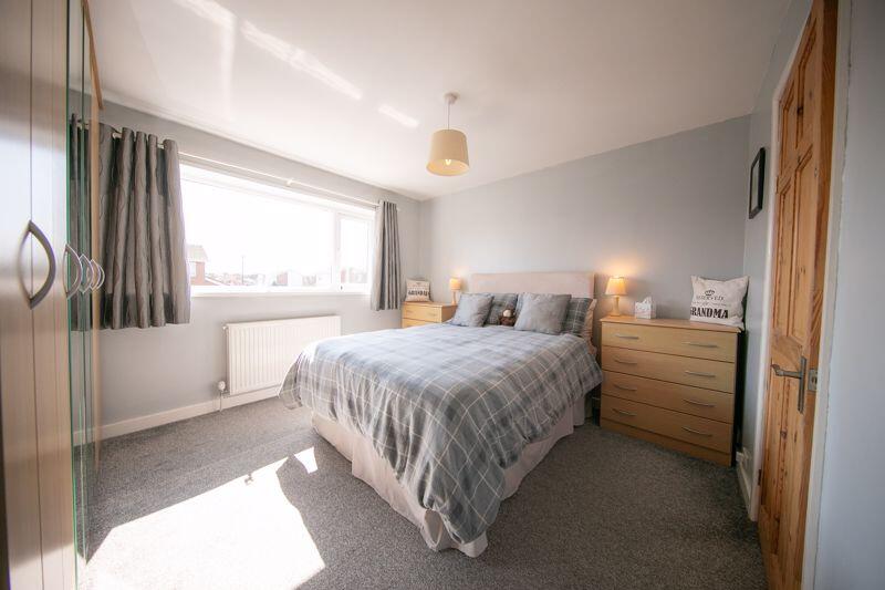
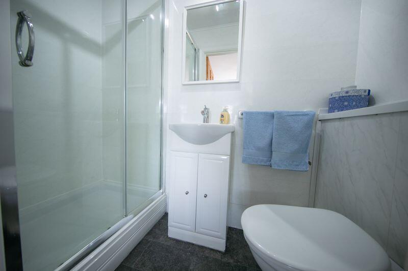
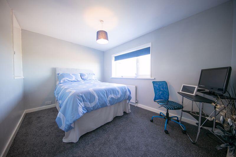
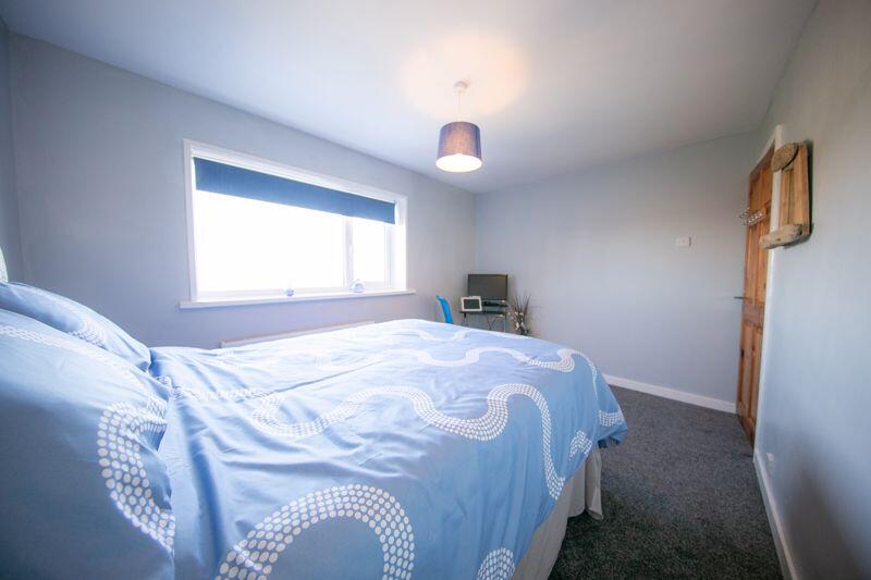
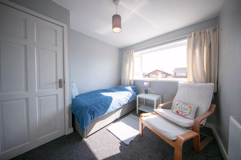
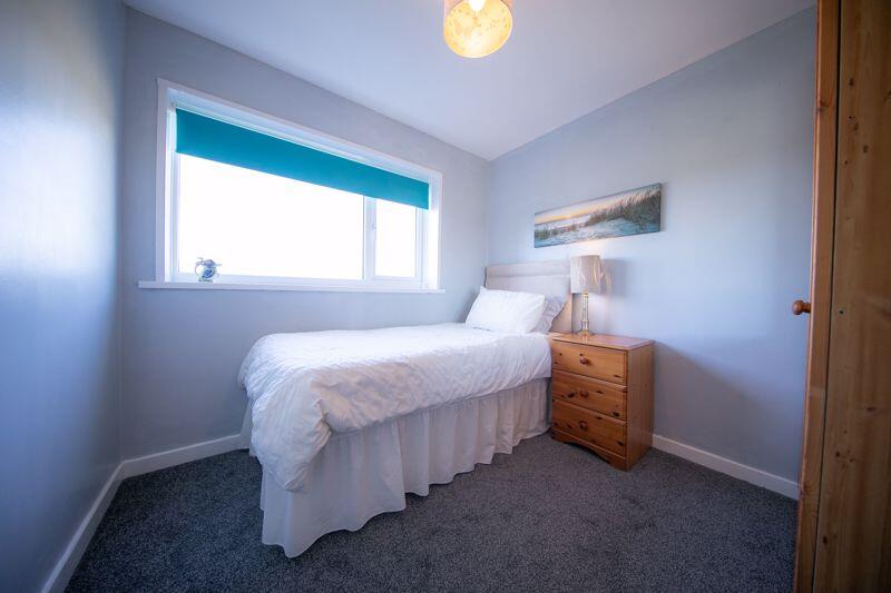
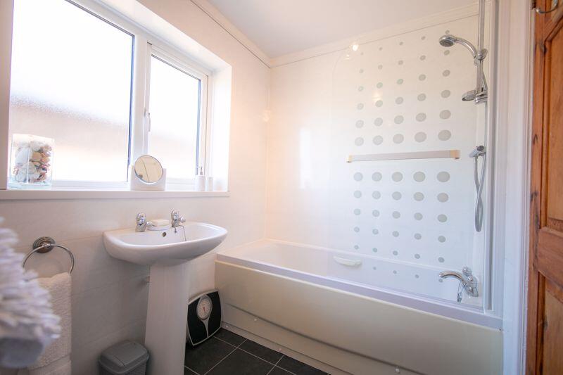
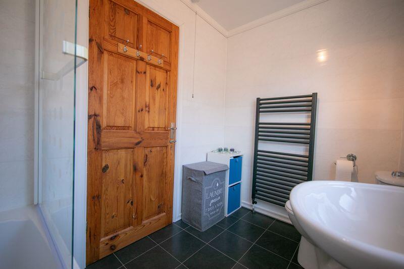
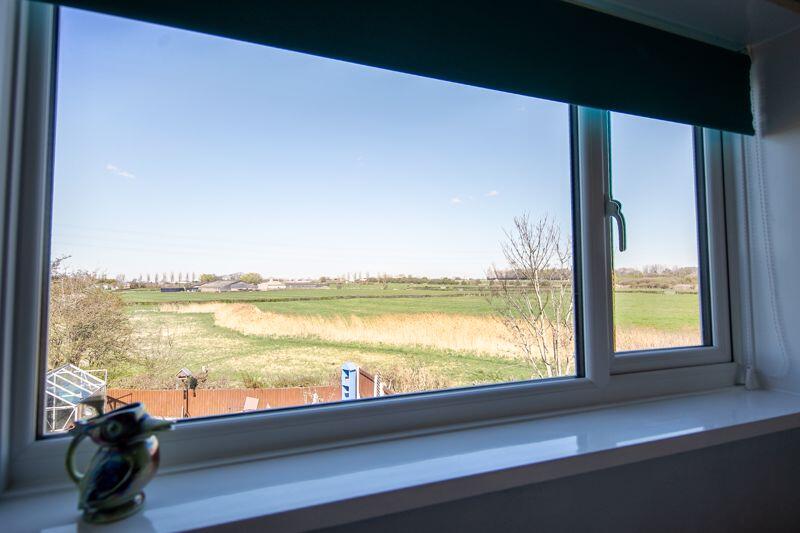
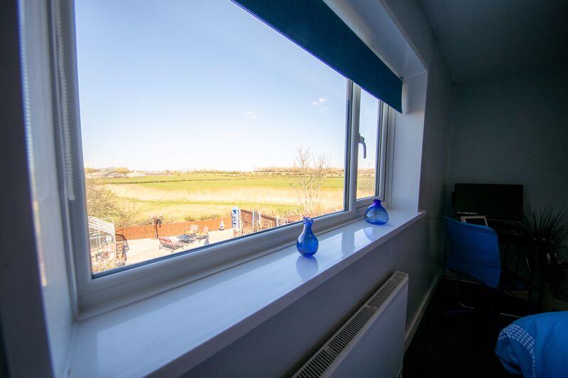
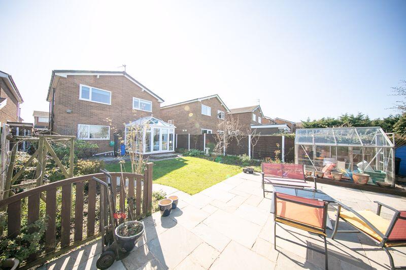
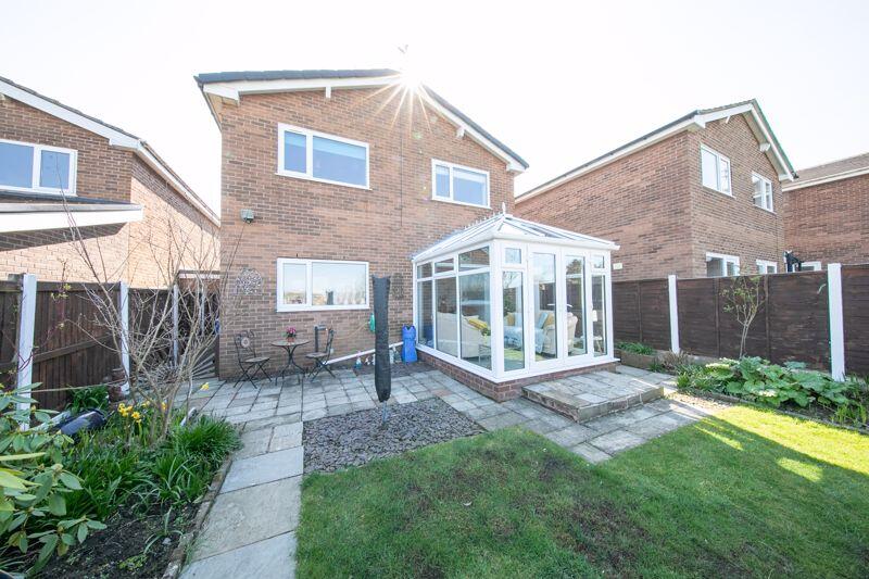
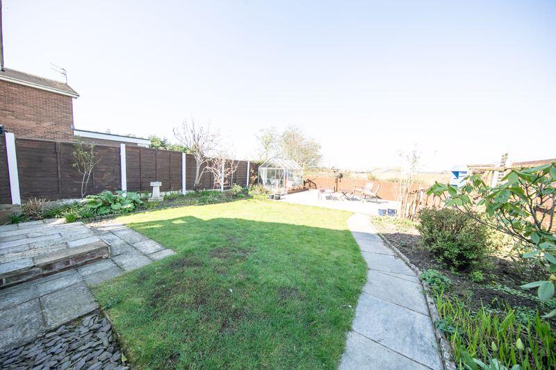
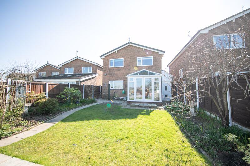
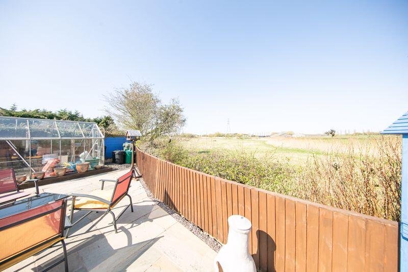
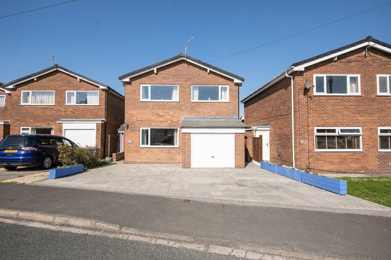
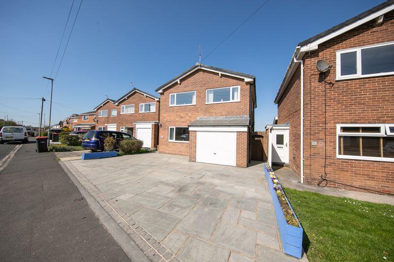
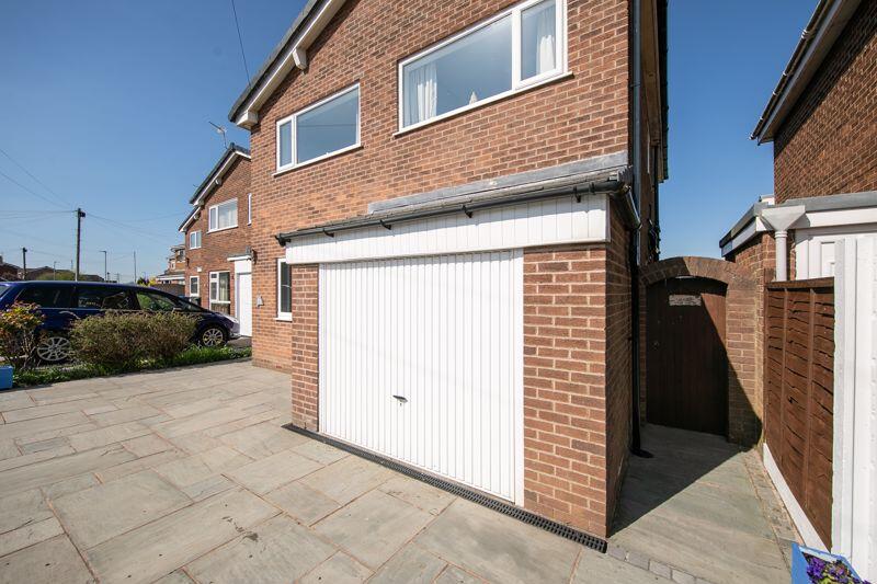
Front elevation Kitchen Kitchen, dining room & sun lounge Sun lounge Entrance porch Lounge Lounge Lounge Kitchen & dining room Dining room & sun lounge Sun lounge Utility room Ground floor washroom & utilities... First floor landing Bedroom 1 Bedroom 1 Bedroom 1 en-suite Bedroom 2 Bedroom 2 Bedroom 3 Bedroom 4 Family bathroom Family bathroom Bedroom 4 open aspect view Bedroom 2 open aspect view Rear external Rear elevation Private garden with open aspect Rear elevation Garden rear open aspect view Front elevation Front external Internal garage
/ 33
Property details
Tenure
FREEHOLD
Council tax band
D
Last sold
£315,000
Local average
£376,209 (-13.6%)
Deprivation
Decile 9 (29,892 of 33,755)
Street crime
108 incidents within 1 mile (Apr 2026)
Key features
- Detached four bedroom family home in SUPERB residential location
- Comprehensively renovated and TURN KEY READY
- FOUR spacious double bedrooms including en-suite Master
- THREE bathroom suites
- Open plan kitchen, dining and living space and utilities space.
- Neatly landscaped private garden with STUNNING open aspect views beyond
- Internal garage and off road parking for MULTIPLE vehicles
- FREEHOLD
Additional details
- Parking
- Yes
- Garden
- Yes
Description
No. 71, Arundel Drive,
Carleton.
Property At A Glance
Detached FOUR bedroom family home in FANTASTIC quiet residential location
with STUNNING open aspect views to rear.
Comprehensively renovated and tastefully appointed to an EXCEPTIONALLY HIGH STANDARD throughout
this superb FAMILY HOME TICKS ALL THE BOXES.
Featuring FOUR spacious double bedrooms including en-suite Master, generously proportioned
lounge, open plan kitchen and dining space, relaxing sun lounge, utilities space, THREE bathroom
suites, internal garage, off road parking for MULTIPLE vehicles and beautifully landscaped private
garden to rear with STUNNING open aspect sunset views.
Situated in popular residential location only a short walk from highly rated primary school and
around ten minutes stroll from all remaining Carleton Village centre amenities to include shops
and cafes, popular pub and eatery, sports and social clubs, recreational parks and transport links
across the Fylde Coast and beyond with further amenities and rail links of Poulton-le-Fylde
around five minutes further.
* A REAL BOX TICKER *
EARLY VIEWING HIGHLY RECOMMENDED
Call - to view
Listed by
Poulton-Le-Fylde
Royle Estate Agents
Reference: 160253678
EPC ratings on this postcode
We don't have a matched EPC for this property yet. Below are efficiency scores and details for other addresses on this postcode.
| Address | Current | Potential | Floor area | Age band | Type |
|---|---|---|---|---|---|
| 15, Arundel Drive, POULTON-LE-FYLDE | 66 | 83 | 122 m² | England and Wales: 1976-1982 | Detached |
| 19, Arundel Drive, POULTON-LE-FYLDE | 66 | 77 | 123 m² | England and Wales: 1976-1982 | Detached |
| 19, Arundel Drive, POULTON-LE-FYLDE | 63 | 77 | 123 m² | England and Wales: 1976-1982 | Detached |
| 27, Arundel Drive, POULTON-LE-FYLDE | 72 | 86 | 88 m² | England and Wales: 1976-1982 | Detached |
| 3 Arundel Drive, POULTON-LE-FYLDE | 56 | 79 | 115 m² | England and Wales: 1967-1975 | Detached |
| 35, Arundel Drive, POULTON-LE-FYLDE | 61 | 83 | 81 m² | England and Wales: 1930-1949 | Detached |
| 37 Arundel Drive, POULTON-LE-FYLDE | 69 | 89 | 69 m² | England and Wales: 1976-1982 | Detached |
| 37, Arundel Drive, POULTON-LE-FYLDE | 62 | 86 | 72 m² | England and Wales: 1967-1975 | Detached |
| 41 Arundel Drive, POULTON-LE-FYLDE | 70 | 88 | 70 m² | England and Wales: 1976-1982 | Detached |
| 41, Arundel Drive, POULTON-LE-FYLDE | 61 | 87 | 70 m² | England and Wales: 1967-1975 | Detached |
| 45, Arundel Drive, POULTON-LE-FYLDE | 58 | 86 | 86 m² | England and Wales: 1983-1990 | Detached |
| 49 Arundel Drive, POULTON-LE-FYLDE | 71 | 77 | 113 m² | England and Wales: 1976-1982 | Detached |
| 49, Arundel Drive, POULTON-LE-FYLDE | 64 | 83 | 102 m² | England and Wales: 1976-1982 | Detached |
| 53, Arundel Drive, POULTON-LE-FYLDE | 63 | 77 | 110 m² | England and Wales: 1967-1975 | Detached |
| 61, Arundel Drive, POULTON-LE-FYLDE | 64 | 83 | 108 m² | England and Wales: 1967-1975 | Detached |
Flood risk
Zone: 1
Risk: Low
Job (default Low)
Floorplans
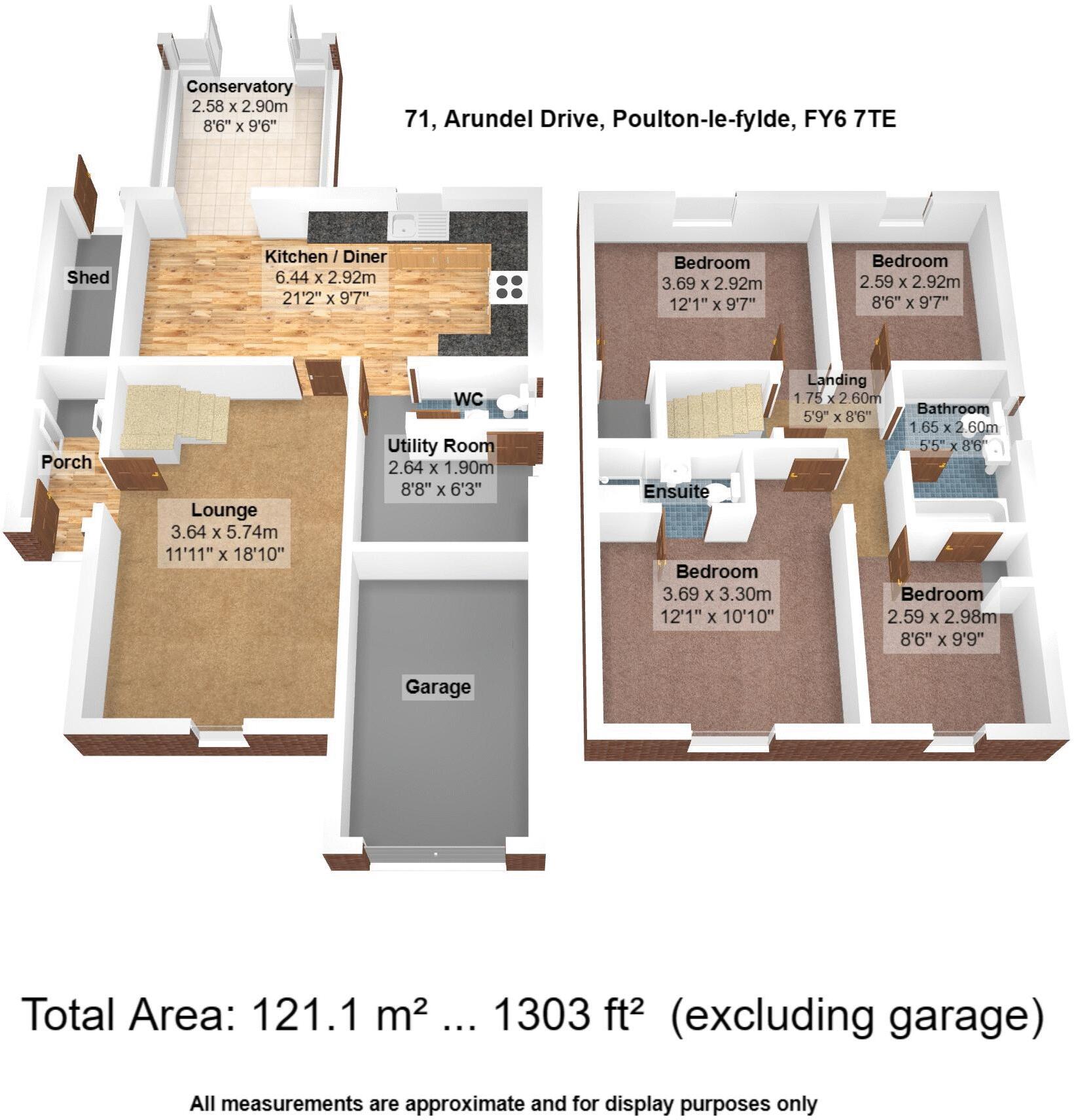
Floorplan 1
EPC Graphs

EPC Full Pack
Price history
0% since 2025
| Event | Date | Price | % change |
|---|---|---|---|
| Sold | 01/01/2025 (1 year ago) | £315,000 | 0% |
| Sold | 01/01/2025 (1 year ago) | £315,000 | — |
Source: HM Land Registry Price Paid Data. Crown copyright.
Sold Comparables
Same street and nearby sales within 0.25 miles (last 5 years). Data from Land Registry Price Paid.
| Address | Price | Date | Type |
|---|---|---|---|
| 20 ELVASTON ROAD, POULTON-LE-FYLDE, WYRE, LANCASHIRE, FY6 7TH | £240,000 | 15/12/2025 | Detached |
| 71 ARUNDEL DRIVE, POULTON-LE-FYLDE, WYRE, LANCASHIRE, FY6 7TE | £315,000 | 03/12/2025 | Detached |
| 71 ARUNDEL DRIVE, POULTON-LE-FYLDE, WYRE, LANCASHIRE, FY6 7TE | £315,000 | 03/12/2025 | Detached |
| 66 ARUNDEL DRIVE, POULTON-LE-FYLDE, WYRE, LANCASHIRE, FY6 7TF | £248,950 | 30/11/2023 | Detached |
| 6 CARISBROOKE CLOSE, POULTON-LE-FYLDE, WYRE, LANCASHIRE, FY6 7UA | £335,000 | 26/05/2023 | Detached |
| 10 FARNHAM WAY, POULTON-LE-FYLDE, WYRE, LANCASHIRE, FY6 7TQ | £260,000 | 27/03/2023 | Detached |
| 1 PLECK PLACE, POULTON-LE-FYLDE, WYRE, LANCASHIRE, FY6 7FD | £355,000 | 19/12/2022 | Detached |
| 89 ARUNDEL DRIVE, POULTON-LE-FYLDE, WYRE, LANCASHIRE, FY6 7TE | £265,000 | 31/10/2022 | Detached |
| 19 FLEETWOOD ROAD, POULTON-LE-FYLDE, WYRE, LANCASHIRE, FY6 7NU | £380,000 | 27/10/2022 | Detached |
| 6 HAREWOOD CLOSE, POULTON-LE-FYLDE, WYRE, LANCASHIRE, FY6 7RB | £275,000 | 14/10/2022 | Detached |
| 3 ELVASTON ROAD, POULTON-LE-FYLDE, WYRE, LANCASHIRE, FY6 7TH | £275,000 | 26/08/2022 | Detached |
| 9 AVERY GARDENS, POULTON-LE-FYLDE, WYRE, LANCASHIRE, FY6 7UP | £290,000 | 23/06/2022 | Detached |
| 19 FARNHAM WAY, POULTON-LE-FYLDE, WYRE, LANCASHIRE, FY6 7TQ | £263,000 | 26/04/2022 | Detached |
| 8 CANTERBURY CLOSE, POULTON-LE-FYLDE, WYRE, LANCASHIRE, FY6 7UU | £251,000 | 18/03/2022 | Detached |
| 16 CANTERBURY CLOSE, POULTON-LE-FYLDE, WYRE, LANCASHIRE, FY6 7UU | £290,000 | 18/03/2022 | Detached |
| 2 ELVASTON ROAD, POULTON-LE-FYLDE, WYRE, LANCASHIRE, FY6 7TH | £298,500 | 17/03/2022 | Detached |
| 16 CALDICOT WAY, POULTON-LE-FYLDE, WYRE, LANCASHIRE, FY6 7LP | £309,950 | 08/12/2021 | Detached |
| 4 ARUNDEL DRIVE, POULTON-LE-FYLDE, WYRE, LANCASHIRE, FY6 7TF | £235,000 | 01/11/2021 | Detached |
| 31 FLEETWOOD ROAD, POULTON-LE-FYLDE, WYRE, LANCASHIRE, FY6 7NU | £275,000 | 29/09/2021 | Detached |
| 8 CARISBROOKE CLOSE, POULTON-LE-FYLDE, WYRE, LANCASHIRE, FY6 7UA | £210,000 | 28/09/2021 | Detached |
Area average: £284,320 (20 sales)
Capital growth trend
Land Registry outcode average: last 12 months vs 5y and 10y ago (from sold prices).
House Price Index (HM Land Registry — official index, not sold-price averages): Wyre. Series: Detached. As of March 2026.
Rental Range
Estimated market rent for Wyre. Low = conservative, Realistic = average, Optimistic = best case.
Based on Local Authority from postcode lookup → Wyre.
LHA (30th percentile) floor for Fylde Coast: £740/mo (Apr 2025 – Mar 2026)
Location
Address
Arundel Drive
Nearby
Nearest stations, universities and amenities (distance from property).
| Type | Name | Distance |
|---|---|---|
| Bus stop | Unknown | 0.2 miles |
| Shop | Brambles Garden Centre | 0.3 miles |
| Shop | Ashley Alexander | 0.3 miles |
| Train station | Poulton-le-Fylde | 0.8 miles |
| University | Blackpool and The Fylde College | 1.1 miles |
| Train station | Layton | 2.0 miles |
| University | Blackpool & The Fylde College, Fleetwood Nautical Campus | 3.2 miles |
| Hospital | Fleetwood Hospital | 4.8 miles |
| Hospital | South Shore Primary Care Centre | 5.6 miles |
Street-level crime
| Category | Count |
|---|---|
| Violence and sexual offences | 42 |
| Anti-social behaviour | 18 |
| Shoplifting | 12 |
| Vehicle crime | 7 |
| Other crime | 6 |
| Public order | 6 |
| Other theft | 5 |
| Criminal damage and arson | 4 |
| Possession of weapons | 3 |
| Burglary | 2 |
| Drugs | 2 |
| Bicycle theft | 1 |
| Total incidents | 108 |
Within 1 mile during Apr 2026. Source: data.police.uk (England & Wales).
Schools nearby
Nearest open schools with Ofsted ratings (England). Closed schools are not shown. Data from Get Information about Schools and Ofsted.
| Name | Type | Distance | Ofsted |
|---|---|---|---|
| Carleton Green Community Primary School | Primary | 0.1 miles | Good — 25 Mar 2024 |
| Carleton St Hilda's Church of England Primary School | Primary | 0.4 miles | Good — 25 Oct 2013 |
| Millfield Science & Performing Arts College | Secondary | 0.6 miles | Good — 25 Sep 2022 |
| McKee College House | Other | 0.7 miles | Good — 18 Apr 2016 |
| St John's Catholic Primary School, Poulton-le-Fylde | Primary | 0.7 miles | — (Inspected (no overall grade)) |
Rental Comparables
Residential lets from OpenRent and Rightmove for the area (same bedroom count). Use to validate rent estimates. Student lets are excluded.
| Title | Rent | Beds | Distance | As seen on |
|---|---|---|---|---|
| 4 Bed Detached House, Romney Close, FY5 | £1,700/mo | 4 | 0.89 miles | OpenRent |
Average rent: £1,700/mo (1 listing)
Rent-driven metrics
Based on OpenRent comparables.
- Rent ratio — Monthly rent ÷ purchase price (1% rule). 1%+ = strong, 0.8–1% = okay, <0.8% = weak for cashflow.
- Max investor price — Rent ÷ 0.8%; the price at which rent would be 0.8% of price (Stoke-style target).
- Target investor price — Rent ÷ 1%; the price at which rent would be 1% of price (strong cashflow band).
- Gross yield — Annual rent as % of purchase price (no costs).
- Cost-to-rent — Price ÷ annual rent (from OpenRent comparables). Under 14× = strong, 14–16× = acceptable, 17×+ = compressed.
- Cashflow — Rent minus mortgage, 10% maintenance, £25/mo compliance. Assumes 75% LTV, 3.95% APR (5yr fixed), 25yr term.
- ROI — Annual profit ÷ cash in (deposit + 4% purchase costs).
Enter House Number
Enter the house number to help us retrieve more accurate pricing history and property data.
Please log in to submit or correct the house number for this listing.
Log in to continue