7 QUEENS ROAD
LONDON, LEYTONSTONE, GREATER LONDON E11 1BA
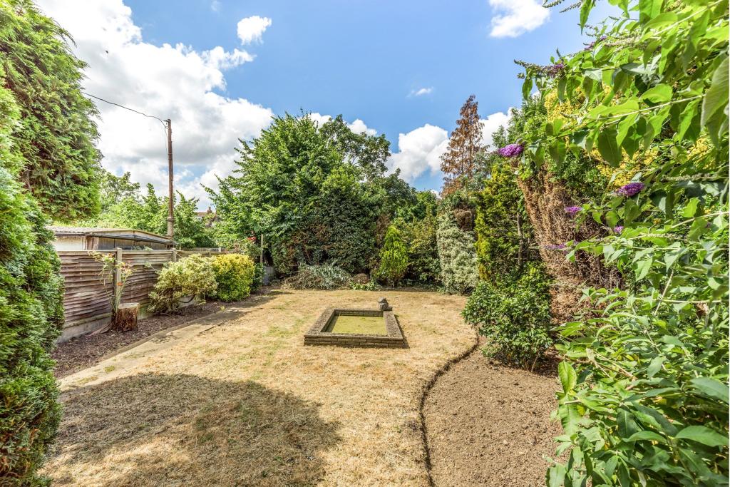
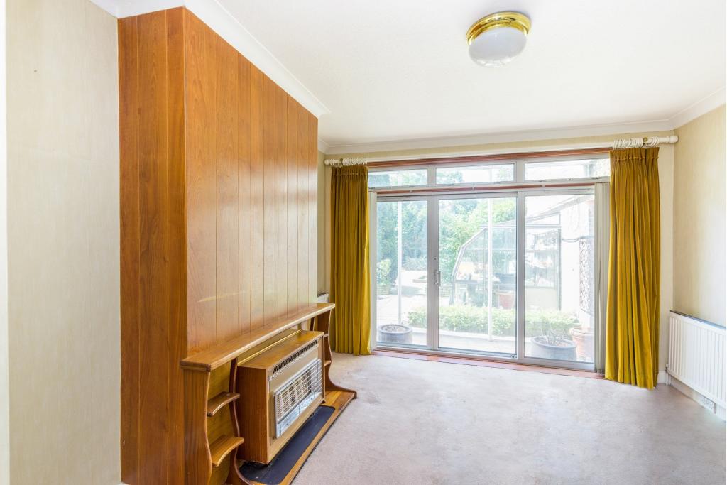
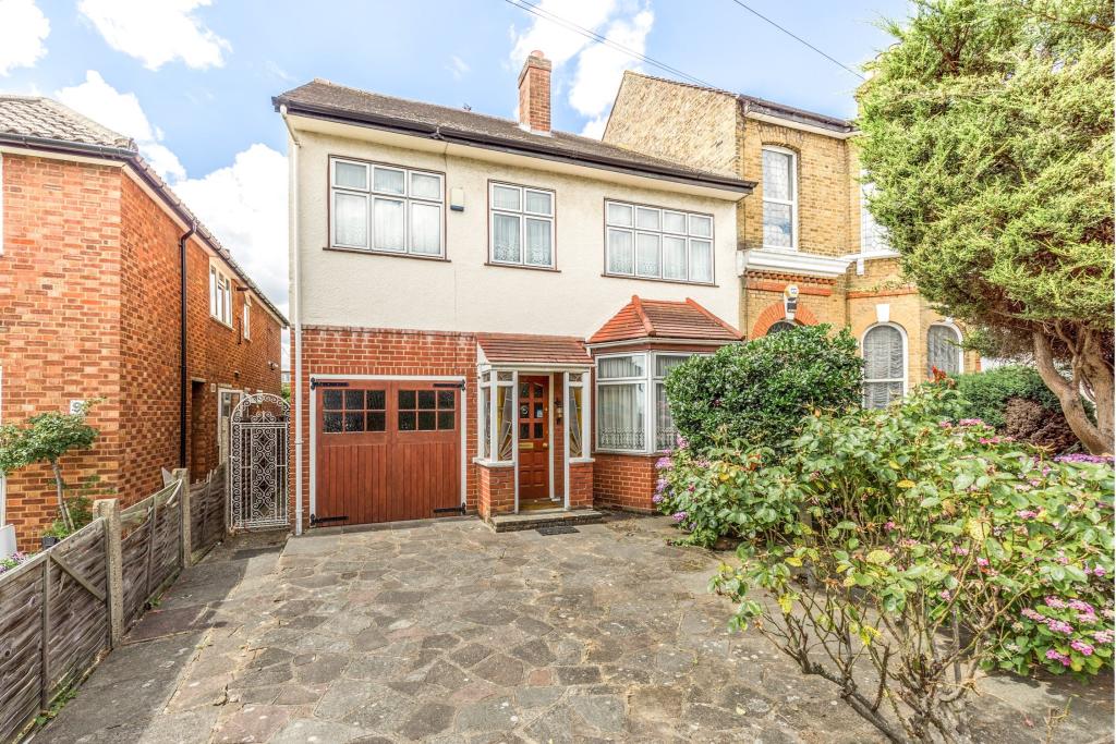
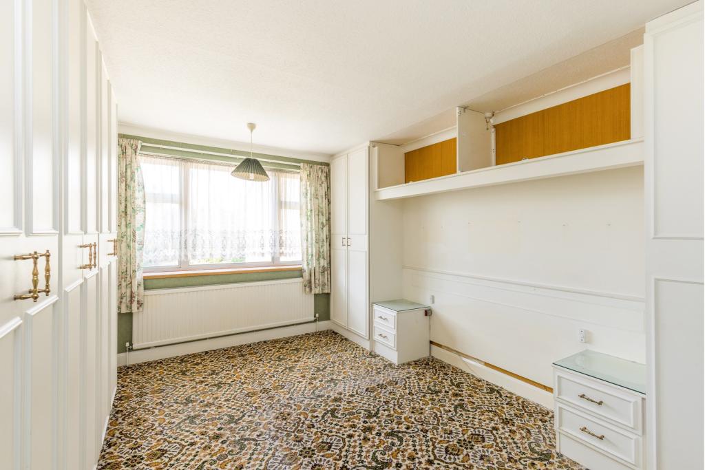
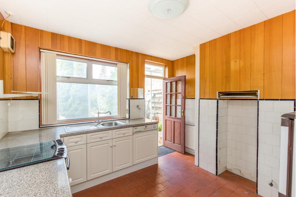
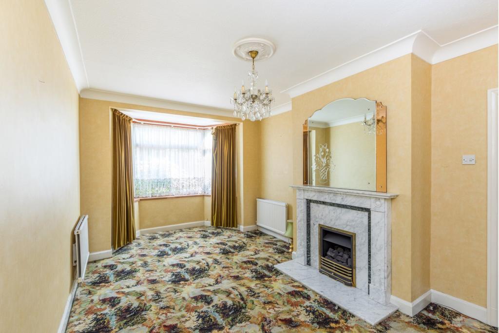
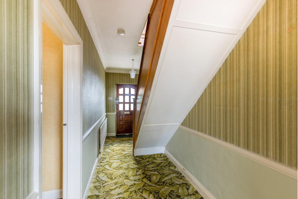
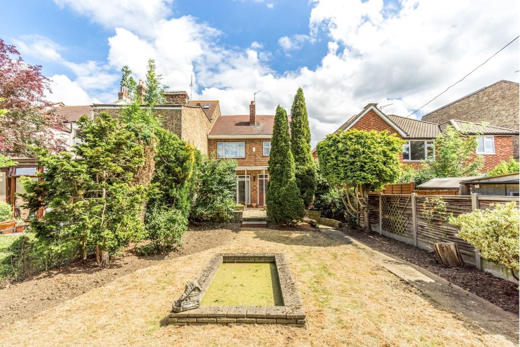
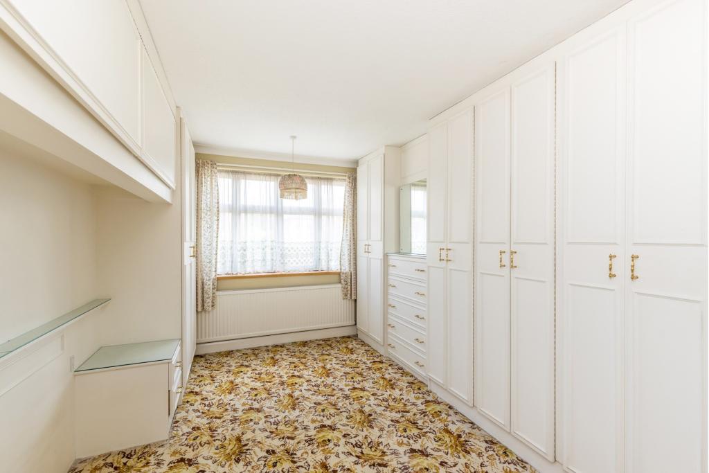
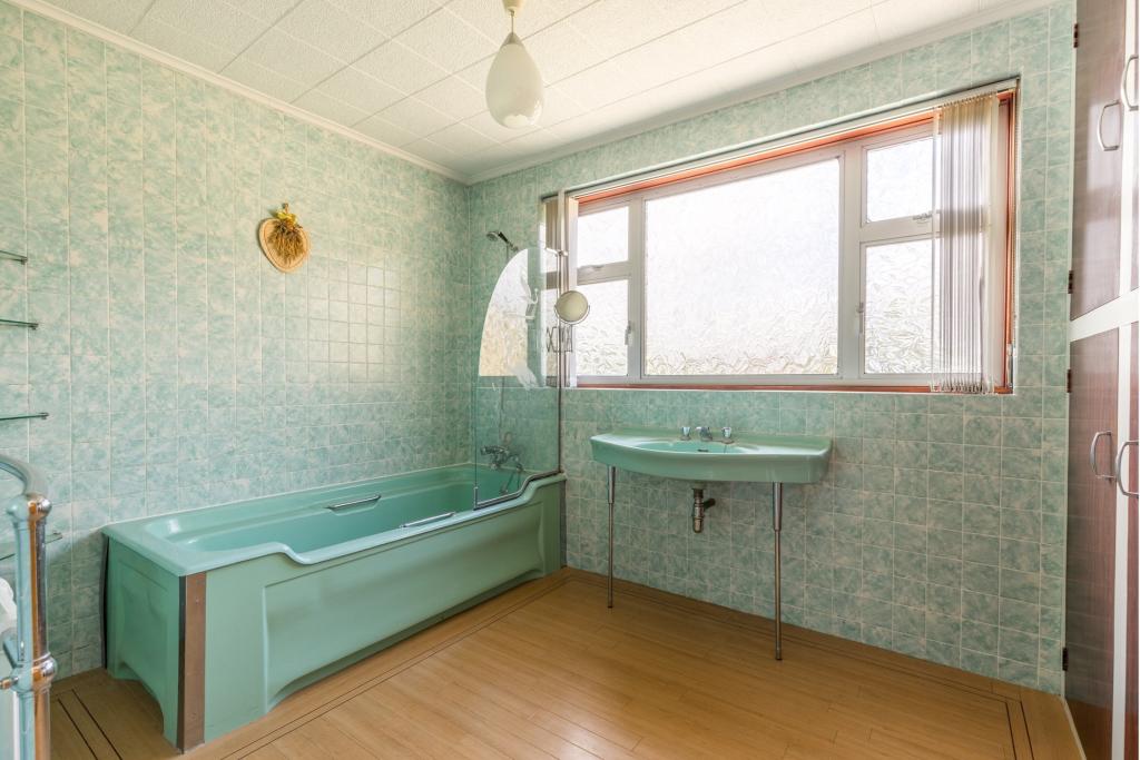
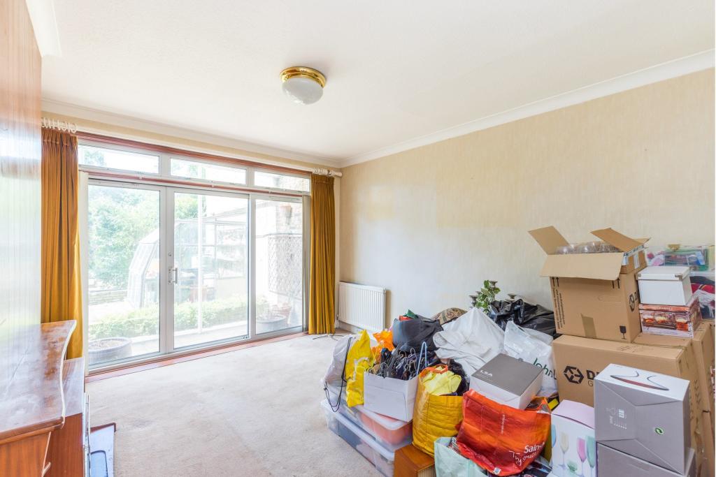
Photo 1 Photo 2 Photo 3 Photo 4 Photo 5 Photo 6 Photo 7 Photo 8 Photo 9 Photo 10 Photo 11 Photo 12
/ 12
Property details
Tenure
FREEHOLD
Floor area
71 m²
Last sold
£725,000 Nov 2019
Local average
£1,030,781 (-29.7%)
Deprivation
Decile 3 (9,275 of 33,755)
Street crime
785 incidents within 1 mile (Apr 2026)
Key features
- 3 Bedrooms
- Fantastic development potential (subject to planning)
- Semi detached house
- Popular Upper Leytonstone area
- Superb rear garden
- Modernisation required throughout
- Vacant possession
Additional details
- Parking
- Yes
- Garden
- Yes
Description
Set within a short distance of Leytonstone Central Line station can be found this good size semi-detached family home with development potential (subject to planning).
The property is situated within the leafy and popular Upper Leytonstone area and would also suit the growing family looking for a project to make their own.
The versatile accommodation comprises of two good size reception rooms, kitchen, three good size bedrooms and family bathroom. Externally there is a superbly presented garden to rear, internal garage to side and off street parking to front.
Queens Rd is conveniently located within walking distance of Leytonstone Station on the Central Line, which is 21 minutes from Oxford Circus and moments away from Westfield Stratford City Shopping Centre and the Queen Elizabeth Olympic Park. Maryland and Leyton Central Line Tube stations are also a short walk away.
In the heart of one of London’s Olympic boroughs, Leytonstone showcases a strong mix of chain stores and small, family-run shops with an array of historic pubs and modern bars. Bridging the borders of Epping and Woodford and the City’s Liverpool St and Tower Bridge, this tight-knit community is still reveling in the ‘Olympic effect’ and is an up-and-coming growth hotspot.
Internal viewing is highly recommended to fully appreciate this substantial family home with room to expand.
Listed by
Leyton
Leaders and Romans Group
Reference: 72831664
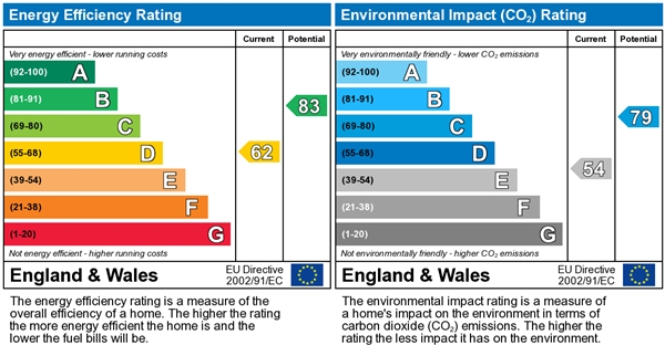
EPC Rating & Upgrade Cost
Fetching EPC data… Refresh this page in a moment.
Flood risk
Zone: 1
Risk: Low
Job (default Low)
Floorplans
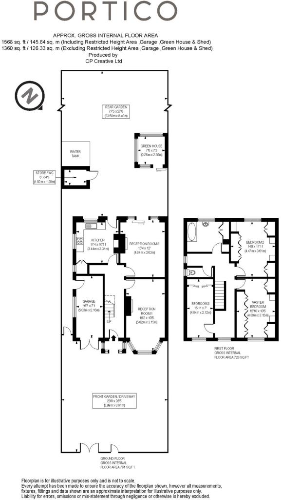
Floorplan 1
EPC Graphs
EPC 1
Price history
| Event | Date | Price | % change |
|---|---|---|---|
| Sold | 14/11/2019 (6 years ago) | £725,000 | — |
Source: HM Land Registry Price Paid Data. Crown copyright.
Sold Comparables
Same street and nearby sales within 0.25 miles (last 5 years). Data from Land Registry Price Paid.
| Address | Price | Date | Type |
|---|---|---|---|
| Same street QUEENS LODGE, 13 1 QUEENS ROAD, LEYTONSTONE, LONDON, WALTHAM FOREST, GREATER LONDON, E11 1BA | £625,000 | 10/03/2025 | Flat |
| Same street 33 QUEENS ROAD, LEYTONSTONE, LONDON, WALTHAM FOREST, GREATER LONDON, E11 1BA | £555,000 | 24/11/2023 | Flat |
| Same street 79 FLAT 1 QUEENS ROAD, LEYTONSTONE, LONDON, WALTHAM FOREST, GREATER LONDON, E11 1BA | £405,000 | 05/09/2023 | Other |
| Same street 9B QUEENS ROAD, LEYTONSTONE, LONDON, WALTHAM FOREST, GREATER LONDON, E11 1BA | £430,000 | 09/07/2022 | Flat |
| 50 FAIRLOP ROAD, LEYTONSTONE, LONDON, WALTHAM FOREST, GREATER LONDON, E11 1BN | £893,225 | 05/01/2022 | Semi-detached |
Street average: £503,750 (4 sales)
Area average: £893,225 (1 sale)
Capital growth trend
Land Registry outcode average: last 12 months vs 5y and 10y ago (from sold prices).
House Price Index (HM Land Registry — official index, not sold-price averages): Waltham Forest. Series: Semi-detached. As of March 2026.
Rental Range
Estimated market rent for Waltham Forest. Low = conservative, Realistic = average, Optimistic = best case.
Based on Local Authority from postcode lookup → Waltham Forest.
LHA (30th percentile) floor for Outer East London: £1,670/mo (Apr 2025 – Mar 2026)
Location
Nearby
Nearest stations, universities and amenities (distance from property).
| Type | Name | Distance |
|---|---|---|
| Bus stop | Clarendon Road | 0.1 miles |
| Train station | Leytonstone | 0.2 miles |
| Shop | Unknown | 0.2 miles |
| Train station | Leytonstone High Road | 0.5 miles |
| University | Arden University Stratford Campus | 2.0 miles |
| Hospital | Rainbow Ward | 3.5 miles |
| Hospital | A&E Department | 3.5 miles |
| University | NTU London | 4.9 miles |
Street-level crime
| Category | Count |
|---|---|
| Violence and sexual offences | 185 |
| Anti-social behaviour | 174 |
| Shoplifting | 81 |
| Vehicle crime | 63 |
| Other theft | 54 |
| Drugs | 46 |
| Public order | 41 |
| Criminal damage and arson | 40 |
| Burglary | 33 |
| Theft from the person | 25 |
| Robbery | 19 |
| Possession of weapons | 10 |
| Bicycle theft | 8 |
| Other crime | 6 |
| Total incidents | 785 |
Within 1 mile during Apr 2026. Source: data.police.uk (England & Wales).
Schools nearby
Nearest open schools with Ofsted ratings (England). Closed schools are not shown. Data from Get Information about Schools and Ofsted.
| Name | Type | Distance | Ofsted |
|---|---|---|---|
| Gwyn Jones Primary School | Primary | 0.2 miles | Good — 15 Oct 2014 |
| Connaught School for Girls | Secondary | 0.3 miles | Good — 15 Jun 2011 |
| George Tomlinson Primary School | Primary | 0.3 miles | Good — 5 Mar 2018 |
| Norlington School and 6th Form | Secondary | 0.4 miles | Good — 4 Oct 2013 |
| Leytonstone School | Secondary | 0.4 miles | Good — 8 Jul 2016 |
Rental Comparables
Rental listings exist nearby, but none matched the 3-bedroom count for this property.
Rent-driven metrics
Based on Area rent estimate.
- This street — Gross yield for this street only (Land Registry sales + rental comparables, same postcode + street).
- Rent ratio — Monthly rent ÷ purchase price (1% rule). 1%+ = strong, 0.8–1% = okay, <0.8% = weak for cashflow.
- Max investor price — Rent ÷ 0.8%; the price at which rent would be 0.8% of price (Stoke-style target).
- Target investor price — Rent ÷ 1%; the price at which rent would be 1% of price (strong cashflow band).
- Gross yield — Annual rent as % of purchase price (no costs).